
Join us for a hike! Registration required:
All hikes available to BTC members. Some hikes are open to non-members.
TIP: The calendar view displays up to 7 hikes on a day, but often there are more. Click “More events” to see them all.
Toronto Hike Schedule
Toronto Bruce Trail Club Registration Live Dates
Day Winter Coach Program
Registration begins two weeks in advance of the event departure (at 8:00 PM)
Day Bus Hikes
Registration begins two weeks in advance of the event departure (at 8:00 PM) with some exceptions of special event hikes
Day Coach Hikes
Registration begins 7 weeks in advance of the event departure
Day Car Hikes and Urban Hikes
Registration begins two weeks in advance of the event departure
Overnight and Weekend Trips
Registration begins 12 weeks in advance of the event departure
To view all Bruce Trail Conservancy Hikes click here
- 04May 4, 2025
Urban Walk: Humber River to High Park
https://hikes.brucetrail.org/event/urban-walk-humber-river-to-high-park-2/Sorry, the registration cut-off time for this hike has been reached.Not a member? Click here to join today!Hosting Club: Toronto
Category: Urban Walk
Location (Google Maps): Meet inside Old Mill Subway StationHike Leader(s): Danny Pivnick Click here to contact Hike Leader(s)
Pace: Moderate (3-4 km/hr)
Terrain: Flat, Level 1 (Easy – mostly on flat, well maintained trails with hard-packed surface)
Distance: 9 kms.Description
Please join us on this wonderful spring hike taking us from Humber River down to Lake Ontario and then up into High Park. See some of Toronto’s true highlights and hopefully as well the beautiful Cherry Blossoms inside High Park. Do note that the start point and end point of the hike will not be the same, and thus plan accordingly.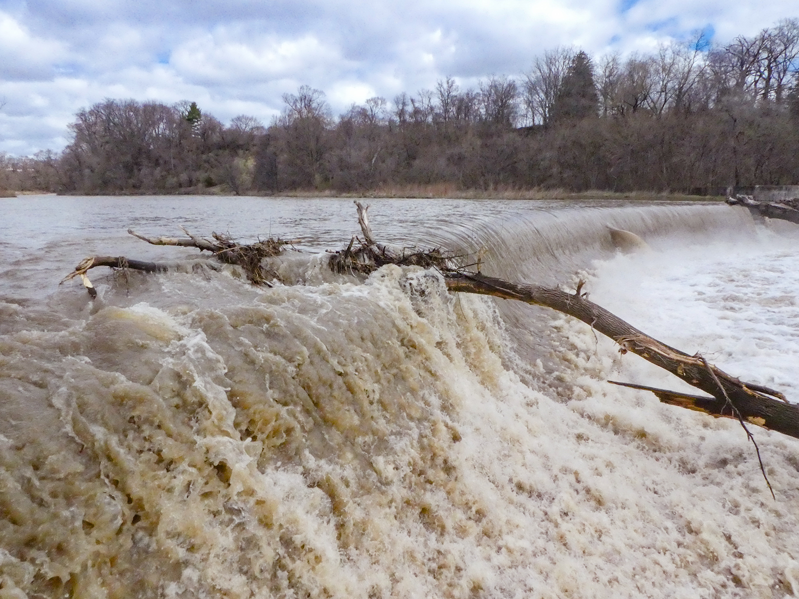
Urban Walk - Toronto Urban Badge Hike - 1 of 7
https://hikes.brucetrail.org/event/urban-walk-toronto-urban-badge-hike-1-of-7-2/Sorry, the registration cut-off time for this hike has been reached.Not a member? Click here to join today!Hosting Club: Toronto
Category: Urban Walk
Location (Google Maps): Humber Recreational TrailHike Leader(s): Brian Rideout Click here to contact Hike Leader(s)
Pace: Moderate (3-4 km/hr)
Terrain: Flat
Distance: 11 kmDescription
Please join me at the south west corner of Finch and Weston by 10 AM. We will hike south on the Humber Recreational Trail to Scarlet and Eglinton (km 30.2 to km 19.2). Here is an online map with km markings of our route for all 7 hikes for the Toronto Urban Badge: https://onthegomap.com/s/c2c1hf3nPlease make sure you bring at least 2 liters of water, a lunch, bug spray and sunscreen.
Birding Hike: Colonel Sam Smith Park to the Arsenal Lands
https://hikes.brucetrail.org/event/birding-hike-colonel-sam-smith-park-to-the-arsenal-lands-2/Sorry, the registration cut-off time for this hike has been reached.Not a member? Click here to join today!Hosting Club: Toronto
Category: Urban Walk
Location (Google Maps): Power House Recreation Centre, Colonel Samuel Smith Park Dr. Coming by transit you can take TTC bus# 44 from Kipling Station at 9:21 (scheduled every 9 minutes) to the end. Look for the tall Powerhouse Smokestack. It is about 50 metres from the stop. Coming by car follow Kipling Avenue to Lake Shore Blvd and keep straight. Kipling Avenue becomes Colonel Samuel Smith Park Drive. Follow to the end parking lot which has free parking. On the way you will pass the Powerhouse smokestack on the left. After parking your car walk back to the Powerhouse meetup spot. Please arrive 15 minutes early.Hike Leader(s): Andrew Proczek Click here to contact Hike Leader(s)
Pace: Leisurely (2-3 km/hr), Moderate (3-4 km/hr)
Terrain: Flat
Distance: 10-11 kmDescription
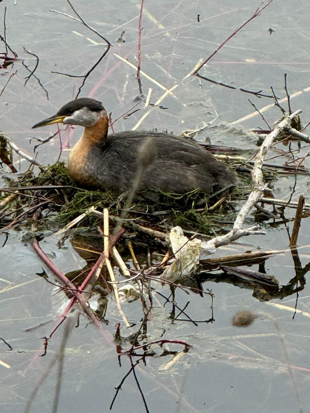
Please join me and foremost local birder, Peter Sproule, for our second annual birding hike through Colonel Sam Smith Park and westward to Marie Curtis Park and the former Arsenal Lands. As promised last year this event is taking place two weeks earlier so that we can get better views of the birds in the yet undeveloped foliage. Peter won’t know exactly what birds are arriving or migrating through until the day before, but we can expect Warblers, Swallows and a variety of shore birds. You can see the birds with the naked eye but a pair of binoculars will certainly enhance your experience.In case you cannot do a lot of walking and you will have your car, you can chose to return to your car when we will be leaving Colonel Sam Smith Park with the option of dropping out or meeting the group at Marie Curtis Park. There is one small park in between but most of the birding will take place at Sam Smith and Marie Curtis Parks including the former Arsenal Lands.
Public washrooms: Ken Cox Community Centre (open from 9 am) opposite the #44 Bus Loop stop; The Powerhouse Recreation Centre will likely be open and there is also a Porta Potty in front; Marie Curtis Park by the boardwalk.
- 05May 5, 2025No events
- 06May 6, 2025
Urban Walk: Valley View Park Thornhill
https://hikes.brucetrail.org/event/urban-walk-valley-view-park-thornhill-73/Sorry, the registration cut-off time for this hike has been reached.Not a member? Click here to join today!Hosting Club: Toronto
Location (Google Maps): Parking lot is inside Sycamore Drive East of Bayview , across Starbucks plaza
Hike Leader(s): Mohammad Aghamiri Click here to contact Hike Leader(s)
Pace: Moderate (3-4 km/hr)
Terrain: Hilly, Level 2 (Intermediate – some hills and uneven surfaces, rocks and roots underfoot)
Distance: 7-8 kmDescription
We will explore Valleyview and Maple View parks, and walk along German Mill Creak, in return we stop in Huntington park and have snack under beautiful shed ,Even it is considered Urban walk, it is urban hike as we have some up and down hills and tree roots, please bring your hiking poles, water and snacks

Car Hike: Spring Birding Silver Creek
https://hikes.brucetrail.org/event/car-hike-spring-birding-silver-creek/Sorry, the registration cut-off time for this hike has been reached.Not a member? Click here to join today!Hosting Club: Toronto
Category: Car Hike
Location (Google Maps): Silver CreekHike Leader(s): Janet Patterson Click here to contact Hike Leader(s)
Pace: Leisurely (2-3 km/hr)
Terrain: Variable
Distance: approx 3 – 4 kmDescription
Join BTC ecologist Mara McHaffie and members of the Toronto Bruce Trail Club’s Biodiversity Team on a hike to learn about birds along the Bruce Trail. This will be a leisurely walk with plenty of stops to observe and listen to the birds we find. This hike will be geared towards beginner birders (no experience necessary) but all are welcome. The BTC’s Silver Creek property boasts a variety of habitats, including meadows, forests, ponds and streams, so we expect to see a good diversity of birds. Some will be just passing through during migration, while others will be staying for the breeding season.During the hike, we will discuss how you can use apps like iNaturalist, Merlin Bird ID and eBird to enhance your birding experience. If you’d like to try them out for yourself, please download them ahead of time, as cell service can be spotty at this location.
Besides water and snacks, bring binoculars if you have them, and please dress for the weather. Note that due to the slow pace and frequent stops, you may want to dress more warmly than you would for a faster-paced hike.
While there is no regular public parking at this location, we will have the gate open to allow parking on site. Parking is available just inside the farm gate off Highway 7, just west of where Trafalgar side trail enters the property (just west of the intersection of Highway 7 and Trafalgar Rd). A sign will be placed at the entrance and PLEASE NOTE that due to the divided road, you can only turn right into the property while travelling southwest on Highway 7 (no left turn). Refer to the map for more details: https://drive.google.com/file/d/1-GvFUz_TAnTi9iqKkJSyRwYNxZM3xxX3/view?usp=drive_link
- 07May 7, 2025No events
- 08May 8, 2025
Urban Walk: Valley View Park Thornhill
https://hikes.brucetrail.org/event/urban-walk-valley-view-park-thornhill-72/Sorry, the registration cut-off time for this hike has been reached.Not a member? Click here to join today!Hosting Club: Toronto
Location (Google Maps): Parking lot is inside Sycamore Drive East of Bayview , across Starbucks plaza
Hike Leader(s): Mohammad Aghamiri Click here to contact Hike Leader(s)
Pace: Moderate (3-4 km/hr)
Terrain: Hilly, Level 2 (Intermediate – some hills and uneven surfaces, rocks and roots underfoot)
Distance: 7-8 kmDescription
We will explore Valleyview and Maple View parks, and walk along German Mill Creak, in return we stop in Huntington park and have snack under beautiful shed ,Even it is considered Urban walk, it is urban hike as we have some up and down hills and tree roots, please bring your hiking poles, water and snacks
Urban Walk: Toronto Islands Evening Walk
https://hikes.brucetrail.org/event/urban-walk-toronto-islands-evening-walk-11/Sorry, the registration cut-off time for this hike has been reached.Not a member? Click here to join today!Hosting Club: Toronto
Location (Google Maps):
Jack Layton Ferry Terminal, near the gates to Wards Island Ferry. Arrive 20 minutes prior to departure to check in with hike leader.
From Union Station take the LRT and get off at the stop Ferry Docks.Walk up to the Ferry Docks on Queens Quay West, street level. at the foot of Bay Street.
Hike Leader(s): Miriam Stevens Click here to contact Hike Leader(s)
Pace: Leisurely (2-3 km/hr)
Terrain: Flat
Distance: 6-9 kmDescription
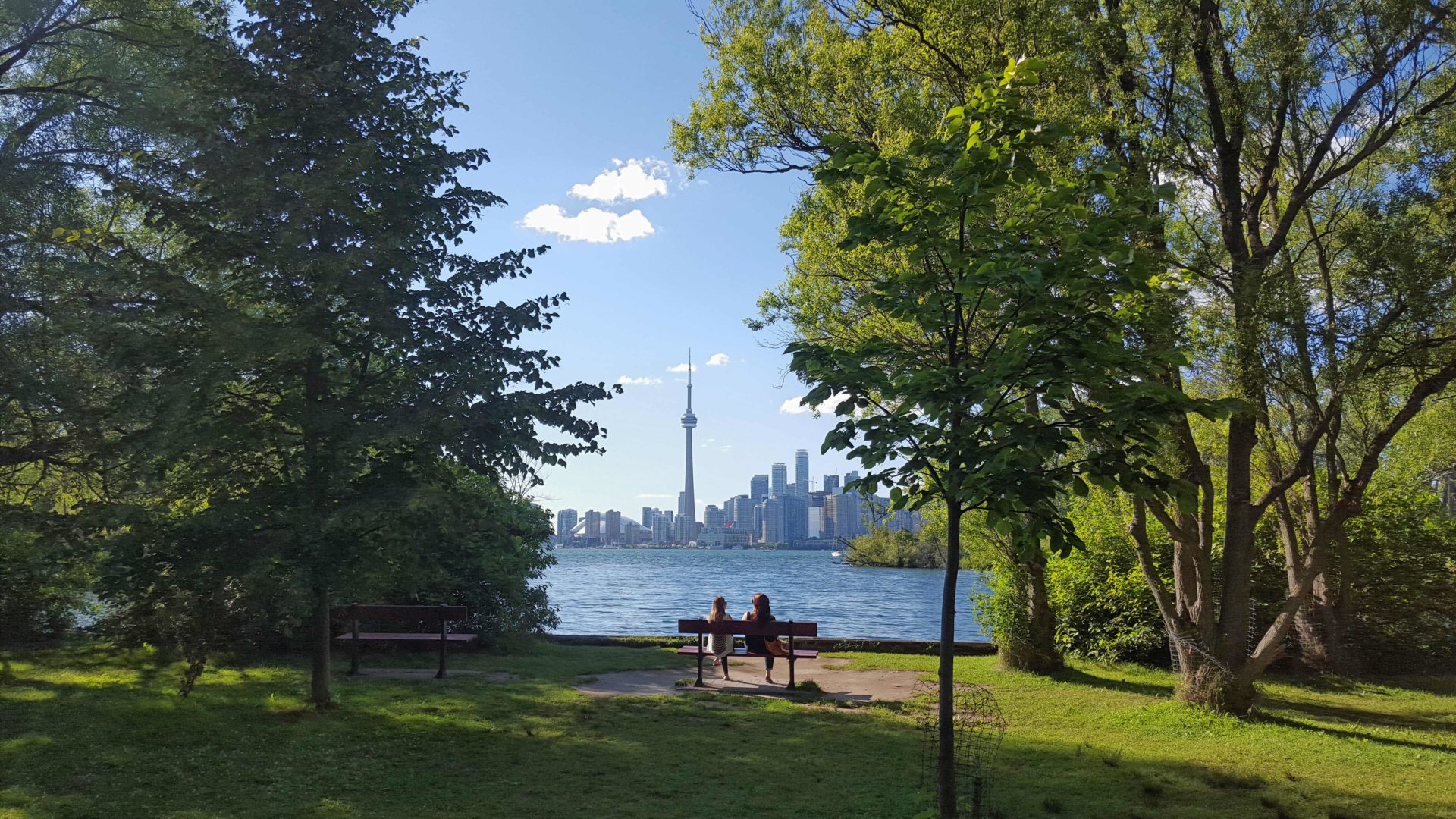
After a day’s work come and “cool off” on the Toronto Islands free of fumes and traffic. Enjoy the view of the city skyline and Toronto’s beautiful island parkland.
Pack a dinner for a sit down picnic. Food is not available for purchase on the Islands early in the season. Also bring a warm jacket and flashlight.
Return fare ticket for the ferry is $9.11 adults and $5.86 seniors.
Hikes will take place rain or shine.
Toronto Island evening hikes will take place every Thursday in May and June 2025.
Same time and same meeting place. No preregistration is required – just show up at the ferry docks at 5:40 PM and sign in with the hike leader. - 09May 9, 2025No events
- 10May 10, 2025
Car Hike: Bethesda Trail Richmond Hill
https://hikes.brucetrail.org/event/car-hike-bethesda-trail-richmond-hill-24/Sorry, the registration cut-off time for this hike has been reached.Not a member? Click here to join today!Hosting Club: Toronto
Location (Google Maps): Meet at Bethesda Trail Head Parking on Bethesda Sideroad off Bayview Avenue, across from Lake Wilcox. This parking lot is free.
Hike Leader(s): Mohammad Aghamiri Click here to contact Hike Leader(s)
Pace: Moderate (3-4 km/hr)
Terrain: Hilly, Level 2 (Intermediate – some hills and uneven surfaces, rocks and roots underfoot), Variable
Distance: 12-14 kmDescription
Join us to explore the trails of York Regional Forest and the Oak Ridges Corridor at Jefferson Forest and Bond lake,From parking lot we hike thought Jefferson forest and continue to Bond Lake and have snack beside the lake and return to parking around 13 to 13.30

School Bus Hike: Niagara E2E #3 of 6
https://hikes.brucetrail.org/event/bus-hike-niagara-e2e-3-of-6/Sorry, the registration cut-off time for this hike has been reached.Not a member? Click here to join today!Trip Information
Departure Time: 08:30
Return to City Time: 18:00
Departure Point: Kipling Departure PointOptional Items
Hosting Club: Toronto
Category: Bus Hike
Location (Google Maps): Niagara Section Kms 29.9 to 46.3Hike Leader(s): Tim Wainwright, Felix Wan Click here to contact Hike Leader(s)
Pace: Moderate (3-4 km/hr)
Terrain: Variable
Distance: 16.4 kmDescription
Join us for a lovely hike through Short Hills Provincial Park outside of St. Catharines. We begin at the DeCew House Heritage Park, and then follow the shore of Lake Moodie, and cross Twelve Mile Creek on the way to Short Hills Provincial Park. In the park we’ll pass a couple of waterfalls, before ending at Rockway Falls in the Rockway Conservation Area. There will be a refreshment stop on the way back to Toronto.Bring a packed lunch, two litres of water and sun/rain/bug protection as needed. Be prepared for some muddy ground along the way.
Drop-out point at 7 kms.
See Map 3 in the Bruce Trail Guide.
The remaining hikes in the Niagara E2E are:
- May 17
- May 24
- June 7
Boyne Valley Provincial Park- Murphy's Pinnacle
https://hikes.brucetrail.org/event/boyne-valley-provincial-park-murphys-pinnacle/Sorry, the registration cut-off time for this hike has been reached.Not a member? Click here to join today!Hosting Club: Toronto, Dufferin Hi-Land
Category: Car Hike
Location (Google Maps): County Road 19 (Prince of Wales Rd) Parking Area. This parking is 80 meters south of the Prince of Wales Side Trail. GPS Coordinates N44.100049, W80.137339.Hike Leader(s): Ross Estrella Click here to contact Hike Leader(s)
Pace: Brisk (4-5 km/hr)
Terrain: Hilly, Level 2 (Intermediate – some hills and uneven surfaces, rocks and roots underfoot), Rocky
Distance: 14 kmDescription
We’ll hike the Prince of Wales, Primrose Loop. Boyne Valley Side Trails and portion of the Main Trail at Boyne Valley Provincial Park. Atop Murphy’s Pinnacle we’ll enjoy and appreciate the early greening of the sorrounding landscape. Please bring your favorite liquid fuel, snacks/lunch and personal medications if any and health card. There maybe some muddy and slippery spots so hiking poles and proper footwear is always recommended. Please arrive fifteen minutes early.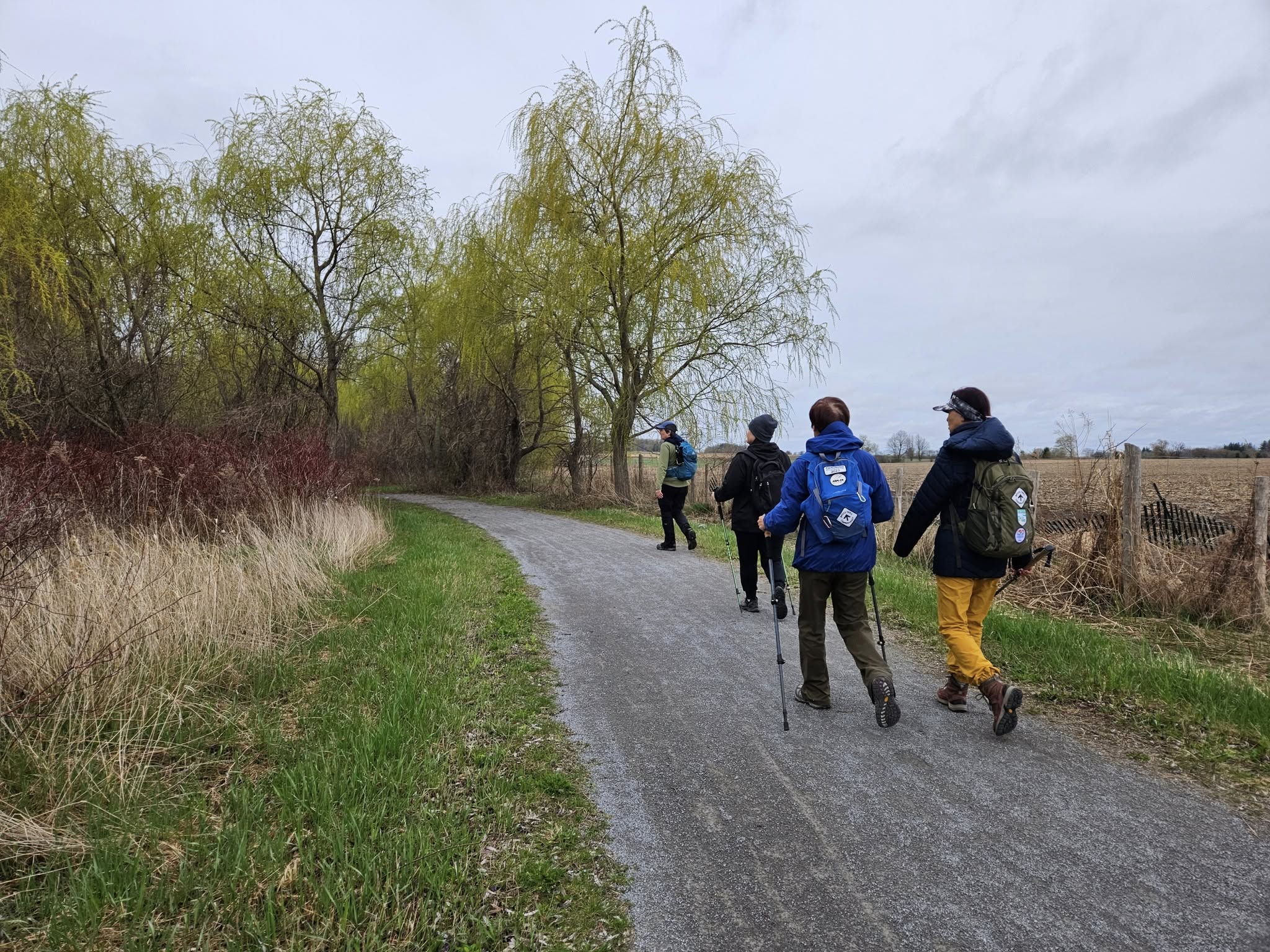
Car Hike: Rouge National Park Trails 16 KM
https://hikes.brucetrail.org/event/car-hike-rouge-national-park-trails-16-km/Sorry, the registration cut-off time for this hike has been reached.Not a member? Click here to join today!Hosting Club: Toronto
Category: Car Hike
Location (Google Maps): Rouge National Urban Park, 16th Ave Parking LotHike Leader(s): Alina Lin
Pace: Brisk (4-5 km/hr)
Terrain: Flat, Level 2 (Intermediate – some hills and uneven surfaces, rocks and roots underfoot)
Distance: 16 KMDescription
Meet at the parking lot Northeast of the Ninth Line @ 19th Ave, GPS ( 43.952621, -79.246167) .Please arrive before 8:45 am to get yourself ready.
We will leave the parking lot at 9:00am, hike along Rouge National Park Trails up to the Elgin Mills Road , and then return. Here is the planned route FYI: https://onthegomap.com/s/12v2do4v . Depending on the trail condition, we may have to adjust the route or distance.
Notes for your attention:
- Wear clothing in layers for the weather.
- Bring water, snacks or light lunch. We will have a short break for lunch after reaching turning point.
- No dogs/pets.

Urban Walk: Toronto Urban Badge Hike - 3 of 7
https://hikes.brucetrail.org/event/urban-walk-toronto-urban-badge-hike-3-of-7/Sorry, the registration cut-off time for this hike has been reached.Not a member? Click here to join today!Hosting Club: Toronto
Category: Urban Walk
Location (Google Maps): Toronto Waterfront TrailHike Leader(s): Brian Rideout Click here to contact Hike Leader(s)
Pace: Moderate (3-4 km/hr)
Terrain: Flat
Distance: 10.4 kmDescription
Please join me at the south west corner of Lakeshore Blvd West and Ellis by 10 AM. We will hike east along the Waterfront Trail to the Distillery District (km 8.3 to km 71.4). Here is an online map with km markings of our route for all 7 hikes for the Toronto Urban Badge.Please make sure you bring at least 2 liters of water, a lunch, bug spray and sunscreen.