Join us for a hike! Registration required:
All hikes available to BTC members. Some hikes are open to non-members.
TIP: The calendar view displays up to 7 hikes on a day, but often there are more. Click “More events” to see them all.
Toronto Hike Schedule
Toronto Bruce Trail Club Registration Live Dates
Day Winter Coach Program
Registration begins two weeks in advance of the event departure (at 8:00 PM)
Day Bus Hikes
Registration begins two weeks in advance of the event departure (at 8:00 PM) with some exceptions of special event hikes
Day Coach Hikes
Registration begins 7 weeks in advance of the event departure
Day Car Hikes and Urban Hikes
Registration begins two weeks in advance of the event departure
Overnight and Weekend Trips
Registration begins 12 weeks in advance of the event departure
To view all Bruce Trail Conservancy Hikes click here
- 29September 29, 2024
Bruce Trail Conservancy and Vieni Estates Presents: A Celebration of Partnership And Community
https://hikes.brucetrail.org/event/bruce-trail-conservancy-and-vieni-estates-presents-a-celebration-of-partnership-and-community/Sorry, the registration cut-off time for this hike has been reached.Not a member? Click here to join today!Hosting Club: Niagara, Iroquoia, Toronto, Caledon Hills, Dufferin Hi-Land, Blue Mountains, Beaver Valley, Sydenham, Peninsula
Category: Event Hikes
Location (Google Maps): Vieni Estates WineryHike Leader(s): Bess Maclaughlin Nakashima, Sam Rutherford Click here to contact Hike Leader(s)
Pace: Leisurely, Medium
Terrain: Moderate
Distance: 3-5kmDescription
Join us in celebrating the ongoing relationship between Vieni Estates and the Bruce Trail Conservancy. Sam Rutherford will be guiding you on a 1-and-a-half-hour hike starting at Vieni Estates. We will return to our starting point for a wine tasting and lunch.Let’s celebrate this ongoing relationship as we look to the future!
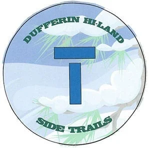
Car Hike: Hike #9 to earn the Dufferin Hi-Land Youth and/or Side Trails Badge!
https://hikes.brucetrail.org/event/car-hike-hike-9-to-earn-the-dufferin-hi-land-youth-and-or-side-trails-badge/Sorry, the registration cut-off time for this hike has been reached.Not a member? Click here to join today!Hosting Club: Toronto, Dufferin Hi-Land
Category: Car Hike
Location (Google Maps): We will meet at roadside parking on 15 Sideroad at Prince of Wales Road. Note that the only access to this location is from River Road, 500 m west of Kilgorie. Look for a small road sign, “15 Sideroad”, on a sharp curve on River Road. (Map 20 of the Bruce Trail Reference Guide, Edition 31).Hike Leader(s): Monica Pasquali Click here to contact Hike Leader(s)
Pace: Leisurely (2-3 km/hr)
Terrain: Variable
Distance: 7.7 kmDescription
Calling all families with children who love hiking and earning badges!!!This is the ninth in a series of ten hikes that will be offered throughout 2024 on a roughly monthly basis so that children who are 15 years of age and younger can earn the Dufferin Hi-Land Adventurer Youth Badge and their parents/guardians can earn the Dufferin Hi-Land Side Trails Badge at the same time!!! Details regarding the requirements for each badge can be found here: https://dufferinbrucetrailclub.org/dufferin-bruce-trail-club-badges/ Each of the ten hikes will be a loop hike so no car shuttles will be needed, and each hike will cover a distance of approximately 6-9 km hiked at a leisurely pace (2-3 km/h) so children and adults alike can participate.
This ninth hike will be a late summer/early autumn hike to explore the following three side trails: part of the Pine River Valley ST, the Carl Alexander ST, and the Melodonna ST. Please dress appropriately for a late summer/early autumn hike by dressing in layers (wear an inner layer that wicks sweat away from your skin, a middle layer that keeps you warm, and an outer layer that protects you from wind and rain), wearing a sunhat, and wearing comfortable footwear that has good traction. Hiking poles or walking sticks are an asset since they will help keep you balanced if the ground is muddy/slippery. As well, make sure you bring enough water and food for a 3-4 hour hike since we’ll be covering a total distance of approximately 7.7 km.
Hopefully you’ll be able to join me on Sunday, September 29th! Until then, happy hiking, everyone!
- 30September 30, 2024No events
- 01October 1, 2024
Car Hike: Blue Mountain E2E Stain Glass Badge
https://hikes.brucetrail.org/event/car-hike-blue-mountain-e2e-stain-glass-badge/Sorry, the registration cut-off time for this hike has been reached.Not a member? Click here to join today!Hike open to BTC Members only.
This is a Multi-Day Hike
You are signing up for the following dates and times:
2024-10-01 at 08:30
2024-10-02 at 08:30
2024-10-03 at 08:30Hosting Club: Toronto
Category: Car Hike
Location (Google Maps): Day 1- Km 51.9 Dufferin, Mulmur -Nottawasaga Townline, at the cemetery. Coordinates N 44.268777,W 80.156810 map 21
Day 2- 380 meters north of km 46.8 coordinates N 44.430927,W 80.275390
Day 3- same as day 2Hike Leader(s): Smadar junkin Click here to contact Hike Leader(s)
Pace: Brisk
Terrain: Challenging, Hilly
Distance: 21.9 kmDescription
Welcome to the Blue Mountain fund raising hike series. The funds collected for this section are used to maintain the pledge of “ Ribbon Of Wilderness For Everyone Forever”. On this hike series you will be allowed to miss one hike that you will need to make up on your own to qualify for the stain glass badge.
on day one we will shuttle to km 21.9 , paid parking. Everyone will be required to pay their share of the parking. We will hike back to km0.0.
on day two we will shuttle to the same place, everyone is required to pay their share of the parking. We will hike 25 km. On day three we will shuttle to the end of the Blue Mountain section and hike back. 20 km.
Bring 2 litres of water, snacks, lunch. Be at the meeting place 15 minutes early so we can leave by 8:30. Everyone is required to take turns in the car shuttles.Urban Walk: Valley View Park Thornhill
https://hikes.brucetrail.org/event/urban-walk-valley-view-park-thornhill-20/Sorry, the registration cut-off time for this hike has been reached.Not a member? Click here to join today!Hosting Club: Toronto
Location (Google Maps): Parking lot at the corner of Bayview Ave, and Sycamore Dr. South of Highway 7
Sycamore Dr. is 3blocks south of highway 7 and 2 blocks north of John Street, parking lot is across plaza of Dollarama and Star boxHike Leader(s): Mohammad Aghamiri Click here to contact Hike Leader(s)
Pace: Moderate (3-4 km/hr)
Terrain: Level 2 (Intermediate – some hills and uneven surfaces, rocks and roots underfoot)
Distance: 7-8 kmDescription
We will explore Valleyview and Maple view parks, and walk along German Mill Creek, for a distance of 7-8 km. Difficulty Level: 2 (Moderate) - 02October 2, 2024No events
- 03October 3, 2024
Urban Walk:: Valley View Park Thornhill
https://hikes.brucetrail.org/event/urban-walk-valley-view-park-thornhill-21/Sorry, the registration cut-off time for this hike has been reached.Not a member? Click here to join today!Hosting Club: Toronto
Location (Google Maps): Parking lot at the corner of Bayview Ave, and Sycamore Dr. South of Highway 7
Sycamore Dr. is 3blocks south of highway 7 and 2 blocks north of John Street, parking lot is across plaza of Dollarama and Star boxHike Leader(s): Mohammad Aghamiri Click here to contact Hike Leader(s)
Pace: Moderate (3-4 km/hr)
Terrain: Level 2 (Intermediate – some hills and uneven surfaces, rocks and roots underfoot)
Distance: 7-8 kmDescription
We will explore Valleyview and Maple view parks, and walk along German Mill Creek, for a distance of 7-8 km. Difficulty Level: 2 (Moderate) - 04October 4, 2024No events
- 05October 5, 2024
Bus Hike: Warsaw Caves and Canadian Canoe Museum
https://hikes.brucetrail.org/event/bus-hike-warsaw-caves-and-canadian-canoe-museum/Sorry, the registration cut-off time for this hike has been reached.Not a member? Click here to join today!Trip Information
Departure Time: 07:30
Return to City Time: 19:00
Departure Point: York Mills Bus PickupOptional Items
Hosting Club: Toronto
Category: Bus Hike
Location (Google Maps): Warsaw Caves Conservation AreaHike Leader(s): Martina Furrer, Brenda Dalglish, Robin Crombie Click here to contact Hike Leader(s)
Pace: Moderate (3-4 km/hr)
Terrain: Rocky, Variable
Distance: 14Description
DescriptionJoin us for a fun day exploring Warsaw Caves Conservation Area. We will hike about 14 km (dropout after 9 km) at a 4 km/hr pace through forests, across open limestone plains, past potholes and kettles, and stop to enjoy the lookout over the Indian River valley. If you choose to dropout after 9km then you will have time to go spelunking (caving) and discover the park’s seven caves, or relax on the beach. Après hike stop in Peterborough (2 hours) where you can visit the Canadian Canoe Museum at it’s beautiful new location on Little Lake, or walk to the historic Peterborough Lift Lock (about 1 hour return), or enjoy a refreshment (craft beer, ice cream, or specialty coffee) at the Silver Bean Café, or relax on the beach in Beavermead Park. Washrooms and water bottle filling stations in the museum and the park. Museum admission for groups of 10 or more is: $18 adults, $16 seniors, and $13 youth (plus tax). Children are free.
Pack lunch, snacks, enough water for the hike (about 2 litres), sun and rain protection. If you plan to go spelunking, bring a headlight.
Bus will depart from 10 York Mills Rd at 7:30 AM. We hope to be back in the city around 7 PM.
Bethesda Trail Richmond Hill 155
https://hikes.brucetrail.org/event/car-hike-health-valley-trail-to-st-jacob-village/Sorry, the registration cut-off time for this hike has been reached.Not a member? Click here to join today!Hosting Club: Toronto
Category: Car Hike
Location (Google Maps): Oak Ridges Corridor, Bethesda Trail Head Parking Lot, Bethesda Side Road, Richmond Hill, OntarioHike Leader(s): Mohammad Aghamiri Click here to contact Hike Leader(s)
Pace: Moderate (3-4 km/hr)
Terrain: Hilly, Level 2 (Intermediate – some hills and uneven surfaces, rocks and roots underfoot)
Distance: 10-11kmDescription
Join us to explore Jefferson Forest and Bond lakePlease bring hiking poles, proper closing and shoes and lots of water,
Bus Hike: Caledon E2E Hike #5 of 5
https://hikes.brucetrail.org/event/caledon-e2e-hike-5-of-5/Sorry, the registration cut-off time for this hike has been reached.Not a member? Click here to join today!Trip Information
Departure Time: 08:30
Return to City Time: 17:00
Departure Point: Kipling Departure PointOptional Items
Hosting Club: Toronto, Caledon Hills
Category: Bus Hike
Location (Google Maps): Hockley Valley Provincial Nature ReserveHike Leader(s): Sajedeh Zahraei; Celia Ho; Felix Wan Click here to contact Hike Leader(s)
Pace: Moderate (3-4 km/hr)
Terrain: Variable
Distance: 11.3 KMDescription
Maps 18-19, km 57.3 – 70.2 km (15.1 km)Starting Point: km 57.3 on 3rd Line EHS (43°58’26.2″N 80°02’33.9″W)
Drop Off Point: Roadside parking area at km 67.8 on Dunby Road (44°00’23.2″N 80°03’34.1″W)
End Point: Roadside Parking – km 70.2/km 0.0 (on the 3rd Line EHS, 30 m south of County Rd. 8) (44.029973°N 80.057360°W)
or
Mono Community Centre, 200 m south of Mono Centre. (44.026195°N 80.071516°W)Car Hike: Fall Indigenous Teachings Hike with Alan Colley -Living Wild in the City
https://hikes.brucetrail.org/event/car-hike-fall-indigenous-teachings-hike-with-alan-colley/Sorry, the registration cut-off time for this hike has been reached.Not a member? Click here to join today!Hike open to BTC Members only.
Hosting Club: Toronto
Category: Car Hike
Location (Google Maps): Meeting place and parking will be at the 17th side road BTC Trail head. This is east of County Road 25, north of Speyside. Map 12 at Vanderleck side trail junction with 17 Sideroad.Hike Leader(s): Patricia Lynn McFerran Click here to contact Hike Leader(s)
Pace: Leisurely
Terrain: Variable
Distance: depending on conditions 5-8 kmDescription
This hike was planned for fall 2023 but had to be cancelled. Alan Colley, of Wild in the City, has agreed to come out and walk the trail and share some of his indigenous teachings about the plants and land use.
We may not be “”living wild in the city but Alan has much to share. This will be a pleasant slow walk through this very diverse section of the Toronto section.
Alan led a very interesting hike back in the spring of 2023 at Silver Creek. The fall is a lovely time to hike theses trails.
Please dress for the weather. Bring lunch and water. Be sure to have your camera and or your apps on your phone, there will be lots to see. Hike will go rain or shine.