Join us for a hike! Registration required:
All hikes available to BTC members. Some hikes are open to non-members.
TIP: The calendar view displays up to 7 hikes on a day, but often there are more. Click “More events” to see them all.
Toronto Hike Schedule
Toronto Bruce Trail Club Registration Live Dates
Day Winter Coach Program
Registration begins two weeks in advance of the event departure (at 8:00 PM)
Day Bus Hikes
Registration begins two weeks in advance of the event departure (at 8:00 PM) with some exceptions of special event hikes
Day Coach Hikes
Registration begins 7 weeks in advance of the event departure
Day Car Hikes and Urban Hikes
Registration begins two weeks in advance of the event departure
Overnight and Weekend Trips
Registration begins 12 weeks in advance of the event departure
To view all Bruce Trail Conservancy Hikes click here
- 22September 22, 2024
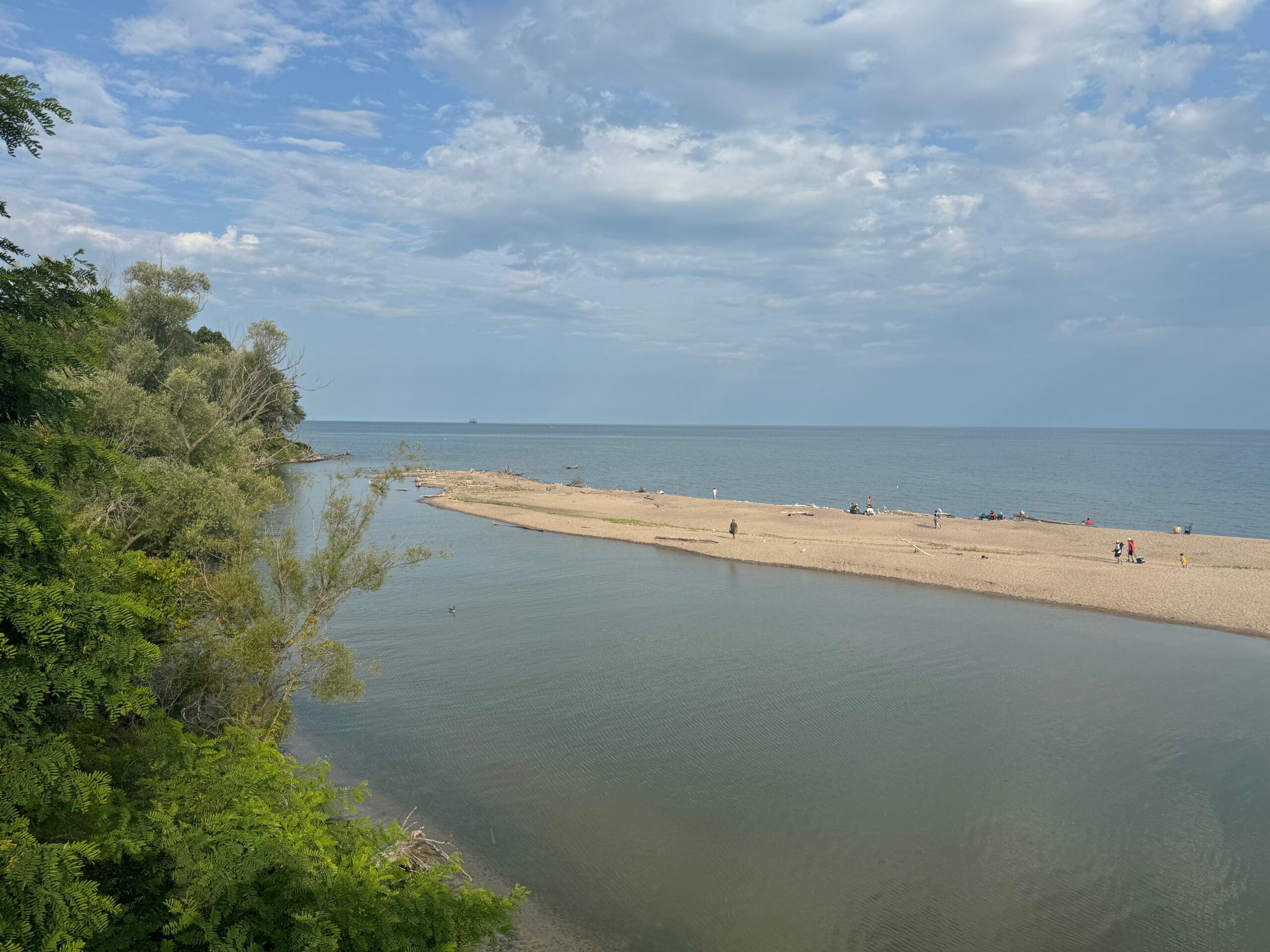
Urban Walk: Beach side views along the Pickering and Rouge waterfronts
https://hikes.brucetrail.org/event/urban-walk-beach-side-views-along-the-pickering-and-rouge-waterfronts/Sorry, the registration cut-off time for this hike has been reached.Not a member? Click here to join today!Hosting Club: Toronto
Category: Urban Walk
Location (Google Maps): We will meet at the Pickering Go station on the south side. If coming from Toronto Union Station, take the Lakeshore East Go train towards Durham College, Oshawa. The 6th stop is the Pickering Go (~45 minutes train trip).
The latest train you should take is the 13:50 – 14:32 so you are on time for the briefing 15 minutes before the departure time at 3 PM. Trains depart from Toronto Union every 30 minutes.Hike Leader(s): KJ Chong Click here to contact Hike Leader(s)
Pace: Moderate (3-4 km/hr)
Terrain: Level 1 (Easy – mostly on flat, well maintained trails with hard-packed surface), Variable
Distance: 9 kmDescription
Join me for a delightful stroll by the Pickering and Rouge waterfronts. We will pass boardwalks with bridges, pretty neighbourhoods and take in views of two different beaches along Lake Ontario. We will also have a great view of the cliffs around Rouge Beach. The walk also features a few discussion stops regarding biodiversity, wetlands and sand dunes, and invasive species. We will also catch a glimpse of the Pickering Nuclear Power Plant producing clean energy, and discuss the role that nuclear is playing in fighting climate change.The official hike ends at Rouge Hill GO station, where you can either catch the GO train back to Toronto Union Station or you can take the GO train east one-stop towards Pickering GO station. For those interested, we can also continue with a 10 minute walk to visit a local restaurant for a sushi dinner at Azumi Sushi. Plenty of washroom stops too.
Terrain is mostly on tarmac, with one hill as we pass through Petticoat Creek Conservation Park.
Pickering GO station has free parking and so if you were coming by car to meet us, you can also park there.
- 23September 23, 2024No events
- 24September 24, 2024
Urban hike: Valley View Park Thornhill
https://hikes.brucetrail.org/event/urban-hike-valley-view-park-thornhill-4/Sorry, the registration cut-off time for this hike has been reached.Not a member? Click here to join today!Hosting Club: Toronto
Location (Google Maps): Parking lot at the corner of Bayview Ave, and Sycamore Dr. South of Highway 7
Sycamore Dr. is 3blocks south of highway 7 and 2 blocks north of John Street, parking lot is across plaza of Dollarama and Star boxHike Leader(s): Mohammad Aghamiri Click here to contact Hike Leader(s)
Pace: Moderate (3-4 km/hr)
Terrain: Level 2 (Intermediate – some hills and uneven surfaces, rocks and roots underfoot)
Distance: 7-8 kmDescription
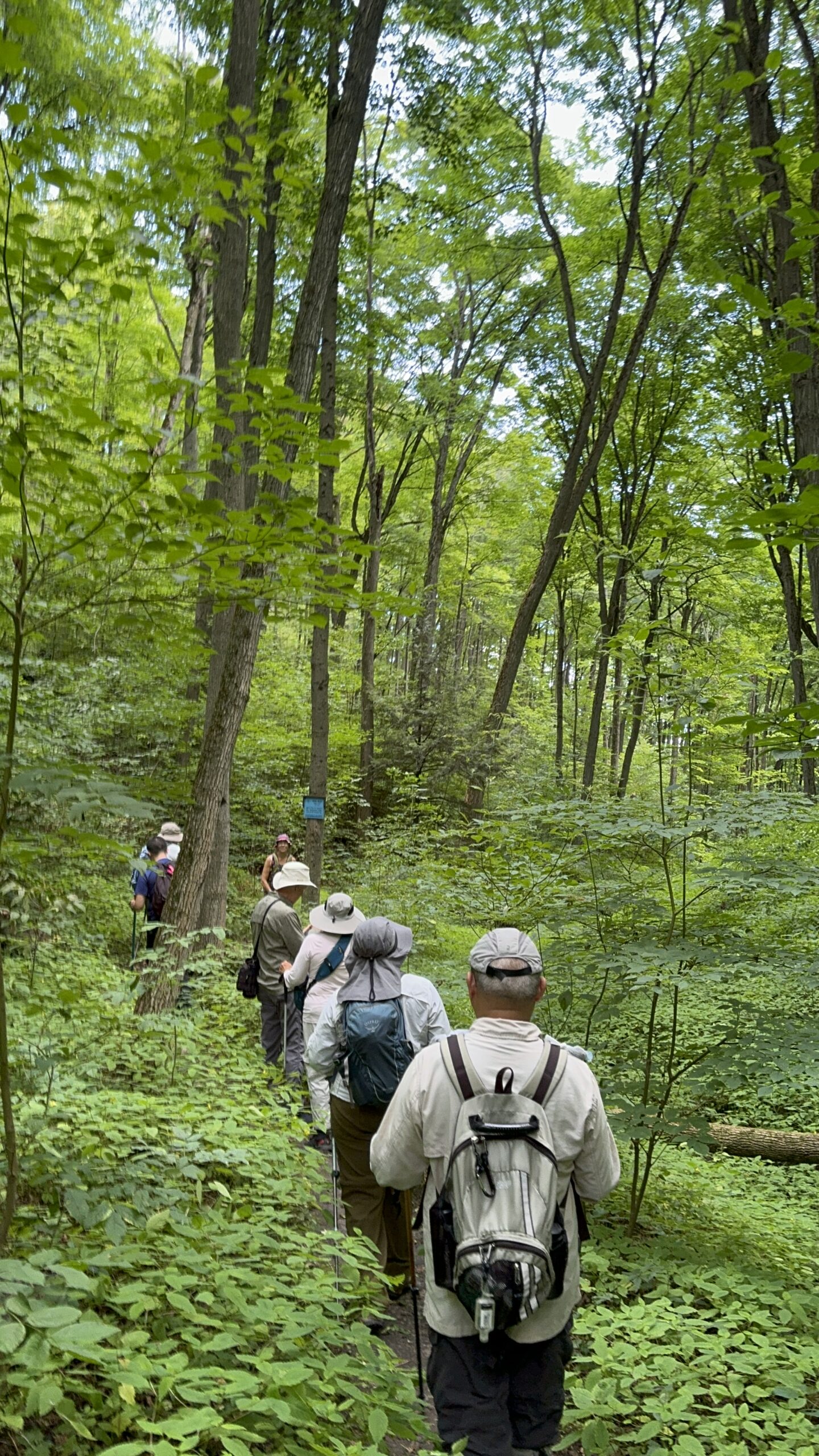
We will explore Valleyview and Maple view parks, and walk along German Mill Creek for approximate 7-8 km. Difficulty Level: 2 (Intermediate) - 25September 25, 2024No events
- 26September 26, 2024
Urban hike: Valley View Park Thornhill 40
https://hikes.brucetrail.org/event/urban-hike-valley-view-park-thornhill/Sorry, the registration cut-off time for this hike has been reached.Not a member? Click here to join today!Hosting Club: Toronto
Location (Google Maps): Parking lot at the corner of Bayview Ave, and Sycamore Dr. South of Highway 7
Sycamore Dr. is 3blocks south of highway 7 and 2 blocks north of John Street, parking lot is across plaza of Dollarama and Star boxHike Leader(s): Mohammad Aghamiri Click here to contact Hike Leader(s)
Pace: Moderate (3-4 km/hr)
Terrain: Level 2 (Intermediate – some hills and uneven surfaces, rocks and roots underfoot)
Distance: 7-8 kmDescription
We will explore Valleyview and Maple view parks, and walk along German Mill Creek for approximately 7-8 km Difficulty Level 2: (Intermediate) - 27September 27, 2024
Car Hike: Tobermory Fall Hiking Weekend (2 overnights)
https://hikes.brucetrail.org/event/car-hike-tobermory-fall-hiking-weekend-2-overnights/Sorry, the registration cut-off time for this hike has been reached.Not a member? Click here to join today!This is a Multi-Day Hike
You are signing up for the following dates:
2024-09-27, 2024-09-28, 2024-09-29Hosting Club: Toronto
Category: Car Hike
Location (Google Maps): Princess Hotel
34 Bay St, Tobermory, ON N0H 2R0Hike Leader(s): Jeanette Vincent. Click here to contact Hike Leader(s)
Pace: Moderate (3-4 km/hr)
Terrain: Rocky, Variable
Distance: 13 -15kmDescription
We continue Greg Vincent’s legacy of weekends away. Please join Jeanette Vincent, as we explore the Tip o’ the Bruce, Tobermory in the Fall. The beauty of this area of the Bruce Peninsula every season is wonderful! We will take in a number of walks using side trails and the Bruce Trail. Approximately 13-15km/day. We stay and have our meals at a comfortable hotel overlooking Little Tub Harbour. This outing is restricted to those staying with us at the Princess Hotel in Tobermory for the weekend – the hotel fills quickly. You will need a car to access this outing. Please contact the Princess Hotel for a reservation.1-519-592-8282 or info@tobermoryprincesshotel.com and mention Vincent/Royle Fall weekend.Before registering at the hotel please contact Jeanette: vincentjeanette1604@gmail.com | 519-588-5916 For prices and more details.
- 28September 28, 2024
School Bus Hike: Boyne Valley and Primrose - ** CANCELLED Due to Low Registration **
https://hikes.brucetrail.org/event/school-bus-hike-boyne-valley-and-primrose/Sorry, the registration cut-off time for this hike has been reached.Not a member? Click here to join today!Hosting Club: Toronto
Category: Cancelled
Location (Google Maps): Bruce Trail parking lot at Prince Of Wales RdHike Leader(s): Amir Alemohammad, Michael Humpage, Mehrnoush Ahmadi Click here to contact Hike Leader(s)
Pace: Moderate (3-4 km/hr)
Terrain: Hilly, Level 2 (Intermediate – some hills and uneven surfaces, rocks and roots underfoot), Variable
Distance: 14kmDescription
Bus departs 10 York Mills Rd at 8:00 AM and Major Mackenzie Dr and HWY 400 Park and Ride at 8:30 AM. If you wish to be picked up at the Major Mackenzie Dr and HWY 400 Park and Ride, type ‘yes’ in the additional information field. Please arrive 15 minutes before departure.Join us for an early fall hike in Boyne Valley Provincial Park, a hidden gem along the BT. We will explore the Primrose ST and will head into the Boyne Valley Park to reach the Murphy’s Pinnacle. After hiking in the valley we will make a loop return to the parking lot at Prince of Wales Rd. We will have frequent short stops for water and bio breaks and a 20 minute stop for lunch. Please bring water, snacks/lunch and dress according to the weather condition. Be prepared for early morning chilled air at this time of the season. Boots are mandatory and poles are recommended. A short stop for refreshments in Shelbourne down town if enough time. We do love pets but they are not allowed in this hike.
Drop out after 8K at the 1EHS Rd.Car Hike: Erindale Park Mississauga
https://hikes.brucetrail.org/event/car-hike-erindale-park-mississauga-3/Sorry, the registration cut-off time for this hike has been reached.Not a member? Click here to join today!Hosting Club: Toronto
Category: Car Hike
Location (Google Maps): Erindale Park, Dundas Street West,
park in parking lotHike Leader(s): Mohammad Aghamiri Click here to contact Hike Leader(s)
Pace: Moderate (3-4 km/hr)
Terrain: Variable
Distance: 14-15 kmDescription
We will hike Credit River North,and will see nice views of Credit River .And we will see Salmons heading upstream
Urban Walk; Humber Valley Recreational Trail
https://hikes.brucetrail.org/event/urban-walk-humber-valley-recreational-trail/Sorry, the registration cut-off time for this hike has been reached.Not a member? Click here to join today!Hosting Club: Toronto
Category: Urban Walk
Location (Google Maps): Humber Recreational Trail, TorontoHike Leader(s): Brian Rideout Click here to contact Hike Leader(s)
Pace: Moderate (3-4 km/hr)
Terrain: Flat, Level 1 (Easy – mostly on flat, well maintained trails with hard-packed surface)
Distance: 26.4 kmDescription
Meet at the north east corner of Steeles Ave W and Kipling Ave by 10:00 am. The hike starts on time so don’t be late.This hike follows the Humber Recreational Trail south from Steeles Ave West at Kipling Ave through Toronto to Lake Ontario. The pub stop after is at Firkin on Bay. The bus to Old Mill Station stops in front of the pub.
Please bring a lunch and at least two liters of water. Be prepared for cool / wet weather.
This is the itinerary
0.0 km – 10:00 am – Steeles Ave W at Kipling Ave
4.3 km – 11:15 am – Finch Ave W at Islington Ave
8.4 km – 12:35 pm – 25 minute lunch – near Weston Rd and Sheppard Ave W (on trail behind and south of school)
12.0 km – 2:05 pm – Weston Rd and Oak St
15.8 km – 3:00 pm – Eglinton Ave W at Scarlet Rd
19.2 km – 4:00 pm – Dundas St W
23.7 km – 5:15 pm – Stephen – Berry Rd at Drive
26.4 km – 6:00 pm – Firkin on BayHere is an online map of our route: Humber Recreational Trail – https://onthegomap.com/s/vjskof0f
Note: Registration closes 48 hours before the start of the hike.
This hike is at capacity Car Hike: Where Geology and Biodiversity meet HIke with Beth Gilhespy geologist and author
https://hikes.brucetrail.org/event/car-hike-where-geology-and-biodiversity-meet-hike-with-beth-gilhespy-geologist-and-author/Sorry, the registration cut-off time for this hike has been reached.Not a member? Click here to join today!Hosting Club: Toronto
Category: Car Hike
Location (Google Maps): Toronto section Silver Creek Map13 Edition 31 Parking at the Silver Creek Outdoor Education Centre Km 36.2 Fallbrook Trail NW of 27 Sideroad
THis hike is at its capacity no further registrationsHike Leader(s): Lynn McFerran Click here to contact Hike Leader(s)
Pace: Leisurely (2-3 km/hr)
Terrain: Rocky, Variable
Distance: 6-8 kmDescription
This hike is another of the Biodiversity Team education hikes to help hikers learn more about the region where we hike. Beth is a geologist and has led hikes in various part of the Bruce Trail sharing her knowledge about the geology of the area. The Silver Creek section has lots of interesting geological features.This will be a great day out hiking and learning.
Please dress for the day, Hiking boots recommended, bring your lunch, water and snacks. This hike will go rain or shine.