
The BTC office will be closed Tues. Sept. 22 and Wed. Sept. 23. The office will reopen on Thurs. Sept. 24 at 9 am. Thank you for your understanding.
Join us for a hike! Registration required:
All hikes available to BTC members. Some hikes are open to non-members.
TIP: The calendar view displays up to 7 hikes on a day, but often there are more. Click “More events” to see them all.
Toronto Hike Schedule
Toronto Bruce Trail Club Registration Live Dates
Day Winter Coach Program
Registration begins two weeks in advance of the event departure (at 8:00 PM)
Day Bus Hikes
Registration begins two weeks in advance of the event departure (at 8:00 PM) with some exceptions of special event hikes
Day Coach Hikes
Registration begins 7 weeks in advance of the event departure
Day Car Hikes and Urban Hikes
Registration begins two weeks in advance of the event departure
Overnight and Weekend Trips
Registration begins 12 weeks in advance of the event departure
To view all Bruce Trail Conservancy Hikes click here
- 15September 15, 2024
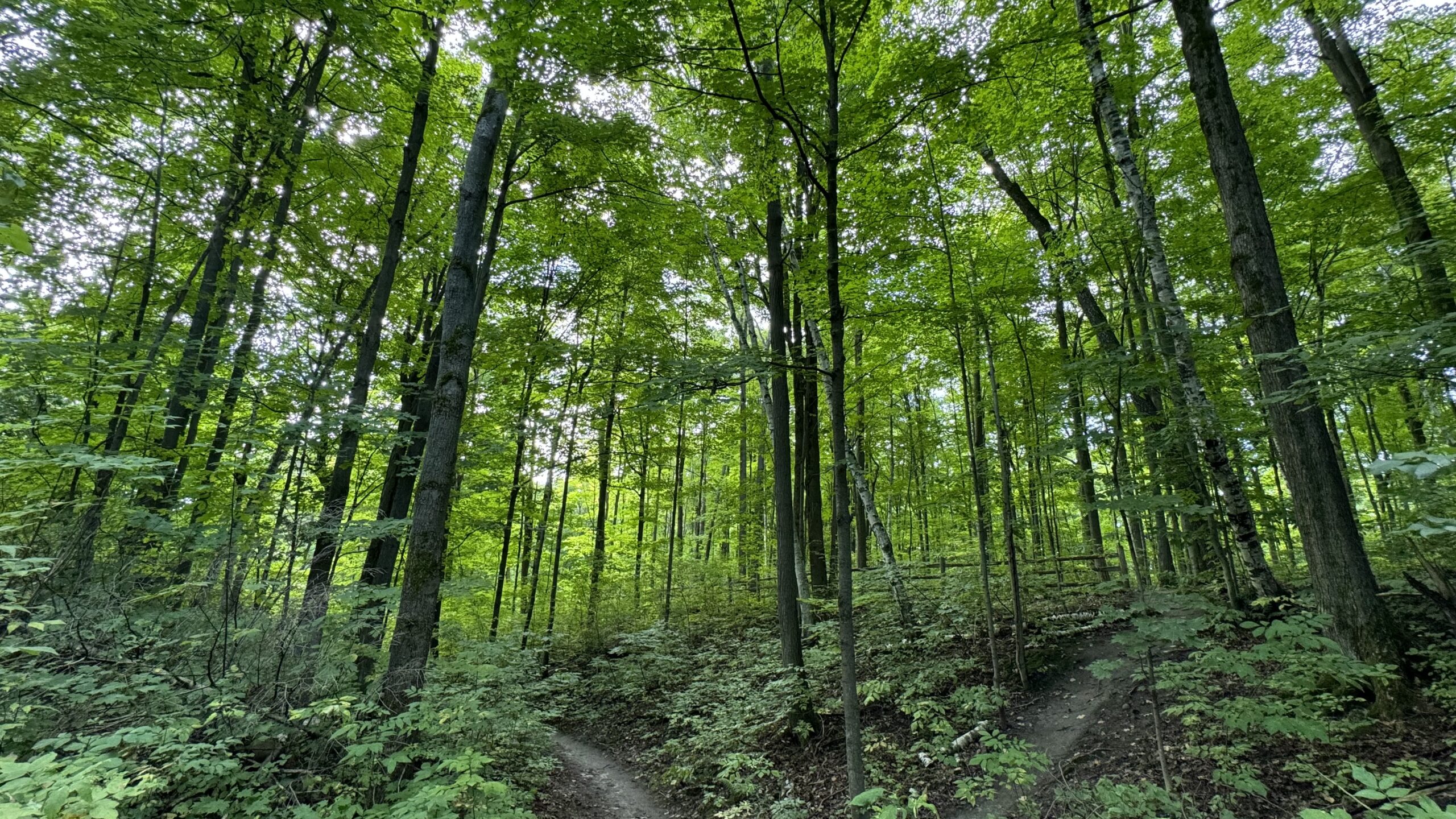
Car Hike: Jefferson Forest and Bond Lake
https://hikes.brucetrail.org/event/car-hike-jefferson-forest-and-bond-lake/Sorry, the registration cut-off time for this hike has been reached.Not a member? Click here to join today!Hosting Club: Toronto
Category: Car Hike
Location (Google Maps): 1235-1245 Bethesda Side Rd, Richmond Hill, ON L4E 1A2 ( Bethesda Trail Head Parking lot)Hike Leader(s): Amir Alemohammad Click here to contact Hike Leader(s)
Pace: Moderate (3-4 km/hr)
Terrain: Hilly, Level 2 (Intermediate – some hills and uneven surfaces, rocks and roots underfoot), Variable
Distance: 12-14 kmDescription
Join us for a wonderful hike in Jefferson Forest and have a snack/lunch beside the Bond Lake with amazing early fall views. We will hike among tall trees and bushes of the Jefferson Forest and across the Bayview-Yonge corridor to reach to the Bond Lake. Boots mandatory, poles recommended, bring at least 2L of water, bug spray, sunscreen, snack/lunch and dress according to the weather conditions. Sorry dogs are not allowed in this hike. Please avoid parking along the road. Difficulty Level: 2 (Moderate)Please arrive @8:00 AM for start 8:15 AM.

Urban Walk: McMichael Art Gallery via William Granger Greenway (Humber Trail)
https://hikes.brucetrail.org/event/urban-walk-mcmichael-art-gallery-via-william-granger-greenway-humber-trail/Sorry, the registration cut-off time for this hike has been reached.Not a member? Click here to join today!Hosting Club: Toronto
Category: Urban Walk
Location (Google Maps): Meet no later than 09.30 am at the Vaughan Metropolitan Centre TTC station. From there, we will use YRT public transport buses to get to our hiking starting point (if using a Presto Card the YRT bus is free under the “One Fare” program). If you prefer to drive meet us at the corner of Napa Valley Ave and Islington Ave at 10:30 (there is a Tim Horton’s at the corner). Please contact the hike leader for meeting instructions and parking options if driving to the start of the hike.Hike Leader(s): Leonora Rochwerger Click here to contact Hike Leader(s)
Pace: Moderate (3-4 km/hr)
Terrain: Flat, Level 1 (Easy – mostly on flat, well maintained trails with hard-packed surface)
Distance: 8.5 kmDescription
Join us for a 8.5 km hike along the William Granger Greenway (Humber Trail), to the McMichael Art Gallery and back. We will spend time at the Art Gallery, where you will have the option of visiting the current exhibits and/or exploring the beautiful grounds. Entrance to the Gallery is free on that day. Difficulty Level: Easy – flat terrain, packed gravel and paved surfacesRoute map: https://onthegomap.com/s/n5vnrdkv
How to get there and get home: We will meet as a group no later than 09.30 at the Vaughan Metropolitan Centre TTC station. From there, we will use YRT public transport buses to get to our hiking starting point.
If you are driving, you can meet us at the corner of Napa Valley and Islington at 10:30 (there is a Tim Horton’s at the corner). Please contact the hike leader for meeting instructions and parking options.
To go back, we will use YRT public transport to return to Vaughan TTC station.
What to bring: Proper walking /hiking shoes, at least 2 litres of water, sunscreen, hat, bug repellent if used and a packed lunch. Lunch is also available at the Gallery cafe. Appropriate clothing for the weather. No dogs allowed.
For more information about the Art Gallery, visit: https://mcmichael.com/
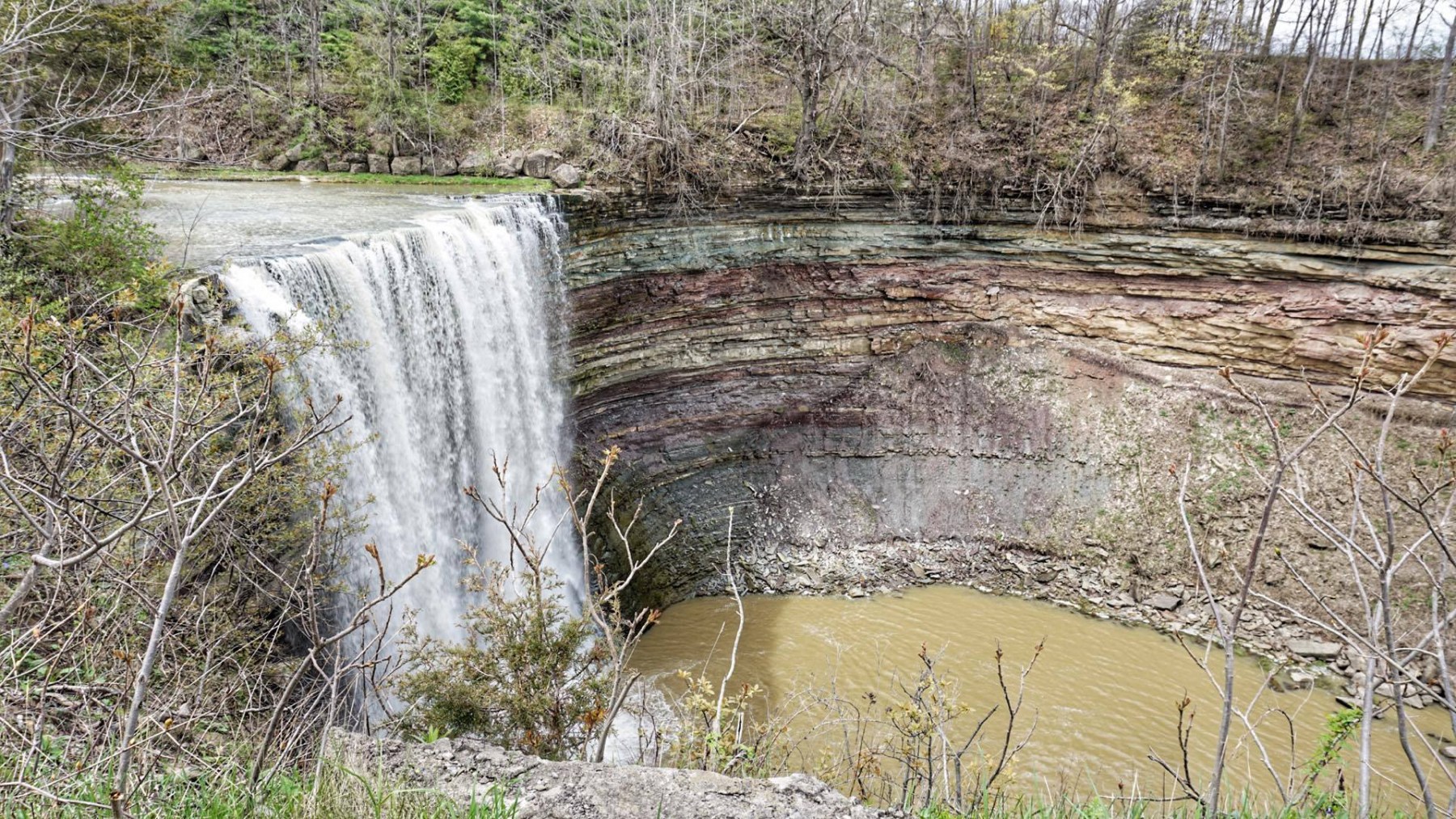
Ball's Falls Hike 10km + Farm Fruit Pick Up
https://hikes.brucetrail.org/event/balls-falls-hike-10km-farm-fruit-pick-up/Sorry, the registration cut-off time for this hike has been reached.Not a member? Click here to join today!Hosting Club: Toronto
Category: Car Hike
Location (Google Maps): Jordan Hollow Park, GPS (43.142022, -79.372672)Hike Leader(s): Alina Lin
Pace: Moderate (3-4 km/hr)
Terrain: Challenging, Hilly, Level 2 (Intermediate – some hills and uneven surfaces, rocks and roots underfoot), Rocky, Variable
Distance: Approximately 10 kmDescription
We will hike along the Bruce Trail and side trails for around 10KM, in and around the Ball’s Falls Conservation area. The hike will last about two and half hours.Bring lunch and at least 1L of water. Wear proper clothing for the weather. Hiking boots are strongly recommended. No dogs or kids under 13 years of old. Difficulty Level: 2 (Moderate)
After hike, you are welcome to join me for some fun of picking-up-your-own-fruit at Cherry Avenue Farms, for blue plums, and at Lipsitt Orchards, for grapes. Picking up your own activity is optional and there are fees charged by the farms. According to the information given, the entrance fee for Cherry Avenue Farms is $8 per person and comes with a 2L basket for filling. For grape pick up, Lipsitt Orchards may offer different sized basket at different prices.
- 16September 16, 2024No events
- 17September 17, 2024
Urban hike: Valley View Park Thornhill
https://hikes.brucetrail.org/event/urban-hike-valley-view-park-thornhill-9/Sorry, the registration cut-off time for this hike has been reached.Not a member? Click here to join today!Hosting Club: Toronto
Location (Google Maps): Parking lot at the corner of Bayview Ave, and Sycamore Dr. South of Highway 7
Sycamore Dr. is 3blocks south of highway 7 and 2 blocks north of John Street, parking lot is across plaza of Dollarama and Star boxHike Leader(s): Mohammad Aghamiri Click here to contact Hike Leader(s)
Pace: Moderate (3-4 km/hr)
Terrain: Level 2 (Intermediate – some hills and uneven surfaces, rocks and roots underfoot)
Distance: 7-8 kmDescription
We will explore Valleyview and Maple view parks, and walk along German Mill Creek for a distance of 7-8 km. Difficulty Level: 2 (Intermediate) - 18September 18, 2024
Car Hike: Midweek Fitness Hike from the Crawford Conservation Area to the Rattlesnake Point and back (about 14 km)
https://hikes.brucetrail.org/event/car-hike-midweek-fitness-hike-from-the-crawford-conservation-area-to-the-rattlesnake-point-and-back-about-14-km/Sorry, the registration cut-off time for this hike has been reached.Not a member? Click here to join today!Hosting Club: Toronto
Category: Car Hike
Location (Google Maps): Crawford Lake Conservation AreaHike Leader(s): Natalia Svechnikova Click here to contact Hike Leader(s)
Pace: Moderate (3-4 km/hr)
Terrain: Hilly, Level 2 (Intermediate – some hills and uneven surfaces, rocks and roots underfoot), Rocky, Variable
Distance: About 14 kmDescription
Please join me for a moderate midweek fitness hike in the Crawford Lake conservation area.We will meet at the main entrance to the visitors centre accessible from the parking road off Conservation Road. You would have to pass the gate. The gate fee can be paid online $10.50 or in person a t the gate $12 plus HST. The gate is open from 10 am to 4 pm.
We will hike from the Crawford Lake to the Rattlesnake Point Conservation Area and back keeping up a moderate speed of about 3.5 km/h. The hike should take about 4.5 hours including a short lunch break at one of the lookouts in the Rattlesnake Point Conservation Area.
If the weather is not favorable (light rain or muddy condition after rainfall), I would shorten the hike to about 10 km.
- 19September 19, 2024
Urban Walk: Valley View Park Thornhill
https://hikes.brucetrail.org/event/urban-walk-valley-view-park-thornhill-11/Sorry, the registration cut-off time for this hike has been reached.Not a member? Click here to join today!Hosting Club: Toronto
Location (Google Maps): Parking lot at the corner of Bayview Ave, and Sycamore Dr. South of Highway 7
Sycamore Dr. is 3blocks south of highway 7 and 2 blocks north of John Street, parking lot is across plaza of Dollarama and Star boxHike Leader(s): Mohammad Aghamiri Click here to contact Hike Leader(s)
Pace: Moderate (3-4 km/hr)
Terrain: Level 2 (Intermediate – some hills and uneven surfaces, rocks and roots underfoot)
Distance: 7-8 kmDescription
We will explore Valleyview and Maple view parks, and walk along German Mill Creek, for a distance of 7-8 km. Difficulty Level:2 (Moderate) - 20September 20, 2024
Coach Trip: Sept 20 to 22 Saugeen Peninsula Hiking Weekend
https://hikes.brucetrail.org/event/coach-trip-sept-20-to-22-saugeen-peninsula-hiking-weekend/Sorry, the registration cut-off time for this hike has been reached.Not a member? Click here to join today!Trip Information
Departure Time: 07:00
Return to City Time: 19:30
Departure Point: York Mills Bus PickupTrip Activities
Moderate group ($0.01)
Fast group ($0.01)
Optional ItemsHosting Club: Toronto, Peninsula
Category: Coach Trips
Location (Google Maps): Evergreen Resort, Red BayHike Leader(s): Martina Furrer, Roland Mark, George Lennon and Tim Wainwright Click here to contact Hike Leader(s)
Pace: Fast, Moderate
Terrain: Hilly, Rocky, Variable
Distance: Moderate group about 12 km, fast group 15 km +Description
Join us for three days of guided hiking on the beautiful Saugeen Peninsula. Spend your days on the Bruce Trail and your evenings at Evergreen Resort overlooking Lake Huron.We will explore the Skinner’s Bluff, Cape Crocker, Hope Bay, Barrow Bay, Lion’s Head, and/or Cape Chin areas. Hikes will be up to 15 km (dropouts will not be possible) with lots of awesome views. Expect some strenuous climbs, some challenging footing over boulders and crevasses, and some exposed sections. These hikes are not suitable for people who are afraid of heights. All fit, experienced hikers comfortable walking on this type or terrain are welcome. There will be a moderate group and a slightly faster group; both will do full day hikes with no dropouts. Please note: there will not be a sight seeing group or other activities for non-hikers.
Accommodation is in one-, two-, and three-bedroom cottages (linens, bedding, and towels provided). Each cottage has a full bathroom, fridge, and heater. The resort has a hot tub and a private beach perfect for viewing sunsets. Cost is $393.81 per person (includes all taxes and fees, gratuity extra). This includes two nights’ accommodation, two dinners, two breakfasts, and two boxed lunches.
Coach fare is $170 for members, $180 for non-members, and $90 for children.
Registration instructions:
Please reserve your cottage and your seat on the coach at the same time.
- Call Evergreen Resort at 519-534-1868 to book your cottage. You will need to find roommates/cottagemates. There are no single hotel rooms.
- To reserve your seat on the bus, register here starting on Sunday June 9 at 8 PM.
Cancellation policy: While we are hoping for sunshine, the trip cannot be cancelled due to weather. Coach fare is non-refundable.
Our coach will depart at 7 AM on Friday September 20. We plan to be back in Toronto between 7 and 8 PM on Sunday September 22. Departure locations: 10 York Mills Rd and HWY 400 and Major Mackenzie Park and Ride.
- 21September 21, 2024
Bus Hike: Spencer Gorge & Borer's Falls - CANCELLED Diue To Low Registration
https://hikes.brucetrail.org/event/school-bus-hike-spencer-gorge-borers-falls/Sorry, the registration cut-off time for this hike has been reached.Not a member? Click here to join today!Hosting Club: Toronto
Category: Cancelled
Location (Google Maps): Dundas, ON – Spencer Gorge/Borer’s FallsHike Leader(s): Peter Leeney, Leila Damband Click here to contact Hike Leader(s)
Pace: Moderate (3-4 km/hr)
Terrain: Hilly, Level 2 (Intermediate – some hills and uneven surfaces, rocks and roots underfoot), Other (Refer to Description), Rocky
Distance: 13 km, Dropout at 6kmDescription
We will begin with a visit to Tews Falls then follow the side trail down to the Main Bruce Trail. We will hike north on the Trail past Borer’s Falls and under Hwy 6 to Clappison Woods; then up the Rockcliffe Side Trail to Waterdown.
The terrain will be moderate but there will be some hills and poor footing. Hiking boots are essential. Dropout at 6 km. Difficulty Level: 2 (Intermediate)Car Hike; Bethesda Trail Richmond Hill
https://hikes.brucetrail.org/event/car-hike-bethesda-trail-richmond-hill-21/Sorry, the registration cut-off time for this hike has been reached.Not a member? Click here to join today!Hosting Club: Toronto
Location (Google Maps): Meet at Bethesda Trail Head Parking on Bethesda Sideroad off Bayview Avenue, across from Lake Wilcox. This parking lot is free.
Hike Leader(s): Mohammad Aghamiri Click here to contact Hike Leader(s)
Pace: Moderate (3-4 km/hr)
Terrain: Hilly, Variable
Distance: 14-17 kmDescription
Join us to explore Jefferson Forest and Bond lakePlease bring hiking poles, proper closing and shoes and lots of water,
Car Hike: Hockley Valley Map 18
https://hikes.brucetrail.org/event/car-hike-hockley-valley-map-18-3/Sorry, the registration cut-off time for this hike has been reached.Not a member? Click here to join today!Hosting Club: Toronto
Category: Car Hike
Location (Google Maps): Hockley Valley, Map 18Hike Leader(s): Al Brown Click here to contact Hike Leader(s)
Pace: Moderate (3-4 km/hr)
Terrain: Challenging
Distance: 14 kmDescription
We will hike 14 km through the Nature Preserve, one of the most challenging (hilliest) and scenic parts of the Bruce Trail. Fall colors should be showing. Most of the route is under the forest canopy. After the hike I invite those interested to stop at the Hockley Valley Resort for refreshments.To get to the meeting point drive north of Hwy 10 from Orangeville to Hockley Road. Turn right and go about 5 km east to the parking area on your left. It is across the road from the Black Birch restaurant.
Car Hike: Toronto Bruce Trail Club Biodiversity Fall Fern Identification Hike
https://hikes.brucetrail.org/event/car-hike-toronto-bruce-trail-club-biodiversity-fall-fern-identification-hike/Sorry, the registration cut-off time for this hike has been reached.Not a member? Click here to join today!Hosting Club: Toronto
Category: Car Hike
Location (Google Maps): Please note the meeting location has been changed as of 19/09/2024, Meet: Map 14 38.8 km along 10th line north of 27 sideroad.
The change is to ensure we had some ferns to actually find!!
Toronto Section Map12, Km 17.4 There is parking along the roadside both north and south bound. Where the trail crosses the road. We will meet at the boot brush station. Please be ready to hike at 10:00am.Hike Leader(s): Patricia Lynn McFerran Click here to contact Hike Leader(s)
Pace: Leisurely (2-3 km/hr)
Terrain: Variable
Distance: 4-5kmDescription
Today we are looking for ferns to identify with the help of BTC Ecologist Mara McHaffie.
THis are is diverse and has some wet areas so hopefully we will find some interesting plants. THis is a slow paced look and learn hike. This will be a good opportunity for hikers to collect some of the requirements of the TBTC Naturalist badge. Please bring a light lunch or snacks and lots of water . Cameras and the iNaturalist app on your phone will be handy to record what we are going to see. Last fall I saw some rather interesting fungi in this area too.
This hike will go rain or shine, so dress for the weather.