Join us for a hike! Registration required:
All hikes available to BTC members. Some hikes are open to non-members.
TIP: The calendar view displays up to 7 hikes on a day, but often there are more. Click “More events” to see them all.
Toronto Hike Schedule
Toronto Bruce Trail Club Registration Live Dates
Day Winter Coach Program
Registration begins two weeks in advance of the event departure (at 8:00 PM)
Day Bus Hikes
Registration begins two weeks in advance of the event departure (at 8:00 PM) with some exceptions of special event hikes
Day Coach Hikes
Registration begins 7 weeks in advance of the event departure
Day Car Hikes and Urban Hikes
Registration begins two weeks in advance of the event departure
Overnight and Weekend Trips
Registration begins 12 weeks in advance of the event departure
To view all Bruce Trail Conservancy Hikes click here
- 06October 6, 2024
Bruce Trail Day Car Hike
https://hikes.brucetrail.org/event/bruce-trail-day-car-hike/Sorry, the registration cut-off time for this hike has been reached.Not a member? Click here to join today!Hosting Club: Toronto
Category: Car Hike
Location (Google Maps): Limehouse Conservation AreaHike Leader(s): Lindita Kalo Click here to contact Hike Leader(s)
Pace: Moderate (3-4 km/hr)
Terrain: Level 2 (Intermediate – some hills and uneven surfaces, rocks and roots underfoot), Rocky, Variable
Distance: 10-12kmDescription
Annual Bruce Trail Day Hike, lets celebrate with hiking, the Bruce Trail, and the Niagara Escarpment. Meet at Limehouse parking lot N 43.632448,W 79.973355 We will start our hike south of Limehouse on the main Bruce trail and hike up from Canada Goose side trail to end at Limehouse. You will have the opportunity to visit the Toronto Club’s Bruce Trail Day drop-in event at the Limehouse Community Hall after the hike. Refreshment and snacks will be available.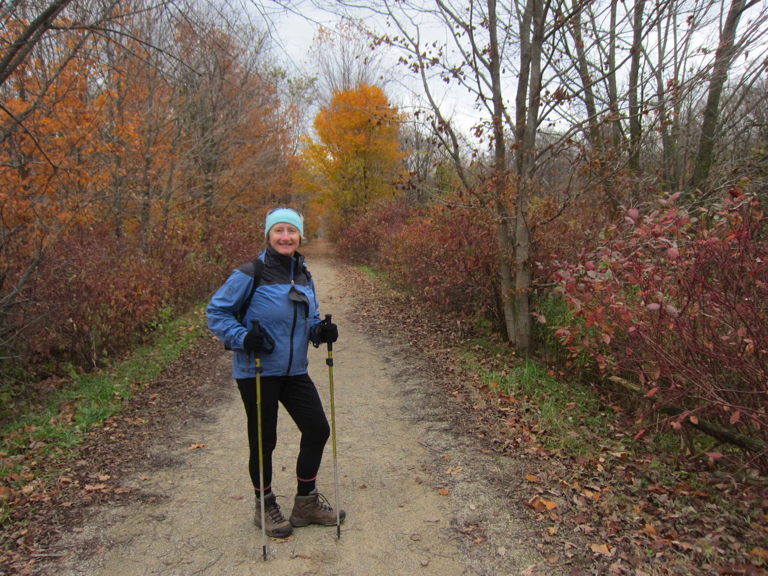
Car Hike: Lynn Valley Trail - Simcoe to Port Dover - 13 KM or 24 KM
https://hikes.brucetrail.org/event/car-hike-lynn-valley-trail-simcoe-to-port-dover-24-km/Sorry, the registration cut-off time for this hike has been reached.Not a member? Click here to join today!Hosting Club: Toronto
Category: Car Hike
Location (Google Maps): Depart: Meet for a 9:30 a.m. departure from Simcoe Memorial Park parking lot, 273 Owen St. Simcoe, ON, N3Y 2V3 (Norfolk County)
If you want a shorter walk of 13 km arrive at 8:50 a.m. at the meeting location for a car shuttle to drop off your car and return to the start. Hike begins at 9:30 a.m.Hike Leader(s): Jeanette Vincent Click here to contact Hike Leader(s)
Pace: Moderate (3-4 km/hr)
Terrain: Flat, Level 1 (Easy – mostly on flat, well maintained trails with hard-packed surface), Other (Refer to Description)
Distance: 13km or 23-24 kmDescription
About the hike:The rail trail in Carolinian Canada is one of Canada’s best, following the Lynn River to Lake Erie, located on the former CNR rail line which was established along the pioneer river trail in 1873 as the Lake Huron and Port Dover Railway. The rail line was abandoned in 1988. The Lynn Valley Trail passes through a number of different habitats including; mixed woods, wetlands, open grassland and agricultural land, all along the scenic Lynn River. Interesting examples of Carolinian flora and fauna may be found along the trail. The autumn colours should be upon us and you may see the famous Osage Orange, species: Maclura Pomifera along Silver Lake. We will take a little detour to see Port Dover’s hidden gem; Lynn River Waterfalls and the luxury Clonmel Castle. Who would have guessed! We lunch in Port Dover and we retrace our steps to Simcoe. Bring a lunch or head to one of the local fish restaurants in Port Dover.
Length: 24 km (6- 6 1/2 hrs) with snack break & lunch stop.
Hike level: 2 (moderate). we will hike at 4 km/hr. Flat terrain, some paved & some stone dust.- From Toronto about a 2 hour drive, add a little extra time if you are unfamiliar with the area.
What to wear and bring: Bring water, snacks and lunch. Or you may want to purchase a fish lunch at one of the local restaurants. Be prepared for weather conditions for this day. Hiking shoes or boots recommended. Hiking poles if you use them.
Bus Hike: Bruce Trail Day - CANCELLED
https://hikes.brucetrail.org/event/school-bus-hike-bruce-trail-day-hike-toronto-section-jim-vanderleck-side-trail-main-trail-to-limehouse/Sorry, the registration cut-off time for this hike has been reached.Not a member? Click here to join today!Hosting Club: Toronto
Category: Cancelled
Location (Google Maps): Toronto Section – Jim Vanderleck Side Trail/Main Trail to Limehouse Conservation AreaHike Leader(s): Tom Swales, David Rowney Click here to contact Hike Leader(s)
Pace: Leisurely (2-3 km/hr)
Terrain: Level 2 (Intermediate – some hills and uneven surfaces, rocks and roots underfoot)
Distance: 12 kmDescription
Join us for the annual Bruce Trail Day event as we celebrate the Niagara Escarpment and Bruce Trail while promoting one of Ontario’s greatest assets to the community at large. On this “School Bus Hike” from Toronto we will hike the Jim Vanderleck Side Trail to where it meets the main Bruce Trail then continue northwards into the Limehouse Conservation Area (home of the “Hole In The Wall”, limestone kilns, and the stone arch bridge featured on the Toronto Club’s fundraiser End-2-End badge). There will be an optional dropout at approximately 6.6 km where hikers will have the option to be taken directly to the Limehouse Community Hall to view the exhibits and speak with the volunteers at the Toronto Club’s Bruce Trail Day drop-in event. Refreshments and snacks will be available. Those wishing to hike further will continue on the Bruce Trail into the Limehouse Conservation area to end the Limehouse Community Hall where they will also have the opportunity to visit the drop-in event before the bus returns to York Mills. In the spirit of our theme of “A Sense Of Belonging” everyone is invited to join us on this hike in the prime hiking season on this special day and non-members will pay the discounted member bus fare of $25 Adults/$10 Children Under 12. Allowing for the later TTC subway opening the bus departure time from York Mills will be a convenient 9:30 AM. Though some uneven surfaces and roots/rocks underfoot can be expected (hiking boots recommended), this route has been chosen to bypass the rockier, more technical, parts of the Toronto Section making the Difficulty Level 1/2 (Easy to Intermediate). TBTC Bus Hikes go rain or shine. No refunds are given unless the club cancels the hike due to insufficient registration or hazardous travel conditions.Car Hike:: Bruce trail day hike
https://hikes.brucetrail.org/event/car-hike-bruce-trail-day-hike/Sorry, the registration cut-off time for this hike has been reached.Not a member? Click here to join today!Hosting Club: Toronto
Category: Car Hike
Location (Google Maps): We will meet at Tim Hortons on Hwy 25 North of Milton (3025 James Snow Parkway)Hike Leader(s): Makhan Dhesi Click here to contact Hike Leader(s)
Pace: Leisurely (2-3 km/hr)
Terrain: Level 2 (Intermediate – some hills and uneven surfaces, rocks and roots underfoot), Variable
Distance: 8kmDescription
We will hike about 8 km to enjoy nature on the lower end of the Toronto section then join the Bruce trail day celebration at Limehouse. For more information about the Bruce Trail Day see listing for bus hike
Car Hike: Family Fun at Limehouse for Bruce Trail Day!
https://hikes.brucetrail.org/event/car-hike-family-fun-at-limehouse-for-bruce-trail-day/Sorry, the registration cut-off time for this hike has been reached.Not a member? Click here to join today!Hosting Club: Toronto
Category: Car Hike
Location (Google Maps): We will meet at the Limehouse Conservation Area parking lot – coordinates are 43.632448, -79.973355.Hike Leader(s): Monica Pasquali Click here to contact Hike Leader(s)
Pace: Leisurely (2-3 km/hr)
Terrain: Level 2 (Intermediate – some hills and uneven surfaces, rocks and roots underfoot)
Distance: 4 kmDescription
Come and join me for a family-friendly hike in honour of Bruce Trail Day! We will use the Limehouse Side Trail, the Black Creek Side Trail, and the main trail to make a lovely 4 km loop within Limehouse Conservation Area. Approximately halfway through our hike we will leave the trail in order to enjoy refreshments and visit displays put on by the Toronto Bruce Trail Club at Limehouse Memorial Hall (and so we can have a washroom break, if needed) before returning to the trail to complete our loop. There will be a scavenger hunt to complete while hiking, and individuals who would like to work on their “Biodiversity Naturalist Badge” (https://torontobrucetrailclub.org/the-trail/badges) are encouraged to do so during this hike – I love spotting interesting flora, fauna, and fungi whenever I’m on the Bruce Trail so I would be happy to help hikers in their quest for this badge.Children under 13 years of age are encouraged to join their parents/guardians on this hike so they can fulfill the requirements for the Toronto Bruce Trail Club’s Youth Badge (https://torontobrucetrailclub.org/the-trail/badges) – all family members who are planning on joining us should register for the hike, including children. You should bring enough water and food for a 2-hour hike, comfortable footwear with good traction, appropriate clothing for the weather, and a big smile because we’re going to have a great time!
Everyone is welcome – I hope to see you there!
Celebrate Bruce Trail Day & Toronto Ravine Days
https://hikes.brucetrail.org/event/celebrate-bruce-trail-day-toronto-ravine-days/Sorry, the registration cut-off time for this hike has been reached.Not a member? Click here to join today!Hosting Club: Toronto
Category: Urban Walk
Location (Google Maps): High Park Nature CentreHike Leader(s): Sajedeh Zahraei Click here to contact Hike Leader(s)
Pace: Moderate (3-4 km/hr)
Terrain: Level 1 (Easy – mostly on flat, well maintained trails with hard-packed surface), Variable
Distance: 8-10 kmDescription
Join us on this special hike to celebrate Bruce Trail Day and Toronto Ravine Days. We will start in High Park and learn about its unique history and ecosystem then walk through the park to lakeshore and head east to walk through Martin Goodman trail and visit various parks along the waterfront exploring Indigenous graffiti art and learning about the social history of the area ending the hike at the Roundhouse Park. - 07October 7, 2024

Blue Mountains Stained Glass series in 4 hikes
https://hikes.brucetrail.org/event/blue-mountains-stained-glass-series-in-4-hikes/Sorry, the registration cut-off time for this hike has been reached.Not a member? Click here to join today!Hike open to BTC Members only.
This is a Multi-Day Hike
You are signing up for the following dates and times:
2024-10-07 at 09:15
2024-10-08 at 07:45
2024-10-24 at 09:15
2024-10-25 at 07:45Hosting Club: Toronto, Blue Mountains
Category: Car Hike
Location (Google Maps): On day 1, we’ll meet at the Lavender Cemetery at the end of the Dufferin section. Refer to hike description for meeting locations of the following 3 hikes.Hike Leader(s): Jacquie Van Dyke and Anhong MacNeil Click here to contact Hike Leader(s)
Pace: Moderate (3-4 km/hr)
Terrain: Challenging, Hilly, Variable
Distance: 15kmDescription
Please join Anhong and myself (Jacquie) in hiking the Blue Mountain section over four hikes to earn their stained glass badge. The funds collected for this badge are used to maintain the pledge of “A Ribbon of Wilderness For Everyone”. You will be permitted to miss one hike which must be made up on your own in order to qualify for this special badge. If there is paid parking, we will all share in the cost. Bring 2L of water, snacks and a lunch. Everyone is expected to share equally in the car shuttles, both as a driver and a passenger.Oct. 7 Meet at 9:15 am at 44.268777, -80.156810 Roadside parking on Mulmur-Nottawasaga Townline, 550m east of Lavender Hill Rd, at the cemetery gate. Do not block gate. Hike distance – 15km
Oct. 8 Meet at 7:45 am at km 14.1, GPS 44.312310, -80.193602 Accessible only from Con 10 South, roadside parking on the shoulder of 9/10 Sideroad. Hike distance – 18km
Oct. 24 Meet at 9:15 am near km 46.8, GPS 44.430927, -80.275390 Parking area located 380m north of the main trail crossing on Pretty River Rd. Hike distance – 15km
Oct. 25 Meet at 7:45 am again near km 46.8 Hike distance – 21km. Badge day!!!
- 08October 8, 2024
Urban Walk: Valley View Park Thornhill
https://hikes.brucetrail.org/event/urban-walk-valley-view-park-thornhill-22/Sorry, the registration cut-off time for this hike has been reached.Not a member? Click here to join today!Hosting Club: Toronto
Location (Google Maps): Parking lot at the corner of Bayview Ave, and Sycamore Dr. South of Highway 7
Sycamore Dr. is 3blocks south of highway 7 and 2 blocks north of John Street, parking lot is across plaza of Dollarama and Star boxHike Leader(s): Mohammad Aghamiri Click here to contact Hike Leader(s)
Pace: Moderate (3-4 km/hr)
Terrain: Level 2 (Intermediate – some hills and uneven surfaces, rocks and roots underfoot)
Distance: 7-8 kmDescription
We will explore Valleyview and Maple view parks, and walk along German Mill Creek, for a distance of 7-8 km. Difficulty Level: 2 (Moderate)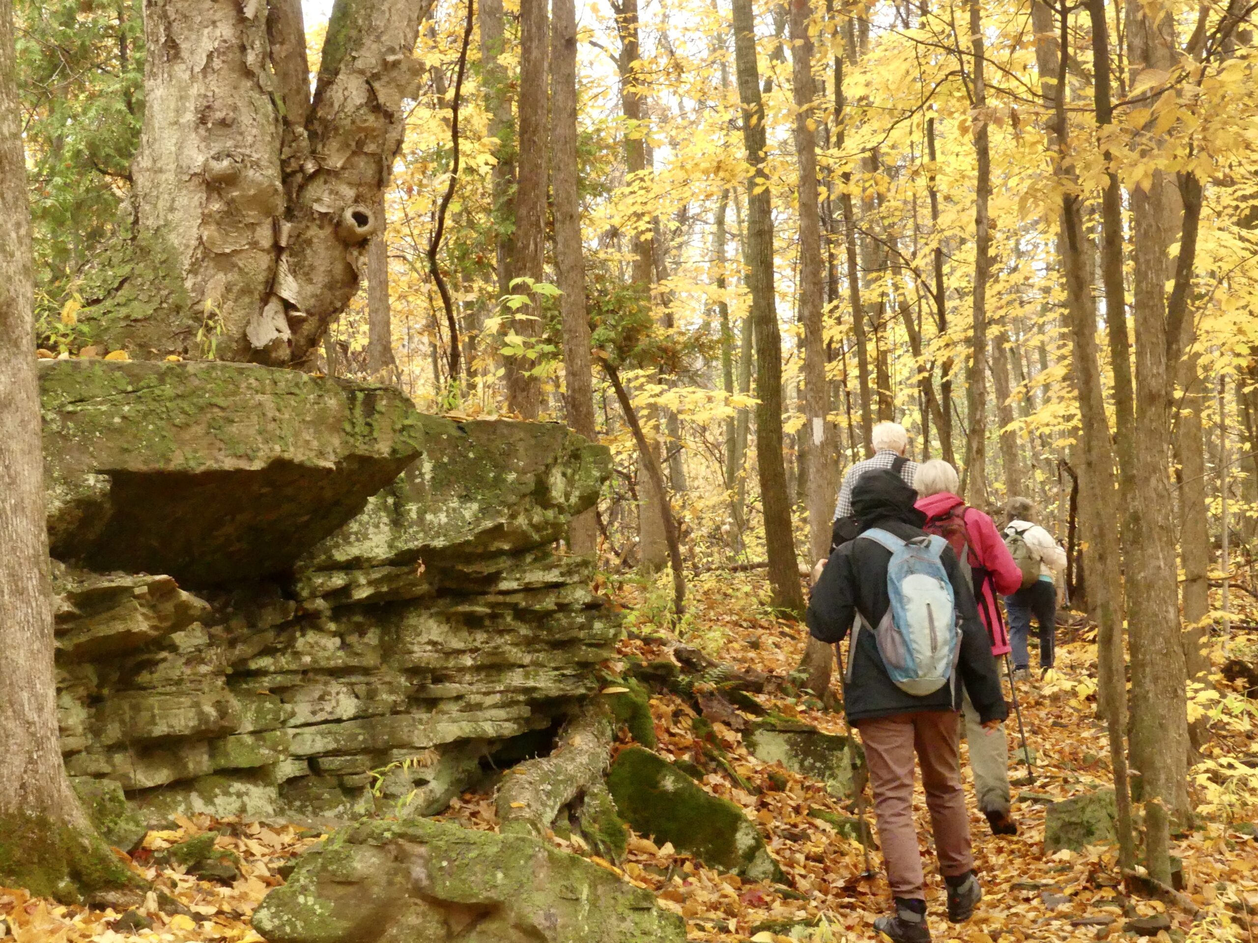
Car Hike: Nature Appreciation - Rockside Side Trail
https://hikes.brucetrail.org/event/car-hike-nature-appreciation-rockside-side-trail-2/Sorry, the registration cut-off time for this hike has been reached.Not a member? Click here to join today!Hosting Club: Toronto
Category: Car Hike
Location (Google Maps):Parking is at the end of Boston Mills Road, just west of the intersection with Mississauga Road. Take care not to block the private driveway.
Driving directions: From Highway 410 north, continue on Highway 10, left on King Street, right on Mississauga Rd., left on Boston Mills Rd. to parking at the dead end.Hike Leader(s): Janet Patterson Click here to contact Hike Leader(s)
Pace: Leisurely (2-3 km/hr)
Terrain: Variable
Distance: approximately 6 kmDescription
We’ll take a slower pace to allow time to observe and identify the ferns, fungi, birds, dragonflies, etc. that we encounter along the trail. Using the iNaturalist app, participants will be encouraged to take photos with their smartphones and contribute observations to the Bruce Trail Conservancy’s iNaturalist Project. Of course anyone who simply wants to take in the wonders of nature while we walk is also welcome to come along! Note: Limit of 10 hikers, and registration is mandatory.https://brucetrail.org/pages/get-involved/volunteering/citizen-science
This is a perfect opportunity to accumulate sightings towards earning your Naturalist badge!
Bring your curiosity, nature guidebooks, binoculars, camera, smartphone, lunch and water. Please wear proper hiking shoes or boots, and consider poles. There are a few steep sections. Difficulty Level: 1-2 (Easy/Moderate)
- 09October 9, 2024

Urban Walk: Bronte Village
https://hikes.brucetrail.org/event/urban-walk-bronte-village-2/Sorry, the registration cut-off time for this hike has been reached.Not a member? Click here to join today!Hosting Club: Toronto
Category: Urban Walk
Location (Google Maps): Meet at the Bronte Athletic Park parking lot. The baseball diamond will be on your right as you enter.Hike Leader(s): Roger Harris Click here to contact Hike Leader(s)
Pace: Moderate (3-4 km/hr)
Terrain: Level 1 (Easy – mostly on flat, well maintained trails with hard-packed surface)
Distance: 8 kmDescription
We will follow the Donovan Bailey Trail to Bronte Road, then take Heritage Trail to Bronte Harbour. After a short break, we will continue along Waterfront Trail to Water’s Edge Drive, then walk southwest along Marine Drive to return to our starting point. The route is on a mixture of paved and packed gravel paths.If you would like to read up on this walk, it is described as Hike No. 11 (‘Donovan Bailey/Bronte Village Loop’) in Nicola Ross’ book ”Halton Hikes” (2016).
Please dress appropriately for the weather, and bring water and snacks. Hiking boots and poles will not be necessary.
- 10October 10, 2024
Urban Walk: Valley View Park Thornhill
https://hikes.brucetrail.org/event/urban-walk-valley-view-park-thornhill-23/Sorry, the registration cut-off time for this hike has been reached.Not a member? Click here to join today!Hosting Club: Toronto
Location (Google Maps): Parking lot at the corner of Bayview Ave, and Sycamore Dr. South of Highway 7
Sycamore Dr. is 3blocks south of highway 7 and 2 blocks north of John Street, parking lot is across plaza of Dollarama and Star boxHike Leader(s): Mohammad Aghamiri Click here to contact Hike Leader(s)
Pace: Moderate (3-4 km/hr)
Terrain: Level 2 (Intermediate – some hills and uneven surfaces, rocks and roots underfoot)
Distance: 7-8 kmDescription
We will explore Valleyview and Maple view parks, and walk along German Mill Creek, for a distance of 7-8 km. Difficulty level: 2 (Moderate) - 11October 11, 2024No events
- 12October 12, 2024

School Bus Hike: Niagara Glen and Niagara-on-the-Lake
https://hikes.brucetrail.org/event/school-bus-hike-niagara-glen-and-niagara-on-the-lake/Sorry, the registration cut-off time for this hike has been reached.Not a member? Click here to join today!Trip Information
Departure Time: 08:30
Return to City Time: 18:00
Departure Point: Kipling Departure PointOptional Items
Hosting Club: Toronto
Category: Bus Hike
Location (Google Maps): Niagara Falls, Niagara-on-the-LakeHike Leader(s): Celia Ho; Tom Swales; Leila Damband Click here to contact Hike Leader(s)
Pace: Leisurely (2-3 km/hr), Mixed (See Hike Description), Moderate (3-4 km/hr)
Terrain: Other (Refer to Description), Variable
Distance: 8-9 kmDescription
Join us to visit Niagara Glen (https://www.niagaraparks.com/visit/attractions/niagara-glen) and Niagara-on-the-Lake (https://www.niagaraonthelake.com/).There will be 4-5 km of trails at Niagara Glen (excluding the rocky Whirlpool Trail). The terrain is Moderate (Difficulty Level 2) trails suitable for most hikers with basic trail experience and with infrequent obstacles and gently rolling areas with some short, steep sections. There are steep staircases going down into the gorge and coming back up.
After Niagara Glen the bus will take us to Niagara-on-the-Lake where we will do a 4 km loop on the Heritage Trail with paved and unpaved trails between Fort George, Butler’s Barracks, and Paradise Grove. The trails link Fort George National Historic Site and Butler’s Barracks National Historic Site. The terrain is Easy with hard-packed surface, no obstacles, minimal stairs and little or no change in elevation. Please refer to the route map: https://onthegomap.com/s/gi8t3622
After the hike free time will be given to explore the streets of the Historic Old Town of Niagara-on-the-Lake and stop for refreshments.
Pro-rated parking fee of $1.35 for bus parking at Niagara On The Lake will be added to the bus fare when registering.
Car Hike: Glasgow Village Whitchurch-Stouffville 156
https://hikes.brucetrail.org/event/car-hike-glasgow-village-whitchurch-stouffville-9/Sorry, the registration cut-off time for this hike has been reached.Not a member? Click here to join today!Hosting Club: Toronto
Category: Car Hike
Location (Google Maps): Glasgow Trail, Concession Road 2 Park in parking lot at the trail head.From Highway 404 turn right to Stouffville Rd, till to the end of road and turn left on York Durham line in About 1km turn right to Webb Rd. and turn right to Concession Road 2 ,you will see parking lot in 500 meters
Hike Leader(s): Mohammad Aghamiri Click here to contact Hike Leader(s)
Pace: Moderate (3-4 km/hr)
Terrain: Hilly, Level 2 (Intermediate – some hills and uneven surfaces, rocks and roots underfoot), Variable
Distance: 14-15KMDescription
Lets explore Goodwood conservation area and visit Secord forest and pondApproximately 5-hour hike, bring lots of water
Urban Walk: Toronto Islands
https://hikes.brucetrail.org/event/urban-walk-toronto-islands-4/Sorry, the registration cut-off time for this hike has been reached.Not a member? Click here to join today!Hosting Club: Toronto
Category: Urban Walk
Location (Google Maps): Toronto IslandHike Leader(s): Michael Humpage, Janet McColeman Click here to contact Hike Leader(s)
Pace: Moderate (3-4 km/hr)
Terrain: Flat, Level 1 (Easy – mostly on flat, well maintained trails with hard-packed surface)
Distance: 13.5 KMDescription
The island can be very beautiful and peaceful in the early fall. We will meet at 9:15 AM at the Toronto Islands Ferry Dock at the bottom of Bay Street to take the 9:30 AM Ward’s Island ferry (as per Island Fall Schedule). Tickets can be bought online or at the ticket booth. Ferry adult return cost is $9.11. The hike will do a loop around the islands, along the boardwalk, past the lighthouse to Hanlan’s Point and returning on the other side of Ward’s island. Expected return on the Ward’s Island ferry departing at 2:15 PM. Dropout anytime by returning to Ward’s island ferry dock or there are also ferries leaving from Hanlan’s Point or Centre Island on a limited schedule. Hiking shoes or good walking shoes needed. Bring water (2 litres recommended), lunch, sunscreen and insect repellant. Difficulty Level: 1/2 (Easy to/Moderate)