|
Sun | Mon | Tue | Wed | Thu | Fri | Sat |
|---|
May | May | May | May | May | May | 1  Car Hike: Rouge National Park Scarborough Car Hike: Rouge National Park Scarborough 8:15 AM-1:30 PM 06/01/2024 https://hikes.brucetrail.org/event/car-hike-rouge-national-park-scarborough-2/2024-06-01/ Click here for more information or to register Hosting Club: Toronto Location (Google Maps): Rouge Park, Zoo Road Parking Lot, off Meadowvale Road north of Sheppard Ave Hike Leader(s): Mohammad Aghamiri Click here to contact Hike Leader(s) Pace: Moderate
Terrain: Hilly, Variable
Distance: 14-17 km Description
Will explore Toronto part of Rouge park along Rouge river and Little Rouge Creek, Some safety procedures during the hike: 1-Hikers must stay between the leader and the sweep. 2-Hikers must advise the leader or the sweep if they wish to leave the group. 3- Hikers must follow the whistle instructions: 1 blast- stay where you are; 2 blasts come to the leader; 3 blasts – come to the leader quickly. 4-Hike leader may request volunteers to stop at trail intersections, they need to help hikers to the direction the group walk and wait till they see the sweep . 5-Hikers have to make sure they can see the persons behind and in front of them.
  Bus Hike: Caledon E2E – Hike #2 of 5 Bus Hike: Caledon E2E – Hike #2 of 5 8:30 AM-5:00 PM 06/01/2024 https://hikes.brucetrail.org/event/bus-hike-caledon-e2e-hike-2-of-5/2024-06-01/ Trip Information
Departure Time: 08:30
Return to City Time: 17:00
Departure Point: Kipling Departure Point Click here for more information or to register Optional Items
Hosting Club: Toronto, Caledon Hills
Category: Bus Hike
Location (Google Maps): Willoughby Rd and McLaren Sideroad Hike Leader(s): Sajedeh Zahraei; Celia Ho Click here to contact Hike Leader(s) Pace: Moderate
Terrain: Variable
Distance: 15.6 Km Description
Maps 15-16, km 16.0 – km 31.6 (15.6 km)
Starting Point: Roadside Parking – km 16.0 (along the southwest shoulder of the Willoughby Rd and Escarpment Sideroad intersection) (43.831244°N 79.980588°W)
Drop-out Point: Roadside Parking – km 26.1 (along Escarpment Sideroad on the north side where the Trail crosses the road) (43.884912°N 79.920313°W)
End Point: Roadside Parking – km 31.6 (on Innis Lake Rd, north of Finnerty Sideroad) (43.918917°N 79.909387°W)
- Car Hike: Rouge Valley Cedar Trail – 16km
9:30 AM-2:30 PM 06/01/2024 https://hikes.brucetrail.org/event/car-hike-rouge-valley-cedar-trail-16km/2024-06-01/ 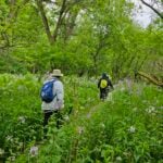 Click here for more information or to register Hosting Club: Toronto
Category: Car Hike
Location (Google Maps): Rouge Valley Conservation Centre parking lot. Hike Leader(s): Alina Lin Pace: Moderate
Terrain: Flat, Hilly, Variable
Distance: 13 km -16km Description
Meet at the main parking lot next to the Rouge Valley Conservation Centre, GPS (43.81780727235202, -79.17176449225887). We will hike along the main trail Cedar Trail and Little Rouge Creek Woodland Trail. The route includes a mix of flat and hilly terrains. Be prepared for some muddy sections. Bring at least 1.5 liter of water. Wear sunscreen and a hat. Bug spray may also be needed. No kids under 13 years old. No dog. This hike will take place rain or shine.
|
2  Toronto Urban Badge Hike – 7 of 7 Toronto Urban Badge Hike – 7 of 7 10:00 AM-1:00 PM 06/02/2024 https://hikes.brucetrail.org/event/toronto-urban-badge-hike-7-of-7-3/2024-06-02/  Click here for more information or to register Hosting Club: Toronto
Category: Urban Walk
Location (Google Maps): Toronto Hike Leader(s): Brian Rideout Click here to contact Hike Leader(s) Pace: Moderate
Terrain: Flat
Distance: 9 km Description
Please join me at the south east corner of Overlea Blvd and Don Mills Rd by 10 AM. We will hike south on the Don Trail to the Distillery District (km 62.4 to km 71.4). Here is an online map with km markings of our route for all 7 hikes for the Toronto Urban Badge. Please make sure you bring at least 2 liters of water, a lunch, bug spray and sunscreen.
| 3 | 4 | 5 | 6 - Urban Walk: Valley View and Maple view Parks Thornhill 31
8:45 AM-11:15 AM 06/06/2024 https://hikes.brucetrail.org/event/urban-walk-valley-view-and-maple-view-parks-thornhill-7/2024-06-06/ Click here for more information or to register Hosting Club: Toronto Location (Google Maps): Parking lot at the corner of Bayview Ave, and Sycamore Dr. South of Highway 7
Sycamore Dr. is 2 blocks south of highway 7,parking lot is across plaza of Dollarama and Star box Hike Leader(s): Mohammad Aghamiri Click here to contact Hike Leader(s) Pace: Moderate
Terrain: Variable
Distance: 7-8 km Description
We will explore Valleyview and Maple view parks, and walk along German Mill Creek,
- Urban Walk: Toronto Islands Evening Walk
6:00 PM-9:00 PM 06/06/2024 https://hikes.brucetrail.org/event/urban-walk-toronto-islands-evening-walk-6/2024-06-06/  Click here for more information or to register Hosting Club: Toronto Location (Google Maps): Jack Layton Ferry Terminal, near the gates to Wards Island Ferry. Arrive 20 minutes prior to departure to check in with hike leader. From Union Station take the LRT and get off at the stop Ferry Docks.Walk up to the Ferry Docks on Queens Quay West, street level. at the foot of Bay Street. Hike Leader(s): Miriam Stevens Click here to contact Hike Leader(s) Pace: Leisurely
Terrain: Flat
Distance: 6-9 km Description
After a day’s work come and “cool off” on the Toronto Islands free of fumes and traffic. Enjoy the view of the city skyline and Toronto’s beautiful island parkland.
Pack a dinner for a sit down picnic. Food is not available for purchase on the Islands early in the season. Also bring a warm jacket and flashlight.
Return fare ticket for the ferry approx $10.00 less for seniors.
Hikes will take place rain or shine.
Toronto Island evening hikes will take place every THURSDAY in MAY and JUNE 2024.
Same time and same meeting place. No preregistration is required – just show up at the ferry docks at 5:40 PM and sign with the hike leader. ** As of the publication of the hike entry the start date of the Spring schedule is not available – current departure time to Wards Island is 6:00 PM, check back closer to the date to confirm the time ** ** As of the publication of the hike entry the start date of the Spring schedule is not available – current departure time to Wards Island is 6:00 PM, check back closer to the date to confirm the time **
| 7 | 8 - Bus Hike: International Hike – Niagara Gorge & Goat Island
8:00 AM-6:30 PM 06/08/2024 https://hikes.brucetrail.org/event/bus-hike-international-hike-niagara-gorge-goat-island/2024-06-08/ Trip Information
Departure Time: 08:00
Return to City Time: 18:30
Departure Point: Kipling Departure Point Click here for more information or to register Optional Items
Rainbow Bridge Pedestrian Toll ($1.00)
Hosting Club: Toronto
Category: Bus Hike
Location (Google Maps): The bus will drop us off in Niagara Falls, Canada and we will hike to and across the Rainbow Bridge to the USA. Hike Leader(s): Tom Swales, Celia Ho, Smadar Junkin, Jacquie Van Dyke Click here to contact Hike Leader(s) Pace: Fast, Moderate
Terrain: Hilly, Rocky, Variable
Distance: 14 km Description
Join us for an International Hike adventure where we will hike across the Rainbow Bridge to the Niagara State Park and descend into the Niagara Gorge Trails downriver from the Falls. Recommended for experienced hikers as some parts will be more technically challenging and some boulder hopping and a steep staircase will be involved. From the site of the Schoellkopf Power plant we will have good views of the Rainbow Bridge and the Horseshoe Falls. Before returning to the Canadian side will hike a portion of Goat Island for a closeup view of the American Falls. You will need to bring (1) a $1.00 coin for the pedestrian bridge toll to be collected by automated tollgate before exiting Canada and (2) a valid Canadian Passport. The Hike Leaders will verify all hikers have a valid passport as you check in and board the bus. There will be two groups – a moderate pace with Tom and Celia and a faster pace with Smadar and Jacquie. For day travel to the USA emergency medical medical insurance coverage, available for a few dollars, is strongly recommended.
- Car Hike: Wilder Forest Uxbridge
8:15 AM-1:30 PM 06/08/2024 https://hikes.brucetrail.org/event/car-hike-wilder-forest-uxbridge-7/2024-06-08/ Click here for more information or to register Hosting Club: Toronto Location (Google Maps): 2499 Brock Road, Uxbridge, ON there is a free parking when you enter the road off brock road beside Horse training facility Hike Leader(s): Mohammad Aghamiri Click here to contact Hike Leader(s) Pace: Moderate
Terrain: Hilly, Variable
Distance: 14-17 km Description
We will explore Wilder forest and the beautiful scenery of Uxbridge forests. Some safety procedures during the hike: 1-Hikers must stay between the leader and the sweep. 2-Hikers must advise the leader or the sweep if they wish to leave the group. 3- Hikers must follow the whistle instructions: 1 blast- stay where you are; 2 blasts come to the leader; 3 blasts – come to the leader quickly. 4-Hike leader may request volunteers to stop at trail intersections, they need to help hikers to the direction the group walk and wait till they see the sweep . 5-Hikers have to make sure they can see the persons behind and in front of them.
- Toronto Urban Badge Hike – 6 of 7
10:00 AM-1:15 PM 06/08/2024 https://hikes.brucetrail.org/event/toronto-urban-badge-hike-6-of-7-4/2024-06-08/  Click here for more information or to register Hosting Club: Toronto Location (Google Maps): Toronto, Ontario, Canada Hike Leader(s): Brian Rideout Click here to contact Hike Leader(s) Pace: Moderate
Terrain: Flat
Distance: 9 km Description
Please join me at the south east corner of Sheppard Ave East and Leslie by 10 AM. We will hike south through several parks to Don Mills (S of Overleigh) (km 51.7 to km 62.4). Here is an online map with km markings of our route for all 7 hikes for the Toronto Urban Badge. Please make sure you bring at least 2 liters of water, a lunch, bug spray and sunscreen.
- Car Hike: Dufferin Hi-Lands 4 of 4 – Cancelled
10:30 AM-3:00 PM 06/08/2024 https://hikes.brucetrail.org/event/car-hike-dufferin-hi-lands-4-of-4/2024-06-08/ Click here for more information or to register Hosting Club: Toronto, Dufferin Hi-Land
Category: Cancelled
Location (Google Maps): Dufferin Hi-Land, Map 21 Hike Leader(s): Al Brown Click here to contact Hike Leader(s) Pace: Moderate
Terrain: Variable
Distance: 11 km Description
We will complete the last portion of the Dufferin Hi-Land section passing through stream valleys and rolling farmland. After the hike all are invited to join the hike leaders for refreshments in Creemore. On completion of the hike badges will be given out to those who completed the entire section and requested them. Badges cost about $10 (price to be confirmed). Speak to the hike leader on hike 3 of 4 if you want a badge. To get to the meeting place go north on Hwy 10 to Primrose. Continue north on Prince of Wales Rd to River Road. Turn right and go about 5 km to Centre Road. Turn left and go about 8 km to Lavender. Turn right and go about 0.5 km to the cemetery
- Car Hike: Scotsdale Farm
11:00 AM-3:00 PM 06/08/2024 https://hikes.brucetrail.org/event/car-hike-scotsdale-farm-6/2024-06-08/ Click here for more information or to register Hosting Club: Toronto
Category: Car Hike
Location (Google Maps): Scotsdale Farm, Map 13 Hike Leader(s): Al Brown Click here to contact Hike Leader(s) Pace: Moderate
Terrain: Variable
Distance: 10 km Description
We will complete a loop hike on the mail Bruce Trail and side trails. The route follows old farm lanes and trails mostly under the forest canopy. Terrain conditions vary and include rocky sections and glacial formations. After the hike those interested are invited to meet at the Sheppard’s Crook or a nearby coffee shop in Georgetown for refreshments. The hike start time is set at 11:00 am to allow hikers the option of visiting the Georgetown farmers market before the hike. The farmers market is located in the centre of old Georgetown and runs from early morning to about noon. Directions: From the 4o1 go north on Trafalgar Road pasts Georgetown. Trafalgar merges with Hwy 7 for about 3 km then separates to the right at the village of Silver Creek. From the stop light at Silver Creek go north on Trafalgar about 1 km to the entrance of Scotsdale Farm on your right. Drive in to the parking area about half a km.
|
9 - Urban Walk: Whitby to Oshawa
10:30 AM-1:45 PM 06/09/2024 https://hikes.brucetrail.org/event/urban-walk-whitby-to-oshawa-3/2024-06-09/  Click here for more information or to register Hosting Club: Toronto
Category: Urban Walk
Location (Google Maps): Whitby, Ontario Hike Leader(s): Brian Rideout Click here to contact Hike Leader(s) Pace: Moderate
Terrain: Flat
Distance: 10 km Description
Please join me under the clock in the Great Hall of Union Station by 9:05 am. We will take the eastbound Lakeshore train departing 9:20 AM, arriving in Whitby at 10:13 AM. If you prefer to drive, please meet at the north entrance of Whitby Go Station near the washrooms and the ticket counter. Please check out the GO Transit website and consider purchasing a one day pass for $10.
We will hike south to the lake and east to Oshawa along the Waterfront Trail for an estimated distance of 10 km. We will pass through several parks in Whitby and Oshawa along the way. While in Oshawa we will take Durham Region Transit to the Fox and the Goose pub and to Oshawa GO so please bring your Presto card and / or cash fare. Please bring sun screen, bug spray, a light snack and at least 2 liters of water. Here is a map of our route: Whitby to Oshawa
| 10 - Sydenham E2E Stained Glass Fundraising Series in 8 Hikes
8:00 AM-2:00 PM 06/10/2024 https://hikes.brucetrail.org/event/sydenham-e2e-stained-glass-fundraising-series-in-8-hikes/2024-06-10/  Hike open to BTC Members only. This is a Multi-Day HikeYou are signing up for the following dates and times:
2024-06-10 at 08:00
2024-06-11 at 08:00
2024-06-12 at 08:00
2024-06-13 at 08:00
2024-06-17 at 08:00
2024-06-18 at 08:00
2024-06-19 at 08:00
2024-06-20 at 08:00 Click here for more information or to register Hosting Club: Toronto, Sydenham
Category: Car Hike
Location (Google Maps): Km 20.7, on the shoulders of 6th Concession S. GPS N44.507399, W80.810098 Hike Leader(s): Jacquie Van Dyke Pace: Brisk, Moderate
Terrain: Hilly, Variable
Distance: Distances will be approximately 20-25km per day, spread over 8 hikes, for a total of 175km. Description
This Sydenham Stained Glass E2E Fundraising hike series will be spread over 8 days, covering approximately 175km. The funds paid will be collected by the Toronto Bruce Trail Club and transferred to the Sydenham Club to help with the club’s expenses and the pledge of maintaining “The Ribbon of Wilderness for Everyone Forever.” The registration date of March 3 at 9:00pm is for all 8 group hikes. Participants completing this series will receive the Hart’s Tongue Fern badge (designed by Joe Borges) at the end of the last hike. Life aside from hiking does happen and you may miss 2 hikes but please let the hike leader know ahead of time and make it up before June 20, 2024. A hike schedule will be sent late-May to all participants. Hikes will range in distance of 20-25km, hiking at an average speed of 3-5km/hour, depending on trail & weather conditions. Please arrive by 8:00am for each hike to get organized and to be ready to begin the car shuttle at 8:15. All hikers are expected to participate fairly in the car shuttles. No dropout points have been established and therefore hikers who must drop out, will be responsible for their own transportation back to their vehicle. Please note: available transportation back to your vehicle is very limited in this section. It’s going to get warm/hot so please be prepared with enough food to last the hike, a minimum of 2L of hydration, bug repellent, and hiking gear appropriate for the weather/conditions. We’ll have a short morning break and also a lunch break on each hike.
| 11 | 12 | 13 - Urban Walk: Toronto Islands Evening Walk
6:00 PM-9:00 PM 06/13/2024 https://hikes.brucetrail.org/event/urban-walk-toronto-islands-evening-walk-7/2024-06-13/  Click here for more information or to register Hosting Club: Toronto Location (Google Maps): Jack Layton Ferry Terminal, near the gates to Wards Island Ferry. Arrive 20 minutes prior to departure to check in with hike leader. From Union Station take the LRT and get off at the stop Ferry Docks.Walk up to the Ferry Docks on Queens Quay West, street level. at the foot of Bay Street. Hike Leader(s): Miriam Stevens Click here to contact Hike Leader(s) Pace: Leisurely
Terrain: Flat
Distance: 6-9 km Description
After a day’s work come and “cool off” on the Toronto Islands free of fumes and traffic. Enjoy the view of the city skyline and Toronto’s beautiful island parkland.
Pack a dinner for a sit down picnic. Food is not available for purchase on the Islands early in the season. Also bring a warm jacket and flashlight.
Return fare ticket for the ferry approx $10.00 less for seniors.
Hikes will take place rain or shine.
Toronto Island evening hikes will take place every THURSDAY in MAY and JUNE 2024.
Same time and same meeting place. No preregistration is required – just show up at the ferry docks at 5:40 PM and sign with the hike leader. ** As of the publication of the hike entry the start date of the Spring schedule is not available – current departure time to Wards Island is 6:00 PM, check back closer to the date to confirm the time **
| 14 - Car Hike: 21th Annual Excellent Orchid Adventure – Chi-Cheemaun Weekend (2 overnights)
12:00 AM 06/14/2024 https://hikes.brucetrail.org/event/car-hike-21th-annual-excellent-orchid-adventure-chi-cheemaun-weekend-3-overnights/2024-06-14/  This is a Multi-Day HikeYou are signing up for the following dates:
2024-06-14, 2024-06-15, 2024-06-16 Click here for more information or to register Hosting Club: Toronto, Peninsula
Category: Car Hike
Location (Google Maps): Princess Hotel
34 Bay St, Tobermory, ON N0H 2R0 Hike Leader(s): Jeanette Vincent. Brenda Menezes. David Royle. Click here to contact Hike Leader(s) Pace: Leisurely
Terrain: Hilly, Rocky, Variable
Distance: 10 – 12 Km Description
We continue Greg Vincent’s legacy of weekends away. Please join Jeanette Vincent, Brenda and David Royle as we explore the Tip o’ the Bruce, Tobermory in search of orchids and other flowers. Our search will extend to Flowerpot Island (cost approx. $60.00 for the glass bottom ferry and Parks Canada fee). The wildflowers in the Tobermory area at this time of year are wonderful and our slow paced walks will focus on these flowers and the area’s great views. We stay and have our meals at a comfortable hotel overlooking Little Tub Harbour. Approximately 10km/day. This outing is restricted to those staying with us at the Princess Hotel in Tobermory for the weekend – the hotel fills quickly. You will need a car to access this outing. Please contact the Princess Hotel for a reservation.1-519-592-8282 or info@tobermoryprincesshotel.com and mention Vincent/Royle Excellent Orchid weekend. Before registering at the hotel please contact Jeanette: vincentjeanette1604@gmail.com | 519-588-5916 For prices and more details.
- Car Hike: Beaver Valley E2E Fundraiser Badge in 8 hikes.
8:30 AM-3:00 PM 06/14/2024 https://hikes.brucetrail.org/event/beaver-valley-e2e-fundraiser/2024-06-14/ 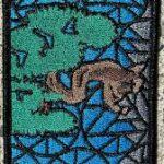 Hike open to BTC Members only. This is a Multi-Day HikeYou are signing up for the following dates and times:
2024-06-14 at 08:30
2024-06-15 at 08:30
2024-06-16 at 08:30
2024-06-17 at 08:30
2024-06-21 at 08:30
2024-06-22 at 08:30
2024-06-23 at 08:30
2024-06-24 at 08:30 Click here for more information or to register Hosting Club: Toronto, Beaver Valley
Category: Car Hike
Location (Google Maps): Hike 1- Maple Lane, km 67.3 Blue Mountain on map 24. It is also km 0.0 of the BV. Coordinates N 44504973,W 80.331780 Hike Leader(s): Smadar Junkin Click here to contact Hike Leader(s) Pace: Brisk
Terrain: Hilly, Variable
Distance: 13.7 km Description
This is a fundraiser hike to keep the pledge of “ ribbon of wilderness for everyone forever “. The funds will be collected by the Toronto Bruce Trail Club and will be transferred to the Beaver Valley Club to help continuing the gear maintenance work that the team of volunteers doing. this hike will earn you the special stained glass badge of the BV.
you will be permitted to miss two of the organized hikes and make them up on your own to get the badge.
hike2- meet at km 27.9 parking- a 100 meters south of the main trail across the 10th line coordinates N 44.416209,W 80.443557 we will shuttle to 6th line. Map 25 hike 3- meet at at the same place as hike 2 and shuttle to km 43.5 map 25 hike 4- meet at km 43.6 side road 7B coordinates N 44.395310,W 80.518495 we will shuttle to km 56.1 north street. Map 26 hike 5- meet at km 71.7 Johnston side road parking. Coordinates N 44.315674,W 80.549984 we will shuttle to NorthStreet.
hike 6- we will meet at the same place as hike 5 and shuttle to km 86.9 side road 13A map27 hike 7- we will meet at km 86.9 side road 13A coordinates N 44.420867,W 80.562233 we will shuttle to km 99.9. Map 27 hike 8 badge day we will meet at Blantyre km 117,3 and shuttle to km 99.9. Please note that at this time the parking in Blantyre is closed. The resident across the street kindly offered us parking in an area in his property. At this time I’m not sure if the the parking will be open. More information to come at the later date. after each hike I will be hiking a geology hike to to learn about the geology of the beaver valley and to earn the badge. If you wish to join me, let me know and I’ll send you information closer to the time of the hikes. These will not be official Bruce Trail hikes. If you are interested it might be a good idea to get Beth Gilhespy’s book “Walking Through Time” from. The conservancy office.
please bring two litres of water to each hike, bug prevalent and sun screen.
| 15 - Bus Hike: Pretty River
8:00 AM-6:15 PM 06/15/2024 https://hikes.brucetrail.org/event/bus-hike-pretty-river-2/2024-06-15/ Trip Information
Departure Time: 08:00
Return to City Time: 18:15
Departure Point: York Mills Bus Pickup Click here for more information or to register Optional Items
Hosting Club: Toronto, Blue Mountains
Category: Bus Hike
Location (Google Maps): Pretty River Valley Provincial Park Hike Leader(s): Martina Furrer, Roland Mark, Michael Humpage and Ross Estrella Click here to contact Hike Leader(s) Pace: Fast, Moderate
Terrain: Hilly
Distance: Fast (16 to 18 km), moderate (13 km) Description
Join us for a fun and challenging hike through Nottawasaga Lookout Provincial Nature Reserve and Pretty River Valley Provincial Park. Our efforts will be rewarded with great views and hopefully the forest floor will be dotted with wildflowers. From Osler Bluff and the Petun Side Trail we should have amazing views of Georgian Bay. We will split into two groups. The moderate group will do about 13 km at a pace of approximately 3 km/hr. The fast group will hike 16 to 18 km at a 4 km/hr pace (including on hills). Pack lunch, water (about 2 litres), sun protection, rain protection, and bug protection. Refreshment stop after if time allows. Bus departs 10 York Mills Rd at 8 AM.
- Car Hike: Hike of 2 lakes
8:15 AM-1:15 PM 06/15/2024 https://hikes.brucetrail.org/event/car-hike-hike-of-2-lakes/2024-06-15/ Click here for more information or to register Hosting Club: Toronto
Category: Car Hike
Location (Google Maps): Park along Fairfield Dr. or Dufferin Street. Gather at trail head on Dufferin Street. Hike Leader(s): Mohammad Aghamiri Pace: Moderate
Terrain: Variable
Distance: 14-17 km Description
We will hike in trails around Seneca lake and Mary Lake, pass by Eaton hall and visit Pine farm where you can enjoy coffee, tea, apple pie during our snack time. Some safety procedures during the hike: 1-Hikers must stay between the leader and the sweep. 2-Hikers must advise the leader or the sweep if they wish to leave the group. 3- Hikers must follow the whistle instructions: 1 blast- stay where you are; 2 blasts come to the leader; 3 blasts – come to the leader quickly. 4-Hike leader may request volunteers to stop at trail intersections, they need to help hikers to the direction the group walk and wait till they see the sweep . 5-Hikers have to make sure they can see the persons behind and in front of them.
- Toronto Urban Badge Hike – 7 of 7
10:00 AM-1:00 PM 06/15/2024 https://hikes.brucetrail.org/event/toronto-urban-badge-hike-7-of-7-4/2024-06-15/ Click here for more information or to register Hosting Club: Toronto Location (Google Maps): Toronto Hike Leader(s): Brian Rideout Click here to contact Hike Leader(s) Pace: Moderate
Terrain: Flat
Distance: 9 km Description
Please join me at the south east corner of Overlea Blvd and Don Mills Rd by 10 AM. We will hike south on the Don Trail to the Distillery District (km 62.4 to km 71.4). Here is an online map with km markings of our route for all 7 hikes for the Toronto Urban Badge. Please make sure you bring at least 2 liters of water, a lunch, bug spray and sunscreen.
|
16 - Urban Walk: Lynde Shores Conservation Area
10:30 AM-2:30 PM 06/16/2024 https://hikes.brucetrail.org/event/urban-walk-lynde-shores-conservation-area/2024-06-16/ 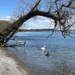 Click here for more information or to register Hosting Club: Toronto
Category: Urban Walk
Location (Google Maps): Lynde Shores Conservation Area – New Parking Lot on Halls Road Transit riders coming from Toronto can meet Tom Swales at Union Station in the Great Hall at 8.35 am. You will be taking the 8.50 GO Train to Whitby, taking a short bus ride, and will be walking down Halls Rd. to meet the drivers. Parking Fee at the Conservation Area is $6.00 flat rate for the day Hike Leader(s): Tom Swales, Lisa Lifshitz Click here to contact Hike Leader(s) Pace: Moderate
Terrain: Flat
Distance: 10 km Description
We will hike a couple of loops, including the Chickadee Bird Feeder Trail and the Lake Ontario Trail, around the lovely Lynde Shores Conservation Area, 1225 Victoria Street, Whitby. This is a great spot for birds and other wildlife. Optional refreshment stop at the “Oak and Ale Whitby Shores” after the hike. Terrain and Speed – Flat, 3.5k, with stops for photos, viewing wildlife, or appreciating the beauty (approximately 4 hours) Please let us know in the “Additional Information” field if you plan to take the GO Train or drive and park at the Lynde Shores Conservation Area.
| 17 | 18 | 19 | 20 - Urban Walk: Toronto Islands Evening Walk
6:00 PM-9:00 PM 06/20/2024 https://hikes.brucetrail.org/event/urban-walk-toronto-islands-evening-walk-8/2024-06-20/  Click here for more information or to register Hosting Club: Toronto Location (Google Maps): Jack Layton Ferry Terminal, near the gates to Wards Island Ferry. Arrive 20 minutes prior to departure to check in with hike leader. From Union Station take the LRT and get off at the stop Ferry Docks.Walk up to the Ferry Docks on Queens Quay West, street level. at the foot of Bay Street. Hike Leader(s): Miriam Stevens Click here to contact Hike Leader(s) Pace: Leisurely
Terrain: Flat
Distance: 6-9 km Description
After a day’s work come and “cool off” on the Toronto Islands free of fumes and traffic. Enjoy the view of the city skyline and Toronto’s beautiful island parkland.
Pack a dinner for a sit down picnic. Food is not available for purchase on the Islands early in the season. Also bring a warm jacket and flashlight.
Return fare ticket for the ferry $9.11, $5.86 for seniors.
Hikes will take place rain or shine.
Toronto Island evening hikes will take place every THURSDAY in MAY and JUNE 2024.
Same time and same meeting place. No preregistration is required – just show up at the ferry docks at 5:40 PM and sign with the hike leader.
| 21 | 22 - Car Hike: Seaton Trail Pickering
8:15 AM-1:30 PM 06/22/2024 https://hikes.brucetrail.org/event/car-hike-seaton-trail-pickering/2024-06-22/ Click here for more information or to register Hosting Club: Toronto
Category: Car Hike
Location (Google Maps): Free parking lot at 1 Mutual Street Pickering Hike Leader(s): Mohammad Aghamiri Click here to contact Hike Leader(s) Pace: Moderate
Terrain: Variable
Distance: 14-17 km Description
We will hike along Seaton trail and enjoy the lovely sceneries of forest and river at the same time Some safety procedures during the hike: 1-Hikers must stay between the leader and the sweep. 2-Hikers must advise the leader or the sweep if they wish to leave the group. 3- Hikers must follow the whistle instructions: 1 blast- stay where you are; 2 blasts come to the leader; 3 blasts – come to the leader quickly. 4-Hike leader may request volunteers to stop at trail intersections, they need to help hikers to the direction the group walk and wait till they see the sweep . 5-Hikers have to make sure they can see the persons behind and in front of them.
|
23 - TBTC Volunteer Appreciation Day Hike (For TBTC Volunteers Only)
10:30 AM-12:00 PM 06/23/2024 https://hikes.brucetrail.org/event/tbtc-volunteer-appreciation-day-hike-for-tbtc-volunteers-only/2024-06-23/ Click here for more information or to register Hosting Club: Toronto
Category: TBTC Special Events
Location (Google Maps): Terra Cotta Conservation Area. TBTC Volunteers who wish to join the hike please meet at our reserved Picnic Area (Picnic Area #1) for a 10:30 AM departure time.
There is no on-line registration for the hike – just meet us at Picnic Area #1 before 10:30 Am where we are having the Volunteer Appreciation Event and sign in. Hike Leader(s): Tom Swales Click here to contact Hike Leader(s) Pace: Moderate
Terrain: Flat
Distance: 5 km Description
This is a short leisurely to moderate hike for Toronto Bruce Trail Club Volunteers attending our annual Volunteer Appreciation Day Event at Terra Cotta Conservation Area. Before lunch and group activities we will hike the McGregor Spring Trail, Vaughan Trail and Terra Cotta Lane trail in a circular route around Wolf Lake to return to our group picnc site for lunch, activites, and mix and mingle with fellow volunteers and TBTC Board Members. This hike is part of the TBTC’s Volunteer Appreciation Day Event to thank our dedicated volunteers for their service. The TBTC hiking program will be paused this day so the board can thank our hike leaders. Our member’s understanding is appreciated.
| 24 | 25 | 26 | 27 - Urban Walk: Toronto Islands Evening Walk
6:00 PM-9:00 PM 06/27/2024 https://hikes.brucetrail.org/event/urban-walk-toronto-islands-evening-walk-9/2024-06-27/  Click here for more information or to register Hosting Club: Toronto Location (Google Maps): Jack Layton Ferry Terminal, near the gates to Wards Island Ferry. Arrive 20 minutes prior to departure to check in with hike leader. From Union Station take the LRT and get off at the stop Ferry Docks.Walk up to the Ferry Docks on Queens Quay West, street level. at the foot of Bay Street. Hike Leader(s): Miriam Stevens Click here to contact Hike Leader(s) Pace: Leisurely
Terrain: Flat
Distance: 6-9 km Description
After a day’s work come and “cool off” on the Toronto Islands free of fumes and traffic. Enjoy the view of the city skyline and Toronto’s beautiful island parkland.
Pack a dinner for a sit down picnic. Food is not available for purchase on the Islands early in the season. Also bring a warm jacket and flashlight.
Return fare ticket for the ferry $9.11, $5.86 for seniors.
Hikes will take place rain or shine.
Toronto Island evening hikes will take place every THURSDAY in MAY and JUNE 2024.
Same time and same meeting place. No preregistration is required – just show up at the ferry docks at 5:40 PM and sign with the hike leader.
| 28 - Sydenham Fundraising E2E in 8 hikes
8:30 AM-3:00 PM 06/28/2024 https://hikes.brucetrail.org/event/sydenham-fundraising-e2e-in-8-hikes/2024-06-28/  Hike open to BTC Members only. This is a Multi-Day HikeYou are signing up for the following dates and times:
2024-06-28 at 08:30
2024-06-29 at 08:30
2024-06-30 at 08:30
2024-07-01 at 08:30
2024-07-05 at 08:30
2024-07-06 at 08:30
2024-07-07 at 08:30
2024-07-08 at 08:30 Click here for more information or to register Hosting Club: Toronto, Sydenham
Category: Car Hike
Location (Google Maps): Km 20.7, shoulders of 6th concession S. coordinates N 44.507399, 80.810098 map 29 Hike Leader(s): Smadar Junkin Click here to contact Hike Leader(s) Pace: Brisk
Terrain: Challenging, Variable
Distance: 20.7km Description
Welcome to the Fundraising hike series of the Sydenham. These funds will be collected by the Toronto Bruce Trail Club and will be transferred to the Sydenham Club to help with the club’s expenses and the pledge of maintaining The Ribbon Of Wilderness For Everyone Forever.
the hike cost will earn the participants the Stained glass badge of the Hart Tongue Fern.
You are registering for all 8 hikes and expected to hike all 8. However, you will be allowed to miss two hikes and make it up on your own. we will shuttle to km 0.0 and walk back.
We will leave no trace of being on the trail and try to leave the trail in better shape then before we get there.
hikers will receive an email with the meeting locations for each hike.
the pace expectation is 4- 4.5 km per hour. Please arrive 15 minutes early so the shuttle can leave by 8:30. All participants are expected to take part in the shuttles during the 8 hiking days. bring two litres of water. Bug repellent.
| 29 - Mulmur and Boyne Valley Provincial Park
8:00 AM-6:00 PM 06/29/2024 https://hikes.brucetrail.org/event/mulmur-and-boyne-valley-provincial-park/2024-06-29/ 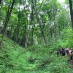 Trip Information
Departure Time: 08:00
Return to City Time: 18:00
Departure Point: York Mills Bus Pickup Click here for more information or to register Optional Items
Major Mackenzie and 400 Park and Ride Parking lot ($0.01)
Hosting Club: Toronto, Dufferin Hi-Land
Category: Bus Hike
Location (Google Maps): Boyne Valley Provincial Park and Mulmur (map 20) Hike Leader(s): Amir Alemohammad, Mohammad Aghamiri, Mehrnoush Ahmadi Click here to contact Hike Leader(s) Pace: Moderate (3-4 km/hr)
Terrain: Variable
Distance: 16-18 km Description
Bus departs 10 York Mills Rd at 8:00 AM and Major Mackenzie Dr and HWY 400 Park and Ride at 8:30 AM. If you wish to be picked up at the Major Mackenzie Dr and HWY 400 Park and Ride, type ‘yes’ in the additional information field. Please arrive 15 minutes before departure. The bus waits for no one This is a fantastic hike to explore Mulmur and the Boyne Valley provincial park. Entering from 10 Sideroad (Road 17) into the main trail (km 30.5, Map 20) we will go south to enter the Boyne Valley on km 20.6. Beautiful side trails, some lookouts and creeks are along the way including Murphy’s Pinnacle Lookout point and Mulmur Lookout side trail. The Boyne valley is always a piece of gem in the Bruce trail. We will end up in the Primrose Bruce Trail parking lot. Drop outs at Km 23.9, 20.6 and First Line E Rd. Please dress according to weather conditions. Boots mandatory poles recommended. Bring at least 4 lit of water, snacks/lunch and be prepared for bugs. Access to the bus is available on the drop out locations. We will have frequent stops to have water and bio breaks and also a 30 min stop for lunch. On the way back we will have a short stop at the nearby local burger shop for refreshments, if there is enough time. We will be back to the York Mills Bus stop by 6:00 pm. We love pets but they are not allowed in this hike.
- Car Hike: Hike the Main Trail from Limehouse CA to Speyside Resource Management Area
8:15 AM-2:00 PM 06/29/2024 https://hikes.brucetrail.org/event/car-hike-hike-the-main-trail-north-of-limehouse-ca-to-speyside-resource-management-area/2024-06-29/ Click here for more information or to register Hosting Club: Toronto
Category: Car Hike
Location (Google Maps): Meeting Location: Roadside parking at Limehouse at the intersection of 22 Sideroad and Fifth Line. Please do not block driveway or access to the bridge. GPS N43.636859, W-79.979818. Map 12 Hike Leader(s): Ross Estrella Click here to contact Hike Leader(s) Pace: Brisk, Moderate
Terrain: Hilly, Rocky, Variable
Distance: 14 kms Description
We will hike the main trail from Limehouse Conservation Area to Speyside Resource Mangement Area. We’ll make this outing a (Hike4Health-Hike4Fun) which allowed us ample time for fun activities and photograhy of the sceneries that catches our eyes along the way. Please bring snacks, lunch and enough water for hydration. Make handy of sunscreen, sun head protection and bug spray as we may be greeted by our friendly mosquitoes. Comfortable/sturdy hiking shoe/boot and poles are strongly recommended. Check weather forecast and dress accordingly. Strongly suggest to bring your personal medication and health ID. Please arrive fifteen minutes early to allow for car shuttling. No drop out allowed.
- Car Hike: Happy Valley – CANCELLED
8:15 AM-1:30 PM 06/29/2024 https://hikes.brucetrail.org/event/car-hike-happy-valley-3/2024-06-29/ Click here for more information or to register Hosting Club: Toronto Location (Google Maps): Happy Valley, Oak Ridges Trail 16th Sideroad and Weston Road Hike Leader(s): Mohammad Aghamiri Click here to contact Hike Leader(s) Pace: Moderate
Terrain: Variable
Distance: 14-17 km Description
Come and join the group to view nice sceneries and look out of Happy valley Some safety procedures during the hike: 1-Hikers must stay between the leader and the sweep. 2-Hikers must advise the leader or the sweep if they wish to leave the group. 3- Hikers must follow the whistle instructions: 1 blast- stay where you are; 2 blasts come to the leader; 3 blasts – come to the leader quickly. 4-Hike leader may request volunteers to stop at trail intersections, they need to help hikers to the direction the group walk and wait till they see the sweep . 5-Hikers have to make sure they can see the persons behind and in front of them.
- Car Hike: Bethesda Trail Richmond Hill
8:30 AM-1:15 PM 06/29/2024 https://hikes.brucetrail.org/event/car-hike-bethesda-trail-richmond-hill-28/2024-06-29/ Click here for more information or to register Hosting Club: Toronto Location (Google Maps): Free parking lot at the head of trail Bethesda Side Road off Bayview Ave. across Wilcox lake Hike Leader(s): Mohammad Aghamiri Click here to contact Hike Leader(s) Pace: Moderate (3-4 km/hr)
Terrain: Hilly, Level 2 (Intermediate – some hills and uneven surfaces, rocks and roots underfoot)
Distance: 14-15 km Description
Join us to explore the trails of York Regional Forest and the Oak Ridges Corridor at Jefferson Forest and Bond lake, From parking lot we hike thought Jefferson forest and continue to Bond Lake and have snack beside the lake and return to parking around 13 to 13.30
|
30 - Car Hike: Hike #6 to earn the Dufferin Hi-Land Youth and/or Side Trails Badge!
10:00 AM-1:00 PM 06/30/2024 https://hikes.brucetrail.org/event/car-hike-hike-6-to-earn-the-dufferin-hi-land-youth-and-or-side-trails-badge/2024-06-30/  Click here for more information or to register Hosting Club: Toronto, Dufferin Hi-Land
Category: Car Hike
Location (Google Maps): We will meet at roadside parking on 1st Line E north of Highway 89 – where the Boyne Valley ST heads on the road (Map 20 of the Bruce Trail Reference Guide, Edition 31). Hike Leader(s): Monica Pasquali Click here to contact Hike Leader(s) Pace: Leisurely
Terrain: Variable
Distance: 6.4 km Description
Calling all families with children who love hiking and earning badges!!! This is the sixth in a series of ten hikes that will be offered throughout 2024 on a roughly monthly basis so that children who are 15 years of age and younger can earn the Dufferin Hi-Land Adventurer Youth Badge and their parents/guardians can earn the Dufferin Hi-Land Side Trails Badge at the same time!!! Details regarding the requirements for each badge can be found here: https://dufferinbrucetrailclub.org/dufferin-bruce-trail-club-badges/ Each of the ten hikes will be a loop hike so no car shuttles will be needed, and each hike will cover a distance of approximately 6-9 km hiked at a leisurely pace (2-3 km/h) so children and adults alike can participate. This sixth hike will be an early summer hike to explore some side trails within Boyne Valley Provincial Park, specifically the Boyne Valley Side Trail and Murphy’s Pinnacle Side Trail. Please dress appropriately for an early summer hike by dressing in lightweight and breathable clothing, wearing a sunhat, and wearing comfortable footwear that has good traction. It is also advised that you bring sunscreen, bug spray, a light sweater, and suitable rain apparel in case conditions require their use. As well, make sure you bring enough water and food for a 2-3 hour hike since we’ll be covering a total distance of approximately 6.4 km. Hopefully you’ll be able to join me on Sunday, June 30th! Until then, happy hiking, everyone!
- Urban Walk: Central Don Parks
10:30 AM-1:00 PM 06/30/2024 https://hikes.brucetrail.org/event/urban-walk-central-don-parks-2/2024-06-30/ Click here for more information or to register Hosting Club: Toronto
Category: Urban Walk
Location (Google Maps): Meet front entrance Civic Garden Centre Pavilion, Toronto Botanical Gardens – Leslie Street & Lawrence Avenue.
Take Bus #54 Lawrence or #51 Leslie from Eglinton Station on Line 1 Hike Leader(s): Tom Swales Click here to contact Hike Leader(s) Pace: Moderate
Terrain: Variable
Distance: 10-12 km Description
We’ll hike a couple of loops through Wilket Creek, Sunnybrook, ET Seton, and Serena Gundy Parks. Those who wish may join us for lunch or coffee at Corks Beer & Wine Bar in Longo’s in Leaside.
| July | July | July | July | July | July |