
Join us for a hike! Registration required:
All hikes available to BTC members. Some hikes are open to non-members.
TIP: The calendar view displays up to 7 hikes on a day, but often there are more. Click “More events” to see them all.
Toronto Hike Schedule
Toronto Bruce Trail Club Registration Live Dates
Day Winter Coach Program
Registration begins two weeks in advance of the event departure (at 8:00 PM)
Day Bus Hikes
Registration begins two weeks in advance of the event departure (at 8:00 PM) with some exceptions of special event hikes
Day Coach Hikes
Registration begins 7 weeks in advance of the event departure
Day Car Hikes and Urban Hikes
Registration begins two weeks in advance of the event departure
Overnight and Weekend Trips
Registration begins 12 weeks in advance of the event departure
To view all Bruce Trail Conservancy Hikes click here
- 14April 14, 2024
Car Hike: Mono Cliffs
https://hikes.brucetrail.org/event/car-hike-mono-cliffs-6/Sorry, the registration cut-off time for this hike has been reached.Not a member? Click here to join today!Hosting Club: Toronto, Dufferin Hi-Land
Category: Car Hike
Location (Google Maps): Mono Cliffs Provincial Park, Map 19Hike Leader(s): Al Brown Click here to contact Hike Leader(s)
Pace: Moderate
Terrain: Flat, Variable
Distance: 14 kmDescription
We will complete a loop hike through the Park including the Splitrock side trail north of it. The terrain is generally flat to rolling and occasionally rocky, relatively easy hiking. Given the early end to winter spring flowers may be out for our viewing pleasure. After the hike those interested may meet at the Hockley Valley resort for refreshments.To get to the meeting point take Hwy 10 north from Orangeville. Turn right at Camilla onto Mono Centre Road. Follow it to the village of Mono. Turn right onto a gravel lane just before you get to the community centre (on your right as you approach the village). Parking is on the graveled areas behind the tennis court.

Urban Walk: Waterfront Trail - Ajax GO to Pickering GO
https://hikes.brucetrail.org/event/urban-walk-waterfront-trail-ajax-go-to-pickering-go/Sorry, the registration cut-off time for this hike has been reached.Not a member? Click here to join today!Hosting Club: Toronto
Category: Urban Walk
Location (Google Maps): Durham Waterfront TrailHike Leader(s): Brian Rideout Click here to contact Hike Leader(s)
Pace: Moderate
Terrain: Flat
Distance: 11 kmDescription
Please join me under the clock in the Great Hall at Union Station by 9:05 am. We will take the eastbound Lakeshore Train departing Union Station GO at 9:20 am, arriving Ajax GO at 10:15 am. You may choose to join the group at Ajax GO Station.We will hike south to Lake Ontario (washrooms in the park), west to Sandy Beach Rd, and north to Bayly St with a pub stop at Irish Times adjacent to Pickering GO. Trains to Toronto depart at 25 minutes and 55 minutes after the hour.
Here is an online map of our route (please click on the link): Ajax to Pickering
You can buy a GO Transit day pass for $10.
A Hike Leader’s Hike - For TBTC Hike Leaders & Prospective Hike Leaders (BUT ANYONE WELCOME)
https://hikes.brucetrail.org/event/a-hike-leaders-hike-for-tbtc-hike-leaders/Sorry, the registration cut-off time for this hike has been reached.Not a member? Click here to join today!Hike open to BTC Members only.
Hosting Club: Toronto
Category: TBTC Special Events
Location (Google Maps): Streetsville Memorial Park, 335 Church St., bottom of the hill, in the parking lot near the Culham Trail and the bridge to the island. You can access Church St. from Queen St. which is an extension of Mississauga Rd.
If coming by public transit, meet Andrew at Kipling Terminal by 8:50 to take the #29 Guelph GO Transit Bus at 9 am to Erin Mills Station. We will transfer to #21 Lisgar GO Transit bus leaving at 9:45 to Streetsville Go STN and arriving at 9:55. Presto Card users will now have their TTC Fare deducted from the GO Transit fare making the adult return fare $5.50. Use washrooms at Streetsville station before walking 9 minutes to the meeting point. If coming by transit from the east end or downtown Toronto you may alternatively meet Tom in the Great Hall of Union Station at 8:30 to take the westbound Lakeshore GO Train to Clarkson where we will transfer to the same #21 Lisgar GO Bus those coming with Andrew from Kipling will board at Erin Mills.Hike Leader(s): Andrew Proczek, Tom Swales
Pace: Moderate
Terrain: Flat
Distance: 12.5Description
This is a hike for current Toronto Bruce Trail Club Hike Leaders to meet some of the other Toronto Bruce Trail Club Hike Leaders and those interested in becoming Hike Leaders and would like an opportunity to ask questions before taking the Hike Ontario Certified Hike Leader Training scheduled for June. However anyone is welcome to join us. Hiking Director Tom Swales and other Hike Leaders who have taken the Hike Ontario Certified Hike Leader (CHL) Course will be available to answer questions about the course, the process of becoming a Certified TBTC Hike Leader, and expectations of a Hike Leader. There will be further opportunities to mingle after the hike at a local pub.We will hike on the Culham Trail from Streetsville to Credit Meadows Park and return. Lunch will be at km 6.3 by the Credit River. The is a pleasant and fairly easy hike with only one major hill. We will be walking on packed gravel, dirt and grass trails as well as a short section of paved trail near River Grove Park.
- 15April 15, 2024No events
- 16April 16, 2024
Urban Walk: Valley View and Maple view Parks Thornhill
https://hikes.brucetrail.org/event/urban-walk-valley-view-and-maple-view-parks-thornhill-2/Sorry, the registration cut-off time for this hike has been reached.Not a member? Click here to join today!Hosting Club: Toronto
Location (Google Maps): Parking lot at the corner of Bayview Ave, and Sycamore Dr. South of Highway 7
Sycamore Dr. is 2 blocks south of highway 7,parking lot is across plaza of Dollarama and Star boxHike Leader(s): Mohammad Aghamiri Click here to contact Hike Leader(s)
Pace: Moderate
Terrain: Variable
Distance: 7-8 kmDescription
We will explore Valleyview and Maple view parks, and walk along German Mill Creek, - 17April 17, 2024No events
- 18April 18, 2024No events
- 19April 19, 2024
Car Hike: Toronto E2E in 4 and biodiversity badge (1of4)
https://hikes.brucetrail.org/event/car-hike-toronto-e2e-in-4-and-biodiversity-badge-1of4/Sorry, the registration cut-off time for this hike has been reached.Not a member? Click here to join today!Hike open to BTC Members only.
Hosting Club: Toronto
Category: Car Hike
Location (Google Maps): Km 12.1, map 12. Southeast side of 15 sideroad. Coordinates N 43.582968,W 79.971787Hike Leader(s): Smadar Junkin Click here to contact Hike Leader(s)
Pace: Moderate
Terrain: Rocky, Variable
Distance: 12.1Description
This is a 4 hikes series that will include the E2E and the biodiversity badges options. You can choose the regular E2E badge for the $5.00 or the fundraising stain glass badge for $30.00. Hikers are expected to bring the money on the first hike of the series. Children age 8 and up are invited to join this hike for the great opportunity to engage, enjoy and learn about nature. 2 of the hikes in this series on a TDSB PA days). Children must be accompanied by a parent/ guardian.If you are interested in getting the biodiversity badge, please read about it on the Toronto BTC page to familiarize yourself with the requirements.
after each hike we will have a treat. Children can earn the youth Toronto BTC badge at no cost. Make sure that your child/ grandchild can hike the distance posted.
we will shuttle to km 0.0 and hike back. Everyone is expected to shuttle at least once during the 4 outings. - 20April 20, 2024
Car Hike: Wilder Forest Uxbridge
https://hikes.brucetrail.org/event/car-hike-wilder-forest-uxbridge-5/Sorry, the registration cut-off time for this hike has been reached.Not a member? Click here to join today!Hosting Club: Toronto
Category: Car Hike
Location (Google Maps): 2499 Brock Road, Uxbridge, ON there is a free parking when you enter the road off brock road beside Horse training facilityHike Leader(s): Mohammad Aghamiri Click here to contact Hike Leader(s)
Pace: Moderate
Terrain: Hilly, Variable
Distance: 14-17 kmDescription
We will explore Wilder forest and the beautiful scenery of Uxbridge forests.Bus Hike: Hill Fun in Hockley Valley and Mono Cliffs
https://hikes.brucetrail.org/event/bus-hike-hill-fun-in-hockley-valley-and-mono-cliffs/Sorry, the registration cut-off time for this hike has been reached.Not a member? Click here to join today!Trip Information
Departure Time: 08:30
Return to City Time: 18:00
Departure Point: York Mills Bus PickupOptional Items
Hosting Club: Toronto, Caledon Hills, Dufferin Hi-Land
Category: Bus Hike
Location (Google Maps): Hockley Valley and Mono CliffsHike Leader(s): Martina Furrer, Roland Mark, Leonora Rochwerger and Tim Wainwright Click here to contact Hike Leader(s)
Pace: Fast, Moderate
Terrain: Hilly, Variable
Distance: Fast (18 km), moderate (13 km)Description
Join us for an awesome hike with great views and fun hills. We will split into two groups and hike north from Hockley Valley to the Split Rock Side Trail. Moderate group will hike about 13 km. Fast group will hike about 18 km. Refreshments after if time allows.Bus departs 10 York Mills Rd at 8:3o AM, and should be back in the city by 6 PM.
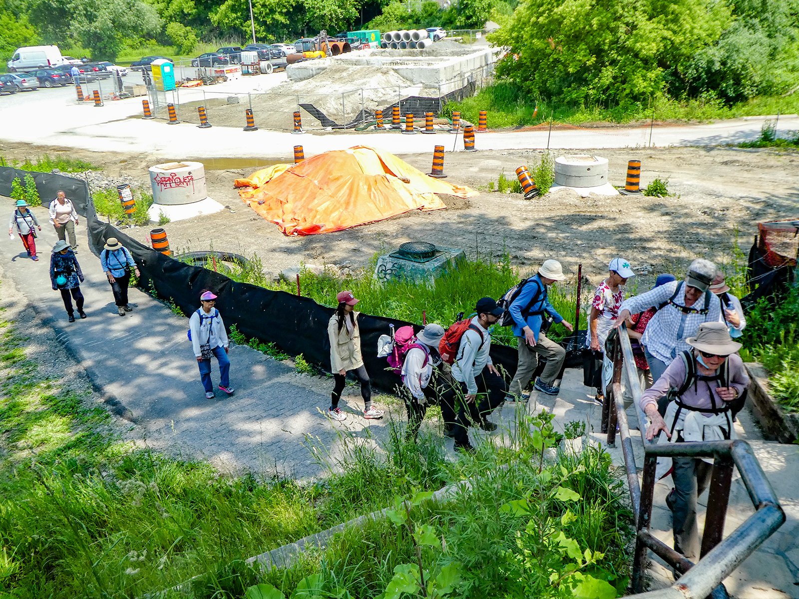
Toronto Urban Badge Hike - 2 of 7
https://hikes.brucetrail.org/event/toronto-urban-badge-hike-2-of-7-4/Sorry, the registration cut-off time for this hike has been reached.Not a member? Click here to join today!Hosting Club: Toronto
Location (Google Maps):
Toronto, Ontario, Canada
Hike Leader(s): Brian Rideout Click here to contact Hike Leader(s)
Pace: Moderate
Terrain: Flat
Distance: 10.9 kmDescription
Please join me at the south east corner of Eglinton and Scarlett by 10 AM. We will hike south on the Humber Recreational Trail to Lakeshore Blvd and Ellis (km 19.2 to km 8.3). Here is an online map with km markings of our route for all 7 hikes for the Toronto Urban Badge.Please make sure you bring at least 2 liters of water, a lunch, bug spray and sunscreen.
Urban Walk: Humber River to High Park
https://hikes.brucetrail.org/event/urban-walk-humber-river-to-high-park/Sorry, the registration cut-off time for this hike has been reached.Not a member? Click here to join today!Hosting Club: Toronto
Category: Urban Walk
Location (Google Maps): Old Mill Subway StationHike Leader(s): Danny Pivnick Click here to contact Hike Leader(s)
Pace: Moderate
Terrain: Flat
Distance: 8 KmsDescription
Join us for an afternoon walk in Toronto’s West End. Beginning at Old Mill subway station, we will make our way south following a part of the Humber River. Upon reaching Lake Ontario, we will have a chance for some photos before crossing the beautiful Humber Bay Arch Bridge. We will then follow the Waterfront Trail and head up into High Park where we will hopefully be able to enjoy the beginning of the short-lived Cherry Blossom season. The walk will then end in High Park.