|
Sun | Mon | Tue | Wed | Thu | Fri | Sat |
|---|
May | 1  NEW Black Bear Badge Peninsula End2End – Hikes 1-5 of 8 hikes, June 1-5 (Hikes 6-8 of 8 July 27-29) NEW Black Bear Badge Peninsula End2End – Hikes 1-5 of 8 hikes, June 1-5 (Hikes 6-8 of 8 July 27-29) 12:00 PM-3:30 PM 06/01/2026 https://hikes.brucetrail.org/event/new-black-bear-badge-peninsula-end2end-hikes-1-5-of-8-hikes-june-1-5-hikes-6-8-of-8-july-27-29/2026-06-01/  This is a Multi-Day HikeYou are signing up for the following dates and times:
2026-06-01 at 12:00
2026-06-02 at 07:30
2026-06-03 at 07:30
2026-06-04 at 07:30
2026-06-05 at 07:30 Click here for more information or to register Hosting Club: Iroquoia, Peninsula
Category: General Hike
Location (Google Maps): Bluewater Park, Wiarton Hike Leader(s): Steven White Click here to contact Hike Leader(s) Pace: Brisk – 4 to 5 km/hr
Terrain: Dependent on Conditions, Moderate – Some hills and/or some poor footing, Strenuous – Hilly with steep climbs and some poor footing
Distance: 13.3kms Description
Hike Peninsula in 8 hikes this summer and earn the New Black Bear Fundraising Badge!! June 1-5 and July 27-29, 2026. Separate registrations of June 1-5 and July 27-29. We will meet at 12 noon at Bluewater Park in Wiarton and shuttle to Crawford Drive Side Trail and hike back to Bluewater Park. June 2-5, we will be hiking the top part of the Peninsula. We will meet each morning at 7:30am and shuttle to the trail head. Shuttling at the beginning of the day and one shuttle at end of each day to take morning drivers back to their cars, will be shared among all hikers. These start times allow hikers to travel the morning of the hike and finish mid-afternoon. Any parking fees will be shared equally by all hikers. A full itinerary will be shared with hikers the week before our hikes begin. For those booking accommodation, recommend staying near the top part of the peninsula for June 1-5 and near Wiarton for the July dates. I expect to have the new Black Bear End to End Fundraising badges for our last hike July 29, to be distributed to those who completed all 8 hikes. Hikers should bring layered clothing in case of cool, breezy or rainy days. Hikers should have hiking shoes/boots, poles, hat, raingear, sunblock, bug repellant, 2-3 litres of water and snacks/lunch. We will have 2 scheduled breaks each day, except for June1 (1 break) as it is a shorter hike. Anticipate 4 km/hr average pace including breaks, so please be honest with respect to your capability.
| 2  Boots and Books – The Iroquoia Bruce Trail Book Club Meet time is 10:30am Boots and Books – The Iroquoia Bruce Trail Book Club Meet time is 10:30am 10:30 AM-12:30 PM 06/02/2026 https://hikes.brucetrail.org/event/boots-and-books-the-iroquoia-bruce-trail-book-club-4/2026-06-02/  Click here for more information or to register Hosting Club: Iroquoia
Category: Boots and Books – The Iroquoia Bruce Trail Book Club
Location (Google Maps): Kilbride Park Parking Lot behind the Kilbride School Hike Leader(s): Ruth Moffatt Click here to contact Hike Leader(s) Pace: Medium – 3 to 4 km/hr
Terrain: Moderate – Some hills and/or some poor footing, Strenuous – Hilly with steep climbs and some poor footing
Distance: Approx 7km Description
Welcome to the 3rd Iroquoia Bruce Trail Book Club – “Boots and Books” Our book is “Theo of Golden” by Allen Levi. Please check your local library for available copies of this book. We will hike from the parking lot north bound to Calcium Pits/Twiss Rd and return – about 7km which will take about 2 hours approximately. Please wear suitable foot wear, dress for the weather and bring poles if you use them and gaiters as the trail may be muddy. Please bring enough snacks and water suitable for the length/duration of the hike. It is not necessary to bring the book. The June book will be “A History of Canada in 10 Maps” by Adam Shoalts and the July book will be “Woman, Watching” by Merilyn Simonds It may be a good idea to reserve these books now from your local library. The hike is open to everyone whether you have read the book or not but there may he spoilers, if you haven’t read it. It will be open to 10 people to keep it more intimate for discussing the book. If your plans change, please cancel your registration so that people who are waitlisted may join. To cancel your registration, here is a step by step:
– Sign into your account on the Bruce Trail website.
– Go to the Hike Schedule
– Click on My Hikes tab which you should find at the top of the schedule
– Scroll to the appropriate hike you wish to cancel
– Cursor to the far right of the hike to the Action column
– Click cancel under the hike you wish to cancel.
| 3 - Hidden Valley Park to Cityview Park
9:00 AM-1:00 PM 06/03/2026 https://hikes.brucetrail.org/event/hidden-valley-park-to-cityview-park/2026-06-03/ Click here for more information or to register Hosting Club: Iroquoia
Category: General Hike
Location (Google Maps): Meeting at the South parking lot of City View Park, Burlington (on Kerns Rd off of Hwy #5) where we will shuttle to Hidden Valley Park, Burlington (parking lot beside the HVP washrooms and just south of the Burlington Model Railway Club Inc) to begin our hike. Drivers for the shuttle will be needed as well as someone to return the drivers to retrieve their cars at the end of the hike. Thank you! Hike Leader(s): Karen Capindale-Smith Click here to contact Hike Leader(s) Pace: Medium – 3 to 4 km/hr
Terrain: Strenuous – Hilly with steep climbs and some poor footing
Distance: 10+km Description
We will begin our hike on Hidden Valley Rd which goes thru the quaint village of Lemonville. Following Grindstone Creek past the village and into the woods we will connect with the main Bruce Trail. We will make the steep climb out of Sleepy Hollow and continue east along the BT to our original meeting spot at City View Park. Please remember to dress in appropriate layers and bring water and snacks. Baked good should be expected 🙂
| 4 - Halton Forest to Speyside (E2E)
9:30 AM-12:00 PM 06/04/2026 https://hikes.brucetrail.org/event/halton-forest-to-speyside-e2e-4/2026-06-04/ 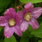 Click here for more information or to register Hosting Club: Iroquoia
Category: General Hike
Location (Google Maps): Meet at the Pear Tree parking lot at Speyside on 15 Side Road at 9:15 am. Hike Leader(s): Karen Bergmann Click here to contact Hike Leader(s) Pace: Medium – 3 to 4 km/hr
Terrain: Moderate – Some hills and/or some poor footing
Distance: 8 kms Description
We will meet at 9:15 in the Pear Tree parking lot on 15 Side Road and carpool to 6th Line at the Halton Agreement Forest and hike back along the Hilton Falls Side Trail, Al Shaw Side Trail and the main trail. This trail has some serious rocks and we cross a couple of creeks. Bring sufficient water and bug spray/bug net.
| 5 | 6   Blue Mountains End to End Fundraiser for the Stained Glass Badge June 6,7,8, 2026 Blue Mountains End to End Fundraiser for the Stained Glass Badge June 6,7,8, 2026 7:30 AM-2:00 AM 06/06/2026 https://hikes.brucetrail.org/event/blue-mountains-end-to-end-fundraiser-for-the-stained-glass-badge-june-678-2026/2026-06-06/  This is a Multi-Day HikeYou are signing up for the following dates and times:
2026-06-06 at 07:30
2026-06-07 at
2026-06-08 at Click here for more information or to register Hosting Club: Iroquoia, Blue Mountains
Category: Stained Glass Badge End to End Fundraiser Hike
Location (Google Maps): Registered participants will receive a WhatsApp invitation (optional)which can be used for photo share and other pertinent information. This is a three day fundraiser ETE for the stained glass badge. You must be able to hike at least 4km an hour with hills and rough terrain. June 6 – Day 1 – Meet in the parking lot parking lot area located 380 m north of the main trail crossing Pretty River Road (40 car capacity) 44.430927, -80.275390 Shuttle to Maple Lane in Ravenna. Park only on the north side 44.504973, -80.331780 (4 car capacity) 20km
June 7 – Day 2 – Meet in the parking lot parking lot area located 380 m north of the main trail crossing Pretty River Road (40 car capacity) 44.430927, -80.275390 Shuttle to $paid parking lot off of 15/16 Sideroad – accessible only from Concession 10 South. 44.342784, -80.210628 (car capacity 7) 24km
June 8 Day 3 – Meet in front of the Lavender Cemetery on Mulmar Nottawasaga Townline 550 meters east of Lavender Hill Road – do not block cemetery gate. 44.268777, -80.156810 (Car capacity 10) and shuttle to $paid parking lot on 15/16 Sideroad 44.342784, -80.210628 (Car capacity 7) 22.50km. Parking fees are shared by everyone except the drivers. Hike Leader(s): Ruth Moffatt Click here to contact Hike Leader(s) Pace: Brisk – 4 to 5 km/hr
Terrain: Moderate – Some hills and/or some poor footing, Slippery and Steep Sections, Strenuous – Hilly with steep climbs and some poor footing
Distance: 67.50km spread over three days Description
Everyone who is registered for this hike series will be invited to join an optional WhatsApp which can be used to share photos and other information. Distances will be spread over 3 days as equally as possible depending on the parking. Please bring enough food and snacks for a 20km + day of hiking and 2l of water minimum.
Everyone must have a first aid kit in their backpack as well as all the other items you require for a long day hike (poles, rain gear etc)
The registration fee includes the badge, guidance and organization. The fee supports the club’s infrastructure and the mission of “Preserving a ribbon of wilderness for everyone, forever.” There are no refunds. This series of hikes is intended for hikers who are used to a multi-day distance of 20+km at a steady pace. We will have a short break around 10am and a lunch break. Afternoon break is dependent on expected finishing time. Please do not over estimate your hiking ability.
Participants can make up one of the three days on their own if you have a scheduling conflict. Please try to do this before we get started.
You must be willing to share in the car shuttle to the start of the hike or driving the drivers back at the end of the day. Please have a minimum 4 useable seats including driver’s. This is a group hike and it is intended that everyone be present on each day.
Please cancel your registration if your plans change so that someone else who may be on the waitlist can take your place. Paid parking on two days to be shared by non-drivers. All registered hikers will be invited to join a WhatsApp group. This can be used for sharing photos and other items of interest. Refunds: https://brucetrail.org/paid-hike-refund-policy/
 RAINBOW HIKE: Birding with Pride RAINBOW HIKE: Birding with Pride 8:00 AM-10:00 AM 06/06/2026 https://hikes.brucetrail.org/event/rainbow-hike-birding-with-pride/2026-06-06/  Click here for more information or to register Hosting Club: Iroquoia
Category: Rainbow Hike
Location (Google Maps): Royal Botanical Gardens – Hendrie Valley Sanctuary, Cherry Hill Gate Hike Leader(s): Shayne Ward Click here to contact Hike Leader(s) Pace: Leisurely – 3km/hr or less
Terrain: Easy – Mostly flat and usually good footing, Moderate – Some hills and/or some poor footing
Distance: 5KM Description
Join us as we kick off Pride Month with a colourful morning of birding! 🦅🦉🦆🌈 For this edition, it’s encouraged to come dressed in the colours of your favourite bird! 🌈 This gentle early-morning outing will explore the trails around Royal Botanical Gardens, one of our region’s important migration areas. We will start at the trailhead parking lot of the Cherry Hill Gate. Plan to arrive for 745AM and we’ll have a small crash course on downloading and using two popular birding apps, Merlin Bird ID and eBird recording our sightings! We’ll depart by 8-810AM. Hoping to catch some Blue Herons, Swans, Wood Ducks, and if we’re lucky, a sighting of the RBG resident Screech Owl! 🌈 This is a queer-led, 2SLGBTQIA+ inclusive Rainbow Hike, welcoming LGBTQ+ hikers, allies, birders, photographers, and anyone interested in connecting with nature and community. This is a short, relaxed hike (approx. 5 km) designed to get us moving and birding! What to Bring
• Water and light snacks
• Weather-appropriate clothing and sturdy footwear
• Binoculars or camera if you have them (optional but fun! And a cell phone counts!) Not a Bruce Trail member yet?! Sign up here!
https://brucetrail.org/become-a-member/ Come enjoy a spring morning on the trail, celebrate migratory birds, and connect with your Bruce Trail community! 🐾 Please leave pets at home for this hike! It’s migration season and we’ll be passing through an important bird migration and nesting area, so we want to keep disturbance to our feathered friends to a minimum! 🐦 🚗 🚌 This outing is accessible by car or public transit. Planning to drive?
Parking is 3$/hour to a maximum of 15$ if you park at Cherry Hill Gate, or free if you park across the street at RBG Centre. Taking the Bus?
HSR #9 or BT1 stops near the trailhead entrance! Map of the bus and it’s schedule can be found here.
https://www.hamilton.ca/sites/default/files/2026-04/hsr-9-ROCK%20GARDENS-may10.pdf Free Bruce Trail Rainbow badges and stickers for all participants!
Questions? Simply click “Contact Hike Leader” on the registration form.
|
7 | 8 - Duncan Escarpment Provincial Park
10:00 AM-1:00 PM 06/08/2026 https://hikes.brucetrail.org/event/duncan-escarpment-provincial-park/2026-06-08/ 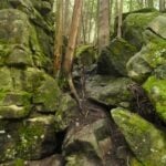 Click here for more information or to register Hosting Club: Iroquoia
Category: General Hike
Location (Google Maps): Duncan Escarpment Provincial Park – small parking lot on Side Road 9. If you would like to carpool from Mississauga, please contact the Hike Leader. Hike Leader(s): Karen Bergmann Click here to contact Hike Leader(s) Pace: Medium – 3 to 4 km/hr
Terrain: Strenuous – Hilly with steep climbs and some poor footing
Distance: 11 kms Description
Time for an adventure in the Beaver Valley section! This loop hike is challenging and so rewarding! Takes about 2 hours drive from the GTA. We’ll hike on the main trail and a couple of side trails in a loop. There are hilly parts and plenty of rocks and roots. Bring water and a snack/lunch. If you would like to carpool from Mississauga, I am happy to have a few people ride with me. I will send an email a couple of days prior to the hike.
| 9 - Beaver Valley Stained Glass Badge Fundraiser – June 9, 10, 11, 12 13, 2026 7:30 meet time
7:30 AM-3:00 PM 06/09/2026 https://hikes.brucetrail.org/event/beaver-valley-stained-glass-badge-fundraiser-june-9-10-11-12-13-2026-730-meet-time/2026-06-09/  Click here for more information or to register Hosting Club: Iroquoia, Beaver Valley
Category: Stained Glass Badge End to End Fundraiser Hike
Location (Google Maps): Registered participants will receive a WhatsApp invitation (optional)which can be used for photo share and other pertinent information.
June 9 – Meet at the Kolopore Uplands Parking Lot Grey Rd 2 located 650m south of the Trail 44.422919, -80.405597 (30) Shuttle to Roadside Parking along the north side of Maple Lane 44.504973, -80.331780 (4) 26km
June 10 – Meet at Kolopore Uplands, Shuttle to Roadside Parking on the northern shoulder of Sideroad 7B where the main trail enters the forest. 44.395310, -80.518495 (6) 20km
June 11 – Meet at Hogg’s Falls parking lot 44.285307, -80.543081 (16) Shuttle to Sideroad 7B 21km
June 12 – Meet at Hogg’s Falls Shuttle to John Muir Epping Lookout – Enter from Grey Rd 7, 300 m north of 19 Sideroad 44.461522, -80.554756 (40) 29km
June 13 – Meet at John Muir Lookout. Shuttle to BTC parking lot on the east side of Grey Rd 12 where the trail crosses the road. 44.500537, -80.632902 (15) 24km Hike Leader(s): Ruth Moffatt Click here to contact Hike Leader(s) Pace: Brisk – 4 to 5 km/hr, Medium – 3 to 4 km/hr
Terrain: Dependent on Conditions, Moderate – Some hills and/or some poor footing, Strenuous – Hilly with steep climbs and some poor footing
Distance: 20-29 per day Description
Beaver Valley Stained Glass Badge Fundraiser End 2 End Everyone who is registered for this hike series will be invited to join an optional WhatsApp which can be used to share photos and other information. In this series of 5 hikes you will get a chance to test your strength, endurance and perseverance! You will be rewarded with the breathtaking views of spring in the valley, good company and of course the Beaver Valley Stained Glass badge ETE badge. This is a monetized hike – proceeds go to the Beaver Valley Bruce Trail Club to continue to maintain infrastructure along the trail. There are no refunds. This E2E is intended for strong hikers only. We will be hiking at a steady pace with very few short breaks It will be tough hiking due to the distances involved so be sure of your physical ability before signing up for this hike. We will take only a few short breaks and lunch. Photo stops, as well. It is expected that everyone keep pace with the person in front of them. Bio breaks are as you need; please let the sweep know and they will wait for you. Please do not register for this hike unless you can commit to all 5 days. If you need to miss one day, please make it up before this hike begins. The Stained Glass ETE Beaver Valley Club series can only be completed with a club leader. All hikes in this series will include a car shuttle and everyone will take a turn as a shuttle driver. Please have your vehicle passenger-ready with at least 4 available seatbelts. If you have any questions please email me. Please bring all snacks/lunch and at least 2l of water as well as all the other things you require for a long day hike including a first aid kit, bug spray, sunscreen and poles, if you use them. No dogs. Do not show up unregistered. Any questions may be directed through contact on this form.
If you cannot make it, please remove yourself from registration. To cancel your registration, here is a step by step:
– Sign into your account on the BTC website
– Click on My Hikes under your account
– This will take you to a list of hikes you have registered for
– Scroll down to the appropriate hike and cursor over to the far right hand column under the Action column.
– Click Cancel under the hike you wish to cancel There are no drop outs. If for some reason you are unable to complete the days’ hike, you will be responsible for finding your way back to your vehicle. Badges will be presented on the last day, hopefully. If not, a list of finishers will be sent to the club for mailing out. Refunds: https://brucetrail.org/paid-hike-refund-policy/
| 10 - Radial lines, waterfalls and lattes!
9:30 AM-12:00 PM 06/10/2026 https://hikes.brucetrail.org/event/radial-lines-waterfalls-and-lattes/2026-06-10/ 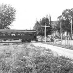 Hike open to BTC Members only. Click here for more information or to register Hosting Club: Iroquoia
Category: Good Companions
Location (Google Maps): Parking lot behind St. John’s Anglican Church. 272 Wilson Street East. Enter off Halson Street and park by the entrance to the trail. Hike Leader(s): Kathy Rymal Click here to contact Hike Leader(s) Pace: Medium – 3 to 4 km/hr
Terrain: Easy – Mostly flat and usually good footing, Moderate – Some hills and/or some poor footing, Strenuous – Hilly with steep climbs and some poor footing
Distance: 9.5 km Description
We will begin our hike behind the St. John’s Anglican Church graveyard at the entrance to the Ancaster Radial Line Trail. After a smooth, flat, 3 km walk along the trail and Filman Road we meet up with the Bruce Trail (rugged and steep) which takes us down into Tiffany Falls (poles recommended!) over to Sherman and Canterbury Falls and back along the Heritage Trail to Wilson Street. Heading back up Wilson we will pass both the Trails Cafe and the Caniche French Bakery for optional croissants, treats, sandwiches etc. Water, snacks and bug spray recommended.
| 11 - Halton Agreement Forest – using All Trails to navigate your hike
9:30 AM-12:00 PM 06/11/2026 https://hikes.brucetrail.org/event/halton-agreement-forest-using-all-trails-to-navigate-your-hike-2/2026-06-11/  Click here for more information or to register Hosting Club: Iroquoia
Category: General Hike
Location (Google Maps): Meet at the corner of 10 Side Road and 4th Line at 9:15 am. Hike Leader(s): Karen Bergmann Click here to contact Hike Leader(s) Pace: Medium – 3 to 4 km/hr
Terrain: Moderate – Some hills and/or some poor footing
Distance: 8 kms Description
You’d like to explore new trails but aren’t sure of where you’re going? This hike will provide experience and tips on how to navigate hikes using the All Trails app. Be sure to download it and come prepared to participate in navigating the unmarked trails of the Halton Agreement Forest.
| 12  Afternoon Hike -Terra Cotta to Walking Fern Afternoon Hike -Terra Cotta to Walking Fern 4:30 PM-6:00 PM 06/12/2026 https://hikes.brucetrail.org/event/afternoon-hike-terra-cotta-to-walking-fern/2026-06-12/  Click here for more information or to register Hosting Club: Iroquoia
Category: Afternoon/Evening Hikes
Location (Google Maps): Meet at 4:15 pm on 10 Line, between Terra Cotta and Silver Creek Conservation Areas. Hike Leader(s): Karen Bergmann Click here to contact Hike Leader(s) Pace: Medium – 3 to 4 km/hr
Terrain: Moderate – Some hills and/or some poor footing
Distance: 6 kms Description
A short afternoon hike, we will carpool from 10 Line to Winston Churchill Blvd and hike back through Terra Cotta CA along the main trail and then on the Walking Fern Side Trail, which is very technical (rocky). Bring bug spray/bug net and sufficient water and sturdy hiking boots.
| 13 - RAINBOW HIKE: Three Waterfalls + a Hiker Cafe
9:30 AM-1:45 PM 06/13/2026 https://hikes.brucetrail.org/event/rainbow-hike-three-waterfalls-a-hiker-cafe/2026-06-13/  Click here for more information or to register Hosting Club: Iroquoia
Category: Rainbow Hike
Location (Google Maps): Parking lot at corner of Wilson & Academy, downtown Ancaster Hike Leader(s): Doug O’Neill Click here to contact Hike Leader(s) Pace: Leisurely – 3km/hr or less, Medium – 3 to 4 km/hr
Terrain: Moderate – Some hills and/or some poor footing
Distance: 13 KM approximately Description
Happy Pride Month! This queer-led, all-inclusive 2SLGBTQIA+ hike starts in downtown Ancaster, connects with the Bruce Trail—stopping at three waterfalls—then follows a mishmash of sidetrails with lunch at the Trail Centre/Historic Train Station (indoor washrooms). Arrive by 9:30 a.m. for a 9:45 a.m. start. In honour of Pride Month, we’ll head to the gay-owned and operated Trails Cafe in Ancaster for our optional post-hike refreshment stop. Fully accessible by Hamilton Public Transit or car. We’ll start and end in the same spot, no shuttle or carpooling required. What’s a Rainbow Hike: The aim of the Bruce Trail’s Rainbow Hikes is to create a safe, welcoming space for 2SGBTQIA+ hikers—including trans, gay, lesbian, bisexual, queer, Two-Spirit, intersex, asexual, and straight friends—to show up and be themselves in a safe and friendly outdoor setting. Our hiking group typically includes 20 to 25 people representing a full spectrum of sexual orientations, ages. gender identities, and expressions. Diversity Rules 🙂 Highlights for this hike: Three waterfalls (Tiffany, Sherman and Canterbury), Hermitage ruins, Dundas Valley Conservation nature interpretation centre. Bonus: The Basadinaa Experience—the relatively new Indigenous-led trail-signage journey along the BT main Trail in Dundas Valley. Where to meet: We’ll rendezvous at the small parking lot right the corner of Wilson Street East and Academy in Ancaster (put 392 Wilson Street East into your GPS). Coming by Hamilton Transit: Take the 5A MEADOWLANDS via McMASTER bus from King and Bay (in downtown Hamilton), get off at Rousseaux at Wilson (in Ancaster), and walk 5 minutes (max) up Wilson street to our meeting spot. Parking at corner of Wilson Street East and Academy. Just look for the unpaved parking lot right at the corner. Free. If full, there’s also parking across the street. If you arrive early and you need to visit the loo, there’s a Tim Horton’s (370 Wilson). You need to ask for the washroom key and they may prioritize people who are buying something. Try your luck! Bring sufficient water (1 L minimum–There’s a fountain to replenish at half-way point) and proper lunch, energizing snacks. Hiking boots or sturdy shoes. Avoid shorts during tick season. Hat, sunblock, insect repellent. Get your complimentary Bruce Trail Rainbow badge! Feel free to reach out to the Hike Leader Doug if you have any questions “Click here to contact Hike Leader” on this form.
|
14 - Glen Cross to Riverside Woods
9:30 AM-12:30 PM 06/14/2026 https://hikes.brucetrail.org/event/glen-cross-to-riverside-woods/2026-06-14/ 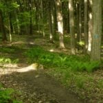 Click here for more information or to register Hosting Club: Iroquoia
Category: General Hike
Location (Google Maps): Meet roadside at 9:15 on Second Line, south of Hockley Valley. Hike Leader(s): Karen Bergmann Click here to contact Hike Leader(s) Pace: Medium – 3 to 4 km/hr
Terrain: Moderate – Some hills and/or some poor footing
Distance: 9 kms Description
Meeting roadside at 9:15 on Second Line, we will carpool to Fourth Line and hike back. The trail takes us through the forest and the grounds of the Hockley Valley Resort, across a golf course and bike trails, down to Second Line. We will continue into Riverside Woods and hike a loop along the side trails there, back to the cars. Bring sufficient water and a snack, as needed, as well as bug spray/bug net.
| 15 | 16 | 17 - Sydenham END to END Stained Glass Fundraiser Badge plus Sydenham Side Trail Badge plus Sydenham Walking Through Time Badge – June 17, 18, 19, 20, 21, 22, and 25, 26, 27, 28, 29, 30.
7:00 AM-2:00 PM 06/17/2026 https://hikes.brucetrail.org/event/sydenham-stained-glass-badge-fundraiser-sydenham-side-trail-badge-tba-and-sydenham-walking-through-time-badge-june-17-18-19-20-21-24-25-26-27-28-29-30/2026-06-17/  This is a Multi-Day HikeYou are signing up for the following dates and times:
2026-06-17 at 07:00
2026-06-18 at
2026-06-19 at
2026-06-20 at
2026-06-21 at
2026-06-22 at
2026-06-25 at
2026-06-26 at
2026-06-27 at
2026-06-28 at
2026-06-29 at
2026-06-30 at Click here for more information or to register Hosting Club: Iroquoia, Sydenham
Category: Stained Glass Badge End to End Fundraiser Hike
Location (Google Maps): Sydenham Bruce Trail Club – Stained Glass Badge; Side Trails Badge and Walking Through Time Badge – 12 day hike – (2x6days).
We are meeting in the parking lot at Blantyre on the first morning. East side of Grey Rd 12
Registered participants will receive a WhatsApp invitation (optional)which can be used for photo share and other pertinent information. Hike Leader(s): Ruth Moffatt Click here to contact Hike Leader(s) Pace: Brisk – 4 to 5 km/hr, Medium – 3 to 4 km/hr
Terrain: Dependent on Conditions, Moderate – Some hills and/or some poor footing
Distance: Main trail is about 170km; Side Trails are 117km. Some parts will have to be hiked twice. The total will be divided across the 12 days of hiking as equitably as possible. Description
Please read all information contained in this hike description before registering for this series of hikes. You cannot show up to participate without first registering. There will be a WhatsApp invitation to join for this multi day/series hike. This 2×6 day hiking series is for endurance hikers. Please know your physical limit before signing up. If you are unable to finish a days’ hike, you will need to find your way back to your vehicle and resources are limited in this section of trail. You will earn your 1 – Sydenham Stained-glass fundraiser badge, 2 – Side Trail badge and 3 – Walking Through Time badge (the 3rd badge will be earned simultaneously with permission from the Sydenham Hike Director), and if you are collecting the secret codes, we can assist with that too since some of them are on the side trails and we will be covering all of the side trails. This is a car shuttle hike series – everyone will be asked to volunteer to participate fairly and in rotation. If you come to the hike with 2 people in your car, your vehicle goes into rotation twice. Please ensure your vehicle has at least 4 useable seatbelts including the driver’s. Please, no food or drink in other people’s vehicles unless you have permission. The hikes are early to start and will move at a steady pace. A clothing adjustment, morning break, lunch break and an afternoon break will all be built into the day’s hike. Bio-breaks are as you need them, please let the sweep know who will wait for you. We hike as a group so it is important to keep pace with the person in front of you. If there are any health concerns, please communicate them to the hike leader ahead of time, privately. Please sign up with the intention of being present on each day. If your schedule means you absolutely must miss a couple of days, please let the Hike Leader know a week in advance of our start date through the link on this form. Please bring at least 2l of water, snacks, lunch, sunscreen, hat, bug spray, first aid kit and poles if you use them and anything else you need for a long day-hike. If your schedule changes and you cannot make it, please remove yourself from registration to allow someone else to join. To cancel your registration, here is a step by step:
– Sign into your account on the BTC website
– Click on My Hikes under your account
– This will take you to a list of hikes you have registered for
– Scroll down to the appropriate hike and cursor over to the far right hand column under the Action column.
– Click Cancel under the hike you wish to cancel Optional, but recommended is purchasing the book associated with the Walking Through Time badge which is available through the BTC store or other retailers listed here. https://walkingthroughtime.ca/home/how-to-buy A specific schedule will be provided to all registered participants via email in May about a month before we start. It will incorporate all the side trails that are required as well as all geology stops. Some side trail hiking will take place after we finish hiking the main trail. Please note, it might be possible that we will need one or two more days to complete these shorter pieces. Daily distances might be up to 30km occasionally. Members $50 Non-members $70 – Proceeds go the Sydenham Bruce Trail Club to maintain the trail infrastructure. The costs include your badges, the guidance and all logistics. There are no refunds within 30 days of the hike start date. If you have any questions, please click the link on this form for the Hike Leader. Refunds: https://brucetrail.org/paid-hike-refund-policy/
- Silver Creek
9:30 AM-11:30 AM 06/17/2026 https://hikes.brucetrail.org/event/silver-creek/2026-06-17/  Click here for more information or to register Hosting Club: Iroquoia
Category: General Hike
Location (Google Maps): Meet roadside on Fallbrook Trail at 9:15 am Hike Leader(s): Karen Bergmann Click here to contact Hike Leader(s) Pace: Medium – 3 to 4 km/hr
Terrain: Moderate – Some hills and/or some poor footing
Distance: 7 kms Description
Meeting roadside on Fallbrook Trail at Silver Creek Conservation Area, we will hike the Roberts Side Trail to the main trail almost to Tenth Line. Turning back along the main trail to the Irwin Quarry Side Trail and to the cars. This hike has some rocky spots and a few hilly bits. Come with sufficient water as well as bug spray/bug net.
| 18 | 19 - Afternoon Hike – Rattlesnake Conservation Area
4:30 PM-6:00 PM 06/19/2026 https://hikes.brucetrail.org/event/afternoon-hike-rattlesnake-conservation-area/2026-06-19/ 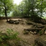 Click here for more information or to register Hosting Club: Iroquoia
Category: Afternoon/Evening Hikes
Location (Google Maps): Meet at 4:15 at Rattlesnake Conservation Area in the first (upper) parking lot (reserve your time at conservationhalton.ca). Hike Leader(s): Karen Bergmann Click here to contact Hike Leader(s) Pace: Medium – 3 to 4 km/hr
Terrain: Easy – Mostly flat and usually good footing
Distance: 6 kms Description
Meet at 4:15 at Rattlesnake Conservation Area in the first (upper) parking lot (reserve your time at conservationhalton.ca). We will hike along the side trails for about 6 kms. This is a fairly easy hike.
| 20 |
21 - Limehouse Side Trails
9:30 AM-12:30 PM 06/21/2026 https://hikes.brucetrail.org/event/limehouse-side-trails/2026-06-21/ 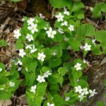 Click here for more information or to register Hosting Club: Iroquoia
Category: General Hike
Location (Google Maps): Meet roadside at 9:15 am on 5th Line, just north of Limehouse. Hike Leader(s): Karen Bergmann Click here to contact Hike Leader(s) Pace: Medium – 3 to 4 km/hr
Terrain: Moderate – Some hills and/or some poor footing
Distance: 9 kms Description
Come explore the side trails just north of Limehouse. We will meet roadside on 5th Line and hike the Beeney Creek Side Trail to the main trail. Then down the Ridge Side Trail to the main trail and around the Todd Bardes ST loop back to the main trail to Ancient Maple ST and back to the main trail, finishing along the Beeney Creek ST. Bring sufficient water as well as bug spray/bug net.
| 22 | 23 - Afternoon Hike – Halton Agreement Forest
4:30 PM-6:30 PM 06/23/2026 https://hikes.brucetrail.org/event/afternoon-hike-halton-agreement-forest-6/2026-06-23/ 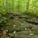 Click here for more information or to register Hosting Club: Iroquoia
Category: Afternoon/Evening Hikes
Location (Google Maps): Meet roadside on 10 Side Road, just east of Guelph Line, north of Campbellville. Hike Leader(s): Karen Bergmann Click here to contact Hike Leader(s) Pace: Medium – 3 to 4 km/hr
Terrain: Moderate – Some hills and/or some poor footing
Distance: About 7 kms Description
Meet roadside on 10 Side Road, just north of Campbellville. We will hike around several of the bike trails. Please bring bug spray/bug net, as this Forest is very buggy.
| 24 - Cootes Paradise North Shore Trails
9:30 AM-12:00 PM 06/24/2026 https://hikes.brucetrail.org/event/cootes-paradise-north-shore-trails-2/2026-06-24/ Click here for more information or to register Hosting Club: Iroquoia
Category: Good Companions
Location (Google Maps): Arboretum at Royal Botanical Gardens – off Old Guelph Road, Dundas – see map below Hike Leader(s): Ted Bossence Click here to contact Hike Leader(s) Pace: Medium – 3 to 4 km/hr
Terrain: Moderate – Some hills and/or some poor footing
Distance: 7 km Description
We will walk the North Shore trails from and to the Arboretum at the Royal Botanical Gardens. Mostly flat with a few hills. Earlier Start – please be at the start point by 9:15am and we will leave by 9:30 am. RBG parking pass or paid parking at Princess Point. Bring water and sunscreen. I will cancel in the case of inclement weather – please check your email the evening before the hike. I will email you the day before the hike with contact information for cancellations after 3:30 pm on the day prior to the hike.
| 25 | 26 - Caledon North
9:30 AM-12:00 PM 06/26/2026 https://hikes.brucetrail.org/event/caledon-north-4/2026-06-26/ 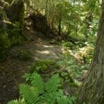 Click here for more information or to register Hosting Club: Iroquoia
Category: General Hike
Location (Google Maps): Meet in the parking lot at the Mono Centre Park at 9:15 am Hike Leader(s): Karen Bergmann Click here to contact Hike Leader(s) Pace: Medium – 3 to 4 km/hr
Terrain: Moderate – Some hills and/or some poor footing
Distance: 8 kms Description
Meeting at 9:15 am in the parking lot of Mono Centre Community Centre, we will hike the main trail and around the Turnbull, Springwater, Whitetail Refuge and Third Outlier Side Trails and back along the main trail into Mono Cliffs to the Laidlaw Side Trail to the cars. Bring sufficient water, a snack as needed, and bug spray/bug net.
- Bronte Creek East
10:00 AM-1:45 PM 06/26/2026 https://hikes.brucetrail.org/event/bronte-creek-east/2026-06-26/ Click here for more information or to register Hosting Club: Iroquoia
Category: General Hike
Location (Google Maps): Children’s Playground, 2524 Valley Ridge Dr, Oakville Hike Leader(s): Anne Armstrong Click here to contact Hike Leader(s) Pace: Leisurely – 3km/hr or less
Terrain: Easy – Mostly flat and usually good footing
Distance: Approx. 8-9 km. Description
This hike takes us into the north end of Bronte Creek Provincial Park and along the banks of Bronte Creek. We will use urban trails to get to the fields at the northern end of the park and then hike to the Creek’s banks. Meet in Elephant Park playground at 9:45 for a 10:00 am. start. Bring water, a snack, insect repellent and sunscreen. I suggest long pants as we will be moving through some grassy areas. I will send out a message the day before with me contact information in the event you need to cancel the night before or the morning of the hike.
| 27 |
28 - Terra Cotta to Boston Mills Rd (E2E)
9:30 AM-12:30 PM 06/28/2026 https://hikes.brucetrail.org/event/terra-cotta-to-boston-mills-rd-e2e-2/2026-06-28/ 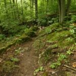 Click here for more information or to register Hosting Club: Iroquoia
Category: General Hike
Location (Google Maps): Meet at 9:15 am at the end of Boston Mills Rd. Hike Leader(s): Karen Bergmann Click here to contact Hike Leader(s) Pace: Medium – 3 to 4 km/hr
Terrain: Moderate – Some hills and/or some poor footing
Distance: 9 kms Description
We will meet at the end of Boston Mills Rd (off Mississauga Rd) at 9:15 am and carpool to 10th Line and hike back on the main trail through Terra Cotta Conservation Area, across Winston Churchill Blvd and Heritage Rd and back to the cars. Bring a snack as needed. As well as bug spray/bug net. There are some technical (rocky) parts to this hike. as well as a couple of hilly bits.
 Full Moon Night Hike No.7 (Strawberry Moon) Full Moon Night Hike No.7 (Strawberry Moon) 9:30 PM-11:30 PM 06/28/2026 https://hikes.brucetrail.org/event/full-moon-night-hike-no-7-strawberry-moon/2026-06-28/ 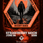 Click here for more information or to register Hosting Club: Iroquoia
Category: Moonlight Hikes
Location (Google Maps): We will meet at Dundas Driving Park, at 71 Cross St, Dundas. Proceed through the gate and take the road on the right to available parking on the east side of the park. I will have my tailgate up on my white Nissan Qashqai. Please plan to arrive by 9:00 pm so we can get everyone registered and head out at 9:30 pm. Hike Leader(s): Joe Borges Click here to contact Hike Leader(s) Pace: Medium – 3 to 4 km/hr
Terrain: Dependent on Conditions, Slippery and Steep Sections, Strenuous – Hilly with steep climbs and some poor footing
Distance: 7.5 km Description
The Full Strawberry Moon hike is the seventh full moon of 2026. We’ll meet at the parking area inside Dundas Driving Park (71 Cross St Dundas) on the east side of the park. Please plan to arrive by 9:00 pm to get everyone registered and on our way by 9:30 pm. We will hike out of the park along Alma St and pick up the main trail/Tews Fall Side Trail, climbing the escarpment, hiking along the top to Dundas Peak – there will many views overlooking Dundas and afford us some good views of the Full Worm Moon. A short pause for pics at the Peak and back down along the Glen Ferguson Side Trail/Tews Fall Side Trail and back to the park and our cars. Be sure to wear layered clothing, bring water, icers and poles if you use them. The ascent might be icy as this is a popular trail to the Dundas Peak. If this is your third hike in the series you qualify for the Iroquoia Full Moon badge – new for 2026! Cost is $10 for BTC Members and $15 for non-members. Badges can be picked up at this hike if you pre-order and pay through Iroquoia Bruce Trail Club Badges – Iroquoia Bruce Trail Club Members / Click to Purchase Your Badges
https://www.zeffy.com/en-CA/ticketing/1de4dba1-aca4-44e2-b0b0-d94f1c826c42 Non-Members / Click to Purchase Your Badges
https://www.zeffy.com/en-CA/ticketing/93131d23-cc73-44fe-913d-e4938ee174c6
| 29 - Blue Mountains End-to-End in 5 – Hike 3 Make-Up
8:30 AM-1:30 PM 06/29/2026 https://hikes.brucetrail.org/event/blue-mountains-end-to-end-in-5-hike-3/2026-06-29/ Hike open to BTC Members only. Click here for more information or to register Hosting Club: Iroquoia, Blue Mountains
Category: General Hike
Location (Google Maps): Roadside Parking on north end of Osprey-Clearview Townline Hike Leader(s): Pati Greenwood, Jeff Dowsett Click here to contact Hike Leader(s) Pace: Medium – 3 to 4 km/hr
Terrain: Dependent on Conditions, Moderate – Some hills and/or some poor footing
Distance: 12.9 km Description
NOTE: This is a make-up hike for the 3rd in the Blue Mountains E2E series that was cancelled due to weather. This is an End-to-End hike series to complete the Blue Mountains section of the Bruce Trail in 5 hikes. Join for all or as many hikes as desired – you will need to register for each hike in the series which will take place on the following dates in April: 17, 18, 19, 24 and 25. Since this is a group hike, please consider your fitness level before registering. We will be walking at a pace of 3km – 4km per hour and hikers will need to keep up with the person in front of them for the duration of the hike. The hike series will also involve car shuttles and every hiker is expected to participate as drivers. Weather conditions in the spring can be changeable, so it’s best to dress in layers and come prepared for varying conditions throughout the day. Hiking boots are required and hiking poles are strongly recommended. Bring plenty of fluids and a snack. This third hike of the series will be 12.9 km long. Plan to arrive at the meeting place by 8:15 a.m. as we will start the car shuffle to the hike starting point at 8:30 a.m. sharp. Further details will be provided to registered hikers a few days prior to the hike.
- Peninsula Strawberry Full Moon Hike – Meet time 9pm
8:30 PM-10:30 PM 06/29/2026 https://hikes.brucetrail.org/event/peninsula-strawberry-full-moon-hike-meet-time-9pm/2026-06-29/  Click here for more information or to register Hosting Club: Iroquoia, Peninsula
Category: Moonlight Hikes
Location (Google Maps): Barrow Bay Parking Lot in the Peninsula Club Hike Leader(s): Ruth Moffatt Click here to contact Hike Leader(s) Pace: Leisurely – 3km/hr or less, Medium – 3 to 4 km/hr
Terrain: Dependent on Conditions, Moderate – Some hills and/or some poor footing
Distance: 7-8km Description
This full moon hike is in the Peninsula Section of trail and led by an Iroquoia Hike Leader. Welcome to more Full Moon Hike Series – This is 1/4 that will be led this summer. Details for collecting badges are at the bottom of the hike details.
We will meet in the Barrow Bay parking lot and make our way out to the Barrow Bay Cliffs Nature Reserve at the lookout and make our way back on the Beth Gilhespy and John Appleton Side Trails. We will not be descending the staircase. Sunset is at 9:17.
Bring water and whatever snacks you need as well as a first aid kit, poles if you use them and most importantly, a head-lamp with a red light if you have one.
2/4 July 29 Buck Moon – Meet time is 8:30pm 3/4 August 28 Sturgeon Moon – Meet time is 7:45pm 4/4 September 26 Harvest Moon – Meet time is 6:00pm The following is from the Bruce Trail Conservancy website regarding Hiking at Night.
While most hikers choose to explore the Bruce Trail by day to take in the colourful sights and vast vistas, venturing out after dark also has its benefits.
Hiking at night allows you to tap into other senses and explore nature in a whole new way. From stargazing to nocturnal animal sightings, there is a lot to see and hear when exploring the Bruce Trail after sunset. No matter your motivation for heading out for a nighttime hike, certain precautions should be taken to ensure that your time on the Trail is safe and enjoyable. Before you go
Plan your route and choose somewhere familiar. It’s easy to get turned around in the darkness. Planning your route and hiking it in daylight first will help you know what to expect. If you’ve never tried hiking at night, start with a shorter hike somewhere familiar to you. Always stay on the Trail to avoid getting lost. Bring a headlamp or flashlight and extra batteries. The Trail can be quite rugged with uneven surfaces, rocks, and roots. A headlamp or flashlight is essential for preventing trips and falls – and both are brighter and last longer than your phone’s built-in light. A light source with different settings, including a red light, is ideal as bright lights can be hard on your eyes over time. Bring a fully charged cell phone. You should always bring your phone with you when hitting the trails in case you need to call for help. Most phones have a flashlight function that can act as a backup to your headlamp. You can also use your phone’s GPS with apps like the Bruce Trail App and what3words for navigational and safety purposes. Wear reflective clothing and bring a whistle. A reflective piece of clothing can help other hikers or drivers see you in the darkness. A whistle can help others hear you in case of an emergency, even if they can’t see you. Plan to do your first hike under a full moon and a clear sky.
A full moon can provide a surprising amount of light. Planning your first night hike during a full moon and clear sky can be a great way to acclimate yourself to hiking after dark. Don’t go solo and tell someone where you are going. Always share your route with someone before heading out in case of an emergency. Bring a friend to explore the Trail together, or join one of the moonlit hikes offered by some Bruce Trail Clubs. Bring layers. The temperature can drop quickly in the woods at night. Bring layers to stay warm and comfortable.
While Hiking Slow down and be aware of hazards. Don’t expect to hike at the same pace you would in daylight. Darkness can make the terrain more challenging. Slow down, pay attention to your surroundings, and stay away from cliff edges to prevent injuries. Be prepared for wildlife. Many animals such as coyotes, owls, bats, salamanders, foxes, opossums, and skunks are active at night. Sightings can enhance your nighttime hiking experience but be careful not to get too close. Keep your ears open to the sounds around you to avoid unwanted interactions. While more preparations may be needed for a hike after dusk, for many, once they find themselves in the cool of the night gazing up at the constellations or watching an owl swoop through the darkness, the effort is well worth it. If you are collecting your badge tonight or on any of the following full moon hikes: July 29, August 28, September 26, please bring exact cash $10 for members and $15 for non-members to cover the cost of the badge. You must’ve have completed at least 4 full moon hikes. If you wish to pay by e-transfer and have your badge mailed out to you, you may also choose to receive it that way. For simplicity sake, and because it will be dark out, it would be appreciated if you could please choose one method of receiving your badge or the other. Badges are on the honour system so if this is your 4th hike, please feel free to receive your badge.
| 30 - Hilton Falls on the Bike Trails
9:30 AM-12:00 PM 06/30/2026 https://hikes.brucetrail.org/event/hilton-falls-on-the-bike-trails-4/2026-06-30/ 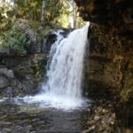 Click here for more information or to register Hosting Club: Iroquoia
Category: General Hike
Location (Google Maps): Meet in the parking lot at Hilton Falls Conservation Area at 9:15 am Hike Leader(s): Karen Bergmann Click here to contact Hike Leader(s) Pace: Medium – 3 to 4 km/hr
Terrain: Moderate – Some hills and/or some poor footing
Distance: 8 kms Description
Meeting in the parking lot at 9:15 am, we will hike to the Falls and then across the creek to the bike trails and back along the Hilton Falls Side Trail. Reserve your time at conservationhalton.ca Bring sufficient water as well as bug spray/bug net.
| July | July | July | July |
