|
Sun | Mon | Tue | Wed | Thu | Fri | Sat |
|---|
April | April | April | April | April | 1  Hockley Valley Loops Hockley Valley Loops 8:30 AM-2:30 PM 05/01/2026 https://hikes.brucetrail.org/event/hockley-valley-loops-2/2026-05-01/ Click here for more information or to register Hosting Club: Iroquoia
Category: General Hike
Location (Google Maps): Hockley Valley Road – Bruce Trail Parking Hike Leader(s): Pati Greenwood, Jeff Dowsett Click here to contact Hike Leader(s) Pace: Medium – 3 to 4 km/hr
Terrain: Strenuous – Hilly with steep climbs and some poor footing
Distance: 18 km Description
This hike will follow the main trail to Dunby Road and take in four side trails on the return route – Cam Snell, Glen Cross, Isabell East and Tom East – to form an 18 km loop back to the parking lot on Hockley Road. Wear hiking boots, bring poles. Dress for the weather conditions, bring plenty to drink and a snack. Please arrive at the meeting place by 8:15 am for an 8:30 am departure.
- Speyside from 4th Line
9:30 AM-12:00 PM 05/01/2026 https://hikes.brucetrail.org/event/speyside-from-4th-line-3/2026-05-01/ Click here for more information or to register Hosting Club: Iroquoia
Category: General Hike
Location (Google Maps): Meet at 9:15 roadside on 4th Line where the main trail crosses the road Hike Leader(s): Karen Bergmann Click here to contact Hike Leader(s) Pace: Medium – 3 to 4 km/hr
Terrain: Moderate – Some hills and/or some poor footing
Distance: 9 kms Description
A new way to hike the Speyside trails, we’ll meet roadside on Fourth Line at 9:15 am and hike the main trail to the Canada Goose ST and onto the Charles Hildebrandt ST to the “unassumed road” and into Speyside from that end. Hiking around the Cliff Hatch ST and main trail back to Fourth Line. There are some very rocky sections along these trails.
 Moonlight Hike Moonlight Hike 8:00 PM-9:30 PM 05/01/2026 https://hikes.brucetrail.org/event/moonlight-hike/2026-05-01/ 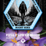 Click here for more information or to register Hosting Club: Iroquoia
Category: Moonlight Hikes
Location (Google Maps): Grimsby Lion’s Club Pool 1 Elm St Grimsby Hike Leader(s): Ruth Moffatt Click here to contact Hike Leader(s) Pace: Brisk – 4 to 5 km/hr, Medium – 3 to 4 km/hr
Terrain: Dependent on Conditions, Strenuous – Hilly with steep climbs and some poor footing
Distance: 5-6km Description
Earn your Iroquoia Moonlight badge by hiking 3 Moonlight Hikes with a leader.
Tonight’s sunset is at 8:20pm. We will hike up the escarpment and over to the Hawkwatch area and out to Beamer’s Falls and return around 9:30pm.
If you’ve never hiked at night we are sure you will love the way it heightens all of your senses promising a great sleep afterwards.
Everyone must have a headlamp or a flashlight 🔦. Most phones have torches which could also be used as supplemental light. Please ensure your light device is fully charged/batteries to last about 1.5hours. Dress for the weather and bring enough water to suit your needs as well as all the other things you need for a hike – first aid kit, snack, poles (recommended). This is an arduous climb up the escarpment so be sure to know your physical limit.
This is the second of 3 full moon hikes to be held in Grimsby. After you complete three leader-led hikes, you will qualify for a badge. $10/$15 The third moonlight hike is May 31. Any questions may be directed through contact on this form.
If you cannot make it, please remove yourself from registration by following these steps: To cancel your registration, here is a step by step:
– Sign into your account on the BTC website
– Click on My Hikes under your account
– This will take you to a list of hikes you have registered for
– Scroll down to the appropriate hike and cursor over to the far right hand column under the Action column.
– Click Cancel under the hike you wish to cancel
| 2   City of Waterfalls – Special Event Fundraiser City of Waterfalls – Special Event Fundraiser 6:45 AM-1:45 PM 05/02/2026 https://hikes.brucetrail.org/event/city-of-waterfalls-special-event-fundraiser-4/2026-05-02/  This is a Multi-Day HikeYou are signing up for the following dates and times:
2026-05-02 at 06:45
2026-05-03 at 06:45 Click here for more information or to register Hosting Club: Iroquoia
Category: City of Waterfalls – Special Event Fundraiser
Location (Google Maps): DAY 1: MAY 2 – Parking lot at City View Park off of Kerns Rd. Enter from Dundas St. (capacity 50) 43.351747, -79.862195
DAY 2: MAY 3 – Parking Lot off of Mud St providing access to the Mud Street Side Trail (capacity 30) Hike Leader(s): Joe Borges Click here to contact Hike Leader(s) Pace: Medium – 3 to 4 km/hr
Terrain: Dependent on Conditions, Moderate – Some hills and/or some poor footing, Slippery and Steep Sections
Distance: Approximately 22-25km / per day Description
Welcome to Iroquoia, City of Waterfalls Challenge! This is a fundraiser challenge event. All funds raised go towards the Iroquoia Bruce Trail Club to maintain the infrastructure of this beautiful section of trail and to “Preserve this ribbon of wilderness, for everyone, forever!” We also encourage participants to consider a membership with Conservation Hamilton
https://conservationhamilton.ca/hca-membership-pass/ And/or Conservation Halton (50%discount with BTC membership)
https://www.conservationhalton.ca/park-fees-membership-rates/ DAY 1: MAY 2 – We will meet at Cityview Park and car shuttle to Spencer Gorge Parking Lot (Conservation Hamilton) and hike back. The cost at this parking lot is $16.50 per vehicle and driver plus $5.50 for each passenger.
Day 1 Distance 21km DAY 2: MAY 3 – We will meet in the parking area off of Mud St and car shuttle to Artaban Rd Parking Lot (Conservation Hamilton) and hike back. The cost for this parking lot is $11.00 per vehicle.
Day 2 Distance 24 km Please ensure your vehicle is car shuttle ready by having a minimum of 4 seatbelts available – drivers do not pay for the parking. Please volunteer for this important component of this challenge or we can throw all the names into a hat. While we encourage carpooling to the start of the hike, please let the hike leader know if you’re planning to arrive with more than two people in your vehicle. This hike will be limited to 20 people including the hike leader so we will need at least 4 vehicles and one vehicle with 5 seatbelts to drive the drivers back at the end of the day. We will try to take as few vehicles as possible. On the second day, those who did not drive on the first day will be asked to drive. There will be short breaks along the way to admire the waterfalls on route and a short lunch. Please bring all the hiking items you require for a long day hike including 2l of water, snacks, lunch, first aid kit, rain gear if rain is forecast, plastic shower caps for your boots if muddy, bug spray, sunscreen, rimmed hat, poles (if you use them) and your camera for all the photo ops. Please ensure you are physically able to complete two long day hikes over two days – if you must drop out, you will have to arrange your own transportation back to your vehicle. There is public transportation, Uber, and taxi’s in the area. If you are concerned about whether you will be able to manage the distance over the two day period, it’s possible that you may need to wait until a 4 day version of this event is posted. The badge will be presented to all participants who have completed the challenge at the end of the second day. Any questions may be directed through contact on this form.
- *First Aid/CPR Course for active Iroquoia Bruce Trail Club Hike Leaders & Trail Maintenance Volunteers.
9:00 AM-5:00 PM 05/02/2026 https://hikes.brucetrail.org/event/first-aid-cpr-course-for-active-iroquoia-bruce-trail-club-hike-leaders-trail-maintenance-volunteers/2026-05-02/  This is a Multi-Day HikeYou are signing up for the following dates and times:
2026-05-02 at 09:00
2026-05-03 at 09:00 Click here for more information or to register Hosting Club: Iroquoia
Category: Special Event
Location (Google Maps): Training held at the Bruce Trail Conservancy Offices Hike Leader(s): Joe Borges Click here to contact Hike Leader(s) Description
Join us for this essential two-day First Aid + CPR certification weekend for Volunteers.
Tailored for active Bruce Trail Iroquoia Club Hike Leaders and volunteers of the Trail Maintenance Crew. Class run form 9:00am – 5:00pm. Gain confidence to respond effectively on the trail—empowering you to keep our adventures safe.
The course is instructed again by Scott Fraichine. Bruce Trail Conservancy covers all costs. Who Should Attend
Only active hike leaders and trail maintenance volunteers. Please confirm your eligibility with the Iroquoia Hike Director or the Trail Development and Maintenance Director before registering.
Please note: while the cost of this course is covered by the BTC, if you cancel within two weeks, the cost will be passed on to you if a replacement registration cannot be found. This allows our instructor enough time to rent equipment and prepare for the course.
|
3  Rainbow Hike Rainbow Hike 8:00 AM-11:00 AM 05/03/2026 https://hikes.brucetrail.org/event/rainbow-hike-2/2026-05-03/ Click here for more information or to register Hosting Club: Iroquoia, Toronto
Category: Rainbow Hike
Location (Google Maps): Meet at the parking lot on 22nd Sideroad. Hike Leader(s): Anita Bergsma Click here to contact Hike Leader(s) Pace: Leisurely – 3km/hr or less, Medium – 3 to 4 km/hr
Terrain: Easy – Mostly flat and usually good footing
Distance: 10 Kms Description
Bruce Trail Rainbow Hike Celebrate the beauty of the Bruce Trail and the spirit of community on our Rainbow Hike! 🌈🥾 Join us for a welcoming group hike along one of Ontario’s most scenic sections of the Bruce Trail. Whether you’re a seasoned hiker or just getting started, this event is all about enjoying nature, meeting new people, and sharing a positive outdoor experience together. What to Expect - A guided group hike along a picturesque section of the Bruce Trail
- Beautiful forest paths, escarpment views, and fresh spring air
- A friendly, inclusive atmosphere where everyone is welcome
- Opportunities to connect with fellow hikers and outdoor enthusiasts
Hike Details - Distance: Approximately 10 km
- Pace: Easy to moderate, with plenty of breaks
- Terrain: Mixed forest trails with some gentle elevation changes
- Duration: About 2–3 hours
What to Bring - Comfortable and appropriate hiking shoes or boots
- Water and light snacks
- Weather-appropriate clothing
- Your positive energy and rainbow spirit! 🌈
Whether you come solo or with friends, the Rainbow Hike is a chance to explore nature, celebrate diversity, and build community on the trail. The rainbow badge will be provided at the end of our hike.
- Scotsdale Farm Great Esker
9:30 AM-12:30 PM 05/03/2026 https://hikes.brucetrail.org/event/scotsdale-farm-great-esker-2/2026-05-03/ 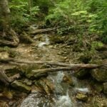 Click here for more information or to register Hosting Club: Iroquoia
Category: General Hike
Location (Google Maps): Scotsdale Farm main parking lot Hike Leader(s): Karen Bergmann Click here to contact Hike Leader(s) Pace: Medium – 3 to 4 km/hr
Terrain: Moderate – Some hills and/or some poor footing
Distance: 11 kms Description
Meet in the main parking lot at Scotsdale Farm at 9:15 am. We’ll hike the Bennet Heritage Side Trail to the main trail and around the Great Esker Side Trail, back to the main trail and the Maureen Smith Side Trail for a total of about 11 kms. There are some hills. Bring water and a snack.
- Frontenac Provincial Park – Perimeter Challenge, Check In May 3, Check Out May 6, 3 days of hiking/multiday trip
2:00 PM 05/03/2026 https://hikes.brucetrail.org/event/frontenac-provincial-park-perimeter-challenge-check-in-may-3-check-out-may-6-3-days-of-hiking-multiday-trip/2026-05-03/  This is a Multi-Day HikeYou are signing up for the following dates and times:
2026-05-03 at 14:00
2026-05-04 at 07:30
2026-05-05 at 07:30
2026-05-06 at 07:30 Click here for more information or to register Hosting Club: Iroquoia
Category: Special Event
Location (Google Maps): Accommodation is at Snug Harbour Resort.
Hiking is in Frontenac Provincial Park, a short distance away from the cabins. Hike Leader(s): Heather Zrini Click here to contact Hike Leader(s) Pace: Brisk – 4 to 5 km/hr, Medium – 3 to 4 km/hr
Terrain: Dependent on Conditions, Moderate – Some hills and/or some poor footing, Strenuous – Hilly with steep climbs and some poor footing
Distance: 12.5-23.6km daily Description
This is a special 4 day, 3 night trip to Frontenac Provincial Park. During this hiking event, we will be hiking the perimeter of Frontenac Provincial Park in three sections and it is called the Frontenac Perimeter Challenge. It is organised by the Friends of Frontenac Provincial Park each year. The Park is about 3.5 hours east of Toronto and an hour north of Kingston. The 3 sections are from 12.5-23.6km in length. If you have access to the Frontenac map, you will find it helpful so that everyone can follow along and help with way-finding. The cost for registering for the Challenge in 2025 was $10. If you are a member of the Friends of Frontenac, the fee is free. This includes a badge for your first challenge. Registration for the Challenge starts on April 1 and the hikes must take place during the month of May. Proof of the hikes is to be submitted in the form of a GPS track and submitted no later than May 31. If you would like the badge mailed to you, a self-addressed stamped envelope must be left at the park office. If they have them available, they may give them to us on our last day. Accommodation is at Snug Harbour Resort, a short distance from the park. There are several two and three bedroom cabins available for May 3-6. http://www.snugharbour.on.ca. We will arrive on Sunday, May 3 after 12pm but won’t hike until Monday morning. The cabins are located on a lake and there is access to canoes and kayaks. Check out will be on Wednesday, May 6 by 10am. You are welcome to come earlier or stay later at your own expense. Please contact Rob at relax@snugharbour.on.ca. Let Rob know you are with the Bruce Trail Perimeter Challenge Group. Please review the list of the items you must bring with you for your stay at the cabins and coordinate the list with the other people sharing your cabin. Once you book a cabin, please share your name and your cabin number with me so that I can share it with everyone else who registers for the Challenge. It will be up to you, as the cabin coordinator, to pay for the cost of the entire cabin and to collect from everyone else who is sharing the cabin. The rate is $120 per cabin plus tax, per day (paid by e-transfer). A $180 deposit is required at the time of booking which should be paid by the cabin coordinator. The cabin coordinator will collect from everyone else who is sharing the cabin. Unfortunately, we have had to implement this rule because of late cancellations which can leave the cost of the cabin in the hands of the people who are left sharing the cabin. If you need to cancel after registering, we will attempt to fill your spot and cost of the cabin with another person but there are no guarantees. Parking fees at the Frontenac Provincial Park also apply. For our hikes, we will be carpooling from Snug Harbour over to the park and then shuttling to the trailhead. We will have the same driver and carpooling groups for the first two days. Since we will be leaving from the park on Day 3, everyone will have to drive. We will need a Day Use reservation for the first day and all vehicles will need a reservation for the last day of hiking as most people drive straight home after our last hike. Borrowing a park pass from your local library, if available, or purchasing an annual pass, is encouraged. Please Note: Paid parking is only required on our first day and our last day of hiking – May 4th and 6th. There are no additional fees for daily usage of the park. Fees for the parking reservation and a contribution for gas is a shared expense for the people in the shuttle. More information will be provided closer to the date to those who register.
| 4 - Mt Nemo – North and South Loops
10:00 AM-12:00 PM 05/04/2026 https://hikes.brucetrail.org/event/mt-nemo-north-and-south-loops/2026-05-04/ Click here for more information or to register Hosting Club: Iroquoia
Category: General Hike
Location (Google Maps): Mt Nemo (main parking lot) off of Guelph Line just South of Lowville. Conservation Pass required or fee to park. Online reservation necessary for entry to the parking lot Hike Leader(s): Karen Capindale-Smith Click here to contact Hike Leader(s) Pace: Medium – 3 to 4 km/hr
Terrain: Moderate – Some hills and/or some poor footing
Distance: 6km + Description
We will be completing the North and South Loop trails of Mt Nemo with great views along the way from the Escarpment. Please dress in appropriate layers and bring water and a snack. Baked goods should be expected 🙂
| 5 | 6 - Crawford Lake Ramble/Wildflowers
10:00 AM-12:30 PM 05/06/2026 https://hikes.brucetrail.org/event/crawford-lake-ramble-wildflowers/2026-05-06/ 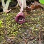 Click here for more information or to register Hosting Club: Iroquoia
Category: Good Companions
Location (Google Maps): Crawford Lake Conservation Area. 3115 Conservation Rd. Milton Hike Leader(s): Anne Armstrong Click here to contact Hike Leader(s) Pace: Leisurely – 3km/hr or less
Terrain: Moderate – Some hills and/or some poor footing
Distance: Approx. 7 km. Description
Please join in this favourite hiking area with its spectacular views across Nassagaweya Canyon towards Rattlesnake Canyon, its Meromictic and at this time of year its wildflower treasures which grown among the rocky parts of the escarpment. Expect one section of rocky terrain with tricky footing. Hopefully the boardwalk around the lake will have reopened. Please bring water, a snack, sunscreen and insect repellent. A reservation is necessary to park here through Halton Parks Reservation System. I will email the day before with my contact information should you need to cancel the morning of the hike.
 Afternoon Hike – Duff Pit Afternoon Hike – Duff Pit 4:30 PM-6:00 PM 05/06/2026 https://hikes.brucetrail.org/event/afternoon-hike-duff-pit/2026-05-06/  Click here for more information or to register Hosting Club: Iroquoia
Category: Afternoon/Evening Hikes
Location (Google Maps): Meet roadside on Hwy 7, just after the curve in the road. Hike Leader(s): Karen Bergmann Click here to contact Hike Leader(s) Pace: Medium – 3 to 4 km/hr
Terrain: Moderate – Some hills and/or some poor footing
Distance: 5 kms Description
Meet roadside at 4:15 pm on Hwy 7 north of Georgetown, as you round the curve in the road. We will hike the Side Trails of Duff Pit, Reservoir, Trafalgar Rd and North Rim (through the old open quarry land) back to Duff Pit. It’s a short hike with lots of variety.
| 7 | 8 | 9 - RAINBOW HIKE: World Migratory Bird Day + Iroquoia BTC Pre-AGM Hike
7:45 AM-10:00 AM 05/09/2026 https://hikes.brucetrail.org/event/rainbow-hike-world-migratory-bird-day-iroquoia-btc-pre-agm-hike/2026-05-09/ 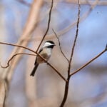 Click here for more information or to register Hosting Club: Iroquoia
Category: Rainbow Hike
Location (Google Maps): Meet at the start of the Spencer Creek Trail (Dundas St/Cootes Dr (HWY 8)) Hike Leader(s): Shayne Ward Click here to contact Hike Leader(s) Pace: Leisurely – 3km/hr or less
Terrain: Easy – Mostly flat and usually good footing, Moderate – Some hills and/or some poor footing
Distance: 5KM Description
Join us on World Migratory Bird Day for a pre-AGM Rainbow Hike! 🦅 🦉 🦆 This gentle early-morning outing will explore the trails around Spencer Creek and Cootes Paradise, one of the region’s most important bird migration areas. We will start at the trailhead parking lot on the southeast corner of Dundas Street and Cootes Drive (HWY 8) and hike along the creek, under the HWY 8 (under the bridge does involve some moderate stepping and slight ‘duck’ing for us tall folks). Plan to arrive for 745AM and we’ll have a small crash course on downloading and using two popular birding apps, Merlin Bird ID and eBird recording our sightings as part of World Migratory Bird Day! We’ll depart by 8-810AM. Hoping to catch some Blue Herons, Black-crowned Night Herons, and if we’re lucky, a sighting of the RBG resident Bald Eagles! 🌈 This is a queer-led, 2SLGBTQIA+ inclusive Rainbow Hike, welcoming LGBTQ+ hikers, allies, birders, photographers, and anyone interested in connecting with nature and community before the AGM. This is a short, relaxed hike (approx. 5 km) designed to get everyone back in time for the AGM Meet-and-Greet at 10:30 AM at the Westdale Theatre. What to Bring
• Water and light snacks
• Weather-appropriate clothing and sturdy footwear
• Binoculars or camera if you have them (optional but fun! And a cell phone counts!) After the hike, we encourage participants to join fellow members at the Iroquoia Bruce Trail Club AGM just a short walk away at the Westdale Theatre. Not a Bruce Trail member yet?! Sign up here!
https://brucetrail.org/become-a-member/ Come enjoy a spring morning on the trail, celebrate migratory birds, and connect with your Bruce Trail community! 🐾 Please leave pets at home for this hike! It’s peak migration season and we’ll be passing through an important bird migration and nesting area, so we want to keep disturbance to our feathered friends to a minimum! 🐦 🚗 🚌 This outing is accessible by car or public transit. Planning to drive?
Parking is free but limited at the trailhead. We also ask for some assistance with shuttling folks back to the Westdale Theatre afterward for the Iroquoia Bruce Trail AGM. Taking the Bus?
HSR #5 (Delaware) stops near the trailhead entrance! Map of the bus and it’s schedule can be found here.
https://www.hamilton.ca/sites/default/files/2024-04/5-Delaware-apr24.pdf Free Bruce Trail Rainbow badges and stickers for all participants!
Questions? Simply click “Contact Hike Leader” on the registration form.
- Iroquoia Bruce Trail Club Pre-AGM / Westdale to Princess Point
8:00 AM-10:00 AM 05/09/2026 https://hikes.brucetrail.org/event/iroquoia-bruce-trail-club-pre-agm-westdale-to-princess-point/2026-05-09/  Hike open to BTC Members only. Click here for more information or to register Hosting Club: Iroquoia
Category: Special Event
Location (Google Maps): Hamilton Parking Lot #1002
85 Oak Knoll Dr, Hamilton ON L8S 4C2 Hike Leader(s): Joe Borges Click here to contact Hike Leader(s) Terrain: Dependent on Conditions, Moderate – Some hills and/or some poor footing
Distance: 4.7 km Description
Join us for a pre-AGM hike.
If you’d like to view the hike route, please click the All Trails link below. It’s approx. 5 km so we should be back in plenty time for the Meet-and-Greet at 10:30, before the AGM.
https://www.alltrails.com/explore/custom-routes/custom-route-be20ded?u=m&sh=4wexyx The hike route will start from the Hamilton Parking Lot #1002 heading to Princess Point, and loop back to the parking lot.
From the lot it’s a short walk to the Westdale Theatre, if you are attending the AGM afterwards. Parking is $3 per hour, or all day for $15. Please bring enough water and snacks for your hike. Trails may be muddy at this time of year, so gaiters would be useful. We encourage Hikers to register and stay for the AGM after our Hike. Connect with other members, help commemorate a wonderful year for the Club and to celebrate all our amazing volunteers. Full AGM Details and Agenda below. AGM LOCATION:
The Westdale Theatre, 1014 King St W, Hamilton, ON L8S 1L4
10:30 – 11:00 AM
MEET-AND-GREET
Connect with your Trail Community
11:00 – 11:45 AM
IBTC AGM & VOLUNTEER AWARDS
Celebrate the Heart of our Club
11:45 – 12:30 PM
HOT LUNCH
Enjoy a delicious meal locally catered. SPECIAL EVENT // BRUCE TRAIL TALKS / SESSION 1: Indigenous Trails
FREE for all IBTC Members attending the AGM
1:05 pm Welcome & Introduction by BTC CEO Michael McDonald 1:10 pm First Nations Trail Systems A historical & archaeological perspective with Martin S. Cooper, Snr Archaeologist, ASI Toronto 1:30 pm First Nations Priorities For engagement, education, and reconciliation, a current perspective
with Tim Johnson and Rick Hill 2:00 pm Panel Discussion with Tim, Rick, Martin and moderated by Michael McDonald
Key takeaways, challenges, & priorities for action, including audience Q&A 2:30 pm Closing remarks Michael
|
10 - St. Helena Forest
9:30 AM-12:00 PM 05/10/2026 https://hikes.brucetrail.org/event/st-helena-forest-2/2026-05-10/  Click here for more information or to register Hosting Club: Iroquoia
Category: General Hike
Location (Google Maps): Meet in the Pear Tree parking lot at Speyside on 15 Side Road at 9:15 am Hike Leader(s): Karen Bergmann Click here to contact Hike Leader(s) Pace: Medium – 3 to 4 km/hr
Terrain: Moderate – Some hills and/or some poor footing
Distance: 10 kms Description
Meeting at 9:15 am in the Pear Tree parking lot, we will hike the main trail into the St. Helena forest and along the trails, which are VERY rocky. This is a dense forest that takes us around a large marsh pond and back up the Al Shaw Side Trail. This hike is about 90% technical (on rocks), so be prepared for that. Not for first time hikers.
| 11 - *Caledon Hills Sideways Badge – Hike #3
9:00 AM-3:00 PM 05/11/2026 https://hikes.brucetrail.org/event/caledon-hills-sideways-badge-hike-3/2026-05-11/ 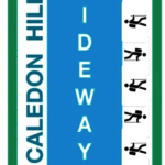 Click here for more information or to register Hosting Club: Iroquoia, Caledon Hills
Category: Special Event
Location (Google Maps): Caledon Hills – Location will be advised Hike Leader(s): Heather Zrini Click here to contact Hike Leader(s) Pace: Medium – 3 to 4 km/hr
Terrain: Dependent on Conditions, Moderate – Some hills and/or some poor footing, Strenuous – Hilly with steep climbs and some poor footing
Distance: 20 km Description
On this series of three hiking days, we will complete the five loop hikes that are required to earn the Caledon Hills Sideways Badge. If you are not interested in earning the badge, please join us for some great hiking. Hikers can sign up for individual hikes as you do not need to complete all three to participate. The dates of the three hiking days will be April 13, April 27 and May 11. We will meet at the starting point at 9am each week. Our finishing time is an approximation. On each of the first two hiking days, we will be completing two of the loops. On May 11, there will be one loop hike and if there is interest, we will hike another loop in Mono Cliffs Provincial Park. Each loop is approximately 10 km in length. For more information about the hikes, please see the link below: Sideways Badge Loop .PDF Download Our schedule will be as follows: April 13 – Hike One and Hike Five April 27 – Hike Two and Hike Three May 11 – Hike Four and a hike in Mono Cliffs Provincial Park Carpooling is encouraged. Since these are loop hikes, we will not need to shuttle. On the first day, a Provincial Park Daily Vehicle Permit Reservation will be required. We will be parking and hiking in the Forks of the Credit Provincial Park on Day 1. Passes that can be used when making the reservation can be purchased through the Ontario Provincial Park website or borrowed from your local library. If a car does not have a pass, the cost of the Daily Vehicle Permit reservation will be split between those people in that car. More information, including specific details about the meeting points, will be provided to those who sign up for the hikes. If there are any questions, please don’t hesitate to ask.
| 12 - Mono Cliffs Provincial Park
9:30 AM-12:30 PM 05/12/2026 https://hikes.brucetrail.org/event/mono-cliffs-provincial-park/2026-05-12/ 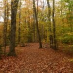 Click here for more information or to register Hosting Club: Iroquoia
Category: General Hike
Location (Google Maps): Meet at 9:15 am on Second Line EHS Hike Leader(s): Karen Bergmann Click here to contact Hike Leader(s) Pace: Medium – 3 to 4 km/hr
Terrain: Moderate – Some hills and/or some poor footing
Distance: 10 kms Description
Meeting at 9:15 on 2nd Line, we will hike the main trail, down the loop to the South Outlier Trail and down the switchback to the Walter Tovell Side Trail and Lookout ST to the main trail. Bring water and a snack, as needed.
| 13 - Dundas Valley – Trilliums, Loops and Waterfalls
10:00 AM-12:30 PM 05/13/2026 https://hikes.brucetrail.org/event/dundas-valley-trilliums-loops-and-waterfalls/2026-05-13/ 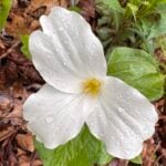 Hike open to BTC Members only. Click here for more information or to register Hosting Club: Iroquoia
Category: Good Companions
Location (Google Maps): Artaban Road parking lot.
Please note paid parking unless you have a Hamilton Conservation pass. Hike Leader(s): Kathy Rymal Click here to contact Hike Leader(s) Pace: Medium – 3 to 4 km/hr
Terrain: Moderate – Some hills and/or some poor footing, Strenuous – Hilly with steep climbs and some poor footing
Distance: 7.5 km Description
We will be heading along Artaban Road to the Monarch Trail leading to the Main Loop. Nice meanders and hilly climbs along the loop to the Heritage Trail where we will view a few waterfalls on our way back to the parking lot. Hike will be cancelled in case of rain. I will inform you by email the evening before the hike if this is the case. Bring water, a snack, sunscreen, insect repellant and your own first aid kit. Please arrive 15 minutes before start time
| 14 | 15 - Afternoon hike – Limehouse Conservation Area
4:30 PM-6:00 PM 05/15/2026 https://hikes.brucetrail.org/event/afternoon-hike-limehouse-conservation-area-2/2026-05-15/ 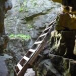 Click here for more information or to register Hosting Club: Iroquoia
Category: Afternoon/Evening Hikes
Location (Google Maps): Meet at 4:15 pm in the parking lot at Limehouse Conservation Area. Hike Leader(s): Karen Bergmann Click here to contact Hike Leader(s) Pace: Medium – 3 to 4 km/hr
Terrain: Moderate – Some hills and/or some poor footing
Distance: 7 kms Description
The trees will be leafing out so we will be surrounded by green. We will hike around the park and then briefly out along the main trail to the Todd Bardes Meadowland Side Trail and back. Bring bug spray in case they have awakened.
| 16 - Avon Trail E2E in 5
8:00 AM-4:00 PM 05/16/2026 https://hikes.brucetrail.org/event/avon-trail-e2e-in-5/2026-05-16/  This is a Multi-Day HikeYou are signing up for the following dates and times:
2026-05-16 at 08:00
2026-05-17 at 08:00
2026-05-18 at 08:00
2026-05-23 at 08:00
2026-05-24 at 08:00 Click here for more information or to register Hosting Club: Iroquoia
Category: General Hike
Location (Google Maps): Day 1 – May 16,2026 – 26.8km
meet at Oxford Line 33 shoulders. Coordinates: 43.2526, -80.9853
shuttle to Water St N beside tennis courts. Coordinates: 43.2491, -81.1498 Day 2 – May 17,2026 – 24.8km
Meet at Perth Road 111. Coordinates: 43.3764, -80.9377
shuttle to Oxford Line 33 shoulders. Coordinates: 43.2526, -80.9853 Day 3 – May 18,2026 – 20.9
Meet at Peth Rd. 104. 8 spots north of trail head at Lisbon Cemetery; do not block entrance to cemetery. Coordinates: 43.4362, -80.7882
shuttle to Perth Road 111. Coordinates: 43.3764, -80.9377 Day 4 – May 23, 2026 – 29km
Meet at Wideman Rd, shoulder. Coordinates: 43.4714, -80.6159
Shuttle to Peth Rd. 104. 8 spots north of trail head at Lisbon Cemetery; do not block entrance to cemetery. Coordinates: 43.4362, -80.7882 Day 5 – May 24, 2026 – 27km
Meet at Golf Course Rd / Priddle Park, parking sth side for several cars, or at display board at bend in road. Coordinates: 43.5418, -80.494
Shuttle to Wideman Rd, shoulder. Coordinates: 43.4714, -80.6159 Hike Leader(s): IgorT Click here to contact Hike Leader(s) Pace: Brisk – 4 to 5 km/hr, Medium – 3 to 4 km/hr
Terrain: Dependent on Conditions, Moderate – Some hills and/or some poor footing
Distance: 25-30 Description
Please join me to explore Avon trail E2E in 5 days. We going to hike 20 – 30 km a day. This is a Challenger series of hikes; we will complete the entire 128 km of the Avon trail in 5 hikes. You are welcome to come on just a few of the hikes or on all of them, but you will have to complete the missing areas of the trail on your own and submit the log for the E2E badge. You can join WhatApp group if you wish to share photos and conversation about the hike. By the end of the hike, you can apply for badge thru https://avontrail.ca/ or badge can be provide to you at last day. There 3 different options of you choose. We meet at meeting point at 8am every day. Please arrive 10min before. Please know your physical limit before signing up for this hike. The trail is a combination of road and trails. Hikers will be expected to participate in shuttling to and from the hike. Responsibility will be shared equally. Please bring at least 2l of water and enough snacks & lunch to get you through the day as well as bug spray, sunscreen, a first aid kit and poles if you use them. There are no dropouts. If you cannot finish the hike, you will be responsible for getting back to your vehicle. No dogs. Any questions may be directed through contact on this form.
If you cannot make it, please remove yourself from registration so that a spot can be opened for someone else.
- RAINBOW HIKE: Trillium Quest – Dundas Valley Conservation Area
10:00 AM-2:00 PM 05/16/2026 https://hikes.brucetrail.org/event/rainbow-hike-trillium-quest-dundas-valley-conservation-area/2026-05-16/ 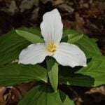 Click here for more information or to register Hosting Club: Iroquoia
Category: Rainbow Hike
Location (Google Maps): Dundas Valley Conservation Area, main parking lot. Hike Leader(s): Doug O’Neill Click here to contact Hike Leader(s) Pace: Leisurely – 3km/hr or less, Medium – 3 to 4 km/hr
Terrain: Easy – Mostly flat and usually good footing, Moderate – Some hills and/or some poor footing
Distance: 12 km (with dropout opportunities) Description
Come by car or HSR transit to this all-inclusive, 2SLGBTQIA+ friendly quest to spot trilliums and other spring flowers. This queer-led, all-inclusive hike is designed to provide a safe, welcoming space for 2SLGBTQIA+ hikers—including Two-Spirit, trans, gay, lesbian, bisexual, queer, intersex, and asexual folks, as well as allies and friends. Show up, be your authentic self, and have fun. We’ll meet in the main parking lot of the Dundas Valley Conservation Area (the one closest to the Trail Centre) at 650 Governors Rd., at 10 a.m. for a 10:15 start. If arriving by car: Conservation parking at 650 Governor’s Road is $11.50 per vehicle. Anyone with a HCA pass gets free parking. Coming by public transit: Take the “5B PIRIE AT GOVERNORS” bus and get off at the very last stop (at Pirie). It’s a 6-minute walk west along Governors Road to the entrance of the Conservation Centre, and then another 5 minutes up the laneway to the last parking lot. (There’s no admission fee if you arrive on foot.) Continue past the Stacey Meadows lot (the first parking lot you’ll come to) until you reach the main parking lot. We’ll rendezvous at the big sign at the far end of the lot. Look for the guy with Bruce Trail cap 🙂 Our route: After a washroom stop at the Trail Centre, we’ll follow the Bruce Trail main trail (a.k.a. McCormick Trail) all the way to Dundas (Woolley Lane) where trilliums have been known to flourish. We’ll loop back and then follow a mix of main and side trails, stopping for lunch. We’ll aim for 12 kilometres but there will be opportunities to drop out earlier. Washrooms: there are indoor washrooms and a water fountain at the Trail Centre. Complimentary Bruce Trail Rainbow badges ]to all participants. Bring 1 or 2 litres of water, energizing snacks and lunch. Don’t forget sunscreen and insect repellent. Hiking boots or sturdy footwear are recommended—as well a cap. Because we’ll be in long grassy areas, long pants are recommended as it’s tick season. (Always avoid wearing shorts in long grass.) Email any questions to the Hike Leader – “Click here to contact Hike Leader” on this form.
- Kilbride River & Ruins
10:00 AM-1:00 AM 05/16/2026 https://hikes.brucetrail.org/event/kilbride-river-ruins/2026-05-16/ 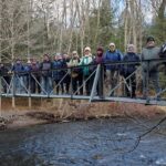 Click here for more information or to register Hosting Club: Iroquoia
Category: General Hike
Location (Google Maps): Meeting at Park behind Kilbride Public School Hike Leader(s): Cathie Green Click here to contact Hike Leader(s) Pace: Leisurely – 3km/hr or less
Terrain: Moderate – Some hills and/or some poor footing
Distance: Approximately 8 kms Description
Suitable hike for beginners and family – Some hills, but leisurely pace We will meet at park behind Kilbride Public School and hike along Kilbride Street to Twiss Road and onto the main trail at 8th Line – this will meet up with the River and Ruins side trail which we will take along Bronte Creek and then follow the upper side trail to main trail and follow blue trail- side streets back to our vehicles Must bring Water and wear suitable clothing for weather- Snack/poles/hat/bug spray/sunscreen – Any concerns or questions, please text or email me through this form.
|
17 - Speyside to Vanderleck ST return
9:30 AM-11:30 AM 05/17/2026 https://hikes.brucetrail.org/event/speyside-to-vanderleck-st-return-3/2026-05-17/ Click here for more information or to register Hosting Club: Iroquoia
Category: General Hike
Location (Google Maps): Meet at the Speyside Pear Tree parking lot on 15 Side Road at 9:15 am. Hike Leader(s): Karen Bergmann Click here to contact Hike Leader(s) Pace: Medium – 3 to 4 km/hr
Terrain: Moderate – Some hills and/or some poor footing
Distance: 8 kms Description
We will hike the main trail from Speyside, to the Al Shaw ST, Hilton Falls ST and onto the Vanderleck ST up to 17 Side Road and then return the same way. There are some very technical (rocky) sections on this hike but no major hills. Bring bug spray/bug net and a snack, as needed.
| 18 | 19 - In/Out to Crawford Lake CA from Kilbride Park
9:30 AM-2:30 AM 05/19/2026 https://hikes.brucetrail.org/event/in-out-to-crawford-lake-ca-from-kilbride-park/2026-05-19/ Click here for more information or to register Hosting Club: Iroquoia
Category: General Hike
Location (Google Maps): We will meet behind Kilbride Public School (6611 Panton St.) by the tennis courts. Ignore the one-way arrows Hike Leader(s): Karen Capindale-Smith Click here to contact Hike Leader(s) Pace: Medium – 3 to 4 km/hr
Terrain: Moderate – Some hills and/or some poor footing
Distance: 16+/- km Description
We will leave the parking lot at 9:30 am SHARP via the “Kilbride Pass” and entering the woods of Yaremko Nature Reserve. We will continue on the BT past the calcium pits over to Guelph Line where we will enter Crawford CA. Taking the side trail, we will make our way toward the lake (and hopefully around it if construction is completed). After lunch at the Information Centre we will hike the Crawford Lake Side Trail around to the lookout over the Nassagaweya Canyon. We will make our way back to Kilbride from here using alternate trails where possible. Please remember to dress in layers and bring water, snacks and lunch. Baked goods can be expected 🙂
| 20 - Halton Agreement Forest
9:30 AM-12:00 PM 05/20/2026 https://hikes.brucetrail.org/event/halton-agreement-forest/2026-05-20/ 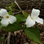 Click here for more information or to register Hosting Club: Iroquoia
Category: General Hike
Location (Google Maps): Meet at the corner of 10 Side Road and 4th Line at 9:15 am. Hike Leader(s): Karen Bergmann Click here to contact Hike Leader(s) Pace: Medium – 3 to 4 km/hr
Terrain: Moderate – Some hills and/or some poor footing
Distance: 8 kms Description
On the lookout for Trillium and other wildflowers. We will hike the bike trails around a big loop. Bring bug spray/bug net and plenty of water.
- Annual Bluebell Hike
10:00 AM-12:30 PM 05/20/2026 https://hikes.brucetrail.org/event/annual-bluebell-hike-2/2026-05-20/ 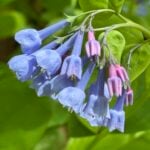 Click here for more information or to register Hosting Club: Iroquoia
Category: Good Companions
Location (Google Maps): Oakville, Sixteen Mile Creek Valley Hike Leader(s): Anne Armstrong Click here to contact Hike Leader(s) Pace: Leisurely – 3km/hr or less
Terrain: Moderate – Some hills and/or some poor footing
Distance: Approx. 9 km. – 10 km. Description
Please join in this hike to savour the many wildflowers which grow in the Sixteen Mile Creek Valley, especially the Virginia Bluebells. Depending on the season’s progress they should be at their best. Please meet in the parking lot at the end of Old Upper Middle Rd., located south of the current Upper Middle Rd. and west of Oxford St. We will hike north into the valley and complete a loop, bringing us back to the start. Bring water, a snack, sunscreen and insect repellent. Poles may be useful for the hills. I will send out a message the day before with my contact information in the event that you need to cancel the morning of the hike.
- RAINBOW HIKE: Japanese Interval Walking – Chedokee Trail
6:30 PM-8:30 PM 05/20/2026 https://hikes.brucetrail.org/event/rainbow-hike-japanese-interval-walking-chedokee-trail/2026-05-20/  Click here for more information or to register Hosting Club: Iroquoia
Category: Rainbow Hike
Location (Google Maps): Hillcrest Loop, bottom of Dundurn stairs Hike Leader(s): Doug O’Neill Click here to contact Hike Leader(s) Pace: Brisk – 4 to 5 km/hr, Leisurely – 3km/hr or less
Terrain: Easy – Mostly flat and usually good footing Description
Everyone is welcome on this uber-friendly, all-inclusive 2SLGBTQAI+ Rainbow Hike. Japanese Interval Walking was a hit last summer and fall so we’ll try it again this season! Tonight’s hike, along the Chedokee Trail and Robert MacLaren Sidetrail, features an opportunity to try Japanese interval walking (Nihon-shiki)—for at least two 30-minute segments. You’re welcome to hike at your own pace for part of the evening. We’ll stay on flat, rock-free sections of the trail. Suitable for first-timers. How Japanese Interval Walking works:
• Alternate 3 minutes of brisk walking (enough to raise your heart rate and make talking difficult) with 3 minutes of slower, recovery walking
• Each cycle = 6 minutes; we’ll repeat it five times for a total of 30 minutes
• If everyone agrees, we’ll try another 30-minute interval toward the end of our hike.
• No one gets left behind (and if they did, well, we’ve not heard from them since)
The surprising part: last season’s participants actually found they had to force themselves to walk slowly for the slow segment. It’s a lot of fun! Everyone gets a Bruce Trail Rainbow Badge. Again, this is NOT a high-intensity hike. Bring water, perhaps a snack if you’ve skipped dinner, and sturdy shoes (runners will work for this hike). Or lightweight hiking boots. Coming by transit?: the No 7 Hillcrest Loop bus will drop you off right where we’ll begin the hike.
Driving: there’s parking on various side streets off Dundurn. Meeting spot: look for the benches at foot of Dundurn Stairs, next to bus loop. Questions? Simply click “Contact Hike Leader” on the registration form.
| 21 | 22 - Afternoon hike – Mount Nemo (reservation required)
4:30 PM-6:00 PM 05/22/2026 https://hikes.brucetrail.org/event/afternoon-hike-mount-nemo-reservation-required-2/2026-05-22/  Click here for more information or to register Hosting Club: Iroquoia
Category: Afternoon/Evening Hikes
Location (Google Maps): Meet at 4:15 pm in the main parking lot at Mount Nemo on Guelph Line. Hike Leader(s): Karen Bergmann Click here to contact Hike Leader(s) Pace: Medium – 3 to 4 km/hr
Terrain: Moderate – Some hills and/or some poor footing
Distance: 7 kms Description
Meet in the main parking lot at 4:15 and we will hike around the main loop and into the forest for a bit. Reserve your time at conservationhalton.ca
- Burlington Waterfront Sculpture Trail Evening Hike
7:00 PM-9:30 PM 05/22/2026 https://hikes.brucetrail.org/event/burlington-waterfront-sculpture-trail-evening-hike/2026-05-22/ Click here for more information or to register Hosting Club: Iroquoia
Category: Afternoon/Evening Hikes
Location (Google Maps): Burlington Public Library – Central Branch Hike Leader(s): Cathie Green, Colleen Mabalay Click here to contact Hike Leader(s) Pace: Medium – 3 to 4 km/hr
Terrain: Easy – Mostly flat and usually good footing
Distance: Approx 6km Description
We will be meeting in the front parking lot of the Burlington Central Library. Bring a flashlight or headlamp. We will be hiking along the bike path to Spencer Smith Park to view the sculptures in the park. Starting at dusk, the major installations will be brought to life with theatrical lighting and music. Don’t forget your camera 📸
| 23 |
24 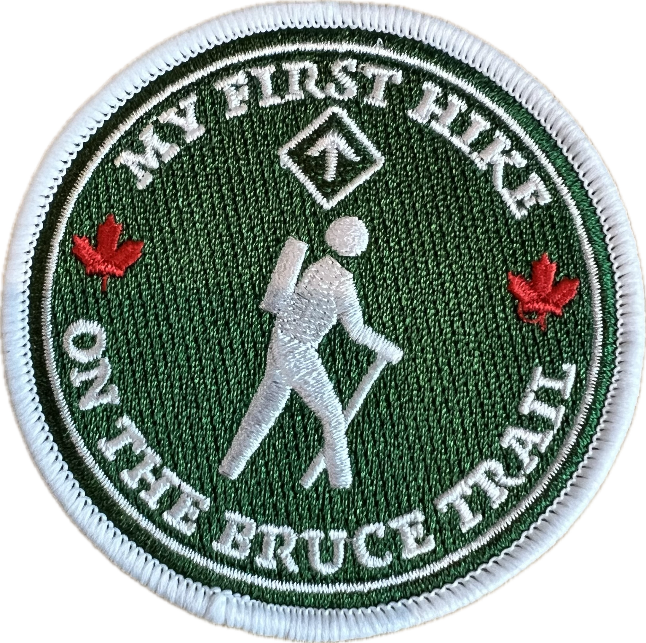 Smokey Hollow Lollipop Hike Smokey Hollow Lollipop Hike 8:45 AM-11:30 AM 05/24/2026 https://hikes.brucetrail.org/event/smokey-hollow-lollipop-hike/2026-05-24/ 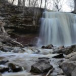 Click here for more information or to register Hosting Club: Iroquoia
Category: My First Hike
Location (Google Maps): King Road Side Road Hike Leader(s): Kirsten McCarthy Click here to contact Hike Leader(s) Pace: Medium – 3 to 4 km/hr
Terrain: Moderate – Some hills and/or some poor footing, Slippery and Steep Sections
Distance: 6-7km Description
Are you new to hiking? Interested in learning more about the Bruce Trail? Join me for a lovely morning in nature as we hike from our cars to Smokey Hollow Waterfall and back completing this Lollipop hike. Along the way, I’ll provide some safety tips for successful and enjoyable hiking. Hikers who are new to hiking The Bruce Trail will receive a “My First Hike” badge. Please bring enough water (Min. 2L), proper hiking boots, snacks and hiking poles as there are some steep sections. We’ll stop at the waterfall for pictures and snacks, about halfway through the hike.
- CANCELLED – Canada Goose to Speyside (E2E)
9:30 AM-12:00 PM 05/24/2026 https://hikes.brucetrail.org/event/canada-goose-to-speyside-e2e-4/2026-05-24/  Click here for more information or to register Hosting Club: Iroquoia
Category: General Hike
Location (Google Maps): Meet at 9:15 in the parking lot on 22 Side Rd, just off Fourth Line. Hike Leader(s): Karen Bergmann Click here to contact Hike Leader(s) Pace: Medium – 3 to 4 km/hr
Terrain: Moderate – Some hills and/or some poor footing
Distance: 8 kms Description
Meeting at 9:15 am in the Bruce Trail parking lot on 22 Side Rd, just off Fourth Line, we will carpool to 15 Side Road and hike back along the main trail and Canada Goose Side Trail. There are some rocky parts to this hike, so be prepared. Bring water and snack, as needed.
- GeoHike – Chedoke Radial Trail
2:00 PM-4:00 PM 05/24/2026 https://hikes.brucetrail.org/event/geohike-chedoke-radial-trail/2026-05-24/ Hike open to BTC Members only. Click here for more information or to register Hosting Club: Iroquoia
Category: Geo Hike
Location (Google Maps): [Chedoke Golf Club Parking Lot] Meet at the western end of the parking lot at the foot of the Chedoke Stairs. Please DO NOT park too close to the Golf Club house. Hike Leader(s): Ann Grindall Click here to contact Hike Leader(s) Pace: Leisurely – 3km/hr or less
Terrain: Moderate – Some hills and/or some poor footing
Distance: 4 km Description
An introduction to the geology of the Niagara Escarpment in the Hamilton Region. Explore the ancient story etched into the Niagara Escarpment on this guided hike through the Hamilton region. Together, we’ll uncover how layers of rock were formed hundreds of millions of years ago, when this landscape lay beneath a shallow sea. As we follow the escarpment’s edge, we’ll trace its transformation over time. From the initial deposition of limestone, shale, and dolostone to the powerful forces of erosion that sculpted its dramatic cliffs, valleys, and waterfalls. Along the way, we’ll look at how the escarpment continues to evolve today, shaped by wind, water, and time. Please meet up at 1:30 pm (1/2 hour before Hike Start) to give us time for check-in and pre-hike info. Please bring:
🥾 Dress for the weather and bring layers, sturdy footwear (hike boots or hike shoes recommended), Hiking poles (optional).
💧 1 L water, snacks, ID/health card, small first aid kit.
| 25 | 26 - Kelso Summit (reservation required)
9:30 AM-12:00 PM 05/26/2026 https://hikes.brucetrail.org/event/kelso-summit-reservation-required-2/2026-05-26/ 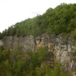 Click here for more information or to register Hosting Club: Iroquoia
Category: General Hike
Location (Google Maps): Kelso Summit parking lot at 9:15 am (reservation required) Hike Leader(s): Karen Bergmann Click here to contact Hike Leader(s) Pace: Medium – 3 to 4 km/hr
Terrain: Moderate – Some hills and/or some poor footing
Distance: 8 kms Description
Meet at 9:15 in the Summit parking lot. We will explore the trails for a large loop and enjoy spring wildflowers along the way. Reserve your time at conservationhalton.ca for KELSO SUMMIT.
- Hilton Falls Conservation Area Trails
9:30 AM-12:45 PM 05/26/2026 https://hikes.brucetrail.org/event/hilton-falls-conservation-area-trails-5/2026-05-26/ Click here for more information or to register Hosting Club: Iroquoia
Category: General Hike
Location (Google Maps): Hilton Falls Conservation Area parking lot, Campbellville Rd/Side Rd 5 East of Guelph Line Rd. Reservation required along with Conservation pass or fee for parking. Hike Leader(s): Karen Capindale-Smith Click here to contact Hike Leader(s) Pace: Brisk – 4 to 5 km/hr
Terrain: Easy – Mostly flat and usually good footing
Distance: 13km Description
We will hike the Beaver Dam loop and part of the Hilton Falls and Red Oak Trails at a brisk speed. There will an opportunity to visit the falls and stop for other sights along the way but please know that we will be moving at a clip. Please bring water, a snack and appropriate layers for the weather. Note: the finish time has been extended by 45 min to ensure the completion of the full 13km while still having an opportunity to enjoy the scenery/take breaks. Baked goods can be expected 🙂
| 27 - Princess Point Exploration
10:00 AM-12:30 PM 05/27/2026 https://hikes.brucetrail.org/event/princess-point-exploration/2026-05-27/  Click here for more information or to register Hosting Club: Iroquoia
Category: General Hike
Location (Google Maps): Princess Point, 335 Longwood Rd. N., Hamilton Hike Leader(s): Anne Armstrong Click here to contact Hike Leader(s) Pace: Leisurely – 3km/hr or less
Terrain: Moderate – Some hills and/or some poor footing
Distance: Approx. 8 km. Description
Come explore the lovely trails of Princess Point on the south shores of Cootes Paradise. We will hike Princess Point Trail, Ginger Valley, Sassafras Point, Caleb’s Walk, Ravine Rd. and Churchill Park ending up back an our cars. Please meet in the parking lot of Princess Point at 9:45 for a 10:00 am. start. Paid parking or RBG Pass. Bring water, a snack, insect repellent and sunscreen. I will send out a message the day before the hike with my contact information in the event that you need to cancel the evening before or in the morning.
- Niagara Glen Short and Sassy
10:00 AM-12:30 PM 05/27/2026 https://hikes.brucetrail.org/event/niagara-glen-short-and-sassy-8/2026-05-27/ Click here for more information or to register Hosting Club: Niagara, Iroquoia
Category: Good Companions
Location (Google Maps): Niagara Glen, 3050 Niagara Parkway, Niagara-on-the-Lake, ON Hike Leader(s): Craig Sim Click here to contact Hike Leader(s) Pace: Medium – 3 to 4 km/hr
Terrain: Moderate – Some hills and/or some poor footing
Distance: 7k (approximate) Description
Loop hike in beautiful Niagara Glen, NOT using Whirlpool Trail. We meet in between Niagara Glen parking lot and building near lot. Pay parking or Niagara parks pass. Trail ranges from moderate to quite rocky, has hills and stairs. Watch footing. Lots of boulders and great views close to Niagara River. We descend steel stairs before and after hike. Wear hiking boots or shoes. Bring water, snack, appropriate layered clothing for the weather and rain gear. Optional beverage/food after. Niagara Glen is close to both Butterfly Conservatory and Floral Clock.
| 28 | 29 - Afternoon Hike – Halton Agreement Forest
4:30 PM-6:30 PM 05/29/2026 https://hikes.brucetrail.org/event/afternoon-hike-halton-agreement-forest-5/2026-05-29/  Click here for more information or to register Hosting Club: Iroquoia
Category: Afternoon/Evening Hikes
Location (Google Maps): Parking lot on 6th Line, about 3 kms up from Campbellville Rd. Small parking lot so plan to arrive between 4 and 4:15 pm. Hike Leader(s): Karen Bergmann Click here to contact Hike Leader(s) Pace: Medium – 3 to 4 km/hr
Terrain: Moderate – Some hills and/or some poor footing
Distance: About 7 kms Description
Meet at 4:15 in the small parking lot on 6th Line. We will hike a few of the bike trails. Expect to see spring wildflowers in abundance.
| 30 - Hunting Spring Ephemerals
10:00 AM-1:00 PM 05/30/2026 https://hikes.brucetrail.org/event/hunting-spring-ephemerals/2026-05-30/ 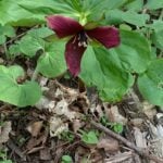 Click here for more information or to register Hosting Club: Iroquoia
Category: General Hike
Location (Google Maps): Hilton Falls Conservation Area Hike Leader(s): Anne Armstrong Click here to contact Hike Leader(s) Pace: Leisurely – 3km/hr or less
Terrain: Moderate – Some hills and/or some poor footing
Distance: Approx. 9 – 10 km. Description
Hilton Falls is a beautiful conservation area not only for its waterfalls but also the profusion of Spring Ephemerals which grow along its many trails. We’ll be on the hunt for late blooming Spring wildflowers. Please meet in the main parking lot of Hilton Falls Conservation Area located on Campbellville Rd. between Guelph Line and Highway 25 by 9:45 am. for a 10:00 am. start. Bring water, a snack, sunscreen and insect repellent. Hiking poles may be useful. A reservation is necessary to enter the area. Make it through Halton Parks. I will send out an email the day before the hike with my contact information in the event you need to cancel the morning of the hike.
|
31  Iroquoia BTC Naturalist Hike Series- Discovering Nature One Hike at a Time – Forest Bathing – Meet in the parking lot at 7:45am Iroquoia BTC Naturalist Hike Series- Discovering Nature One Hike at a Time – Forest Bathing – Meet in the parking lot at 7:45am 7:45 AM-10:45 AM 05/31/2026 https://hikes.brucetrail.org/event/iroquoia-btc-naturalist-hike-series-discovering-nature-one-hike-at-a-time-forest-bathing-meet-in-the-parking-lot-at-745am/2026-05-31/  Click here for more information or to register Hosting Club: Iroquoia
Category: Iroquoia BTC Naturalist Hike Series : Discovering Nature, One Hike at a Time.
Location (Google Maps): Ancaster Little League parking area at 286 Jerseyville Rd East, Ancaster. Hike Leader(s): Ruth Moffatt Click here to contact Hike Leader(s) Pace: Leisurely – 3km/hr or less, Medium – 3 to 4 km/hr
Terrain: Easy – Mostly flat and usually good footing, Moderate – Some hills and/or some poor footing, Dependent on Conditions
Distance: 8-10km Description
Please join us for an introduction to Forest Bathing as part of our Naturalist Hike Series. Forest bathing shinrinyoku, is a Japanese practise of spending calm intentional time in nature to improve health, well-being and relaxation. We will use all 5 senses to engage with our surroundings at the Dundas Valley Conservation area. Our movement will be leisurely and slow paced and in peace. We may sit down, we may close our eyes and we will listen without speaking. The benefits of Forest Bathing have been found to reduce blood pressure and boost immune function. Recommended reading is Forest Bathing by Dr. Qing Li. Please bring snacks and water and mute your phones. If your plans change, please cancel your registration so that someone from the waitlist can potentially join the hike. To cancel your registration, here is a step by step:
– Sign into your account on the BTC website
– Click on My Hikes under your account
– This will take you to a list of hikes you have registered for
– Scroll down to the appropriate hike and cursor over to the far right hand column under the Action column.
– Click Cancel under the hike you wish to cancel Any questions may be directed through the link on this form.
- St Helena Rd to Hilton Falls (E2E)
9:30 AM-1:00 PM 05/31/2026 https://hikes.brucetrail.org/event/speyside-to-hilton-falls-e2e/2026-05-31/  Click here for more information or to register Hosting Club: Iroquoia Location (Google Maps): Meet at 9:15 am in the Hilton Falls parking lot Hike Leader(s): Karen Bergmann Click here to contact Hike Leader(s) Pace: Medium – 3 to 4 km/hr
Terrain: Moderate – Some hills and/or some poor footing
Distance: 8.5 kms Description
We will meet at Hilton Falls and carpool to St Helena Rd. For those leaving their car at Hilton Falls, you will need to reserve your time at conservationhalton.ca Always a popular hike, this is a challenging hike because there are several technical (rocky) spots. We hike on the main trail along the edge of the Escarpment and will stop for a break by the Quarry, finishing along the Philip Gosling Side Trail. Bring a snack/lunch and plenty of water.
- Full Moon Hike – Hendrie After Dark
8:15 PM-9:45 PM 05/31/2026 https://hikes.brucetrail.org/event/full-moon-hike-hendrie-after-dark-2/2026-05-31/  Click here for more information or to register Hosting Club: Iroquoia
Category: Moonlight Hikes
Location (Google Maps): RBG Centre Parking – across from Easterbrook’s 694 Spring Garden Road Hike Leader(s): Kathrin Koenig Click here to contact Hike Leader(s) Pace: Medium – 3 to 4 km/hr
Terrain: Moderate – Some hills and/or some poor footing
Distance: Approx 6 km Description
Please be at parking by 8:00 pm as the hike will leave promptly at 8:15 pm. The Full Blue Moon is the sixth full moon of 2026. Please dress appropriately for the weather. Bring enough water and snacks to suit your needs, and a headlamp or flashlight. Headlamps with a red or green light setting are the most wildlife friendly, and best for preserving your night vision. Please ensure your device is fully charged/fresh batteries to last the duration of the hike. We will start by following the outer road at Woodland Cemetery and pick up Grindstone Marsh Trail at Sunfish Pond. Following Grindstone Marsh Trail into Hendrie Valley, we will loop our way along the North and South Bridle Trail to Cherry Hill Gate and back to the cars. There is a set of stairs, one steep-ish downhill section, and a couple of smaller hills. Please leave dogs at home. This hike will qualify you for the new Iroquoia Full Moon badge! Complete three leader led-hikes in 2026, and you will qualify. Badges are $10 for BTC members/ $15 for non-members. Any questions may be directed through “Click here to contact Hike Leader” on this form. In the event you are no longer able to attend, please remove yourself from registration by following these steps: – Sign into your account on the BTC website
– Click on My Hikes under your account
– This will take you to a list of hikes you have registered for
– Scroll down to the appropriate hike and cursor over to the far right hand column under the Action column.
– Click Cancel under the hike you wish to cancel
- Moonlight Hike – Meet time is 8:15pm
8:30 PM-10:00 PM 05/31/2026 https://hikes.brucetrail.org/event/moonlight-hike-2/2026-05-31/  Click here for more information or to register Hosting Club: Iroquoia
Category: Moonlight Hikes
Location (Google Maps): Parking lot off of Ridge Rd located east of the southernmost portion of Beamer’s Side Trail which is now main trail.
Please park close together. If this lot is full, there are a few more spots a little further west on Ridge Rd. Roadside parking may also be possible. Hike Leader(s): Ruth Moffatt Click here to contact Hike Leader(s) Pace: Medium – 3 to 4 km/hr
Terrain: Dependent on Conditions, Moderate – Some hills and/or some poor footing, Strenuous – Hilly with steep climbs and some poor footing
Distance: 4km Description
Earn your Iroquoia Moonlight badge by hiking 3 Moonlight Hikes with a leader.
Tonight’s sunset is at 8:50pm. We will follow the main trail past Beamer’s Falls around to the Hawkwatch area then the Grimsby Point Side Trail to form a loop back to the parking area onRidge Rd
If you’ve never hiked at night we are sure you will love the way it heightens all of your senses promising a great sleep afterwards.
Everyone must have a headlamp or a flashlight 🔦. Most phones have torches which could also be used as supplemental light. Please ensure your light device is fully charged/batteries to last about 1.5hours. Dress for the weather and bring enough water to suit your needs as well as all the other things you need for a hike – first aid kit, snack, poles (recommended).
This is the third of 3 full moon hikes to be held in Grimsby. After you complete three leader-led hikes, you will qualify for a badge. $10members/$15nin-members. Badges will be on hand – please bring cash. Any questions may be directed through contact on this form.
If you cannot make it, please remove yourself from registration by following these steps: To cancel your registration, here is a step by step:
– Sign into your account on the BTC website
– Click on My Hikes under your account
– This will take you to a list of hikes you have registered for
– Scroll down to the appropriate hike and cursor over to the far right hand column under the Action column.
– Click Cancel under the hike you wish to cancel
| June | June | June | June | June | June |
