|
Sun | Mon | Tue | Wed | Thu | Fri | Sat |
|---|
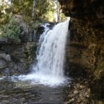
March | March | March | 1 - Rail Trail and Mountain Brow (with Albion Falls)
10:00 AM-12:30 PM 04/01/2026 https://hikes.brucetrail.org/event/rail-trail-and-mountain-brow-with-albion-falls-2/2026-04-01/ 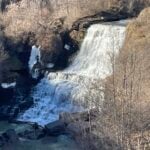 Click here for more information or to register Hosting Club: Iroquoia
Category: Good Companions
Location (Google Maps): LIUNA 4 Ice Centre on Mountain Brow Blvd on the east mountain area of Hamilton See map below Hike Leader(s): Ted Bossence Click here to contact Hike Leader(s) Pace: Medium – 3 to 4 km/hr
Terrain: Easy – Mostly flat and usually good footing
Distance: 7 km Description
Leaving the parking lot we will join the rail trail going east and visit Albion and Buttermilk Falls following the blue side trail back to the rail trail and on to the Margate stairs (165 stairs) returning by paved paths following the escarpment and rail trail. (Please arrive by 9:45 am as we will be on the trail by 10:00 am sharp. Bring water and a snack. Icers if necessary (hopefully not!). This is an urban hike with almost no cover for a call of nature! If cancelled due to rain (snow?), I will notify you by email the evening prior to the hike. If you cancel after 4:00 pm on the day prior to the hike, use the contact information I will send you by email a day or two before the hike.
 Moonlight Hike Moonlight Hike 7:30 PM-9:00 PM 04/01/2026 https://hikes.brucetrail.org/event/moonlight-hike-3/2026-04-01/ 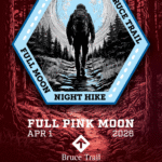 Click here for more information or to register Hosting Club: Iroquoia
Category: Moonlight Hikes
Location (Google Maps): Grimsby Lion’s Club Pool 1 Elm St, Grimsby Hike Leader(s): Ruth Moffatt Click here to contact Hike Leader(s) Pace: Medium – 3 to 4 km/hr
Terrain: Dependent on Conditions, Strenuous – Hilly with steep climbs and some poor footing
Distance: 5-6km Description
Earn your Iroquoia Moonlight badge by hiking 3 Moonlight Hikes with a leader.
Tonight’s sunset is at 7:45pm. We will hike up the escarpment and over to the Hawkwatch area and out to Beamer’s Falls and return around 9:00pm.
If you’ve never hiked at night we are sure you will love the way it heightens all of your senses promising a great sleep afterwards.
Everyone must have a headlamp or a flashlight 🔦. Most phones have torches which could also be used as supplemental light. Please ensure your light device is fully charged/batteries to last about 1.5hours. Dress for the weather and bring enough water to suit your needs as well as all the other things you need for a hike – first aid kit, snack, poles (recommended). This is an arduous climb up the escarpment so be sure to know your physical limit.
This is the first of 3 full moon hikes to be held in Grimsby. After you complete three leader-led hikes, you will qualify for a badge. $10/$15 Second hike is May 1 Third hike is May 31 Any questions may be directed through contact on this form.
If you cannot make it, please remove yourself from registration by following these steps: To cancel your registration, here is a step by step:
– Sign into your account on the BTC website
– Click on My Hikes under your account
– This will take you to a list of hikes you have registered for
– Scroll down to the appropriate hike and cursor over to the far right hand column under the Action column.
– Click Cancel under the hike you wish to cancel
- Full Moon Night Hike No.4 (Pink Moon)
8:00 PM-10:00 PM 04/01/2026 https://hikes.brucetrail.org/event/full-moon-night-hike-no-4-pink-moon/2026-04-01/ 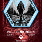 Click here for more information or to register Hosting Club: Iroquoia
Category: Moonlight Hikes
Location (Google Maps): Sixteen Hollow Park (Parking Lot), 2140 Westoak Trails Blvd, Oakville ON L6M 3K5 Hike Leader(s): Joe Borges Click here to contact Hike Leader(s) Pace: Medium – 3 to 4 km/hr
Terrain: Dependent on Conditions, Moderate – Some hills and/or some poor footing
Distance: 7.5 km Description
Pink Moon Full Moon Hike No. 4 Chase the Spring Glow.
For a mid-week hike, we’re taking advantage of the urban Oakville Trails system. Consider it a little BTC community outreach. Step onto the path beneath April’s Pink Moon — the next chapter in our 2026 Full Moon Night Hike Series. As winter fades, this early spring moon lights the budding forest with a soft rose-gold glow. Long known as the Pink Moon, it marks renewal, wildflowers, and the return of warmer evenings. It’s the perfect time to shake off winter’s chill, breathe in the fresh night air, and walk together under the bright rhythm of a new season. Continue your Full Moon Night Hike Badge Series journey! Join any 3 Full Moon Night Hikes led by an Iroquoia Club Leader in 2026 to qualify and purchase the new badge. Important Guidelines - Hike Start Time: 8:00 pm
- Arrive: Please arrive 30 minutes early at the Sixteen Hollow Park / Parking Lot, 2140 Westoak Trails Blvd, Oakville.
- Lighting: Headlamp (recommended) or flashlight with fresh batteries or a full charge.
- Poles & Traction: Poles useful on uneven terrain; icers not required unless late frost conditions.
- Clothing: Dress in layers for mild spring temps and variable terrain.
- Essentials: Bring I.D. and your health card.
- Hydration: Carry at least 1L of water.
- Safety: A small first aid kit is recommended.
- Pets: No dogs permitted on this hike.
See the route on AllTrails:
https://www.alltrails.com/explore/custom-routes/custom-route-388469e?u=m&sh=4wexyx Join us as we welcome spring under the soft light of the Pink Moon — a night for reflection, renewal, and shared steps toward the season ahead.
| 2  CANCELLED – Silver Creek CANCELLED – Silver Creek 9:30 AM-11:30 AM 04/02/2026 https://hikes.brucetrail.org/event/silver-creek-3/2026-04-02/  Click here for more information or to register Hosting Club: Iroquoia
Category: General Hike
Location (Google Maps): Meet roadside on Fallbrook Trail at 9:15 am Hike Leader(s): Karen Bergmann Click here to contact Hike Leader(s) Pace: Medium – 3 to 4 km/hr
Terrain: Moderate – Some hills and/or some poor footing
Distance: 7 kms Description
Meeting roadside on Fallbrook Trail at Silver Creek Conservation Area, we will hike the Roberts Side Trail to the main trail almost to Tenth Line. Turning back along the main trail to the Irwin Quarry Side Trail and to the cars. This hike has some rocky spots and a few hilly bits. Come with icers for your boots in case there is still snow/ice. Hike is dependent on weather conditions.
| 3   Dufferin End to End for the Stained Glass Badge Fundraiser – Multi Day Hike Series – April 3, 4, 5, 2026 Meet time is 7:45am Dufferin End to End for the Stained Glass Badge Fundraiser – Multi Day Hike Series – April 3, 4, 5, 2026 Meet time is 7:45am 7:45 AM 04/03/2026 https://hikes.brucetrail.org/event/dufferin-end-to-end-for-the-stained-glass-badge-fundraiser-multi-day-hike-series-april-3-4-5-2026/2026-04-03/  This is a Multi-Day HikeYou are signing up for the following dates:
2026-04-03, 2026-04-04, 2026-04-05 Click here for more information or to register Hosting Club: Iroquoia, Dufferin Hi-Land
Category: Stained Glass Badge End to End Fundraiser Hike
Location (Google Maps): Registered participants will receive a WhatsApp invitation (optional)which can be used for photo share and other pertinent information. Day 1 – Friday April 3- Meet at Mono Cliffs Community Centre, 200m south of Mono Centre (County Rd 8). Park in gravel lot. – https://maps.app.goo.gl/fKzqRtxnVtZjExgG6 –
Shuttle to Roadside parking on 1st Line https://maps.app.goo.gl/edUYBQopt8JnCuSs5 ~ 20km
Day 2 – Saturday April 4 – Meet in BT parking lot located off of 15th Sideroad, 50 m west of the stop sign at the intersection of Prince of Wales and 15th Sideroad. https://maps.app.goo.gl/t3QAFcmmYFWkRzWF6
Shuttle to Roadside parking on 1st Line https://maps.app.goo.gl/edUYBQopt8JnCuSs5 ~ 17.50km
Day 3 – Sunday April 5 – Meet in BT parking lot located off of 15th Sideroad, 50m west of the stop sign at the intersection of Prince of Wales and 15th Sideroad https://maps.app.goo.gl/t3QAFcmmYFWkRzWF6
Shuttle to Roadside parking on Mulmur-Nottawasga Townline, 550 metres east of Lavender Hill Rd at the cemetery. https://maps.app.goo.gl/is6cF8QsmPiAgscj9 ~18km Hike Leader(s): Ruth Moffatt Click here to contact Hike Leader(s) Pace: Brisk – 4 to 5 km/hr, Medium – 3 to 4 km/hr
Terrain: Dependent on Conditions, Moderate – Some hills and/or some poor footing, Strenuous – Hilly with steep climbs and some poor footing
Distance: Varies – Dufferin section is about 55km according to the BT app spread over three days. Description
Everyone who is registered for this hike series will be invited to join an optional WhatsApp which can be used to share photos and other information. This is a monetized hike with the proceeds going towards the Dufferin Bruce Trail Club – “Preserving a ribbon of wilderness for everyone, forever.” There are no refunds. Your badge depicting the yellow lady slipper, the hike logistics, shared shuttle driving and hike guidance are all included in your fee. Since it is the intention to run a similar hike in all sections this year, why not join the Bruce Trail Conservancy if you are not already a member? Please use my code 67abd1234c568 until the end of 2025 to receive free digital maps as well as all the other great benefits included with membership. https://brucetrail.org/product-category/memberships/ Please read all details for this hike to ensure it is suitable for you. The pace and terrain are particularly important details.
Registered participants will receive a WhatsApp invitation (optional) which can be used for photo share.
You must be registered to participate in this group hike. You cannot just show up as there are often people on the waitlist. This is a multi-day hike – April 3, 4, 5th, 2026. Please ensure your car is car shuttle-ready with at least 4 available seatbelts including the driver’s. We will take turns either being the shuttle driver or driving the drivers back to their cars after the hike is over. Please pack whatever food you will require for a long day hike including lunch and snacks; 2l of water minimum; first aid kit; poles if you use them; and icers. You may also wish to pack extra socks and rain gear. Remember to dress in layers. Gloves/mitts, scarf / neck gator, a toque and a puffy jacket. Consider snow shoes, depending on conditions. We will break for a morning clothing adjustment, a 10min break around 10am, 15 min lunch and an afternoon break if we are finishing after 2pm. Bio-breaks are as you need them – please let the sweep know who will wait for you. This is a 3 day group hike so it is important you keep pace with the person in front of you. We will help each other and wait for one another but please consider your physical ability before signing up for this hike. There are no drop outs – if you are not able to finish the hike you will need to arrange for transportation back to your car via taxi or Uber at your cost. Obtaining either in this section of trail is unlikely so please sign up if you know your limit and can maintain the pace. The Dufferin stained-glass badge will be presented on the last day. If you have to miss one of these hiking days, you may make it up on your own before the last day of the series. Since it is a group hike, it is intended that everyone who registers be present on all days. Any questions may be directed through contact on this form.
If you cannot make it, please remove yourself from registration to allow another person who may be on the waitlist to join the hike. To cancel your registration, here is a step by step:
– Sign into your account on the BTC website
– Click on My Hikes under your account
– This will take you to a list of hikes you have registered for
– Scroll down to the appropriate hike and cursor over to the far right hand column under the Action column.
– Click Cancel under the hike you wish to cancel Any questions may be directed through the link on this form. Refunds: https://brucetrail.org/paid-hike-refund-policy/
| 4 |
5 - Hilton Falls Conservation Halton
8:00 AM-2:00 AM 04/05/2026 https://hikes.brucetrail.org/event/hilton-falls-conservation-halton/2026-04-05/ 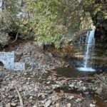 Click here for more information or to register Hosting Club: Iroquoia, Toronto
Category: General Hike
Location (Google Maps): Meet at Hilton Falls Conservation Park Parking lot.
Coordinates: 43.505705, -79.961589 Hike Leader(s): IgorT Click here to contact Hike Leader(s) Pace: Brisk – 4 to 5 km/hr, Medium – 3 to 4 km/hr
Terrain: Dependent on Conditions, Moderate – Some hills and/or some poor footing, Slippery and Steep Sections, Slippery Sections Likely
Distance: 16 Description
Join me to explore Hilton Falls. park entrance fee 10.50 plus tax per car, reservation required. https://www.conservationhalton.ca/parks/hilton-falls/ We going to hike thru beautiful forest, enjoy amazing views, 2 waterfalls. If you wish bring you treats, like marshmallows, hotdogs etc., we going to stop for break at campfire by the falls. Please read all details for this hike to ensure it is suitable for you. The pace and terrain are particularly important details. You must be registered to participate in this group hike. You cannot just show up as there are often people on the waitlist. Please pack whatever food you will require for a long day hike including lunch and snacks; 2l of water minimum; first aid kit; poles if you use them; and icers. You may also wish to pack extra socks and rain gear. Remember to dress in layers. Gloves/mitts, scarf / neck gator, a toque and a puffy jacket. Consider snow shoes, depending on conditions. We will help each other and wait for one another but please consider your physical ability before signing up for this hike. There are no drop outs – if you are not able to finish the hike you will need to arrange for transportation back to your car via taxi or Uber at your cost.
| 6 - Dufferin Seven Rivers Hike Series – Multi Day Hike April 6, 7, 8 and 9th, 2026.
7:45 AM-3:00 PM 04/06/2026 https://hikes.brucetrail.org/event/dufferin-seven-rivers-hike-series-multi-day-hike-april-6-7-8-and-9th-2026/2026-04-06/  Click here for more information or to register Hosting Club: Iroquoia, Dufferin Hi-Land
Category: Special Event
Location (Google Maps): April 6th – Pretty River 11.89 km and Mad River 10.9km
April 7th – Noisy River 10.2km and Pine River 10.75km
April 8th – Boyne River 10.41km and Nottawasaga River 13.1km
April 9th – Humber River 11.4km Hike Leader(s): Ruth Moffatt Click here to contact Hike Leader(s) Pace: Brisk – 4 to 5 km/hr, Medium – 3 to 4 km/hr
Terrain: Dependent on Conditions, Moderate – Some hills and/or some poor footing, Strenuous – Hilly with steep climbs and some poor footing
Distance: Just shy of 80km over 4 days Description
This is a small group, multi-day hike. Everyone who is registered for this hike series will be invited to join an optional WhatsApp which can be used to share photos and other information. This is a 4 day hike series to cover the Seven River Series will take us to Blue Mtn Club, Dufferin and Caledon Club. It is limited to a small group. Please prepare for 3.5 long days of hiking. Seven Rivers/3.5 days is two per day plus a short one on the final day. A detailed hike schedule will be sent to all participants. The hikes require driving from One hike to another hike on the same day. Please pack whatever food you will require for a long day hike including lunch and snacks; 2l of water minimum; first aid kit; poles if you use them; and icers. You may also wish to pack extra socks and rain gear. Remember to dress in layers. Gloves/mitts, scarf / neck gator, a toque and an insulated jacket. Consider lined pants as well. Check the weather forecast before heading out. We will break briefly in the morning, at lunch and in the afternoon. Bio-breaks are as you need them – please let the sweep know who will wait for you. This is a 4 day group hike so it is important you keep pace with the person in front of you. We will help each other and wait for one another but please consider your physical ability before signing up for this hike series. There are no drop outs – if you are not able to finish the hike you will need to arrange for transportation back to your car and in this area, it would be minimal at best. The Dufferin Seven Rivers badge will be presented on the last day, hopefully. $10 members and $15 non-members. Since it is a group hike, it is intended that everyone who registers be present on all days. Any questions may be directed through contact on this form.
If you cannot make it, please remove yourself from registration by following these steps: To cancel your registration, here is a step by step:
– Sign into your account on the BTC website
– Click on My Hikes under your account
– This will take you to a list of hikes you have registered for
– Scroll down to the appropriate hike and cursor over to the far right hand column under the Action column.
– Click Cancel under the hike you wish to cancel
- Rattlesnake Point – Crawford Lake Loop
8:30 AM-1:30 PM 04/06/2026 https://hikes.brucetrail.org/event/rattlesnake-point-crawford-lake-loop-2/2026-04-06/ Click here for more information or to register Hosting Club: Iroquoia
Category: General Hike
Location (Google Maps): Rattlesnake Point Conservation Area – Park Registration Required Hike Leader(s): Pati Greenwood, Jeff Dowsett Click here to contact Hike Leader(s) Pace: Medium – 3 to 4 km/hr
Terrain: Moderate – Some hills and/or some poor footing, Slippery and Steep Sections
Distance: 15 km Description
Starting at Rattlesnake Point Conservation Area, we will hike on the Main Trail and Side Trails to Crawford Lake, around the escarpment edge, down through the Nassagaweya Canyon and back up to our meeting area in the parking lot at Rattlesnake Point. Trail conditions may be wet, muddy, and slippery in spots so wear hiking boots and bring poles. Dress in layers for the weather conditions, bring plenty to drink and a snack. Please arrive at the meeting place in the main parking lot, by 8:15 am for an 8:30 am departure. Park reservations will be required. They can be obtained online at Halton Conservation Area web-site: https://www.conservationhalton.ca/.
| 7 - Limehouse
9:30 AM-11:30 AM 04/07/2026 https://hikes.brucetrail.org/event/limehouse-3/2026-04-07/  Click here for more information or to register Hosting Club: Iroquoia
Category: General Hike
Location (Google Maps): Limehouse Conservation Area Hike Leader(s): Karen Bergmann Click here to contact Hike Leader(s) Pace: Medium – 3 to 4 km/hr
Terrain: Easy – Mostly flat and usually good footing
Distance: 7 kms Description
The main trail was taken off the road north of Limehouse and put through a lovely forest from 6th Line. A fairly easy hike, with rocks and roots but no major hills. We will meet in the parking lot at Limehouse at 9:15 am and carpool to 6th Line, hiking back along the main Bruce Trail into the Conservation Area and passing the iconic stone arch, turning onto the Black Creek Side Trail to the main trail. This is a great hike for beginners and those who are exploring the dynamic of a group hike.
| 8 - River and Ruin and loop
9:30 AM-12:00 PM 04/08/2026 https://hikes.brucetrail.org/event/river-and-ruin-and-loop-4/2026-04-08/ Click here for more information or to register Hosting Club: Iroquoia
Category: Good Companions
Location (Google Maps): Kilbride Park. Please park behind public school Hike Leader(s): Jill Parratt Click here to contact Hike Leader(s) Pace: Medium – 3 to 4 km/hr
Terrain: Moderate – Some hills and/or some poor footing
Distance: 7.5 Description
Meet at 9:15 for a 9:30am start. We will hike Kilbride side trail, part of River & Ruin and the loop. Some good hills so poles are recommended. If it is too muddy we will change the route. Lunch afterwards. Jill Parratt
| 9 | 10 - CANCELLED – Terra Cotta Loop
8:30 AM-2:00 PM 04/10/2026 https://hikes.brucetrail.org/event/terra-cotta-loop-2/2026-04-10/ Click here for more information or to register Hosting Club: Iroquoia
Category: General Hike
Location (Google Maps): Boston Mills Road – Roadside Parking Hike Leader(s): Pati Greenwood, Jeff Dowsett Click here to contact Hike Leader(s) Pace: Medium – 3 to 4 km/hr
Terrain: Moderate – Some hills and/or some poor footing, Slippery Sections Likely
Distance: 15 km Description
Starting from Boston Mills Road, we will take the main trail and side trails to form a large loop through the Terra Cotta Conservation Area. Our route will include some rocky and uneven terrain, which may be wet and slippery. Wear hiking boots and bring poles. Dress in layers for weather conditions, bring plenty to drink and a snack. Please arrive at the meeting place by 8:15 am for an 8:30 am departure.
 Rucking for Beginners Series Rucking for Beginners Series 9:30 AM-12:00 PM 04/10/2026 https://hikes.brucetrail.org/event/rucking-for-beginners-series-2/2026-04-10/ This is a Multi-Day HikeYou are signing up for the following dates and times:
2026-04-10 at 09:30
2026-04-17 at 09:30
2026-04-24 at 09:30
2026-05-01 at 09:30 Click here for more information or to register Hosting Club: Iroquoia
Category: Rucking: Hikes/Walks with Weight
Location (Google Maps): Meet up at 9:30am SHARP at Kilbride Public School (6611 Panton St., North Burlington) in back parking by tennis club (ignore one-way arrows). Hike Leader(s): Karen Capindale-Smith Click here to contact Hike Leader(s) Pace: Medium – 3 to 4 km/hr
Terrain: Moderate – Some hills and/or some poor footing, Strenuous – Hilly with steep climbs and some poor footing
Distance: +/- 6 km Description
This is a progressive rucking series – starting off slow and building as you are able. I will be starting with a village street route as you learn the subtle skills of rucking and progressing from there to close by main and side hiking trails of the Bruce Trail. Information covered over the 4 weeks will include: the uses of rucking, its health benefits, proper posture and “stability” when rucking, tips on how to safely progress your rucking. Prerequisite of participants: Please sign up for this fun and encouraging rucking series ONLY IF: 1) YOU CAN MAKE ALL 4 WEEKS OF THE SERIES 2) You have (or can borrow) a backpack with both a hip (padded is recommended) and chest strap. A cover for your pack is optional but recommended for wet conditions; 3) you walk or hike 6km+ regularly (2-3 times a week) and can maintain a moderate pace (3-4km/hr); and, 4) you have NO unresolved joint issues (especially hip, knee, ankle and feet joints). What to Bring: your backpack ;), water and a snack. Please dress according to the weather (layers are best). Icers may be necessary. Note: wearing a backpack (especially with weight) will keep you warmer than without. I will be contacting you closer to the first week with any other information you may need to know. This series will run RAIN OR SHINE. Extreme weather will always be a consideration. This series is back by popular demand! Both the May and November 2025 Series were well attended and interest in a more advanced Series has been expressed. Hope to see you there!
| 11 - Celebration In Memory of Dennis Chamberlain
9:00 AM-12:30 PM 04/11/2026 https://hikes.brucetrail.org/event/celebration-in-memory-of-dennis-chamberlain/2026-04-11/ 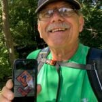 Click here for more information or to register Hosting Club: Iroquoia
Category: General Hike
Location (Google Maps): Scotsdale Farm Hike Leader(s): Steven White Click here to contact Hike Leader(s) Pace: Medium – 3 to 4 km/hr
Terrain: Moderate – Some hills and/or some poor footing
Distance: 12.6km Description
To mark the anniversary of Dennis Chamberlain’s passing in 2025, I am re-tracing Dennis’s first BTC hike and my first hike as hike leader. As fate would have it, Dennis and I struck up an enduring friendship that took us to all paths on the Bruce Trail, and we made many friends with the same crazy passion for hiking, adventure and friendship. All are welcome! We will meet at the Bruce Trail Parking area at Scotsdale Farm, and so a loop hike coving the Bennett Heritage Trail, parts of main Bruce Trail and the Great Esker Side Trail. Total distance, 12.6 km. I expect we’ll tell many Dennis stories along the way and share some of Dennis’ favourite treats. Lunch at Kelseys Original Roadhouse, 256 Guelph St, Georgetown afterwards for those interested in joining.
- Scotsdale Farm Duff Pit loop
9:30 AM-12:30 PM 04/11/2026 https://hikes.brucetrail.org/event/scotsdale-farm-duff-pit-loop-4/2026-04-11/ 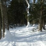 Click here for more information or to register Hosting Club: Iroquoia
Category: General Hike
Location (Google Maps): Meet in the parking lot on 8 Line. Hike Leader(s): Karen Bergmann Click here to contact Hike Leader(s) Pace: Medium – 3 to 4 km/hr
Terrain: Moderate – Some hills and/or some poor footing
Distance: 9 kms Description
There are so many trails here that it’s hard to choose where to go. But this hike will take us down the main trail to the Side Trails of Duff Pit, Reservoir, Trafalgar Rd and Great Esker to the main trail and Maureen Bennett Side Trail and finishing on the Bennett Heritage Trail. Bring icers for your boots.
|
12 - Toronto Side Trails Badge
8:00 AM-2:00 PM 04/12/2026 https://hikes.brucetrail.org/event/toronto-side-trails-badge/2026-04-12/  Click here for more information or to register Hosting Club: Iroquoia, Toronto
Category: General Hike
Location (Google Maps): 15 side road, coordinate: 43.577963, -79.977024 Hike Leader(s): IgorT Click here to contact Hike Leader(s) Pace: Medium – 3 to 4 km/hr
Terrain: Easy – Mostly flat and usually good footing, Moderate – Some hills and/or some poor footing
Distance: 15km Description
Join me to explore Bruce Trail Toronto section side trails. This is 1 of … hikes, future hikes will be posted later, towards the side trail badge, that awarded to hikers who completed 45km of side trails. Will meet at 15 side road (43.577963, -79.977024) And shuttle from there to start point at Hilton falls parking lot. Please be prepared to volunteer in car shuttle from parking lot to start of the hike. Please do not reserve parking yet. Contact myself for clarification. Park entrance fee 10.50 plus tax per car, reservation required.(https://www.conservationhalton.ca/parks/hilton-falls/) We will organize the shuttle at parking lot, and pay the sum to the driver who is shuttling. Please bring some change. We are going to hike through 3 side trails, total of 15km Please read all details for this hike to ensure it is suitable for you. The pace and terrain are particularly important details. You must be registered to participate in this group hike. You cannot just show up as there are often people on the waitlist. Please pack whatever food you will require for a day hike including lunch and snacks; 2l of water minimum; first aid kit; poles if you use them; and icers. You may also wish to pack extra socks and rain gear. Remember to dress in layers. Gloves/mitts, scarf / neck gator, a toque and a puffy jacket. We will help each other and wait for one another but please consider your physical ability before signing up for this hike. There are no drop outs – if you are not able to finish the hike you will need to arrange for transportation back to your car via taxi or Uber at your cost.
- CANCELLED – Caledon North
9:30 AM-12:00 PM 04/12/2026 https://hikes.brucetrail.org/event/caledon-north-2/2026-04-12/ 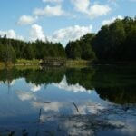 Click here for more information or to register Hosting Club: Iroquoia
Category: General Hike
Location (Google Maps): Meet in the parking lot at the Mono Centre Park at 9:15 am Hike Leader(s): Karen Bergmann Click here to contact Hike Leader(s) Pace: Medium – 3 to 4 km/hr
Terrain: Moderate – Some hills and/or some poor footing
Distance: 8 kms Description
Meeting at 9:15 am in the parking lot of Mono Centre Community Centre, we will hike the main trail and around the Turnbull, Springwater, Whitetail Refuge and Third Outlier Side Trails and back along the main trail into Mono Cliffs to the Laidlaw Side Trail to the cars. Bring icers for your boots. Hike is dependent on weather.
 Iroquoia Naturalist Hike Series- Discovering Nature One Hike at a Time – Niagara Hawkwatch – Meet in the 1 Elm St parking lot in Grimsby at 9:15 Iroquoia Naturalist Hike Series- Discovering Nature One Hike at a Time – Niagara Hawkwatch – Meet in the 1 Elm St parking lot in Grimsby at 9:15 9:30 AM-1:00 PM 04/12/2026 https://hikes.brucetrail.org/event/iroquoia-naturalist-hike-series-discovering-nature-one-hike-at-a-time-niagara-hawkwatch-meet-in-the-1-elm-st-parking-lot-in-grimsby-at-915-2/2026-04-12/ 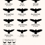 Click here for more information or to register Hosting Club: Iroquoia
Category: Iroquoia BTC Naturalist Hike Series : Discovering Nature, One Hike at a Time.
Location (Google Maps): Meet in the Quarry Rd parking lot at 9:15. Hike will commence at 9:30.
https://maps.app.goo.gl/rjkk83wYYmCfkNxQ9 Quarry Rd intersects with Ridge Rd West just west of Beamer’s Falls. Hike Leader(s): Ruth Moffatt Click here to contact Hike Leader(s) Pace: Leisurely – 3km/hr or less, Medium – 3 to 4 km/hr
Terrain: Dependent on Conditions, Easy – Mostly flat and usually good footing, Moderate – Some hills and/or some poor footing, Strenuous – Hilly with steep climbs and some poor footing
Distance: 3.5km Description
Please join us for another Iroquoia Naturalist Hike Series- Discovering Nature One Hike at a Time. Spring is the time for migrating raptors and every year, for over 50 years, volunteers have been monitoring the annual migration of hawks, eagles, falcons and vultures over the Niagara Peninsula. Did you see the last BTC webinar Spring Raptor Migration at Beamer Memorial Niagara Peninsula Hawkwatch https://www.youtube.com/watch?v=nrcjba1Zwrc If you haven’t watched it, I highly recommend it. Keith Dieroff: President, Niagara Peninsula Hawkwatch, will meet us on this hike and be available to answer any questions we might have. I will also have a raptor handout so we can try to identify any raptors we see. Parents: If you would like to bring children, Spring Youth badges will be available for $7. Please dress for the weather, bring enough water and snacks for your hike. Bring hiking poles if you use them and wear gaiters in case of muddy conditions. Binoculars might be useful.
Spring should be upon us by April 12 so we’ll look for the early spring ephemerals, as well. If you need to cancel your registration, please follow these instructions:
– Sign into your account on the Bruce Trail website.
– Go to the Hike Schedule
– Click on My Hikes tab which you should find at the tip of the schedule
– Scroll to the appropriate hike you wish to cancel
– Cursor to the far right of the hike to the Action column
– Click cancel under the hike you wish to cancel.
| 13 - CANCELLED – Scotsdale Farm Big Loop
8:30 AM-2:30 PM 04/13/2026 https://hikes.brucetrail.org/event/scotsdale-farm-big-loop/2026-04-13/ Click here for more information or to register Hosting Club: Iroquoia
Category: General Hike
Location (Google Maps): Scotsdale Farm main parking area Hike Leader(s): Pati Greenwood, Jeff Dowsett Click here to contact Hike Leader(s) Pace: Medium – 3 to 4 km/hr
Terrain: Moderate – Some hills and/or some poor footing, Strenuous – Hilly with steep climbs and some poor footing
Distance: 17.5 km Description
Starting at the main parking area, we will take the main trail and side trails to form a large, 17.5 km loop. There will be some rocky sections and steep climbs along the way which may be slippery. Wear hiking boots and bring poles. Dress in layers for the weather conditions, Bring plenty to drink and a snack. Please arrive at the meeting place by 8:15 am for an 8:30 am departure.
- *Caledon Hills Sideways Badge – Hike #1
9:00 AM-3:00 PM 04/13/2026 https://hikes.brucetrail.org/event/caledon-hills-sideways-badge-hike-1/2026-04-13/ Click here for more information or to register Hosting Club: Iroquoia, Caledon Hills
Category: Special Event
Location (Google Maps): Caledon Hills – Location will be advised Hike Leader(s): Heather Zrini Click here to contact Hike Leader(s) Pace: Medium – 3 to 4 km/hr
Terrain: Strenuous – Hilly with steep climbs and some poor footing
Distance: 20 km Description
On this series of three hiking days, we will complete the five loop hikes that are required to earn the Caledon Hills Sideways Badge. If you are not interested in earning the badge, please join us for some great hiking. Hikers can sign up for individual hikes as you do not need to complete all three to participate. The dates of the three hiking days will be April 13, April 27 and May 11. We will meet at the starting point at 9am each week. Our finishing time is an approximation. On each of the first two hiking days, we will be completing two of the loops. On May 11, there will be one loop hike and if there is interest, we will hike another loop in Mono Cliffs Provincial Park. Each loop is approximately 10 km in length. For more information about the hikes, please see the link below: Sideways Badge Loop .PDF Download Our schedule will be as follows: April 13 – Hike One and Hike Five April 27 – Hike Two and Hike Three May 11 – Hike Four and a hike in Mono Cliffs Provincial Park Carpooling is encouraged. Since these are loop hikes, we will not need to shuttle. On the first day, a Provincial Park Daily Vehicle Permit Reservation will be required. We will be parking and hiking in the Forks of the Credit Provincial Park on Day 1. Passes that can be used when making the reservation can be purchased through the Ontario Provincial Park website or borrowed from your local library. If a car does not have a pass, the cost of the Daily Vehicle Permit reservation will be split between those people in that car. More information, including specific details about the meeting points, will be provided to those who sign up for the hikes. If there are any questions, please don’t hesitate to ask.
| 14 | 15 - CANCELLED – Hilton Falls on the Bike Trails
9:30 AM-12:00 PM 04/15/2026 https://hikes.brucetrail.org/event/hilton-falls-on-the-bike-trails-2/2026-04-15/ 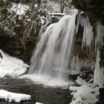 Click here for more information or to register Hosting Club: Iroquoia
Category: General Hike
Location (Google Maps): Meet in the parking lot at Hilton Falls Conservation Area at 9:15 am. Hike Leader(s): Karen Bergmann Click here to contact Hike Leader(s) Pace: Medium – 3 to 4 km/hr
Terrain: Moderate – Some hills and/or some poor footing
Distance: 8 kms Description
Meeting in the parking lot at 9:15 am, we will hike to the Falls and then across the creek to the bike trails and back along the Hilton Falls Side Trail. Bring icers for your boots. Reserve your time at conservationhalton.ca
- Headwaters Trail – Sutcliffe Vista
10:00 AM-12:30 PM 04/15/2026 https://hikes.brucetrail.org/event/headwaters-trail-sutcliffe-vista/2026-04-15/ Hike open to BTC Members only. Click here for more information or to register Hosting Club: Iroquoia
Category: Good Companions
Location (Google Maps): Meet at 134 Martin Road, Ancaster
Parking lot beside Ancaster Matthew Krol field. End of Martin Rd past the Rotary Centre. Hike Leader(s): Kathy Rymal Click here to contact Hike Leader(s) Pace: Medium – 3 to 4 km/hr
Terrain: Dependent on Conditions, Moderate – Some hills and/or some poor footing
Distance: 8 km approx. Description
We will head down Martin Road and do the Headwaters Trail loop in the beautiful west Dundas Valley. If we are lucky we might see an early trillium or two. A short stop at Sutcliffe Vista for a refreshment break and hopefully have a view of the city of Hamilton. Coming back via Gravel Pit Road, Rail Trail, Mineral Springs Road and then back to Martin Road. Bring water and a snack. Poles may be useful for the two big climbs. Please arrive ten minutes before the start time as we will be leaving right at ten.
| 16 | 17 - Blue Mountains End-to-End in 5 – Hike 1
9:30 AM-3:30 PM 04/17/2026 https://hikes.brucetrail.org/event/blue-mountains-end-to-end-in-5-hike-1/2026-04-17/ Hike open to BTC Members only. Click here for more information or to register Hosting Club: Iroquoia, Blue Mountains
Category: General Hike
Location (Google Maps): Roadside Parking on Mulmur-Nottawasaga Townline Hike Leader(s): Pati Greenwood, Jeff Dowsett Click here to contact Hike Leader(s) Pace: Medium – 3 to 4 km/hr
Terrain: Dependent on Conditions, Moderate – Some hills and/or some poor footing
Distance: 14.1 km Description
This is an End-to-End hike series to complete the Blue Mountains section of the Bruce Trail in 5 hikes. Join for all or as many hikes as desired – you will need to register for each hike in the series which will take place on the following dates in April: 17, 18, 19, 24 and 25. Since this is a group hike, please consider your fitness level before registering. We will be walking at a pace of 3km – 4km per hour and hikers will need to keep up with the person in front of them for the duration of the hike. The hike series will also involve car shuttles and every hiker is expected to participate as drivers. Weather conditions in the spring can be changeable, so it’s best to dress in layers and come prepared for varying conditions throughout the day. Hiking boots are required and hiking poles are strongly recommended. Bring plenty of fluids and a snack. This first hike of the series will be 14.1 km long. Plan to arrive at the meeting place by 8:15 a.m. as we will start the car shuffle to the hike starting point at 8:30 a.m. sharp. Further details will be provided to registered hikers a few days prior to the hike.
- Bent Rim 2 Loop
9:30 AM-12:30 PM 04/17/2026 https://hikes.brucetrail.org/event/bent-rim-2-loop-2/2026-04-17/ 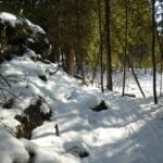 Click here for more information or to register Hosting Club: Iroquoia
Category: General Hike
Location (Google Maps): Meet in the small parking lot on 6th Line. Hike Leader(s): Karen Bergmann Click here to contact Hike Leader(s) Pace: Medium – 3 to 4 km/hr
Terrain: Moderate – Some hills and/or some poor footing
Distance: 9 kms Description
We will hike the Bent Rim 2 bike trail and back through the Halton Forest. Meet at 9:15 (earlier if possible) in the small parking lot on 6th Line, about 3 kms north of Campbellville Rd. Bring icers for your boots, in case there is still snow/ice.
| 18 -
 City of Waterfalls – Special Event Fundraiser City of Waterfalls – Special Event Fundraiser 8:00 AM 04/18/2026 https://hikes.brucetrail.org/event/city-of-waterfalls-special-event-fundraiser-6/2026-04-18/  This is a Multi-Day HikeYou are signing up for the following dates and times:
2026-04-18 at 08:00
2026-04-19 at 08:00 Click here for more information or to register Hosting Club: Iroquoia
Category: City of Waterfalls – Special Event Fundraiser
Location (Google Maps): Varies Hike Leader(s): Freddy Wang Click here to contact Hike Leader(s) Pace: Brisk – 4 to 5 km/hr
Terrain: Strenuous – Hilly with steep climbs and some poor footing
Distance: Day 1- 21km/ Day 2-24km Description
Welcome to Iroquoia, City of Waterfalls Challenge! This is a fundraiser challenge event. All funds raised go towards the Iroquoia Bruce Trail Club to maintain the infrastructure of this beautiful section of trail and to “Preserve this ribbon of wilderness, for everyone, forever!” We also encourage participants to consider a membership with Conservation Hamilton https://conservationhamilton.ca/hca-membership-pass/ DAY 1: FEB 14 – We will meet at Cityview Park and car shuttle to Spencer Gorge Parking Lot (Conservation Hamilton) and hike back. The cost at this parking lot is $16.50 per vehicle and driver plus $5.50 for each passenger.
Day 1 Distance 21km DAY 2: FEB 15 – We will meet in the parking area off of Mud St and car shuttle to Artaban Rd Parking Lot (Conservation Hamilton) and hike back. The cost for this parking lot is $11.00 per vehicle.
Day 2 Distance 24 km Please ensure your vehicle is car shuttle ready by having a minimum of 4 seatbelts available – drivers do not pay for the parking. Please volunteer for this important component of this challenge. While we encourage carpooling to the start of the hike, please let the hike leader know if you’re planning to arrive with more than two people in your vehicle. This hike will be limited to 20 people including the hike leader so we will need 4-5 vehicles and one vehicle with 4 seatbelts to drive the drivers back at the end of the day. We will try to take as few vehicles as possible. On the second day, those who did not drive on the first day will be asked to drive. There will be short breaks along the way to admire the waterfalls on route and a short lunch. This hike is intended to be at a Brisk pace and through a very hilly section. Please be honest about your degree of physical fitness prior to registration. It is a group hike so it is important you are able to keep pace with the person in front of you. Hikers will be expected to wear proper hiking footwear and layered clothing. Sufficient snacks/lunch, water, hiking poles, gaiters and layered clothing are recommended. Depending on terrain, icers may be required. Don’t forget your camera for all the photo ops! The badge will be presented to all participants who have completed the challenge at the end of the second day. Any questions may be directed through the “Contact Hike Leader” on this form. The fee is non-refundable. If your availability changes, please cancel your Bruce Trail hike registration by logging into the BTC website, go to your “My Hikes” section, find the hike, and click “cancel”; if it’s last minute (under 24 hours), please email the Hike Leader directly.
- Blue Mountains End-to-End in 5 – Hike 2
8:30 AM-2:30 PM 04/18/2026 https://hikes.brucetrail.org/event/blue-mountains-end-to-end-in-5-hike-2/2026-04-18/ Hike open to BTC Members only. Click here for more information or to register Hosting Club: Iroquoia, Blue Mountains
Category: General Hike
Location (Google Maps): Parking Lot Devil’s Glen Provincial Park Hike Leader(s): Pati Greenwood, Jeff Dowsett Click here to contact Hike Leader(s) Pace: Medium – 3 to 4 km/hr
Terrain: Dependent on Conditions, Strenuous – Hilly with steep climbs and some poor footing
Distance: 15.4 km Description
This is an End-to-End hike series to complete the Blue Mountains section of the Bruce Trail in 5 hikes. Join for all or as many hikes as desired – you will need to register for each hike in the series which will take place on the following dates in April: 17, 18, 19, 24 and 25. Since this is a group hike, please consider your fitness level before registering. We will be walking at a pace of 3km – 4km per hour and hikers will need to keep up with the person in front of them for the duration of the hike. The hike series will also involve car shuttles and every hiker is expected to participate as drivers. Weather conditions in the spring can be changeable, so it’s best to dress in layers and come prepared for varying conditions throughout the day. Hiking boots are required and hiking poles are strongly recommended. Bring plenty of fluids and a snack. This second hike of the series will be 15.4 km long. Plan to arrive at the meeting place by 8:15 a.m. as we will start the car shuffle to the hike starting point at 8:30 a.m. sharp. Further details will be provided to registered hikers a few days prior to the hike.
|
19 - Nassagaweya Canyon, from Rattlesnake Point (reservations required)
9:30 AM-12:30 PM 04/19/2026 https://hikes.brucetrail.org/event/nassagaweya-canyon-from-rattlesnake-point-reservations-required/2026-04-19/ 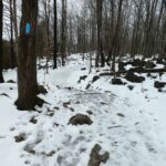 Click here for more information or to register Hosting Club: Iroquoia
Category: General Hike
Location (Google Maps): Meet in the upper parking lot at Rattlesnake Point. You will need to reserve your time at conservationhalton.ca Hike Leader(s): Karen Bergmann Click here to contact Hike Leader(s) Pace: Medium – 3 to 4 km/hr
Terrain: Moderate – Some hills and/or some poor footing
Distance: 9 kms Description
Meeting at 9:15 am in the upper parking lot at Rattlesnake Point, we will hike through the park and down into the canyon and back up into the park for a large loop. There are some rocks along the way and a couple of steep hills (going down into the canyon and then back up). Bring icers for your boots. Reserve your time at conservationhalton.ca
| 20 - Fletcher Creek Preserve, Puslinch, HCA Property
10:00 AM-1:00 PM 04/20/2026 https://hikes.brucetrail.org/event/fletcher-creek-preserve-puslinch-hca-property-2/2026-04-20/  Click here for more information or to register Hosting Club: Iroquoia
Category: General Hike
Location (Google Maps): Park at Fletcher Creek Ecological Preserve on Concession 7 just north of Gore Rd , Puslinch
HCA passes can be used or $8.50 per vehicle Hike Leader(s): Cathie Green Click here to contact Hike Leader(s) Pace: Medium – 3 to 4 km/hr
Terrain: Easy – Mostly flat and usually good footing
Distance: Approx. 10 kms Description
Easy, Moderate hike – Fletcher’s Creek Preserve is an abandoned quarry site that has been rehabilitated and is located at the headwaters of the Spencer Creek watershed We will loop hike through the preserve as well as an adjacent trail that also was part of the quarry back in the day-lots of local history- it was the area swimming hole and some still use it. Wear appropriate clothing and footwear for the weather-could be wet. Bring water, snack, hiking poles, cell
| 21 - Rattle Snake Pt Conservation Area to Kilbride Park
9:30 AM-3:00 PM 04/21/2026 https://hikes.brucetrail.org/event/rattle-snake-pt-conservation-area-to-kilbride-park-3/2026-04-21/ Click here for more information or to register Hosting Club: Iroquoia
Category: General Hike
Location (Google Maps): 9:30am SHARP meet at Kilbride parking lot behind Kilbride Public School (6611 Panton St.) by tennis courts (ignore oneway arrows) and shuttle to Rattlesnake Pt. Conservation Area. Drivers with Halton Conservation Passes will be needed to help with the shuttle and should preregister at Rattlesnake CA. Thank you! Hike Leader(s): Karen Capindale-Smith Click here to contact Hike Leader(s) Pace: Medium – 3 to 4 km/hr
Terrain: Strenuous – Hilly with steep climbs and some poor footing
Distance: +/- 16km Description
From Rattlesnake Pt. CA we will follow conservation side trails and main BT along the escarpment and descend/ascend Nassagaweya Canyon into Crawford Lake CA for lunch. From there we will wind our way through the CA and on to the calcium pits/caves at Twiss Rd. The last leg of our hike will follow the main BT thru a nature reserve to the “Kilbride Pass” and parking lot. Please wear appropriate layers and bring water, a snack and lunch. Icers may be necessary! Baked goods should be expected:)
- Halton Agreement Forest
9:30 AM-11:30 AM 04/21/2026 https://hikes.brucetrail.org/event/halton-agreement-forest-17/2026-04-21/  Click here for more information or to register Hosting Club: Iroquoia
Category: General Hike
Location (Google Maps): Meet roadside on 4th Line at 9:15 am. Up Guelph Line from the 401, turn right on 10 Side Road and follow the curve as it becomes 4th Line. Hike Leader(s): Karen Bergmann Click here to contact Hike Leader(s) Pace: Medium – 3 to 4 km/hr
Terrain: Moderate – Some hills and/or some poor footing
Distance: 8 kms Description
Meeting at 9:15 am in the small parking lot and roadside on 4th Line, we will hike several of the bike trails, including The Den and The Pines.
| 22  Seeking Out Spring Ephemerals Seeking Out Spring Ephemerals 10:00 AM-12:30 PM 04/22/2026 https://hikes.brucetrail.org/event/seeking-out-spring-ephemerals/2026-04-22/ 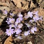 Click here for more information or to register Hosting Club: Iroquoia
Category: Wildflowers and Spring Ephemerals
Location (Google Maps): Halton Agreement Forest Hike Leader(s): Anne Armstrong Click here to contact Hike Leader(s) Pace: Leisurely – 3km/hr or less
Terrain: Easy – Mostly flat and usually good footing
Distance: Approx 8.5 Km. Description
Please join in this first Spring Ephemeral hike as we search for the first wildflower arrivals of Spring. Depending on when Spring arrives this year we will see some early Spring wildflowers. We will do a “lollipop” hike in the beautiful Halton Agreement Forest with its many hiking and biking trails. Meet at 9:45 am. for a 10:00 am. start in the northeast corner of the Woodbine/Mohawk Casino/Raceway parking lot on the west side of Guelph Line, north of Highway 401. Bring water, sunscreen and a snack. Although generally flat and wide there is one rocky section. I will send out an email the day before the hike with my contact information in the event you cancel the night before or the morning of the hike. Remember to cancel via your BTC account as well.
| 23 | 24 - Blue Mountains End-to-End in 5 – Hike 4
9:30 AM-3:30 PM 04/24/2026 https://hikes.brucetrail.org/event/blue-mountains-end-to-end-in-5-hike-4/2026-04-24/ Hike open to BTC Members only. Click here for more information or to register Hosting Club: Iroquoia, Blue Mountains
Category: General Hike
Location (Google Maps): Parking Lot Petun Conservation Area Hike Leader(s): Pati Greenwood, Jeff Dowsett Click here to contact Hike Leader(s) Pace: Medium – 3 to 4 km/hr
Terrain: Dependent on Conditions, Strenuous – Hilly with steep climbs and some poor footing
Distance: 13.1 km Description
This is an End-to-End hike series to complete the Blue Mountains section of the Bruce Trail in 5 hikes. Join for all or as many hikes as desired – you will need to register for each hike in the series which will take place on the following dates in April: 17, 18, 19, 24 and 25. Since this is a group hike, please consider your fitness level before registering. We will be walking at a pace of 3km – 4km per hour and hikers will need to keep up with the person in front of them for the duration of the hike. The hike series will also involve car shuttles and every hiker is expected to participate as drivers. Weather conditions in the spring can be changeable, so it’s best to dress in layers and come prepared for varying conditions throughout the day. Hiking boots are required and hiking poles are strongly recommended. Bring plenty of fluids and a snack. This fourth hike of the series will be 13.1 km long. Plan to arrive at the meeting place by 9:15 a.m. as we will start the car shuffle to the hike starting point at 9:30 a.m. sharp. Further details will be provided to registered hikers a few days prior to the hike.
- Hilton Falls (reservation required)
9:30 AM-12:00 PM 04/24/2026 https://hikes.brucetrail.org/event/kelso-summit-reservation-required/2026-04-24/
| 25 - Sydenham E2E in 6
7:00 AM 04/25/2026 https://hikes.brucetrail.org/event/sydenham-e2e-in-6/2026-04-25/  Hike open to BTC Members only. This is a Multi-Day HikeYou are signing up for the following dates and times:
2026-04-25 at 07:00
2026-04-26 at 07:00
2026-05-02 at 07:00
2026-05-03 at 07:00
2026-05-09 at 07:00
2026-05-10 at 07:00 Click here for more information or to register Hosting Club: Iroquoia, Sydenham
Category: Stained Glass Badge End to End Fundraiser Hike
Location (Google Maps): Day 1 – Apr 25,2026 – 27km
Meet at: Bognor Marsh Conservation Area: Enter from County Rd 18 Capacity: 10, Fee ($11.30) Coordinates: 44.538525, -80.782217
Shuttle to: Blantyre BTC Parking Area on East side of Grey Rd 12 directly across from Blantyre sign Capacity: 15, Coordinates: 44.500537,-80.632902 Day 2 – Apr 26,2026 – 26km
Meet at: Bayview Escarpment PNR. Off road parking on St. Vincent-Sydenham Townline Capacity: 5, Coordinates: 44.637539, -80.733406
Shuttle to: Bognor Marsh Conservation Area: Enter from County Rd 18 Capacity: 10, Fee ($11.30) Coordinates: 44.538525, -80.782217 Day 3 – May 2,2026 – 29.00km
Meet at: Utility Tower Lot, West side of Hwy 6/10 Capacity: 12, Coordinates: 44.556781, -80.925586
Shuttle to: Bayview Escarpment PNR. Off road parking on St. Vincent-Sydenham Townline Capacity: 5, Coordinates: 44.637539, -80.733406 Day 4 – May 3,2026 – 29.00km
Meet at: East Linton Rd, roadside parking, access to East Linton Side Trail Capacity: 3, Coordinates: 44.649257, -80.964331
Shuttle to: Utility Tower Lot, West side of Hwy 6/10 Capacity: 12, Coordinates: 44.556781, -80.925586 Day 5 – May 9,2026 – 28.00km
Meet at: Roadside parking area on Kemble Rock Rd Capacity: 4, Coordinates: 44.747360, -80.932857
Shuttle to: East Linton Rd, roadside parking, access to East Linton Side Trail Capacity: 3, Coordinates: 44.649257, -80.964331 Day 6 – May 10,2026 – 29.00km
Meet at: Bluewater Park, Wiarton, opposite the arena Capacity: 20, Coordinates: 44.742514, -81.135140
Shuttle to: Roadside parking area on Kemble Rock Rd Capacity: 4, Coordinates: 44.747360, -80.932857 Hike Leader(s): IgorT Click here to contact Hike Leader(s) Pace: Brisk – 4 to 5 km/hr, Medium – 3 to 4 km/hr
Terrain: Dependent on Conditions, Moderate – Some hills and/or some poor footing, Slippery and Steep Sections, Slippery Sections Likely, Strenuous – Hilly with steep climbs and some poor footing
Distance: 27 – 29 Description
This is a Challenger series of hikes; we will complete the entire 171.6 km of the Sydenham section in 6 hikes. You are registering for all 6 hikes, please review the dates carefully to ensure you are able to participate fully. Registration is limited to 5 persons. - This hike series is intended for experienced distance hikers only. Hikers must be able to sustain the distance and maintain a pace.
- Be very aware of your ability to join this series.
- Expect to be on-trail for 8 – 10 hours;
- There will be mud and wet conditions in many places of course in April and May, especially flooding conditions on Day 2 at Bognor Marsh and probably Day 6 in the Colpoy’s Range Road/Ancient Beach Nature Reserve BTC property area (carrying water shoes is recommended for those sections);
- Meeting time is scheduled for 7:00 am;
- Hikers must carry sufficient hydration, accessible snacks, lunch, first-aid kit, rain gear, extra socks, and possibly protective boot covers (i.e. bags);
- Hikers will be expected to participate in shuttling to and from the hike. Responsibility will be shared equally;
- Any applicable parking fees will be shared within the group.
If you have concerns, or questions please use the Contact Hike Leader form to inquire in advance of registering.
- Blue Mountains End-to-End in 5 – Hike 5
8:30 AM-2:30 PM 04/25/2026 https://hikes.brucetrail.org/event/blue-mountains-end-to-end-in-5-hike-5/2026-04-25/ Hike open to BTC Members only. Click here for more information or to register Hosting Club: Iroquoia, Blue Mountains
Category: General Hike
Location (Google Maps): Parking Lot Petun Conservation Area Hike Leader(s): Pati Greenwood, Jeff Dowsett Click here to contact Hike Leader(s) Pace: Medium – 3 to 4 km/hr
Terrain: Dependent on Conditions, Strenuous – Hilly with steep climbs and some poor footing
Distance: 16.3 km Description
This is an End-to-End hike series to complete the Blue Mountains section of the Bruce Trail in 5 hikes. Join for all or as many hikes as desired – you will need to register for each hike in the series which will take place on the following dates in April: 17, 18, 19, 24 and 25. Since this is a group hike, please consider your fitness level before registering. We will be walking at a pace of 3km – 4km per hour and hikers will need to keep up with the person in front of them for the duration of the hike. The hike series will also involve car shuttles and every hiker is expected to participate as drivers. Weather conditions in the spring can be changeable, so it’s best to dress in layers and come prepared for varying conditions throughout the day. Hiking boots are required and hiking poles are strongly recommended. Bring plenty of fluids and a snack. This fifth and final hike of the series will be 16.3 km long. Plan to arrive at the meeting place by 8:15 a.m. as we will start the car shuffle to the hike starting point at 8:30 a.m. sharp. Further details will be provided to registered hikers a few days prior to the hike.
 RAINBOW HIKE: Devil’s Punch Bowl to Red Hill (cancelled; see July 18) RAINBOW HIKE: Devil’s Punch Bowl to Red Hill (cancelled; see July 18) 9:00 AM-1:00 PM 04/25/2026 https://hikes.brucetrail.org/event/rainbow-hike-devils-punch-bowl-to-red-hill/2026-04-25/  Click here for more information or to register Hosting Club: Iroquoia
Category: Rainbow Hike
Location (Google Maps): Red Hill Valley South Parking Lot, Mud Street Hike Leader(s): Doug O’Neill Click here to contact Hike Leader(s) Pace: Medium – 3 to 4 km/hr
Terrain: Moderate – Some hills and/or some poor footing
Distance: Approx. 10-11 Description
Join this 2SLGBTQIA+ Rainbow hike from Devil’s Punch Bowl to Red Hill Parking lot. PLEASE NOTE: after you’ve completed registration for this hike, click “Contact the Hike Leader” and let us know if (a) you’re a car driver willing to shuttle a few fellow hikers at the start of the hike, or (b) if you need a ride for the shuttle. Read below for details. Note: While the hike begins at Devil’s Punch Bowl, we’ll actually meet at Red Hill Parking Lot. This hike involves a short car shuttle. If you’re arriving without a car, don’t worry—we’ll arrange rides for everyone. We’ll ask a number of drivers (in advance) if they would conisder volunteering for the shuttle. The Route: We plan to explore Devil’s Punchbowl, a geological treasure formed in the last Ice Age, after which we’ll hike westward along the main trail and a few sidetrails—passing a couple waterfalls-—ending up at Red Hill Parking Lot. Terrain: Expect a few hills, some paved (unused) roadway, and dirt paths along the Bruce Trail (main trail) overlooking the east branch of Red Hill Creek. “The Wonders of Devil’s Punchbowl in 10”
Upon arrival at Devil’s Punchbowl, Hike Leader and Geologist Ann Grindall will unravel some of the mysteries of this amazing 37-metre “ribbon waterfall” formation: • Learn how this massive amphitheatre-shaped gorge was carved into the Niagara Escarpment, exposing over 40 million years of geological history
• The visible rock strata: why it looks like a natural “layer cake” of shale, dolostone, sandstone, and limestone
• How it’s two waterfalls, not one—both formed in the last Ice Age
• Ann will be pleased to answer any questions! WHERE TO MEET: We’re meeting at 9 a.m. in the Red Hill South Parking Lot at the corner of Mud Street and Pritchard. We’ll depart at 9:15 a.m. sharp COMING BY PUBLIC TRANSITt: Take the No. 21 Heritage Green Terminal Bus (which you can catch downtown and up on the mountain) and get off at Mud & Pritchard. You’ll see the parking lot entrance across the street. Parking: Free at Red Hill South Parking Lot (at Mud & Pritchard), where we’ll meet; but $8.50 per vehicle at Devil’s Punchbowl. Passengers will split the parking costs, about $2 or $3 each (drivers shouldn’t pay). PLEASE READ: HOW THE CAR SHUTTLE WORKS
Some of you may be unfamiliar with the magic of car shuttles. Three benefits of car shuttles:
A) We minimize the number of cars — thereby reducing our footprint, which is central our Bruce Trail approach
B) It allows non-car owners to join the hike
D) Saves money on the parking lot fees. Morning plan
• All hikerswill meet at Red Hill South Parking Lot (Mud & Pritchard) by 8:45 a.m. (There’s a bus stop at the intersection.)
• We’ll quickly group ourselves into as few vehicles as possible (about 4–5 hikers per car). We’ll sort this out the week before. If you are able to drive hikers for the shuttle, let the Hike Leader know now–see “Contact” button on this page
• A small number of volunteer drivers will shuttle everyone to Devil’s Punch Bowl, where we’ll start hiking
• We ask that you don’t independently drive your own car to Devil’s Punch Bowl unless helping with the shuttle, as you could end up separated from your vehicle at the end of the hike.
• We depart Red Hill promptly at 9:00 a.m. and should arrive at Devil’s Punch Bowl by 9:15 a.m.-ish.
• Start hiking after Ann’s geological talk. At the end of the hike
• Our hike finishes back at Red Hill South
• We’ll ask for one additional volunteer driver to shuttle the morning drivers back to Devil’s Punch Bowl to retrieve their vehicles.
• Everyone else can hop into their cars or grab the bus (a 4-minute walk from the parking lot at Mud & Prichard). Complimentary Bruce Trail Rainbow badges to all participants!å PLEASE CANCEL your registration if you change your mind: This is especially important if the hike has a waitlist, since your cancellation opens a spot for someone else. Online 1. Log in to the Bruce Trail hike site with the same account you used to register.
2, Go to “My Hikes” (under your profile menu).
3, You’ll see a list of the hikes you’re registered for.
4. Click “Cancel” beside the hike you want to withdraw from.
5. You should receive a confirmation email showing your spot has been released. If you can’t log in simply use the (above) “Contact the hike leader” link. Similarly, use that link if you have any questions whatsoever about our Rainbow hikes.
|
26 - Speyside Loops
9:30 AM-12:00 PM 04/26/2026 https://hikes.brucetrail.org/event/speyside-loops-4/2026-04-26/  Click here for more information or to register Hosting Club: Iroquoia
Category: General Hike
Location (Google Maps): Meet at 9:15 at the end of 17 Sideroad, off Hwy 25, just north of Milton Hike Leader(s): Karen Bergmann Click here to contact Hike Leader(s) Pace: Medium – 3 to 4 km/hr
Terrain: Moderate – Some hills and/or some poor footing
Distance: 7 kms Description
We will hike 3 loops including the main and 3 side trails. There are lots of rocks on this trail and some possible wet areas. Bring icers for your boots. Hike is dependent on weather conditions.
 Boots and Books – The Iroquoia Bruce Trail Book Club Boots and Books – The Iroquoia Bruce Trail Book Club 10:00 AM-12:00 PM 04/26/2026 https://hikes.brucetrail.org/event/boots-and-books-the-iroquoia-bruce-trail-book-club-2/2026-04-26/  Click here for more information or to register Hosting Club: Iroquoia
Category: Boots and Books – The Iroquoia Bruce Trail Book Club
Location (Google Maps): City View Park Hike Leader(s): Ruth Moffatt Click here to contact Hike Leader(s) Pace: Leisurely – 3km/hr or less, Medium – 3 to 4 km/hr
Terrain: Dependent on Conditions, Easy – Mostly flat and usually good footing, Moderate – Some hills and/or some poor footing
Distance: Approx 8km Description
Welcome to the 2nd Iroquoia Bruce Trail Book Club – “Boots and Books” Book – The Bookwoman of Troublesome Creek by Kim Michele Richardson. Please check your local library for available copies of this book. We will hike from the parking lot at City View along the City View ST to the main trail and follow it westerly to the Iroquoia Wind Phone and return; about 8km which will take about 2-2.5 hours approximately. Please wear suitable foot wear, dress for the weather and bring poles if you use them and gaiters as the trail may be muddy depending on how spring arrives. Please bring enough snacks and water suitable for the length of the hike and duration and all the other items you require in your back pack. It is not necessary to bring the book. The next book will be Theo of Golden by Allen Levi. It may be a good idea to reserve this one now. The hike is open to everyone whether you have read the book or not but there will be spoilers. It will be open to 10 people to keep it more intimate for discussing the book. If your plans change, please cancel your registration so that people who are waitlisted may join. To cancel your registration, here is a step by step:
– Sign into your account on the Bruce Trail website.
– Go to the Hike Schedule
– Click on My Hikes tab which you should find at the top of the schedule
– Scroll to the appropriate hike you wish to cancel
– Cursor to the far right of the hike to the Action column
– Click cancel under the hike you wish to cancel.
| 27 - *Caledon Hills Sideways Badge – Hike #2
9:00 AM-3:00 PM 04/27/2026 https://hikes.brucetrail.org/event/caledon-hills-sideways-badge-hike-2/2026-04-27/ Click here for more information or to register Hosting Club: Iroquoia, Caledon Hills
Category: Special Event
Location (Google Maps): Caledon Hills – Location will be advised Hike Leader(s): Heather Zrini Click here to contact Hike Leader(s) Pace: Medium – 3 to 4 km/hr
Terrain: Strenuous – Hilly with steep climbs and some poor footing
Distance: 20 km Description
On this series of three hiking days, we will complete the five loop hikes that are required to earn the Caledon Hills Sideways Badge. If you are not interested in earning the badge, please join us for some great hiking. Hikers can sign up for individual hikes as you do not need to complete all three to participate. The dates of the three hiking days will be April 13, April 27 and May 11. We will meet at the starting point at 9am each week. Our finishing time is an approximation. On each of the first two hiking days, we will be completing two of the loops. On May 11, there will be one loop hike and if there is interest, we will hike another loop in Mono Cliffs Provincial Park. Each loop is approximately 10 km in length. For more information about the hikes, please see the link below: Sideways Badge Loop .PDF Download Our schedule will be as follows: April 13 – Hike One and Hike Five April 27 – Hike Two and Hike Three May 11 – Hike Four and a hike in Mono Cliffs Provincial Park Carpooling is encouraged. Since these are loop hikes, we will not need to shuttle. On the first day, a Provincial Park Daily Vehicle Permit Reservation will be required. We will be parking and hiking in the Forks of the Credit Provincial Park on Day 1. Passes that can be used when making the reservation can be purchased through the Ontario Provincial Park website or borrowed from your local library. If a car does not have a pass, the cost of the Daily Vehicle Permit reservation will be split between those people in that car. More information, including specific details about the meeting points, will be provided to those who sign up for the hikes. If there are any questions, please don’t hesitate to ask.
| 28  CANCELLED – Afternoon Hike – Silver Creek CANCELLED – Afternoon Hike – Silver Creek 4:30 PM-6:30 PM 04/28/2026 https://hikes.brucetrail.org/event/afternoon-hike-silver-creek/2026-04-28/  Click here for more information or to register Hosting Club: Iroquoia
Category: Afternoon/Evening Hikes
Location (Google Maps): Meet at 4:15 roadside on Fallbrook Trail at Silver Creek Conservation Area. Hike Leader(s): Karen Bergmann Click here to contact Hike Leader(s) Pace: Medium – 3 to 4 km/hr
Terrain: Moderate – Some hills and/or some poor footing
Distance: 7 kms Description
We will hike around the Roberts ST and Irwin Quarry ST and then cross the road to the main trail and around a couple of side trails that you may not have known were there.
| 29 - Dundas Driving Park to Dundas Peak and Tew’s Falls return
10:00 AM-1:00 PM 04/29/2026 https://hikes.brucetrail.org/event/dundas-driving-park-to-dundas-peak-and-tews-falls-return-4/2026-04-29/ Click here for more information or to register Hosting Club: Iroquoia
Category: Good Companions
Location (Google Maps): Dundas Driving Park Hike Leader(s): Craig Sim Click here to contact Hike Leader(s) Pace: Medium – 3 to 4 km/hr
Terrain: Moderate – Some hills and/or some poor footing, Strenuous – Hilly with steep climbs and some poor footing
Distance: 8k (approximate) Description
A moderate to strenuous, hilly, up and down hike with great views. We park and meet in Dundas Driving Park not far from the washrooms, and follow city streets to trail leading to Dundas Peak and Tew’s Falls. Wear sturdy hiking shoes or hiking boots, bring icers, layers of clothing appropriate to weather, bring water and snack. Optional outing for beverage/food after.
| 30 - Iroquoia BTC Naturalist Hike Series- Discovering Nature One Hike at a Time – Grimsby Wetlands – Meet in the parking lot at 6:45pm
6:45 PM-8:30 PM 04/30/2026 https://hikes.brucetrail.org/event/iroquoia-naturalist-hike-series-discovering-nature-one-hike-at-a-time-grimsby-wetlands-meet-in-the-parking-lot-at-645pm/2026-04-30/  Click here for more information or to register Hosting Club: Iroquoia
Category: Iroquoia BTC Naturalist Hike Series : Discovering Nature, One Hike at a Time.
Location (Google Maps): Oakes Road Dog Park – From here we will walk over to the Grimsby Wetlands. Hike Leader(s): Ruth Moffatt Click here to contact Hike Leader(s) Pace: Leisurely – 3km/hr or less
Terrain: Easy – Mostly flat and usually good footing
Distance: 2-3km Description
Please join well-known Hamilton Naturalists’ Club, Bruce McKenzie, for a tour of the award-winning Grimsby Wetlands. Bruce will describe the history of this 25 year old wetland from its beginnings as a wastewater treatment area to its notoriety for birding, now. A cinnamon teal duck was spotted here a couple of years ago and birders from all over descended into the area. Bruce was quoted as saying, “I can’t go into the property and not find someone enjoying the solitude or the nature.” Indeed, it is a peaceful oasis. Please bring water and snacks. It is recommended that everyone wear long pants that are tucked into socks, long sleeves as well as a wide brimmed hats. Sunscreen and bug spray. This is a leisurely walk and will be filled with highlights of this important wetland. Everyone must be registered to participate. Members and non-members are welcome.
| May | May |