|
Sun | Mon | Tue | Wed | Thu | Fri | Sat |
|---|
1  Kilbride to Twiss Rd return Kilbride to Twiss Rd return 9:30 AM-11:30 AM 03/01/2026 https://hikes.brucetrail.org/event/kilbride-to-twiss-rd-return/2026-03-01/ 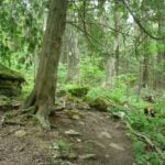 Click here for more information or to register Hosting Club: Iroquoia
Category: General Hike
Location (Google Maps): Meet in the parking lot behind the school in Kilbride at 9:15 am Hike Leader(s): Karen Bergmann Click here to contact Hike Leader(s) Pace: Medium – 3 to 4 km/hr
Terrain: Moderate – Some hills and/or some poor footing
Distance: 6.5 kms Description
Meeting in the parking lot behind the Kilbride School at 9:15 am, we will hike along the main trail to Twiss Road and turn around and hike back. There is some technical footing near the Twiss Road end of the trail, but otherwise this is a fairly easy hike. Bring icers for your boots. Hike is dependent on weather conditions.
- GeoHike – Cave Springs Conservation Area
1:00 PM-2:30 PM 03/01/2026 https://hikes.brucetrail.org/event/geohike-cave-springs-conservation-area-2/2026-03-01/ 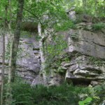 Hike open to BTC Members only. Click here for more information or to register Hosting Club: Niagara, Iroquoia
Category: In and Out
Location (Google Maps): Cave Springs Conservation Area, 3949 Cave Spring Rd, Lincoln Hike Leader(s): Kristin Hanson Click here to contact Hike Leader(s) Pace: Leisurely
Terrain: Moderate
Distance: 1.7KM Description
From the parking lot, we will hike along the Ice Cave Trail, the Margaret Reed Side Trail and the main Bruce Trail, stopping to explore and discuss the geology of the Niagara Escarpment, the Beamsville Bench wine region and the physiographic and geologic conditions that make it special. After a short in-and-out hike on the Ice Cave Trail, we will slowly begin an incline up the Margaret Reed side trail as we scale the Niagara Escarpment. We will consider the 450+million years of history we are hiking through as we make our way slowly to the top. We will stop along the way to discuss and rest. Once at the top, the terrain on the Bruce Trail is generally flat but footing may be uneven. It may be icy or wet and slippery. Hiking poles will make the ascent easier and give more stability on uneven footing. We will hike to the site of the very first blaze on the Bruce Trail and admire the views of Lake Ontario and the vineyards of Cave Spring and Malivoire wineries. Winter offers the most unobstructed views of this beautiful area. We will return the way we came. Hikers that are not registered cannot be accommodated on this hike. This hike is for members only.
 Full Moon Night Hike No.3 (Worm Moon) Full Moon Night Hike No.3 (Worm Moon) 7:00 PM-9:00 PM 03/01/2026 https://hikes.brucetrail.org/event/full-worm-moon-iroquoia-btc-night-hike/2026-03-01/ 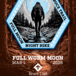 Click here for more information or to register Hosting Club: Iroquoia
Category: Moonlight Hikes
Location (Google Maps): We will meet at Dundas Drive Through Park, at 71 Cross St, Dundas. Proceed through the gate and take the road on the right to available parking on the east side of the park. I will have my tailgate up on my dark grey Acura RDX. Please plan to arrive by 6:30 so we can get everyone registered and head out Hike Leader(s): Steven White Click here to contact Hike Leader(s) Pace: Medium – 3 to 4 km/hr
Terrain: Slippery and Steep Sections, Strenuous – Hilly with steep climbs and some poor footing
Distance: 7.5 km Description
The Full Worm Moon hike is the third full moon hike of 2026. We meet at the parking area inside Dundas Drive Through Park (71 Cross St Dundas) on the east side of the park. Please plan to arrive by 6:30 to get everyone registered and on our way. We will hike out of the park along Alma St and pick up the main trail/Tews Fall Side Trail, climbing the escarpment, hiking along the top to Dundas Peak – there will many views overlooking Dundas and afford us some good views of the Full Worm Moon. A short pause for pics at the Peak and back down along the Glen Ferguson Side Trail/Tews Fall Side Trail and back to the park and our cars. Be sure to wear layered clothing, bring water, icers and poles if you use them. The ascent might be icy as this is a popular trail to the Dundas Peak. Since this the third hike in the series, some hikers will qualify for the Iroquoia Full Moon badge – new for 2026! Cost is $10 for BTC Members and $15 for non-members. Badges can be picked up at this hike if you pre-order and pay through Iroquoia Bruce Trail Club Badges – Iroquoia Bruce Trail Club Members / Click to Purchase Your Badges
https://www.zeffy.com/en-CA/ticketing/1de4dba1-aca4-44e2-b0b0-d94f1c826c42 Non-Members / Click to Purchase Your Badges
https://www.zeffy.com/en-CA/ticketing/93131d23-cc73-44fe-913d-e4938ee174c6
| 2 - Toronto Winter Blues – Hike 6
8:30 AM-1:30 PM 03/02/2026 https://hikes.brucetrail.org/event/toronto-winter-blues-hike-6/2026-03-02/ Click here for more information or to register Hosting Club: Iroquoia, Toronto
Category: General Hike
Location (Google Maps): Roadside Parking on Tenth Line Hike Leader(s): Pati Greenwood, Jeff Dowsett Click here to contact Hike Leader(s) Pace: Medium – 3 to 4 km/hr
Terrain: Dependent on Conditions, Moderate – Some hills and/or some poor footing
Distance: 12 km Description
This is a series of 6 hikes to explore various side trails in the Toronto Section of the Bruce Trail. Hikers completing all six hikes will be eligible to obtain the Toronto Side Trail Badge. Each hike requires a separate registration. The hikes in this series will take place on January 12, 26, February 2, 9, 23, and March 2. Hikes will be dependent on weather / travel conditions. All hikes will be undertaken at a medium pace. This hike, the final one of the series, will explore the Terra Cotta Side Trail as part of a loop around the Terra Cotta Conservation area. Dress in layers for the weather, wear appropriate hiking footwear, bring icers and hiking poles. Bring plenty of water or other hydration and a snack. Please arrive at the meeting place by 8:15 am. We will depart promptly at 8:30 am. If your plans change and you are unable to join the hike, please cancel your reservation in the My Hikes Section of the BTC website.
| 3 - Urban Walk – Mississauga Culham Trail : Erindale Park to Barbertown Park
9:00 AM-12:30 PM 03/03/2026 https://hikes.brucetrail.org/event/urban-walk-mississauga-culham-trail-erindale-park-to-barbertown-park/2026-03-03/ 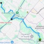 Hike open to BTC Members only. Click here for more information or to register Hosting Club: Iroquoia
Category: General Hike
Location (Google Maps): Meet at Erindale Park. The entrance to Erindale Park is 1695 Dundas Street West, Mississauga, just east of Mississauga Road. Hike Leader(s): Howard Cheng Click here to contact Hike Leader(s) Pace: Medium – 3 to 4 km/hr
Terrain: Dependent on Conditions
Distance: 13 km Description
This is leisurely in-out hike. We will walk north on the Culham Trail along the Credit River for around 6.5 km to the Barbertown Park near Barbertown Bridge. We will have a snack break there, and return through the same route to our starting point at Erindale Park. Even on the same trail, in the same park, the walk back offers a different view—the light shifts, details emerge, and familiar scenery feels newly revealed. The terrain is flat with gentle hills but may have some poor footing, muddy or slippery sections during winter condition. Bring hiking poles, icers, plenty of water or other hydration and a snack. Public washrooms are only available at Erindale Park, but nature stops will be offered during the hike.
- Full Moon Hike – Hendrie After Dark
7:30 PM-9:00 PM 03/03/2026 https://hikes.brucetrail.org/event/full-moon-hike-hendrie-after-dark/2026-03-03/ 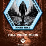 Click here for more information or to register Hosting Club: Iroquoia
Category: Moonlight Hikes
Location (Google Maps): RBG Centre Parking – across from Easterbrook’s 694 Spring Garden Road Hike Leader(s): Kathrin Koenig Click here to contact Hike Leader(s) Pace: Medium – 3 to 4 km/hr
Terrain: Dependent on Conditions, Moderate – Some hills and/or some poor footing
Distance: Approx 6 km Description
Please be at parking by 7:15 pm as the hike will leave promptly at 7:30 pm. The Full Worm Moon is the third full moon of 2026. Depending on the weather, please bring your poles and icers; dress in layers to keep warm. Bring enough water and snacks to suit your needs. Please remember to bring your headlamp or flashlight. Headlamps with a red or green light setting are the most wildlife friendly, and best for preserving your night vision. Please ensure your device is fully charged/fresh batteries to last the duration of the hike. We will start by following the outer road at Woodland Cemetery and pick up Grindstone Marsh Trail at Sunfish Pond. Following Grindstone Marsh Trail into Hendrie Valley, we will loop our way along the North and South Bridle Trail to Cherry Hill Gate and back to the cars. There is a set of stairs, one steep-ish downhill section, and a couple of smaller hills. Please leave dogs at home. This hike will qualify you for the new Iroquoia Full Moon badge! Complete three leader led-hikes in 2026, and you will qualify. Badges are $10 for BTC members/ $15 for non-members. Any questions may be directed through “Click here to contact Hike Leader” on this form. In the event you are no longer able to attend, please remove yourself from registration by following these steps: – Sign into your account on the BTC website
– Click on My Hikes under your account
– This will take you to a list of hikes you have registered for
– Scroll down to the appropriate hike and cursor over to the far right hand column under the Action column.
– Click Cancel under the hike you wish to cancel
| 4 - Hilton Falls (reservation required)
9:00 AM-12:30 PM 03/04/2026 https://hikes.brucetrail.org/event/mono-cliffs-provincial-park-6/2026-03-04/ 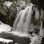 Click here for more information or to register Hosting Club: Iroquoia
Category: General Hike
Location (Google Maps): Meet at 8:45 am in the Hilton Falls parking lot Hike Leader(s): Karen Bergmann Click here to contact Hike Leader(s) Pace: Medium – 3 to 4 km/hr
Terrain: Moderate – Some hills and/or some poor footing
Distance: 8 kms Description
We will hike a loop around a variety of trails, stopping at the Falls on the way. Reserve your time at conservationhalton.ca Bring icers for your boots.
- Hidden and Hendrie Valley Trails
10:00 AM-12:00 PM 03/04/2026 https://hikes.brucetrail.org/event/hidden-and-hendrie-valley-trails/2026-03-04/ 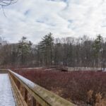 Hike open to BTC Members only. Click here for more information or to register Hosting Club: Iroquoia
Category: Good Companions
Location (Google Maps): Meet at the parking lot at 1137 HIDDEN VALLEY ROAD -east side of Road -by the Hidden Valley Park washrooms(NOT the south lot off Lemonville Rd) Hike Leader(s): Kathy Rymal Click here to contact Hike Leader(s) Pace: Medium – 3 to 4 km/hr
Terrain: Dependent on Conditions, Easy – Mostly flat and usually good footing, Moderate – Some hills and/or some poor footing, Slippery Sections Likely
Distance: 7 km Description
We will start in the Hidden Valley and make our way along the Grindstone Creek to the RBG Hendrie Valley Sanctuary. Taking the South Bridle Trail over to the boardwalk overlooking the beautiful marsh and all of its inhabitants we will make our way back along the North Bridle Trail. It is a lovely walk along the marsh. If you are a birder you might want to bring your binoculars. Spring like conditions-wet areas-dress for the weather, bring water, hiking poles, icers, snack
| 5 | 6 | 7   Caledon End to End Fundraiser for the Stained Glass Badge – Mar 7, 8, 14, 15, 2026 – Meet time is 7:45am Caledon End to End Fundraiser for the Stained Glass Badge – Mar 7, 8, 14, 15, 2026 – Meet time is 7:45am 7:45 AM-2:00 PM 03/07/2026 https://hikes.brucetrail.org/event/caledon-fundraiser-for-the-stained-glass-badge/2026-03-07/  This is a Multi-Day HikeYou are signing up for the following dates:
2026-03-07, 2026-03-08, 2026-03-14, 2026-03-15 Click here for more information or to register Hosting Club: Iroquoia, Caledon Hills
Category: Stained Glass Badge End to End Fundraiser Hike
Location (Google Maps): Day 1 – Sat, Mar 7 – Meet at Mono Community Centre, 200m south of Mono Centre (County Road 8). Park in gravel lot. https://maps.app.goo.gl/hW5VcpFWCBhAe5xq7
Shuttle to BT parking lot on the east side of the 5th Line EHS just south of the Hockley Rd https://maps.app.goo.gl/JgGmJD9tjqh1KBGJ7 ~ 21.50km Day 2 – Sun, Mar 8 – Meet in BT parking lot on the east side of the 5th Line EHS just south of the Hockley Rd https://maps.app.goo.gl/JgGmJD9tjqh1KBGJ7
Shuttle to Roadside parking on Innis Lake Rd north of Finnerty Sideroad https://maps.app.goo.gl/AYqSXpPmFtc4EytN6~ 21km Day 3 – Sat, Mar 14 – Meet at Roadside parking along the southwest shoulder of the Willoughby Rd and Escarpment Sideroad https://maps.app.goo.gl/sRMCqGTsFX2zWGNeA
Shuttle to Roadside parking on Innis Lake Rd north of Finnerty Sideroad https://maps.app.goo.gl/AYqSXpPmFtc4EytN6 – 15km Day 4 – Sun, Mar 15 – Meet at Roadside parking at Boston Mills Rd just west of the Mississauga Rd intersection. Note: driveway is private property.
Shuttle southwest shoulder of the Willoughby Rd and Escarpment Sideroad https://maps.app.goo.gl/sRMCqGTsFX2zWGNeA(includes 2.47km of Toronto section) Includes 2.5km of Toronto section – 18.50km Please save March 21 for a make-up day in the event of inclement weather. Hike Leader(s): Ruth Moffatt Click here to contact Hike Leader(s) Pace: Brisk – 4 to 5 km/hr
Terrain: Dependent on Conditions, Slippery Sections Likely, Strenuous – Hilly with steep climbs and some poor footing
Distance: 72km split over 4 days – daily distance dependent on parking capacities Description
This is a monetized hike with the proceeds going towards the Caledon Bruce Trail Club – “Preserving a ribbon of wilderness for everyone, forever.” Your badge depicting the white-tailed deer, the hike logistics, shared shuttle driving and hike guidance are all included in your fee. Since it is the intention to run a similar hike in all sections this year, why not join the Bruce Trail Conservancy if you are not already a member? Please use my code 67abd1234c568 until the end of 2025 to receive free digital maps as well as all the other great benefits included with membership. https://brucetrail.org/product-category/memberships/ Registered participants will receive a WhatsApp invitation (optional) which can be used for photo share. Please read all details for this hike to ensure it is suitable for you. The pace and terrain are particularly important details. You must be registered to participate in this group hike. You cannot just show up as there are often people on the waitlist. This is a multi-day hike – Mar 7/8, 14/15, 2026. Please save March 21 for a make-up day in case there is inclement weather. Please ensure your car is car shuttle-ready with at least 4 available seatbelts including the driver’s. We will take turns either being the shuttle driver or driving the drivers back to their cars after the hike is over. Please pack whatever food you will require for a long day hike including lunch and snacks; 2l of water minimum; first aid kit; poles if you use them; and icers. You may also wish to pack extra socks and rain gear. Remember to dress in layers. Gloves/mitts, scarf / neck gator, a toque and a puffy jacket. Consider snow shoes, depending on conditions. We will break for a morning clothing adjustment, a 10min break around 10am, 15 min lunch and an afternoon break if we are finishing after 2pm. Bio-breaks are as you need them – please let the sweep know who will wait for you. This is a 4 day group hike so it is important you keep pace with the person in front of you. We will help each other and wait for one another but please consider your physical ability before signing up for this hike. There are no drop outs – if you are not able to finish the hike you will need to arrange for transportation back to your car via taxi or Uber at your cost. The Caledon stained-glass badge will be presented on the last day. If you have to miss one of these hiking days, you may make it up on your own before the last day of the series. Since it is a group hike, it is intended that everyone who registers be present on all days. Any questions may be directed through contact on this form.
If you cannot make it, please remove yourself from registration. To cancel your registration, here is a step by step:
– Sign into your account on the BTC website
– Click on My Hikes under your account
– This will take you to a list of hikes you have registered for
– Scroll down to the appropriate hike and cursor over to the far right hand column under the Action column.
– Click Cancel under the hike you wish to cancel
- CANCELLED – Speyside to Vanderleck ST return
9:30 AM-11:30 AM 03/07/2026 https://hikes.brucetrail.org/event/speyside-to-vanderleck-st-return-5/2026-03-07/ 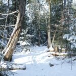 Click here for more information or to register Hosting Club: Iroquoia
Category: General Hike
Location (Google Maps): Meet at the Speyside Pear Tree parking lot on 15 Side Road at 9:15 am. Hike Leader(s): Karen Bergmann Click here to contact Hike Leader(s) Pace: Medium – 3 to 4 km/hr
Terrain: Moderate – Some hills and/or some poor footing
Distance: 8 kms Description
Meeting at 9:15 am, we will hike the main trail from Speyside, to the Al Shaw ST, Hilton Falls ST and onto the Vanderleck ST up to 17 Side Road and then return the same way. There are some very technical (rocky) sections on this hike but no major hills. Bring icers for your boots, in case we have snow. Hike is dependent on weather.
|
8 - Sunday at the Marsh – Hendrie Valley and Woodland Cemetery
8:30 AM-11:00 AM 03/08/2026 https://hikes.brucetrail.org/event/sunday-at-the-marsh-hendrie-valley-and-woodland-cemetery-2/2026-03-08/ 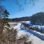 Click here for more information or to register Hosting Club: Iroquoia
Category: General Hike
Location (Google Maps): RBG Centre Parking – across from Easterbrook’s 694 Spring Garden Road Hike Leader(s): Kathrin Koenig Click here to contact Hike Leader(s) Pace: Medium – 3 to 4 km/hr
Terrain: Dependent on Conditions, Moderate – Some hills and/or some poor footing, Slippery and Steep Sections
Distance: Approx 6 km Description
Please be at parking by 8:15 am as the hike will leave promptly at 8:30 am. Depending on the weather, please bring your poles and icers; dress in layers to keep warm. Bring enough water and snacks to suit your needs. We will start by following the outer road at Woodland Cemetery and pick up Grindstone Marsh Trail at Sunfish Pond. Following Grindstone Marsh Trail into Hendrie Valley, we will loop our way along the North and South Bridle Trail to Cherry Hill Gate and back to the cars. There is a set of stairs, one steep-ish downhill section, and a couple of smaller hills. Please leave dogs at home. Easterbrook’s Hot Dog Stand is open all winter for anyone wishing to stop in for a bite to eat. Please note, the hike might be canceled due to extreme weather, or unsafe trail conditions. A cancellation email will be sent to all registered hikers. Any questions may be directed through contact on this form. In the event you are no longer able to attend, please remove yourself from registration by following these steps: – Sign into your account on the BTC website
– Click on My Hikes under your account
– This will take you to a list of hikes you have registered for
– Scroll down to the appropriate hike and cursor over to the far right hand column under the Action column.
– Click Cancel under the hike you wish to cancel
- International Women’s Day – Bayfront park to Princess Point
10:00 AM-12:00 PM 03/08/2026 https://hikes.brucetrail.org/event/international-womens-day-bayfront-park-to-princess-point/2026-03-08/  Click here for more information or to register Hosting Club: Iroquoia
Category: Special Event
Location (Google Maps): 200 Harbour Front Dr Hamilton Meet by the gazebo. Free parking Hike Leader(s): Muskan Sidana Click here to contact Hike Leader(s) Pace: Medium – 3 to 4 km/hr
Terrain: Easy – Mostly flat and usually good footing
Distance: 8 Kms Description
Celebrate International Women’s Day with an easy, social out-and-back urban hike along Hamilton’s waterfront. We will meet at 9:45 a.m. for a 10 am departure. We’ll walk from Bayfront Park to Princess Point on flat, paved paths at a relaxed pace, with time to enjoy the views and good conversation. This walk is open to all who want to mark the day by getting outside together and celebrating women, community and movement. What to Bring:
• Water, snacks, perhaps a hot beverage.
• Dress in layers. Everyone is invited to join us for a post-hike coffee/tea on James St North. Email any questions to the Hike Leader – “Click here to contact Hike Leader” on this form. If you cannot make it, please remove yourself from registration by following these steps: To cancel your registration, here is a step by step:
– Sign into your account on the BTC website
– Click on My Hikes under your account
– This will take you to a list of hikes you have registered for
– Scroll down to the appropriate hike and cursor over to the far right hand column under the Action column.
– Click Cancel under the hike you wish to cancel
| 9 - Tews Falls Loop – NEW DATE – rescheduled from Jan 30
8:30 AM-12:30 PM 03/09/2026 https://hikes.brucetrail.org/event/tews-falls-loop/2026-03-09/ Click here for more information or to register Hosting Club: Iroquoia
Category: General Hike
Location (Google Maps): Dundas Driving Park Hike Leader(s): Pati Greenwood, Jeff Dowsett Click here to contact Hike Leader(s) Pace: Medium – 3 to 4 km/hr
Terrain: Dependent on Conditions, Strenuous – Hilly with steep climbs and some poor footing
Distance: 9 km Description
Starting at the Dundas Driving Park, we will make our way to the Tews Falls Side Trail and hike to the Falls and make our way back taking in the Glen Ferguson Side Trail. Along the way, we will take in the Dundas Peak. The hike will be a lengthy and steady climb up all the way to the Falls and, of course, a steady descent all the way back. Wear layered clothing appropriate to winter weather conditions, wear hiking boots, bring icers and hiking poles. Bring water and a snack. Please arrive at the meeting place by 8:15 a.m. for an 8:30 a.m departure.
- Halton Agreement Forest
9:30 AM-12:00 PM 03/09/2026 https://hikes.brucetrail.org/event/halton-agreement-forest-16/2026-03-09/ 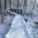 Click here for more information or to register Hosting Club: Iroquoia
Category: General Hike
Location (Google Maps): Meet at the corner of 10 Side Road and 4th Line at 9:15 am. Hike Leader(s): Karen Bergmann Click here to contact Hike Leader(s) Pace: Medium – 3 to 4 km/hr
Terrain: Moderate – Some hills and/or some poor footing
Distance: 8 kms Description
We will meet at 9:15 am at the corner of 10 SR and 4th Line, just north of Campbellville, off Guelph Line and hike the bike trails around a big loop. Bring icers for your boots. Hike is dependent on weather conditions.
| 10 | 11 - Crawford Lake Ramble
10:00 AM-12:30 PM 03/11/2026 https://hikes.brucetrail.org/event/crawford-lake-ramble/2026-03-11/ 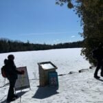 Click here for more information or to register Hosting Club: Iroquoia
Category: Good Companions
Location (Google Maps): Crawford Lake Conservation Area, 3115 Conservation Rd., Milton Hike Leader(s): Anne Armstrong Click here to contact Hike Leader(s) Pace: Leisurely – 3km/hr or less
Terrain: Dependent on Conditions, Moderate – Some hills and/or some poor footing
Distance: Approx 7.5 km, Description
An old favourite, I love hiking the trails here. With luck the new boardwalk around the lake will be finished and early Spring will be on its way. We’ll get great views across to Rattlesnake as we hike along the escarpment edge (won’t be a ramble here! ). Who knows. we might even see early returning Turkey Vultures. Bring a snack, water and icers. Poles are useful for the escarpment edge. A reservation is necessary through Halton Conservation Area Parks. I will send out a pre-hike message the day before with my contact information.
| 12 | 13 - CANCELLED – Halton Forest to Speyside (E2E)
9:30 AM-12:00 PM 03/13/2026 https://hikes.brucetrail.org/event/halton-forest-to-speyside-e2e-3/2026-03-13/ 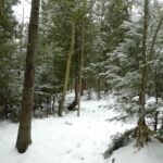 Click here for more information or to register Hosting Club: Iroquoia
Category: General Hike
Location (Google Maps): Meet at the Pear Tree parking lot at Speyside on 15 Side Road at 9:15 am. Hike Leader(s): Karen Bergmann Click here to contact Hike Leader(s) Pace: Medium – 3 to 4 km/hr
Terrain: Moderate – Some hills and/or some poor footing
Distance: 8 kms Description
We will meet at 9:15 in the Pear Tree parking lot on 15 Side Road and carpool to 6th Line at the Halton Agreement Forest and hike back along the Hilton Falls Side Trail, Al Shaw Side Trail and the main trail. This trail has some serious rocks and we cross a couple of creeks. Bring icers for your boots. Hike is dependent on weather conditions.
| 14 - Introduction to Trail Running – Dundas Valley Conservation Area (RE-SCHEDULED FROM MARCH 7)
9:00 AM-11:30 AM 03/14/2026 https://hikes.brucetrail.org/event/introduction-to-trail-running-dundas-valley-conservation-area/2026-03-14/  Click here for more information or to register Hosting Club: Iroquoia
Category: Special Event
Location (Google Maps): 134 Martin Road, Ancaster, ON. Parking beside Ancaster Baseball Matthew Kroll Field (unpaved lot) Hike Leader(s): Kristen Rose Click here to contact Hike Leader(s) Pace: Fast – 5+ km/hr
Terrain: Dependent on Conditions, Moderate – Some hills and/or some poor footing, Slippery Sections Likely
Distance: 10 km Description
*Originally scheduled for March 7; and moved to March 14 due to weather conditions* Are you curious about trail running but not sure how / where to get started? Come join a guided trail run where you can learn the ropes while taking in the beauty of Dundas Valley in a small group setting. What to expect: After a brief warmup, we’ll hit the trails and do an approximately 10 km loop through Dundas Valley Conservation Area, primarily on the Headwaters Trail. This section of trail is used for local trail races and features a hilly section known as “The Three Sisters.” To accommodate different paces and trail conditions, this will be a hike/run, where we will lightly jog flat and downhill sections and hike uphill sections, with some light instruction provided along the way. Requirements: -Registration is required for this event. -Please wear trail running shoes; road running shoes are not suitable for this trail. -Bring icers to put on your trail shoes for added traction, as the trail may be slippery at this time of year. Dress in layers for warmth. Bring water and a small snack for your needs. Recommended: -Hydration vest or run belt for carrying water and snacks. Interested in getting informed before hitting the trails? Burlington Runners Club recently announced they will be hosting a “Welcome to the Trails” series, which includes 1-2 interactive sessions covering various topics such as safety, trail etiquette, essential gear and hydration and nutrition tips. Check out @Burlingtonrunnersclub for more details + session dates. Notes: - In the event of poor weather or trail conditions, I will need to cancel this event, for safety reasons.
-
 Iroquoia E2E-in-Six / Stained Glass Badge (March 14/15, 21/22, 28/29) Iroquoia E2E-in-Six / Stained Glass Badge (March 14/15, 21/22, 28/29) 9:00 AM 03/14/2026 https://hikes.brucetrail.org/event/iroquoia-e2e-in-six/2026-03-14/ 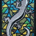 This is a Multi-Day HikeYou are signing up for the following dates:
2026-03-14, 2026-03-15, 2026-03-21, 2026-03-22, 2026-03-28, 2026-03-29 Click here for more information or to register Hosting Club: Iroquoia
Category: Stained Glass Badge Fundraiser – Iroquoia E2E-in-Six
Location (Google Maps): Day 1 – March 14, 2026/ Meet Up: Kilbride School, Panton St, Burlington (Please park in the back) 43.427756, -79.937991 (20 car spots).
Car shuttle to Hilton Falls Conservation Area.4985 Campbellville Rd, Milton 43.505705, -79.961589 (100 car spots) Hike Leader(s): Joe Borges Click here to contact Hike Leader(s) Pace: Medium – 3 to 4 km/hr
Terrain: Dependent on Conditions, Slippery and Steep Sections, Slippery Sections Likely, Strenuous – Hilly with steep climbs and some poor footing
Distance: 26.68km Description
Join us in the Iroquoia End-to-End in 6 starting in March 14, 2026 for 6 hikes. Each hike will be approximately 15-26 kms at a moderate pace.
This is suitable for intermediate to advanced hikers. (No children or pest on this hike) We will be using hiker’s vehicles to shuttle between our start and end point for each hike. As well, there will be costs at some parking location, the cost will be shared. Please note the longer distances and be physically prepared to hike at a 3-4 km pace. Proper hiking boots is a must! Bring hiking poles, food/snacks, water, hat, layers and rain gear. *Icers/Crampons are recommended. Arrive at 8:30am at the Meet Up Point for roll call/check in/drive to the starting point. Hike will start at 9 am. It is important to complete each section within a time frame to consider the shorter days. Hikers will receive their End-to-End 6 Jefferson Salamander Badge upon completion on the last hike day. If you must miss a day but can make it up before the last scheduled hike, you will still qualify for this special Jefferson Salamander badge which represents an endangered species sometimes seen in the Iroquoia section. This is a fundraising hike for the Iroquoia Bruce Trail Club. Proceeds go to the mission of protecting this ribbon of wilderness, the Bruce Trail. All logistics/scheduling/start/stop and parking (shared cost if there is a fee) and a hike leader to guide you, is included.
provided in February, closer to the start date. __________ Day 1 – March 14, 2026/
Meet Up: Kilbride School, Panton St, Burlington (Please park in the back) 43.427756, -79.937991 (20 car spots). Car shuttle to Hilton Falls Conservation Area.4985 Campbellville Rd, Milton 43.505705, -79.961589 (100 car spots) Hiking Distance: 26.68km Day 2 – March 15, 2026/
Meet Up: City View Park Waterdown (2nd entrance off Kerns Rd. South of Dundas St.) N43.352308, W79.862585 (50 car spots). Car shuttle to Kilbride School, Panton St, Burlington – Please park in the back 43.427756, -79.937991
(20 car spots). Hiking Distance: 22.64km Day 3 – March 21, 2026/
Meet Up: Davidson Blvd. Dundas N43.265251, W79.990490 (5 car spots). Car shuttle to City View Park Waterdown (2nd entrance off Kerns Rd. South of Dundas St.) N43.352308, W79.862585 (50 car spots). Hiking Distance: 21.94km Day 4 – March 22, 2026/
Meet Up: Chedoke Golf Club parking lot, Hamilton N43.246205, W79.906935 (40 car spots). Car shuttle to Davidson Blvd. Dundas N43.265251, W79.990490 (5 car spots). Hiking Distance: 15.24km Day 5 – March 28, 2026/
Meet Up: Glover Mountain Rd. Side Trail roadside parking, Stoney Creek N43.209155, W79.773801 (10 car spots). Car shuttle to Chedoke Golf Club parking lot, Hamilton N43.246205, W79.906935 (40 car spots). Hiking Distance: 17.58km Day 6 – March 28, 2026/
Meet Up: Grimsby Lions Community Pool 1 Elm St, Grimsby N43.193201, W79.565301 (30 car spots). Car shuttle to Glover Mountain Rd. Side Trail roadside parking, Stoney Creek N43.209155, W79.773801 (10 car spots).
Hiking Distance: 21.33km This will be a great challenge and accomplishment, you’ll meet some great people and enjoy our beautiful section of the Bruce Trail. But, remember to have fun!
 RAINBOW HIKE: Pi Day Rail Trail/Mountain Brow Loop RAINBOW HIKE: Pi Day Rail Trail/Mountain Brow Loop 10:00 AM-1:30 PM 03/14/2026 https://hikes.brucetrail.org/event/rainbow-hike-pi-day-rail-trail-mountain-brow-loop/2026-03-14/  Click here for more information or to register Hosting Club: Iroquoia
Category: Rainbow Hike
Location (Google Maps): Meet at the base of the Wentworth stairs Hike Leader(s): Shayne Ward Click here to contact Hike Leader(s) Pace: Medium – 3 to 4 km/hr
Terrain: Dependent on Conditions, Easy – Mostly flat and usually good footing
Distance: 10km Description
Join us for a leisurely loop and stellar views through the Hamilton portion of the Bruce Trail and Mountain Brow Blvd/Mountain Park Ave. 🌈 This queer-led, all-inclusive 2SLGBTQIA+ hike is designed to provide a safe, welcoming space for 2SGBTQIA+ hikers—including trans, gay, lesbian, bisexual, queer, Two-Spirit, intersex, asexual, allies and friends. Show up, be your authentic self! Please plan to arrive for 9:45am as we will leave at 10am prompt. We will depart from the base of the Wentworth stairs and walk the paved portion of the trail/Rail Trail to the Margate Stairs (380 stairs, metal with traction and rails). We’ll go up the stairs and take Mountain View/Concession/Mountain Park back to the Wentworth Stairs (498 stairs, metal with traction and rails) and walk down the stairs to end where we started. Please pack a lunch! Plan for a lunch break at the top of the Margate Stairs. There is a water fountain and benches there we can catch our breath before finishing the brow and Wentworth stairs. 🚗 🚌 This outing is accessible by car or public transit. Parking available on side streets, start of hike is accessible by HSR Bus #05 (Delaware) at Wentworth Ave. 🐾 Dogs are welcome on this hike! For everyone’s safety and enjoyment, pups must be fully trained and kept on a non-retractable leash at all times. Please ensure you pack out all your dog’s waste. Visit “Dogs on the Bruce Trail” for further information. https://brucetrail.org/dogs-on-the-trail/ What to Bring:
• Water, snacks, and lunch, perhaps a hot beverage.
• Sunscreen, sunglasses, comfortable walking shoes/runners.
• Dress based on weather. Free Bruce Trail Rainbow badges and stickers for all participants!
Questions? Simply click “Contact Hike Leader” on the registration form.
|
15 | 16 | 17 - St. Patrick’s Day Hike – Please wear green if you can. Meet time is 8:45am – Ancaster Little League parking lot at 286 Jerseyville Rd Ancaster
8:45 AM-11:30 AM 03/17/2026 https://hikes.brucetrail.org/event/st-patricks-day-hike-please-wear-green-if-you-can-meet-time-is-845am-chedoke-golf-club-parking-lot/2026-03-17/  Click here for more information or to register Hosting Club: Iroquoia
Category: Special Event
Location (Google Maps): Ancaster Little League Park 286 Jerseyville Road West Hike Leader(s): Ruth Moffatt Click here to contact Hike Leader(s) Pace: Medium – 3 to 4 km/hr
Terrain: Dependent on Conditions, Moderate – Some hills and/or some poor footing, Slippery Sections Likely
Distance: Approx 10km through Dundas Valley Conservation Description
♣ St. Patrick’s Day honours Irish heritage, symbolizing luck, growth and national pride. Wearing something green is traditional so please do, if you like. Please wear your icers as the path could be icy; dress in layers for warmth. Bring enough snacks and water for your needs. Our hike will take us into the DVCA where we will visit the Hermitage and the falls. An optional lunch afterward at the Trail Cafe 286 Wilson St East, Ancaster. Please let me know through contact on this form so we can make reservation. Photo: Livingston and Dora by Ruth
| 18 - Christie Lake
10:00 AM-12:30 PM 03/18/2026 https://hikes.brucetrail.org/event/christie-lake-4/2026-03-18/ Click here for more information or to register Hosting Club: Iroquoia
Category: Good Companions
Location (Google Maps): Christie Lake Conservation Area largest parking lot. Hike Leader(s): Craig Sim Click here to contact Hike Leader(s) Pace: Medium – 3 to 4 km/hr
Terrain: Moderate – Some hills and/or some poor footing
Distance: 10k (approximate) Description
Drive straight in from entrance, main parking lot to your right turn from stop sign at T junction. Either Hamilton Conservation Area membership or parking fees apply. Loop of lake, as well as across the road upstream, exact route may vary. Wear boots and bring icers. One side of loop flat, other has some moderate hills. Prepare for variable conditions and footing in winter conditions. Dress in layers appropriate to weather. Bring water and snack. Hike leaves at 10am.
| 19 - Welcoming Spring at Mountsberg Conservation Area with “Maple Town – Sweet Water”
9:30 AM-2:00 PM 03/19/2026 https://hikes.brucetrail.org/event/welcoming-spring-at-mountsberg-conservation-area-with-maple-town-sweet-water/2026-03-19/  Click here for more information or to register Hosting Club: Iroquoia, Toronto
Category: Special Event
Location (Google Maps): Conservation Halton – Mountsberg Conservation Area Hike Leader(s): Ruth Moffatt Click here to contact Hike Leader(s) Pace: Leisurely – 3km/hr or less, Medium – 3 to 4 km/hr
Terrain: Dependent on Conditions, Easy – Mostly flat and usually good footing, Moderate – Some hills and/or some poor footing
Distance: 6.5km plus optional 5.6km Description
Mountsberg Conservation Area is part of Conservation Halton. Did you know that as a Bruce Trail member you can get 50% off an annual pass? https://brucetrail.org/member-discounts/ Maple syrup production is the gateway to spring and we are here for it. Please join Toronto Bruce Trail Club – Tom Swales and Iroquoia Bruce Trail Club – Ruth Moffatt as we usher in Spring with hike around Mountsberg Conservation Area. Mountsberg is part of Conservation Halton, so if you have a pass, tickets to this event are discounted. Please follow the link below. Please book your ticket for 9:30am or you might be able to purchase tickets at the gate, if available. We will assemble in the parking area, hike the Pioneer Creek Trail 6.5km, stop for pancakes (extra cost), take in all the festivities and then proceed around the optional Lakeshore Lookout Trail 5.6Km. Tickets can be obtained in advance at the link below. https://admin.parkpassproject.com/book?inventoryGroup=1554186518&startDate=2026-03-19&inventory=1374091365&carArrivalTime=9.3&reservationType=21&screen=2&selectedDiscountGroup=ch_member&&sid= Tickets include: - Learn all about tree tapping, sap collection, syrup making and our amazing Sugar Maples!
- Learn about the history of syrup making
- Explore the Maple Trivia Trail and other Mountsberg trails
- Sample maple sugar and syrup
- Enjoy maple taffy on snow available for purchase on site
- Enjoy fresh pancakes and treats by the fireside (Additional fees apply)
- Sugar Rangers Challenge for kids! Earn your Sugar Rangers certificate by completing fun maple challenges!
- Shop for delicious maple treats at the Country Store in the sugar bush or the Gift Shop in the Discovery Centre
- Visit the Animal Barn, Raptor Trail and Raptor Centre
- Play on the natural playground
- NEW! Meet a Raptor: Stop by the Raptor Centre Flyway to meet one of our Raptor Centre staff and a bird
- Add on a wagon ride, Talons & Tailfeathers, or a maple sugar making workshop (Additional fees apply)
Please check the weather and dress accordingly. Be sure to pack whatever snacks and lunch you would like and plenty of water and/or warm beverage. Bring icers in case the trails are still icy. Need a ride? A shared ride from Toronto for a few people can be arranged and a shared ride from Niagara can be arranged. Please click the Contact link on this form.
| 20 - Caledon End To End Stain-Glass Badge
8:30 AM-12:30 PM 03/20/2026 https://hikes.brucetrail.org/event/caledon-end-to-end-stain-glass-badge/2026-03-20/ This is a Multi-Day HikeYou are signing up for the following dates and times:
2026-03-20 at 08:30
2026-03-27 at 08:30
2026-04-03 at 08:30
2026-04-10 at 08:30 Click here for more information or to register Hosting Club: Iroquoia, Caledon Hills
Category: Stained Glass Badge End to End Fundraiser Hike
Location (Google Maps): We will be meeting at Escarpment Rd an Willoughby and shuttling back to Boston Mills Rd Hike Leader(s): Anita Bergsma Click here to contact Hike Leader(s) Pace: Medium – 3 to 4 km/hr
Terrain: Moderate – Some hills and/or some poor footing, Strenuous – Hilly with steep climbs and some poor footing Description
Pace: Medium – 3 to 4 km/hr
Terrain: Dependent on Conditions, Moderate – Some hills and/or some poor footing, Strenuous – Hilly with steep climbs and some poor footing
Distance: 72 over 4 days ~ approximately 20km + per day. Itinerary will be emailed to participants upon registration Description Overview Important: Please do not register for this hike unless you can attend all four Fridays. You may only miss one day if necessary.
This series of 4 hikes will complete the Caledon section of the Bruce Trail. The organization, guidance, logistics and stained glass badge are included in your fee. Proceeds support the Caledon Bruce Trail Club, which in turn supports the Bruce Trail Conservancy’s mission to “Preserve a ribbon of wilderness, for everyone, forever.” For this E2E in 4, we will be following the main trail northbound. Please note that you are signing up for the entire series of 4 hikes as a Group Hike. The Caledon in 4 series is geared toward experienced long-distance hikers with the expectation of a 3 to 4 km/ hr. pace maintained over a 20km plus day. The section is approximately 62km, so daily distances will be based on available parking. Physical Fitness The hikes will be physical. Please ensure you have completed at least 1 to 2 20 km hikes and/or are a strong hiker who has been on the trails 5+ times this year. No dropout points have been established, and therefore, hikers who must drop out will be responsible for their transportation back to their vehicles. Please note that public transportation back to your car is nonexistent in this section. Please be honest about your hiking abilities. We will hike at a steady pace, but there will be plenty of time to take pictures and enjoy the flora and fauna of this beautiful but challenging section. This particular set of 3 hikes is intended to be Moderate. It is a group hike, so you must be able to keep pace with the person in front of you. Attire and Daily Hikes. Hikers will be expected to be wearing proper hiking boots and layered clothing with the expectation of warmer and possibly wet weather. Sufficient food and water for a full day of hiking is required, as well as hiking poles (if you use them), and wet-weather gear is strongly recommended. Bug spray is also suggested. Clothing adjustments and bio-breaks are as needed. Please let the sweep person know, and they will wait for you. A morning break, lunch and afternoon break will be scheduled. Shuttling All participants will be expected to take turns either driving to the start or driving the drivers back at the end of the day. Carpooling to our meeting spot with 2 people in the car is generally ok but we would like to minimize and equalize the driving/shuttling as much as possible so it is fair for all participants. Leave No Trace Please remember, like all hikes, this is a Leave No Trace hike. Pack out whatever you pack in. Do not toss anything onto or into any sections of the trail. We will also try to leave the trail better than we found it so we will be collecting collectable garbage we might see along the way. Daily volunteers to collect trail trash will be supplied with a bag. Dogs will not be welcome on this hike. Daily We meet for each hike at 8:30 am each day. A schedule for meetings and start locations will be sent to each participant in September. We will hike north each day. No Pets or Children. Hike Cancellations/Rescheduling The schedule is subject to change due to weather or trail closures.
- CANCELLED – Hilton Falls (reservation required)
9:30 AM-12:00 PM 03/20/2026 https://hikes.brucetrail.org/event/hilton-falls-reservation-required-4/2026-03-20/ 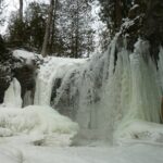 Click here for more information or to register Hosting Club: Iroquoia
Category: General Hike
Location (Google Maps): Meet in the parking lot at Hilton Falls Conservation Area at 9:15 am. Hike Leader(s): Karen Bergmann Click here to contact Hike Leader(s) Pace: Medium – 3 to 4 km/hr
Terrain: Moderate – Some hills and/or some poor footing
Distance: 8 kms Description
Meeting at 9:15 am in the parking lot, we will hike to the Falls and then around to Bent Rim 1 and back to the cars. Reserve your time at conservationhalton.ca Bring icers for your boots. Hike is dependent on weather conditions.
| 21 - Dufferin E2E Stained Glass Badge Fundraiser – Multi Day Hike Sat, Mar 21 & Sun, Mar 22, 2026 (Do not confuse this 2 day ETE with the 4 day ETE which is also starting today)
7:45 AM 03/21/2026 https://hikes.brucetrail.org/event/dufferin-e2e-stained-glass-badge-fundraiser-multi-day-hike-sat-mar-21-sun-mar-22-2026-do-not-confuse-this-2-day-ete-with-the-4-day-ete-which-is-also-starting-today/2026-03-21/  This is a Multi-Day HikeYou are signing up for the following dates:
2026-03-21, 2026-03-22 Click here for more information or to register Hosting Club: Iroquoia, Dufferin Hi-Land
Category: Stained Glass Badge End to End Fundraiser Hike
Location (Google Maps): Day 1 – Sat, Mar 21,2026 – 28.63km
Meet at: Bruce Trail parking on the 1st Line East (Emergency #716599) Snow plowed in winter. (Capacity 20)
https://maps.app.goo.gl/aV64P4QRZCDmY9hg6
Shuttle to: Mono Cliffs Community Centre, 200m south of Mono Centre (County Rd 8). Park in gravel lot. – https://maps.app.goo.gl/diTkzwJSaHVpQTPb6
We will hike northbound.
Day 2 – Sun, Mar 22,2026 – 25.64km
Meet at: Meet at: Bruce Trail parking on the 1st Line East (Emergency #716599) Snow plowed in winter. (Capacity 20)
https://maps.app.goo.gl/aV64P4QRZCDmY9hg6
Shuttle to: Roadside parking on Mulmur-Nottawasga Townline, 550 metres east of Lavender Hill Rd at the cemetery – https://maps.app.goo.gl/vijVfZpJPNSCjQrj9 Please note: There is another Dufferin ETE in 4 starting today. Please do not confuse the two series. Hike Leader(s): IgorT Click here to contact Hike Leader(s) Pace: Brisk – 4 to 5 km/hr, Medium – 3 to 4 km/hr
Terrain: Dependent on Conditions, Moderate – Some hills and/or some poor footing, Slippery and Steep Sections, Slippery Sections Likely, Strenuous – Hilly with steep climbs and some poor footing
Distance: Day1-28.63, Day2-25.64 Description
This is a monetized hike with the proceeds going towards the Dufferin Bruce Trail Club – “Preserving a ribbon of wilderness for everyone, forever.” Your badge depicting the yellow lady slipper, the hike logistics, shared shuttle driving and hike guidance are all included in your fee. Please read all details for this hike to ensure it is suitable for you. The pace and terrain are particularly important details.
You must be registered to participate in this group hike. You cannot just show up as there are often people on the waitlist. This is a multi-day hike – Mar 21 and 22, 2026. We will hike from Mono Center to Lavender in 2 days. Please understand that there is no way to predict the weather conditions. There are many hills in this section of trail and it could still be snow covered making for some difficult hiking. Please know your limit before signing up for this hike. There are no drop outs as this section of trail is often remote; there is no provision to get you back to your car. Please ensure your car is car shuttle-ready with at least 4 available seatbelts including the driver’s. We will take turns either being the shuttle driver or driving the drivers back to their cars after the hike is over. Please pack whatever food you will require for a long day hike including lunch and snacks; 2l of water minimum; first aid kit; poles if you use them; and icers. Check the weather and dress accordingly. You may also wish to pack extra socks and rain gear. Remember to dress in layers. Gloves/mitts, scarf / neck gator, a toque and a puffy jacket. Consider snow shoes, depending on conditions. We will break for a morning clothing adjustment, a 10min break around 10am, 15 min lunch and an afternoon break. Bio-breaks are as you need them – please let the sweep know who will wait for you. This is a 2 day group hike so it is important you keep pace with the person in front of you. We will help each other and wait for one another but please consider your physical ability before signing up for this hike. The Dufferin stained-glass badge will be presented on the 2nd day. Since it is a group hike, it is intended that everyone who registers be present on both days. If this two day hike has to be postponed due to inclement weather, all hikers will be notified. Any questions may be directed through contact on this form.
If you cannot make it, please remove yourself from registration to allow another person who may be on the waitlist to join the hike.
|
22  Spring Time Junior Hiker – 3km Hike Spring Time Junior Hiker – 3km Hike 10:00 AM-12:00 PM 03/22/2026 https://hikes.brucetrail.org/event/spring-time-junior-hiker-3km-hike/2026-03-22/ 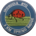 Click here for more information or to register Hosting Club: Iroquoia
Category: Junior Hiker
Location (Google Maps): Meet and park in the Grimsby Lions Community Pool parking lot at 1 Elm St at the South end of Coronation Park – Park capacity for 30 Hike Leader(s): Ruth Moffatt Click here to contact Hike Leader(s) Pace: Leisurely – 3km/hr or less
Terrain: Dependent on Conditions, Easy – Mostly flat and usually good footing, Moderate – Some hills and/or some poor footing, Slippery Sections Likely
Distance: 4km Description
It’s Spring! Please join Ruth and Asia for a Spring Junior Hiker hike. All children must be accompanied by a parent or guardian who must be registered for the hike. The hike will be leisurely but will involve climbing up the hill at a pace suitable for the group. Please bring enough water and snacks needed for a 2 hour hike. You may wish to bring poles if you like and if icey conditions still exist, bring icers. Badges will be available for $7 each for anyone who is under 13 years of age.
| 23 - Dundas Valley to Tiffany Falls and Back
8:30 AM-1:30 PM 03/23/2026 https://hikes.brucetrail.org/event/dundas-valley-to-tiffany-falls-and-back/2026-03-23/ Click here for more information or to register Hosting Club: Iroquoia
Category: General Hike
Location (Google Maps): Dundas Valley Conservation Area – Main Parking off of Governor’s Road. Parking fee required. Hike Leader(s): Pati Greenwood, Jeff Dowsett Click here to contact Hike Leader(s) Pace: Medium – 3 to 4 km/hr
Terrain: Moderate – Some hills and/or some poor footing
Distance: 13 km Description
This hike will explore the main trail and side trails through the Dundas Valley Conservation Area to Tiffany Falls and back to form a large loop. The trail may still be snow-covered so bring icers and hiking poles. Dress in layers for the weather and bring plenty to drink and a snack. Please arrive at the meeting place by 8:15 a.m. for an 8:30 a.m. departure. A parking fee will be required at the main gate. This hike will be dependent on weather conditions.
| 24 | 25 - Bent Rim 1 and 2 (E2E)
9:30 AM-12:00 PM 03/25/2026 https://hikes.brucetrail.org/event/bent-rim-1-and-2-e2e-3/2026-03-25/ 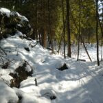 Click here for more information or to register Hosting Club: Iroquoia
Category: General Hike
Location (Google Maps): Meet in the parking lot at Hilton Falls Conservation Area. Reservation required. Hike Leader(s): Karen Bergmann Click here to contact Hike Leader(s) Pace: Medium – 3 to 4 km/hr
Terrain: Moderate – Some hills and/or some poor footing
Distance: 7 kms Description
We will meet in the Hilton Falls Parking lot and carpool to 6th Line and hike back along the two Bent Rim trails and the Hilton Falls Side Trail back to the cars. The Bent Rim trails are actually bike trails and have some rather technical (rocky) sections to them, so be prepared for some challenges. Bring icers for your boots. For those leaving their car at Hilton Falls, you will need to reserve your time at conservationhalton.ca Hike is dependent on weather conditions.
- Good Companions – Eastward and Return from Chedoke Golf Course
10:00 AM-12:30 PM 03/25/2026 https://hikes.brucetrail.org/event/good-companions-eastward-and-return-from-chedoke-golf-course-4/2026-03-25/ Click here for more information or to register Hosting Club: Iroquoia
Category: Good Companions
Location (Google Maps): Chedoke Golf Course Parking Lot, Hamilton (See map below) Hike Leader(s): Ted Bossence Click here to contact Hike Leader(s) Pace: Medium – 3 to 4 km/hr
Terrain: Dependent on Conditions, Moderate – Some hills and/or some poor footing, Slippery Sections Likely
Distance: 7.5 km Description
We will head east from the Chedoke Golf Course parking lot along the radial line and then onto the Bruce Trail (with some hills and one steep section) up the escarpment. We will need to cross busy Beckett’s Drive/Queen Street Hill. We will then follow the Bruce Trail to the top of the escarpment and then descending to the city streets and return via the tree lined streets to the radial trail and the golf course parking lot. Bring icers, water . Walk will be cancelled in case of poor weather/driving conditions (please check your email the evening before). Please arrive for 9:45 and we will start walking at 10:00 am sharp! I will email you on the day before the hike with contact information should you need to cancel after 4:00 pm on that day.
| 26 - Kilbride to Crawford Lake and back 17kms
9:00 AM-2:00 AM 03/26/2026 https://hikes.brucetrail.org/event/kilbride-to-crawford-lake-and-back-17kms/2026-03-26/ Hike open to BTC Members only. Click here for more information or to register Hosting Club: Iroquoia
Category: General Hike
Location (Google Maps): Kilbride Park Hike Leader(s): Lois Corey Click here to contact Hike Leader(s) Pace: Brisk – 4 to 5 km/hr
Terrain: Moderate – Some hills and/or some poor footing
Distance: 17 kms Description
Kilbride to Crawford Lake and Back: This is an out and back hike, no carpooling required. We will hike north from the Kilbride Community Park along Bruce Trail to Crawford Lake, where we will follow the trail along the edge of the Nottasagwa Canyon, with a brief stop at lookout. We will then loop back along side trail to the Crawford Lake Interpretive Centre where we will stop for snacks/lunch break. We will then hike side trail around Crawford Lake, rejoing the main Bruce Trail and retrace our steps back to Kilbride. Rocky terrain, hiking poles highly ecommended, along with icers if snowy/icy conditions are still in effect at that time. Please bring water and snacks/lunch. If you need to cancel, please use the registered hike cancellation process.
| 27 - City View Park to Grindstone Creek and Back
8:30 AM-1:30 PM 03/27/2026 https://hikes.brucetrail.org/event/city-view-park-to-grindstone-creek-and-back/2026-03-27/ Click here for more information or to register Hosting Club: Iroquoia
Category: General Hike
Location (Google Maps): City View Park – Parking Lot off of Kerns Road Hike Leader(s): Pati Greenwood, Jeff Dowsett Click here to contact Hike Leader(s) Pace: Medium – 3 to 4 km/hr
Terrain: Dependent on Conditions, Moderate – Some hills and/or some poor footing, Slippery and Steep Sections
Distance: 14 KM Description
This hike will explore the main trail and side trails from City View Park to Grindstone Creek and back, There will be a number of steep sections that might be slippery along the way. Bring icers and hiking poles. Dress in layers for the weather conditions. Bring plenty to drink and a snack. Please arrive at the meeting place by 8:15 am for an 8:30 am departure. The hike will be dependent on weather conditions.
| 28 - Toronto Section – Winter Magic
8:30 AM-3:30 PM 03/28/2026 https://hikes.brucetrail.org/event/toronto-section-winter-magic/2026-03-28/  Click here for more information or to register Hosting Club: Iroquoia, Toronto
Category: Good Companions
Location (Google Maps): Meeting Point at parking lot on St. Helena Rd. near its juntion with Regional Rd 25. Note: The far end of this road is posted as “No parking” ( please park on the right side across houses- close to the trail. Hike Leader(s): Corina Seceleanu Click here to contact Hike Leader(s) Pace: Medium – 3 to 4 km/hr
Terrain: Dependent on Conditions, Moderate – Some hills and/or some poor footing, Slippery Sections Likely
Distance: 22.5km Description
Hello Fellow Hikers, Please join me for an unforgettable adventure as we explore a breathtaking stretch of the Toronto section of the Bruce Trail. This exhilarating and rewarding 22.5 km route forms a mostly open loop that highlights the beauty and character of a section that’s especially close to my heart.
Our journey begins (after the car shuttle point ) at Spyside Bruce Trail Pear Tree Park On. 15 Side Road 200 M South of Halton Rd 25 . From here, we’ll head out counterclockwise along a side trail before joining the main trail. Along the way, we’ll pass several notable landmarks within Hilton Falls Conservation Area, including the enchanting Hilton Falls, its serene reservoir, and a number of impressive glacial potholes.
Once we merge onto the main trail, we’ll enjoy approximately 9 km of steady ascent all the way to Helena Road, where our adventure concludes. This stretch of the Escarpment is both rewarding and challenging, offering sweeping vistas toward Milton, Mississauga, and Toronto—views that make every step worthwhile. Expectations: This is a medium with a difficult section (last portion ) hike but we gone tackle in various pace to allow ourself to enjoy and immerse in an endless beauty of this exploration. Expect to be on-trail 6- 7 hours. Breaks will be taken for lunch, snacks, photography, and to appreciate the scenery. Meeting Time: Please arrive no later than 15 minutes prior to the scheduled time. Participant Requirements: - Intermediate/experienced hikers, comfortable with longer distances and some elevation gains.
- Must be physically fit for group hiking, and mentally for an endurance of 22.5 km
- Proper hiking boots, layered clothing, and wet/cold weather gear. Hiking poles and icers recommendated/ must.
- Essentials: Lunch, snacks, water (1.5 2L min) , and your enthusiasm
- Breaks for photography and appreciation wildlife (if lucky, as I was seeing a bald eagle) and bio breaks as well.
We’ll run a short car shuttle from Helena Rd. meeting point to the Bruce Trail Pear Tree Park parking area on 15 Sideroad, about 200 metres southwest of Halton Road 25 where the hike will start . This quick shuttle will make logistics easy and ensure we finish right on time.
|
29  Boots and Books – The Iroquoia Bruce Trail Book Club Boots and Books – The Iroquoia Bruce Trail Book Club 9:00 AM-12:00 PM 03/29/2026 https://hikes.brucetrail.org/event/boots-and-books-the-iroquoia-bruce-trail-book-club/2026-03-29/  Click here for more information or to register Hosting Club: Iroquoia
Category: Boots and Books – The Iroquoia Bruce Trail Book Club
Location (Google Maps): Chedoke Golf Club Parking lot – Access from Beddoe Dr off Studholme Rd South of Aberdeen Hike Leader(s): Ruth Moffatt Click here to contact Hike Leader(s) Pace: Leisurely – 3km/hr or less, Medium – 3 to 4 km/hr
Terrain: Easy – Mostly flat and usually good footing
Distance: Approx 8km Description
Welcome to the first Iroquoia Bruce Trail Book Club – “Boots and Books” Book – Remarkably Bright Creatures by Shelby Van Pelt – Please check your local library for available copies of this book. We will hike from the Chedoke Golf Club parking lot west on the Bruce Trail where most of our hike will be on the Chedoke Radial Trail – about 8km which will take about 2-2.5 hours approximately. Please wear suitable foot wear, dress for the weather and bring poles if you use them and icers as the trail may still be icy depending on how spring arrives. Please bring enough snacks and water suitable for the length of the hike and duration and all the other items you require in your back pack. It is not necessary to bring the book. The next book will be chosen amongst the group. The next hike will be near the end of April, once a month depending on weather. The hike is open to everyone whether you have read the book or not but there will be spoilers. It will be open to 10 people to keep it more intimate for discussing the book. If your plans change, please cancel your registration so that people who are waitlisted may join. To cancel your registration, here is a step by step:
– Sign into your account on the BTC website
– Click on My Hikes under your account
– This will take you to a list of hikes you have registered for
– Scroll down to the appropriate hike and cursor over to the far right hand column under the Action column.
– Click Cancel under the hike you wish to cancel
- Terra Cotta/Heritage Road loop
9:30 AM-12:00 PM 03/29/2026 https://hikes.brucetrail.org/event/terra-cotta-heritage-road-loop/2026-03-29/ 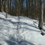 Click here for more information or to register Hosting Club: Iroquoia
Category: General Hike
Location (Google Maps): Roadside on Winston Churchill Blvd, just north of Terra Cotta Conservation Area. Meet at 9:15 am, earlier if you can, as parking is limited. Hike Leader(s): Karen Bergmann Click here to contact Hike Leader(s) Pace: Medium – 3 to 4 km/hr
Terrain: Moderate – Some hills and/or some poor footing
Distance: 8.5 kms Description
We will meet at 9:15 am roadside on Winston Churchill Blvd, just north of Terra Cotta. Parking is limited, so try to come closer to 9 am in case there are other cars. Hiking along the main trail, across Heritage Rd and around to the Rockside Side Trail and back on the main trail to the cars. This trail has some easy parts and some challenging rocky parts, so come prepared. There’s a bit of road walking. Bring icers for your boots. Hike is dependent on weather conditions.
- RAINBOW HIKE: Spring Reset Hike on the Chedokee Trail
10:00 AM-1:30 PM 03/29/2026 https://hikes.brucetrail.org/event/rainbow-hike-spring-reset-hike-on-the-chedokee-trail/2026-03-29/  Click here for more information or to register Hosting Club: Iroquoia
Category: Rainbow Hike
Location (Google Maps): Hillcrest Loop, bottom of Dundurn Stairs, next to bus stop Hike Leader(s): Doug O’Neill Click here to contact Hike Leader(s) Pace: Leisurely – 3km/hr or less
Terrain: Easy – Mostly flat and usually good footing
Distance: Approx. 7 km Description
Shake off winter and get ready for spring hiking with this uber-friendly, all-inclusive 2SLGBTQIA+ Rainbow Hike. This 7-km hike, on established park trails as well as some Bruce Trail side trails, is perfect for anyone getting back into hiking after a winter break—or for those who simply want a relatively easy outing on a Sunday morning. Expect a relaxed jaunt outdoors. There are no hills. Dog-friendly. Meeting time Please arrive by 9:45 a.m. for a 10 a.m. start
Duration: Expect a 2.5 outing, allowing for water/snack breaks.
Where we’ll meet: We’ll start at Hillcrest Loop, at the top of Dundurn Street just below the Dundurn Steps, follow the Chedokee Trail westward for about 3.5 km, and then return to our starting point—perhaps using a different side trail to change things up. This queer-led, all-inclusive hike is designed to provide a safe, welcoming space for 2SLGBTQIA+ hikers—including Two-Spirit, trans, gay, lesbian, bisexual, queer, intersex, and asexual folks, as well as allies and friends. Show up, be your authentic self, and have fun. Coming by transit? The No 7 Hillcrest Loop bus will drop you off right where we begin the hike.
Parking: street parking, especially side streets off Dundurn. What to Bring:
• Water and energizing snacks.
• Sense of humour always helps 🙂
• Dress in layers.
• Hiking boots or sturdy shoes.
• Packing rain gear is always wise.
• Gaiters are recommended if ground is wet/muddy. Free Bruce Trail Rainbow badges for first-time Rainbow hikers!
Questions? Simply click “Contact Hike Leader” on the registration form. PLEASE DON’T BE A NO-SHOW Plans change. C’est la vie. But you don’t want your hiking group waiting around for you if you’re not coming. Very simple solution: Cancel your Bruce Trail hike registration by logging into the BTC website, go to your “My Hikes” section, find the hike, and click “cancel”; if it’s last minute (under 24 hours), you can also email the Hike Leader directly as a courtesy to the volunteers.
| 30 | 31 | April | April | April | April |
