
Join us for a hike! Registration required:
All hikes available to BTC members. Some hikes are open to non-members.
TIP: The calendar view displays up to 7 hikes on a day, but often there are more. Click “More events” to see them all.
To view all Bruce Trail Conservancy Hikes click here- 01March 1, 2026

Kilbride to Twiss Rd return
https://hikes.brucetrail.org/event/kilbride-to-twiss-rd-return/Sorry, the registration cut-off time for this hike has been reached.Not a member? Click here to join today!Hosting Club: Iroquoia
Category: General Hike
Location (Google Maps): Meet in the parking lot behind the school in Kilbride at 9:15 amHike Leader(s): Karen Bergmann Click here to contact Hike Leader(s)
Pace: Medium – 3 to 4 km/hr
Terrain: Moderate – Some hills and/or some poor footing
Distance: 6.5 kmsDescription
Meeting in the parking lot behind the Kilbride School at 9:15 am, we will hike along the main trail to Twiss Road and turn around and hike back. There is some technical footing near the Twiss Road end of the trail, but otherwise this is a fairly easy hike. Bring icers for your boots. Hike is dependent on weather conditions.
GeoHike - Cave Springs Conservation Area
https://hikes.brucetrail.org/event/geohike-cave-springs-conservation-area-2/Sorry, the registration cut-off time for this hike has been reached.Not a member? Click here to join today!Hike open to BTC Members only.
Hosting Club: Niagara, Iroquoia
Category: In and Out
Location (Google Maps):Cave Springs Conservation Area, 3949 Cave Spring Rd, Lincoln
Hike Leader(s): Kristin Hanson Click here to contact Hike Leader(s)
Pace: Leisurely
Terrain: Moderate
Distance: 1.7KMDescription
From the parking lot, we will hike along the Ice Cave Trail, the Margaret Reed Side Trail and the main Bruce Trail, stopping to explore and discuss the geology of the Niagara Escarpment, the Beamsville Bench wine region and the physiographic and geologic conditions that make it special. After a short in-and-out hike on the Ice Cave Trail, we will slowly begin an incline up the Margaret Reed side trail as we scale the Niagara Escarpment. We will consider the 450+million years of history we are hiking through as we make our way slowly to the top. We will stop along the way to discuss and rest. Once at the top, the terrain on the Bruce Trail is generally flat but footing may be uneven. It may be icy or wet and slippery. Hiking poles will make the ascent easier and give more stability on uneven footing. We will hike to the site of the very first blaze on the Bruce Trail and admire the views of Lake Ontario and the vineyards of Cave Spring and Malivoire wineries. Winter offers the most unobstructed views of this beautiful area. We will return the way we came.Hikers that are not registered cannot be accommodated on this hike. This hike is for members only.
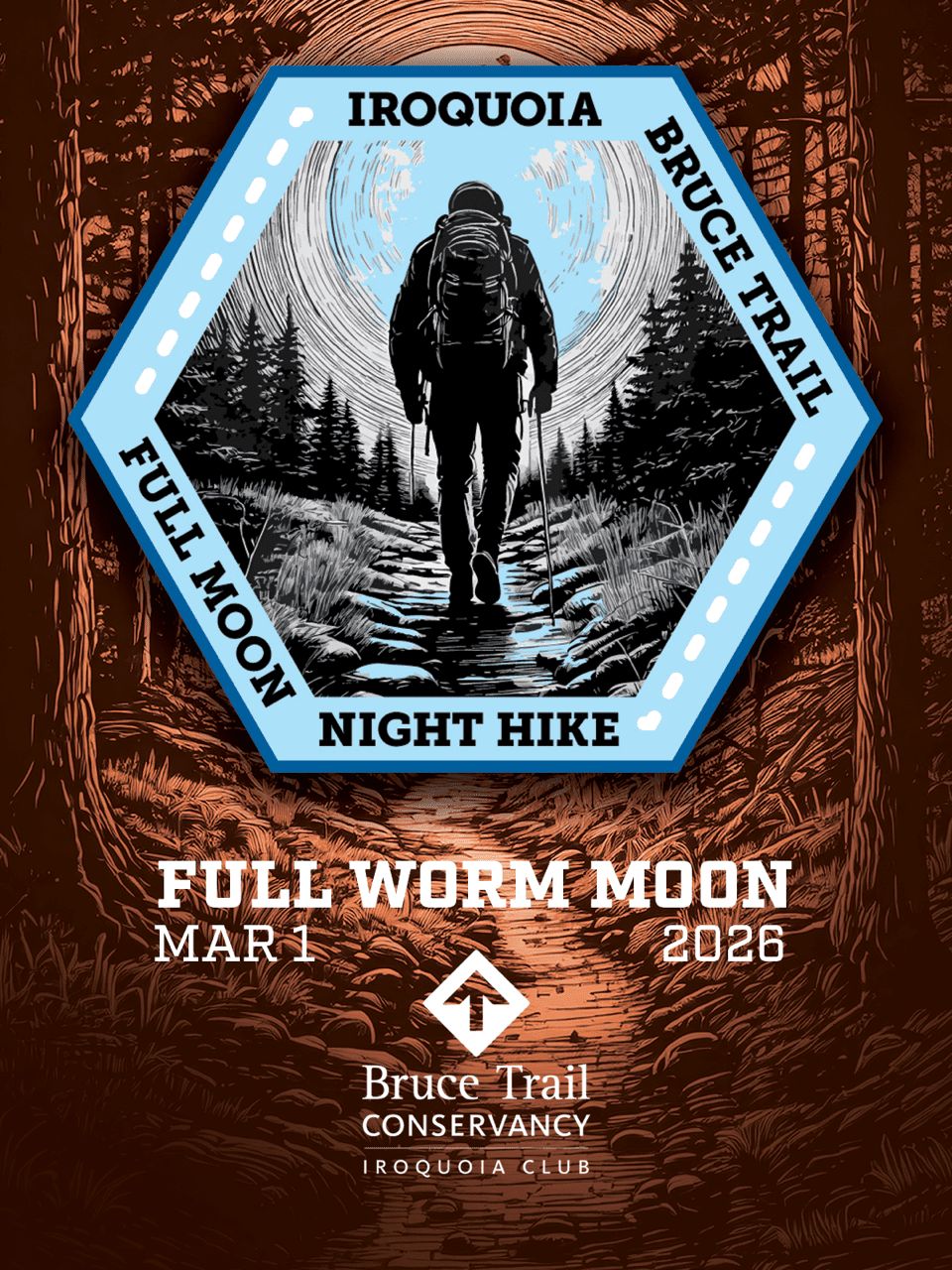
Full Moon Night Hike No.3 (Worm Moon)
https://hikes.brucetrail.org/event/full-worm-moon-iroquoia-btc-night-hike/Sorry, the registration cut-off time for this hike has been reached.Not a member? Click here to join today!Hosting Club: Iroquoia
Category: Moonlight Hikes
Location (Google Maps): We will meet at Dundas Drive Through Park, at 71 Cross St, Dundas. Proceed through the gate and take the road on the right to available parking on the east side of the park. I will have my tailgate up on my dark grey Acura RDX. Please plan to arrive by 6:30 so we can get everyone registered and head outHike Leader(s): Steven White Click here to contact Hike Leader(s)
Pace: Medium – 3 to 4 km/hr
Terrain: Slippery and Steep Sections, Strenuous – Hilly with steep climbs and some poor footing
Distance: 7.5 kmDescription
The Full Worm Moon hike is the third full moon hike of 2026. We meet at the parking area inside Dundas Drive Through Park (71 Cross St Dundas) on the east side of the park. Please plan to arrive by 6:30 to get everyone registered and on our way.We will hike out of the park along Alma St and pick up the main trail/Tews Fall Side Trail, climbing the escarpment, hiking along the top to Dundas Peak – there will many views overlooking Dundas and afford us some good views of the Full Worm Moon. A short pause for pics at the Peak and back down along the Glen Ferguson Side Trail/Tews Fall Side Trail and back to the park and our cars.
Be sure to wear layered clothing, bring water, icers and poles if you use them. The ascent might be icy as this is a popular trail to the Dundas Peak.
Since this the third hike in the series, some hikers will qualify for the Iroquoia Full Moon badge – new for 2026! Cost is $10 for BTC Members and $15 for non-members. Badges can be picked up at this hike if you pre-order and pay through Iroquoia Bruce Trail Club Badges – Iroquoia Bruce Trail Club
Members / Click to Purchase Your Badges
https://www.zeffy.com/en-CA/ticketing/1de4dba1-aca4-44e2-b0b0-d94f1c826c42Non-Members / Click to Purchase Your Badges
https://www.zeffy.com/en-CA/ticketing/93131d23-cc73-44fe-913d-e4938ee174c6 - 02March 2, 2026
Toronto Winter Blues - Hike 6
https://hikes.brucetrail.org/event/toronto-winter-blues-hike-6/Sorry, the registration cut-off time for this hike has been reached.Not a member? Click here to join today!Hosting Club: Iroquoia, Toronto
Category: General Hike
Location (Google Maps): Roadside Parking on Tenth LineHike Leader(s): Pati Greenwood, Jeff Dowsett Click here to contact Hike Leader(s)
Pace: Medium – 3 to 4 km/hr
Terrain: Dependent on Conditions, Moderate – Some hills and/or some poor footing
Distance: 12 kmDescription
This is a series of 6 hikes to explore various side trails in the Toronto Section of the Bruce Trail. Hikers completing all six hikes will be eligible to obtain the Toronto Side Trail Badge. Each hike requires a separate registration. The hikes in this series will take place on January 12, 26, February 2, 9, 23, and March 2. Hikes will be dependent on weather / travel conditions. All hikes will be undertaken at a medium pace.This hike, the final one of the series, will explore the Terra Cotta Side Trail as part of a loop around the Terra Cotta Conservation area.
Dress in layers for the weather, wear appropriate hiking footwear, bring icers and hiking poles. Bring plenty of water or other hydration and a snack.
Please arrive at the meeting place by 8:15 am. We will depart promptly at 8:30 am.
If your plans change and you are unable to join the hike, please cancel your reservation in the My Hikes Section of the BTC website.
- 03March 3, 2026
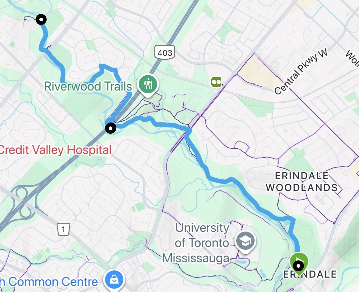
Urban Walk - Mississauga Culham Trail : Erindale Park to Barbertown Park
https://hikes.brucetrail.org/event/urban-walk-mississauga-culham-trail-erindale-park-to-barbertown-park/Sorry, the registration cut-off time for this hike has been reached.Not a member? Click here to join today!Hike open to BTC Members only.
Hosting Club: Iroquoia
Category: General Hike
Location (Google Maps): Meet at Erindale Park. The entrance to Erindale Park is 1695 Dundas Street West, Mississauga, just east of Mississauga Road.Hike Leader(s): Howard Cheng Click here to contact Hike Leader(s)
Pace: Medium – 3 to 4 km/hr
Terrain: Dependent on Conditions
Distance: 13 kmDescription
This is leisurely in-out hike.We will walk north on the Culham Trail along the Credit River for around 6.5 km to the Barbertown Park near Barbertown Bridge. We will have a snack break there, and return through the same route to our starting point at Erindale Park. Even on the same trail, in the same park, the walk back offers a different view—the light shifts, details emerge, and familiar scenery feels newly revealed.
The terrain is flat with gentle hills but may have some poor footing, muddy or slippery sections during winter condition. Bring hiking poles, icers, plenty of water or other hydration and a snack.
Public washrooms are only available at Erindale Park, but nature stops will be offered during the hike.
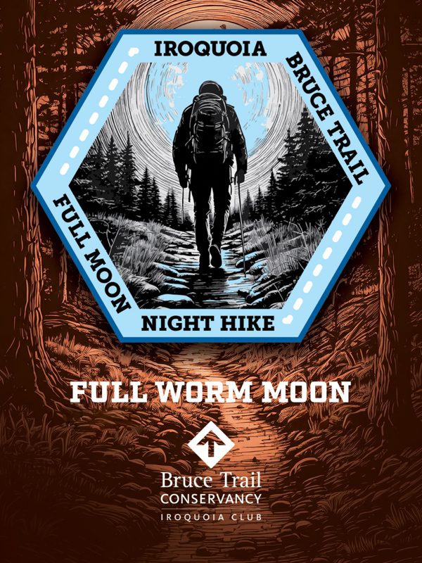
Full Moon Hike - Hendrie After Dark
https://hikes.brucetrail.org/event/full-moon-hike-hendrie-after-dark/Sorry, the registration cut-off time for this hike has been reached.Not a member? Click here to join today!Hosting Club: Iroquoia
Category: Moonlight Hikes
Location (Google Maps):RBG Centre Parking – across from Easterbrook’s 694 Spring Garden Road
Hike Leader(s): Kathrin Koenig Click here to contact Hike Leader(s)
Pace: Medium – 3 to 4 km/hr
Terrain: Dependent on Conditions, Moderate – Some hills and/or some poor footing
Distance: Approx 6 kmDescription
Please be at parking by 7:15 pm as the hike will leave promptly at 7:30 pm.The Full Worm Moon is the third full moon of 2026. Depending on the weather, please bring your poles and icers; dress in layers to keep warm. Bring enough water and snacks to suit your needs. Please remember to bring your headlamp or flashlight. Headlamps with a red or green light setting are the most wildlife friendly, and best for preserving your night vision. Please ensure your device is fully charged/fresh batteries to last the duration of the hike.
We will start by following the outer road at Woodland Cemetery and pick up Grindstone Marsh Trail at Sunfish Pond. Following Grindstone Marsh Trail into Hendrie Valley, we will loop our way along the North and South Bridle Trail to Cherry Hill Gate and back to the cars. There is a set of stairs, one steep-ish downhill section, and a couple of smaller hills.
Please leave dogs at home.
This hike will qualify you for the new Iroquoia Full Moon badge! Complete three leader led-hikes in 2026, and you will qualify. Badges are $10 for BTC members/ $15 for non-members.
Any questions may be directed through “Click here to contact Hike Leader” on this form.
In the event you are no longer able to attend, please remove yourself from registration by following these steps:
– Sign into your account on the BTC website
– Click on My Hikes under your account
– This will take you to a list of hikes you have registered for
– Scroll down to the appropriate hike and cursor over to the far right hand column under the Action column.
– Click Cancel under the hike you wish to cancel - 04March 4, 2026

Hilton Falls (reservation required)
https://hikes.brucetrail.org/event/mono-cliffs-provincial-park-6/Sorry, the registration cut-off time for this hike has been reached.Not a member? Click here to join today!Hosting Club: Iroquoia
Category: General Hike
Location (Google Maps): Meet at 8:45 am in the Hilton Falls parking lotHike Leader(s): Karen Bergmann Click here to contact Hike Leader(s)
Pace: Medium – 3 to 4 km/hr
Terrain: Moderate – Some hills and/or some poor footing
Distance: 8 kmsDescription
We will hike a loop around a variety of trails, stopping at the Falls on the way. Reserve your time at conservationhalton.caBring icers for your boots.
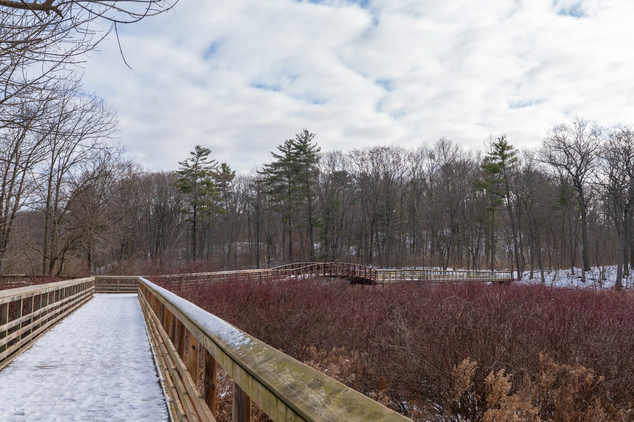
Hidden and Hendrie Valley Trails
https://hikes.brucetrail.org/event/hidden-and-hendrie-valley-trails/Sorry, the registration cut-off time for this hike has been reached.Not a member? Click here to join today!Hike open to BTC Members only.
Hosting Club: Iroquoia
Category: Good Companions
Location (Google Maps): Meet at the parking lot at 1137 HIDDEN VALLEY ROAD -east side of Road -by the Hidden Valley Park washrooms(NOT the south lot off Lemonville Rd)Hike Leader(s): Kathy Rymal Click here to contact Hike Leader(s)
Pace: Medium – 3 to 4 km/hr
Terrain: Dependent on Conditions, Easy – Mostly flat and usually good footing, Moderate – Some hills and/or some poor footing, Slippery Sections Likely
Distance: 7 kmDescription
We will start in the Hidden Valley and make our way along the Grindstone Creek to the RBG Hendrie Valley Sanctuary.Taking the South Bridle Trail over to the boardwalk overlooking the beautiful marsh and all of its inhabitants we will make our way back along the North Bridle Trail.
It is a lovely walk along the marsh. If you are a birder you might want to bring your binoculars.
Spring like conditions-wet areas-dress for the weather, bring water, hiking poles, icers, snack
- 05March 5, 2026No events
- 06March 6, 2026No events
- 07March 7, 2026
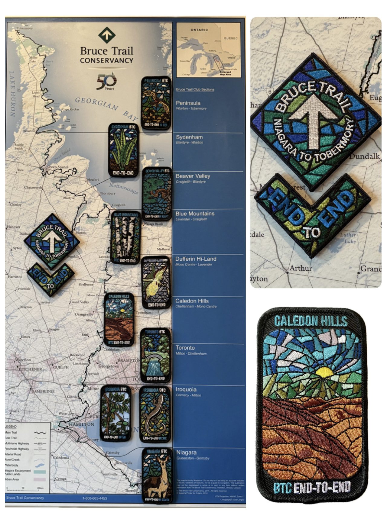
Caledon End to End Fundraiser for the Stained Glass Badge - Mar 7, 8, 14, 15, 2026 - Meet time is 7:45am
https://hikes.brucetrail.org/event/caledon-fundraiser-for-the-stained-glass-badge/Sorry, the registration cut-off time for this hike has been reached.Not a member? Click here to join today!This is a Multi-Day Hike
You are signing up for the following dates:
2026-03-07, 2026-03-08, 2026-03-14, 2026-03-15Hosting Club: Iroquoia, Caledon Hills
Category: Stained Glass Badge End to End Fundraiser Hike
Location (Google Maps): Day 1 – Sat, Mar 7 – Meet at Mono Community Centre, 200m south of Mono Centre (County Road 8). Park in gravel lot. https://maps.app.goo.gl/hW5VcpFWCBhAe5xq7
Shuttle to BT parking lot on the east side of the 5th Line EHS just south of the Hockley Rd https://maps.app.goo.gl/JgGmJD9tjqh1KBGJ7 ~ 21.50kmDay 2 – Sun, Mar 8 – Meet in BT parking lot on the east side of the 5th Line EHS just south of the Hockley Rd https://maps.app.goo.gl/JgGmJD9tjqh1KBGJ7
Shuttle to Roadside parking on Innis Lake Rd north of Finnerty Sideroad https://maps.app.goo.gl/AYqSXpPmFtc4EytN6~ 21kmDay 3 – Sat, Mar 14 – Meet at Roadside parking along the southwest shoulder of the Willoughby Rd and Escarpment Sideroad https://maps.app.goo.gl/sRMCqGTsFX2zWGNeA
Shuttle to Roadside parking on Innis Lake Rd north of Finnerty Sideroad https://maps.app.goo.gl/AYqSXpPmFtc4EytN6 – 15kmDay 4 – Sun, Mar 15 – Meet at Roadside parking at Boston Mills Rd just west of the Mississauga Rd intersection. Note: driveway is private property.
Shuttle southwest shoulder of the Willoughby Rd and Escarpment Sideroad https://maps.app.goo.gl/sRMCqGTsFX2zWGNeA(includes 2.47km of Toronto section) Includes 2.5km of Toronto section – 18.50kmPlease save March 21 for a make-up day in the event of inclement weather.
Hike Leader(s): Ruth Moffatt Click here to contact Hike Leader(s)
Pace: Brisk – 4 to 5 km/hr
Terrain: Dependent on Conditions, Slippery Sections Likely, Strenuous – Hilly with steep climbs and some poor footing
Distance: 72km split over 4 days – daily distance dependent on parking capacitiesDescription
This is a monetized hike with the proceeds going towards the Caledon Bruce Trail Club – “Preserving a ribbon of wilderness for everyone, forever.” Your badge depicting the white-tailed deer, the hike logistics, shared shuttle driving and hike guidance are all included in your fee. Since it is the intention to run a similar hike in all sections this year, why not join the Bruce Trail Conservancy if you are not already a member? Please use my code 67abd1234c568 until the end of 2025 to receive free digital maps as well as all the other great benefits included with membership. https://brucetrail.org/product-category/memberships/Registered participants will receive a WhatsApp invitation (optional) which can be used for photo share.
Please read all details for this hike to ensure it is suitable for you. The pace and terrain are particularly important details.
You must be registered to participate in this group hike. You cannot just show up as there are often people on the waitlist.
This is a multi-day hike – Mar 7/8, 14/15, 2026. Please save March 21 for a make-up day in case there is inclement weather.
Please ensure your car is car shuttle-ready with at least 4 available seatbelts including the driver’s. We will take turns either being the shuttle driver or driving the drivers back to their cars after the hike is over.
Please pack whatever food you will require for a long day hike including lunch and snacks; 2l of water minimum; first aid kit; poles if you use them; and icers. You may also wish to pack extra socks and rain gear. Remember to dress in layers. Gloves/mitts, scarf / neck gator, a toque and a puffy jacket. Consider snow shoes, depending on conditions.
We will break for a morning clothing adjustment, a 10min break around 10am, 15 min lunch and an afternoon break if we are finishing after 2pm. Bio-breaks are as you need them – please let the sweep know who will wait for you. This is a 4 day group hike so it is important you keep pace with the person in front of you. We will help each other and wait for one another but please consider your physical ability before signing up for this hike. There are no drop outs – if you are not able to finish the hike you will need to arrange for transportation back to your car via taxi or Uber at your cost.
The Caledon stained-glass badge will be presented on the last day. If you have to miss one of these hiking days, you may make it up on your own before the last day of the series. Since it is a group hike, it is intended that everyone who registers be present on all days.
Any questions may be directed through contact on this form.
If you cannot make it, please remove yourself from registration.To cancel your registration, here is a step by step:
– Sign into your account on the BTC website
– Click on My Hikes under your account
– This will take you to a list of hikes you have registered for
– Scroll down to the appropriate hike and cursor over to the far right hand column under the Action column.
– Click Cancel under the hike you wish to cancel
CANCELLED - Speyside to Vanderleck ST return
https://hikes.brucetrail.org/event/speyside-to-vanderleck-st-return-5/Sorry, the registration cut-off time for this hike has been reached.Not a member? Click here to join today!Hosting Club: Iroquoia
Category: General Hike
Location (Google Maps): Meet at the Speyside Pear Tree parking lot on 15 Side Road at 9:15 am.Hike Leader(s): Karen Bergmann Click here to contact Hike Leader(s)
Pace: Medium – 3 to 4 km/hr
Terrain: Moderate – Some hills and/or some poor footing
Distance: 8 kmsDescription
Meeting at 9:15 am, we will hike the main trail from Speyside, to the Al Shaw ST, Hilton Falls ST and onto the Vanderleck ST up to 17 Side Road and then return the same way. There are some very technical (rocky) sections on this hike but no major hills. Bring icers for your boots, in case we have snow. Hike is dependent on weather.