Categories
- 30May 30, 2026
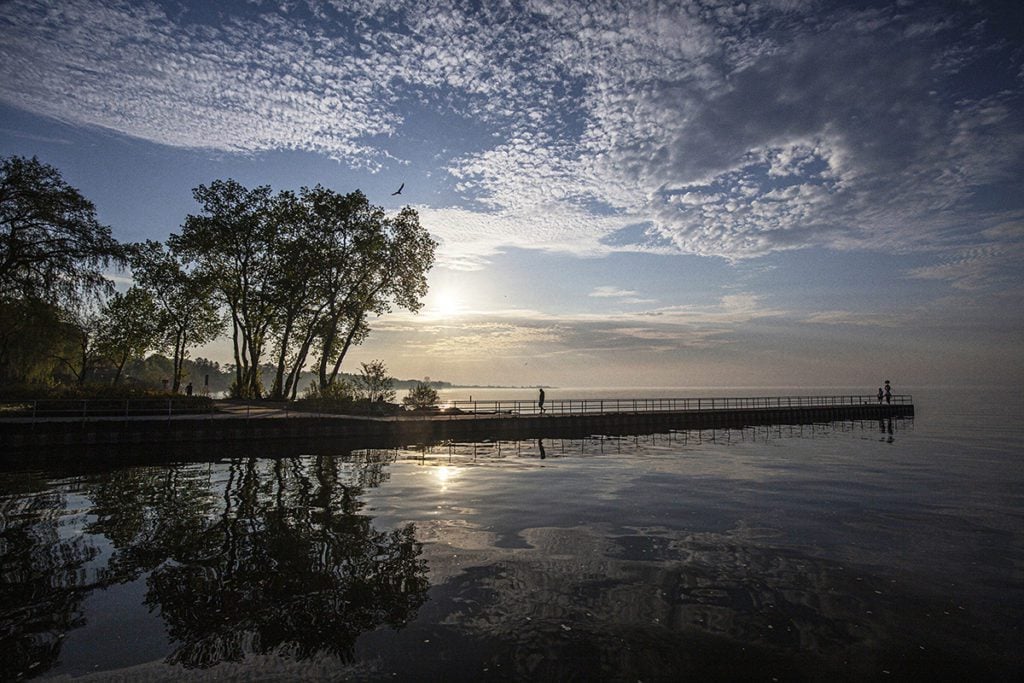
Sunrise Ceremony for the opening of Jim Tovey Lakeview Conservation Area with birding afterwards
https://hikes.brucetrail.org/event/sunrise-ceremony-for-the-opening-of-jim-tovey-lakeview-conservation-area-with-birding-afterwards/Sorry, the registration cut-off time for this hike has been reached.Not a member? Click here to join today!Hosting Club: Toronto
Category: Urban Walk
Location (Google Maps): Marie Curtis Park by the washrooms. If coming by TTC, take bus 337 from Bloor St W at Islington Ave West side at 4:39 to Lake Shore Blvd. Change to any Westbound Streetcar to Long Branch Loop. Walk 10 minutes to our meeting spot.Hike Leader(s): Andrew Proczek Click here to contact Hike Leader(s)
Pace: Leisurely (2-3 km/hr)
Terrain: Flat, Level 1 (Easy – mostly on flat, well maintained trails with hard-packed surface)
Distance (km): 5-6 kmDescription
Please join me for the opening of the long awaited Jim Tovey Lakeview Conservation Area (10 years in the making). This will be an indigenous led ceremony to honour Grandfather Sun and open the conversation area by the Eagle Spirits of the Great Waters, starting at 6 am. The ceremony will be held in the Indigenous Teaching Amphitheater.Ceremony Schedule
5:30-6:00 am – Guests arrive and light refreshments (coffee/tea/pastries).
6:00-6:15 am – Raiden Levesque of Credit Valley Conservation will open the ceremony in a good way and conduct a pipe ceremony.
6:15-6:45 am – Eagle Spirits of the Great Waters Drummers.
6:45-7:00 am – Story telling and closing out ceremony.The Jim Tovey Lakeview Conservation Area is a newly built 26-hectare greenspace that transforms a degraded section of eastern Mississauga’s Lake Ontario shoreline. Located west of Marie Curtis Park, the site restores natural functions while reconnecting people and wildlife back to nature. This new greenspace will allow lakefront access unimpeded from Marie Curtis Park in Etobicoke all the way to Lakefront Promenade Park in Mississauga.
We will be joined by expert birder, Peter Sproule, who has guided us in back to back years at Colonel Samuel Smith Park to the Arsenal lands. Starting at 7 am we will bird and hike on the new Jim Tovey Lakeview Trails as well as on the Arsenal Lands, Marie Curtis and Etobicoke Creek trails.
Free parking available at Marie Curtis Park, however, the washrooms will not open until 9 am. We will make a nature stop in the woods before arriving at the Opening Ceremony.
For the future, Jim Tovey Lakeview Conservation Area has no road access or parking lot. The closest parking area is the large west parking lot at Marie Curtis Park. For our hike on Saturday, we are meeting on the east side of Etobicoke Creek by the washrooms.
https://cvc.ca/discover-our-parks/jim-tovey-lakeview-conservation-area/#faq
Sydenham Bruce Trail E2E Run - Day 7 of 8 Only
https://hikes.brucetrail.org/event/sydenham-bruce-trail-e2e-run-day-7-of-8-only/Sorry, the registration cut-off time for this hike has been reached.Not a member? Click here to join today!Hike open to BTC Members only.
Hosting Club: Sydenham, Peninsula
Category: Sydenham E2E Trail Run
Location (Google Maps): Day 7 of the E2E Trail Run of the Sydenham Bruce Trail section. Meeting at Massie Hills Parking on 6th Concession S.Hike Leader(s): Margie Gloade; Natalie Mechalko Click here to contact Hike Leader(s)
Pace: Fast (5.5 – 7.0 km/h+): A quick pace maintained by experienced hikers or trail runners.
Terrain: Difficult: Steep ascents/descents, rocky scrambling, and some rugged escarpment paths.
Distance: About 19kmDescription
This is a single-day registration – Day 7 of 8.The Sydenham Bruce Trail Club (SBTC), in partnership with the Peninsula Bruce Trail Club (PBTC), is excited to offer its first-ever trail running Sydenham End-to-End series in 2026. Join the fun for one of the eight days in this trail running series! The trail running Sydenham E2E series will take place over 4 weekends and 8 days, starting at 7:30am. Below is the start and end location and estimated distance for this day (subject to change slightly). The group will meet at the end location, and carpool to the start of each day’s route. You are expected to participate in shuttling vehicles.
Please carefully read the details below to understand the logistics, costs, important notes, and fitness required for this challenge.
Saturday, May 30, 2026: Woodford Community Centre to Massie Hills Parking off 6th Concession S; ~19km.
- When you register here, you are registering for only one day in the series. (You also have the option of registering for the whole series for $60 even if you aren’t able to make all eight days).
- These are group trail runs. It is not a race. It is not a hike. There may be a couple different pace groups that naturally form, but you will be expected to stay with a group and wait to regroup at key locations. Runners are expected to remain between the lead runner and the sweep at all times. Anticipate each day to be running for about 3+/- hours, at a pace ranging from 7-9 min./km.
- Participants are expected to have some experience trail running as this is difficult terrain. There are also some roads, and some active farm fields. In some locations throughout Sydenham, trail running will not be permitted near livestock. On roads, runners are expected to follow standard Highway Traffic Act regulations, crossing safely and running on the shoulder, in single file, facing oncoming traffic.
- Mandatory gear includes a whistle and minimum 250ml of water carrying capacity. Trail runners will need to carry their own water and fuel.
- At approximate mid-way points each day, there will be volunteer support arranged so you can fill up water bottles. Some snacks (e.g. oranges, bananas, pretzels, cookies, water) will be provided but please plan to be self-sufficient.
- Exercise care and caution and common sense on trails, especially when passing other trail users. Let others know you are coming and that you intend to pass. Headphones/earbuds are not permitted while participating in this group run.
- Participants must be age 16 years or older.
- Dogs are not permitted.
- This trail run is for BTC members only. To become a member, click here: https://brucetrail.org/.
- The designated meeting points will not incur any personal parking fees but parking space is limited. Participants are encouraged to car pool whenever possible.
The single day fee is $20. This fee covers snacks, vehicle shuttle, volunteer support, and a donation to the PBTC hike program. There is also an option to register for the whole series ($60).
As per BTC policy, no refunds will be considered 30 days before the series starts (not after April 1, 2026).
The trail run will go ahead rain or shine, however, in extremely inclement weather, a date may be cancelled and rescheduled, ideally prior to the May 31st finish date.
Falling Water Trail Badge Event - (participants hike independently, no hike leader)
https://hikes.brucetrail.org/event/falling-water-trail-badge-event-participants-hike-independently-no-hike-leader-4/Sorry, the registration cut-off time for this hike has been reached.Not a member? Click here to join today!Hosting Club: Beaver Valley
Location (Google Maps): Meet in the Beaver Valley Ski Club Lower parking lot at the far south end of the lot, past the tennis courts (do not park by the private picnic area near the river and bridge). Map 26, Edition 31 N44.357382, W80.543331
Hike Leader(s): Glenda Collings Click here to contact the hike leader.
Pace: Medium
Terrain: Some rocky footing, Some steep sections, Strenuous
Length of Hike: 30.1km You set your own pace, however a medium pace will get the job done in a timely fashion.Description
Come and test your mettle! This is a 30.1 km loop hike that traverses the beautiful, rugged upper Beaver Valley. It’s a challenging hike during which you’ll experience all that spring has to offer, including cascading creeks, waterfalls and possibly muddy conditions. Registrants should have experience with hiking long distances over strenuous terrain.Registration will be through the Bruce Trail Conservancy Online Calendar and will open at 8:30 a.m. on March 2, 2026. The $40.00 registration fee covers the cost of the online registration fee, check point refreshments and the badge.
Further details of the event will be emailed to participants once registration is received. For more information contact beavervalleytrailactivities@gmail.com
Blue Mountains E2E #4/4
https://hikes.brucetrail.org/event/car-hike-blue-mountains-e2e-4-4/Sorry, the registration cut-off time for this hike has been reached.Not a member? Click here to join today!Hosting Club: Toronto, Blue Mountains
Category: Car Hike
Location (Google Maps):Meet up location. 320 meters north of km 55.7 a small parking area on the east side of 2nd Line. GPS N44.449741, W80.307524
Hike Leader(s): Ross Estrella Click here to contact Hike Leader(s)
Pace: Brisk (4-5 km/hr), Moderate (3-4 km/hr)
Terrain: Challenging, Hilly, Level 2 (Intermediate – some hills and uneven surfaces, rocks and roots underfoot), Level 3 (Advanced – steep hills and some scrambling over boulders), Rocky
Distance (km): 18.5kmDescription
Day 3/4 of BMBTC E2E. Hikers must complete the entire Blue Mountain section to earn and receive their badge upon completion. Missed segment/s must be made up prior to the completion of the last segment to receive your badge. Hikers who are completing their missed section of BMBTC are welcome to join. This segment will pass thru Pretty River Valley Provincial Park and we’ll take the side trail to the Bruce Trail Highest Point. Expect some challenging rolling hills, rocks and underfoot trail but you’ll be rewarded with stunning beauty of the surrounding landscape. We’ll be on a moderate to brisk pace. Day hike essentials to bring; lunch/snacks, sufficient liquid hydration of your choice, sun screen, bug spray, head covering for sun protection and dress appropriately for the forecasted weather. As we are in the middle of spring season some section could be muddy/slippery therefore, hiking poles, waterproof hiking shoe and gaiter are strongly recommended. Fifteen minutes early arrival is expected and please make sure your car ready for shuttling. We’ll shuttle to parking area on the north side of County Rd 91, 850 meters west of Concession 10. GPS N44.388871, W80.236727.Cost of badge is Ten dollars for BTC members and Fifteen dollars for non members.
Car Hike: Hockley Crest, Airport Rd to Hockley Rd
https://hikes.brucetrail.org/event/car-hike-hockley-crest-airport-rd-to-hockley-rd-2/Sorry, the registration cut-off time for this hike has been reached.Not a member? Click here to join today!Hosting Club: Toronto, Caledon Hills
Category: Car Hike
Location (Google Maps):Meet at the Bruce Trail Parking Lot on Mono 5 Sideroad on the north side of the 5th Sideroad.
Hike Leader(s): Amir Alemohammad Click here to contact Hike Leader(s)
Pace: Moderate (3-4 km/hr)
Terrain: Flat, Hilly, Level 2 (Intermediate – some hills and uneven surfaces, rocks and roots underfoot), Variable
Distance (km): 12-14 kmDescription
Join us for a out and back hike in Hockley Crest. The route explores a diverse landscape of dense sugar maple and beech hardwood forests, open grassy meadows, active pine plantations, and steep ravines. We will explore the main and side trails of the Bruce Trail. Bring at least two liters of water and your favorite snacks. Boots mandatory, poles recommended. Be prepared for the ticks and bugs. This is a joint hike with the ORTA.Seaton Trail Pickering
https://hikes.brucetrail.org/event/car-hike-bethesda-trail-richmond-hill-36/Sorry, the registration cut-off time for this hike has been reached.Not a member? Click here to join today!Hosting Club: Toronto
Location (Google Maps): Seaton Trail Parking Lot, Pickering
Hike Leader(s): Mohammad Aghamiri Click here to contact Hike Leader(s)
Pace: Moderate (3-4 km/hr)
Terrain: Hilly, Level 2 (Intermediate – some hills and uneven surfaces, rocks and roots underfoot), Variable
Distance (km): 14-15 kmDescription
We will hike along Seaton trail and enjoy the lovely scenery of forest and river.
• Please dress appropriately for the weather.
• We will have short water, picture, Bio and a 15 minute snack breaks. Everyone is welcome!Please bring lots of water and snacks ,hiking poles are recommended
phone number for the day of hike 289 588 6482
Seven Rivers Hike Badge Series- Hike 1
https://hikes.brucetrail.org/event/seven-rivers-hike-badge-series-hike-1/Sorry, the registration cut-off time for this hike has been reached.Not a member? Click here to join today!Hosting Club: Dufferin Hi-Land
Category: General Hike
Location (Google Maps): Pretty River Blue Montains Section Map 23
Parking: “Snowdrifters Parking Area” or snowmobile parking lot at 549949 Pretty River Rd, Nottawa which is just west of Clearview Collingwood Townline and North of Duntroon.Hike Leader(s): Tristan Goguen and Pat Foley Click here to contact Hike Leader(s)
Pace: Medium
Terrain: Moderate
Distance: 11.9 KmDescription
Today we will walk north bound on the main trail starting at Pretty River Rd. Where the trail crosses 6th side rd we will head west for 500 meters to pick up the Russ McConnell Side Trail south bound. We will re- join the main trail where these trails again intersect. A short while later we will then follow the Pretty River Side Trail to where it again intersects with the main trail. We will then follow the main trail back to Pretty River Road where we will head east back to the parking lot.Please be prepared for the weather, we will hike rain or shine. Ensure you have enough water, lunch and snacks, sunscreen and bug repellent. Hats and sunglasses are recommended as are poles and sturdy shoes.
For those wishing to earn their 7 Rivers – complete all 7 hikes, badges will be available on the last day from the hike leaders at a cost of $10 for members and $15 for non members.
Anyone completing make-up hikes may log their hikes and apply directly to the Dufferin Highlands BT Club for the badge.
Escarpment Sideroad Trail Reroute
https://hikes.brucetrail.org/event/escarpment-sideroad-trail-reroute/Sorry, the registration cut-off time for this hike has been reached.Not a member? Click here to join today!Hosting Club: Caledon Hills
Category: Trail Development Project
Location (Google Maps): Just west of Highway 10 at the corner of Escarpment Side road and Willoughby RoadHike Leader(s): Lynn Dobson Click here to contact Hike Leader(s)
Terrain: Strenuous – hilly with steep climbs and some poor footing
Description
The work to be done will be moving materials to a variety of work sites to build boardwalks and bridges. There will also be some benching along a steep slope to make an easier hiking trail. If all goes well the team can also blaze the new trail on the same day.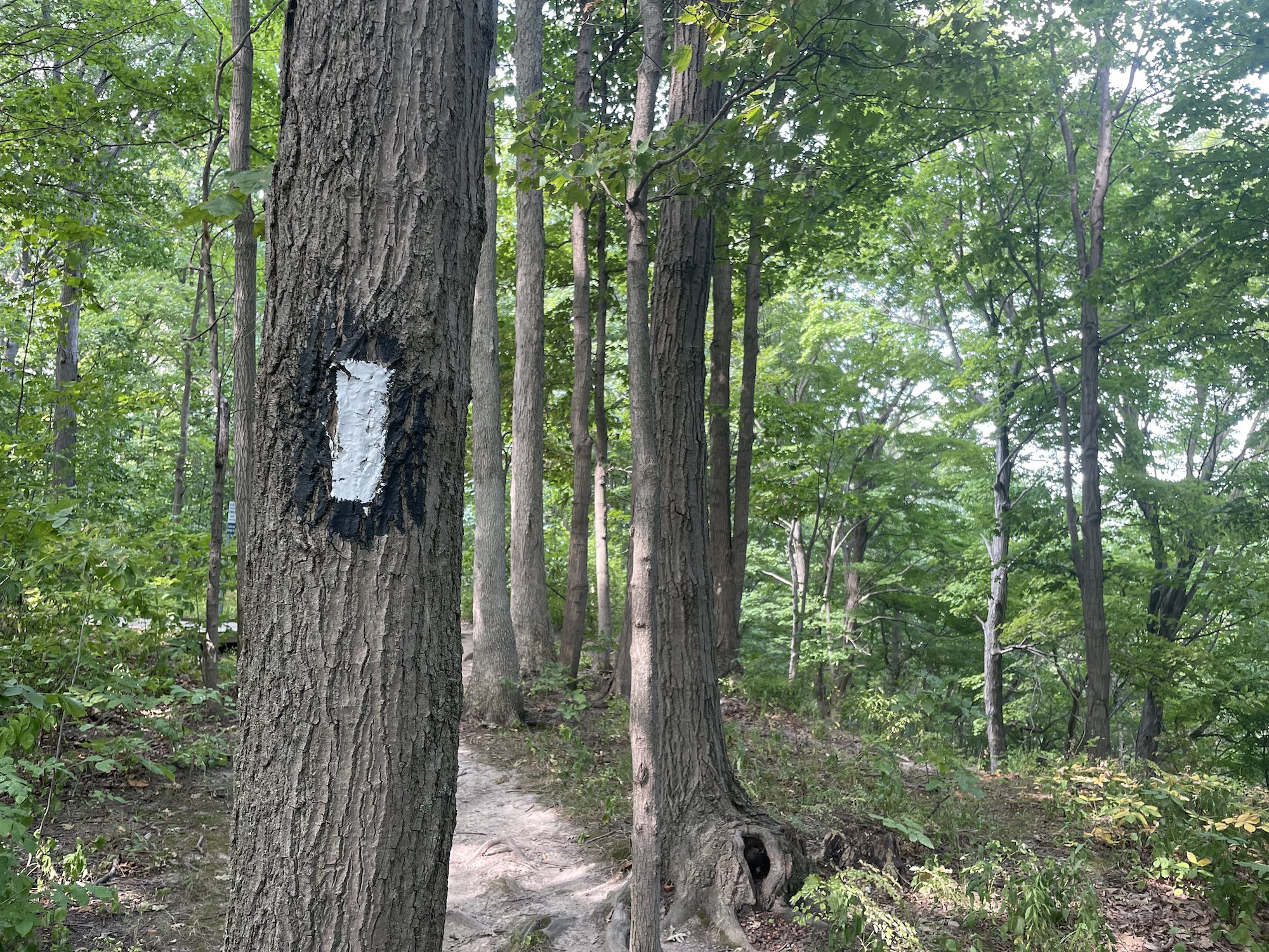
DeCew/12 Mile Creek Loop
https://hikes.brucetrail.org/event/decew-12-mile-creek-loop/Sorry, the registration cut-off time for this hike has been reached.Not a member? Click here to join today!Hosting Club: Niagara
Category: Loop
Location (Google Maps): Meet at DeCew House Heritage Park, DeCew Rd, ThoroldHike Leader(s): Margaret Northfield Click here to contact Hike Leader(s)
Pace: Medium 3- 4 km/hr
Terrain: Moderate: some hills and some poor footing
Distance: 12kmDescription
We will hike from DeCew towards Brock University. We will go down Hydro Hill to 12 Mile Creek. We will follow the creek north to Glendale Ave, cross over the creek and loop back through Short Hills Provincial Park, crossing the Laura Secord bridge to DeCew.Birding Hike #3
https://hikes.brucetrail.org/event/birding-hike-2/Sorry, the registration cut-off time for this hike has been reached.Not a member? Click here to join today!Hosting Club: Blue Mountains
Category: Organized Hike
Location (Google Maps): We will meet at Tim’s and carpool to parking on 9/10 Sideroad Nottawasaga south of Nottawasaga Bluffs CA.Hike Leader(s): Jim Lewis Click here to contact Hike Leader(s)
Pace: Leisurely – 3 km/hr. or less
Terrain: Moderate – Some hills and/or some poor footing
Distance: 5kmDescription
Please join us for this birding hike, led by birding enthusiast Kate Jaczko. We will meet at Tim’s on 1st Street in Collingwood and carpool to Conc 10 Nottawasaga and follow the trail east past a beautiful meadow where Bobolinks nest. We will look for singing males defending their territories. There is a mix of hardwoods, cedars, and a sparkling stream that should provide more birds and spring wildflowers. We will loop back to our cars having completed about a 5 km hike. Bring Your binoculars!
Spaces will be limited to 15 hikers, so please register in advance.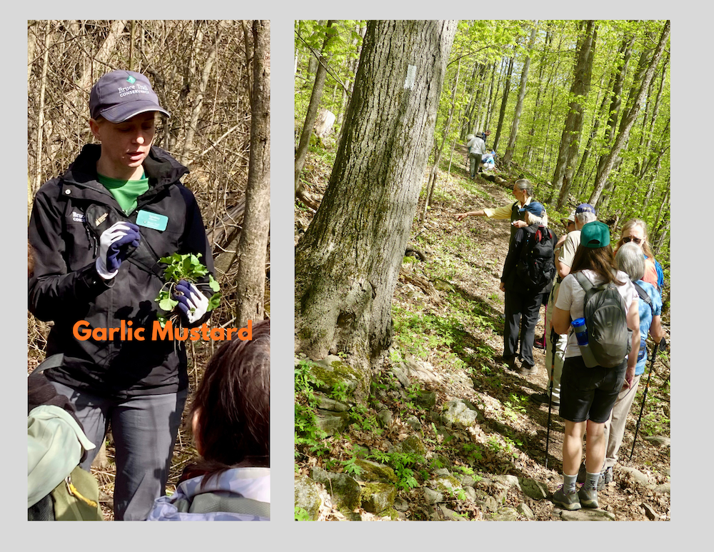
Double Day: hike and work party
https://hikes.brucetrail.org/event/double-day-hike-and-work-party/Sorry, the registration cut-off time for this hike has been reached.Not a member? Click here to join today!Trip Information
Departure Time: 09:30
Return to City Time: 17:00
Departure Point: York Mills Bus PickupOptional Items
Hosting Club: Toronto
Category: Bus Hike
Location (Google Maps): Halton HillsHike Leader(s): Janet Patterson; Monica Pasquali; George Lennon Click here to contact Hike Leader(s)
Pace: Leisurely (2-3 km/hr)
Terrain: Level 1 (Easy – mostly on flat, well maintained trails with hard-packed surface), Variable
Distance (km): approx 3 kmDescription
This outing is an experiment. It is a family-friendly event offering our members the chance to “give back”. NOTE: discounted bus fee ($20) and children accompanied by an adult ride the bus for free. Register your child/childern by selecting “add additional hiker” and adding their information (select “child” and no fare will be charged).The bus will deliver us to the trail head (Duff Pit), and on arrival, we will split into two groups. Group A will go off on a guided hike with members of the club’s Biodiversity Team, observing, identifying and perhaps even photographing the delightful flora and fauna we can discover. This will be a great way to gain points towards your Biodiversity Naturalist badge.
Meanwhile, Group B will learn to identify and pull out the invasive garlic mustard that is proliferating there. We will have members of the Land Stewardship team and BTC Conservation Ambassadors guiding and supervising us, so no previous experience is necessary!
We’ll meet back at the trail head for lunch, after which the groups will switch roles.
So everyone will get a chance to explore the trails AND contribute to stewardship activities that support our ongoing efforts preserve and enhance the natural ecosystems along the trail. There’s even a badge for this!
We hope you will support this new initiative.
What to bring (& wear):
- garden gloves if you have them
- Plenty of water (1L minimum)
- Lunch, snacks
- Sunscreen, insect repellent, wide-brimmed hat, long sleeves and long pants
- Sturdy shoes or boots
- A few reusable shopping bags if you have some
Splitrock Narrows Geology Hike
https://hikes.brucetrail.org/event/splitrock-narrows-geology-hike/Sorry, the registration cut-off time for this hike has been reached.Not a member? Click here to join today!Hosting Club: Dufferin Hi-Land
Category: General Hike
Location (Google Maps): Meet at Splitrock Narrows parking to hike the Splitrock Side Trail.Hike Leader(s): Lynda Bloom Click here to contact Hike Leader(s)
Pace: Leisurely
Terrain: Easy
Distance: 5 kmDescription
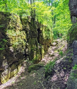
We will hike into the accessible crevices to see fossils (no dinosaurs!) and the lush mix of species that are at home along the rocky shelves of the Niagara Escarpment. Roughly 14,000 years ago the entire area was covered by glaciers and we will chat with a professional geologist about how the melting water formed today’s landscape. There will be time to admire the views and trees. The white cedars, some more than 1,000 years old, clinging to weathered rock faces are impressive. No dogs, please.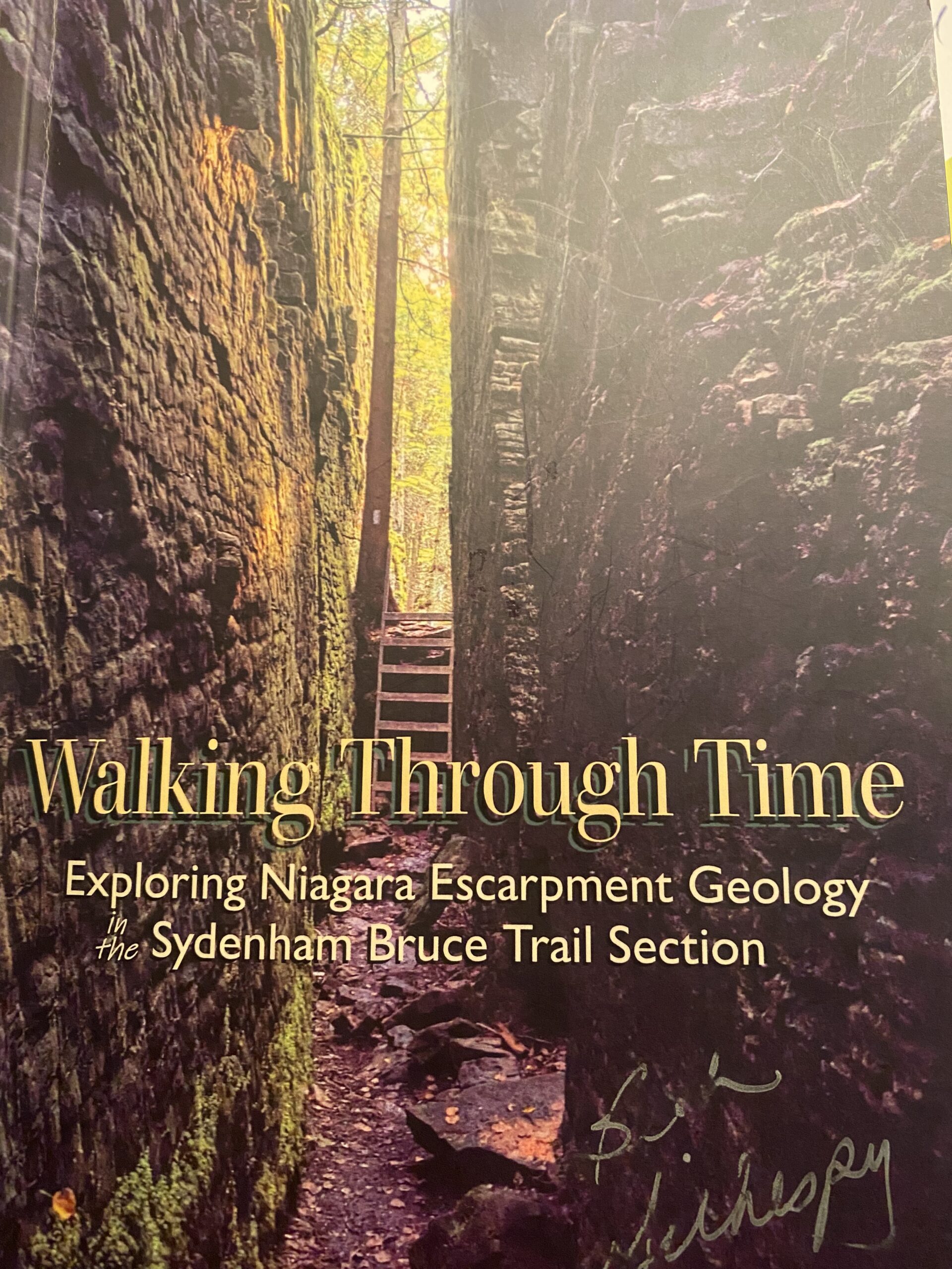
Geology Hike #6A Palisades
https://hikes.brucetrail.org/event/geology-hike-6a-palisades-2/Sorry, the registration cut-off time for this hike has been reached.Not a member? Click here to join today!Hosting Club: Sydenham
Category: Geology Hike
Location (Google Maps):Harrison Park Inn parking lot, 137 Second Avenue East Owen Sound
Hike Leader(s): Karen Buschert Click here to contact Hike Leader(s)
Pace: Leisurely: 3 km/h or less
Terrain: Moderate: Some hills and/or poor footing, Strenuous: Hilly with steep climbs and some poor footing., There might be muddy sections., There might be sections with water on the trail.
Distance: 6 km. approxDescription
This is part A of Geology Hike #6 (Palisades section) following Beth Gilhespy’s book “Walking Through Time” in the Sydenham Bruce Trail Section. You will be immersed in a wilderness of towering rock, talus boulders and thick tree cover. Scenic viewpoint from Raven’s Nest Sidetrail.
This is a balloon hike, starting from the parking lot at Harrison Park Inn, hiking north along the Harrison Park sidetrail up to 7th Avenue East access to the main trail and returning back on the Palisades side trail and back to our starting point.Please bring water and a snack if you wish. Proper hiking footwear and hiking poles are recommended.
10:00 Malivoire Wine Co Hike and Wine Tasting Experience
https://hikes.brucetrail.org/event/1000-malivoire-wine-co-hike-and-wine-tasting-experience-3/Sorry, the registration cut-off time for this hike has been reached.Not a member? Click here to join today!Hike open to BTC Members only.
Hosting Club: Niagara
Category: Loop
Location (Google Maps): Park at Malivoire Wine Co 4260 King St, Lincoln ONHike Leader(s): Sam Rutherford Click here to contact Hike Leader(s)
Pace: Medium 3- 4 km/hr
Terrain: Moderate: some hills and some poor footing
Distance: 5 kmsDescription
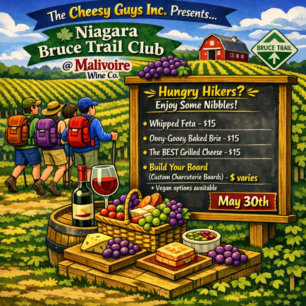
We will hike a loop on the main trail from Malivoire Wine Co to the Margaret Reed Side Trail at Cave Springs Conservation Area and back to Malivoire Wine Co by 11:30. Upon return we will enjoy a private structured wine tasting led by one of the knowledgeable and friendly winery staff from 11:30 to 12:00 noon. The cost for the tasting experience is $15.00 per person (tax and tip included). Please bring your $15.00 with you as I will collect it prior to the tasting to simplify the payment to Malivoire Wine Co. Thank you.The Cheesy Guys are at Malivoire on the weekends so if you choose to enjoy some nibbles please check out the poster for some interesting selections and prices. Food is extra. You can find them on INSTAGRAM – https://www.instagram.com/thecheesyguysinc/
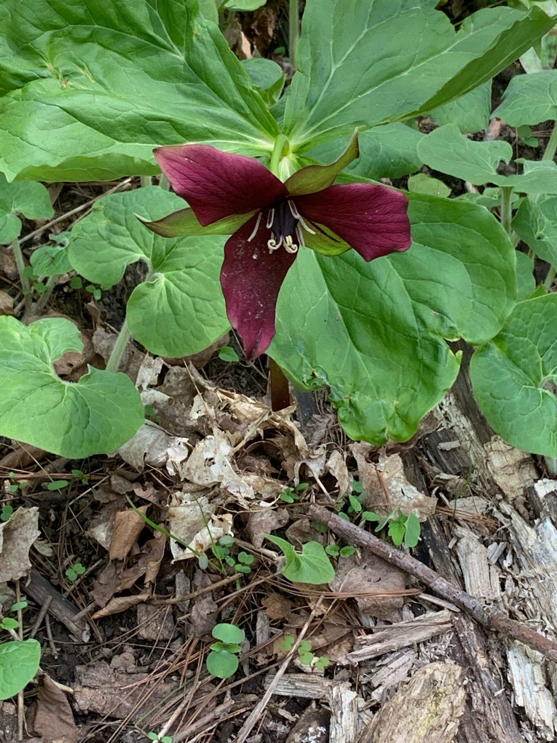
Hunting Spring Ephemerals
https://hikes.brucetrail.org/event/hunting-spring-ephemerals/Sorry, the registration cut-off time for this hike has been reached.Not a member? Click here to join today!Hosting Club: Iroquoia
Category: General Hike
Location (Google Maps): Hilton Falls Conservation AreaHike Leader(s): Anne Armstrong Click here to contact Hike Leader(s)
Pace: Leisurely – 3km/hr or less
Terrain: Moderate – Some hills and/or some poor footing
Distance: Approx. 9 – 10 km.Description
Hilton Falls is a beautiful conservation area not only for its waterfalls but also the profusion of Spring Ephemerals which grow along its many trails. We’ll be on the hunt for late blooming Spring wildflowers. Please meet in the main parking lot of Hilton Falls Conservation Area located on Campbellville Rd. between Guelph Line and Highway 25 by 9:45 am. for a 10:00 am. start. Bring water, a snack, sunscreen and insect repellent. Hiking poles may be useful. A reservation is necessary to enter the area. Make it through Halton Parks. I will send out an email the day before the hike with my contact information in the event you need to cancel the morning of the hike.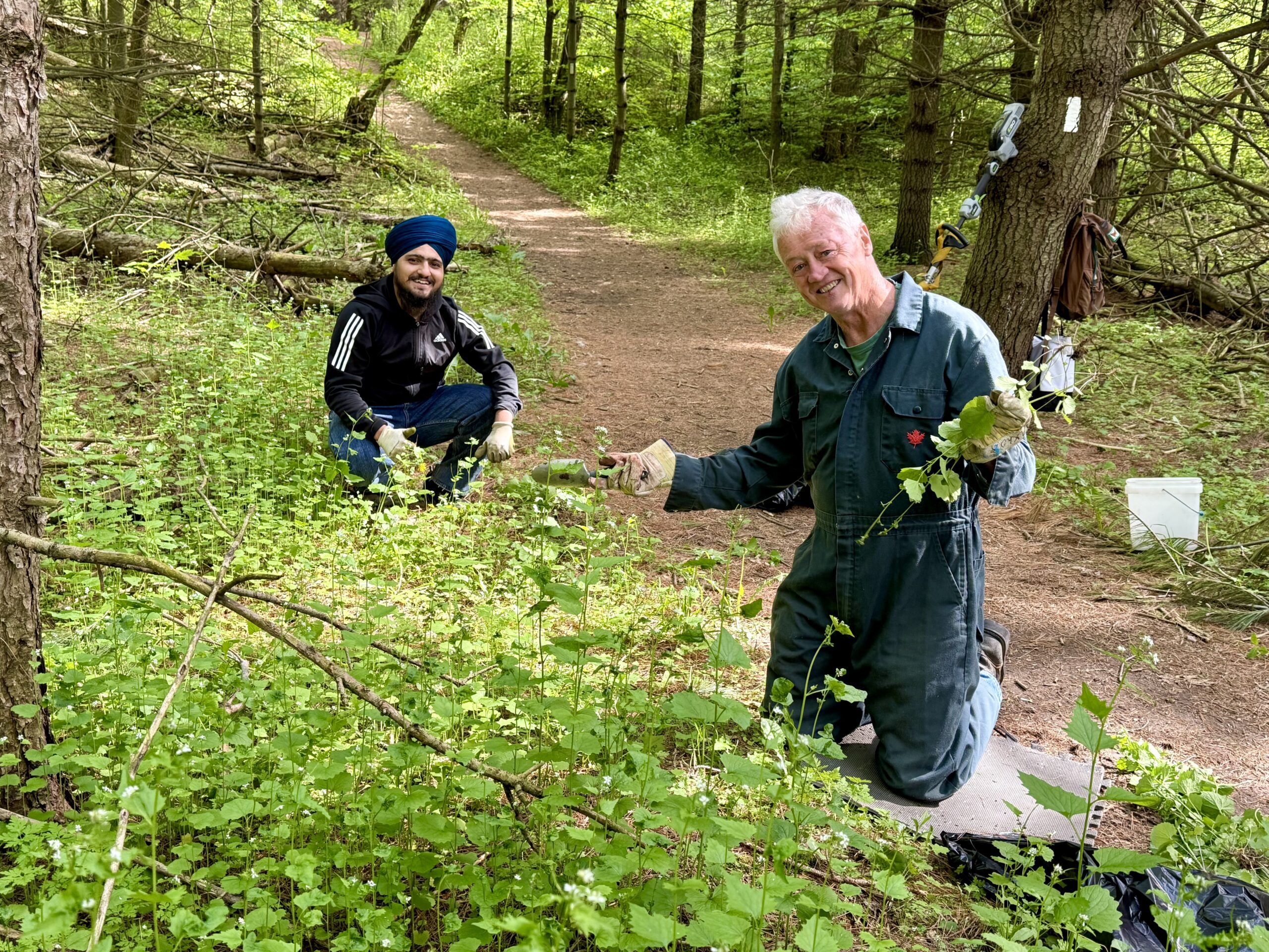
Habitat Restoration Project - Controlling the Spread of Garlic Mustard
https://hikes.brucetrail.org/event/habitat-restoration-project-controlling-the-spread-of-garlic-mustard/Sorry, the registration cut-off time for this hike has been reached.Not a member? Click here to join today!Hosting Club: Caledon Hills
Category: Habitat Restoration Project
Location (Google Maps): Meet at Mono 5 Sideroad Parking lot east of Airport Road 43.974055 – 79.984988From Airport Road, head east on Mono 5 Sideroad for approximately 1 kilometre. The parking lot is on the left side.
Hike Leader(s): Sandy Green Click here to contact Hike Leader(s)
Pace: Leisurely – 3 km/hour or less
Terrain: Easy – mostly flat and usually good footing
Distance: 2 kilometresDescription
Volunteers are needed to help control the spread of garlic mustard on two BTC Protected Natural Areas in the Hockley Valley East area. Join Land Stewards Bill and Sandy to pull the invasive species by hand or if you prefer bring a small trowel or dandelion weeder. Wear long sleeves and long pants. Pack gloves, sunscreen, insect repellent, a beverage, and a snack. The work is satisfying, and the camaraderie is always fun. All are welcome to help enhance biodiversity.