Categories
- 31May 31, 2026
Sydenham Bruce Trail E2E Run - Day 8 of 8 Only
https://hikes.brucetrail.org/event/sydenham-bruce-trail-e2e-run-day-8-of-8-only/Sorry, the registration cut-off time for this hike has been reached.Not a member? Click here to join today!Hike open to BTC Members only.
Hosting Club: Sydenham, Peninsula
Category: Sydenham E2E Trail Run
Location (Google Maps): Day 8 of the E2E Trail Run of the Sydenham Bruce Trail section. Meeting at Blantyre BTC Parking Lot.Hike Leader(s): Margie Gloade; Natalie Mechalko Click here to contact Hike Leader(s)
Pace: Fast (5.5 – 7.0 km/h+): A quick pace maintained by experienced hikers or trail runners.
Terrain: Difficult: Steep ascents/descents, rocky scrambling, and some rugged escarpment paths.
Distance: About 21 kmDescription
This is a single-day registration – Day 8 of 8.The Sydenham Bruce Trail Club (SBTC), in partnership with the Peninsula Bruce Trail Club (PBTC), is excited to offer its first-ever trail running Sydenham End-to-End series in 2026. Join the fun for one of the eight days in this trail running series! The trail running Sydenham E2E series will take place over 4 weekends and 8 days, starting at 7:30am. Below is the start and end location and estimated distance for this day (subject to change slightly). The group will meet at the end location, and carpool to the start of each day’s route. You are expected to participate in shuttling vehicles.
Please carefully read the details below to understand the logistics, costs, important notes, and fitness required for this challenge.
Sunday, May 31, 2026: Massie Hills Parking off 6th Concession S to Blantyre BTC Parking Lot; ~21km.
- When you register here, you are registering for only one day in the series. (You also have the option of registering for the whole series for $60 even if you aren’t able to make all eight days).
- These are group trail runs. It is not a race. It is not a hike. There may be a couple different pace groups that naturally form, but you will be expected to stay with a group and wait to regroup at key locations. Runners are expected to remain between the lead runner and the sweep at all times. Anticipate each day to be running for about 3+/- hours, at a pace ranging from 7-9 min./km.
- Participants are expected to have some experience trail running as this is difficult terrain. There are also some roads, and some active farm fields. In some locations throughout Sydenham, trail running will not be permitted near livestock. On roads, runners are expected to follow standard Highway Traffic Act regulations, crossing safely and running on the shoulder, in single file, facing oncoming traffic.
- Mandatory gear includes a whistle and minimum 250ml of water carrying capacity. Trail runners will need to carry their own water and fuel.
- At approximate mid-way points each day, there will be volunteer support arranged so you can fill up water bottles. Some snacks (e.g. oranges, bananas, pretzels, cookies, water) will be provided but please plan to be self-sufficient.
- Exercise care and caution and common sense on trails, especially when passing other trail users. Let others know you are coming and that you intend to pass. Headphones/earbuds are not permitted while participating in this group run.
- Participants must be age 16 years or older.
- Dogs are not permitted.
- This trail run is for BTC members only. To become a member, click here: https://brucetrail.org/.
- The designated meeting points will not incur any personal parking fees but parking space is limited. Participants are encouraged to car pool whenever possible.
The single day fee is $20. This fee covers snacks, vehicle shuttle, volunteer support, and a donation to the PBTC hike program. There is also an option to register for the whole series ($60).
As per BTC policy, no refunds will be considered 30 days before the series starts (not after April 1, 2026).
The trail run will go ahead rain or shine, however, in extremely inclement weather, a date may be cancelled and rescheduled, ideally prior to the May 31st finish date.

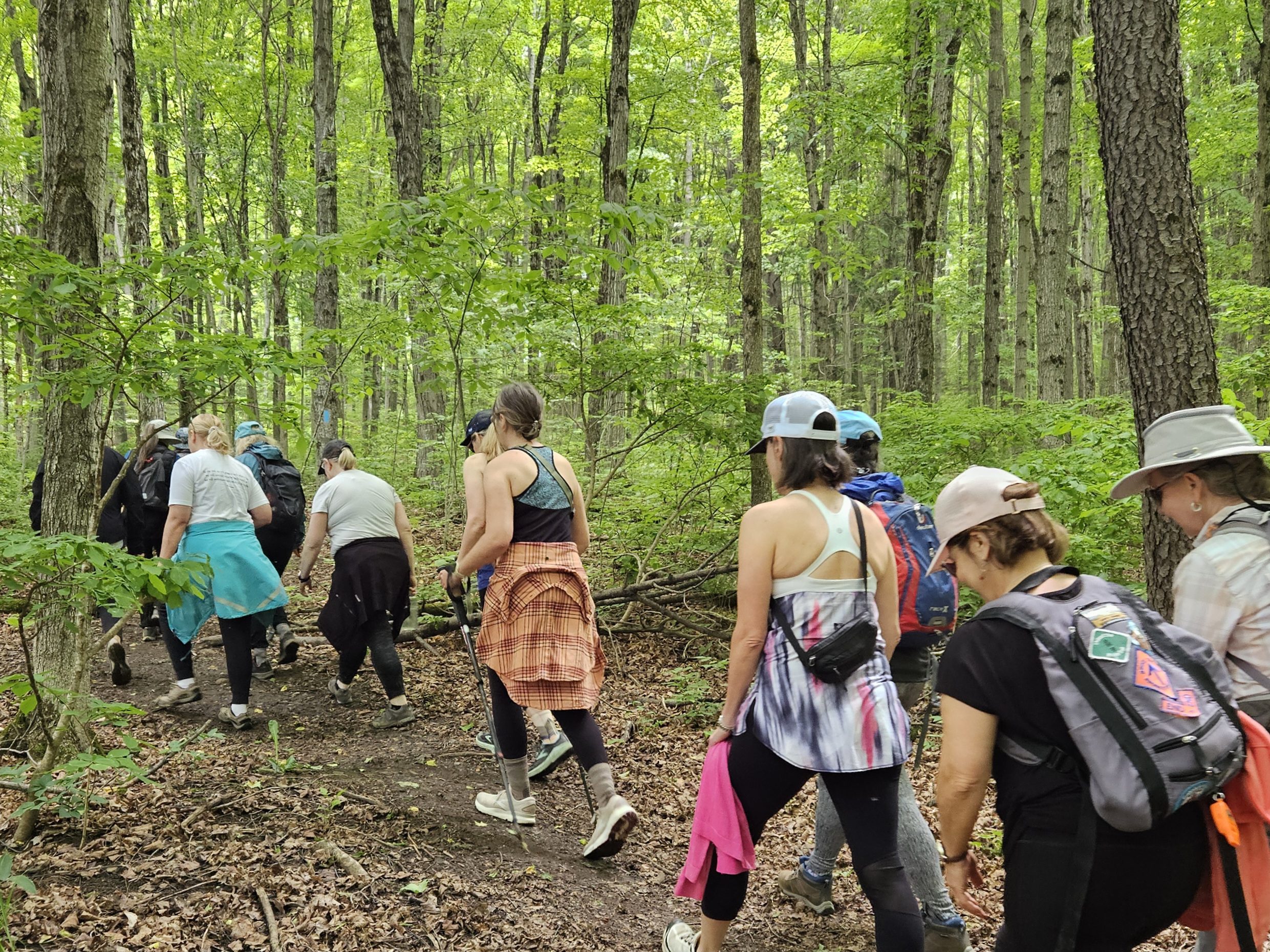
Iroquoia BTC Naturalist Hike Series- Discovering Nature One Hike at a Time – Forest Bathing – Meet in the parking lot at 7:45am
https://hikes.brucetrail.org/event/iroquoia-btc-naturalist-hike-series-discovering-nature-one-hike-at-a-time-forest-bathing-meet-in-the-parking-lot-at-745am/Sorry, the registration cut-off time for this hike has been reached.Not a member? Click here to join today!Hosting Club: Iroquoia
Category: Iroquoia BTC Naturalist Hike Series : Discovering Nature, One Hike at a Time.
Location (Google Maps): Ancaster Little League parking area at 268 Jerseyville Rd West, Ancaster.Hike Leader(s): Ruth Moffatt Click here to contact Hike Leader(s)
Pace: Leisurely – 3km/hr or less, Medium – 3 to 4 km/hr
Terrain: Dependent on Conditions, Easy – Mostly flat and usually good footing, Moderate – Some hills and/or some poor footing
Distance: 8-10kmDescription
Please join us for an introduction to Forest Bathing as part of our Naturalist Hike Series.Forest bathing shinrinyoku, is a Japanese practise of spending calm intentional time in nature to improve health, well-being and relaxation. We will use all 5 senses to engage with our surroundings at the Dundas Valley Conservation area. Our movement will be leisurely and slow paced and in peace. We may sit down, we may close our eyes and we will listen without speaking. The benefits of Forest Bathing have been found to reduce blood pressure and boost immune function. Recommended reading is Forest Bathing by Dr. Qing Li.
Please bring snacks and water and mute your phones.
If your plans change, please cancel your registration so that someone from the waitlist can potentially join the hike.
To cancel your registration, here is a step by step:
– Sign into your account on the BTC website
– Click on My Hikes under your account
– This will take you to a list of hikes you have registered for
– Scroll down to the appropriate hike and cursor over to the far right hand column under the Action column.
– Click Cancel under the hike you wish to cancelAny questions may be directed through the link on this form.
Car Hike: Jefferson Forest and Bond Lake
https://hikes.brucetrail.org/event/car-hike-jefferson-forest-and-bond-lake-richmond-hill-13/Sorry, the registration cut-off time for this hike has been reached.Not a member? Click here to join today!Hosting Club: Toronto
Category: Car Hike
Location (Google Maps):1245 Bethesda Side Rd, Richmond Hill, ON L4E 1A2 ( Bethesda Trail Head Parking lot)
Hike Leader(s): Amir Alemohammad Click here to contact Hike Leader(s)
Pace: Moderate (3-4 km/hr)
Terrain: Flat, Hilly, Level 2 (Intermediate – some hills and uneven surfaces, rocks and roots underfoot), Variable
Distance (km): 15-16 kmDescription
Let’s roll the hills of the Jefferson Forest and around the Bond Lake. Every week we hike in Jefferson Forest, located in the heart of Richmond Hill, it boasts numerous hiking trails. This 3.5 hour hike can range from 14 to 15 kilometres, depending on the weather conditions. Remember to bring water, snacks, hiking boots, poles, and your camera. Not recommended for beginners. Park in the free Bethesda parking lot and avoid parking along the road. Dress appropriately for the weather. Difficulty Level: 2 (Moderate).Please arrive @7:45AM for start of 8:00AM.
This is a joint hike with the Oak Ridges Trail Association (ORTA).
what3words:
https://w3w.co/twisting.mailer.awakes
School Bus Hike: Hockley Valley
https://hikes.brucetrail.org/event/school-bus-hike-hockley-valley/Sorry, the registration cut-off time for this hike has been reached.Not a member? Click here to join today!Trip Information
Departure Time: 08:30
Return to City Time: 18:30
Departure Point: York Mills Bus PickupOptional Items
Pick up at HWY 400 & Major Mac ($0.01)Hosting Club: Toronto
Category: Bus Hike
Location (Google Maps): Hockley ValleyHike Leader(s): Martina Furrer, Celia Ho, Leila Damband, Roland Mark Click here to contact Hike Leader(s)
Pace: Brisk (4-5 km/hr), Moderate (3-4 km/hr)
Terrain: Hilly, Level 2 (Intermediate – some hills and uneven surfaces, rocks and roots underfoot), Variable
Distance (km): Fast (18 km), moderate (13 km)Description
Join us for an awesome hike with great views and fun hills. We will split into two groups and hike north from Hockley Valley Rd to Mono Centre. The moderate group will hike about 13 km and the fast about 18 km.Refreshments at Sonnen Hill (www.sonnenhill.com). Sit back, relax, and socialize with your hiking friends while you sip a fresh, cold, local brew (or non-alcoholic beverage) in their beautiful beer garden. Or walk up to their lookout for more great views (a 20 minute loop).
Departure 1: 10 York Mills Rd at 8:30 AM
Departure 2: HWY 400 & Major Mac Park and Ride at 8:50 AM
We hope to be back in the city by 6:30 PM.
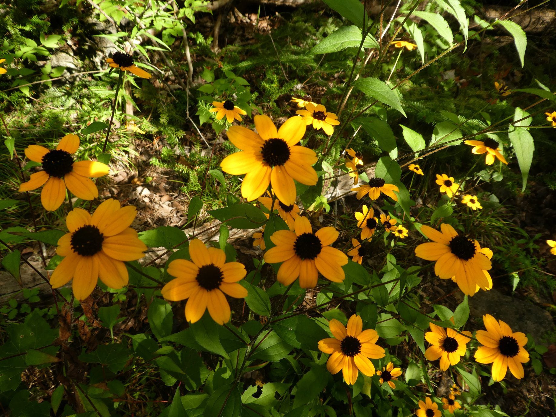
Geology Hike and Badge Series - Hope Bay
https://hikes.brucetrail.org/event/geology-hike-and-badge-series-hope-bay/Sorry, the registration cut-off time for this hike has been reached.Not a member? Click here to join today!Hosting Club: Peninsula
Category: Geology Hike
Location (Google Maps): Hope BayHike Leader(s): Beth Gilhespy Click here to contact Hike Leader(s)
Pace: Leisurely (2.0 – 3.0 km/h): A relaxed pace with frequent breaks and a focus on enjoyment., Medium (3.0 – 4.5 km/h): A comfortable pace for most hikers with steady progress.
Terrain: Moderate: Rolling hills, mild slopes and rocky paths.
Distance: 8.1Description
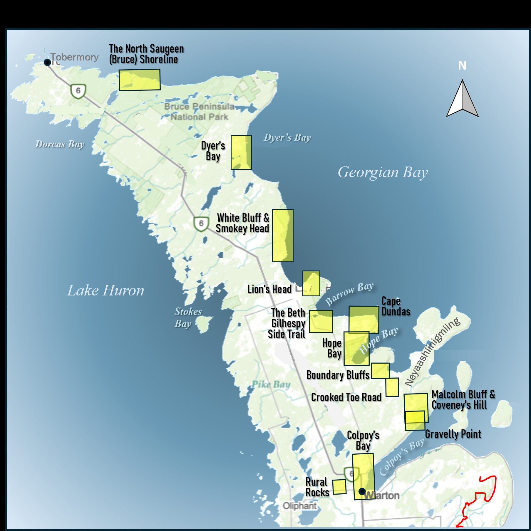
Join the adventure and earn the inaugural Peninsula Geology Badge! Over a stretch of 13 hikes and a couple of extra stops, we will explore the fascinating geology of the Peninsula to learn about the rocks, the shoreline features, glaciation, fossils and all things earthy. The 13 hikes are from the book “Walking Through Time – Exploring the Geology of the Saugeen (Bruce) Peninsula”. Having a copy will give you a lot of great information, but you do not have to purchase the book to attend and enjoy the hikes. Just bring your curiosity! We will make sure to hit all the locations that qualify for the beautiful new Walking Through Time – Saugeen (Bruce) Peninsula geology hike badge. If you would like to purchase a book I will have some available on the hikes, or you can pick one up from the BTC Head Office, at Ginger Press in Owen Sound, Suntrail Source for Adventure in Hepworth, the Shop at 84 Main in Lion’s Head and at Reader’s Haven in Tobermory.You are welcome to come on just a few of the hikes or on all of them, and the dates and hikes are as follows:
Date Geology Hike km
Saturday May 2, 2026 Colpoy’s Bay 9.0
Saturday May 9, 2026 Gravelly Point (am) and Rural Rocks (pm) 8.6
Saturday May 16, 2026 Malcolm Bluff 7.3
Sunday May 17, 2026 White Bluff/Smokey Head 11.8
Sunday May 24, 2026 Crooked Toe Road 5.5
Sunday May 31, 2026 Hope Bay 8.1
Sunday June 14, 2026 Boundary Bluffs 5.2
Saturday July 4, 2026 Cape Dundas 6.2
Saturday July 11, 2026 Beth Gilhespy Side Trail 7.6
Saturday August 8, 2026 Lion’s Head 11.0
Saturday August 15, 2026 Dyer’s Bay Loops 7.5
Saturday August 22, 2026 North Saugeen (Bruce) Shoreline 8.0
Meeting times will vary depending on the hike, but will generally be some time between 9 am and 10 am. Information on exact meeting times and locations will be sent out a few days prior to the hike.
St Helena Rd to Hilton Falls (E2E)
https://hikes.brucetrail.org/event/speyside-to-hilton-falls-e2e/Sorry, the registration cut-off time for this hike has been reached.Not a member? Click here to join today!Hosting Club: Iroquoia
Location (Google Maps): Meet at 9:15 am in the Hilton Falls parking lot
Hike Leader(s): Karen Bergmann Click here to contact Hike Leader(s)
Pace: Medium – 3 to 4 km/hr
Terrain: Moderate – Some hills and/or some poor footing
Distance: 8.5 kmsDescription
We will meet at Hilton Falls and carpool to St Helena Rd. For those leaving their car at Hilton Falls, you will need to reserve your time at conservationhalton.caAlways a popular hike, this is a challenging hike because there are several technical (rocky) spots. We hike on the main trail along the edge of the Escarpment and will stop for a break by the Quarry, finishing along the Philip Gosling Side Trail.
Bring a snack/lunch and plenty of water.
Yoga + Hike Fundraiser
https://hikes.brucetrail.org/event/yoga-hike-fundraiser-2/Sorry, the registration cut-off time for this hike has been reached.Not a member? Click here to join today!Hosting Club: Caledon Hills
Category: General
Location (Google Maps): Meet at the BTC parking lot, 713377 1st Line EHS, Mono. It is easier to go north on 1st Line from Side Road 5 than it is to go south on 1st Line from Hockley Road. 1st Line is not maintained between the parking lot and Hockley Road. It is best to aim for arriving around 9:15 am, so we can start our yoga session as close to 9:30 as possible. Thanks!Hike Leader(s): Elizabeth Ganong and Janice McLelland Click here to contact Hike Leader(s)
Pace: Leisurely – 3 km/hour or less
Terrain: Easy – mostly flat and usually good footing, Moderate – some hills and/or some poor footing
Distance: Approximately 4 kmDescription
Join us for the CHBTC’s Yoga + Hike Fundraiser happening at Riverside Woods. Led by Elaine Vallevand, we’ll start with an outdoor yoga session at 9:30 am. Bring your mat! Light refreshments will be provided following our yoga session. During this break, you will have time to put your mat in your vehicle and get ready to hike. By 11 am, we should be on the trails. The large group will be divided into two smaller groups to enable hikers to better enjoy our forest bathing inspired hike, approximately 4 km. The Marsh Marigolds are in bloom! Plan to be finished just after 12:30 pm.100% of the proceeds will support maintaining and preserving the Bruce Trail. Our kind and giving yoga instructor is donating her time, the refreshments are donated by our generous organizing team, and of course, our hike leaders are donating their time. Thank you for your generosity in being part of this event!
There is no separate program for participating children, but all those who aspire to connect with nature in a meaningful way are welcome.
While there are no refunds for this fundraiser, you may name a person who will take your spot. Please message the hike leaders to name the person attending in your place. Thanks!
Things to consider bringing: a water bottle, a mat, a blanket (if you want a larger area on the grass covered), insect repellent, sunscreen, a hat, hiking shoes/boots, poles, a snack/lunch.

Side Trails Hike #9 (start at Margaret Reed St finish at
https://hikes.brucetrail.org/event/side-trails-hike-9-start-at-margaret-reed-st-finish-at/Sorry, the registration cut-off time for this hike has been reached.Not a member? Click here to join today!Hosting Club: Niagara
Category: Car Pool
Location (Google Maps): Park at Mountainview CA and then carpool to Margaret Reed ST. Beamsville Bench ST)Hike Leader(s): Lynskie Click here to contact Hike Leader(s)
Pace: Brisk 4-5 km/hr
Terrain: Moderate: some hills and some poor footing
Distance: 10.1kmsDescription
Park at Mountainview CA and then carpool to Margaret Reed ST. Take the main trail from Margaret Reed ST to Mountainview ST Follow the main trail until it meets Mountainview ST. Take Mountainview ST until it ends at main trail. Turn right onto Main Trail until it meets Beamsville Bench ST. Take Beamsville Bench ST until it meets Angel ST. Take Angel ST out and back. Turn left back onto Beamsville Bench ST and follow it until it meets the main trail. Go left on main trail and follow it back to parking lot.Photos: Mountainview ST sign with arrows going in both directions, Beamsville Bench ST sign, LC Jordanne
Winery,
Urban Walk: Humber River & High Park
https://hikes.brucetrail.org/event/urban-walk-humber-river-valley-and-high-park-hike/Sorry, the registration cut-off time for this hike has been reached.Not a member? Click here to join today!Hosting Club: Toronto
Category: Urban Walk
Location (Google Maps): Royal York Subway Station, Grenview Blvd. exitHike Leader(s): Ted Moriarty, Felix Wan Click here to contact Hike Leader(s)
Pace: Moderate (3-4 km/hr)
Terrain: Level 2 (Intermediate – some hills and uneven surfaces, rocks and roots underfoot)
Distance (km): 11 kmDescription
Please join Ted on his ‘graduation hike’ to become a certified Toronto Bruce Trail Club Hike Leader. We’ll hike through some of west Toronto’s most scenic green spaces. We will begin by walking through Park Lawn Cemetery and at the Old Mill descend into the Humber River Valley. We’ll follow the valley trail south to the lakefront, walk along the Martin Goodman Trail boardwalk and explore High Park and surrounding neighbourhoods. The hike will conclude at Runnymede Station.Route map:
https://onthegomap.com/?route=019c9129-e175-7169-8ed0-a3ad904bebfd&context=share
The terrain is mostly flat but please note that we will be walking in to and out of two river valleys so there will be two hills to climb. Please bring a lunch or snacks and at least 2L of drinking water.
Travel to the trailhead:
- By TTC: Meet Ted and Felix at Royal York Station, Grenview Blvd. exit turnstiles.
- By car: Paid parking is available at two Green P lots:
- 11 Grenview Blvd. N across from the Grenview Blvd. exit.
- 7 Jackson Ave. – one block west of Grenview Blvd. running north off Bloor St.
Washrooms:
There are no washrooms at Royal York Station. The closest subway washroom is at Kipling Station (two stops west of Royal York). During the 11k hike we will stop at three public washrooms located at kilometres 2, 6 and 8.
Après-hike:
There will be an optional après-hike stop at The Swan & Firkin (2205 Bloor St. West). Alternatively, hikers can explore the Bloor and Runnymede neighbourhood and visit one of the many pubs or cafes in the area.
Exploring Sydenham Hike #40 Nels Maher
https://hikes.brucetrail.org/event/exploring-sydenham-hike-40-nels-maher/Sorry, the registration cut-off time for this hike has been reached.Not a member? Click here to join today!Hosting Club: Sydenham
Category: General Hike
Location (Google Maps):We will carpool from 2888 3rd Ave. W., Owen Sound
Hike Leader(s): Bill Snel Click here to contact Hike Leader(s)
Pace: Leisurely: 3 km/h or less
Terrain: Moderate: Some hills and/or poor footing
Distance: 3 kmDescription
We will carpool from Owen Sound to do a loop hike of the Nels Maher side trail. This is hike 40 in the book Exploring Sydenham. There will be one secret to find. If you do not have a book and would like one ($30) let me know by using the “Contact hike leader” link.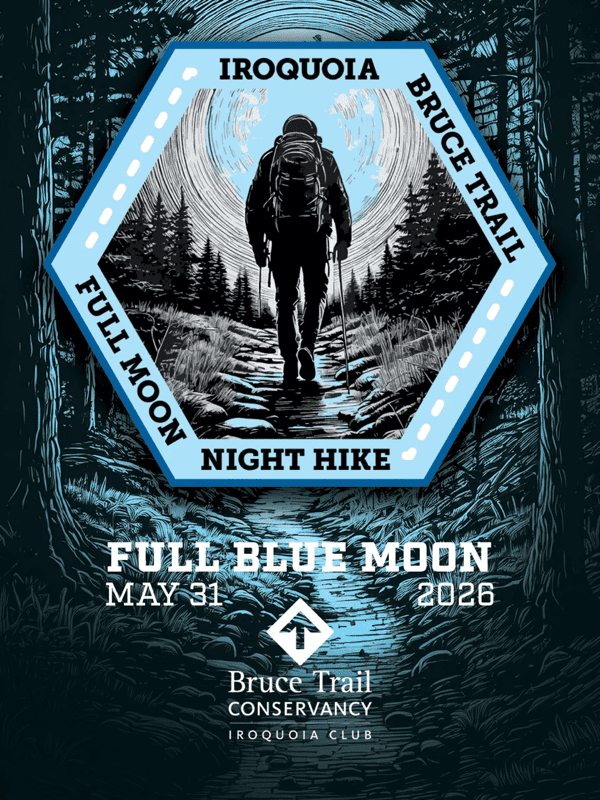
Full Moon Hike - Hendrie After Dark
https://hikes.brucetrail.org/event/full-moon-hike-hendrie-after-dark-2/Sorry, the registration cut-off time for this hike has been reached.Not a member? Click here to join today!Hosting Club: Iroquoia
Category: Moonlight Hikes
Location (Google Maps): RBG Centre Parking – across from Easterbrook’s 694 Spring Garden RoadHike Leader(s): Kathrin Koenig Click here to contact Hike Leader(s)
Pace: Medium – 3 to 4 km/hr
Terrain: Moderate – Some hills and/or some poor footing
Distance: Approx 6 kmDescription
Please be at parking by 8:00 pm as the hike will leave promptly at 8:15 pm.The Full Blue Moon is the sixth full moon of 2026. Please dress appropriately for the weather. Bring enough water and snacks to suit your needs, and a headlamp or flashlight. Headlamps with a red or green light setting are the most wildlife friendly, and best for preserving your night vision. Please ensure your device is fully charged/fresh batteries to last the duration of the hike.
We will start by following the outer road at Woodland Cemetery and pick up Grindstone Marsh Trail at Sunfish Pond. Following Grindstone Marsh Trail into Hendrie Valley, we will loop our way along the North and South Bridle Trail to Cherry Hill Gate and back to the cars. There is a set of stairs, one steep-ish downhill section, and a couple of smaller hills.
Please leave dogs at home.
This hike will qualify you for the new Iroquoia Full Moon badge! Complete three leader led-hikes in 2026, and you will qualify. Badges are $10 for BTC members/ $15 for non-members.
Any questions may be directed through “Click here to contact Hike Leader” on this form.
In the event you are no longer able to attend, please remove yourself from registration by following these steps:
– Sign into your account on the BTC website
– Click on My Hikes under your account
– This will take you to a list of hikes you have registered for
– Scroll down to the appropriate hike and cursor over to the far right hand column under the Action column.
– Click Cancel under the hike you wish to cancel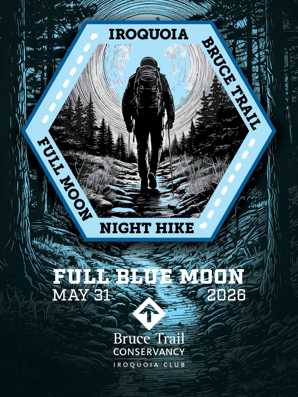
Moonlight Hike - Meet time is 8:15pm
https://hikes.brucetrail.org/event/moonlight-hike-2/Sorry, the registration cut-off time for this hike has been reached.Not a member? Click here to join today!Hosting Club: Iroquoia
Category: Moonlight Hikes
Location (Google Maps): Parking lot off of Ridge Rd located east of the southernmost portion of Beamer’s Side Trail which is now main trail.
Please park close together. If this lot is full, there are a few more spots a little further west on Ridge Rd. Roadside parking may also be possible.Hike Leader(s): Ruth Moffatt Click here to contact Hike Leader(s)
Pace: Medium – 3 to 4 km/hr
Terrain: Dependent on Conditions, Moderate – Some hills and/or some poor footing, Strenuous – Hilly with steep climbs and some poor footing
Distance: 4kmDescription
Earn your Iroquoia Moonlight badge by hiking 3 Moonlight Hikes with a leader.
Tonight’s sunset is at 8:50pm. We will follow the main trail past Beamer’s Falls around to the Hawkwatch area then the Grimsby Point Side Trail to form a loop back to the parking area onRidge Rd
If you’ve never hiked at night we are sure you will love the way it heightens all of your senses promising a great sleep afterwards.
Everyone must have a headlamp or a flashlight 🔦. Most phones have torches which could also be used as supplemental light. Please ensure your light device is fully charged/batteries to last about 1.5hours. Dress for the weather and bring enough water to suit your needs as well as all the other things you need for a hike – first aid kit, snack, poles (recommended).
This is the third of 3 full moon hikes to be held in Grimsby. After you complete three leader-led hikes, you will qualify for a badge. $10members/$15nin-members. Badges will be on hand – please bring cash.Any questions may be directed through contact on this form.
If you cannot make it, please remove yourself from registration by following these steps:To cancel your registration, here is a step by step:
– Sign into your account on the BTC website
– Click on My Hikes under your account
– This will take you to a list of hikes you have registered for
– Scroll down to the appropriate hike and cursor over to the far right hand column under the Action column.
– Click Cancel under the hike you wish to cancel