Categories
- 29May 29, 2026
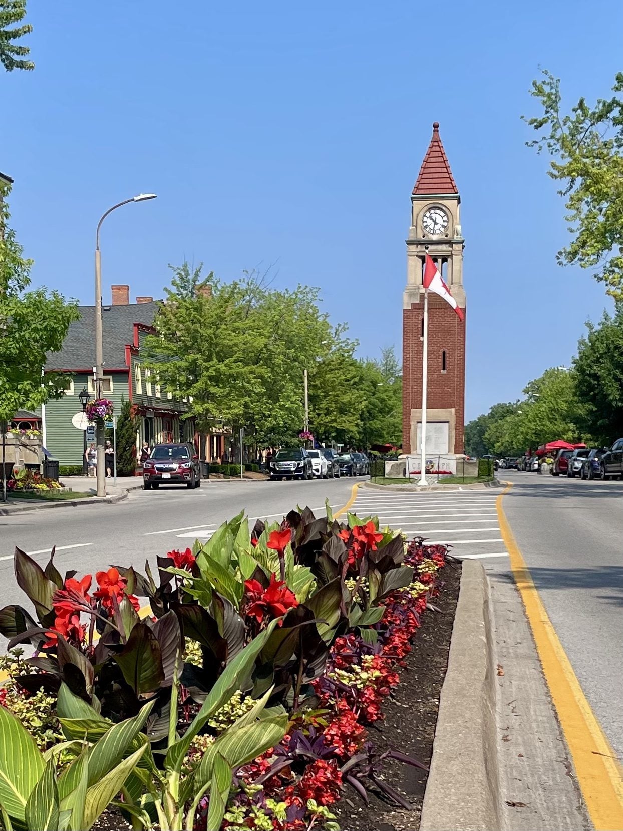
Niagara-on-the-Lake Tour
https://hikes.brucetrail.org/event/niagara-on-the-lake-tour-28/Sorry, the registration cut-off time for this hike has been reached.Not a member? Click here to join today!Hosting Club: Niagara
Category: Urban
Location (Google Maps): Park on King St near Centre St – at entrance to Veteran’s Memorial Park, Niagara-on-the-LakeHike Leader(s): Margaret Northfield Click here to contact Hike Leader(s)
Pace: Medium 3- 4 km/hr
Terrain: Easy: mostly flat, good footing
Distance: 6-7kmDescription
Each Friday we will explore historical Niagara-on-the-Lake while getting a moderate paced walk. Discover where the Niagara River meets Lake Ontario. Experience the Heritage District, woods and the Niagara Parkway.Some weeks may be totally on sidewalks and roads while others may include a mix of trail and paved pathways.
Great way to build up endurance for longer more strenuous hikes.
Plan to stay for conversation and a coffee at Sweets & Swirls, Community Centre, Niagara Stone Rd., NOTL
Niagara E2E #2: Louth Conservation Area to Quarry Road
https://hikes.brucetrail.org/event/niagara-e2e-2-louth-conservation-area-to-quarry-road/Sorry, the registration cut-off time for this hike has been reached.Not a member? Click here to join today!Hike open to BTC Members only.
Hosting Club: Dufferin Hi-Land
Category: General Hike
Location (Google Maps): Where the Bruce Trail crosses Quarry Road at km 67.9 BTC Map 4. Just north of Quarry Road and Fly Road (County Road 73). See Google Maps link for GPS.Hike Leader(s): Stuart Law Click here to contact Hike Leader(s)
Pace: Medium
Terrain: Slippery and Steep Sections, Moderate
Distance: 16 kmsDescription
Join us on a shuttle hike on the main trail taking in Balls Falls in the Jordan Valley and Cave Springs. Slippery muddy sections and rocks guaranteed. Please bring a garbage bag and an extra set of footwear for the ride back. Please also bring 2.5L of water, a snack, a lunch, bug spray, bug head net and sunscreen. Wear long sleeves and pants.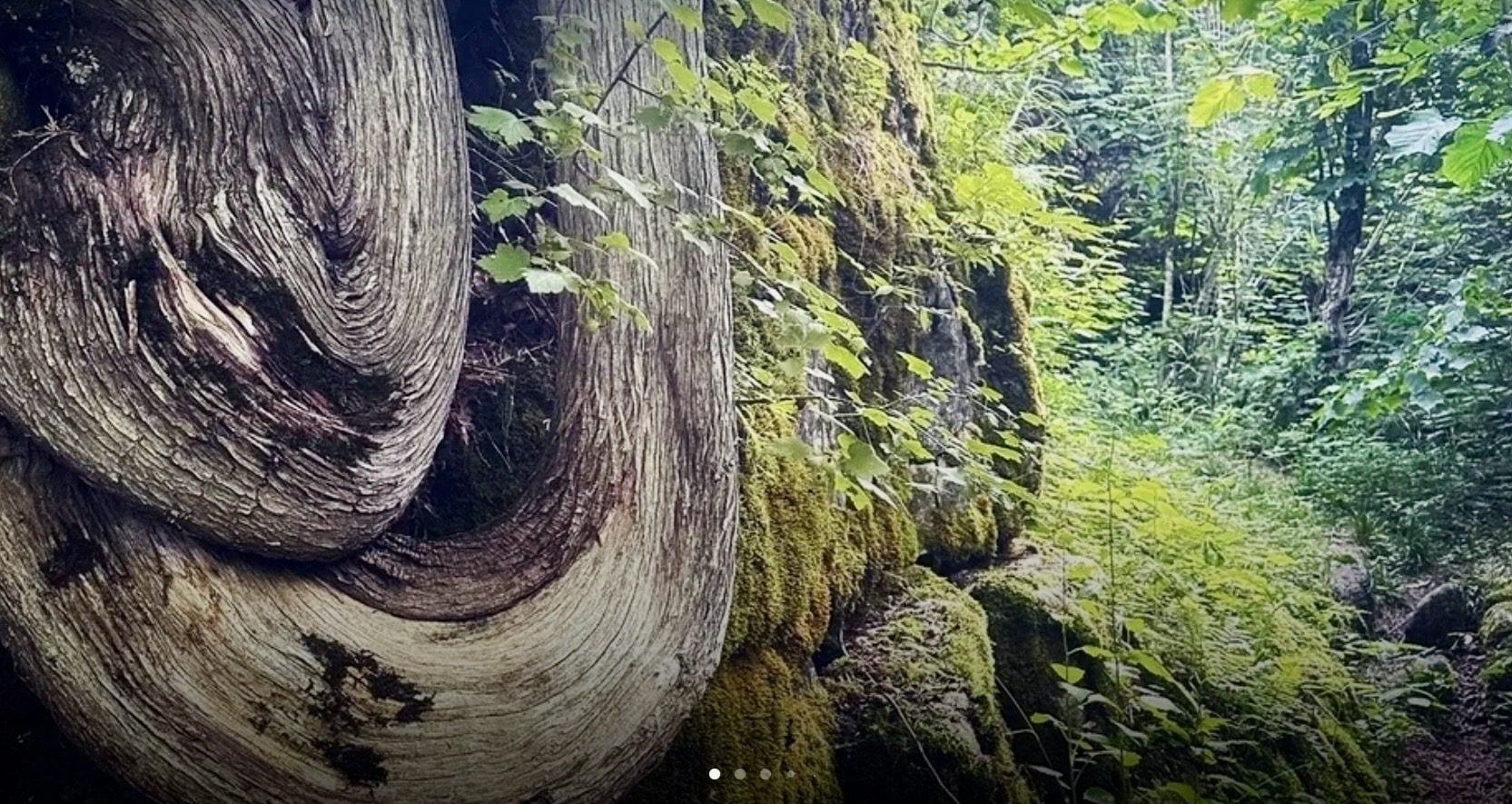
Georgian Bluffs - top of Kemble Mountain
https://hikes.brucetrail.org/event/georgian-bluffs-top-of-kemble-mountain-5/Sorry, the registration cut-off time for this hike has been reached.Not a member? Click here to join today!Hosting Club: Sydenham
Category: General Hike
Location (Google Maps): The Owen Sound Galaxy Cinema parking lot. Meet at the tall “Galaxy Centre” sign next to the traffic lights.Hike Leader(s): Ian Mills
Pace: Medium: 3 to 4 km/h
Terrain: Strenuous: Hilly with steep climbs and some poor footing., There might be muddy sections., There might be sections with water on the trail.
Distance: 9 kmDescription
This Hike is a great opportunity for fresh air and exercise. Plan for 3+ hours on the trail. We will amend our route accordingly if necessary. please pack a snack or lunch as we will be taking a break at the halfway point. We will start @ 142.6 km BTC Map 34 taking the Main Trail south looping with the following Side Trails (Mystery Cabin, Don Richards, Coles, Maple Cross Ridge & Nels Maher). Proper hiking footwear is required , a walking stick could be helpful, pack lots of water and insect repellent.Car Hike: Fitness Hike in the Forks of the Credit Provincial Park (ca 10 km) Apple Trees Blossom
https://hikes.brucetrail.org/event/car-hike-midweek-fitness-hike-in-the-forks-of-the-credit-provincial-park-ca-10-km-apple-trees-blossom-2/Sorry, the registration cut-off time for this hike has been reached.Not a member? Click here to join today!Hosting Club: Toronto, Caledon Hills
Category: Car Hike
Location (Google Maps):Forks of the Credit Provincial Park (McLaren Road entrance)
Hike Leader(s): Natalia Svechnikova Click here to contact Hike Leader(s)
Pace: Moderate (3-4 km/hr)
Terrain: Level 2 (Intermediate – some hills and uneven surfaces, rocks and roots underfoot)
Distance (km): 10 kmDescription
Please join me for an enjoyable fitness hike on a hilly part of the park and, hopefully with views of apple tress blossom. We will hike a 10 km loop with one section going up hill. The trail has mostly treed sections as well as a few open areas. There will be a lunch stop near the Credit River. Be prepared wearing comfortable cloths, hiking shoes/boots. Please bring at least 2 L of water, a light lunch/snacks, sun screen and bug spray optional. We will on the parking lot at the trail head and map poster to the right of the washroom facilities. You have to drive to the main entrance on the McLaren Road and pay for the parking.This car hike will be cancelled if the there is a heavy rain, storm etc in the forecast.
Beaver Valley- Epping to 40
https://hikes.brucetrail.org/event/beaver-valley-km-96-9-113-6/Sorry, the registration cut-off time for this hike has been reached.Not a member? Click here to join today!Hosting Club: Beaver Valley
Category: Car Pool
Location (Google Maps): Epping parking on Sideroad 19Hike Leader(s): Erin Lyttle Click here to contact Hike Leader(s)
Pace: Brisk 4-5 km/hr
Terrain: Strenuous: hilly, with steep climbs, poor footing
Distance: 13.5Description
This hike is for experienced hikers working on their Beaver Valley section end to end. We will meet at the BTC parking on Hwy 40 between Grey Road 7 and 3rd Line D (Google Maps: GC5V+93, Grey Highlands, ON N4L 1W7) and carpool to roadside parking at Epping Sideroad 19 Parking near Eric Winkler Parkway/Grey Road 7. (Slightly west of 686271 19 Siderd, Meaford, ON N4L 1W7)We will be hiking in spring conditions (mud, bugs, possible rain) so be prepared for it all. Please have your and poles at the ready and dress in layers including a waterproof outer layer. Hiking boots/shoes are mandatory. Please bring water/electrolytes and snacks, though we do not plan a meal break as this hike is scheduled between lunch and dinner time.
We will be shuttling to our starting point so please be prepared to participate in the shuttle.
Afternoon Hike - Halton Agreement Forest
https://hikes.brucetrail.org/event/afternoon-hike-halton-agreement-forest-5/Sorry, the registration cut-off time for this hike has been reached.Not a member? Click here to join today!Hosting Club: Iroquoia
Category: Afternoon/Evening Hikes
Location (Google Maps): Parking lot on 6th Line, about 3 kms up from Campbellville Rd. Small parking lot so plan to arrive between 4 and 4:15 pm.Hike Leader(s): Karen Bergmann Click here to contact Hike Leader(s)
Pace: Medium – 3 to 4 km/hr
Terrain: Moderate – Some hills and/or some poor footing
Distance: About 7 kmsDescription
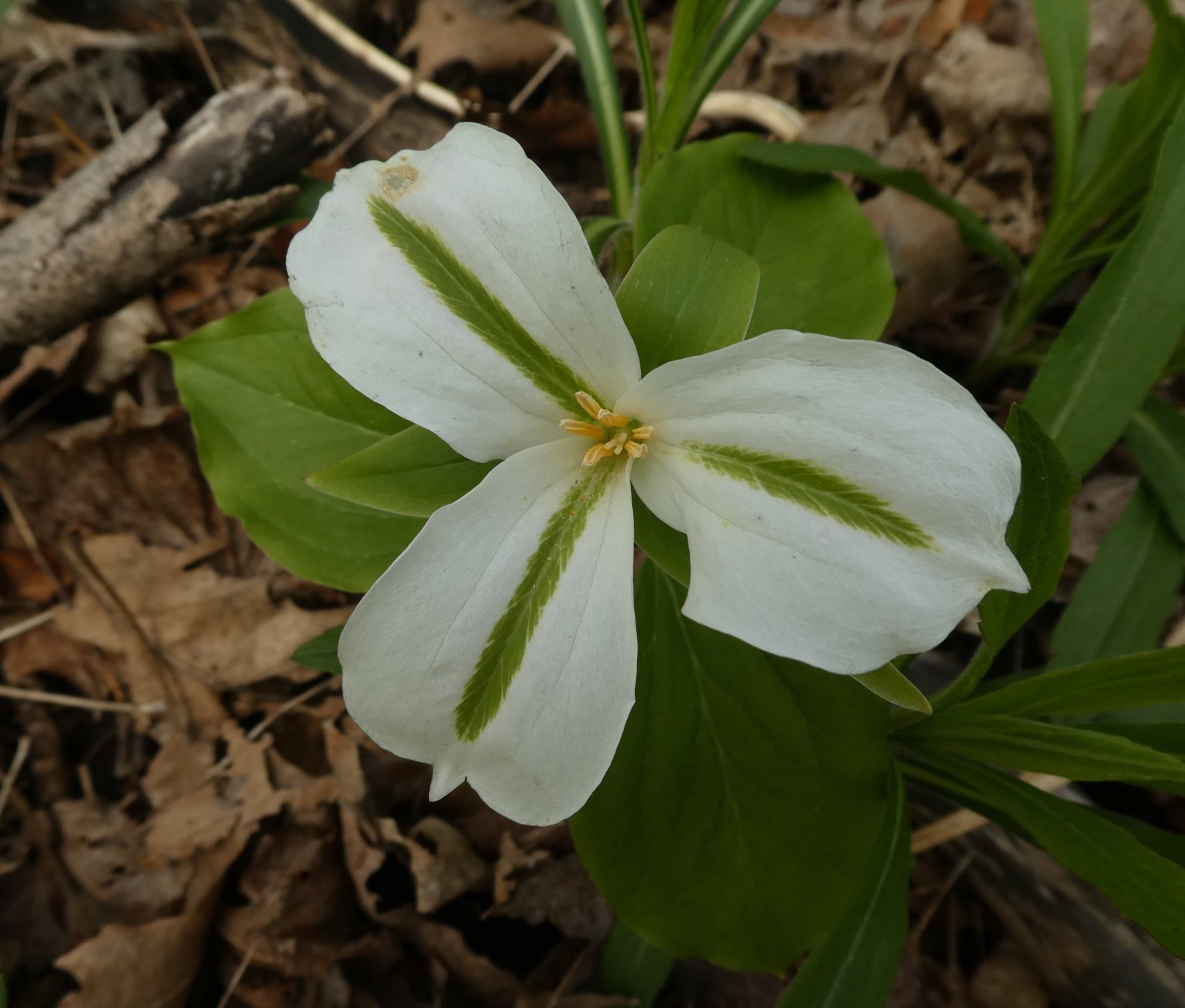
Meet at 4:15 in the small parking lot on 6th Line. We will hike a few of the bike trails. Expect to see spring wildflowers in abundance.