Categories
- 18January 18, 2026
Halton Regional Forest
https://hikes.brucetrail.org/event/halton-regional-forest-3/Sorry, the registration cut-off time for this hike has been reached.Not a member? Click here to join today!Hosting Club: Iroquoia
Category: General Hike
Location (Google Maps): Side road parking lot at Fourth Line Nassagaweya & Ten Side Rd, Milton, ONHike Leader(s): IgorT Click here to contact Hike Leader(s)
Pace: Medium – 3 to 4 km/hr
Terrain: Moderate – Some hills and/or some poor footing
Distance: 10kmDescription
We will hike thru the forest and stop by waterfalls.Meet at 8:15am to start hike at 8:30am.
Please pack whatever food you will require for a hike including snacks; 1l of water minimum; first aid kit; poles if you use them; and icers; I.D. and your health card. You may also wish to pack extra socks and rain gear. Remember to dress in layers. Gloves/mitts, scarf / neck gator, a toque and a puffy jacket.
Please leave dogs at home.
We will break for a 15 min break.
Bio-breaks are as you need them – please let the sweep know who will wait for you.
We will help each other and wait for one another but please consider your physical ability before signing up for this hike. There are no drop outs.
Please note, the hike might be canceled due to extreme weather, if so you will get email notification.
Any questions may be directed through contact on this form.
If you cannot make it, please remove yourself from registration by following these steps:To cancel your registration, here is a step by step:
– Sign into your account on the BTC website
– Click on My Hikes under your account
– This will take you to a list of hikes you have registered for
– Scroll down to the appropriate hike and cursor over to the far right hand column under the Action column.
– Click Cancel under the hike you wish to cancel
Frosty Five Weekend - Hike Two
https://hikes.brucetrail.org/event/frosty-five-weekend-hike-two/Sorry, the registration cut-off time for this hike has been reached.Not a member? Click here to join today!Hosting Club: Caledon Hills
Category: General
Location (Google Maps): Meet at the BTC parking lot on the east side of 5th Line EHS, just south of Hockley Road. 43.993572, -80.014057.Directions: From ON-10 turn east onto Hockley Rd./Dufferin County Rd. 7. Drive for 9.4 kilometres. Turn south/right onto 5th Line E. Drive for 100 metres.
Hike Leader(s): Sandy Green Click here to contact Hike Leader(s)
Pace: Medium – 3 to 4 km/hour
Terrain: Strenuous – hilly with steep climbs and some poor footing
Distance: 9.5 kmDescription
Beat the winter blues! Register individually for one, a few, or all of the Frosty Five Blues hikes. Participants who complete all five hikes are eligible to receive a CHBTC Winter badge and a Sideways badge on the final hike. Hike Two explores parts of the main Trail and Hemlock Ridge, Griffith Ravine and Glacier Valley Side Trails in the Hockley Valley south area. Bring your choice of hydration and snacks. Hiking boots and icers/crampons are required. See Sundays 25, February 1 and 8 for details about the other hikes in the series. (Note: If you wish to purchase badges, the cost of each badge is $10.00 for BTC members and $15.00 for non-members.) Everyone is welcome to join!
Car Hike: Hike #2 of 5 to earn the Toronto Side Trails Badge!
https://hikes.brucetrail.org/event/car-hike-hike-2-of-5-to-earn-the-toronto-side-trails-badge/Sorry, the registration cut-off time for this hike has been reached.Not a member? Click here to join today!Hosting Club: Toronto
Category: Car Hike
Location (Google Maps): We will meet at the Trafalgar & 401 Commuter Lot (43.571569, -79.831797) and then carpool to the start of each hike.Hike Leader(s): Monica Pasquali Click here to contact Hike Leader(s)
Pace: Leisurely (2-3 km/hr), Moderate (3-4 km/hr)
Terrain: Level 2 (Intermediate – some hills and uneven surfaces, rocks and roots underfoot)
Distance (km): 9.14 kmDescription
This is the second in a series of five hikes that will be offered approximately one Sunday per month so that participants can earn the Toronto Side Trails Badge during the winter and early spring. Each out-and-back hike will cover a distance of 8-11 km and be hiked at a leisurely to moderate pace (approximately 3 km/h). Please note that the hikes will be posted separately on the BTC calendar – you will have to register for each hike that you’re interested in joining.For this second hike we will explore three side trails in the Toronto section of the Bruce Trail: Eighth Line Side Trail, Great Esker Side Trail, and part of the Trafalgar Side Trail.
Please dress appropriately for a winter hike by dressing in layers (wear an inner layer that wicks sweat away from your skin, a middle layer that keeps you warm, and an outer layer that protects you from wind and snow), wearing gloves/mittens and a toque, and wearing warm and comfortable footwear that has good traction in snow/ice (icers placed over your boots work great!). Hiking poles or walking sticks are an asset since they will help keep you balanced if the ground is slippery. As well, make sure you bring enough water and food for a 3-4 hour hike since we’ll be covering a total distance of 9.14 km over terrain that has some hills and exposed rocks.
Since parking might be limited at the places we’ll be hiking in this hike series, we will meet at the Trafalgar & 401 Commuter Lot (43.571569, -79.831797) and then carpool to the start of each hike. Please be prepared to participate in each carpool by ensuring you have space in your car if you are not already carpooling with others to the Commuter Lot meeting point.
After the hike, interested participants can join me at the Tim Horton’s on Trafalgar Road just a bit south of Highway 401 for some post-hike refreshment.
Looking forward to exploring some of Toronto’s side trails with you!
Hockleycrest
https://hikes.brucetrail.org/event/hockleycrest/Sorry, the registration cut-off time for this hike has been reached.Not a member? Click here to join today!Hosting Club: Iroquoia
Category: General Hike
Location (Google Maps): Meet at 9:15 am in the Bruce Trail parking lot on 5 Side Road, off Airport Rd.Hike Leader(s): Karen Bergmann Click here to contact Hike Leader(s)
Pace: Medium – 3 to 4 km/hr
Terrain: Moderate – Some hills and/or some poor footing
Distance: About 7 kmsDescription
Meeting at 9:15 to start hiking at 9:30, we will hike around the main and side trails. There are a few hills but not a lot of rocks. Bring icers for your boots.Hike is dependent on weather.
Urban Walk: Downtown Toronto PATH
https://hikes.brucetrail.org/event/urban-walk-downtown-toronto-path-2/Sorry, the registration cut-off time for this hike has been reached.Not a member? Click here to join today!Hosting Club: Toronto
Category: Urban Walk
Location (Google Maps):Meet in the Great Hall of Union Station by the information desk with the clock over it.
Hike Leader(s): Tom Swales Click here to contact Hike Leader(s)
Pace: Leisurely (2-3 km/hr)
Terrain: Flat, Level 1 (Easy – mostly on flat, well maintained trails with hard-packed surface)
Distance (km): 6 kmDescription
Join us to explore underground Toronto through the PATH network discovering art, museums, and other hidden secrets of the PATH.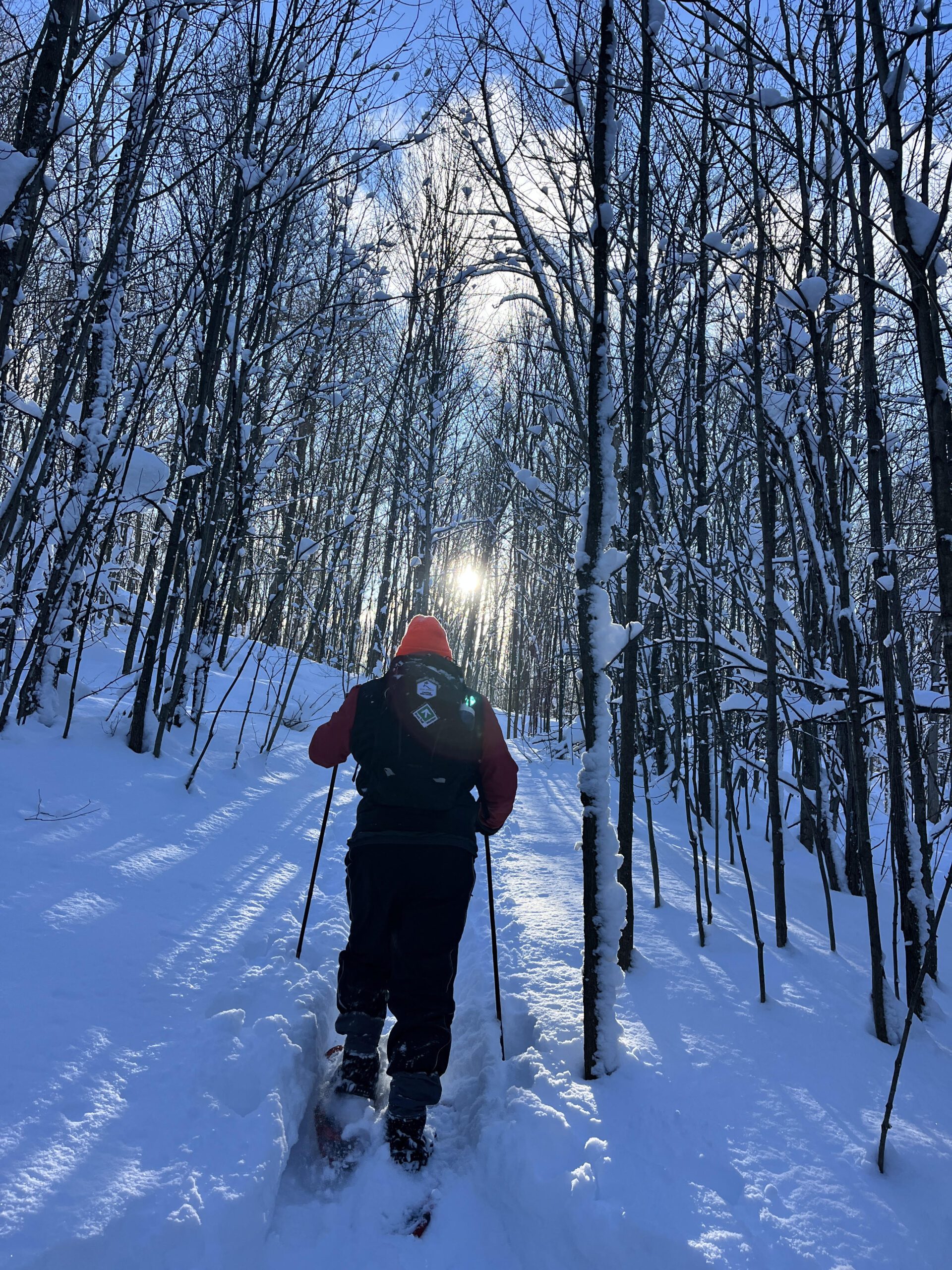
Walk In Nature Series (WINS) - Rocklyn Creek Management Area near Walter's Falls
https://hikes.brucetrail.org/event/walk-in-nature-series-wins-rocklyn-creek-management-area-near-walters-falls/Sorry, the registration cut-off time for this hike has been reached.Not a member? Click here to join today!Hosting Club: Sydenham
Category: Snowshoe Hike
Location (Google Maps): Roadside parking on the St. Vincent-Sydenham Townline, near Walter’s Falls. Click on the P at this location on the Bruce Trail app. This meet location is found near km 7.0 on Map 29 of Edition 31 of the Bruce Trail Reference.
If you don’t have the Bruce Trail app, you can use Google Maps on your device to direct you to the meet location’s GPS coordinates by clicking the link “(Google Maps)” which is found right after the title Location in this description. Alternatively, copy the coordinates from here: 44.506378, -80.705344.Hike Leader(s): Stewart Brown Click here to contact Hike Leader(s)
Pace: Medium: 3 to 4 km/h
Terrain: Moderate: Some hills and/or poor footing
Distance: 4.3 kmDescription
The Walk In Nature Series (WINS) consists of 2 hour hikes in the Sydenham section of the Bruce Trail that combine nature appreciation with fitness in a safe and welcoming group environment led by an experienced hike leader. Consider these hikes to be appointments with yourself in nature that promote health and fitness.On this snowshoe hike, explore the understated, remote beauty of the Rocklyn Creek Management Area. After meeting at parking, we will shuttle to Deviation Road to the hike start and snowshoe to our vehicles. The good news is that we will follow the Rocklyn Creek, downstream!
Arrive 15 min early, dress in layers with good footwear. Bring your snowshoes for sure and hiking poles may be helpful. Bring water and a snack. See you there!