Categories
- 17January 17, 2026
Car Hike: Caledon Hills E2E #5 of 6
https://hikes.brucetrail.org/event/car-hike-caledon-hills-btc-e2e-5-of-6/Sorry, the registration cut-off time for this hike has been reached.Not a member? Click here to join today!Hosting Club: Toronto, Caledon Hills
Category: Car Hike
Location (Google Maps):Meet at GPS N43.972857, W80.056330 at Hockley Road parking lot on the north side of Hockley Road.
Hike Leader(s): Ross Estrella Click here to contact Hike Leader(s)
Pace: Brisk (4-5 km/hr), Moderate (3-4 km/hr)
Terrain: Challenging, Hilly, Level 2 (Intermediate – some hills and uneven surfaces, rocks and roots underfoot), Variable
Distance (km): 10kmDescription
This is an End2End hiking series to cover the Caledon Hills section of the Bruce Trail in 6 hikes. As it is time of year with unsettled weather we will undertake this event at approximately 4 km/hour. Caledon Hills have numerous steep hills and deep valleys so the hikes require consistent stamina. Please consider your hiking fitness level prior to registering as this is a group hike and everyone is expected to keep pace. We will be travelling south to north and will require car shuttling. Please make sure yourself and car shuttle ready, where everyone is expected to participate. Please arrive fifteen minutes early for shuttling schedule. Things to bring: lunch/snacks, liquid hydration, sunscreen, layered clothing, personal medication (if any) health card. Hiking boots, icers, gaiters and hiking poles are highly recommended. This series hikes must be completed to receive the CHBTC E2E and Winter E2E. Don’t forget to bring your happy face and enthusiasm.NOTE: Cost of Badge is 10 dollars for BTC members and 15 dollars for Non BTC members. If you want to receive two CHBTC E2E badges, the Club E2E and Winter E2E badge there’s an additional 10 dollars for BTC members and 15 dollars for Non BTC members.
Car Hike: Boyd Conservation Park Vaughan
https://hikes.brucetrail.org/event/car-hike-boyd-conservation-park-vaughan-11/Sorry, the registration cut-off time for this hike has been reached.Not a member? Click here to join today!Hosting Club: Toronto
Category: Car Hike
Location (Google Maps): parking lot before entrance of park on Islington Ave.Hike Leader(s): Mohammad Aghamiri Click here to contact Hike Leader(s)
Pace: Moderate (3-4 km/hr)
Terrain: Hilly, Level 2 (Intermediate – some hills and uneven surfaces, rocks and roots underfoot), Variable
Distance (km): 14-15 kmDescription
Let’s hike Boyd conservation park trails through beautiful valleys.Please bring lots of water and snacks ,hiking poles are recommended
Please bring lots of water and snacks ,hiking poles are recommended
phone number for the day of hike 289 588 6482
School Bus Hike Toronto Section Winter Badge End to End #2 of 6
https://hikes.brucetrail.org/event/school-bus-hike-toronto-section-winter-badge-end-to-end-2-of-6/Sorry, the registration cut-off time for this hike has been reached.Not a member? Click here to join today!Trip Information
Departure Time: 08:30
Return to City Time: 18:00
Departure Point: York Mills Bus PickupOptional Items
Hosting Club: Toronto
Category: Bus Hike
Location (Google Maps): Toronto Section, Scotch Block/Speyside Resource Management AreaHike Leader(s): George Lennon; Fayyaz Mahmood Click here to contact Hike Leader(s)
Pace: Leisurely (2-3 km/hr)
Terrain: Challenging, Level 2 (Intermediate – some hills and uneven surfaces, rocks and roots underfoot), Variable
Distance (km): 8.3 kmDescription
We will be hiking in winter conditions of ice and snow so these will be slower and shorter hikes than in other seasons. Icers or snowshoes are mandatory, and gaiters and poles recommended. The terrain is not too hilly, but the footing is treacherous in winter with many uneven, rocky sections to navigate. The leaders will let registrants know in advance if snowshoes are feasible for the day. Please bring at least 2L of water, snacks, and your lunch. Any hikers are welcome to join the hikes regardless of whether a person is working towards a badge. Those who complete all 6 hikes will qualify for the Toronto club’s Winter E2E badge. The fee is $10 per badge ($15 for non-members) and will be collected by the hike leader on trip #4. Or you may choose to purchase the special stained glass Fundraising End to End badge for $30.The second hike of our E2E series goes from Scotch Block though the Speyside Resource Management Area to the Fourth Line Parking Lot There will be a refreshment/social stop in Milton after the hike before returning to the York Mills Station departure point by 6:00 PM.
9:00 Cave Springs to Ball's Falls return
https://hikes.brucetrail.org/event/900-cave-springs-to-balls-falls-return/Sorry, the registration cut-off time for this hike has been reached.Not a member? Click here to join today!Hosting Club: Niagara
Category: In and Out
Location (Google Maps): Cave Springs Conservation Area parking lotHike Leader(s): Lauren Doig Click here to contact Hike Leader(s)
Pace: Brisk
Terrain: Strenuous
Distance: 18 kmDescription
Meet at Cave Springs Conservation Area parking lot. We will hike to Ball’s Falls and back to Cave Springs, taking mostly the main trail. Dress for the weather and conditions: icers, poles, layers. Bring water and snacks.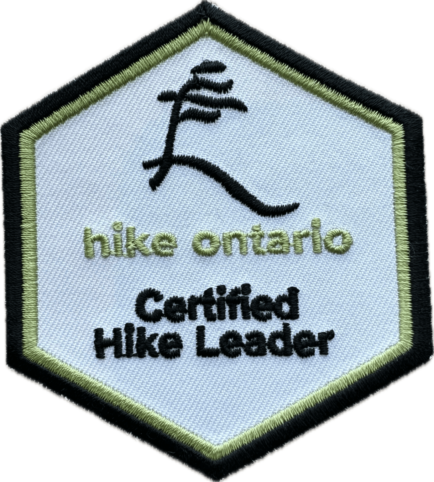
Hike Ontario - Certified Hike Leader Course - January 17, 2026 9-5pm - Please read all the details before signing up for this course.
https://hikes.brucetrail.org/event/hike-ontario-certified-hike-leader-course-january-17-2026-9-5pm-please-read-all-the-details-before-signing-up-for-this-course/Sorry, the registration cut-off time for this hike has been reached.Not a member? Click here to join today!Hosting Club: Iroquoia
Category: Special Event
Location (Google Maps): Entrance to the BTC parking lot, located at 55 Head St in Dundas, is off of Mill St.
Park behind the building.Hike Leader(s): Ruth Moffatt Click here to contact Hike Leader(s)
Distance: N/A
Description
Before signing up, please ensure you have all prerequisites as per Hike Ontario. https://hikeontario.com/takeacourse/trainingcourses/certified-hike-leader/
This one day course is to certify volunteers as Certified Hike Leaders for leading hikes on the Iroquoia Bruce Trail or any other part of the trail. You must be referred by the Iroquoia Hike Director or another volunteer of the Iroquoia Bruce Trail Club who is actively leading hikes. Since I’ve already been presented with a list, I will only confirm with those who are not already on it.
A Certified Hike Leader manual will be sent electronically ahead of time to all registered applicants. You will be required to participate in an all day course delivered in person. There will be about an hour outside. Typically you will have already participated in many group hikes on the Bruce Trail and are ready to lead your own hikes. The fee of $85 is payable on registration but is refundable on completion of leading at least 4 hikes by the end of 2026 within the Iroquoia Club or at least tagging Iroquoia Club on your hike set up.This course is intended for individuals who wish to volunteer their time leading hikes and will include a manual, a badge, a wallet card and guidance on how to complete a hike on-line for the BTC hike schedule.
Please be prepared to put your first hike on the schedule under the instructor’s guidance during the course. There are many different types of hikes that you can lead – just bring a date that is suitable for your schedule, a route that is good for you (we can help with that) and you’ll be ready to go. Have a look at some of the hikes that are already posted to get some ideas. And yes, it’s ok to copy and run a hike that is already on the schedule. Just choose a different day.
Please bring your lunch and any snacks you will need. We will take a break around 10am, 30 min lunch, and an afternoon break and finish around 5 or before. Coffee and tea is complementary. There is a refrigerator/microwave on premises.There are no make-up dates. Please ensure you can attend on the 17th.
Snow date is January 18th.
If you have any questions, please reach out through this form .The fee can be refunded through completion of 4 hikes by the end of 2026 in which the Iroquoia Bruce Trail Club is tagged. Application for refund is through the Iroquoia BTC even if you’re attached to another club.
Dufferin Hi-Land Winter Badge Hike #2 of 4
https://hikes.brucetrail.org/event/dufferin-hi-land-winter-badge-hike-2-of-4/Sorry, the registration cut-off time for this hike has been reached.Not a member? Click here to join today!Hosting Club: Dufferin Hi-Land
Category: Special Events
Location (Google Maps):Dufferin Hi-Land, Map 20. Meet at BTC Rock Hill parking lot on 1st Line EHS, Mulmur, 300 metres south of 10 Sideroad/County Rd 17 (Km 28.3).
Hike Leader(s): Les Babbage; Helen Bailey Click here to contact Hike Leader(s)
Pace: Medium
Terrain: Moderate, Slippery and Steep Sections
Distance: 8 or 9.5 kmDescription
We will hike the Main Trail to the Oliver Creek Loop, returning by way of Moss Haven Side Trail and Main Trail. Option to continue across 1st Line to Rock Hill loop. Lots of hills, streams and crevices. Dress for winter conditions. Snowshoes and/or icers required. Hike leaders will contact registered hikers a day or two before the hike to advise on trail conditions and any weather alerts. Bring water, snacks and lunch.
Rainbow/Welcome Hike: Cave Springs Loop
https://hikes.brucetrail.org/event/rainbow-welcome-hike-cave-springs-loop-2/Sorry, the registration cut-off time for this hike has been reached.Not a member? Click here to join today!Hosting Club: Niagara
Category: In and Out
Location (Google Maps):Quarry Road Parking Lot, Beamsville https://maps.app.goo.gl/XZGtvFN5kkjU8Py29
Hike Leader(s): Angela Lytle Click here to contact Hike Leader(s)
Pace: Leisurely <3 km/hr
Terrain: Moderate: some hills and some poor footing
Distance: 5-6 kmDescription
Join the Niagara Bruce Trail Club, Bridges Niagara Immigrant and Refugee Services and PFLAG Niagara for a Rainbow-Welcome Hike at Cave Spring Conservation Area in Lincoln!What is a Rainbow-Welcome Hike?
These hikes aim to bring 2S-LGBTQIA+ newcomers together with other newcomers and community members, friends and allies to enjoy nature and connect to the land and enjoy nature in all seasons.
It is an intentionally affirming space for people of diverse backgrounds and identities with a focus on 2S-LGBTQIA+ inclusion. Everyone is welcome.
We will have Bruce Trail PRIDE stickers for all hikers, and a limited number of PRIDE badges if you don’t yet have one!
Hike Details
Route: This hike loops from Quarry Rd in Beamsville along the Bruce Trail to Cave Spring Conservation area and back.
Terrain: The path to Cave Spring runs along the escarpment edge and is quite rocky and has some hills. We will adjust the pace to the group but be prepared for some rocky, uneven footing and clambering up and down. We recommend using hiking poles. Wearing good hiking shoes is a must and icy winter conditions on the trail require icers or micro-spikes. Carry water and dress in layers for changeable weather. The hike goes ahead rain, snow or shine unless there are dangerous weather conditions – the hike leader will contact you if anything changes.
Note: There are no toilets on this route.
***Please arrive by 9:50 to check in with the hike leader for departure at 10.
Meet at the parking lot on Quarry Road in Beamsville: https://maps.app.goo.gl/XZGtvFN5kkjU8Py29
Note parking is limited so please carpool with others if possible. When the small lot is full, there is roadside parking along Quarry Rd.
Urban Walk - Toronto Urban Badge Hike - 1 of 7
https://hikes.brucetrail.org/event/urban-walk-toronto-urban-badge-hike-1-of-7-3/Sorry, the registration cut-off time for this hike has been reached.Not a member? Click here to join today!Hosting Club: Toronto
Category: Urban Walk
Location (Google Maps):Humber Recreational Trail
Hike Leader(s): Brian Rideout Click here to contact Hike Leader(s)
Pace: Moderate (3-4 km/hr)
Terrain: Flat, Level 2 (Intermediate – some hills and uneven surfaces, rocks and roots underfoot)
Distance (km): 11 kmDescription
Please join me at the south west corner of Finch and Weston by 10 AM. We will hike south on the Humber Recreational Trail to Scarlet and Eglinton (km 30.2 to km 19.2). Here is an online map with km markings of our route for all 7 hikes for the Toronto Urban Badge: https://onthegomap.com/s/c2c1hf3nPlease make sure you bring at least 2 liters of water, a lunch, and icers.
Urban Walk; Cedarvale Park/Kay Gardner Beltline Trail
https://hikes.brucetrail.org/event/urban-walk-cedarvale-park-kay-gardner-beltline-trail/Sorry, the registration cut-off time for this hike has been reached.Not a member? Click here to join today!Hosting Club: Toronto
Category: Urban Walk
Location (Google Maps): SW Corner, 2nd Floor Loblaws, 396 St. Clair Ave West, TorontoHike Leader(s): Ray Berzins Click here to contact Hike Leader(s)
Pace: Moderate (3-4 km/hr)
Terrain: Flat, Level 1 (Easy – mostly on flat, well maintained trails with hard-packed surface)
Distance: 8 kmDescription
A short Saturday morning hike from St. Clair West subway station to St. Clair subway station on Yonge Street. We shall meet one floor above the Starbucks inside Loblaws, 396 St. Clair West, Toronto. The Loblaws store is immediately above St. Clair West subway station. Use the Loblaws store entance at the traffic light on St. Clair Avenue. Just inside store entrance on left is elevator to second floor where we shall meet. We shall walk North through Cedarvale Park to Kay Gardner Beltline Trail, then East to Yonge Street, then South through Mount Pleasant Cemetery to St. Clair subway station.Difficulty Level: 1 (Easy)
Bring something along to drink. Lunch available in one of the shops at Yonge & St. Clair.
On day of hike check your emails at 8 AM to verify hike status.
Daytime, Snowshoe Adventure Badge #2 - North Street north
https://hikes.brucetrail.org/event/daytime-snowshoe-adventure-badge-2-north-street-north/Sorry, the registration cut-off time for this hike has been reached.Not a member? Click here to join today!Hosting Club: Beaver Valley
Location (Google Maps): Meet on the west end of North St., on the south shoulder of the road facing your car east. Km 56.1 Map 26, Edition 31 ,
Hike Leader(s): Glenda Collings Click here to contact the hike leader.
Pace: Medium
Terrain: Moderate, Some steep sections
Length of Hike: Approx. 5 km, shorter if we encounter very deep snow.Description
If you have participated in both Snowshoe Adventure hikes please bring, on this hike, $10 (members) $15 (non-members) for the badge. This will be an out and back hike from North St. On winter hikes we may encounter bare ground, light snow, deep snow, or ice. Please bring snowshoes and icers and be prepared to take a turn at breaking trail if necessary. Wear appropriate clothing for the weather plus water and a snack. Participants should have some experience with snowshoeing.COVID-19 Precautions Before, During and After your Hike
- Each hiker joining a Bruce Trail Club organized hike must perform a self-screening check before hiking.
Find Ontario’s self-assessment tool here: https://covid-19.ontario.ca/self-assessment/ - If you are experiencing COVID-19 symptoms, stay home.
Other Guidelines
- Arrive 15 minutes before the start of the hike.
- Wear sturdy footwear and appropriate attire for the weather and the terrain.
Hiking poles are a good idea in any season, especially if the terrain is rocky or slippery. In winter, snowshoes or icers/crampons are needed when conditions dictate.
Wearing appropriate clothing and footwear prevents injuries and shows consideration for a safe and positive group hiking experience. - Always carry I.D. and your health card.
- Bring sufficient water and snacks (or lunch if indicated). A minimum of 1L of water is recommended on all hikes, and 3L is recommended for long, challenging hikes in the heat of the summer.
- Bring sunscreen and insect repellent (for spring and summer hikes).
- Bring your own first aid kit.
- Please leave dogs at home.
- Each hiker joining a Bruce Trail Club organized hike must perform a self-screening check before hiking.