Categories
- 28December 28, 2025
Car Hike: Hike #1 of 5 to earn the Toronto Side Trails Badge!
https://hikes.brucetrail.org/event/car-hike-hike-1-of-5-to-earn-the-toronto-side-trails-badge/Sorry, the registration cut-off time for this hike has been reached.Not a member? Click here to join today!Hosting Club: Toronto
Category: Car Hike
Location (Google Maps): We will meet at the Tim Horton’s on Trafalgar Road just south of Highway 401 (coordinates are 43.567794, -79.826086) and then carpool to the start of the hike.Hike Leader(s): Monica Pasquali Click here to contact Hike Leader(s)
Pace: Leisurely (2-3 km/hr), Moderate (3-4 km/hr)
Terrain: Level 2 (Intermediate – some hills and uneven surfaces, rocks and roots underfoot)
Distance (km): 8.24 kmDescription
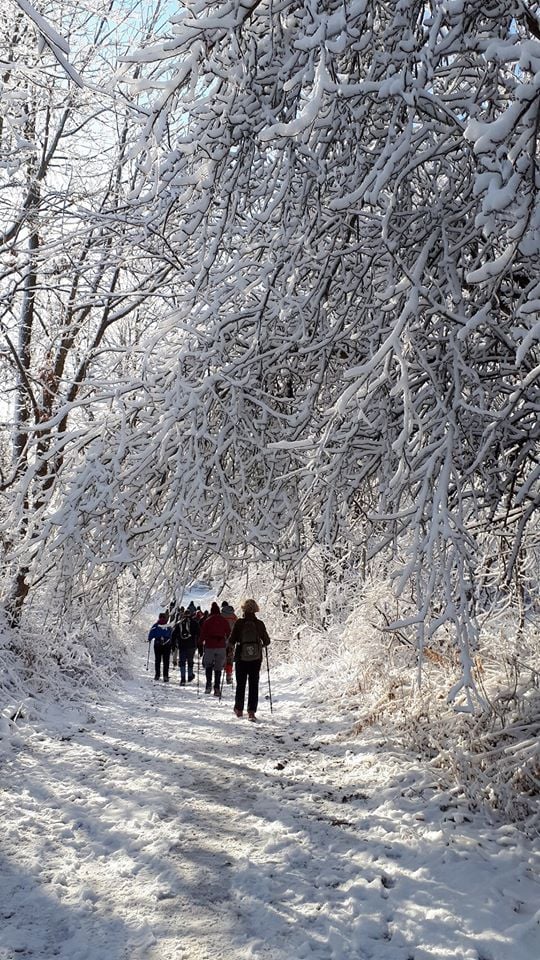
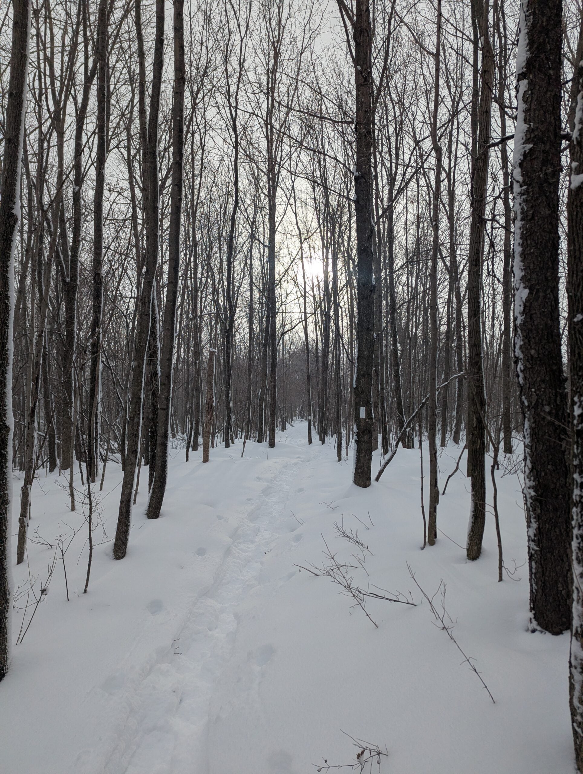
This is the first in a series of five hikes that will be offered one Sunday per month so that participants can earn the Toronto Side Trails Badge during the winter and early spring. Each out-and-back hike will cover a distance of 8-11 km and be hiked at a leisurely to moderate pace (approximately 3 km/h). Please note that the hikes will be posted separately on the BTC calendar – you will have to register for each hike that you’re interested in joining.For this first hike we will explore the newest side trails in the Toronto section – the Beeney Creek Side Trail and the Ancient Maple Side Trail – as well as the nearby Ridge Side Trail and the Todd Bardes Meadowland Side Trail.
Please dress appropriately for a winter hike by dressing in layers (wear an inner layer that wicks sweat away from your skin, a middle layer that keeps you warm, and an outer layer that protects you from wind and snow), wearing gloves/mittens and a toque, and wearing warm and comfortable footwear that has good traction in snow/ice (icers placed over your boots work great!). Hiking poles or walking sticks are an asset since they will help keep you balanced if the ground is slippery. As well, make sure you bring enough water and food for a 3 hour hike since we’ll be covering a total distance of 8.24 km.
Since parking might be limited at the places we’ll be hiking in this hike series, we will meet at the Tim Horton’s on Trafalgar Road just south of Highway 401 (coordinates are 43.567794, -79.826086) and then carpool to the start of each hike. Please be prepared to participate in each carpool by ensuring you have space in your car if you are not already carpooling with others to the Tim Horton’s meeting point.
Looking forward to exploring some of Toronto’s side trails with you!
CANCELLED - Speyside to Vanderleck ST return
https://hikes.brucetrail.org/event/speyside-to-vanderleck-st-return-2/Sorry, the registration cut-off time for this hike has been reached.Not a member? Click here to join today!Hosting Club: Iroquoia
Category: General Hike
Location (Google Maps): Meet at the Speyside Pear Tree parking lot on 15 Side Road at 9:15 am.Hike Leader(s): Karen Bergmann Click here to contact Hike Leader(s)
Pace: Medium – 3 to 4 km/hr
Terrain: Moderate – Some hills and/or some poor footing
Distance: 8 kmsDescription
Meeting at 9:15 am, we will hike the main trail from Speyside, to the Al Shaw ST, Hilton Falls ST and onto the Vanderleck ST up to 17 Side Road and then return the same way. There are some very technical (rocky) sections on this hike but no major hills. Bring icers for your boots, in case we have snow. - 29December 29, 2025
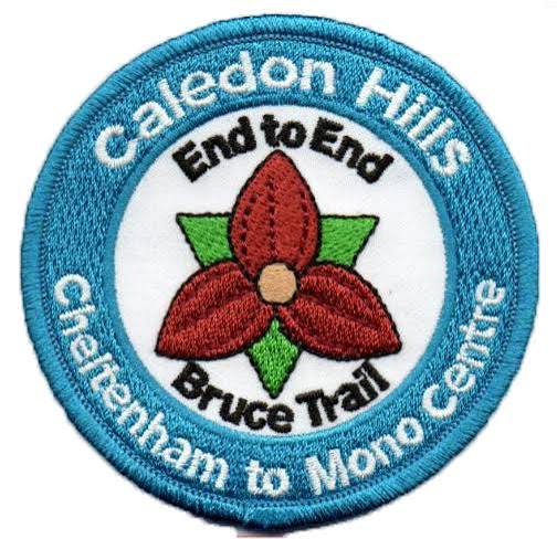
Caledon Hills E2E in 5 - Hike #5
https://hikes.brucetrail.org/event/caledon-hills-e2e-in-5-hike-5/Sorry, the registration cut-off time for this hike has been reached.Not a member? Click here to join today!Hike open to BTC Members only.
Hosting Club: Niagara
Category: Car Pool
Location (Google Maps):Meet at Mono Community Centre. Carpool to Hockley Rd parking lot on north side.
Hike Leader(s): Robin Garrett Click here to contact Hike Leader(s)
Pace: Medium
Terrain: Strenuous
Distance: 13kmDescription
This End-to-End series will start 2kms south of the Cheltenham Badlands and end at the Mono Centre. Earn your E2E Caledon Hills badge in 5 hikes ($10 for members). We will be carpooling and will ask for volunteers to drive other hikers. Please take turns with the driving.Please bring poles, icers, water and lunch.

Phill's Birthday Hike CANCELLED
https://hikes.brucetrail.org/event/phills-birthday-hike/Sorry, the registration cut-off time for this hike has been reached.Not a member? Click here to join today!Hosting Club: Iroquoia
Category: General Hike
Location (Google Maps): Halton Agreement ForestHike Leader(s): Phillip Armstrong Click here to contact Hike Leader(s)
Pace: Leisurely – 3km/hr or less
Terrain: Moderate – Some hills and/or some poor footing
Distance: 8 – 9 km.Description
What better way to celebrate a significant birthday than to take hike. Please join us as we celebrate Phill’s 80th birthday with a hike in one of our favourite areas, the Halton Agreement Forest. Please meet in the Northeast corner of the parking lot at the Elements and Mohawk Casino and Raceway located on the west side of Guelph Line, north of Highway 401. We will hike through the forest to Hilton Falls and back. Meet at 9:45 for a 10:00 am. start. Please bring water, a snack, icers and poles if using. There will be some rocky areas. A message will be sent out the day before with a cell phone number in the event that you want to cancel the day before or the morning of the hike. **Optional pub stop at the Black Swan, Palladium Dr. Brulington** Please let us know if you plan to lunch. - 30December 30, 2025
Urban Walk: Valley View Park Thornhill 157
https://hikes.brucetrail.org/event/urban-walk-valley-view-park-thornhill-130/Sorry, the registration cut-off time for this hike has been reached.Not a member? Click here to join today!Hosting Club: Toronto
Location (Google Maps): Parking lot is off Sycamore Drive East of Bayview , across Starbucks plaza
Bus 91 from Finch east station stops at Sycamore station.Hike Leader(s): Mohammad Aghamiri Click here to contact Hike Leader(s)
Pace: Moderate (3-4 km/hr)
Terrain: Hilly, Level 2 (Intermediate – some hills and uneven surfaces, rocks and roots underfoot)
Distance (km): 7-8 kmDescription
We will explore Valleyview and Maple View parks, and walk along German Mill Creak, in return we stop in Huntington park and have snack under beautiful shed.Although this is considered an “Urban Walk”, you can expect some hills up and down and uneven surfaces with tree roots. Please bring hiking poles, water and snacks.
phone number for the day of hike 289 588 6482
9:00 Long Hike Wiley Road Short Hills NEW TIME
https://hikes.brucetrail.org/event/900-long-hike-wiley-road-short-hills-new-time-12/Sorry, the registration cut-off time for this hike has been reached.Not a member? Click here to join today!Hosting Club: Niagara
Location (Google Maps):
Short Hills Wiley Road Entrance
Pace: Medium
Terrain: Moderate
: 10kmDescription
Explore Short Hills and the majestic side trails of Scarlett Tanager, Hemlock. Swayze Falls and Terrace. Register for each hikeBring Poles, , snack, and dress for the weather
9:15 Short hike, Pelham Road entrance, Short Hills
https://hikes.brucetrail.org/event/915-short-hike-pelham-road-entrance-short-hills-6/Sorry, the registration cut-off time for this hike has been reached.Not a member? Click here to join today!Hosting Club: Niagara
Category: Loop
Location (Google Maps): Short Hills Provincial Park, Pelham Road entranceHike Leader(s): janet davey Click here to contact Hike Leader(s)
Pace: Medium
Terrain: Moderate
Distance: 6 kmsDescription
Hike the main and side trails of Short Hills Provincial Park. Please note that there are some steep hills and rocky sections on the trails so you should have some hiking experience before joining this hike. Please bring water, hiking poles and icers.Forks of the Credit
https://hikes.brucetrail.org/event/forks-of-the-credit-4/Sorry, the registration cut-off time for this hike has been reached.Not a member? Click here to join today!Hosting Club: Caledon Hills
Category: Tuesday Hikers
Location (Google Maps): Mississauga Rd. intersection with Elora-Cataract Trailway.
Driving direction: From Highway 401, north on Mississauga Rd., pass through Belfountain village, after crossing Cataract Rd. and Elora-Cataract Trailway, park on either side of the road.
Alternate direction: North on Highway 410, continue on Highway 10, at Caledon Village, left on Charleston Sideroad (24), left on Mississauga Rd., drive 2 km to the roadside parking.Hike Leader(s): Mohammad Shafiq Click here to contact Hike Leader(s)
Pace: Medium – 3 to 4 km/hour
Terrain: Moderate – some hills and/or some poor footing
Distance: 11 kmDescription
Will enter Forks of the Credit Conservation Area using Elora-Cataract Trailway and hike main Bruce Trail, Mill Pond Trail and parts of conservation trails.
Bring water and snack; poles are recommended.
Optional refreshment stop at one of the cafes nearby – more information on the hiking day.Island Lake Loop
https://hikes.brucetrail.org/event/island-lake-loop/Sorry, the registration cut-off time for this hike has been reached.Not a member? Click here to join today!Hosting Club: Dufferin Hi-Land
Category: Tuesday Hike
Location (Google Maps):Island Lake Conservation Area. Meet at Vicki Barron Lakeside Trail Parking at south end of Hurontario Street, about 1 km south of 5 Sideroad, Mono. You can access 5 Sideroad from Hockley Rd, about 1 km east of Hwy 10, where Hockley Road bends to the north. Hurontario is the first turn on the right after the gravel pit.
Hike Leader(s): Julie Daley,Les Babbage,Inge Eckerich,Tony Evangelista Click here to contact Hike Leader(s)
Pace: Leisurely
Terrain: Easy
Distance: 8.5 km; Shorter hike: 4 kmDescription
We will hike the Vicki Barron Lakeside Trail loop. The shorter hike will turn back after about 2 km. Optional coffee/lunch stop in Orangeville. Dress for the weather and bring icers and poles if we have an early snowfall or icy conditions.Walk In Nature Series (WINS) - Silent Valley loop trails
https://hikes.brucetrail.org/event/walk-in-nature-series-wins-silent-valley-loop-trails-2/Sorry, the registration cut-off time for this hike has been reached.Not a member? Click here to join today!Hosting Club: Sydenham
Category: General Hike
Location (Google Maps): Roadside parking at the dead end of 2nd Concession Rd. S., 1.6 km north of Grey Rd 18. This location is found near km 34 on Map 30 of Edition 31 of the Bruce Trail Reference.
For directions using GPS Coordinates, open a map on your device by following the link embedded in “Google Maps” at the start of this description or copy them from here: 44.55569, -80.75076Hike Leader(s): Stewart Brown Click here to contact Hike Leader(s)
Pace: Medium: 3 to 4 km/h
Terrain: Moderate: Some hills and/or poor footing, Strenuous: Hilly with steep climbs and some poor footing.
Distance: 6 kmDescription
The Walk In Nature Series (WINS) consists of short loop hikes in the Sydenham section of the Bruce Trail that combine nature appreciation with fitness in a safe and welcoming group environment led by an experienced hike leader. Consider these hikes to be appointments with yourself in nature that promote health and fitness.After Christmas, a walk in nature is just what the doctor ordered. On this hike, explore the rugged beauty and cultural history of the Silent Valley Nature Reserve. We will hike through the massive boulders under the escarpment on Avalanche Side Trail, climb then descend the escarpment, survey the remnants of an old farm homestead and the historic wreckage of a plane crash. The exact route on the Silent Valley loops may depend on the trail conditions on the day of the hike meaning we will not climb and descend the escarpment if it is too snowy, slippery or difficult.
Arrive 15 min early, dress in layers with good footwear. Hiking poles may be helpful. Bring water and a snack. See you there!
- 31December 31, 2025
EASY DOES IT HIKE Harold Black Park, Fonthill, On
https://hikes.brucetrail.org/event/easy-does-it-hike-harold-black-park-fonthill-on/Sorry, the registration cut-off time for this hike has been reached.Not a member? Click here to join today!Hosting Club: Niagara
Category: Leisurely
Location (Google Maps): 953 Haist St, Fonthill OnHike Leader(s): Diane Marlatt Click here to contact Hike Leader(s)
Pace: Leisurely
Terrain: Easy
Distance: 3 KmDescription
Halton Agreement Forest
https://hikes.brucetrail.org/event/halton-agreement-forest-8/Sorry, the registration cut-off time for this hike has been reached.Not a member? Click here to join today!Hosting Club: Iroquoia
Category: General Hike
Location (Google Maps): Meet at the corner of 10 Side Road and 4th Line at 9:15 am.Hike Leader(s): Karen Bergmann Click here to contact Hike Leader(s)
Pace: Medium – 3 to 4 km/hr
Terrain: Moderate – Some hills and/or some poor footing
Distance: 8 kmsDescription
Meeting at 9:15 am, we will hike the bike trails around a big loop. Bring sufficient water and icers for your boots, in case we have snow.Car Hike: Scotsdale Farm New Year's Eve Hike
https://hikes.brucetrail.org/event/car-hike-scotsdale-farm-new-years-eve-hike-3/Sorry, the registration cut-off time for this hike has been reached.Not a member? Click here to join today!Hosting Club: Toronto
Category: Car Hike
Location (Google Maps): Scotsdale Farm, Map 13Hike Leader(s): Al Brown Click here to contact Hike Leader(s)
Pace: Leisurely (2-3 km/hr)
Terrain: Level 2 (Intermediate – some hills and uneven surfaces, rocks and roots underfoot), Variable
Distance (km): 8-10 kmDescription
Come join me for a New Year’s Eve hike on the Bruce Trail followed by some good cheer at the Shepard’s Crook in old Georgetown.Trail conditions are expected to be icy so bring your icers. The hike will be shortened depending on whether conditions.
To get to the meeting point from Hwy 401 go north on Trafalgar Road past Georgetown to the juncture with Hwy 7. North on Hwy 7 to Silver Creek. Turn right and back onto Trafalgar Road. Go north about 1.5 km to the entrance of Scotsdale Farm on your right. The parking area is about 0.5 km from Trafalgar Road near the old homestead.
- 01January 1, 2026
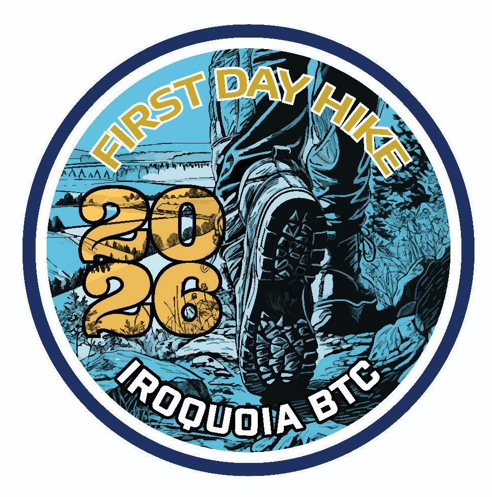
HIKE 1: BRISK PACE / First Day Hike 2026 (Hike Leader: Corina Seceleanu/Ann Grindall/Steven White)
https://hikes.brucetrail.org/event/first-day-of-new-year-2026-hike-long-hike-medium-brisk-weather-depending/Sorry, the registration cut-off time for this hike has been reached.Not a member? Click here to join today!Hosting Club: Iroquoia
Category: First Day Hike – January 1
Location (Google Maps): Dundas Valley Conseration Area (DVCA) at Trail Centre at 650 Governors Rd. Dundas. The Trail Centre is the big RED building which was the former train station located about 200 m from the parking lot.Hike Leader(s): Corina Seceleanu Click here to contact Hike Leader(s)
Pace: Brisk – 4 to 5 km/hr
Terrain: Moderate – Some hills and/or some poor footing
Distance: 7-8 kmDescription
Welcome to our Annual Volunteer Appreciation Event! We welcome all volunteers, members and anyone who needs to start then NEW YEAR 2026 of right foot- with a glamours hike ahead!Meet at the Dundas Valley COnservation Area (DVCA) at the trail Centre by 9.20am for a departure at 9.30 am
The Iroquoia Bruce Trail Club Volunteer Appreciation Event will be taking place in the Trail Centre ( big red building) at 11.30 am. All of you are welcome to join in the refreshments as we toast our incredible volunteers.
There will be badges and other Iroqouia Bruce Trail Merchandise available for purchase. We will have door prizes as well.
Keep in mind that is a pay parking in effect of $ 11.00 /vehicle and driver unless you have a HCA pass.
Please dress for the weather forecast and bring your icers just in case.
** NOTE: In the event of dangerous driving or trail conditions, this event will be postponed to January 3rd 2026. It is important that everyone register so that this can be communicagted in the event of postponement.
Hike route would be communicate at later date.
I want to thank each of you joining the adventure. Your energy, camaraderie, and enthusiasm will make a special day. Whether would be the crisp winter views, the laughter along the trail, or the shared stories at rest stops, we will create memories that set a positive tone for the new year ahead.
See you on the New Year! Happy Trails everyone!
HIKE 2: MEDIUM PACE / First Day Hike 2026 (Hike Leader: Dave Salt/Angela Korstanje)
https://hikes.brucetrail.org/event/first-day-2026-hike-dundas-valley-iroquoia-club/Sorry, the registration cut-off time for this hike has been reached.Not a member? Click here to join today!Hosting Club: Iroquoia
Category: First Day Hike – January 1
Location (Google Maps): Dundas Valley Trail Centre: Enter from Governor’s Rd.,
3.5km west of Main St. W in Dundas
Parking fee required – see hike descriptionHike Leader(s): Dave Salt Click here to contact Hike Leader(s)
Pace: Medium – 3 to 4 km/hr
Terrain: Moderate – Some hills and/or some poor footing
Distance: 7-8kmDescription
Welcome to our annual First Day Hike Event! We welcome all
volunteers, members and anyone who wants to start the new year off right – with
a hike!
Meet at the Dundas Valley Conservation Area (DVCA) at the Trail Centre by 9:30
am for a 99:45 am departure.
The Iroquoia Bruce Trail Club Event will be taking place in
the Trail Centre (big red building) at 11:30 am. All are welcome to join in the
refreshments as we toast our incredible volunteers. There will be badges and other
Iroquoia Bruce Trail merchandise available for purchase. We will have door prizes as well.Complimentary Junior Winter Hiker badges will be available for children under the
age of 13. [Children’s Hike only]Please dress for a winter hike. Wear layers and its advisable to bring your icers just in case.
Poles may be helpful.
Pay parking is in effect $11 per vehicle and driver unless you have a HCA Pass.
In the event of dangerous driving or trail conditions, this event will be postponed
to January 3/26. It is important that everyone register so that this can be
communicated in the event of postponement.Dufferin Hi-Land Annual New Year's Day Hikes - Long
https://hikes.brucetrail.org/event/dufferin-hi-land-annual-new-years-day-hikes-long-2/Sorry, the registration cut-off time for this hike has been reached.Not a member? Click here to join today!Hosting Club: Dufferin Hi-Land
Category: General Hike
Location (Google Maps): Mono Community Centre gravel parking lot. 200m south of Mono Centre (County Road 8). See this hike description Google Maps link for GPS.Hike Leader(s): Stuart Law Click here to contact Hike Leader(s)
Pace: Medium
Terrain: Dependent on Conditions, Slippery Sections Likely, Moderate
Distance: 17 kmsDescription
Please join us for a Dufferin Hi-Land annual tradition – a New Year’s Day hike at Mono Cliffs Provincial Park and its environs. What better way to start the New Year? We have three hikes planned – long, medium and short. This hike is the long one at 17 kms. The short and medium hikes run by longstanding club members Bryan and Carol Foley and Les Babbage will be posted separately for separate sign-up. All three hikes will end back at Mono Centre at 3:30 pm or so for seasonal refreshments and good cheer. Please bring along any seasonal leftovers you may have to share. Hot chocolate for all! We really hope you can make it. Please dress in warm layers for the weather. Icers and hiking boots are a must. Poles recommended. Please also bring a smile as always, a warm drink, some water, a snack and a lunch. Please arrive at 9:15 am to be ready to hike at 9:30 am.
HIKE 3: LEISURELY / First Day Hike 2026 (Hike Leader: Anne Armstrong/Dale Skvereckas)
https://hikes.brucetrail.org/event/first-day-hike/Sorry, the registration cut-off time for this hike has been reached.Not a member? Click here to join today!Hosting Club: Iroquoia
Category: First Day Hike – January 1
Location (Google Maps): Dundas Valley Trail Centre, 650 Governor’s Rd. 3.5 km. west of Main St. West, DundasHike Leader(s): Anne Armstrong Click here to contact Hike Leader(s)
Pace: Leisurely – 3km/hr or less
Terrain: Moderate – Some hills and/or some poor footing
Distance: Approx. 6.5 km.Description
Welcome to our annual VolunteerAppreciation Event. We welcome all volunteers and anyone who wants to start the year off right – with a hike!
Meet at theDundas Valley Conservation Area (DVCA) at the Trail Centre at 9:45 am. for a 10: 10 am. departure. After the hike the Iroquoia Bruce Trail Club Volunteer Appreciation Event will be taking place in the Trail Centre aka Railway Station, at 11:30 am. All are welcome to join in the refreshments as we toast our incredible volunteers. There will be badges and other Iroquoia Bruce Trail Club merchandise available for purchase. We will have door prizes as well.Complimentary Junior Winter Hike badge for children under the age of 13 (children’s hike only).
Pay parking of $13 per vehicle is in effect except for those with a HCA pass. Please dress for the weather and bring your icers just in case. Poles may be useful.
In the event of dangerous driving or trail conditions, this event will be postponed to January 3/26. It is important that everyone register so that this can be communicated in the event of postponement.
One parent or guardian may register on behalf of everyone in your party. All children are expected to be accompanied by at least one parent or guardian. (Children’s hike only.)

HIKE 4: FAMILY/CHILDREN / First Day Hike 2026 (Hike Leader: Cathie Green/Victoria Best)
https://hikes.brucetrail.org/event/first-day-hike-2026/Sorry, the registration cut-off time for this hike has been reached.Not a member? Click here to join today!Hosting Club: Iroquoia
Category: First Day Hike – January 1
Location (Google Maps): Dundas Valley Conservation Area – TRAIL CENTREHike Leader(s): Cathie Green Click here to contact Hike Leader(s)
Pace: Leisurely – 3km/hr or less
Terrain: Easy – Mostly flat and usually good footing
Distance: Approximately 5 kms Main TrailDescription
Welcome to our annual Volunteer Appreciation Event! We welcome all
volunteers, members and anyone who wants to start the new year off right – with
a hike!
Meet at the Dundas Valley Conservation Area (DVCA) at the Trail Centre by 9:45 am
am for a 10 am departure.
The Iroquoia Bruce Trail Club Volunteer Appreciation Event will be taking place in
the Trail Centre (big red building) at 11:30 am. All are welcome to join in the
refreshments as we toast our incredible volunteers. There will be badges and other
Iroquoia Bruce Trail merchandise available for purchase. We will have door prizes,
as well.
Complimentary Junior Winter Hiker badges will be available for children under the
age of 13. [Children’s Hike only]
Pay parking is in effect $11 per vehicle and driver unless you have a HCA Pass.
Please dress for the weather forecast and bring your icers just in case. Water, walking sticks also recommended
In the event of dangerous driving or trail conditions, this event will be postponed
to January 3/26. It is important that everyone register so that this can be
communicated in the event of postponement.One parent or guardian may register on behalf of everyone in your party. All
children are expected to be accompanied by at least one parent or guardian.
[Children’s Hike only]
New Year’s Day Family and Friends Hike
https://hikes.brucetrail.org/event/new-years-day-family-and-friends-hike/Sorry, the registration cut-off time for this hike has been reached.Not a member? Click here to join today!Hosting Club: Caledon Hills
Category: General
Location (Google Maps): Bruce Trail Parking Lot at Riverside Woods Nature Reserve
713377 1st Line EHS, Mono
Google GPS Coordinates: 43.959916, -80.070494Driving Directions:
From Hwy #10 north of Orangeville turn east on Hockley Road.
Drive for 1.1 km.
Continue straight onto Side Road 5 for 1.6 km.
Turn left onto 1st Line EHS for 900 metres.
Continue straight into the parking lot.FYI There is an outhouse at the parking lot.
***DO NOT take 1st Line EHS south from Hockley Road. It is NOT maintained. Google Maps may suggest this impassable route.
Hike Leader(s): Sandy Green Click here to contact Hike Leader(s)
Pace: Leisurely – 3 km/hour or less
Terrain: Moderate – some hills and/or some poor footing
Distance: 1.5 km and 5.0 kmDescription
There is no better way to start the year than to spend time in nature with family and friends. Join Club President Sandy Green and co-hike leaders for a leisurely hike. There is a distance for everyone’s enjoyment: 1.5 km or 5 km. Dress for a wintery adventure. Light refreshments will be served at the end.Urban Walk: Toronto Islands downtown377
https://hikes.brucetrail.org/event/urban-walk-toronto-islands-downtown/Sorry, the registration cut-off time for this hike has been reached.Not a member? Click here to join today!Hosting Club: Toronto
Category: Urban Walk
Location (Google Maps): Toronto Islands
Meet at Jack Layton Ferry docks at
10:15 a.m. for 10:30 departure to Ward Island) you can buy your tickets online in advance. https://secure.toronto.ca/FerryTicketOnline/tickets2/index.jspHike Leader(s): Mohammad Aghamiri Click here to contact Hike Leader(s)
Pace: Brisk (4-5 km/hr)
Terrain: Flat, Level 2 (Intermediate – some hills and uneven surfaces, rocks and roots underfoot)
Distance (km): 10-12 kmDescription
Lets hike Toronto islands for our new year and our first hike in 2026Please bring hiking poles, proper clothing, shoes and your ice cleats
For the day of hike phone number 289 588 6482
10:30 New Years Day Long President's Hike @ Fireman's Park
https://hikes.brucetrail.org/event/1030-new-years-day-long-presidents-hike-firemans-park-4/Sorry, the registration cut-off time for this hike has been reached.Not a member? Click here to join today!Hosting Club: Niagara
Category: Loop
Location (Google Maps):Fireman’s Park – Upper Parking Lot
Hike Leader(s): Lynskie Click here to contact Hike Leader(s)
Pace: Brisk
Terrain: Moderate
Distance: ~10 kmDescription
Join us for our annual New Year’s Day President’s Hike Celebration!This is the longer of two hikes available to register for – we will hike a loop around Fireman’s Park ~ 2.5 hours- 10:30am start. Pot luck New Years Celebration to follow under the gazebo @ 1:00pm- bring your favorite pot luck item to share!
Members who don’t want to hike can meet at 1:00pm at the gazebo for the Happy New Year celebration.
11am, President's Hike, short
https://hikes.brucetrail.org/event/11am-presidents-hike-short/Sorry, the registration cut-off time for this hike has been reached.Not a member? Click here to join today!Hosting Club: Niagara
Category: Loop
Location (Google Maps): Meet in the upper parking lot of Fireman’s Park, 2275 Dorchester Rd, Niagara Falls (corner of Dorchester and Mountain Reds.Hike Leader(s): Margaret Northfield Click here to contact Hike Leader(s)
Pace: Medium
Terrain: Moderate
Distance: 5-6kmDescription
Join us for the first hike of the year with NBTC President, Ellen Savoie. Meet at the upper parking lot of Fireman’s park. Wear weather appropriate clothes. Poles and icers may be needed depending upon the weather.
Bring potluck to share with your fellow hikers. Outdoor picnic – dress accordingly.
New Years Urban Walk: Tommy Thompson Park (Leslie Spit)
https://hikes.brucetrail.org/event/new-years-urban-walk-tommy-thompson-park-leslie-spit/Sorry, the registration cut-off time for this hike has been reached.Not a member? Click here to join today!Hosting Club: Toronto
Category: Urban Walk
Location (Google Maps): Tommy Thompson Park parking lot at the intersection of Leslie St and Unwin Ave (by park pavillion).Hike Leader(s): Michael Humpage;Janet McColeman Click here to contact Hike Leader(s)
Pace: Leisurely (2-3 km/hr)
Terrain: Level 1 (Easy – mostly on flat, well maintained trails with hard-packed surface)
Distance (km): 10 -12 kmsDescription
Tommy Thompson Park ( Leslie Spit) is located at the intersection of Leslie St and Unwin Ave in Toronto. It is winter and the start of the new year so please dress accordingly. As we will be hiking near the lake it might be a little colder so dress for it. ICERS are advisable. The trail might be covered in a sheet of ICE, ( if you have them bring them with you ). Bring a snack, a hot drink, Water and any other essentials you will need for this outing.We will walk up to the light house and back. We meet in the sheltered area by the washrooms in the parking lot. Parking is FREE. Please arrive by about 15 minutes prior to the departure time of 11:00 AM as we will be leaving on time.
New Years Day at Loree
https://hikes.brucetrail.org/event/new-years-day-at-loree-3/Sorry, the registration cut-off time for this hike has been reached.Not a member? Click here to join today!Hosting Club: Beaver Valley
Location (Google Maps): Meet at the unopened road allowance on Side Road 21, Town of the Blue Mountains, about 1/2 km east of km 8.4, Map 24, Edition 30. We may make arrangements for people to travel to the starting point together from another parking area as the Town of the Blue Mountains initiated paid parking for non-residents.
Hike Leader(s): Margaret Yaraskavitch Click here to contact the hike leader.
Pace: Medium
Terrain: Easy, Some rocky footing, Some steep sections
Length of Hike: 6.5 kmsDescription
A great way to start 2026! The Trail at Loree travels through a mature forest and to the edge of the Escarpment with views, through the trees, of Nottawasaga Bay. May be snowy conditions, well suited for snowshoes. Otherwise regular boots and/or crampons.Guidelines
- Arrive 15 minutes before the start of the hike.
- Wear sturdy footwear and appropriate attire for the weather and the terrain.
Hiking poles are a good idea in any season, especially if the terrain is rocky or slippery. In winter, snowshoes or icers/crampons are needed when conditions dictate.
Wearing appropriate clothing and footwear prevents injuries and shows consideration for a safe and positive group hiking experience. - Always carry I.D. and your health card.
- Bring sufficient water and snacks (or lunch if indicated). A minimum of 1L of water is recommended on all hikes, and 3L is recommended for long, challenging hikes in the heat of the summer.
- Bring sunscreen and insect repellent (for spring and summer hikes).
- Bring your own first aid kit.
- Please leave dogs at home.
Dufferin Hi-Land Annual New Year's Day Hike - Medium
https://hikes.brucetrail.org/event/dufferin-hi-land-annual-new-years-day-hike-medium/Sorry, the registration cut-off time for this hike has been reached.Not a member? Click here to join today!Hosting Club: Dufferin Hi-Land
Category: Special Events
Location (Google Maps): Mono Centre Community Centre Parking Lot Mono Centre Ont. Please see Google Maps link for GPS.Hike Leader(s): Bryan and Carol Foley Click here to contact Hike Leader(s)
Pace: Medium
Terrain: Moderate, Slippery Sections Likely
Distance: 8.5 kmDescription
Celebrate the New Year by joining the Dufferin HI-Lands Annual New Years Medium Hike. Hot Chocolate, Goodies following the hike. Bring water, appropriate footwear , dress for the weather. Icers and/or snowshoes may be required.Dufferin Hi-Land New Year's Day Hikes - Short
https://hikes.brucetrail.org/event/dufferin-hi-land-new-years-day-hikes-short/Sorry, the registration cut-off time for this hike has been reached.Not a member? Click here to join today!Hosting Club: Dufferin Hi-Land
Category: Special Events
Location (Google Maps): Dufferin Hi-Land Section, Map 19. Meet at Mono Community Centre hiker parking area off of 2nd Line Mono at south end of Mono Centre village. Please see Google Maps link for GPS.Hike Leader(s): Inge Eckerich Click here to contact Hike Leader(s)
Pace: Leisurely
Terrain: Dependent on Conditions, Moderate, Slippery Sections Likely
Distance: 5.6 kmDescription
Please join us for a Dufferin Hi-Land annual tradition – a New Year’s Day hike at Mono Cliffs Provincial Park and its environs. What better way to start the New Year? We have three hikes planned – long, medium and short. This hike is the short one at 5.6 kms. The medium and long hikes run by Bryan and Carol Foley and Stuart Law are posted separately for separate sign-up. All three hikes will end back at Mono Centre at 3:30 pm or so for seasonal refreshments and good cheer. Please bring along any seasonal leftovers you may have to share. Hot chocolate for all! We really hope you can make it. Please dress in warm layers for the weather. Icers and hiking boots are a must. Poles recommended. Please also bring a smile as always, a warm drink, some water and a snack. Please arrive at 1:15 pm to be ready to hike at 1:30 pm - 02January 2, 2026
9:00 am Niagara-on-the-Lake Tour
https://hikes.brucetrail.org/event/900-am-niagara-on-the-lake-tour-52/Sorry, the registration cut-off time for this hike has been reached.Not a member? Click here to join today!Hosting Club: Niagara
Category: Urban
Location (Google Maps):Veterans Memorial Park, park just outside the park on King Street
Hike Leader(s): Robin Garrett Click here to contact Hike Leader(s)
Pace: Medium
Terrain: Easy
Distance: 6-7 kmDescription
Each Friday we will explore different neighbourhoods, trails and parkland throughout Historic Niagara-on-the-Lake.Moderate pace with some weeks entirely on sidewalks and roads while others may include a mix of trails and paved pathways. Great way to build up endurance for longer more strenuous hikes.
Prepare for cooler windy conditions on open parkland and along Lake Ontario and Niagara River trails.
Plan to stay for conversation and a warm cup of coffee or tea at Sweets & Swirls, Community Centre, Niagara Stone Road, NOTL
Brisk Fridays - Lindenwood
https://hikes.brucetrail.org/event/brisk-fridays-lindenwood/Sorry, the registration cut-off time for this hike has been reached.Not a member? Click here to join today!Hosting Club: Sydenham
Category: Snowshoe Hike
Location (Google Maps): Roadside parking on Lindenwood Road, just east of Grey Rd 17. The off-road parking lot may be plowed? This location is found at km 125.7 on Map 33 of Edition 31 of the Bruce Trail Reference.
For directions using GPS Coordinates, use a map on your device to direct you to the meet location by clicking the link “(Google Maps)” which is found right after the title Location in this description or copy the coordinates from here: 44.685558, -80.995885Hike Leader(s): Stewart Brown Click here to contact Hike Leader(s)
Pace: Medium: 3 to 4 km/h
Terrain: Moderate: Some hills and/or poor footing
Distance: 8 kmDescription
The hike title says it all! A Friday morning hike at a brisk pace for 3-4 hours on the Bruce Trail, even if the weather is, um, brisk. Brisk Fridays are right for you if you are looking for a faster hiking experience which energizes and enlivens. Given that snowshoeing is more strenuous and slower than hiking, this snowshoe hike will seem to be brisk but our pace will cover only 8 km in 3 h. A good workout none the less! We’ll loop back to parking on the main trail after traversing 3 side trails, Lindenwood, Gap, and Lindenwood Pond. Please arrive at 9:15 p.m. with your snowshoes for sure and poles if you have them. A great way to kick start a New Year’s resolution!
Celebrate Winter Series- Burnt Loop
https://hikes.brucetrail.org/event/celebrate-winter-series-burnt-loop/Sorry, the registration cut-off time for this hike has been reached.Not a member? Click here to join today!Hosting Club: Peninsula
Category: Winter Hikes
Location (Google Maps): 120 Chi sin tib dek Rd, Tobermory, ON N0H 2R0Hike Leader(s): Marg and Owen Glendon Click here to contact Hike Leader(s)
Pace: Leisurely (2.0 – 3.0 km/h): A relaxed pace with frequent breaks and a focus on enjoyment.
Terrain: Moderate: Rolling hills, mild slopes and rocky paths.
Distance: ~5 kmDescription
Celebrate Winter Hikes Series – Burnt Loop SidetrailStep into winter with the Celebrate Winter on the Trail Series—an invitation to enjoy the season’s beauty on the trail. These small-group adventures offer shorter distances (~5 km) hikes, a slower but steady pace, with a duration of ~ 3hours. Gear requirements will vary with the weather, and may include snowshoes, winter hiking boots, or hiking poles. Join one or all five!
Kick off 2026 with a refreshing winter hike on Friday, January 2nd along the Burnt Loop Side Trail in Tobermory, located within Bruce Peninsula National Park (BPNP). This beautiful route begins and ends at the Park’s Visitor Centre on the main trail, leading us through serene forest paths with stunning winter views of Georgian Bay. The hiking trail terrain is variable, including rocky, rooty sections, as well as an easy and flat start and finish trail section. Total distance is ~ 5 km. Winter weather conditions will influence our pace. We aim to finish by ~12:30 pm. Come see how winter has transformed the landscape!
After the hike, warm up by the fire at the Visitor Centre and enjoy your packed lunch. If you’d like to extend your visit, explore the impressive displays, chat with a BPNP Interpreter, or stick around for a full-length feature film.
Plan ahead if you don’t have your own snowshoes. Snowshoes and poles kits are available from Bruce County Libraries, free. The BPNP Visitor Centre also has snowshoes available for borrowing. Please let me know if you need adult or children’s snowshoes in advance.
Thanks to the Canada Strong Pass, Bruce Peninsula National Park admission is free from December 15th- January 15th. Parking fees are still required.
- 03January 3, 2026
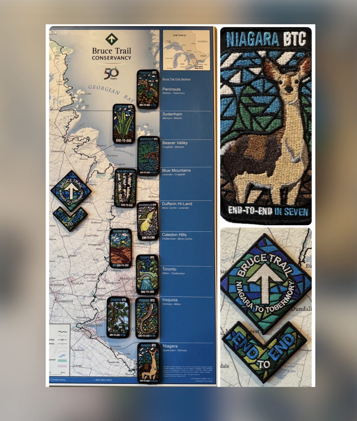
Niagara End to End for the Stained Glass Badge - Fundraiser Hike - Multi day hike series - Jan 3,4,10,11, 2026 Meet time 7:45am
https://hikes.brucetrail.org/event/niagara-end-to-end-for-the-stained-glass-badge-fundraiser-hike-multi-day-hike-series-jan-341011-2026-meet-time-745am/Sorry, the registration cut-off time for this hike has been reached.Not a member? Click here to join today!This is a Multi-Day Hike
You are signing up for the following dates:
2026-01-03, 2026-01-04, 2026-01-10, 2026-01-11Hosting Club: Niagara, Iroquoia
Category: Stained Glass Badge End to End Fundraiser Hike
Location (Google Maps): All locations are in the details below. No other communication will be shared unless we have weather issues. Please show up for all hikes by 7:45am to allow enough time to get ready for the hike and to share any information.Hike Leader(s): Ruth Moffatt Click here to contact Hike Leader(s)
Pace: Brisk – 4 to 5 km/hr, Medium – 3 to 4 km/hr
Terrain: Dependent on Conditions, Moderate – Some hills and/or some poor footing, Slippery and Steep Sections, Strenuous – Hilly with steep climbs and some poor footing
Distance: Between 17.50 and 25kmDescription
This is a monetized hike with the proceeds going towards the Niagara Bruce Trail Club – “Preserving a ribbon of wilderness for everyone, forever.” Your badge depicting the white-tailed deer, the hike logistics, shared shuttle driving and hike guidance are all included in your fee. Since it is the intention to run a similar hike in all sections this year, why not join the Bruce Trail Conservancy if you are not already a member? Please use my code 67abd1234c568 until the end of 2025 to receive free digital maps as well as all the other great benefits included with membership. https://brucetrail.org/product-category/memberships/Please read all details for this hike to ensure it is suitable for you. The pace and terrain are particularly important details.
This is a multi-day hike – Jan 3/4, 2026 and Jan 10/11, 2026. Please save Jan 18th for a makeup date in case of inclement weather on the first two weekends.
Day 1 – January 3/26
Meet – Off road parking: North side of Glendale Ave 50m east of Welland Canal https://maps.app.goo.gl/mgcgkMGKBBef7ytr6
Car shuttle to Southern Cairn at Queenston https://maps.app.goo.gl/DaiZMqTTp9YgFLA37 Distance ~ 18.5km
Day 2 – January 4/26
Meet in the parking lot off of Roland Rd – https://maps.app.goo.gl/Sds7249R4B6SsNpL6
Car shuttle to Off road parking: North side of Glendale Ave 50m east of Welland Canal. https://maps.app.goo.gl/mgcgkMGKBBef7ytr6 ~ 25 km
Day 3 – January 10/26
Meet at Cave Springs: Parking area off of Cave Springs Road https://maps.app.goo.gl/MNvdUCC49G4yXGKo8 Car shuttle to the parking lot off of Roland Rd https://maps.app.goo.gl/Sds7249R4B6SsNpL6 ~ 23km
Day 4 – January 11/26
Meet in Grimsby Lions Club Pool Parking lot at 1 Elm St https://maps.app.goo.gl/cfr3dRrcrQhFPGJm9
Car shuttle to parking area off of Cave Springs Road https://maps.app.goo.gl/MNvdUCC49G4yXGKo8 ~ 17.50km
Please ensure your car is car shuttle-ready with at least 4 available seatbelts including the driver’s. We will take turns either being the shuttle driver or driving the drivers back to their cars after the hike is over.
Please pack whatever food you will require for a long day hike including lunch and snacks; 2l of water minimum; first aid kit; poles if you use them; and icers. You may also wish to pack extra socks and rain gear. Remember to dress in layers. Gloves/mitts, scarf / neck gator, a toque and a puffy jacket. Consider lined pants as well.
We will break for a morning clothing adjustment, a 10min break around 10am, 15 min lunch and an afternoon break if we are finishing after 2pm. Bio-breaks are as you need them – please let the sweep know who will wait for you. This is a 4 day group hike so it is important you keep pace with the person in front of you. We will help each other and wait for one another but please consider your physical ability before signing up for this hike. There are no drop outs – if you are not able to finish the hike you will need to arrange for transportation back to your car via taxi or Uber at your cost.
The Niagara stained-glass badge will be presented on the last day. If you have to miss one of these hiking days, you may make it up on your own before the last day of the series. Since it is a group hike, it is intended that everyone who registers be present on all days.
Any questions may be directed through contact on this form.
If you cannot make it, please remove yourself from registration by following these steps:To cancel your registration, here is a step by step:
– Sign into your account on the BTC website
– Click on My Hikes under your account
– This will take you to a list of hikes you have registered for
– Scroll down to the appropriate hike and cursor over to the far right hand column under the Action column.
– Click Cancel under the hike you wish to cancelCar Hike: Happy Valley King City 220
https://hikes.brucetrail.org/event/car-hike-happy-valley-king-city-8/Sorry, the registration cut-off time for this hike has been reached.Not a member? Click here to join today!Hosting Club: Toronto
Location (Google Maps): Happy Valley, Oak Ridges Trail 16th Sideroad & Weston Road
Please park along 16th Side road
Hike Leader(s): Mohammad Aghamiri Click here to contact Hike Leader(s)
Pace: Moderate (3-4 km/hr)
Terrain: Hilly, Level 2 (Intermediate – some hills and uneven surfaces, rocks and roots underfoot)
Distance (km): 12-14 kmDescription
Come and join us to view the nice scenery and look out of Happy valleyCar Hike: Caledon Hills E2E #3 of 6
https://hikes.brucetrail.org/event/car-hike-caledon-hills-btc-e2e-3of6/Sorry, the registration cut-off time for this hike has been reached.Not a member? Click here to join today!Hosting Club: Toronto, Caledon Hills
Category: Car Hike
Location (Google Maps):Meet at GPS Coordinates: N43.960477, W79.979773 at BTC parking lot located off of 7th Line immediately east of Airport Road.
Hike Leader(s): Ross Estrella Click here to contact Hike Leader(s)
Pace: Brisk (4-5 km/hr)
Terrain: Challenging, Hilly, Level 2 (Intermediate – some hills and uneven surfaces, rocks and roots underfoot), Variable
Distance (km): 12kmDescription
This is an End2End hiking series covering the Caledon Hills section of the Bruce Trail in 6 hikes. As it is time of year with unsettled weather we will undertake this event at approximately 4 km/hour for an average of 13 kms per segment. Caledon Hills have numerous steep hills and deep valleys so the hikes require consistent stamina. Please consider your hiking fitness level prior to registering as this is a group hike and everyone is expected to keep pace. We will be travelling south to north and will require car shuttling. Please make sure yourself and car shuttle ready, where everyone is expected to participate. Please arrive fifteen minutes early for shuttling schedule. Things to bring: lunch/snacks, liquid hydration, sunscreen, layered clothing, personal medication (if any) health card. Hiking boots, icers, gaiters and hiking poles are highly recommended. This series hikes must be completed to receive the CHBTC E2E and Winter E2E. Don’t forget to bring your happy face and enthusiasm.NOTE: Cost of Badge is 10 dollars for BTC members and 15 dollars for Non BTC members. If you want to receive two CHBTC E2E badges, the Club E2E and Winter E2E badge there’s an additional 10 dollars for BTC members and 15 dollars for Non BTC members.
Decew, Brock, Twelve Mile Creek loopish
https://hikes.brucetrail.org/event/decew-brock-twelve-mile-creek-loopish/Sorry, the registration cut-off time for this hike has been reached.Not a member? Click here to join today!Hosting Club: Niagara
Category: Loop
Location (Google Maps): Decew House Parking LotHike Leader(s): Lauren Doig Click here to contact Hike Leader(s)
Pace: Brisk
Terrain: Moderate
Distance: 18.5 kmDescription
Meet at the parking lot for Decew House. Hike past Brock then down to 12 Mile Creek to the 406 . Return via route up Hydro hill. Dress for the weather. Bring icers, poles, water and a snack.
Bent Rim 1 and 2 (E2E)
https://hikes.brucetrail.org/event/bent-rim-1-and-2-e2e/Sorry, the registration cut-off time for this hike has been reached.Not a member? Click here to join today!Hosting Club: Iroquoia
Category: General Hike
Location (Google Maps): Meet in the parking lot at Hilton Falls Conservation Area. Reservation required.Hike Leader(s): Karen Bergmann Click here to contact Hike Leader(s)
Pace: Medium – 3 to 4 km/hr
Terrain: Moderate – Some hills and/or some poor footing
Distance: 7 kmsDescription
We will meet in the Hilton Falls Parking lot and carpool to 6th Line and hike back along the two Bent Rim trails and the Hilton Falls Side Trail back to the cars. The Bent Rim trails are actually bike trails and have some rather technical (rocky) sections to them, so be prepared for some challenges. Bring icers for your boots.For those leaving their car at Hilton Falls, you will need to reserve your time at conservationhalton.ca
Hike is dependent on weather conditions.
GO Train Hike: Niagara Falls Winter Festival Of Lights
https://hikes.brucetrail.org/event/go-train-hike-niagara-falls-winter-festival-of-lights/Sorry, the registration cut-off time for this hike has been reached.Not a member? Click here to join today!Hosting Club: Toronto
Category: GO Train Hike
Location (Google Maps): Meet in Toronto’s Union Station in the “Great Hall” by the information desk with the clock over it to depart by 10:45 AMHike Leader(s): Tom Swales, Felix Wan Click here to contact Hike Leader(s)
Pace: Moderate (3-4 km/hr)
Terrain: Flat, Level 1 (Easy – mostly on flat, well maintained trails with hard-packed surface), Variable
Distance (km): 9-11 KM (Approximate) from Niagara Falls Train Station to Dufferin Islands Park and back.Description
Join us for a trip to Niagara Falls, Ontario on the GO Train from Union Station and a hike to view the annual Festival Of Lights in Victoria and Dufferin Islands Parks. We’ll hike from the train station to the tourist area via the 1.44 km Olympic Tourch Run Legacy Trail, view the American, Bridal Veil, and Horseshoe Falls from the Canadian side, and hike on past the Horticultural Showcase to view the light displays in Dufferin Islands Park. On the return towars the train station we will view the light displays along the Niagara Parkway and in Queen Victoria Park. We begin the day taking the 11:09 train from Union Station arriving at the Niagara Falls GO Station at 1:35 pm. We’ll take a break at Table Rock House to allow to get a little darkness. The return options will be (1) 6:47 PM – Express GO Bus to Burlington, connecting with the GO train or (2) Direct train at 7:58 PM semi express to Union Station. Maximum Registration will be 23 Hikers. Be sure to dress warmly for the weather.
Full Moon Hike Series: Part 4 of 7 - Little Dunks Bay by Moonlight – Explore Bruce Peninsula National Park After Dark!
https://hikes.brucetrail.org/event/full-moon-hike-series-part-5-of-7-little-dunks-bay-by-moonlight-explore-bruce-peninsula-national-park-after-dark/Sorry, the registration cut-off time for this hike has been reached.Not a member? Click here to join today!Hosting Club: Peninsula
Category: Moonlit Hike Series
Location (Google Maps):Hike Leader(s): Tainin Hopkinson, Bill Floyd Click here to contact Hike Leader(s)
Pace: Leisurely (2.0 – 3.0 km/h): A relaxed pace with frequent breaks and a focus on enjoyment.
Terrain: Easy: Flat forested sections or lowland trails.
Distance: ~4kmDescription
Start the New Year with a magical moonlit hike along the Burnt Loop side trail, overlooking Little Dunks Bay in Bruce Peninsula National Park.Your guide, Tainin Hopkinson, an interpreter at the park and member of the Chippewas of Nawash Unceded First Nation, will share their knowledge and personal connection with this winter wonderland. The trail winds through forest and alvar landscapes before reaching the rocky shores of Little Dunks Bay. Moonlight reflecting off the water creates stunning views of Fathoms Five islands, and from the far lookout, you may glimpse the Cove Island Lighthouse and the silhouette of Flowerpot Island.
Tainin will also share insights on winter wildlife and plant activity, pointing out the subtle clues left behind by nature. Activity sheets are available at the Visitor Center to help you continue exploring at home.
Arrive early to chat and warm up by the fire with Tainin and Park staff—an hour before the hike at the Visitor Center.
Event Details:
- Moonrise: 5:03 PM (Full Moon, Supermoon – “Beaver Moon” or “Freezing Moon”)
- Sunset: 4:57 PM
- Duration: 2.5 hours
Parking & Fees:
- Visitor Center parking: $17.50
- No park entry fee (Canada Strong Pass in effect)
What to Bring:
- Red-light headlamp (optional)
- Sturdy boots
- Weather-appropriate clothing (layers recommended)
- Something to sit on, snacks, water, or a hot beverage
- Hiking poles
Badge Alert:
- New this year: earn a Full Moon Hiking Badge by joining 4 of the 7 hikes in this series.
Don’t miss this chance to connect with nature under the full moon! Clear skies will make the evening even more special.
Full Moon Hiking Badge Info:
1.Hikers must complete 4 out of 7 hikes (if a hike is canceled, registration counts).
2. Email the treasurer $10.00 to cover the badge cost at treasurer@peninsula.brucetrail.org- In the message section, indicate Full Moon Badge.
- If possible, attach a screenshot of your payment.
3. Email badges@peninsula.brucetrail.org with the subject line: Full Moon Hiking Badge. Include:
- Months attended (e.g., Oct, Dec, Jan, Mar)
- Confirmation of payment (attach screenshot if available)
- Full mailing address
4.Badge collection:
- Attend the April 1 hike to receive your badge (if all steps completed)
- Alternatively, bring $10 in cash that evening
- Badge can also be mailed if you are unable to attend (address required)
Evening, Snowshoe Adventure badge #1 - Hogg's Falls
https://hikes.brucetrail.org/event/evening-snowshoe-adventure-badge-1-hoggs-falls/Sorry, the registration cut-off time for this hike has been reached.Not a member? Click here to join today!Hosting Club: Beaver Valley
Location (Google Maps): Meet in the Hogg’s Falls parking lot (only if it’s been plowed to accommodate cars) otherwise park on the shoulder of the Lower Valley Road, on the west side. Km 65.1, Map 26, Edition 31
Hike Leader(s): Glenda Collings Click here to contact the hike leader.
Pace: Medium
Terrain: Moderate, Some steep sections
Length of Hike: Aprox. 5.1 kmDescription
Hike #1 Moonlight Hike: We will hike on main trail and side trails in the Hogg’s Falls area. On winter hikes we may encounter bare ground, light snow, deep snow, or ice. Please bring snowshoes and icers. Participants should have some experience with snowshoeing. Wear appropriate clothing for the weather plus water and a snack. Headlamps may be worn, however, if it’s a bright full moon, it is magical to hike without a light. If the weather and road conditions preclude driving, the hike will be cancelled and hikers will be notified either the night before or early that morning.COVID-19 Precautions Before, During and After your Hike
- Each hiker joining a Bruce Trail Club organized hike must perform a self-screening check before hiking.
Find Ontario’s self-assessment tool here: https://covid-19.ontario.ca/self-assessment/ - If you are experiencing COVID-19 symptoms, stay home.
Other Guidelines
- Arrive 15 minutes before the start of the hike.
- Wear sturdy footwear and appropriate attire for the weather and the terrain.
Hiking poles are a good idea in any season, especially if the terrain is rocky or slippery. In winter, snowshoes or icers/crampons are needed when conditions dictate.
Wearing appropriate clothing and footwear prevents injuries and shows consideration for a safe and positive group hiking experience. - Always carry I.D. and your health card.
- Bring sufficient water and snacks (or lunch if indicated). A minimum of 1L of water is recommended on all hikes, and 3L is recommended for long, challenging hikes in the heat of the summer.
- Bring sunscreen and insect repellent (for spring and summer hikes).
- Bring your own first aid kit.
- Please leave dogs at home.
Wolf Moon Moonlight hike-Eleventh Line Loop
https://hikes.brucetrail.org/event/wolf-moon-moonlight-hike-eleventh-line-loop-2/Sorry, the registration cut-off time for this hike has been reached.Not a member? Click here to join today!Hosting Club: Blue Mountains
Category: Organized Hike
Location (Google Maps): Tim Horton’s First Street, CollingwoodHike Leader(s): David Little Click here to contact Hike Leader(s)
Pace: Leisurely – 3 km/hr. or less
Terrain: Easy – Mostly flat and usually good footing
Distance: 3 kmDescription
We will drive to a suitable start point for a hike through the many loop trails off the Eleventh Line, just west of Collingwood. The trails are mostly in the trees and well-sheltered. The hike will be about two hours. Bring a snack and water. January’s full moon is commonly known as the Wolf Moon in Native American cultures. These ancient tribes named this moon when wolves howled in hunger outside the Villages. It is also known as the Old Moon. Moonlight Badge available for $10.Winter Badge Series Hike #1 of 4
https://hikes.brucetrail.org/event/winter-badge-series-hike-1-of-4/Sorry, the registration cut-off time for this hike has been reached.Not a member? Click here to join today!Hosting Club: Dufferin Hi-Land
Category: General Hike
Location (Google Maps): Dufferin Hi-Lands Map 20 Km 12.2. 30 Sideroad East of Hurontario St. Google Maps link on this Hike Description.Hike Leader(s): Bryan and Carol Foley Click here to contact Hike Leader(s)
Pace: Leisurely
Terrain: Dependent on Conditions, Moderate, Slippery Sections Likely
Distance: 6.5 kmDescription
Meet Map 20 Km. 12.2 ( 30th Sideroad ) We will hike in and back Roadside parking MIND THE DITCHES Bring water, headlamp, icers, snowshoes. Dress for the weather.
Full Moon Night Hike No.1 (Super Wolf Moon)
https://hikes.brucetrail.org/event/full-moon-night-hike-no-1-super-wolf-moon/Sorry, the registration cut-off time for this hike has been reached.Not a member? Click here to join today!Hosting Club: Iroquoia
Category: Moonlight Hikes
Location (Google Maps): Kerncliff Park, Burlington (Parking + Meet Up Spot is the Kerncliff Parking Lot, not Cityview Park)Hike Leader(s): Joe Borges Click here to contact Hike Leader(s)
Pace: Medium – 3 to 4 km/hr
Terrain: Moderate – Some hills and/or some poor footing
Distance: 5 kmDescription
Super Wolf Moon & Quadrantid MeteorsStep into the magic of the night and join us for our first Full Moon Night Hike of 2026 under the Super Wolf Moon. This month’s full moon will shine brighter and closer than usual, lighting our path as the Quadrantid Meteor Shower reaches its peak. A truly spectacular way to start the hiking year!
This hike also launches our new Full Moon Night Hike Badge Series. Complete 3 Full Moon Night Hikes led by an Iroquoia Club Leader in 2026 to qualify and purchase the new badge. With 13 full moons in 2026, there will be plenty of chances to earn your badge and enjoy the trail by moonlight.
Important Guidelines
Hike Start Time: 7:00 pm
Arrive: at the Parking Lot at least 15 minutes before the hike start time.
Lighting: A headlamp (recommended) or flashlight (bring two) with fresh batteries or a full charge.
Poles & Traction: Hiking poles are helpful, especially for winter hikes. Please bring icers or crampons for icy sections.
Clothing: Dress appropriately for cold weather and varied terrain to ensure a safe and enjoyable experience.
Essentials: Carry I.D. and your health card at all times.
Hydration & Snacks: Bring at least 1L of water and sufficient snacks.
Safety: Pack your own small first aid kit.
Pets: Please note, no dogs on this hike.
Parking: We are meeting and parking in lot for Kerncliff Park (below in the old quarry) not Cityview parking up top. Parking closes at 11 pm, but we will be off the trail by 9:00 pm.Come share the glow of the full moon, connect with fellow hikers, and begin your journey toward earning the new Full Moon Night Hike Badge. The trails (and the stars) are waiting!
7:00 pm Moonlight Night Hike in Niagara-on-the-Lake
https://hikes.brucetrail.org/event/700-pm-moonlight-night-hike-in-niagara-on-the-lake-12/Sorry, the registration cut-off time for this hike has been reached.Not a member? Click here to join today!Hosting Club: Niagara
Category: Night
Location (Google Maps):Veteran’s Memorial Park, park just outside the park on King St.
Hike Leader(s): Robin Garrett Click here to contact Hike Leader(s)
Pace: Medium
Terrain: Easy
Distance: 6-7 kmDescription
Moonlight Night Hike – Take in the magic of the rising moon over Lake Ontario and the Niagara River. This hike includes a stop to connect with your senses – sights, sounds, smells and the rhythm of your breath. Counts towards your night hike badge (5 night hikes).