|
Sun | Mon | Tue | Wed | Thu | Fri | Sat |
|---|
July | July | July | July | July | July | 1  Car Hike: Hollad River Trail Car Hike: Hollad River Trail 8:30 AM-1:00 PM 08/01/2026 https://hikes.brucetrail.org/event/car-hike-hollad-river-trail-2/2026-08-01/ Click here for more information or to register Hosting Club: Toronto Location (Google Maps): We start the hike from Evans park ,you may park along benville cres off Bayview Hike Leader(s): MOHAMMAD AGHAMIRI Click here to contact Hike Leader(s) Pace: Moderate (3-4 km/hr)
Terrain: Level 2 (Intermediate – some hills and uneven surfaces, rocks and roots underfoot), Variable
Distance (km): 14-15 km Description
We start the hike from Evans park ,walking north along Holland River , passing heppard’s Bush Conservation Area to Newmarket trails and return
- Lions Head, 1 of 3
10:00 AM-3:00 PM 08/01/2026 https://hikes.brucetrail.org/event/lions-head-1-of-3/2026-08-01/ Click here for more information or to register Hosting Club: Toronto, Peninsula
Category: Car Hike
Location (Google Maps): Lions Head, Map 39 Hike Leader(s): Alex Brown Click here to contact Hike Leader(s) Pace: Moderate (3-4 km/hr)
Terrain: Level 2 (Intermediate – some hills and uneven surfaces, rocks and roots underfoot), Variable
Distance (km): 12 Description
This is the first of six hikes from Lions Head to Tobermory to be conducted over two weekends. The first series is named Lions Head. The second will be named Tobermory. The first hike in each series will be about 12 km. Follow on hikes will vary in length depending on group wishes. We will begin the series at km 87.2 at the parking area. This section of the trail follows the escarpment north over variable rocky sections. After the hike we will meet for refreshments and to confirm arrangements for the following day. Details TBA. Given the distance it is anticipated that hikers coming from the Toronto area will find accommodation locally. I understand that options range from camping to hotels. More to follow on this subject as well. Those joining the hikes are asked to confirm their personal arrangements with me. Al
|
2 - Lion’s Head, 2 of 3
9:30 AM-3:30 PM 08/02/2026 https://hikes.brucetrail.org/event/lions-head-2-of-3/2026-08-02/ Click here for more information or to register Hosting Club: Toronto, Peninsula
Category: Car Hike
Location (Google Maps): Cape Chin/Dyers Bay, Maps 39 and 40 Hike Leader(s): Alex Brown Click here to contact Hike Leader(s) Pace: Moderate (3-4 km/hr)
Terrain: Level 2 (Intermediate – some hills and uneven surfaces, rocks and roots underfoot), Rocky, Variable
Distance (km): 13.7 or 16.4 km Description
This is the second hike of the Lion’s Head series. We will begin the hike at km 99.3 where the trail crosses Cape Chin South Road and complete at km 113 or 115.7. The hike will mostly follow the forested escarpment edge, occasionally turning inland. Trail conditions are mostly rocky. After the hike we will meet for refreshments and to plan out the activity for day 3.
- Burlington Heritage Week / River & Ruin Historical Hike
9:30 AM-12:00 PM 08/02/2026 https://hikes.brucetrail.org/event/burlington-heritage-week-river-ruin-historical-hike/2026-08-02/ 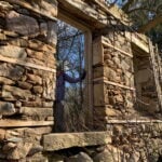 Click here for more information or to register Hosting Club: Iroquoia
Category: Historical Hike
Location (Google Maps): Kilbride Park Parking Lot Behind the Kilbride School, access to Main Trail and Kilbride Pass Hike Leader(s): Joe Borges Click here to contact Hike Leader(s) Pace: Leisurely – 3km/hr or less
Terrain: Dependent on Conditions, Moderate – Some hills and/or some poor footing, Slippery and Steep Sections
Distance: 7.6 km Description
Burlington Heritage Week Hike: River & Ruin Join us for the special hike brought to you by Iroquoia Bruce Trail Club partnering with the City of Burlington for Heritage Week. The theme this year is water, so we will hike through one of Burlington’s most historically rich landscapes. The River & Ruin trail winds through the beautiful Lowville Valley, where the natural drama of Twelve Mile Creek meets the traces of Burlington’s early settlement history. Along the way, we’ll explore the stories of Kilbride, Lowville, and the Cleaver family, whose mill, homestead, and ruins helped shape this valley nearly two hundred ago. This hike offers more than beautiful views, it’s a walk through time. From the limestone ruins and historic mill site to the creek that powered early industry and settlement, the route reveals how farming, waterpower, and pioneering families transformed the area into one of Burlington’s most fascinating heritage corridors. If you enjoy trails with a strong sense of place, local history, and a great story under your boots, this is the hike for you. Come discover the hidden history of Kilbride and the Lowville Valley, experience why this unique trail is one of Burlington’s most memorable heritage walks. Note, no dogs are permitted on this hike.
| 3 - Lion’s Head, 3 of 3
9:30 AM-1:30 PM 08/03/2026 https://hikes.brucetrail.org/event/lions-head-3-of-3/2026-08-03/ Click here for more information or to register Hosting Club: Toronto, Peninsula
Category: Car Hike
Location (Google Maps): Dyers Bay, Map 40 Hike Leader(s): Alex Brown Click here to contact Hike Leader(s) Pace: Moderate (3-4 km/hr)
Terrain: Flat, Level 1 (Easy – mostly on flat, well maintained trails with hard-packed surface)
Distance (km): 12.4 or 9.7 Description
We start at km 113.0 or 115.6 and finish at Km 125.4. This section begins near the escarpment and then moves onto rural roads (Lindsay Road 40 and Crane Lake Road). The roads are flat and easy. We will start this hike a bit earlier and finish earlier. Those who came long distance for the weekend may get an early start on the return trip.
| 4  Urban Walk: Valley View/Huntington Park Urban Walk: Valley View/Huntington Park 9:30 AM-11:45 AM 08/04/2026 https://hikes.brucetrail.org/event/urban-walk-valley-view-huntington-park-13/2026-08-04/ Click here for more information or to register Hosting Club: Toronto Location (Google Maps): Parking lot is off Sycamore Drive, East of Bayview , across Starbucks plaza
Bus 91 from Finch East station stops at Sycamore station. Hike Leader(s): Mohammad Aghamiri Pace: Moderate (3-4 km/hr)
Terrain: Hilly, Level 2 (Intermediate – some hills and uneven surfaces, rocks and roots underfoot)
Distance (km): 6-7 km Description
We will explore Valleyview and Maple View parks, and walk along German Mill Creak, in return we stop in Huntington park and have snack under beautiful shed. Although this is considered an “Urban Walk”, you can expect some hills up and down and uneven surfaces with tree roots. Please bring hiking poles, water and snacks.
| 5 - RIM 2 RIM Badge Hike #2 Mad River Rim (Second in a series of 3 for the Rim2Rim badge)
9:00 AM-2:00 AM 08/05/2026 https://hikes.brucetrail.org/event/rim-2-rim-badge-hike-2-mad-river-rim-second-in-a-series-of-3-for-the-rim2rim-badge/2026-08-05/  Click here for more information or to register Hosting Club: Blue Mountains
Category: Organized Hike
Location (Google Maps): Devil’s Glen Provincial Park, Simcoe County Rd 124, Glen Huron, ON L0M 1H0 Hike Leader(s): Rob Johnston Click here to contact Hike Leader(s) Pace: Medium – 3 to 4 km/hr
Terrain: Strenuous – Hilly with steep climbs and some poor footing
Distance: 10 Description
This is the second of three the Rim-To-Rim hikes required for the Blue Mountain Rim-To-Rim badge. This hikes starts at the top of a river valley, hikes down and up the other side, then back again. As such these are very hilly and strenuous. About 12 km with almost 800 m elevation gain. Meet at Devil’s Glen PP parking lot. We will hike south along the white blazed main Bruce Trail down through the Devil’s Glen area, cross the Mad River, then go up the other side to where the trail meets the blue blazed Mad River Side Trail. We will hike down along the sidetrail until it rejoins the main trail, then return to our cars again following the main trail. Bring lots of snacks, lunch and water. Check the other two Rim-To-Rim hikes in the schedule on 8 July 2026 and 29 Aug 2026
- Evening Hike in Owen Sound followed by Social Time at the Hike Leader`s home
7:00 PM-8:45 PM 08/05/2026 https://hikes.brucetrail.org/event/evening-hike-in-owen-sound-followed-by-social-time-at-the-hike-leaders-home/2026-08-05/ Click here for more information or to register Hosting Club: Sydenham
Category: Hike & Potluck
Location (Google Maps): Meet in the municipal parking lot by the river on the West side of 1st Ave East between 7th St East an 8th St East in Owen Sound Hike Leader(s): Harriet Nixon Click here to contact Hike Leader(s) Pace: Brisk: 4 to 5 km/h
Terrain: Moderate: Some hills and/or poor footing
Distance: Approx 5 km Description
Join us for a brisk summer evening hike exploring the Sydenham River valley within the Owen Sound City limits. Following the hike participants are invited to the Hike Leader`s home for refreshments. There is no need to show up 15 minutes early for this hike, but we will leave promptly at 7:00 pm.
| 6 - Beaver Bites – Hike 1 of 4
9:15 AM-3:30 PM 08/06/2026 https://hikes.brucetrail.org/event/beaver-bites-hike-1-of-4/2026-08-06/ Click here for more information or to register Hosting Club: Caledon Hills
Category: General
Location (Google Maps): Meet at Epping Lookout, km 94.3, on Grey Road 7 north of 19 Sideroad. Hike Leader(s): Nancy Mooney Click here to contact Hike Leader(s) Pace: Medium – 3 to 4 km/hour
Terrain: Moderate – some hills and/or some poor footing
Distance: There are 2 hikes on this day and each of the 4 days in this series. The first hike will be 9.8 km and the second hike will be 3.8 km. Description
This hike series involves long days but a great way to tackle 30 km of side trails in Beaver Valley to earn the Beaver Bites badge. We will loop around Fairmount with a break at Webwood Falls. (Map 28) We will then have a lunch break back at Epping Lookout, including the short Epping Side Trail before heading over to do a short loop at the Wodehouse Management area and the Sligo Side Trail. (Map 27)
- Urban Walk: Valley View/Huntington Park
9:30 AM-11:45 AM 08/06/2026 https://hikes.brucetrail.org/event/urban-walk-valley-view-huntington-park-14/2026-08-06/ Click here for more information or to register Hosting Club: Toronto Location (Google Maps): Parking lot is off Sycamore Drive, East of Bayview , across Starbucks plaza
Bus 91 from Finch East station stops at Sycamore station. Hike Leader(s): Mohammad Aghamiri Pace: Moderate (3-4 km/hr)
Terrain: Hilly, Level 2 (Intermediate – some hills and uneven surfaces, rocks and roots underfoot)
Distance (km): 6-7 km Description
We will explore Valleyview and Maple View parks, and walk along German Mill Creak, in return we stop in Huntington park and have snack under beautiful shed. Although this is considered an “Urban Walk”, you can expect some hills up and down and uneven surfaces with tree roots. Please bring hiking poles, water and snacks.
 Scottsdale Farm the Easy Way Scottsdale Farm the Easy Way 9:30 AM-12:30 PM 08/06/2026 https://hikes.brucetrail.org/event/scottsdale-farm-the-easy-way/2026-08-06/ Click here for more information or to register Hosting Club: Iroquoia, Toronto
Category: Easy Does It Hikes
Location (Google Maps): Scottsdale Farm 13807 Trafalgar Rd. Hike Leader(s): Anne Armstrong Click here to contact Hike Leader(s) Pace: Leisurely – 3km/hr or less
Terrain: Easy – Mostly flat and usually good footing Description
Come join us for this easy hike exploring the side trails around Scottsdale Farm. Learn about the history of the farm and enjoy the beauty of the farm and surrounding area. Meet in the parking lot at the end of a long road into the farm at 9:15 for a 9:30 start. Bring a snack, water, sunscreen and insect repellent. I will send an email the day before with my contact ingormation
 Hike, followed by Blues in the Park Hike, followed by Blues in the Park 5:30 PM-7:00 PM 08/06/2026 https://hikes.brucetrail.org/event/hike-followed-by-blues-in-the-park-6/2026-08-06/  Click here for more information or to register Hosting Club: Niagara
Category: Leisurely
Location (Google Maps): 2275 Dorchester Rd, Niagara Falls, ON L2J 0H1 Hike Leader(s): Marion Hanover Click here to contact Hike Leader(s) Pace: Leisurely <3 km/hr
Terrain: Moderate: some hills and some poor footing
Distance: 4km Description
Hike series Thursday evenings throughout the summer, followed by optional Blues in the Park. Come prepared to hike 1.5 leisure hike. Various blues bands free of charge starting at 7pm in the park. Bring lawn chair, beverage and snack to share.
| 7 | 8 - Peninsula Sunrise Series: The Grotto
5:00 AM 08/08/2026 https://hikes.brucetrail.org/event/peninsula-sunrise-series-the-grotto-2/2026-08-08/ 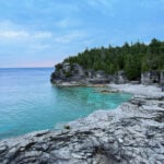 Click here for more information or to register Hosting Club: Peninsula
Category: Sunrise Hike
Location (Google Maps): Parking lot at Dyers Bay Rd & Hwy 6, Northern Bruce Peninsula, ON N0H 1Z0 Hike Leader(s): Kathleen Stahlbaum Click here to contact Hike Leader(s) Pace: Leisurely (2.0 – 3.0 km/h): A relaxed pace with frequent breaks and a focus on enjoyment., Medium (3.0 – 4.5 km/h): A comfortable pace for most hikers with steady progress.
Terrain: Difficult: Steep ascents/descents, rocky scrambling, and some rugged escarpment paths., Easy: Flat forested sections or lowland trails., Moderate: Rolling hills, mild slopes and rocky paths.
Distance: 7.5 km Description
Experience the magic of dawn on the Bruce Trail with the Sunrise Hike Series offered by the Peninsula Bruce Trail Club. These early morning hikes provide a perfect opportunity to awaken your senses, boost your energy, and immerse yourself in the tranquility of nature as the sun paints the sky with breathtaking hues. As we make our way through scenic forest trails, we’ll pause to witness the first light shimmering on the turquoise waters of Georgian Bay – a sight that will surely leave you in awe! Beyond the beauty, morning light helps regulate your circadian rhythm, elevating your mood, boosting energy levels and improving sleep quality. Whether you’re looking to start your day with a sense of calm, capture stunning sunrise photos, or simply reconnect with nature, these hikes offer a unique and inspiring way to greet the day. On Saturday August 8th, join us in hiking the Cyprus Lake and Georgian Bay Trail to the Grotto at Indian Head Cove, where we’ll experience the sun rising over the Bay from the iconic shoreline before returning via the Marr Lake Trail. We’ll have the joy of taking in the stunning colours of the sky as the first light sparkles on the stunning turquoise waters. This peaceful sunrise hike is the perfect way to connect with nature, capture some incredible photos, and start the day with fresh air and inspiration. Whether you’re a morning person or just love a good adventure, come experience the magic of dawn from one of the best vantage points on the Bruce Peninsula! Don’t forget to bring a headlamp or flashlight (preferably with a red light setting) as we begin our adventure in the pre-dawn quiet. Join us and discover how a sunrise hike can nourish your mind, body, and spirit – setting the tone for a brighter, more balanced day. This hike is approximately 7.5 kms in length. Expect to be on the trail for ~3 hours. Pace will be leisurely with ample time to enjoy the sunrise, take some photographs, and nourish yourself! How to prepare - Get a good night’s sleep
- Bring lots of water and a snack (breakfast and/or coffee are recommended if that’s your thing!)
- Bring a headlamp or flashlight (preferably with a red light setting)
- Wear waterproof hiking boots
- Hiking poles are recommended but not necessary
- Bring insect repellant or wear protective clothing
- Bring sunscreen
LIMITED SPACE AVAILABLE! We will be meeting at the parking lot at the corner of Highway 6 & Dyer’s Bay road and carpooling in 2-3 vehicles to Bruce Peninsula National Park. If you have a Parks pass, please bring it with you! In the event of cloudy/rainy weather, the hike will be held on Sunday, August 9th. Please watch your emails for a confirmation the week of the hike!
- Car Hike: Oak Ridges Corridor
8:30 AM-1:00 PM 08/08/2026 https://hikes.brucetrail.org/event/car-hike-oak-ridges-corridor-2/2026-08-08/ Click here for more information or to register Hosting Club: Toronto Location (Google Maps): Oak Ridges Corridor, Bethesda Trail Head Parking Lot, Bethesda Side Road, Richmond Hill, Ontario Hike Leader(s): MOHAMMAD AGHAMIRI Click here to contact Hike Leader(s) Pace: Moderate (3-4 km/hr)
Terrain: Hilly, Level 2 (Intermediate – some hills and uneven surfaces, rocks and roots underfoot)
Distance (km): 14-15 km Description
Join us to explore the trails of York Regional Forest and the Oak Ridges Corridor at Jefferson Forest and Bond lake, From parking lot we hike thought Jefferson forest and continue to Bond Lake and have snack beside the lake and return to parking around 1:pm Please bring lots of water and snacks ,hiking poles are recommended,it is Mosquto and Tick season ,be prepared . phone number for the day of hike 289 588 6482
- Geology Hike and Badge Series – Lion’s Head
9:30 AM 08/08/2026 https://hikes.brucetrail.org/event/geology-hike-and-badge-series-lions-head/2026-08-08/  Click here for more information or to register Hosting Club: Peninsula
Category: Geology Hike
Location (Google Maps): Lion’s Head Hike Leader(s): Beth Gilhespy Click here to contact Hike Leader(s) Pace: Leisurely (2.0 – 3.0 km/h): A relaxed pace with frequent breaks and a focus on enjoyment., Medium (3.0 – 4.5 km/h): A comfortable pace for most hikers with steady progress.
Terrain: Moderate: Rolling hills, mild slopes and rocky paths.
Distance: 11 Description
Join the adventure and earn the inaugural Peninsula Geology Badge! Over a stretch of 13 hikes and a couple of extra stops, we will explore the fascinating geology of the Peninsula to learn about the rocks, the shoreline features, glaciation, fossils and all things earthy. The 13 hikes are from the book “Walking Through Time – Exploring the Geology of the Saugeen (Bruce) Peninsula”. Having a copy will give you a lot of great information, but you do not have to purchase the book to attend and enjoy the hikes. Just bring your curiosity! We will make sure to hit all the locations that qualify for the beautiful new Walking Through Time – Saugeen (Bruce) Peninsula geology hike badge. If you would like to purchase a book I will have some available on the hikes, or you can pick one up from the BTC Head Office, at Ginger Press in Owen Sound, Suntrail Source for Adventure in Hepworth, the Shop at 84 Main in Lion’s Head and at Reader’s Haven in Tobermory. You are welcome to come on just a few of the hikes or on all of them, and the dates and hikes are as follows: Date Geology Hike km Saturday May 2, 2026 Colpoy’s Bay 9.0 Saturday May 9, 2026 Gravelly Point (am) and Rural Rocks (pm) 8.6 Saturday May 16, 2026 Malcolm Bluff 7.3 Sunday May 17, 2026 White Bluff/Smokey Head 11.8 Sunday May 24, 2026 Crooked Toe Road 5.5 Sunday May 31, 2026 Hope Bay 8.1 Sunday June 14, 2026 Boundary Bluffs 5.2 Saturday July 4, 2026 Cape Dundas 6.2 Saturday July 11, 2026 Beth Gilhespy Side Trail 7.6 Saturday August 8, 2026 Lion’s Head 11.0 Saturday August 15, 2026 Dyer’s Bay Loops 7.5 Saturday August 22, 2026 North Saugeen (Bruce) Shoreline 8.0 Meeting times will vary depending on the hike, but will generally be some time between 9 am and 10 am. Information on exact meeting times and locations will be sent out a few days prior to the hike.
|
9  RAINBOW HIKE: Downtown Dundas to Dundas Peak (Tew’s & Webster’s Falls) RAINBOW HIKE: Downtown Dundas to Dundas Peak (Tew’s & Webster’s Falls) 9:00 AM-2:00 PM 08/09/2026 https://hikes.brucetrail.org/event/rainbow-hike-downtown-dundas-to-dundas-peak-tews-websters-falls/2026-08-09/ 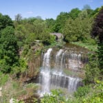 Click here for more information or to register Hosting Club: Iroquoia
Category: Rainbow Hike
Location (Google Maps): Corner of Sydenham and King, downtown Dundas. Hike Leader(s): Doug O’Neill Click here to contact Hike Leader(s) Pace: Medium – 3 to 4 km/hr
Terrain: Moderate – Some hills and/or some poor footing, Strenuous – Hilly with steep climbs and some poor footing
Distance: 10 kms (or 13 km option) Description
Come by car or HSR transit for this all-inclusive 2SLGBTQIA+-friendly hike from downtown Dundas to the top of Dundas Peak/Spencer Gorge with time to explore both Tew’s and Webster’s Falls. Terrain: We’ll get the uphill part of out the way first. Dundas Peak is an estimated 340 metres (1,100 feet) above sea level. Awesome views. Worth every bead of sweat!
Photo buffs will love the incredible views. We’ll follow the Lookout Trail all the way up to the top of the escarpment, with stops at the Dundas Peak and Tew Falls lookouts. Meet-up: We’ll rendezvous no later than 9 a.m. at the benches outside the TD Bank, corner of Sydenham and King Street. Adjacent (free!) parking at Ed & Shawn’s Brewery (65 Hatt St., off Sydenham.) Tip: If you arrive early or need to use the loo before hiking, Starbucks (45 King St. W., downtown Dundas) is a 2-minute walk down the street from the parking lot. Coming by public transit? There are two options: 05-HEAD STREET via DOWNTOWN DUNDAS or 5B -PIRIE AT GOVERNORS, depending where you are coming from. Ensure you arrive no later than 9:00 a.m. for a 9:15 a.m. departure. Bus fares: $2.50-3.50. You have two options of hike lengths: Upon reaching Tew’s Falls, you can enjoy an extended break or continue to Webster’s Falls (for an additional 3 km there and back). Please bring at least 2 litres of water, energizing snacks and proper lunch. There is no option to refill water bottles. There are porta-potties (if you don’t mind the “aroma”) at Tew’s Falls. Don’t forget sunscreen and insect repellent. Hiking boots or sturdy footwear are recommended—as well a cap. Wear long pants (no shorts)—to avoid ticks. Post-hike ice-cream or IPA in downtown Dundas. Everyone is welcome! Complimentary Bruce Trail Rainbow badge and/or stickers to all participants! Email any questions to the Hike Leader – “Click here to contact Hike Leader” on this form.
| 10 | 11 - Urban Walk: Valley View/Huntington Park
9:30 AM-11:45 AM 08/11/2026 https://hikes.brucetrail.org/event/urban-walk-valley-view-huntington-park-15/2026-08-11/ Click here for more information or to register Hosting Club: Toronto Location (Google Maps): Parking lot is off Sycamore Drive, East of Bayview , across Starbucks plaza
Bus 91 from Finch East station stops at Sycamore station. Hike Leader(s): Mohammad Aghamiri Pace: Moderate (3-4 km/hr)
Terrain: Hilly, Level 2 (Intermediate – some hills and uneven surfaces, rocks and roots underfoot)
Distance (km): 6-7 km Description
We will explore Valleyview and Maple View parks, and walk along German Mill Creak, in return we stop in Huntington park and have snack under beautiful shed. Although this is considered an “Urban Walk”, you can expect some hills up and down and uneven surfaces with tree roots. Please bring hiking poles, water and snacks.
| 12 | 13 - Beaver Bites – Hike 2 of 4
9:15 AM-4:00 PM 08/13/2026 https://hikes.brucetrail.org/event/beaver-bites-hike-2-of-4/2026-08-13/ Click here for more information or to register Hosting Club: Caledon Hills
Category: General
Location (Google Maps): Meet at Metcalfe Crevices parking area, km 27.9, where the main trail crosses 10th Line. Hike Leader(s): Nancy Mooney Click here to contact Hike Leader(s) Pace: Medium – 3 to 4 km/hour
Terrain: Moderate – some hills and/or some poor footing, Strenuous – hilly with steep climbs and some poor footing
Distance: Hike one will be 10.4 km and the second hike will be 7 km. Description
This day will be challenging but rewarding when we loop through Duncan Crevice Caves Provincial Nature Reserve, (Map 25) and explore Metcalfe Crevice. After our lunch break we will head over to Loree Forest and hike another loop.
- Urban Walk: Valley View/Huntington Park
9:30 AM-11:45 AM 08/13/2026 https://hikes.brucetrail.org/event/urban-walk-valley-view-huntington-park-16/2026-08-13/ Click here for more information or to register Hosting Club: Toronto Location (Google Maps): Parking lot is off Sycamore Drive, East of Bayview , across Starbucks plaza
Bus 91 from Finch East station stops at Sycamore station. Hike Leader(s): Mohammad Aghamiri Pace: Moderate (3-4 km/hr)
Terrain: Hilly, Level 2 (Intermediate – some hills and uneven surfaces, rocks and roots underfoot)
Distance (km): 6-7 km Description
We will explore Valleyview and Maple View parks, and walk along German Mill Creak, in return we stop in Huntington park and have snack under beautiful shed. Although this is considered an “Urban Walk”, you can expect some hills up and down and uneven surfaces with tree roots. Please bring hiking poles, water and snacks.
- Hike, followed by Blues in the Park
5:30 PM-7:00 PM 08/13/2026 https://hikes.brucetrail.org/event/hike-followed-by-blues-in-the-park-7/2026-08-13/  Click here for more information or to register Hosting Club: Niagara
Category: Leisurely
Location (Google Maps): 2275 Dorchester Rd, Niagara Falls, ON L2J 0H1 Hike Leader(s): Marion Hanover Click here to contact Hike Leader(s) Pace: Leisurely <3 km/hr
Terrain: Moderate: some hills and some poor footing
Distance: 4km Description
Hike series Thursday evenings throughout the summer, followed by optional Blues in the Park. Come prepared to hike 1.5 leisure hike. Various blues bands free of charge starting at 7pm in the park. Bring lawn chair, beverage and snack to share.
| 14 | 15 - Car Hike: Boyd C.A.
8:30 AM-1:15 PM 08/15/2026 https://hikes.brucetrail.org/event/car-hike-boyd-conservation-park-vaughan-16/2026-08-15/ Click here for more information or to register Hosting Club: Toronto Location (Google Maps): Free Parking lot before entrance of park on Islington Ave. Hike Leader(s): Mohammad Aghamiri Click here to contact Hike Leader(s) Pace: Moderate (3-4 km/hr)
Terrain: Hilly, Level 2 (Intermediate – some hills and uneven surfaces, rocks and roots underfoot), Variable
Distance (km): 12-14 km Description
Let’s hike Boyd conservation park trails through beautiful valleys. Please bring lots of water and snacks ,hiking poles are recommended phone number for the day of hike 289 588 6482
- Braiding Friendship
9:30 AM 08/15/2026 https://hikes.brucetrail.org/event/braiding-friendship/2026-08-15/  Hike open to BTC Members only. Click here for more information or to register Hosting Club: Peninsula Location (Google Maps): Rural Rootz Nature Reserve, 645 Northacres Road, South Bruce Peninsula. N0H 2T0 Hike Leader(s): Marg Glendon Click here to contact Hike Leader(s) Pace: Leisurely (2.0 – 3.0 km/h): A relaxed pace with frequent breaks and a focus on enjoyment.
Terrain: Difficult: Steep ascents/descents, rocky scrambling, and some rugged escarpment paths., Easy: Flat forested sections or lowland trails., Moderate: Rolling hills, mild slopes and rocky paths.
Distance: ~4 km Description
The Bruce Trail Conservancy is a founding member of the World Trails Network, working collaboratively to sustainably promote and support public footpaths through the creation of Friendship Trails. Much like twin cities, Friendship Trails connect trail organizations from different countries in a spirit of partnership, shared promotion, and international collaboration. These connections celebrate friendship, strengthen community, and bring people from all walks of life together—both with nature and with one another Although this second hike in the Friendship Trail series is not a designated International Friendship Trail, it explores the idea of friendship through the lens of reciprocity, gratitude, and shared experience, inspired by the teachings of Robin Wall Kimmerer. Join us for a unique combination of a workshop and hike focusing on connection—with each other and with the natural world. We will begin with a hands-on workshop led by Natasha Akiwenzie of Bagida’waad Alliance, who will introduce participants to the concept of sustainable harvesting. You will have an opportunity to braid your own sweetgrass while reflecting on the importance of kindness, reciprocity and nurturing relationships. Sweetgrass is one of four sacred medicines in many First Nations cultures. Following the workshop, we’ll enjoy a short hike at Rural Rootz Nature Reserve, where we’ll observe how these lessons are reflected in nature. Rural Roots Side Trail is the only Bruce Trail Conservancy side trail which is not physically connected to the Bruce Trail. It is a unique ecosystem which holds examples of karst topography, wetland, limestone caves and moss covered boulders. This experience offers a thoughtful blend of learning, reflection, friendship and time outdoors. Free-will cash donations to Rural Rootz Nature Reserve are appreciated. These donations go toward maintaining Rural Rootz Nature Reserve. Thank you to Tom and Dee Ashman for generously welcoming us to Rural Rootz Nature Reserve.
- Geology Hike and Badge Series – Dyer’s Bay
9:30 AM 08/15/2026 https://hikes.brucetrail.org/event/geology-hike-and-badge-series-dyers-bay/2026-08-15/  Click here for more information or to register Hosting Club: Peninsula
Category: Geology Hike
Location (Google Maps): Dyer’s Bay Hike Leader(s): Beth Gilhespy Click here to contact Hike Leader(s) Pace: Leisurely (2.0 – 3.0 km/h): A relaxed pace with frequent breaks and a focus on enjoyment.
Terrain: Difficult: Steep ascents/descents, rocky scrambling, and some rugged escarpment paths., Moderate: Rolling hills, mild slopes and rocky paths.
Distance: 7.5 Description
Join the adventure and earn the inaugural Peninsula Geology Badge! Over a stretch of 13 hikes and a couple of extra stops, we will explore the fascinating geology of the Peninsula to learn about the rocks, the shoreline features, glaciation, fossils and all things earthy. The 13 hikes are from the book “Walking Through Time – Exploring the Geology of the Saugeen (Bruce) Peninsula”. Having a copy will give you a lot of great information, but you do not have to purchase the book to attend and enjoy the hikes. Just bring your curiosity! We will make sure to hit all the locations that qualify for the beautiful new Walking Through Time – Saugeen (Bruce) Peninsula geology hike badge. If you would like to purchase a book I will have some available on the hikes, or you can pick one up from the BTC Head Office, at Ginger Press in Owen Sound, Suntrail Source for Adventure in Hepworth, the Shop at 84 Main in Lion’s Head and at Reader’s Haven in Tobermory. You are welcome to come on just a few of the hikes or on all of them, and the dates and hikes are as follows: Date Geology Hike km Saturday May 2, 2026 Colpoy’s Bay 9.0 Saturday May 9, 2026 Gravelly Point (am) and Rural Rocks (pm) 8.6 Saturday May 16, 2026 Malcolm Bluff 7.3 Sunday May 17, 2026 White Bluff/Smokey Head 11.8 Sunday May 24, 2026 Crooked Toe Road 5.5 Sunday May 31, 2026 Hope Bay 8.1 Sunday June 14, 2026 Boundary Bluffs 5.2 Saturday July 4, 2026 Cape Dundas 6.2 Saturday July 11, 2026 Beth Gilhespy Side Trail 7.6 Saturday August 8, 2026 Lion’s Head 11.0 Saturday August 15, 2026 Dyer’s Bay Loops 7.5 Saturday August 22, 2026 North Saugeen (Bruce) Shoreline 8.0 Meeting times will vary depending on the hike, but will generally be some time between 9 am and 10 am. Information on exact meeting times and locations will be sent out a few days prior to the hike.
- Saturday Shorts: Hockleycrest
9:30 AM-11:30 AM 08/15/2026 https://hikes.brucetrail.org/event/saturday-shorts-hockleycrest-6/2026-08-15/ 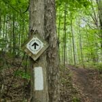 Click here for more information or to register Hosting Club: Caledon Hills
Category: General
Location (Google Maps): Meet at the Mono 5 Sideroad parking area at km 45.4 on the north side of the road where the Trail crosses. This is east of Airport Road. It is best to aim for arriving around 9:20, so we can start hiking as close to 9:30 am as possible. Thanks! It is a popular meet-up spot for hikers. If the parking lot is full, you can park along Mono 5 Sideroad. Hike Leader(s): Elizabeth Ganong Click here to contact Hike Leader(s) Pace: Leisurely – 3 km/hour or less
Terrain: Moderate – some hills and/or some poor footing
Distance: Approximately 5 km Description
Looking to get out on a Saturday but not give up your whole day? Following the main Bruce Trail and side trails, this Saturday’s hike takes us through Hockleycrest. We will cover our approximately 5 km route at a comfortable pace, which allows for enjoying our time out in nature. Consider bringing sunscreen, insect repellent, hiking shoes/boots, a hat, poles, water, and a snack. There will be a short break. No dogs please. Expect a reminder email one or two days before the hike.
|
16 | 17 | 18 - Urban Walk: Valley View/Huntington Park
9:30 AM-11:45 AM 08/18/2026 https://hikes.brucetrail.org/event/urban-walk-valley-view-huntington-park-17/2026-08-18/ Click here for more information or to register Hosting Club: Toronto Location (Google Maps): Parking lot is off Sycamore Drive, East of Bayview , across Starbucks plaza
Bus 91 from Finch East station stops at Sycamore station. Hike Leader(s): Mohammad Aghamiri Pace: Moderate (3-4 km/hr)
Terrain: Hilly, Level 2 (Intermediate – some hills and uneven surfaces, rocks and roots underfoot)
Distance (km): 6-7 km Description
We will explore Valleyview and Maple View parks, and walk along German Mill Creak, in return we stop in Huntington park and have snack under beautiful shed. Although this is considered an “Urban Walk”, you can expect some hills up and down and uneven surfaces with tree roots. Please bring hiking poles, water and snacks.
| 19 | 20  Caledon Hills – Stained Glass Badge Fundraiser – August 20 & 21 and September 3 & 4, 2026 Caledon Hills – Stained Glass Badge Fundraiser – August 20 & 21 and September 3 & 4, 2026 9:00 AM-3:30 PM 08/20/2026 https://hikes.brucetrail.org/event/caledon-hills-stained-glass-badge-fundraiser-august-20-21-and-september-3-4-2026/2026-08-20/ 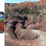 This is a Multi-Day HikeYou are signing up for the following dates:
2026-08-20, 2026-08-21, 2026-09-03, 2026-09-04 Click here for more information or to register Hosting Club: Caledon Hills
Category: Cheltenham Badlands Stained Glass E2E Badge
Location (Google Maps): Registered participants will receive more details by email.
August 20 – Meet at the Roadside parking on 4th Line EHS at the entrance to the Pete Beecham Side Trail. 43.976327, -80.026621 (10; no fee). Shuttle to Mono Community Centre, 200 m south of Mono Centre (County Road 8). Park in gravel lot 44.026195, -80.071516 (40; no fee) 18 km
August 21 – Meet at Roadside parking on Coolihans Sideroad east of where the Trail crosses the road. 43.937967, -79.934650 (10; no fee) 20km
September 3 – Meet at Roadside parking along the southwest shoulder of the Willoughby Rd. and Escarpment Sideroad intersection 44.831244, -79.980588 (5; no fee) 18 km
September 4 – Meet at Roadside parking at Boston Mills Rd. just west of the Mississauga Rd. intersection (do not park on driveway – it is private property) 44.750866, -79.951452 (5) 18 km Hike Leader(s): Joanna Mazur; Karen Buschert Click here to contact Hike Leader(s) Pace: Brisk – 4 to 5 km/hour, Medium – 3 to 4 km/hour
Terrain: Strenuous – hilly with steep climbs and some poor footing
Distance: 17 to 20 km per day Description
Caledon Hills Stained Glass Badge Fundraiser End 2 End In this series of 4 hikes you will get a chance to finish the Caledon Hills section and you will be rewarded with the breathtaking views, good company and of course the Cheltenham Badlands Stained Glass E2E Badge: An Iconic Caledon Hills Geological Heritage Landmark. This is a monetized hike – proceeds go to the Caledon Hills Bruce Trail Club to continue to maintain infrastructure along the trail. There are no refunds. This E2E is intended for strong hikers. We will be hiking at a steady pace with few short breaks and lunch break. Due to the distances involved be sure of your physical ability before signing up for this series. It is expected that everyone keep pace with the person in front of them. Bio breaks are as you need; please let the sweep know and they will wait for you. Please do not register for this hike unless you can commit to all 4 days. If you need to miss one day, please make it up before this series begins and notify the hike leader as well. All hikes in this series will include a car shuttle and everyone will take a turn as a shuttle driver. Please have your vehicle passenger-ready with at least 3 to 4 available seat belts. If you have any questions please email Joanna or Karen. Please bring all snacks/lunch and at least 2l of water as well as all the other things you require for a long day hike including a first aid kit, bug spray, sunscreen and poles, if you use them. No dogs. Do not show up unregistered. Any questions may be directed through contact on this form.
If you cannot make it, please remove yourself from registration. To cancel your registration, here is a step by step:
– Sign into your account on the BTC website
– Click on My Hikes under your account
– This will take you to a list of hikes you have registered for
– Scroll down to the appropriate hike and cursor over to the far right hand column under the Action column.
– Click Cancel under the hike you wish to cancel There are no drop outs. If for some reason you are unable to complete the days’ hike, you will be responsible for finding your way back to your vehicle. Badges will be presented on the last day for all registered for the series. If not, a list of finishers will be sent to the club for mailing out. Refunds: https://brucetrail.org/paid-hike-refund-policy/
- Beaver Bites – Hike 3 of 4
9:15 AM-4:00 PM 08/20/2026 https://hikes.brucetrail.org/event/beaver-bites-hike-3-of-4/2026-08-20/ Click here for more information or to register Hosting Club: Caledon Hills
Category: General
Location (Google Maps): Meet at parking on 7th Line and Sideroad 4A. Hike Leader(s): Nancy Mooney Click here to contact Hike Leader(s) Pace: Medium – 3 to 4 km/hour
Terrain: Moderate – some hills and/or some poor footing, Strenuous – hilly with steep climbs and some poor footing
Distance: The first hike will be 12 km and the second will be 3.5 km. Description
This third challenging day will take us down Beaver Valley ski hill and back up through Kimberley Forest and right to the Stone Foundation Side Trail. (Map 26) The second hike, after a hilltop lunch break, will take us to the Stew Hilts Side Trail and a waterfall.
- Urban Walk: Valley View/Huntington Park
9:30 AM-11:45 AM 08/20/2026 https://hikes.brucetrail.org/event/urban-walk-valley-view-huntington-park-18/2026-08-20/ Click here for more information or to register Hosting Club: Toronto Location (Google Maps): Parking lot is off Sycamore Drive, East of Bayview , across Starbucks plaza
Bus 91 from Finch East station stops at Sycamore station. Hike Leader(s): Mohammad Aghamiri Pace: Moderate (3-4 km/hr)
Terrain: Hilly, Level 2 (Intermediate – some hills and uneven surfaces, rocks and roots underfoot)
Distance (km): 6-7 km Description
We will explore Valleyview and Maple View parks, and walk along German Mill Creak, in return we stop in Huntington park and have snack under beautiful shed. Although this is considered an “Urban Walk”, you can expect some hills up and down and uneven surfaces with tree roots. Please bring hiking poles, water and snacks.
- Hike, followed by Blues in the Park
5:30 PM-7:00 PM 08/20/2026 https://hikes.brucetrail.org/event/hike-followed-by-blues-in-the-park-8/2026-08-20/  Click here for more information or to register Hosting Club: Niagara
Category: Leisurely
Location (Google Maps): 2275 Dorchester Rd, Niagara Falls, ON L2J 0H1 Hike Leader(s): Marion Hanover Click here to contact Hike Leader(s) Pace: Leisurely <3 km/hr
Terrain: Moderate: some hills and some poor footing
Distance: 4km Description
Hike series Thursday evenings throughout the summer, followed by optional Blues in the Park. Come prepared to hike 1.5 leisure hike. Various blues bands free of charge starting at 7pm in the park. Bring lawn chair, beverage and snack to share.
| 21 | 22 - *Belwood Grand Valley Trail One Day End to End
7:30 AM-4:00 PM 08/22/2026 https://hikes.brucetrail.org/event/belwood-grand-valley-trail-one-day-end-to-end/2026-08-22/  Click here for more information or to register Hosting Club: Iroquoia
Category: Special Event
Location (Google Maps): Meet at the Belwood Community Hall/Belwood & District Lions Club Hike Leader(s): Ruth Moffatt Click here to contact Hike Leader(s) Pace: Brisk – 4 to 5 km/hr
Terrain: Dependent on Conditions, Easy – Mostly flat and usually good footing, Moderate – Some hills and/or some poor footing
Distance: 30.8km Description
The Grand Valley Trail stretches from. Port Maitland on Lake Erie in the south to Belwood in the north. This hike is an end to end of the Belwood Section of the Grand Valley Trail – We will meet at the Belwood Community Hall and car shuttle to the start at 43.630704, -80.477034 Township Rd 60 east of Middlebrook Rd at the Grand River and the Middlebrook Bridge. This is a one-day 31km hike suitable for endurance hikers. Please know your physical limit before signing up for this hike. The trail is a combination of road and trail, picturesque towns and topped off with a stop at Belwood Country Market just after we finish. Please bring at least 2l of water and enough snacks & lunch to get you through the day as well as bug spray, sun screen, a first aid kit and poles if you use them. There are no drop outs. If you cannot finish the hike you will be responsible for getting back to your vehicle. The Belwood GVT chevron badge will be available either at the end of the hike or by application through the GVT website after we finish. The price is likely to be between $10 and $15. Since badges help to raise funds for the GVT, this hike is intended to raise funds. If you do not collect badges, please consider a donation to the club. No dogs. There may be an added fee to hike through the Elora Gorge TBA. Any questions may be directed through contact on this form.
If you cannot make it, please remove yourself from registration so that a spot can be opened for someone else. To cancel your registration, here is a step by step:
– Sign into your account on the BTC website
– Click on My Hikes under your account
– This will take you to a list of hikes you have registered for
– Scroll down to the appropriate hike and cursor over to the far right hand column under the Action column.
– Click Cancel under the hike you wish to cancel
- Car Hike: Rouge Park
8:30 AM-1:15 PM 08/22/2026 https://hikes.brucetrail.org/event/car-hike-rouge-national-park-scarborough-on-4/2026-08-22/ Click here for more information or to register Hosting Club: Toronto Location (Google Maps): Free parking in Mast Trail parking Lot off Kingston Road Hike Leader(s): MOHAMMAD AGHAMIRI Click here to contact Hike Leader(s) Pace: Moderate (3-4 km/hr)
Terrain: Hilly, Level 2 (Intermediate – some hills and uneven surfaces, rocks and roots underfoot)
Distance (km): 12-14 km Description
We will hike Vista trail and part of orchard trail, will enjoy look outs between Rouge river and Little Rouge creek
• Please dress appropriately for the weather.
• We will have short water ,picture and a 15 minute snack break. Everyone is welcome! Please bring lots of water and snacks ,hiking poles are recommended phone number for the day of hike 289 588 6482
- Geology Hike and Badge Series – North Saugeen (Bruce) Shoreline
9:00 AM 08/22/2026 https://hikes.brucetrail.org/event/geology-hike-and-badge-series-north-saugeen-bruce-shoreline/2026-08-22/  Click here for more information or to register Hosting Club: Peninsula
Category: Geology Hike
Location (Google Maps): Cyprus Lake/Halfway Log Dump Hike Leader(s): Beth Gilhespy Click here to contact Hike Leader(s) Pace: Leisurely (2.0 – 3.0 km/h): A relaxed pace with frequent breaks and a focus on enjoyment.
Terrain: Difficult: Steep ascents/descents, rocky scrambling, and some rugged escarpment paths., Moderate: Rolling hills, mild slopes and rocky paths.
Distance: 8.0 Description
Join the adventure and earn the inaugural Peninsula Geology Badge! Over a stretch of 13 hikes and a couple of extra stops, we will explore the fascinating geology of the Peninsula to learn about the rocks, the shoreline features, glaciation, fossils and all things earthy. The 13 hikes are from the book “Walking Through Time – Exploring the Geology of the Saugeen (Bruce) Peninsula”. Having a copy will give you a lot of great information, but you do not have to purchase the book to attend and enjoy the hikes. Just bring your curiosity! We will make sure to hit all the locations that qualify for the beautiful new Walking Through Time – Saugeen (Bruce) Peninsula geology hike badge. If you would like to purchase a book I will have some available on the hikes, or you can pick one up from the BTC Head Office, at Ginger Press in Owen Sound, Suntrail Source for Adventure in Hepworth, the Shop at 84 Main in Lion’s Head and at Reader’s Haven in Tobermory. You are welcome to come on just a few of the hikes or on all of them, and the dates and hikes are as follows: Date Geology Hike km Saturday May 2, 2026 Colpoy’s Bay 9.0 Saturday May 9, 2026 Gravelly Point (am) and Rural Rocks (pm) 8.6 Saturday May 16, 2026 Malcolm Bluff 7.3 Sunday May 17, 2026 White Bluff/Smokey Head 11.8 Sunday May 24, 2026 Crooked Toe Road 5.5 Sunday May 31, 2026 Hope Bay 8.1 Sunday June 14, 2026 Boundary Bluffs 5.2 Saturday July 4, 2026 Cape Dundas 6.2 Saturday July 11, 2026 Beth Gilhespy Side Trail 7.6 Saturday August 8, 2026 Lion’s Head 11.0 Saturday August 15, 2026 Dyer’s Bay Loops 7.5 Saturday August 22, 2026 North Saugeen (Bruce) Shoreline 8.0 Meeting times will vary depending on the hike, but will generally be some time between 9 am and 10 am. Information on exact meeting times and locations will be sent out a few days prior to the hike.
- RAINBOW HIKE: Morning Birding with Pride feat. LGBT (Let’s Go Birding Together) 🦅🌈
9:00 AM-11:00 AM 08/22/2026 https://hikes.brucetrail.org/event/rainbow-hike-morning-birding-with-pride-feat-lgtb-lets-go-birding-together-%f0%9f%a6%85%f0%9f%8c%88/2026-08-22/  Click here for more information or to register Hosting Club: Iroquoia
Category: Rainbow Hike
Location (Google Maps): Bayfront Park at the Hamilton Harbour Waterfront Trail Hike Leader(s): Shayne Ward Click here to contact Hike Leader(s) Pace: Leisurely – 3km/hr or less
Terrain: Easy – Mostly flat and usually good footing
Distance: 5KM Description
Join us as we kick off Hamilton Pride with LGBT (Let’s Go Birding Together) and a colourful morning of birding! 🦅🦉🦆🌈 For this edition, it’s encouraged to come dressed in the colours of your favourite bird! 🌈 This gentle early-morning outing will explore the trails around the Hamilton Harbour and Princess Point, one of our region’s important migration areas. We will start at the trailhead parking lot of the Hamilton Habour Waterfront Trail at Bayfront Park. Plan to arrive for 845AM and we’ll have a small crash course on downloading and using two popular birding apps, Merlin Bird ID and eBird recording our sightings! We’ll depart by 9-910AM. Hoping to catch some Blue Herons, Swans, Cormorants, and if we’re lucky, a sighting of the RBG resident Bald Eagles! We will end around 11AM when the Hamilton Pride festivities kick off at Pier 4! 🌈 This is a queer-led, 2SLGBTQIA+ inclusive Rainbow Hike, welcoming LGBTQ+ hikers, allies, birders, photographers, and anyone interested in connecting with nature and community. This is a short, relaxed hike (approx. 5 km or less) designed to get us moving and birding! What to Bring
• Water and light snacks
• Weather-appropriate clothing and sturdy footwear
• Binoculars or camera if you have them (optional but fun! And a cell phone counts!) Not a Bruce Trail member yet?! Sign up here!
https://brucetrail.org/become-a-member/ Come enjoy a spring morning on the trail, celebrate migratory birds, and connect with your Bruce Trail community! 🐾 Please leave pets at home for this hike unless required for accessibility support! We are passing through an important bird migration and nesting area, so we want to keep disturbance to our feathered friends to a minimum! 🐦 🚗 🚌 This outing is accessible by car or public transit. Planning to drive?
Parking is free but limited at Bayfront Park. Taking the Bus?
HSR #99 stops near the trailhead entrance! Map of the bus and it’s schedule can be found here.
https://www.hamilton.ca/sites/default/files/2024-06/hsr-route-99-waterfront-shuttle-jun24_0.pdf Free Bruce Trail Rainbow badges and stickers for all participants!
Questions? Simply click “Contact Hike Leader” on the registration form.
- RAINBOW HIKE: Evening Birding with Pride feat. LGBT (Let’s Go Birding Together) 🦅🌈
6:30 PM-8:30 PM 08/22/2026 https://hikes.brucetrail.org/event/rainbow-hike-evening-birding-with-pride-feat-lgtb-lets-go-birding-together-%f0%9f%a6%85%f0%9f%8c%88/2026-08-22/  Click here for more information or to register Hosting Club: Iroquoia
Category: Rainbow Hike
Location (Google Maps): Bayfront Park at the Hamilton Harbour Waterfront Trail Hike Leader(s): Shayne Ward Click here to contact Hike Leader(s) Pace: Leisurely – 3km/hr or less
Terrain: Easy – Mostly flat and usually good footing Description
Join us as we kick off Hamilton Pride with LGBT (Let’s Go Birding Together) and a colourful evening of birding! 🦅🦉🦆🌈 For this edition, it’s encouraged to come dressed in the colours of your favourite bird! 🌈 This gentle late-afternoon outing will explore the trails around the Hamilton Harbour and Princess Point, one of our region’s important migration areas. We will start at the trailhead parking lot of the Hamilton Habour Waterfront Trail at Bayfront Park. Plan to arrive for 615PM and we’ll have a small crash course on downloading and using two popular birding apps, Merlin Bird ID and eBird recording our sightings! We’ll depart by 630-640PM. Hoping to catch some Blue Herons, Swans, Cormorants, and if we’re lucky, a sighting of the RBG resident Bald Eagles! We will end around 830PM when the evening Hamilton Pride festivities kick off at Pier 4! 🌈 This is a queer-led, 2SLGBTQIA+ inclusive Rainbow Hike, welcoming LGBTQ+ hikers, allies, birders, photographers, and anyone interested in connecting with nature and community. This is a short, relaxed hike (approx. 5 km or less) designed to get us moving and birding! What to Bring
• Water and light snacks
• Weather-appropriate clothing and sturdy footwear
• Binoculars or camera if you have them (optional but fun! And a cell phone counts!) Not a Bruce Trail member yet?! Sign up here!
https://brucetrail.org/become-a-member/ Come enjoy a spring morning on the trail, celebrate migratory birds, and connect with your Bruce Trail community! 🐾 Please leave pets at home for this hike unless required for accessibility support! We are passing through an important bird migration and nesting area, so we want to keep disturbance to our feathered friends to a minimum! 🐦 🚗 🚌 This outing is accessible by car or public transit. Planning to drive?
Parking is free but limited at Bayfront Park. Taking the Bus?
HSR #99 stops near the trailhead entrance! Map of the bus and it’s schedule can be found here.
https://www.hamilton.ca/sites/default/files/2024-06/hsr-route-99-waterfront-shuttle-jun24_0.pdf Free Bruce Trail Rainbow badges and stickers for all participants!
Questions? Simply click “Contact Hike Leader” on the registration form.
|
23 | 24 | 25 - Urban Walk: Valley View Park
9:30 AM-11:45 AM 08/25/2026 https://hikes.brucetrail.org/event/car-hike-valley-view-huntington-park-3/2026-08-25/ Click here for more information or to register Hosting Club: Toronto Location (Google Maps): Parking lot is off Sycamore Drive, East of Bayview , across Starbucks plaza
Bus 91 from Finch East station stops at Sycamore station. Hike Leader(s): Mohammad Aghamiri Pace: Moderate (3-4 km/hr)
Terrain: Hilly, Level 2 (Intermediate – some hills and uneven surfaces, rocks and roots underfoot)
Distance (km): 6-7 km Description
We will explore Valleyview and Maple View parks, and walk along German Mill Creak, in return we stop in Huntington park and have snack under beautiful shed. Although this is considered an “Urban Walk”, you can expect some hills up and down and uneven surfaces with tree roots. Please bring hiking poles, water and snacks.
| 26 | 27 - Beaver Bites – Hike 4 of 4
9:15 AM-4:00 PM 08/27/2026 https://hikes.brucetrail.org/event/beaver-bites-hike-4-of-4/2026-08-27/ Click here for more information or to register Hosting Club: Caledon Hills
Category: General
Location (Google Maps): Meet at Hogg’s Falls parking, km 65.1, on the west side of Lower Valley Rd., north of East Back Line. Hike Leader(s): Nancy Mooney Click here to contact Hike Leader(s) Pace: Medium – 3 to 4 km/hour
Terrain: Moderate – some hills and/or some poor footing, Strenuous – hilly with steep climbs and some poor footing
Distance: The first hike will be about 6 km and the second about 7 km. Description
This last pair of hikes in the series will take us looping around Hogg’s Falls and after a lunch break at Beaver Valley Lookout we will cross Grey Road 13 and explore the new group of trails including Eagles Summit and East Mountain. Celebration with ice cream at Top of The Rock!
- Urban Walk: Valley View Park
9:30 AM-11:45 AM 08/27/2026 https://hikes.brucetrail.org/event/car-hike-valley-view-huntington-park-2/2026-08-27/ Click here for more information or to register Hosting Club: Toronto Location (Google Maps): Parking lot is off Sycamore Drive, East of Bayview , across Starbucks plaza
Bus 91 from Finch East station stops at Sycamore station. Hike Leader(s): Mohammad Aghamiri Pace: Moderate (3-4 km/hr)
Terrain: Hilly, Level 2 (Intermediate – some hills and uneven surfaces, rocks and roots underfoot)
Distance (km): 6-7 km Description
We will explore Valleyview and Maple View parks, and walk along German Mill Creak, in return we stop in Huntington park and have snack under beautiful shed. Although this is considered an “Urban Walk”, you can expect some hills up and down and uneven surfaces with tree roots. Please bring hiking poles, water and snacks.
- Hike, followed by Blues in the Park
5:30 PM-7:00 PM 08/27/2026 https://hikes.brucetrail.org/event/hike-followed-by-blues-in-the-park-9/2026-08-27/  Click here for more information or to register Hosting Club: Niagara
Category: Leisurely
Location (Google Maps): 2275 Dorchester Rd, Niagara Falls, ON L2J 0H1 Hike Leader(s): Marion Hanover Click here to contact Hike Leader(s) Pace: Leisurely <3 km/hr
Terrain: Moderate: some hills and some poor footing
Distance: 4km Description
Hike series Thursday evenings throughout the summer, followed by optional Blues in the Park. Come prepared to hike 1.5 leisure hike. Various blues bands free of charge starting at 7pm in the park. Bring lawn chair, beverage and snack to share.
| 28  Beaver Valley E2E in 8 – Hike 1 Beaver Valley E2E in 8 – Hike 1 8:30 AM-2:30 PM 08/28/2026 https://hikes.brucetrail.org/event/beaver-valley-e2e-in-8-hike-1/2026-08-28/ Hike open to BTC Members only. Click here for more information or to register Hosting Club: Iroquoia, Beaver Valley
Category: General Hike
Location (Google Maps): Off road parking on west side of 6th Line north of Grey Road 119 Hike Leader(s): Pati Greenwood, Jeff Dowsett Click here to contact Hike Leader(s) Pace: Medium – 3 to 4 km/hr
Terrain: Moderate – Some hills and/or some poor footing, Slippery and Steep Sections
Distance: 13.7 km Description
This is an End-to-End hike series to complete the Beaver Valley section of the Bruce Trail in 8 hikes. Join for all or as many hikes as desired – you will need to register for each hike in the series which will take place on the following dates: August 28, August 29, September 11, September 12, October 2, October 3, October 16 & October 17. Hikers completing the entire series will be eligible to obtain an end-to-end badge from the BTC Beaver Valley Club. Since this is a group hike, please consider your fitness level before registering. This section of the trail has numerous hills and rough terrain in spots. We will be walking at a pace of 3km – 4km per hour and hikers will need to keep up with the person in front of them for the duration of the hike. The hike series will also involve car shuttles and every hiker is expected to participate as drivers. Weather conditions in the late summer can still be quite warm, but the hike schedule will extend to mid-October so it’s best come prepared for varying weather conditions. Hiking boots are required and hiking poles are strongly recommended. Bring plenty of fluids and a snack. Insects and ticks will still be active at this time of year, long pants and long sleeves are recommended as is insect repellent. Specific hike details will be provided to registered hikers a few days prior to each hike.
 Peninsula Sturgeon Full Moon Hike – Meet time is 7:45pm Peninsula Sturgeon Full Moon Hike – Meet time is 7:45pm 7:45 PM-9:45 PM 08/28/2026 https://hikes.brucetrail.org/event/peninsula-sturgeon-full-moon-hike-meet-time-is-745pm/2026-08-28/  Click here for more information or to register Hosting Club: Iroquoia, Peninsula
Category: Moonlight Hikes
Location (Google Maps): Meet in the Bruce Trail parking lot located off of Cape Chin North Road Hike Leader(s): Ruth Moffatt Click here to contact Hike Leader(s) Pace: Leisurely – 3km/hr or less, Medium – 3 to 4 km/hr
Terrain: Dependent on Conditions, Moderate – Some hills and/or some poor footing, Strenuous – Hilly with steep climbs and some poor footing
Distance: 10 km Description
This full moon hike is in the Peninsula Section of trail and led by an Iroquoia Hike Leader. Welcome to more Full Moon Hike Series – This is the 3/4 full moon hikes. Details for collecting badges are at the bottom of the hike details.
We will meet in the parking lot located off Cape Chin North Road. From here we will take the Cape Chin Meadows Side Trail and connect. with the main trail out to Cape Chin and then follow the loop around to connect back up with the Cape Chin Meadows Side Trail. Sunset is at 8:10pm
Bring water and whatever snacks you need as well as a first aid kit, poles if you use them and most importantly, a head-lamp with a red light if you have one. The next full moon hike is September 26 Harvest Moon – Meet time is 6:00 pm The following is from the Bruce Trail Conservancy website regarding Hiking at Night.
While most hikers choose to explore the Bruce Trail by day to take in the colourful sights and vast vistas, venturing out after dark also has its benefits.
Hiking at night allows you to tap into other senses and explore nature in a whole new way. From stargazing to nocturnal animal sightings, there is a lot to see and hear when exploring the Bruce Trail after sunset. No matter your motivation for heading out for a nighttime hike, certain precautions should be taken to ensure that your time on the Trail is safe and enjoyable. Before you go
Plan your route and choose somewhere familiar. It’s easy to get turned around in the darkness. Planning your route and hiking it in daylight first will help you know what to expect. If you’ve never tried hiking at night, start with a shorter hike somewhere familiar to you. Always stay on the Trail to avoid getting lost. Bring a headlamp or flashlight and extra batteries. The Trail can be quite rugged with uneven surfaces, rocks, and roots. A headlamp or flashlight is essential for preventing trips and falls – and both are brighter and last longer than your phone’s built-in light. A light source with different settings, including a red light, is ideal as bright lights can be hard on your eyes over time. Bring a fully charged cell phone. You should always bring your phone with you when hitting the trails in case you need to call for help. Most phones have a flashlight function that can act as a backup to your headlamp. You can also use your phone’s GPS with apps like the Bruce Trail App and what3words for navigational and safety purposes. Wear reflective clothing and bring a whistle. A reflective piece of clothing can help other hikers or drivers see you in the darkness. A whistle can help others hear you in case of an emergency, even if they can’t see you. Plan to do your first hike under a full moon and a clear sky.
A full moon can provide a surprising amount of light. Planning your first night hike during a full moon and clear sky can be a great way to acclimate yourself to hiking after dark. Don’t go solo and tell someone where you are going. Always share your route with someone before heading out in case of an emergency. Bring a friend to explore the Trail together, or join one of the moonlit hikes offered by some Bruce Trail Clubs. Bring layers. The temperature can drop quickly in the woods at night. Bring layers to stay warm and comfortable.
While Hiking Slow down and be aware of hazards. Don’t expect to hike at the same pace you would in daylight. Darkness can make the terrain more challenging. Slow down, pay attention to your surroundings, and stay away from cliff edges to prevent injuries. Be prepared for wildlife. Many animals such as coyotes, owls, bats, salamanders, foxes, opossums, and skunks are active at night. Sightings can enhance your nighttime hiking experience but be careful not to get too close. Keep your ears open to the sounds around you to avoid unwanted interactions. While more preparations may be needed for a hike after dusk, for many, once they find themselves in the cool of the night gazing up at the constellations or watching an owl swoop through the darkness, the effort is well worth it. If you are collecting your badge tonight or September 26, please bring exact cash $10 for members and $15 for non-members to cover the cost of the badge. You must’ve have completed at least 4 full moon hikes. If you wish to pay by e-transfer and have your badge mailed out to you, you may also choose to receive it that way. For simplicity sake, and because it will be dark out, it would be appreciated if you could please choose one method of receiving your badge or the other. Badges are on the honour system so if this is your 4th hike, please feel free to receive your badge.
 Full Moon Family Star Gazing Hike Full Moon Family Star Gazing Hike 8:30 PM-10:30 PM 08/28/2026 https://hikes.brucetrail.org/event/full-moon-family-star-gazing-hike/2026-08-28/ Click here for more information or to register Hosting Club: Dufferin Hi-Land
Category: Special Events
Location (Google Maps): Bruce Trail parking lot at the end of Centre Road south of the 5th Side Road. Immediately south of Whitfield. North of Boyne Valley Provincial Park. Please see Google Maps link in this hike description for GPS location. Hike Leader(s): Helen Bailey; Margery Cruise Click here to contact Hike Leader(s) Pace: Leisurely
Terrain: Dependent on Conditions, Easy
Distance: 2 kms Description
A full moon hike up to Murphy’s Pinnacle is your chance to turn an ordinary evening into an adventure. Come with us as we take a short hike through the Dufferin Hi-lands to stargaze from one of the regions most scenic lookouts. Throughout the hike our guide Megan Logeman will teach us about phases of the moon and key constellations drawing our attention to notable features of the summer night sky. This is a short, easy hike suitable for all adults and children over 6 years old. The hike will start promptly at 8:30pm . Please wear long sleeved tops and long pants to avoid any mosquitos or ticks and bring bug spray. Wear sturdy shoes and bring a headlamp or flashlight which we will use only if necessary. Please bring a drink also. Pre-registration is required.
| 29  Summer Social – Welland Jackfish Baseball Game Summer Social – Welland Jackfish Baseball Game 5:45 AM-9:00 AM 08/29/2026 https://hikes.brucetrail.org/event/summer-social-welland-jackfish-baseball-game/2026-08-29/  Hike open to BTC Members only. Click here for more information or to register Hosting Club: Niagara
Category: Register
Location (Google Maps): Welland Jackfish Baseball Stadium, 90 Quaker Road, Welland, ON Hike Leader(s): Kristin Hanson Click here to contact Hike Leader(s) Distance: 0 Description
Niagara Bruce Trail Club Social Event – Canadian Baseball League Summer Outing Welland Jackfish vs the Toronto Maple Leafs Sat, Aug 29, 6:05pm game time; gates open 60 minutes prior (Parking is free at the stadium) Join fellow NBTC members to cheer on the Welland Jackfish in their final regular-season home game. The team proudly calls itself Niagara’s Greatest Show—and for good reason. Welland Stadium offers an excellent view of the field, lively entertainment, and high-quality baseball. Known affectionately as “The Pond,” the stadium is home to the passionate FINatics fan base. NBTC has reserved the Newark Brewing Barge so our group can enjoy the game together. The Barge Experience includes:
Two drinks (beer or soft drink)
One hot dog and a pizza slice
UNLIMITED popcorn
UNLIMITED water
Game Ticket
Jackfish Hat
Wait Service (never leave your seat!)
In the event of rain, over 40% of the Pavilion is covered so we can continue to cheer on the game undercover Tickets are $50 per 19+ adult, $40 for each person under 19 Newark Brewing Barge – Welland Jackfish Baseball Niagara’s Greatest Show! Sign up on the hike calendar and e-transfer the funds for your ticket(s) to: treasurer@niagara.brucetrail.org. Mention Jackfish Game in your etransfer. E-transfers must be completed before end of day August 14. Limited spots available – first to complete their etransfer will get the seats – don’t delay! Who are the Jackfish? If you’ve never experienced a game, come out to The Pond and get in on the fun. The Welland Jackfish are one of nine members of the Canadian Baseball League (CBL). The Intercounty Baseball League is an elite summer baseball league that provides a place for the best local players in Ontario to spend their summers and display their talents. Many players hold professional baseball experience including MLB, and MiLB or current NCAA Division I playing experience. They play 36 games, playing with wood bats, and traveling around Ontario on charter buses.
-
 Coach Trip: Petroglyphs Provincial Park Coach Trip: Petroglyphs Provincial Park 8:00 AM-7:00 PM 08/29/2026 https://hikes.brucetrail.org/event/coach-trip-petroglyphs-provincial-park-2/2026-08-29/  Trip Information
Departure Time: 08:00
Return to City Time: 19:00
Departure Point: York Mills Bus Pickup Click here for more information or to register Trip Activities
Hiking ($0.01)
Optional Items
Hosting Club: Toronto
Category: Coach Trips
Location (Google Maps): Petroglyphs Provincial Park Hike Leader(s): Robin Crombie, Felix Wan Click here to contact Hike Leader(s) Pace: Moderate (3-4 km/hr)
Terrain: Hilly, Level 2 (Intermediate – some hills and uneven surfaces, rocks and roots underfoot), Rocky, Variable
Distance (km): 8 Description
*Re-scheduled from June* Join us for a visit to Petroglyphs Provincial Park. The day will be divided into two portions. We’ll begin by touring the exhibits and watching a 20-minute video at the Learning Place Visitor Centre to discover the traditions of the Ojibway (Nishnaabe) people, which will be followed by a 45-minute guided tour of the Kinoomaage Waapkong (aka The Teaching Rocks or the Peterborough Petroglyphs), the largest known concentration of Indigenous rock carvings (petroglyphs) in Canada. Afterwards, we will hike along the Nanabush Trail, stopping near Minnow Lake for a lunch break, then continue our hike along the Marsh and West Day Use Trails. Although the total hiking distance is short (approximately 8 km), the trails are in the heart of the Canadian Shield and are rugged. There are rocks and roots, and some hilly stretches. Bring hiking boots and poles if you have them. Also bring a lunch and snacks, at least 2L of drinking water, rain/sun protection, and insect repellent. If time permits, we will have a refreshment stop in the town of Lakefield. Expect a late return to Toronto (approximately 7:00 p.m., traffic conditions permitting). ** The bus fare includes the prorated bus parking permit charge at Petroglyphs Provincial Park and the anticipated fuel surcharge at the time of the trip. The published fares are subject to change in late July before the registration opens, when the actual fuel surcharge rate is advised by Coach Canada **
- Beaver Valley End to End Event (participants hike independently, no hike leader)
8:15 AM 08/29/2026 https://hikes.brucetrail.org/event/beaver-valley-end-to-end-event-participants-hike-independently-no-hike-leader-3/2026-08-29/ This is a Multi-Day HikeYou are signing up for the following dates:
2026-08-29, 2026-08-30, 2026-09-05, 2026-09-06, 2026-09-07 Click here for more information or to register Hosting Club: Beaver Valley Location (Google Maps): Meet in the Kolapore Uplands skiers parking lot on Grey County Road 2, 650 m south of where the trail crosses the road at km 23.8, Map 24, Edition 30 N44.422919, W80.405597. Plan to be there at 7:30 a.m. for sign in and bus loading. The bus will leave promptly at 8:00 a.m. Hike Leader(s): Glenda Collings Click here to contact the hike leader. Pace: Medium
Terrain: Some rocky footing, Some steep sections, Strenuous
Length of Hike: The 5 hikes range from approx. 22 km 26 km. You set your own pace but medium will get the job done in a timely fashion. Description
Beaver Valley 2026 End-to-End
August 29, 30 and September 5,6,7
Registration will be through the Bruce Trail Conservancy Online Calendar and will open at 8:30 a.m. on May 4, 2026. Registration is limited to 50 people because of parking area availability. Once registration is full, names will be added to a wait list by the Online Calendar software. The registration fee of $130.00 includes the online registration fee, bus shuttle, checkpoint refreshments and the End-to-End badge. Refunds will be permitted up to 30 days before the first hike date of August 29. Hikers should have experience with hiking 20+ km in a day on challenging terrain. Complete details of the event will be emailed to participants once registration is received. For more information contact beavervalleytrailactivities@gmail.com
- Beaver Valley E2E in 8 – Hike 2
8:30 AM-2:30 PM 08/29/2026 https://hikes.brucetrail.org/event/beaver-valley-e2e-in-8-hike-2/2026-08-29/ Hike open to BTC Members only. Click here for more information or to register Hosting Club: Iroquoia, Beaver Valley
Category: General Hike
Location (Google Maps): Parking lot 100 meters south of the Main Trail crossing on 10th Line Hike Leader(s): Pati Greenwood, Jeff Dowsett Click here to contact Hike Leader(s) Pace: Medium – 3 to 4 km/hr
Terrain: Moderate – Some hills and/or some poor footing, Strenuous – Hilly with steep climbs and some poor footing
Distance: 14.65km Description
This is hike 2 of the End-to-End hike series to complete the Beaver Valley section of the Bruce Trail in 8 hikes. Join for all or as many hikes as desired – you will need to register for each hike in the series which will take place on the following dates: August 28, August 29, September 11, September 12, October 2, October 3, October 16 & October 17. Hikers completing the entire series will be eligible to obtain an end-to-end badge from the BTC Beaver Valley Club. Since this is a group hike, please consider your fitness level before registering. This section of the trail has numerous hills and rough terrain in spots. We will be walking at a pace of 3km – 4km per hour and hikers will need to keep up with the person in front of them for the duration of the hike. The hike series will also involve car shuttles and every hiker is expected to participate as drivers. Weather conditions in the late summer can still be quite warm, but the hike schedule will extend to mid-October so it’s best come prepared for varying weather conditions. Hiking boots are required and hiking poles are strongly recommended. Bring plenty of fluids and a snack. Insects and ticks will still be active at this time of year, long pants and long sleeves are recommended as is insect repellent. Specific hike details will be provided to registered hikers a few days prior to each hike.
- Car Hike:Glasgow village
8:30 AM-1:15 PM 08/29/2026 https://hikes.brucetrail.org/event/car-hike-glasgow-village-uxbridge-9/2026-08-29/ Click here for more information or to register Hosting Club: Toronto Location (Google Maps): Glasgow Trail, Concession Road 2 Park in parking lot at the head of trail Hike Leader(s): MOHAMMAD AGHAMIRI Click here to contact Hike Leader(s) Pace: Moderate (3-4 km/hr)
Terrain: Hilly, Level 2 (Intermediate – some hills and uneven surfaces, rocks and roots underfoot), Variable
Distance (km): 14-15 km Description
Lets explore Goodwood conservation area and visit Secord forest and pond
- RIM 2 RIM Badge Hike #3 Noisy River (Third in a series of 3 for the Rim2Rim badge)
9:00 AM-2:00 AM 08/29/2026 https://hikes.brucetrail.org/event/rim-2-rim-badge-hike-3-noisy-river-third-in-a-series-of-3-for-the-rim2rim-badge/2026-08-29/  Click here for more information or to register Hosting Club: Blue Mountains
Category: Organized Hike
Location (Google Maps): Noisy River Provincial Park. Park along roadside SImcoe Country Road 9, Clearview, ON L0M 1G0. 6.1Km Map 21 Ed 31 Hike Leader(s): Rob Johnston Click here to contact Hike Leader(s) Pace: Medium – 3 to 4 km/hr
Terrain: Strenuous – Hilly with steep climbs and some poor footing
Distance: 10 Description
This is the third of three the Rim-To-Rim hikes required for the Blue Mountain Rim-To-Rim badge. This hikes up and down the Noisy River valley. As such it is hilly and strenuous. About 9 km with almost 400 m elevation gain. HIKERS MUST contact the hike leader if ON-LINE REGISTRATION has closed. NO morning sign-ins on this series as hikers will meet at trailhead. Park your car on the side of the road near the Noisy River Provincial Park sign [44.27499, -80.20731]. Proceed south on the white blazed trail crossing the Noisy River via the new bridge, for 1.5 km until you come to a small bench overlooking a pond. Turn around and head back to the car. Repeat this twice more for a total of three 3 km trips. Bring lots of water and lunch. Congratulations you’ve completed the NoisyTriple, a fitting end to the Rim 2 Rim Triple Run. Check the other two Rim-To-Rim hikes in the schedule on 8 July 2026 and 5 Aug 2026
|
30 | 31 | September | September | September | September | September |