|
Sun | Mon | Tue | Wed | Thu | Fri | Sat |
|---|
June | June | June | 1  Canada Day 🇨🇦 Hike – Meet time is 8:50am Canada Day 🇨🇦 Hike – Meet time is 8:50am 9:00 AM-11:00 AM 07/01/2026 https://hikes.brucetrail.org/event/canada-day-%f0%9f%87%a8%f0%9f%87%a6-hike-meet-time-is-850am/2026-07-01/  Click here for more information or to register Hosting Club: Iroquoia
Category: General Hike
Location (Google Maps): Parking lot off of Mud St Hike Leader(s): Ruth Moffatt Click here to contact Hike Leader(s) Pace: Medium – 3 to 4 km/hr
Terrain: Moderate – Some hills and/or some poor footing, Strenuous – Hilly with steep climbs and some poor footing
Distance: 10-12km Description
Happy Canada Day! 🇨🇦 What better way to celebrate than a Bruce Trail Hike?!
Please wear all your Canadian colours and bring enough water and snacks for the hike. There may very well be an all- Canadian treat for everyone after the hike.
 Car Hike: Forks of the Credit Car Hike: Forks of the Credit 10:00 AM-3:00 PM 07/01/2026 https://hikes.brucetrail.org/event/car-hike-forks-of-the-credit-7/2026-07-01/ Click here for more information or to register Hosting Club: Toronto, Caledon Hills
Category: Car Hike
Location (Google Maps): Forks of the Credit Provincial Park, Map 15 Hike Leader(s): Al Brown Click here to contact Hike Leader(s) Pace: Moderate (3-4 km/hr)
Terrain: Hilly, Level 2 (Intermediate – some hills and uneven surfaces, rocks and roots underfoot)
Distance (km): 15-16 km Description
We will complete a loop hike through the Park, crossing the Credit River above the Cataract Falls. Then we will follow the trail down into the valley to a viewpoint of the Falls itself. The hike will take us by the east bank of the Credit River south then turning east and then north through the main park past glacial features and old homesteads. Natural features include kettle lakes and milkweed fields where we might spot monarch butterflies. The meeting point is the intersection of Mississauga Road and Cataract Road. Parking is located on both sides of the road. Park in marked areas only. To get to this point drive north on Mississauga Road about 3 km past Belfountain
| 2 - Halton Agreement Forest
9:30 AM-12:00 PM 07/02/2026 https://hikes.brucetrail.org/event/halton-agreement-forest-3/2026-07-02/
| 3 | 4 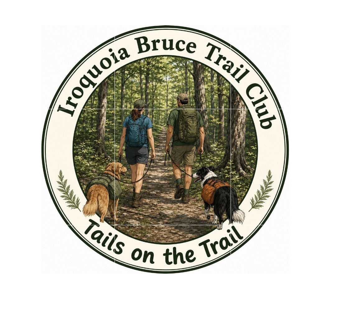 Tails on the Trail – A dog friendly hike! Meet at 8:20am Tails on the Trail – A dog friendly hike! Meet at 8:20am 8:30 AM-10:00 AM 07/04/2026 https://hikes.brucetrail.org/event/tails-on-the-trail-a-dog-friendly-hike-meet-at-820am/2026-07-04/  Click here for more information or to register Hosting Club: Iroquoia
Category: Tails on the Trail
Location (Google Maps): Parking lot off of Ridge Rd, in Grimsby Hike Leader(s): Ruth Moffatt Click here to contact Hike Leader(s) Pace: Medium – 3 to 4 km/hr
Terrain: Moderate – Some hills and/or some poor footing
Distance: 5km Description
Please join us for this dog-friendly hike where we will hike with our canine companions from the parking area over to Beamer’s Conservation Area and around the loop.
Please ensure your dog is leashed, well-socialized and all dog waste is carried out. Note: There may be a waste bin in the area. We will hike rain or shine. Please disregard the notice on the system generated confirmation about dogs. Please bring enough water and treats for you and your dog.
  School Bus Hike: Long Sault Conservation Area School Bus Hike: Long Sault Conservation Area 8:30 AM-6:00 PM 07/04/2026 https://hikes.brucetrail.org/event/school-bus-hike/2026-07-04/ Trip Information
Departure Time: 08:30
Return to City Time: 18:00
Departure Point: York Mills Bus Pickup Click here for more information or to register Optional Items
Hosting Club: Toronto
Category: Bus Hike
Location (Google Maps): Long Sault Conservation Area Hike Leader(s): Tom Swales Click here to contact Hike Leader(s) Pace: Moderate (3-4 km/hr)
Terrain: Level 2 (Intermediate – some hills and uneven surfaces, rocks and roots underfoot), Variable
Distance (km): 11-12 km Description
Join us for an 11 km hike in Long Sault Conservation Area on the Barred Owl, Eastern Bluebird, Wild Turkey, and Oak Ridges Moraine Trails. Once part of the Agreement Forest program operated by the Ontario Ministry of Natural Resources, the Conservation area includes close to 400 hectares of matures forest, plantation, wetland, and Meadow. The trails range from gently sloping and straight to technical rolling and quickly turning. After our hike we will drive to Port Perry on Lake Scugog for free time to enjoy the park, the historic main street, cafes, or the Old Flame craft brewery. Don’t miss Hank’s Pastries, a bakery with a 100+ year tradition known for their specialty donuts and “big as your face” apple fritters (online ordering is available).
 Seven Rivers Hike Badge Series – Hike 6 Seven Rivers Hike Badge Series – Hike 6 8:45 AM-1:00 PM 07/04/2026 https://hikes.brucetrail.org/event/seven-rivers-hike-badge-series-hike-6/2026-07-04/ This is a Multi-Day HikeYou are signing up for the following dates and times:
2026-07-04 at 08:45 Click here for more information or to register Hosting Club: Dufferin Hi-Land
Category: General Hike
Location (Google Maps): Nottawasaga River Caledon Section Map 18
Parking: Hockley Road Parking lot – west of the Black Birch restaurant and east of 2nd Line. Hike Leader(s): Tristan Goguen and Pat Foley Click here to contact Hike Leader(s) Pace: Medium
Terrain: Moderate
Distance: 13.1 Km Description
This series features rivers in our Headwaters area: the Humber, Nottawasaga, Boyne, Pine, Mad, Noisy and Pretty Rivers and includes 7 hikes from three Bruce Trail Sections: Blue Mountains (3), Dufferin Hi-Land (2) and Caledon Hills (2). Today we will walk by and around the Nottawasaga River. From the parking area on Hockley Road we follow the road to the main trail starting at Hockley Rd, then follow the main trail north to the Tom East Side Trail. We will connect again to the main trail and head north along the main trail to the Isabel East Trail. From there we will follow the main trail until we reach the north end of the Cam Snell Side Trail. At the end of the Cam Snell Side Trail we will connect again to the main trail and follow it back to Hockley Road and the parking area. Please be prepared for the weather, we will hike rain or shine. Ensure you have enough water,lunch and snacks, sunscreen and bug repellent. Hats and sunglasses are recommended as are poles and sturdy shoes. For those wishing to earn their 7 Rivers – complete all 7 hikes, badges will be available on the last day from the hike leaders at a cost of $10 for members and $15 for non members. Anyone completing make-up hikes may log their hikes and apply directly to the Dufferin Highlands BT Club for the badge.
- Geology Hike and Badge Series – Cape Dundas
9:30 AM 07/04/2026 https://hikes.brucetrail.org/event/geology-hike-and-badge-series-cape-dundas/2026-07-04/  Click here for more information or to register Hosting Club: Peninsula
Category: Geology Hike
Location (Google Maps): Cape Dundas Hike Leader(s): Beth Gilhespy Click here to contact Hike Leader(s) Pace: Leisurely (2.0 – 3.0 km/h): A relaxed pace with frequent breaks and a focus on enjoyment.
Terrain: Easy: Flat forested sections or lowland trails., Moderate: Rolling hills, mild slopes and rocky paths.
Distance: 6.2 Description
Join the adventure and earn the inaugural Peninsula Geology Badge! Over a stretch of 13 hikes and a couple of extra stops, we will explore the fascinating geology of the Peninsula to learn about the rocks, the shoreline features, glaciation, fossils and all things earthy. The 13 hikes are from the book “Walking Through Time – Exploring the Geology of the Saugeen (Bruce) Peninsula”. Having a copy will give you a lot of great information, but you do not have to purchase the book to attend and enjoy the hikes. Just bring your curiosity! We will make sure to hit all the locations that qualify for the beautiful new Walking Through Time – Saugeen (Bruce) Peninsula geology hike badge. If you would like to purchase a book I will have some available on the hikes, or you can pick one up from the BTC Head Office, at Ginger Press in Owen Sound, Suntrail Source for Adventure in Hepworth, the Shop at 84 Main in Lion’s Head and at Reader’s Haven in Tobermory. You are welcome to come on just a few of the hikes or on all of them, and the dates and hikes are as follows: Date Geology Hike km Saturday May 2, 2026 Colpoy’s Bay 9.0 Saturday May 9, 2026 Gravelly Point (am) and Rural Rocks (pm) 8.6 Saturday May 16, 2026 Malcolm Bluff 7.3 Sunday May 17, 2026 White Bluff/Smokey Head 11.8 Sunday May 24, 2026 Crooked Toe Road 5.5 Sunday May 31, 2026 Hope Bay 8.1 Sunday June 14, 2026 Boundary Bluffs 5.2 Saturday July 4, 2026 Cape Dundas 6.2 Saturday July 11, 2026 Beth Gilhespy Side Trail 7.6 Saturday August 8, 2026 Lion’s Head 11.0 Saturday August 15, 2026 Dyer’s Bay Loops 7.5 Saturday August 22, 2026 North Saugeen (Bruce) Shoreline 8.0 Meeting times will vary depending on the hike, but will generally be some time between 9 am and 10 am. Information on exact meeting times and locations will be sent out a few days prior to the hike.
|
5 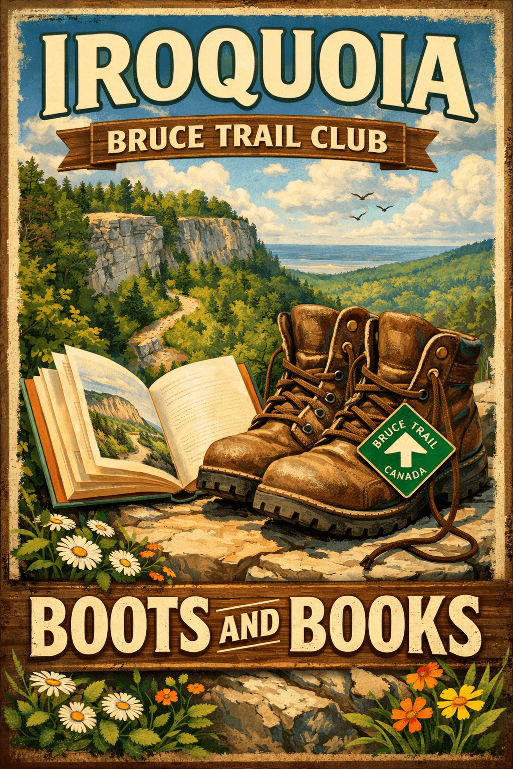 Boots and Books – The Iroquoia Bruce Trail Book Club Boots and Books – The Iroquoia Bruce Trail Book Club 9:00 AM-11:30 AM 07/05/2026 https://hikes.brucetrail.org/event/boots-and-books-the-iroquoia-bruce-trail-book-club-3/2026-07-05/  Click here for more information or to register Hosting Club: Iroquoia
Category: Boots and Books – The Iroquoia Bruce Trail Book Club
Location (Google Maps): Chedoke Golf Club Parking Lot Hike Leader(s): Ruth Moffatt Click here to contact Hike Leader(s) Pace: Medium – 3 to 4 km/hr
Terrain: Dependent on Conditions, Moderate – Some hills and/or some poor footing
Distance: Approx 8km Description
Welcome to the 4thIroquoia Bruce Trail Book Club – “Boots and Books” Our book is “Theo of Golden” by Allen Levi. Please check your local library for available copies of this book. We will hike from the parking lot westbound along the Chedoke Radial Trail and return – about 8km which will take about 2.5-3 hours approximately. Please wear suitable foot wear, dress for the weather and bring poles if you use them. Please bring enough snacks and water suitable for the length/duration of the hike. It is not necessary to bring the book. Our book will be “A History of Canada in 10 Maps” by Adam Shoalts and the July book will be “Woman, Watching” by Merilyn Simonds It may be a good idea to reserve these books now from your local library. The hike is open to everyone whether you have read the book or not but there may he spoilers, if you haven’t read it. It will be open to 10 people to keep it more intimate for discussing the book. If your plans change, please cancel your registration so that people who are waitlisted may join. To cancel your registration, here is a step by step:
– Sign into your account on the Bruce Trail website.
– Go to the Hike Schedule
– Click on My Hikes tab which you should find at the top of the schedule
– Scroll to the appropriate hike you wish to cancel
– Cursor to the far right of the hike to the Action column
– Click cancel under the hike you wish to cancel.
- Black Bank
9:30 AM-12:00 PM 07/05/2026 https://hikes.brucetrail.org/event/black-bank-2/2026-07-05/  Click here for more information or to register Hosting Club: Iroquoia
Category: General Hike
Location (Google Maps): Meet roadside at 9:15 at the corner of 20th Side Road and Prince of Wales Rd, just north of Kilgorie. Hike Leader(s): Karen Bergmann Click here to contact Hike Leader(s) Pace: Medium – 3 to 4 km/hr
Terrain: Moderate – Some hills and/or some poor footing
Distance: 9 kms Description
This hike will take us into a challenging valley with rocks and hills and then through a cattle pasture and over a few stiles. Black Bank is in the Dufferin Section. You are welcome to ride with me from Mississauga if you don’t want to drive. I’ll send an email a couple of days prior to the hike to remind you and see who wants to carpool. Please bring sufficient water, a snack as needed, and bug spray/bug net.
| 6 - Car Hike: Beaver valley E2E hike #1/5
8:30 AM-3:00 PM 07/06/2026 https://hikes.brucetrail.org/event/car-hike-beaver-valley-e2e-hike-1-5/2026-07-06/ Click here for more information or to register Hosting Club: Toronto, Beaver Valley
Category: Car Hike
Location (Google Maps): Meet at Kolapore parking, south of km 23.8 Grey Rd 2. Coordinates N 44.422919,W 80.405597 map 25 Hike Leader(s): Smadar Junkin Click here to contact Hike Leader(s) Pace: Brisk (4-5 km/hr)
Terrain: Challenging, Hilly, Level 3 (Advanced – steep hills and some scrambling over boulders)
Distance (km): About 24kms. A little longer then the map shows because of a reroute. Description
This is the first of 5 consecutive days to complete the Beaver Valley section. Beaver Valley is beautiful and challenging section. Please note that these hikes are long and are at the height of summer. Please assess your ability to keep up with the pace and distance of these hikes series before registering.
we will shuttle to km 0.0 and hike back. Bring at least 2 litres of water, snacks and lunch. Bug repellent and sun screen. make sure to arrive at 8:15 for each hike so we can be in the cars and ready to go by 8:30. All participants need to drive car shuttles as many times as needed at the duration of these hikes. Please note that you need to register to each hike individually. this is a no reply email. If you need to get in touch with me, please use my personal email address above.
- Hilton Falls Side Trail – Shuttle Hike – RESCHEDULED FROM MARCH 30
8:30 AM-2:00 PM 07/06/2026 https://hikes.brucetrail.org/event/hilton-falls-side-trail-shuttle-hike/2026-07-06/ Click here for more information or to register Hosting Club: Iroquoia
Category: General Hike
Location (Google Maps): Hilton Falls Conservation Area Hike Leader(s): Pati Greenwood, Jeff Dowsett Click here to contact Hike Leader(s) Pace: Medium – 3 to 4 km/hr
Terrain: Dependent on Conditions, Moderate – Some hills and/or some poor footing
Distance: 16 km Description
From Hilton Falls Conservation Area, we will shuttle to the Bruce Trail Pear Tree Parking. We will make our way to the Hilton Falls Side Trail following the main trail and the Al Shaw Side Trail. We will hike along the Hilton Falls Side Trail to the main trail and the Philip Gosling Side Trail back to Hilton Falls parking lot. Hydration is important at this time of year. Bring plenty to drink, electrolytes, as well as a snack. Insects, including ticks, are sure to be in full force so take steps to avoid being bitten; wear long sleeves and pants, and bring insect repellent. Also wear hiking boots as the terrain will be quite rugged in areas. Hiking poles are recommended. Please arrive at the meeting place by 8:15 am for an 8:30 am departure. A park registration will be required for those parking at Hilton Falls for the day. Car shuttle arrangements will be worked out with registered hikers a few days prior to the hike. The hike will be dependent on weather conditions.
| 7 - Car Hike: Beaver Valley E2E hike #2/5
8:30 AM-3:00 PM 07/07/2026 https://hikes.brucetrail.org/event/car-hike-beaver-valley-e2e-hike-2-5/2026-07-07/ Click here for more information or to register Hosting Club: Toronto, Beaver Valley
Category: Car Hike
Location (Google Maps): Same as day 1 Hike Leader(s): Smadar Junkin Click here to contact Hike Leader(s) Pace: Brisk (4-5 km/hr)
Terrain: Challenging, Hilly, Level 3 (Advanced – steep hills and some scrambling over boulders)
Distance (km): 26kms and a bit of road walking on each end. Description
Please see hike instructions on day 1. we will shuttle to north of km 50.0 west side of Grey Rd 13 and walk back.
 Afternoon Hike – Scotsdale Farm Afternoon Hike – Scotsdale Farm 4:30 PM-6:00 PM 07/07/2026 https://hikes.brucetrail.org/event/afternoon-hike-scotsdale-farm-2/2026-07-07/  Click here for more information or to register Hosting Club: Iroquoia
Category: Afternoon/Evening Hikes
Location (Google Maps): Meet at 4:15 pm in the parking lot on 8 Line. Hike Leader(s): Karen Bergmann Click here to contact Hike Leader(s) Pace: Medium – 3 to 4 km/hr
Terrain: Moderate – Some hills and/or some poor footing
Distance: 6 kms Description
Meeting at 4:15 pm in the parking lot off 8 Line, we will hike a 6 kms loop. There are some rocky bits and a few hills. Please bring water and bug spray/bug net.
| 8 - Car Hike: Beaver Valley E2E 3/5
8:30 AM-3:00 PM 07/08/2026 https://hikes.brucetrail.org/event/car-hike-beaver-valley-e2e-3-5/2026-07-08/ Click here for more information or to register Hosting Club: Toronto, Beaver Valley
Category: Car Hike
Location (Google Maps): Graham Hill Rd 60 meters to the west of km 74.2. Coordinates N 44.333807,W 80.554916 map # 26. Hike Leader(s): Smadar Junkin Click here to contact Hike Leader(s) Pace: Brisk (4-5 km/hr)
Terrain: Challenging, Hilly, Level 3 (Advanced – steep hills and some scrambling over boulders)
Distance (km): 24 kms. Description
Please see hike notes on hike #1. We will shuttle to km 50.0 and hike back.
- Waterloo Region Wednesday Walks: Huron Natural Area
8:45 AM-12:00 PM 07/08/2026 https://hikes.brucetrail.org/event/waterloo-region-wednesday-walks-huron-natural-area/2026-07-08/  Click here for more information or to register Hosting Club: Caledon Hills
Category: Nature Walks
Location (Google Maps): Meet at Huron Natural Area, 801 Trillium Drive, Kitchener. Hike Leader(s): Dan Patterson Click here to contact Hike Leader(s) Pace: Leisurely – 3 km/hour or less
Terrain: Easy – mostly flat and usually good footing
Distance: 10 km Description
Meet at Huron Natural Area, 801 Trillium Drive, Kitchener. We will explore the trails in this amazing nature preserve. This is a great opportunity to take photos and enjoy being in nature. The pace will be slow. Washrooms are available on site. Bring water, snacks, bug spray, sun screen, a camera and a patient appreciation for nature and our place in it.
- Hiking the Credit
9:30 AM-12:30 PM 07/08/2026 https://hikes.brucetrail.org/event/hiking-the-credit/2026-07-08/  Click here for more information or to register Hosting Club: Iroquoia
Category: Good Companions
Location (Google Maps): Erindale Park/Culham Trail, 1695 Dundas St., Mississauga Hike Leader(s): Anne Armstrong Click here to contact Hike Leader(s) Pace: Leisurely – 3km/hr or less
Terrain: Easy – Mostly flat and usually good footing
Distance: Approx. 9 km. Description
Join in this easy hike which follows the Credit River up to Highway 403. We will then climb a gentle hill to do a loop which then returns us back to the river. Bring a snack, water, insect repellent and sunscreen. Poles for the climb and loop may be useful. I will send an email out the night before with my contact information in the event you need to cancel the night before or the morning of the hike.
- Evening Hike in Owen Sound followed by an Opportunity for Refreshments
7:00 PM-8:45 PM 07/08/2026 https://hikes.brucetrail.org/event/evening-hike-in-owen-sound-followed-by-an-opportunity-for-refreshments-23/2026-07-08/ Click here for more information or to register Hosting Club: Sydenham
Category: An evening walk.
Location (Google Maps): Meet in the municipal parking lot by the river on the West side of 1st Ave East between 7th St East and 8th St East in Owen Sound. Hike Leader(s): Harriet Nixon Click here to contact Hike Leader(s) Pace: Brisk: 4 to 5 km/h
Terrain: Moderate: Some hills and/or poor footing
Distance: Approx 5 km Description
Join us for a brisk summer evening hike exploring the paths and neighbourhoods within the City of Owen Sound. Please note this month this hike takes place on the second Wednesday evening, so you can enjoy Canada Day on the first Wednesday evening. There is no need to show up 15 minutes early for this hike, but we will leave promptly at 7:00 pm. Following the hike there is an opportunity to socialize over refreshments.
| 9 - Car Hike: Beaver Valley E2E 4/5
8:30 AM-3:00 PM 07/09/2026 https://hikes.brucetrail.org/event/car-hike-beaver-valley-e2e-4-5/2026-07-09/ - Twiss Rd to Crawford Lake return
9:30 AM-12:30 PM 07/09/2026 https://hikes.brucetrail.org/event/twiss-rd-to-crawford-lake-return-2/2026-07-09/  Click here for more information or to register Hosting Club: Iroquoia
Category: General Hike
Location (Google Maps): Meet roadside on Twiss Road at 8:45 am. Hike Leader(s): Karen Bergmann Click here to contact Hike Leader(s) Pace: Medium – 3 to 4 km/hr
Terrain: Strenuous – Hilly with steep climbs and some poor footing
Distance: 10 kms Description
Meeting roadside at 9:15 am on Twiss Road, we will hike to Crawford Lake and around the trails and back to Twiss Road. There are some rocky sections along the way. Please bring water and a snack and bug spray/bug net.
| 10 - Car Hike: Beaver Valley E2E 5/5
8:30 AM-3:00 PM 07/10/2026 https://hikes.brucetrail.org/event/car-hike-beaver-valley-e2e-5-5/2026-07-10/ Click here for more information or to register Hosting Club: Toronto, Beaver Valley
Category: Car Hike
Location (Google Maps): Km 117.3 grey Rd 12. Coordinates N 44.500537,W 80.632902 map 28. Please note that this parking is not marked on the map. It is marked on the Bruce Trail App. Hike Leader(s): Smadar Junkin Click here to contact Hike Leader(s) Pace: Brisk (4-5 km/hr)
Terrain: Challenging, Hilly, Level 3 (Advanced – steep hills and some scrambling over boulders)
Distance (km): 21.6 Description
Last day, badge day, treats day. We will shuttle to km 95.7 and hike back. See hike notes on day 1.
| 11 - Peninsula Sunrise Series: White Bluff
5:00 AM 07/11/2026 https://hikes.brucetrail.org/event/peninsula-sunrise-series-white-bluff/2026-07-11/  Click here for more information or to register Hosting Club: Peninsula
Category: Sunrise Hike
Location (Google Maps): Forty Hills Road Bruce Trail Lot Hike Leader(s): Kathleen Stahlbaum Click here to contact Hike Leader(s) Pace: Leisurely (2.0 – 3.0 km/h): A relaxed pace with frequent breaks and a focus on enjoyment., Medium (3.0 – 4.5 km/h): A comfortable pace for most hikers with steady progress.
Terrain: Difficult: Steep ascents/descents, rocky scrambling, and some rugged escarpment paths., Moderate: Rolling hills, mild slopes and rocky paths.
Distance: 5.8 km Description
Experience the magic of dawn on the Bruce Trail with the Sunrise Hike Series offered by the Peninsula Bruce Trail Club. These early morning hikes provide a perfect opportunity to awaken your senses, boost your energy, and immerse yourself in the tranquility of nature as the sun paints the sky with breathtaking hues. As we make our way through scenic forest trails, we’ll pause to witness the first light shimmering on the turquoise waters of Georgian Bay – a sight that will surely leave you in awe! Beyond the beauty, morning light helps regulate your circadian rhythm, elevating your mood, boosting energy levels and improving sleep quality. Whether you’re looking to start your day with a sense of calm, capture stunning sunrise photos, or simply reconnect with nature, these hikes offer a unique and inspiring way to greet the day. On Saturday July 11th, join us in hiking through the Smokey Head White Bluffs Nature Reserve and along the edge of White Bluff, where we’ll experience the sun rising over Lion’s Head. We’ll have the joy of taking in the stunning colours of the sky as the first light sparkles on the stunning turquoise waters of Isthmus Bay. This peaceful sunrise hike is the perfect way to connect with nature, capture some incredible photos, and start the day with fresh air and inspiration. Whether you’re a morning person or just love a good adventure, come experience the magic of dawn from one of the best vantage points on the Bruce Peninsula! Don’t forget to bring a headlamp or flashlight (preferably with a red light setting) as we begin our adventure in the pre-dawn quiet. Join us and discover how a sunrise hike can nourish your mind, body, and spirit – setting the tone for a brighter, more balanced day. This hike is approximately 6 kms in length. Expect to be on the trail for 2.5-3 hours. Pace will be leisurely with ample time to enjoy the sunrise, take some photographs, and nourish yourself! Please note: terrain is challenging with rock scrambling and tripping hazards. Experienced hikers only. How to prepare - Get a good night’s sleep
- Bring lots of water and a snack (breakfast and/or coffee are recommended if that’s your thing!)
- Bring a headlamp or flashlight (preferably with a red light setting)
- Wear waterproof hiking boots
- Hiking poles are recommended but not necessary
- Bring insect repellant or wear protective clothing
In the event of cloudy/rainy weather, the hike will be held on Sunday, July 12th. Please watch your emails for a confirmation the week of the hike!
- Car Hike: Boyd Conservation Park ,Vaughan
8:30 AM-1:15 PM 07/11/2026 https://hikes.brucetrail.org/event/car-hike-boyd-conservation-park-vaughan-15/2026-07-11/ Click here for more information or to register Hosting Club: Toronto Location (Google Maps): Free Parking lot before entrance of park on Islington Ave. Hike Leader(s): Mohammad Aghamiri Click here to contact Hike Leader(s) Pace: Moderate (3-4 km/hr)
Terrain: Hilly, Level 2 (Intermediate – some hills and uneven surfaces, rocks and roots underfoot), Variable
Distance (km): 12-14 km Description
Let’s hike Boyd conservation park trails through beautiful valleys. Please bring lots of water and snacks ,hiking poles are recommended phone number for the day of hike 289 588 6482
- School Bus Hike: Pathways To Port Dover Lynn Valley Trail
8:30 AM-7:00 PM 07/11/2026 https://hikes.brucetrail.org/event/school-bus-hike-pathways-to-port-dover-lynn-valley-trail/2026-07-11/ Trip Information
Departure Time: 08:30
Return to City Time: 19:00
Departure Point: Kipling Departure Point Click here for more information or to register Optional Items
Hosting Club: Toronto
Category: Bus Hike
Location (Google Maps): Lynn Valley Trail Hike Leader(s): Tom Swales Click here to contact Hike Leader(s) Pace: Moderate (3-4 km/hr)
Terrain: Flat, Level 1 (Easy – mostly on flat, well maintained trails with hard-packed surface)
Distance (km): 12 km Description
Join us for a scenic and easy paced walk, a regular summer favorite along the trails running through Norfolk County from downtown Simcoe ending at historic Port Dover. The route is primarily on rail trails so is ideal for those who favor a flatter and easier route in the summer heat. Dropout at 8km. We will stop at the Simcoe Recreation Centre before the hike to use the facilities. After the hike there will be the opportunity to indulge in the local perch fish and chips or hang out at the beach which together make Port Dover famous. Long Distance Bus Fare applies and there will be a late return (after 6:00 Pm).
- Seven Rivers Hike Badge Series- Hike 7
8:45 AM-1:00 AM 07/11/2026 https://hikes.brucetrail.org/event/seven-rivers-hike-badge-series-hike-7/2026-07-11/ This is a Multi-Day HikeYou are signing up for the following dates and times:
2026-07-11 at 08:45 Click here for more information or to register Hosting Club: Dufferin Hi-Land
Category: General Hike
Location (Google Maps): Humber River Caledon Section Maps 17 and 18
Parking: East of Airport Road past the Taoist Tai Chi Centre on Mono 5 Sideroad Hike Leader(s): Tristan Goguen and Pat Foley Click here to contact Hike Leader(s) Pace: Medium
Terrain: Moderate
Distance: 11.4 Km Description
This series features rivers in our Headwaters area: the Humber, Nottawasaga, Boyne, Pine, Mad, Noisy and Pretty Rivers and includes 7 hikes from three Bruce Trail Sections: Blue Mountains (3), Dufferin Hi-Land (2) and Caledon Hills (2). First hike is in the Caledon Hills section of the Bruce Trail and we will view the Humber River. Maps 17 and 18 Today we will hike southbound from the parking lot on 5 Side Rd. to the viewpoint looking out over the Humber Valley. From there we continue southbound past the Glen Haffy Side Trail remaining on the main trail and continuing on the main trail to just before Highway 9. From there we will head back to the parking area. For anyone wishing to add distance to their hike we can add a couple of loops in the forest near the Taoist Tai Chi Centre. Optionally we can have lunch in the gazebo which is about 1 km north of the parking lot. Please be prepared for the weather, we will hike rain or shine. Ensure you have enough water,lunch and snacks, sunscreen and bug repellent. Hats and sunglasses are recommended as are poles and sturdy shoes. For those wishing to earn their 7 Rivers – complete all 7 hikes, badges will be available on the last day from the hike leaders at a cost of $10 for members and $15 for non members. Anyone completing make-up hikes may log their hikes and apply directly to the Dufferin Highlands BT Club for the badge.
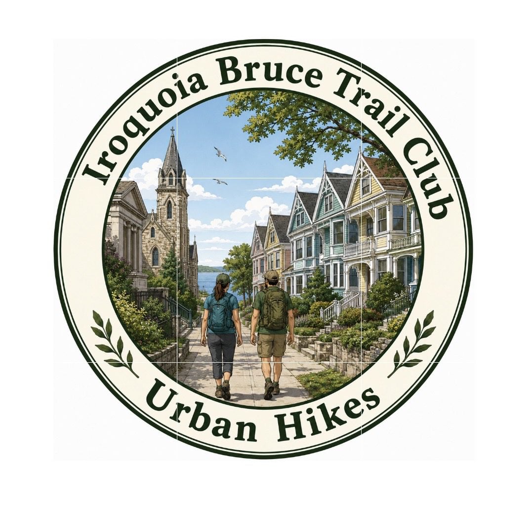 Urban Hike – Grimsby – “The Painted Ladies” Urban Hike – Grimsby – “The Painted Ladies” 9:00 AM-11:00 AM 07/11/2026 https://hikes.brucetrail.org/event/urban-hike-grimsby-the-painted-ladies/2026-07-11/  Click here for more information or to register Hosting Club: Iroquoia
Category: Urban Hikes
Location (Google Maps): Nelles Beach Park – 91 Lake St, Grimsby Hike Leader(s): Ruth Moffatt Click here to contact Hike Leader(s) Pace: Leisurely – 3km/hr or less
Terrain: Easy – Mostly flat and usually good footing
Distance: Approximately 7km Description
Please join us for an Urban Hike where we will explore all the wonderful “Painted Ladies” of Historic Grimsby Beach. A stop at all the favourites as well as some history of this at one time Methodist Church Camp meeting ground from the 1800’s. These Painted Ladies or gingerbread cottages are said to rival those in San Francisco. Please join us for this very special treat.
- Geology Hike and Badge Series – Beth Gilhespy Side Trail
9:30 AM 07/11/2026 https://hikes.brucetrail.org/event/geology-hike-and-badge-series-beth-gilhespy-side-trail/2026-07-11/  Click here for more information or to register Hosting Club: Peninsula
Category: Geology Hike
Location (Google Maps): Beth Gilhespy Side Trail, Barrow Bay Hike Leader(s): Beth Gilhespy Click here to contact Hike Leader(s) Pace: Leisurely (2.0 – 3.0 km/h): A relaxed pace with frequent breaks and a focus on enjoyment.
Terrain: Moderate: Rolling hills, mild slopes and rocky paths.
Distance: 7.6 Description
Join the adventure and earn the inaugural Peninsula Geology Badge! Over a stretch of 13 hikes and a couple of extra stops, we will explore the fascinating geology of the Peninsula to learn about the rocks, the shoreline features, glaciation, fossils and all things earthy. The 13 hikes are from the book “Walking Through Time – Exploring the Geology of the Saugeen (Bruce) Peninsula”. Having a copy will give you a lot of great information, but you do not have to purchase the book to attend and enjoy the hikes. Just bring your curiosity! We will make sure to hit all the locations that qualify for the beautiful new Walking Through Time – Saugeen (Bruce) Peninsula geology hike badge. If you would like to purchase a book I will have some available on the hikes, or you can pick one up from the BTC Head Office, at Ginger Press in Owen Sound, Suntrail Source for Adventure in Hepworth, the Shop at 84 Main in Lion’s Head and at Reader’s Haven in Tobermory. You are welcome to come on just a few of the hikes or on all of them, and the dates and hikes are as follows: Date Geology Hike km Saturday May 2, 2026 Colpoy’s Bay 9.0 Saturday May 9, 2026 Gravelly Point (am) and Rural Rocks (pm) 8.6 Saturday May 16, 2026 Malcolm Bluff 7.3 Sunday May 17, 2026 White Bluff/Smokey Head 11.8 Sunday May 24, 2026 Crooked Toe Road 5.5 Sunday May 31, 2026 Hope Bay 8.1 Sunday June 14, 2026 Boundary Bluffs 5.2 Saturday July 4, 2026 Cape Dundas 6.2 Saturday July 11, 2026 Beth Gilhespy Side Trail 7.6 Saturday August 8, 2026 Lion’s Head 11.0 Saturday August 15, 2026 Dyer’s Bay Loops 7.5 Saturday August 22, 2026 North Saugeen (Bruce) Shoreline 8.0 Meeting times will vary depending on the hike, but will generally be some time between 9 am and 10 am. Information on exact meeting times and locations will be sent out a few days prior to the hike.
|
12 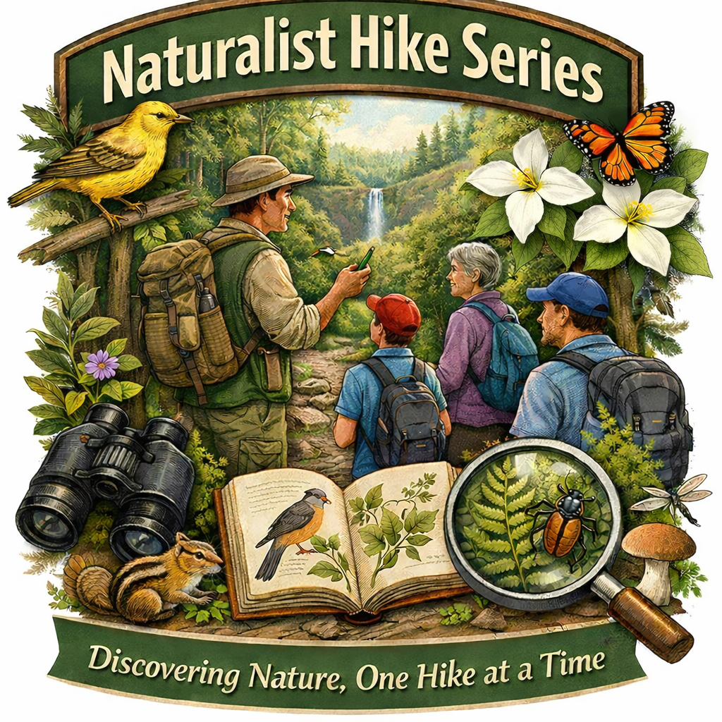 Iroquoia BTC Naturalist Hike Series- Discovering Nature One Hike at a Time – Sketching Nature – Meet in the parking lot at 8:15am Iroquoia BTC Naturalist Hike Series- Discovering Nature One Hike at a Time – Sketching Nature – Meet in the parking lot at 8:15am 8:15 AM-1:00 PM 07/12/2026 https://hikes.brucetrail.org/event/iroquoia-naturalist-hike-series-discovering-nature-one-hike-at-a-time-sketching-nature-meet-in-the-parking-lot-at-815am/2026-07-12/  Click here for more information or to register Hosting Club: Iroquoia
Category: Iroquoia BTC Naturalist Hike Series : Discovering Nature, One Hike at a Time.
Location (Google Maps): City View Park – From Dundas St turn onto Kerns Rd and then take the second road on the left. Follow it through to the parking on the left hand side. Hike Leader(s): Ruth Moffatt Click here to contact Hike Leader(s) Pace: Medium – 3 to 4 km/hr
Terrain: Easy – Mostly flat and usually good footing, Moderate – Some hills and/or some poor footing
Distance: 8.5km Description
Sketching nature has many benefits. It enhances observation and learning, it deepens our connection with nature and it will help to boost memory as the process of sketching helps us to remember details, emotions and places better than a quick photo. It also helps us to create our artistic skills and encourages creativity. John J. Audubon’s Birds of America famous bird drawings were published in 1838 – nearly 200 years ago. For our first foray into sketching nature, our focus will not be on perfection but rather the process of observation. Please join Corie and Ruth as we make our way over to a comfortable log where we will sit and choose something to sketch. All sketching materials will be provided and are yours to keep. Some artistic drawing guidance will be provided by Corie and possibly another guest. Please bring the snacks, lunch, water, poles if you use them and of course all the things you require for a day hike – hat, sunscreen, bug spray, first aid kit etc. If the Sketching Nature portion has to be cancelled due to a forecast of rain, we will hike but sketching will be postponed. Everyone will be notified. This hike is open to a small group of 10. If you have to cancel, please remove your registration so that someone from the waitlist can join. To cancel your registration, here is a step by step:
– Sign into your account on the BTC website
– Click on My Hikes under your account
– This will take you to a list of hikes you have registered for
– Scroll down to the appropriate hike and cursor over to the far right hand column under the Action column.
– Click Cancel under the hike you wish to cancel
- Glen Haffy to 7th Line – carpool hike
9:30 AM-1:00 PM 07/12/2026 https://hikes.brucetrail.org/event/glen-haffy-to-7th-line-carpool-hike/2026-07-12/  Click here for more information or to register Hosting Club: Iroquoia
Category: General Hike
Location (Google Maps): Meet at 9:15 in the 7th Line Bruce Trail parking lot, off Airport Road. Hike Leader(s): Karen Bergmann Click here to contact Hike Leader(s) Pace: Medium – 3 to 4 km/hr
Terrain: Moderate – Some hills and/or some poor footing
Distance: 9 kms Description
Meeting at 9:15 am in the Bruce Trail parking lot at the corner of 7th Line and Airport Road, we will carpool to Coolihans Side Road and hike back through Glen Haffy, along Hwy 7 and into the forest to the cars. There are some hills and tricky footing, so bring poles if you use them. Lots of variety along this trail. There is a 650 meter stretch of road walking just after leaving the Glen Haffy Conservation Area. Bring water and a snack, as needed, as well as bug spray/bug net.
| 13  Tai Chi with Hike Tai Chi with Hike 10:00 AM-12:00 PM 07/13/2026 https://hikes.brucetrail.org/event/tai-chi-with-hike-2/2026-07-13/  Click here for more information or to register Hosting Club: Niagara
Category: Mindfulness
Location (Google Maps): Meet in Queenston Heights Park near the maintenance shed. Enter parking off Portage Rd and turn left to go to the end of the parking lot. Hike Leader(s): Margaret Northfield Click here to contact Hike Leader(s) Pace: Medium 3- 4 km/hr
Terrain: Moderate: some hills and some poor footing
Distance: 5-6km Description
Seeking balance, calm and strength without high impact exercise? Join us for a short hike. Tai Chi Master, Mike Van Natter will instruct us on the benefits of Tai Chi as well as lead us through several Tai Chi movements along our way.
| 14 | 15 - The Beautiful Glen Management Area
8:45 AM-12:00 PM 07/15/2026 https://hikes.brucetrail.org/event/the-beautiful-glen-management-area/2026-07-15/ Click here for more information or to register Hosting Club: Sydenham
Category: General Hike
Location (Google Maps): Roadside Parking – west of km 122.4 on County Road 17, near the Glen Side Trail Hike Leader(s): Sheri Hatcher Click here to contact Hike Leader(s) Pace: Brisk: 4 to 5 km/h
Terrain: Moderate: Some hills and/or poor footing
Distance: 9.5 km Description
Join me for a rewarding morning on the trail starting at the Glen Side Trail. We will start our briefing at 8:45 and start our hike right at 9:00. We will hike to the main trail and continue east to the base of the escarpment on East Linton Road. We will return through the Frank Holley and Ron Savage Side Trail. From crevices to meadows to hardwood forests and ponds, this route offers a rich mix of landscapes.
- Nassagaweya Canyon, from Crawford Lake (reservations required)
9:30 AM-12:30 PM 07/15/2026 https://hikes.brucetrail.org/event/nassagaweya-canyon-from-crawford-lake-reservations-required-2/2026-07-15/  Click here for more information or to register Hosting Club: Iroquoia
Category: General Hike
Location (Google Maps): Meet in the first parking lot at Crawford Lake. You will need to reserve your time at conservationhalton.ca Hike Leader(s): Karen Bergmann Click here to contact Hike Leader(s) Pace: Medium – 3 to 4 km/hr
Terrain: Moderate – Some hills and/or some poor footing
Distance: 9 kms Description
Meeting at 9:15 am in the first parking lot, we will hike through the park and down into the canyon and back up into the park for a large loop. There are some rocks along the way and a couple of steep hills (going down into the canyon and then back up). Bring a snack, as needed, and bug spray/bug net.
| 16 | 17 - Afternoon Hike – Silver Creek
4:30 PM-6:30 PM 07/17/2026 https://hikes.brucetrail.org/event/afternoon-hike-silver-creek-2/2026-07-17/  Click here for more information or to register Hosting Club: Iroquoia
Category: Afternoon/Evening Hikes
Location (Google Maps): Meet at 4:15 roadside on Fallbrook Trail at Silver Creek Conservation Area. Hike Leader(s): Karen Bergmann Click here to contact Hike Leader(s) Pace: Medium – 3 to 4 km/hr
Terrain: Moderate – Some hills and/or some poor footing
Distance: 7 kms Description
Meeting at 4:15 pm roadside on Fallbrook Trail, we will hike around the Roberts ST and Irwin Quarry ST and then cross the road to the main trail and around a couple of side trails that you may not have known were there. Bring water and bug spray/bug net.
| 18 - School Bus Hike: Winery Tasting and Tour
8:15 AM-6:00 PM 07/18/2026 https://hikes.brucetrail.org/event/swayze-falls-to-short-hills-provincial-park-tracing-rim-of-africa-bruce-trail-friendship-trail/2026-07-18/  Trip Information
Departure Time: 08:15
Return to City Time: 18:00
Departure Point: Kipling Departure Point Click here for more information or to register Optional Items
Hosting Club: Toronto
Category: Bus Hike
Location (Google Maps): Kipling Subway Departure Point Hike Leader(s): Ross Estrella Click here to contact Hike Leader(s) Pace: Moderate (3-4 km/hr)
Terrain: Hilly, Level 2 (Intermediate – some hills and uneven surfaces, rocks and roots underfoot), Variable
Distance (km): 8.5 km Description
Join us on a moderate (H4H-H4F) pace hike starting from Swayze Falls area passing thru Short Hills Provincial Park and the Rim of Africa Bruce Trail Friendship Trail. Day hike essentials to bring; snack/lunch, hydration fuel, sunscreen, full brim hat for sun protection and insect repellent in the event our friendly mosquitoes welcome us. Hiking shoe/boot and poles are highly recommended. From the finish of our hike the bus will take us to Pillitteri Estate Winery (official wine supplier of Canada’s Olympic Team) where we’ll experience and enjoy a private structured wine tasting and tour by one or more of their knowledgeable and friendly staff. The cost of tasting and tour experience is $20.00 includes tax and gratuity per person with four wines selected by the host. Wine tasting and tour fee will be paid upon signing and payable via Interac e-Transfer to ross.estrella@rogers.com. There’s no refund on wine tasting and tour fee as the amount will be paid days in advance to secure the function. You may purchase a bottle of your favorite bubbly and souvenirs. If interested in joining this hike please register early (by June 19th) so the number of people expected in our group can be provided to the winery a week in advance. Please arrive at least fifteen minutes prior to the bus departure time. The bus will not wait for latecomers.
- Car Hike: Rouge National Park Scarborough, ON
8:30 AM-1:15 PM 07/18/2026 https://hikes.brucetrail.org/event/car-hike-rouge-national-park-scarborough-on-3/2026-07-18/ Click here for more information or to register Hosting Club: Toronto Location (Google Maps): Free parking in Mast Trail parking Lot off Kingston Road Hike Leader(s): MOHAMMAD AGHAMIRI Click here to contact Hike Leader(s) Pace: Moderate (3-4 km/hr)
Terrain: Hilly, Level 2 (Intermediate – some hills and uneven surfaces, rocks and roots underfoot)
Distance (km): 14-15 km Description
We will hike Vista trail and part of orchard trail, will enjoy look outs between Rouge river and Little Rouge creek
• Please dress appropriately for the weather.
• We will have short water ,picture and a 15 minute snack break. Everyone is welcome! Please bring lots of water and snacks ,hiking poles are recommended phone number for the day of hike 289 588 6482
- Passport To Nature — Pretty River Yoga Hike!
9:00 AM-1:30 AM 07/18/2026 https://hikes.brucetrail.org/event/passport-to-nature-pretty-river-yoga-hike/2026-07-18/ Click here for more information or to register Hosting Club: Blue Mountains
Category: Organized Hike
Location (Google Maps): Tim Horton’s, First Street, Collingwood Hike Leader(s): Helen Stukator, Rob Johnston Click here to contact Hike Leader(s) Pace: Leisurely – 3 km/hr. or less
Terrain: Moderate – Some hills and/or some poor footing
Distance: 5km Description
The first of our club’s Passport To Nature series. Namaste! We will meet behind Tim’s on 1st Street in Collingwood and carpool to the Three Stage parking at the top of Pretty River Prov Park. We will hike a moderate trail of 3-5km through beautiful hardwood forest, accompanied by a qualified Yoga instructor leading us in Yoga stretches and movements. Great views to the west! This hike is has some hills and rocky footing, so hiking boots or trail runners are recommended. Bring water.
- Saturday Shorts: Glen Haffy
9:30 AM-11:30 AM 07/18/2026 https://hikes.brucetrail.org/event/saturday-shorts-glen-haffy-7/2026-07-18/  Click here for more information or to register Hosting Club: Caledon Hills
Category: General
Location (Google Maps): Meet at the roadside parking on Coolihans Sideroad, km 35.0 Map 17, near where the Trail crosses the road. This is just west of the intersection of Glen Haffy Road and Coolihans Sideroad (even though the GPS coordinates are showing just to the east). It is best to aim for arriving around 9:20, so we can start hiking as close to 9:30 am as possible. Thanks! It’s a popular meet-up spot, so there may be a few other hiking groups parked along Coolihans. Hike Leader(s): Elizabeth Ganong Click here to contact Hike Leader(s) Pace: Leisurely – 3 km/hour or less
Terrain: Moderate – some hills and/or some poor footing
Distance: Approximately 6 km Description
Looking to get out on a Saturday but not give up your whole day? This Glen Haffy hike might be the one for you! We’ll hike the main Bruce Trail and conservation trails to make an approximately 6 km route. The pace will be a relaxed one, so you can enjoy the sights and sounds of summer in the forest. Consider the following in your preparations: a hat, insect repellent, sunscreen, hiking shoes/boots, poles. You are encouraged to bring water and a snack as there will be a short break. No dogs please. You can expect a reminder/update message one or two days before the hike.
|
19 - Woolverton to Jones Rd (E2E)
9:30 AM-12:30 PM 07/19/2026 https://hikes.brucetrail.org/event/woolverton-to-jones-rd-e2e/2026-07-19/  Click here for more information or to register Hosting Club: Iroquoia
Category: General Hike
Location (Google Maps): Meet at 9:15 at the end of Jones Rd, off Hwy 8 just past Stoney Creek. Hike Leader(s): Karen Bergmann Click here to contact Hike Leader(s) Pace: Medium – 3 to 4 km/hr
Terrain: Moderate – Some hills and/or some poor footing
Distance: 9 kms Description
Meeting at the end of Jones Rd at 9:15 am, we will carpool to Woolverton Rd and hike back. There are plenty of rocks and roots and a few hills. Bring bug spray/bug net, plenty of water and a snack, as needed.
- Rainbow Hike at Inglis Falls Arboretum
11:00 AM-2:30 PM 07/19/2026 https://hikes.brucetrail.org/event/rainbow-hike-at-inglis-falls-arboretum/2026-07-19/  Click here for more information or to register Hosting Club: Sydenham, Peninsula
Category: Rainbow Hike
Location (Google Maps): Click on the (Google Maps) link to take you there. Meet at the Pavilion beside the Grey Sauble Administration Centre at the Inglis Falls Arboretum at 237897 Inglis Falls Road which is 1.2 km north (towards Owen Sound) from Inglis Falls. You can also walk there from Harrison Park by following the blue-blazed Harrison Park side trail up the hill at the back end of the campground.
Or use these GPS coordinates to the Pavilion: 44.53526, -80.93592 Hike Leader(s): Stewart Brown Click here to contact Hike Leader(s) Pace: Leisurely: 3 km/h or less
Terrain: Easy: Mostly flat and good footing.
Distance: 2-4 km Description
Sydenham Bruce Trail Club (SBTC) is excited to celebrate a Rainbow Hike on the Bruce Trail and the trails at the Inglis Falls Arboretum! The Event will be based at the Pavilion at the Grey Sauble Conservation Administration Centre. Bring your own lunch and drinks to enjoy after the hike at the picnic tables in the shade of the Pavilion. There are washrooms at the Pavilion. This inclusive, family-friendly 2SLGBTQIA+ hike offers a safe and supportive space for trans, gay, lesbian, bisexual, queer, 2Spirit, intersex, asexual people, as well as allies and friends. The day includes two hiking options. We’ll begin with a short introduction at the Pavilion at 11 a.m., then walk an easy section of the Arboretum Trails with Arboretum Interpreter, Nan Brown, and SBTC Hike Leaders. Arboretum interpretation will include an introduction to this unique ecosystem of woody and herbaceous plants using a queer ecology perspective. The guided Arboretum tour offers 2 km of winding trails through 20 acres of the Trees of the World section and the Grey-Bruce Native section both of which are adorned with interpretative signs of interesting details. Among the woody plants, there are intentional brush piles and meadows of native herbaceous plants which provide homes and food for butterflies, bees, birds and other animals in a sustainable, ecologically diverse habitat. Back at the Pavilion about 12:45 p.m., participants can choose to stay there and socialize, or to continue for a 30-40 minute hike along the Bruce Trail to the bridge at the Sydenham River and along the the river a short distance, then return. We will follow the sparkling waters of the Sydenham River that flow past the forested paths. Everyone will meet together by 1:30 p.m. at the Pavilion for a bring-your-own lunch and social time. Plan for about 3.5 hours until 2:30 p.m. for the hike and lunch. You are welcome to stay after 2:30 p.m. at the Pavilion for as long as you would like. Also, consider visiting spectacular Inglis Falls or nearby Harrison Park. Or spend the rest of the day in Owen Sound and explore its River District. All participants will receive a Bruce Trail Conservancy Pride Badge which represents a celebration of 2SLGBTQIA+ inclusion. There are no parking fees at the Administration Centre of Grey Sauble Conservation. If you would like to offer or receive a ride share, please complete the following Google Form: https://forms.gle/AtAETCoHrWTXSoY89 Grey Bruce Pride will facilitate connecting community members amongst Grey Bruce. A consent waiver is included.
| 20 | 21 | 22 - Terra Cotta/Heritage Road loop
9:30 AM-12:00 PM 07/22/2026 https://hikes.brucetrail.org/event/terra-cotta-heritage-road-loop-2/2026-07-22/  Click here for more information or to register Hosting Club: Iroquoia
Category: General Hike
Location (Google Maps): Roadside on Winston Churchill Blvd, just north of Terra Cotta Conservation Area. Meet at 9:15 am, earlier if you can, as parking is limited. Hike Leader(s): Karen Bergmann Click here to contact Hike Leader(s) Pace: Medium – 3 to 4 km/hr
Terrain: Moderate – Some hills and/or some poor footing
Distance: 8.5 kms Description
We will meet at 9:15 am roadside on Winston Churchill Blvd, just north of Terra Cotta. Parking is limited, so try to come closer to 9 am in case there are other cars. Hiking along the main trail, across Heritage Rd and around to the Rockside Side Trail and back on the main trail to the cars. This trail has some easy parts and some challenging rocky parts, so come prepared. There’s a bit of road walking. Bring sufficient water and bug spray/bug net.
| 23 | 24 | 25 - Sunrise Hike at Colpoy’s Bay
5:45 AM 07/25/2026 https://hikes.brucetrail.org/event/sunrise-hike-at-colpoys-bay/2026-07-25/  Click here for more information or to register Hosting Club: Peninsula
Category: Sunrise Hike
Location (Google Maps): Wiarton Hike Leader(s): Marg Glendon Click here to contact Hike Leader(s) Pace: Leisurely (2.0 – 3.0 km/h): A relaxed pace with frequent breaks and a focus on enjoyment., Medium (3.0 – 4.5 km/h): A comfortable pace for most hikers with steady progress.
Terrain: Difficult: Steep ascents/descents, rocky scrambling, and some rugged escarpment paths., Easy: Flat forested sections or lowland trails., Moderate: Rolling hills, mild slopes and rocky paths.
Distance: ~5 km Description
Experience the magic of dawn on the Bruce Trail with the Sunrise Hike Series offered by the Peninsula Bruce Trail Club. These early morning hikes provide a perfect opportunity to awaken your senses, boost your energy, and immerse yourself in the tranquility of nature as the sun paints the sky with breathtaking hues. As we make our way along the shoreline of Colpoy’s Bay and through scenic forest trails, we’ll pause to witness the first light shimmering on the turquoise waters of Georgian Bay – a sight that will surely leave you in awe! Beyond the beauty, morning light helps regulate your circadian rhythm, elevating your mood, boosting energy levels and improving sleep quality. Whether you’re looking to start your day with a sense of calm, capture stunning sunrise photos, or simply reconnect with nature, these hikes offer a unique and inspiring way to greet the day. On, Saturday, July 25th, join us in hiking where we’ll experience the sun rising over beautiful Colpoy’s Bay, and after climbing the spiral staircase – at the top of the escarpment at beautiful Spirit Rock Conservation Area. After having the joy of taking in the stunning colours of the sky as the first light sparkles on the stunning turquoise waters, we will hike the Spirit Rock Side Trail before returning to our starting point. This peaceful sunrise hike is the perfect way to connect with nature, capture some incredible photos, and start the day with fresh air and inspiration. Whether you’re a morning person or just love a good adventure, come experience the magic of dawn from the shores of Bluewater Park and beautiful Colpoy’s Bay! Don’t forget to bring a headlamp or flashlight (preferably with a red light setting) as we begin our adventure in the pre-dawn quiet. Join us and discover how a sunrise hike can nourish your mind, body, and spirit – setting the tone for a brighter, more balanced day. This hike is approximately 5 kms in length. Expect to be on the trail for about 2 1/2 hours. Pace will be leisurely with ample time to enjoy the sunrise, take some photographs, and nourish yourself! Extend your morning of self-care by exploring the Wiarton Lavender Festival located at Bluewater Park, and/or join an outdoor yoga class at nearby Bluewater Lavender Farm. Learn more about the festival and register for yoga here: https://www.bluewaterlavender.com/about-4 . The festival is free. A fee is required for the yoga class. Avoid disappointment and register early for the yoga class. How to prepare - Get a good night’s sleep
- Bring lots of water and a snack (breakfast and/or coffee are recommended if that’s your thing!)
- Bring a headlamp or flashlight (preferably with a red light setting)
- Wear sturdy, closed toe footwear.
- Hiking poles are recommended but not necessary
- Bring insect repellant or wear protective clothing
- Bring sunscreen
In the event of cloudy/rainy weather, the hike will be held on Sunday, July 26th . Please watch your emails for a confirmation the week of the hike
-
 Coach Trip: Silent Lake Provincial Park Coach Trip: Silent Lake Provincial Park 7:30 AM-7:30 PM 07/25/2026 https://hikes.brucetrail.org/event/coach-trip-silent-lake-provincial-park-3/2026-07-25/  Trip Information
Departure Time: 07:30
Return to City Time: 19:30
Departure Point: York Mills Bus Pickup Click here for more information or to register Trip Activities
Fast hike & swim ($0.01)
Moderate hike ($0.01)
Short hike & swim ($0.01)
Optional Items
Hosting Club: Toronto
Category: Coach Trips
Location (Google Maps): Silent Lake Provincial Park Hike Leader(s): Martina Furrer, Marie-Josée Roy, Leonora Rochwerger, Leila Damband, Janet McColeman, Celia Ho Click here to contact Hike Leader(s) Pace: Brisk (4-5 km/hr), Moderate (3-4 km/hr)
Terrain: Hilly, Level 2 (Intermediate – some hills and uneven surfaces, rocks and roots underfoot), Variable
Distance (km): Fast (16 km at greater than 4 km/hr), moderate (16 km at 3 km/hr), short hike (10 to 12 km at 3 km/hr) Description
Join us for a fun summer day at beautiful Silent Lake Provincial Park in the heart of the Kawarthas. Choose your own adventure: - Fast hike and swim: Hike the Silent Lake loop (16 km, 4.5 km/hr pace, no dropouts) with Martina and Marie-Josée , then cool off with a dip in Silent Lake.
- Moderate hike: Hike the Silent Lake loop (16 km, 3 km/hr pace, no dropouts) with Leonora and Leila. This group will not have time for swimming.
- Short hike and swim: An in an out hike (10 to 12 km, 3 km/hr pace) along the Lakeshore and Bonnie’s pond trails with Janet and Celia.
- A self-guided day on the water: Float with the loons as you paddle and swim on peaceful Silent Lake. Canoe, kayak, and stand up paddleboard rentals available ($25 + HST for two hours, $40 + HST for six hours).
All three hiking options include gorgeous views and some challenging rocks. Bring lunch, water, snacks, and your swimming gear. No refreshment stop but there are washrooms and drinking water taps by the day use beach, and you can purchase ice cream and cold drinks in the park store. Bus departs 10 York Mills Rd at 7:30 AM. We hope to be back in the city by 8 PM. Registration cost includes bus fare and park admission.
- Car Hike: Glasgow village Uxbridge
8:30 AM-1:15 PM 07/25/2026 https://hikes.brucetrail.org/event/car-hike-glasgow-village-uxbridge-8/2026-07-25/ Click here for more information or to register Hosting Club: Toronto Location (Google Maps): Glasgow Trail, Concession Road 2 Park in parking lot at the head of trail Hike Leader(s): MOHAMMAD AGHAMIRI Click here to contact Hike Leader(s) Pace: Moderate (3-4 km/hr)
Terrain: Hilly, Level 2 (Intermediate – some hills and uneven surfaces, rocks and roots underfoot), Variable
Distance (km): 14-15 km Description
Lets explore Goodwood conservation area and visit Secord forest and pond
 RAINBOW HIKE: Devil’s Punch Bowl to Red Hill RAINBOW HIKE: Devil’s Punch Bowl to Red Hill 9:00 AM-1:30 PM 07/25/2026 https://hikes.brucetrail.org/event/rainbow-hike-devils-punch-bowl-to-red-hill-2/2026-07-25/  Click here for more information or to register Hosting Club: Iroquoia
Category: Rainbow Hike
Location (Google Maps): Red Hill Valley South Parking Lot, Mud Street Hike Leader(s): Doug O’Neill Click here to contact Hike Leader(s) Pace: Leisurely – 3km/hr or less, Medium – 3 to 4 km/hr
Terrain: Easy – Mostly flat and usually good footing, Moderate – Some hills and/or some poor footing
Distance: 10-11 km Description
NOTE: This was scheduled for July 18 but now on July 25. Join this 2SLGBTQIA+ Rainbow hike from Devil’s Punch Bowl to Red Hill Parking lot. PLEASE NOTE: after you’ve completed registration for this hike, click “Contact the Hike Leader” and let us know if (a) you’re a car driver willing to shuttle a few fellow hikers at the start of the hike, or (b) if you need a ride for the shuttle. Read below for details. Note: While the hike begins at Devil’s Punch Bowl, we’ll actually meet at Red Hill Parking Lot. This hike involves a short car shuttle. If you’re arriving without a car, don’t worry—we’ll arrange rides for everyone. We’ll ask a number of drivers (in advance) if they would conisder volunteering for the shuttle. The Route: We plan to explore Devil’s Punchbowl, a geological treasure formed in the last Ice Age, after which we’ll hike westward along the main trail and a few sidetrails—passing a couple waterfalls-—ending up at Red Hill Parking Lot. Terrain: Expect a few hills, some paved (unused) roadway, and dirt paths along the Bruce Trail (main trail) overlooking the east branch of Red Hill Creek. “The Wonders of Devil’s Punchbowl in 10”
Upon arrival at Devil’s Punchbowl, Hike Leader and Geologist Ann Grindall will unravel some of the mysteries of this amazing 37-metre “ribbon waterfall” formation: • Learn how this massive amphitheatre-shaped gorge was carved into the Niagara Escarpment, exposing over 40 million years of geological history
• The visible rock strata: why it looks like a natural “layer cake” of shale, dolostone, sandstone, and limestone
• How it’s two waterfalls, not one—both formed in the last Ice Age
• Ann will be pleased to answer any questions! WHERE TO MEET: The Red Hill South Parking Lot at the corner of Mud Street and Pritchard. We’ll depart at 9:15 a.m. sharp COMING BY PUBLIC TRANSITt: Take the No. 21 Heritage Green Terminal Bus (which you can catch downtown and up on the mountain) and get off at Mud & Pritchard. You’ll see the parking lot entrance across the street. Parking: Free at Red Hill South Parking Lot (at Mud & Pritchard), where we’ll meet; but $8.50 per vehicle at Devil’s Punchbowl. Passengers will split the parking costs, about $2 or $3 each (drivers shouldn’t pay). PLEASE READ: HOW THE CAR SHUTTLE WORKS
Some of you may be unfamiliar with the magic of car shuttles. Three benefits of car shuttles:
A) We minimize the number of cars — thereby reducing our footprint, which is central our Bruce Trail approach
B) It allows non-car owners to join the hike
C) Saves money on the parking lot fees. Morning plan
• All hikers will meet at Red Hill South Parking Lot (Mud & Pritchard) by 8:45 a.m. (There’s a bus stop at the intersection.)
• We’ll quickly group ourselves into as few vehicles as possible (about 4–5 hikers per car). We’ll sort this out the week before. If you are able to drive hikers for the shuttle, let the Hike Leader know now–see “Contact” button on this page
• A small number of volunteer drivers will shuttle everyone to Devil’s Punch Bowl, where we’ll start hiking
• We ask that you don’t independently drive your own car to Devil’s Punch Bowl unless helping with the shuttle, as you could end up separated from your vehicle at the end of the hike.
• We depart Red Hill promptly at 9:00 a.m. and should arrive at Devil’s Punch Bowl by 9:15 a.m.-ish.
• Start hiking after Ann’s geological talk. At the end of the hike
• Our hike finishes back at Red Hill South
• We’ll ask for one additional volunteer driver to shuttle the morning drivers back to Devil’s Punch Bowl to retrieve their vehicles.
• Everyone else can hop into their cars or grab the bus (a 4-minute walk from the parking lot at Mud & Prichard). Complimentary Bruce Trail Rainbow badges to all participants! PLEASE CANCEL your registration if you change your mind: This is especially important if the hike has a waitlist, since your cancellation opens a spot for someone else. Online To Cancel: 1. Log in to the Bruce Trail hike site with the same account you used to register.
2, Go to “My Hikes” (under your profile menu).
3, You’ll see a list of the hikes you’re registered for.
4. Click “Cancel” beside the hike you want to withdraw from.
5. You should receive a confirmation email showing your spot has been released. What to bring: 2 litres of water, lunch, snacks, sunscreen, insect repellent, hat, hiking poles if you have them. NOTE: we strongly advise hikers not to wear shorts. Long pants (light coloured) are best to avoid ticks. “Contact the hike leader” link. Similarly, use that link if you have any questions whatsoever about our Rainbow hikes.
- Scotsdale Farm Duff Pit loop
9:30 AM-12:30 PM 07/25/2026 https://hikes.brucetrail.org/event/scotsdale-farm-duff-pit-loop-3/2026-07-25/  Click here for more information or to register Hosting Club: Iroquoia
Category: General Hike
Location (Google Maps): Meet in the main parking lot at Scotsdale Farm. Hike Leader(s): Karen Bergmann Click here to contact Hike Leader(s) Pace: Medium – 3 to 4 km/hr
Terrain: Moderate – Some hills and/or some poor footing
Distance: 9 kms Description
There are so many trails here that it’s hard to choose where to go. But this hike will take us down the main trail to the Side Trails of Duff Pit, Reservoir, Trafalgar Rd and Great Esker to the main trail and Maureen Bennett Side Trail and finishing on the Bennett Heritage Trail. Bring bug spray/bug net and plenty of water.
|
26 | 27 - NEW Black Bear Badge Peninsula End2End – Hikes 6-8 of 8 hikes, July 27-29
9:30 AM-4:00 PM 07/27/2026 https://hikes.brucetrail.org/event/new-black-bear-badge-peninsula-end2end-hikes-6-8-of-8-hikes-july-27-29/2026-07-27/  This is a Multi-Day HikeYou are signing up for the following dates and times:
2026-07-27 at 09:30
2026-07-28 at 07:30
2026-07-29 at 07:30 Click here for more information or to register Hosting Club: Iroquoia, Peninsula
Category: General Hike
Location (Google Maps): Rush Cove Nature Reserve Parking – at the end of Rush Cove Rd Hike Leader(s): Steven White Click here to contact Hike Leader(s) Pace: Brisk – 4 to 5 km/hr
Terrain: Dependent on Conditions, Moderate – Some hills and/or some poor footing, Strenuous – Hilly with steep climbs and some poor footing
Distance: 22.4kms Description
Earn the NEW Peninsula Black Bear End to End Badge (Fundraising Badge is $30 for BTC members and $40 for non -members). Hike Peninsula in 8 hikes this summer!! June 1-5 and July 27-29, 2026. Separate registrations of June 1-5 and July 27-29. We will meet at 9:30am at Rush Cove Nature Reserve parking and shuttle to Lion’s Head, McCurdy Dr Municipal Parking Lot and hike south back to Rush Cove. For July 28&29, we will meet at 7:30am and shuttle to the trail head. Itinerary with GPS coordinates will be sent one week prior to the hikes. Each if these hikes is 22-24kms. Please arrive 15 minutes early each day to allow time to gear up and be ready to shuttle at posted times. Shuttling at the beginning of the day and one shuttle at end of each day to take morning drivers back to their cars, will be shared among all hikers. These start times allow hikers to travel the morning of the hike and finish mid-afternoon. Any parking fees will be shared equally by all hikers. For those booking accommodation, recommend staying near Wiarton. I will do my best to obtain the new Black Bear End to End badges for those completing the Peninsula End2End and have ready to distribute on our last hike. Hikers should bring layered clothing in case of cool, breezy or rainy days. Hikers should have hiking shoes/boots, poles, hat, raingear, sunblock, bug repellant, 2-3 litres of water and snacks/lunch. We will have 2 scheduled breaks each day. Anticipate 4 km/hr average pace including breaks, so please be honest with respect to your capability.
- Afternoon Hike – Crawford Lake (reservation required)
4:30 PM-6:00 PM 07/27/2026 https://hikes.brucetrail.org/event/afternoon-hike-crawford-lake-reservation-required-2/2026-07-27/  Click here for more information or to register Hosting Club: Iroquoia
Category: Afternoon/Evening Hikes
Location (Google Maps): Meet at 4:15 pm in the first parking lot at Crawford Lake. Hike Leader(s): Karen Bergmann Click here to contact Hike Leader(s) Pace: Medium – 3 to 4 km/hr
Terrain: Moderate – Some hills and/or some poor footing
Distance: 5 kms Description
We will hike the loop around the park, which includes both side trails and main trail. Reserve your time at conservationhalton.ca Bring water and bug spray/bug net.
| 28 | 29  Peninsula Buck Full Moon Hike – Meet time 8:30pm Peninsula Buck Full Moon Hike – Meet time 8:30pm 8:30 PM-10:00 PM 07/29/2026 https://hikes.brucetrail.org/event/peninsula-buck-full-moon-hike-meet-time-830pm/2026-07-29/  Click here for more information or to register Hosting Club: Iroquoia, Peninsula
Category: Moonlight Hikes
Location (Google Maps): The parking lot off of Forty Hills Rd. Hike Leader(s): Ruth Moffatt Click here to contact Hike Leader(s) Pace: Leisurely – 3km/hr or less, Medium – 3 to 4 km/hr
Terrain: Dependent on Conditions, Easy – Mostly flat and usually good footing, Moderate – Some hills and/or some poor footing
Distance: 6km Description
This full moon hike is in the Peninsula Section of trail and led by an Iroquoia Hike Leader. Welcome to more Full Moon Hike Series – This is the 2/4 that will be led this summer. Details for collecting badges are at the bottom of the hike details.
We will meet in the parking lot off of Forty Hills Road and make our way out on Richardson Side Trail to the main trail, loop around to the Whippoorwill Side Trail at then make our way back to the parking lot via the main trail and Richardson Side Trail. Sunset is at 8:57pm
Bring water and whatever snacks you need as well as a first aid kit, poles if you use them and most importantly, a head-lamp with a red light if you have one. The next full moon hike is August 28 Sturgeon Moon – Meet time is 7:45pm and lastly September 26 Harvest Moon – Meet time is 6:00 pm The following is from the Bruce Trail Conservancy website regarding Hiking at Night.
While most hikers choose to explore the Bruce Trail by day to take in the colourful sights and vast vistas, venturing out after dark also has its benefits.
Hiking at night allows you to tap into other senses and explore nature in a whole new way. From stargazing to nocturnal animal sightings, there is a lot to see and hear when exploring the Bruce Trail after sunset. No matter your motivation for heading out for a nighttime hike, certain precautions should be taken to ensure that your time on the Trail is safe and enjoyable. Before you go
Plan your route and choose somewhere familiar. It’s easy to get turned around in the darkness. Planning your route and hiking it in daylight first will help you know what to expect. If you’ve never tried hiking at night, start with a shorter hike somewhere familiar to you. Always stay on the Trail to avoid getting lost. Bring a headlamp or flashlight and extra batteries. The Trail can be quite rugged with uneven surfaces, rocks, and roots. A headlamp or flashlight is essential for preventing trips and falls – and both are brighter and last longer than your phone’s built-in light. A light source with different settings, including a red light, is ideal as bright lights can be hard on your eyes over time. Bring a fully charged cell phone. You should always bring your phone with you when hitting the trails in case you need to call for help. Most phones have a flashlight function that can act as a backup to your headlamp. You can also use your phone’s GPS with apps like the Bruce Trail App and what3words for navigational and safety purposes. Wear reflective clothing and bring a whistle. A reflective piece of clothing can help other hikers or drivers see you in the darkness. A whistle can help others hear you in case of an emergency, even if they can’t see you. Plan to do your first hike under a full moon and a clear sky.
A full moon can provide a surprising amount of light. Planning your first night hike during a full moon and clear sky can be a great way to acclimate yourself to hiking after dark. Don’t go solo and tell someone where you are going. Always share your route with someone before heading out in case of an emergency. Bring a friend to explore the Trail together, or join one of the moonlit hikes offered by some Bruce Trail Clubs. Bring layers. The temperature can drop quickly in the woods at night. Bring layers to stay warm and comfortable.
While Hiking Slow down and be aware of hazards. Don’t expect to hike at the same pace you would in daylight. Darkness can make the terrain more challenging. Slow down, pay attention to your surroundings, and stay away from cliff edges to prevent injuries. Be prepared for wildlife. Many animals such as coyotes, owls, bats, salamanders, foxes, opossums, and skunks are active at night. Sightings can enhance your nighttime hiking experience but be careful not to get too close. Keep your ears open to the sounds around you to avoid unwanted interactions. While more preparations may be needed for a hike after dusk, for many, once they find themselves in the cool of the night gazing up at the constellations or watching an owl swoop through the darkness, the effort is well worth it. If you are collecting your badge tonight or on any of the following full moon hikes: August 28 or September 26, please bring exact cash $10 for members and $15 for non-members to cover the cost of the badge. You must’ve have completed at least 4 full moon hikes. If you wish to pay by e-transfer and have your badge mailed out to you, you may also choose to receive it that way. For simplicity sake, and because it will be dark out, it would be appreciated if you could please choose one method of receiving your badge or the other. Badges are on the honour system so if this is your 4th hike, please feel free to receive your badge.
| 30 - Kelso Summit (reservation required)
9:30 AM-12:00 PM 07/30/2026 https://hikes.brucetrail.org/event/kelso-summit-reservation-required-3/2026-07-30/  Click here for more information or to register Hosting Club: Iroquoia
Category: General Hike
Location (Google Maps): Kelso Summit parking lot at 9:15 am (reservation required) Hike Leader(s): Karen Bergmann Click here to contact Hike Leader(s) Pace: Medium – 3 to 4 km/hr
Terrain: Moderate – Some hills and/or some poor footing
Distance: 8 kms Description
Meet at 9:15 in the Summit parking lot. We will explore the trails for a large loop. Bring water and bug spray/bug net. Reserve your time at conservationhalton.ca for KELSO SUMMIT.
| 31 | August |