You are signing up for the following dates and times: 2026-06-01 at 12:00 2026-06-02 at 07:30 2026-06-03 at 07:30 2026-06-04 at 07:30 2026-06-05 at 07:30
Pace: Brisk – 4 to 5 km/hr Terrain: Dependent on Conditions, Moderate – Some hills and/or some poor footing, Strenuous – Hilly with steep climbs and some poor footing Distance: 13.3kms
Description Hike Peninsula in 8 hikes this summer and earn the New Black Bear Fundraising Badge!! June 1-5 and July 27-29, 2026. Separate registrations of June 1-5 and July 27-29. We will meet at 12 noon at Bluewater Park in Wiarton and shuttle to Crawford Drive Side Trail and hike back to Bluewater Park. June 2-5, we will be hiking the top part of the Peninsula. We will meet each morning at 7:30am and shuttle to the trail head. Shuttling at the beginning of the day and one shuttle at end of each day to take morning drivers back to their cars, will be shared among all hikers. These start times allow hikers to travel the morning of the hike and finish mid-afternoon. Any parking fees will be shared equally by all hikers. A full itinerary will be shared with hikers the week before our hikes begin. For those booking accommodation, recommend staying near the top part of the peninsula for June 1-5 and near Wiarton for the July dates.
I expect to have the new Black Bear End to End Fundraising badges for our last hike July 29, to be distributed to those who completed all 8 hikes.
Hikers should bring layered clothing in case of cool, breezy or rainy days. Hikers should have hiking shoes/boots, poles, hat, raingear, sunblock, bug repellant, 2-3 litres of water and snacks/lunch. We will have 2 scheduled breaks each day, except for June1 (1 break) as it is a shorter hike. Anticipate 4 km/hr average pace including breaks, so please be honest with respect to your capability.
Location (Google Maps): Short Hills Wiley Road, Thorold
Hike Leader(s): Alan Laver
Pace: Fast 5+ km/hr Terrain: Moderate: some hills and some poor footing : 10k+
Description Back to our regular Spot for the Tuesday Long Hike. Note the new location. We will hike the trails around Short Hills Dress for the weather and bring sunscreen bug spray, poles snack and drink
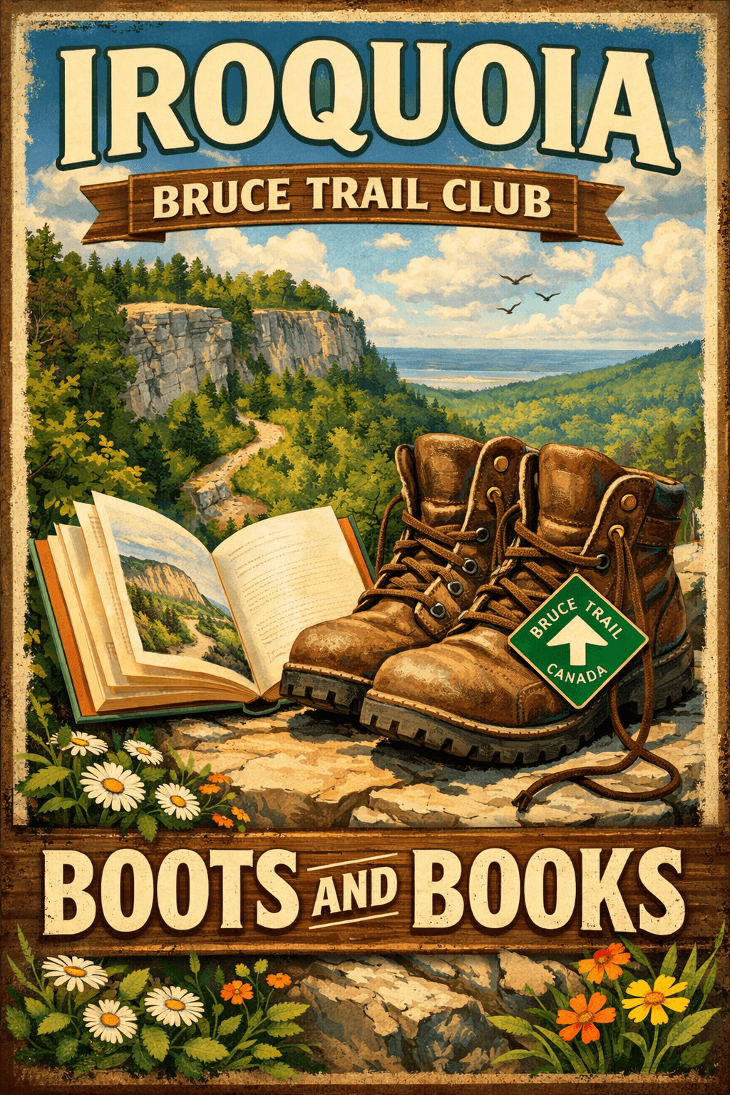
Hosting Club: Iroquoia Category: Boots and Books – The Iroquoia Bruce Trail Book Club Location (Google Maps): Kilbride Park Parking Lot behind the Kilbride School
Pace: Medium – 3 to 4 km/hr Terrain: Moderate – Some hills and/or some poor footing, Strenuous – Hilly with steep climbs and some poor footing Distance: Approx 7km
Description Welcome to the 3rd Iroquoia Bruce Trail Book Club – “Boots and Books”
Our book is “Theo of Golden” by Allen Levi. Please check your local library for available copies of this book.
We will hike from the parking lot north bound to Calcium Pits/Twiss Rd and return – about 7km which will take about 2 hours approximately. Please wear suitable foot wear, dress for the weather and bring poles if you use them and gaiters as the trail may be muddy. Please bring enough snacks and water suitable for the length/duration of the hike. It is not necessary to bring the book.
The June book will be “A History of Canada in 10 Maps” by Adam Shoalts and the July book will be “Woman, Watching” by Merilyn Simonds It may be a good idea to reserve these books now from your local library.
The hike is open to everyone whether you have read the book or not but there may he spoilers, if you haven’t read it. It will be open to 10 people to keep it more intimate for discussing the book.
If your plans change, please cancel your registration so that people who are waitlisted may join.
To cancel your registration, here is a step by step: – Sign into your account on the Bruce Trail website. – Go to the Hike Schedule – Click on My Hikes tab which you should find at the top of the schedule – Scroll to the appropriate hike you wish to cancel – Cursor to the far right of the hike to the Action column – Click cancel under the hike you wish to cancel.
Pace: Leisurely Terrain: Moderate Distance: Long Hike: 7 km, Short Hike: 5.8 km
Description We will quietly hike the Bennet Heritage Trail, crossing Snows Creek pond and then Owl Creek, close to the site of the an Indigenous (Attiwonderonk) village from 1550-80. We will share info about the village. Our hike follows Owl Creek with a scenic break spot. Long hike will return via the Maureen Smith Side Trail and then the Main Trail – the short hike will return directly to the parking lot via the Bennet Side Trail. Please bring water and a lunch.
Pace: Medium 3- 4 km/hr Terrain: Moderate: some hills and some poor footing Distance: 6 kms
Description Hike the main and side trails of Short Hills Provincial Park. Please bring water and hiking poles. Ticks are active so please check yourself for them after the hike.
Location (Google Maps): Parking lot is off Sycamore Drive, East of Bayview , across Starbucks plaza Bus 91 from Finch East station stops at Sycamore station.
Pace: Moderate (3-4 km/hr) Terrain: Hilly, Level 2 (Intermediate – some hills and uneven surfaces, rocks and roots underfoot) Distance (km): 6-7 km
Description We will explore Valleyview and Maple View parks, and walk along German Mill Creak, in return we stop in Huntington park and have snack under beautiful shed.
Although this is considered an “Urban Walk”, you can expect some hills up and down and uneven surfaces with tree roots. Please bring hiking poles, Ice cleats water and snacks.
Location (Google Maps): Meet in the BT parking lot located off of 15 Sideroad, 50m west of the stop sign at the intersection of Prince of Whales and 15th Sideroad. km 36.8 Map 20 Ed 31 We will shuttle to Roadside parking on 1st Line (km19.4)
Pace: Brisk, Medium Terrain: Moderate, Some rocky footing, Some steep sections, Strenuous Length of Hike: 17.5km
Description This Dufferin E2E will take place over 3 Tuesdays. Come out for all of them and earn you Dufferin E2E badge (you can apply for this independenly) or just come to the ones that interest you. We will start at km 0 and make our way north to km 55.5 covering the entire Dufferin section.
This will be a car shuttle hike so please come with your car passenger ready. We will all take turns being the shuttle driver.
This time of year we can expect all types of trail conditions. Please be prepared with for the condition of the day.
Hosting Club: Sydenham Category: General Hike Location (Google Maps): Click the Google Maps link to take you there. Meet and park roadside at the corner of 6th Concession North and Sideroad 22 in the former Sydenham township just east of the Owen Sound airport. In the Bruce Trail Reference, Edition 31, meet at km 67.8 on Map 31.
Pace: Medium: 3 to 4 km/h Terrain: Moderate: Some hills and/or poor footing Distance: 4 km
Description Tuesday evening WINS hikes begin at 6:30 p.m. as a way to enjoy the daylight and nice weather of summer evenings. Join us on this evening hike in the Sydenham Forest and the beauty of the escarpment nestled in the countryside close to Owen Sound. We will walk a 3 km loop which includes beautiful forest and escarpment edge then return 1 km on a quiet country road to our vehicles. We will also view the recent tree plantings that our Sydenham Biodiversity volunteer team has done on the Bruce Trail Conservancy (BTC) Protected Property, Sydenham Escarpment Nature Reserve.
Hosting Club: Iroquoia Category: General Hike Location (Google Maps): Meeting at the South parking lot of City View Park, Burlington (on Kerns Rd off of Hwy #5) where we will shuttle to Hidden Valley Park, Burlington (parking lot beside the HVP washrooms and just south of the Burlington Model Railway Club Inc) to begin our hike. Drivers for the shuttle will be needed as well as someone to return the drivers to retrieve their cars at the end of the hike. Thank you!
Pace: Medium – 3 to 4 km/hr Terrain: Strenuous – Hilly with steep climbs and some poor footing Distance: 10+km
Description We will begin our hike on Hidden Valley Rd which goes thru the quaint village of Lemonville. Following Grindstone Creek past the village and into the woods we will connect with the main Bruce Trail. We will make the steep climb out of Sleepy Hollow and continue east along the BT to our original meeting spot at City View Park.
Please remember to dress in appropriate layers and bring water and snacks.
Pace: Medium Terrain: Moderate Length of Hike: 4.7 kms + 650 m of road
Description We will walk south from 12th Sideroad and as we walk through deciduous forest, we’ll cross a piece of history, remnants of The Old Mail Road. We continue south, crossing Grey Road 19, through property that is managed by the BTC, until we return to our cars. Please bring water.
Pace: Leisurely – 3 km/hr. or less Terrain: Easy – Mostly flat and usually good footing Distance: 2 km loop
Description Come and join a small group for a leisurely summer hike on the unique “Art and Tree Trail” located on Duntroon Highlands Resort property. It was created by the not-for-profit HealthWithNature.org
The 2 km loop meanders through open fields and wooded areas. It has several spots where one can pause and reflect on outdoor installations and features designed by local artists.
You will come away feeling inspired and revitalized.
A fee of $10 is to be paid at the start of the hike. This goes towards paying the artists and maintaining the trail. Meet at Duntroon Highlands.
For those that have time to socialize after the hike, food and refreshments are available at the on-site Clubhouse Cafe.
Hosting Club: Sydenham Category: General Hike Location (Google Maps): Harrison Park – northwest of km 89.0 BTC MAP #32. Drive past restaurant.
Hike Leader(s): Ian Mills
Pace: Medium: 3 to 4 km/h Terrain: Moderate: Some hills and/or poor footing, There might be muddy sections., There might be sections with water on the trail. Distance: 10 km
Description We will meet at Harrison Park just past the restaurant (east) and follow Harrison Park Side Trail north to the Main Trail. We will follow the Main Trail south to Inglis Falls pack a light snack and enjoy some amazing views of the Falls. We will follow the Main Trail north to Creamery Side Trail and circle back to our parking area. Interesting terrain , lovely views and good exercise will be provided by this loop – BTC MAP #32. A walking stick is recommended and proper footwear required.
Description Please join me for a brisk walk on the Humber River trail strting near the McMichael Canadian Art Collection (main building).
The trail has some hills but it is even and easy to walk on. we will walk for about 5 – 5.5 km and return back the same way. It should take us about 2.5 – 3 hours. After we finish, you can spend some time in the gallery and see their newest exhibition”Morrice in Venice” (please check out their website for ore info https://mcmichael.com/upcoming-exhibitions/)
We meet around 10 am near the entrance to the gallery and start hiking at 10:15 am (the trail head is only 50 m away). If you have the McMichael Art Collection membership, you can park free of charge on the gallery’s parking lot. Non-members parking fee is about $7. You can park somewhere in Kleinburg free of charge and walk to the gallery to meet me.
Please be dressed for the weather and wear comfortable shoes. Please bring 2 L of water, rain jacket or umbella and your sun hat, sun galsses. There is no shade on the trail.
You are welcome to reach out if you have any questions.
Please note that the hike will be cancelled if there is a forecast for a heavy rain or storm.
Hosting Club: Sydenham Category: An evening walk. Location (Google Maps): Meet in the municipal parking lot by the river on the West side of 1st Ave East between 7th St East and 8th St East in Owen Sound.
Pace: Brisk: 4 to 5 km/h Terrain: Moderate: Some hills and/or poor footing Distance: Approx 5 km
Description Join us for a brisk evening hike exploring paths and neighbourhoods in Owen Sound, followed by an opportunity for refreshments. There is no need to show up 15 minutes early for this hike, but we will leave promptly at 7:00 pm.
Pace: Medium – 3 to 4 km/hr Terrain: Moderate – Some hills and/or some poor footing Distance: 8 kms
Description We will meet at 9:15 in the Pear Tree parking lot on 15 Side Road and carpool to 6th Line at the Halton Agreement Forest and hike back along the Hilton Falls Side Trail, Al Shaw Side Trail and the main trail. This trail has some serious rocks and we cross a couple of creeks. Bring sufficient water and bug spray/bug net.
Location (Google Maps): Parking lot is off Sycamore Drive, East of Bayview , across Starbucks plaza Bus 91 from Finch East station stops at Sycamore station.
Pace: Moderate (3-4 km/hr) Terrain: Hilly, Level 2 (Intermediate – some hills and uneven surfaces, rocks and roots underfoot) Distance (km): 6-7 km
Description We will explore Valleyview and Maple View parks, and walk along German Mill Creak, in return we stop in Huntington park and have snack under beautiful shed.
Although this is considered an “Urban Walk”, you can expect some hills up and down and uneven surfaces with tree roots. Please bring hiking poles, Ice cleats water and snacks.
Jack Layton Ferry Terminal, by the gate to the Wards Island Ferry. Please arrive 20 minutes prior to departure to check in with hike leader.
From Union Station take the LRT and get off at the stop Ferry Docks.Walk up to the Ferry Docks on Queens Quay West, street level. at the foot of Bay Street.
Pace: Leisurely (2-3 km/hr) Terrain: Flat, Level 1 (Easy – mostly on flat, well maintained trails with hard-packed surface) Distance (km): 6-9 km
Description After a day’s work come and “cool off” on the Toronto Islands free of fumes and traffic. Enjoy the view of the city skyline and Toronto’s beautiful island parkland. Pack a dinner for a sit down picnic. Also bring a warm jacket and flashlight. Return fare ticket for the ferry is $9.57 for adults, $6.15 for seniors Please check the hike schedule for weather related cancellations (hike will be updated by 11:00 AM day of the hike if any changes) Toronto Island evening hikes will take place every Thursday in May and June 2026. Same time and same meeting place. No preregistration is required – just show up at the ferry docks at 5:40 PM and sign in with the hike leader.
Description Enjoy the benefits of pausing for a yoga practice as we tour through the trails, parkland and Historic Niagara-on-the-Lake. No mat required. Movement will focus on a flow of standing poses designed especially for hikers. Plan to stay for conversation and a warm cup of coffee or tea at Sweets & Swirls, Community Centre, Niagara Stone Road, NOTL.
Pace: Leisurely Terrain: Dependent on Conditions, Moderate, Slippery Sections Likely Distance: 3-6 kms a day
Description Join us on a three-day odyssey to find the floral treasures of the Peninsula on Flowerpot Island, the Crane River, Singing Sands, the Oliphant Fens, Petrel Point and the Bruce Alvar. A chance to work on your Peninsula Orchid badges if you are a badge person. These hikes, led by longtime BTC wildflower enthusiasts Anne Armstrong and Jeannine Kralt, are a co-operative effort brought to you by the Peninsula, Iroquoia and Dufferin Hi-Lands BTC Clubs. We look forward to enjoying the camaraderie and fellowship of staying at the same accommodations and sharing a few laughs at dinners. Please bring your own breakfasts and lunches. Discount accommodation/boat package information will be made available on registration. The accommodation/boat package discount pricing will be available until May 4, 2026. Hikers to pay for the accommodation/boat package themselves direct. Please note the $20.00 fee payable on registration is non-refundable. An additional and separate $20.00 contribution per hiker for gas and mileage will also be required.
Hosting Club: Iroquoia, Blue Mountains Category: Stained Glass Badge End to End Fundraiser Hike Location (Google Maps): Registered participants will receive a WhatsApp invitation (optional)which can be used for photo share and other pertinent information.
This is a three day fundraiser ETE for the stained glass badge. You must be able to hike at least 4km an hour with hills and rough terrain.
June 6 – Day 1 – Meet in the parking lot parking lot area located 380 m north of the main trail crossing Pretty River Road (40 car capacity) 44.430927, -80.275390 Shuttle to Maple Lane in Ravenna. Park only on the north side 44.504973, -80.331780 (4 car capacity) 20km June 7 – Day 2 – Meet in the parking lot parking lot area located 380 m north of the main trail crossing Pretty River Road (40 car capacity) 44.430927, -80.275390 Shuttle to $paid parking lot off of 15/16 Sideroad – accessible only from Concession 10 South. 44.342784, -80.210628 (car capacity 7) 24km June 8 Day 3 – Meet in front of the Lavender Cemetery on Mulmar Nottawasaga Townline 550 meters east of Lavender Hill Road – do not block cemetery gate. 44.268777, -80.156810 (Car capacity 10) and shuttle to $paid parking lot on 15/16 Sideroad 44.342784, -80.210628 (Car capacity 7) 22.50km.
Parking fees are shared by everyone except the drivers.
Pace: Brisk – 4 to 5 km/hr Terrain: Moderate – Some hills and/or some poor footing, Slippery and Steep Sections, Strenuous – Hilly with steep climbs and some poor footing Distance: 67.50km spread over three days
Description Everyone who is registered for this hike series will be invited to join an optional WhatsApp which can be used to share photos and other information.
Distances will be spread over 3 days as equally as possible depending on the parking. Please bring enough food and snacks for a 20km + day of hiking and 2l of water minimum. Everyone must have a first aid kit in their backpack as well as all the other items you require for a long day hike (poles, rain gear etc) The registration fee includes the badge, guidance and organization. The fee supports the club’s infrastructure and the mission of “Preserving a ribbon of wilderness for everyone, forever.” There are no refunds.
This series of hikes is intended for hikers who are used to a multi-day distance of 20+km at a steady pace. We will have a short break around 10am and a lunch break. Afternoon break is dependent on expected finishing time. Please do not over estimate your hiking ability. Participants can make up one of the three days on their own if you have a scheduling conflict. Please try to do this before we get started. You must be willing to share in the car shuttle to the start of the hike or driving the drivers back at the end of the day. Please have a minimum 4 useable seats including driver’s. This is a group hike and it is intended that everyone be present on each day. Please cancel your registration if your plans change so that someone else who may be on the waitlist can take your place. Paid parking on two days to be shared by non-drivers.
All registered hikers will be invited to join a WhatsApp group. This can be used for sharing photos and other items of interest.
Pace: Leisurely – 3km/hr or less Terrain: Easy – Mostly flat and usually good footing, Moderate – Some hills and/or some poor footing Distance: 5KM
Description Join us as we kick off Pride Month with a colourful morning of birding! 🦅🦉🦆🌈
For this edition, it’s encouraged to come dressed in the colours of your favourite bird! 🌈
This gentle early-morning outing will explore the trails around Royal Botanical Gardens, one of our region’s important migration areas. We will start at the trailhead parking lot of the Cherry Hill Gate.
Plan to arrive for 745AM and we’ll have a small crash course on downloading and using two popular birding apps, Merlin Bird ID and eBird recording our sightings! We’ll depart by 8-810AM. Hoping to catch some Blue Herons, Swans, Wood Ducks, and if we’re lucky, a sighting of the RBG resident Screech Owl!
🌈 This is a queer-led, 2SLGBTQIA+ inclusive Rainbow Hike, welcoming LGBTQ+ hikers, allies, birders, photographers, and anyone interested in connecting with nature and community. This is a short, relaxed hike (approx. 5 km) designed to get us moving and birding!
What to Bring • Water and light snacks • Weather-appropriate clothing and sturdy footwear • Binoculars or camera if you have them (optional but fun! And a cell phone counts!)
Not a Bruce Trail member yet?! Sign up here! https://brucetrail.org/become-a-member/
Come enjoy a spring morning on the trail, celebrate migratory birds, and connect with your Bruce Trail community!
🐾 Please leave pets at home for this hike! It’s migration season and we’ll be passing through an important bird migration and nesting area, so we want to keep disturbance to our feathered friends to a minimum! 🐦
🚗 🚌 This outing is accessible by car or public transit.
Planning to drive? Parking is 3$/hour to a maximum of 15$ if you park at Cherry Hill Gate, or free if you park across the street at RBG Centre.
Taking the Bus? HSR #9 or BT1 stops near the trailhead entrance! Map of the bus and it’s schedule can be found here. https://www.hamilton.ca/sites/default/files/2026-04/hsr-9-ROCK%20GARDENS-may10.pdf
Free Bruce Trail Rainbow badges and stickers for all participants! Questions? Simply click “Contact Hike Leader” on the registration form.
Pace: Moderate (3-4 km/hr) Terrain: Hilly, Level 2 (Intermediate – some hills and uneven surfaces, rocks and roots underfoot), Rocky, Variable Distance (km): 8
Description In recognition of June being National Indigenous History Month in Canada, join us for a visit to Petroglyphs Provincial Park.
The day will be divided into two portions. We’ll begin by touring the exhibits and watching a 20-minute video at the Learning Place Visitor Centre to discover the traditions of the Ojibway (Nishnaabe) people, which will be followed by a 45-minute guided tour of the Kinoomaage Waapkong (aka The Teaching Rocks or the Peterborough Petroglyphs), the largest known concentration of Indigenous rock carvings (petroglyphs) in Canada. Afterwards, we will hike along the Nanabush Trail, stopping near Minnow Lake for a lunch break, then continue our hike along the Marsh and West Day Use Trails.
Although the total hiking distance is short (approximately 8 km), the trails are in the heart of the Canadian Shield and are rugged. There are rocks and roots, and some hilly stretches. Bring hiking boots and poles if you have them. Also bring a lunch and snacks, at least 2L of drinking water, rain/sun protection, and insect repellent.
If time permits, we will have a refreshment stop in the town of Lakefield.
Expect a late return to Toronto (approximately 7:00 p.m., traffic conditions permitting).
Hosting Club: Dufferin Hi-Land Category: General Hike Location (Google Maps): Mad River Blue Mountains Section Map 22 Parking: lot off County Road 124, east of Singhampton and west of Devil’s Glen Country Club in front of the Devil’s Glen Provincial Park gates.
Description Today we will hike from the parking lot to the viewing platform then return to the main trail walking southbound until we meet the Ganaraska Trail. We will hike along the Ganaraska trail until we come out on Concession Road 8 in Glen Huron. Just past station Street we will turn west and follow the Mad River Side Trail until we rejoin the main trail. From there we will hike back to the cars.
Please be prepared for the weather, we will hike rain or shine. Ensure you have enough water,lunch and snacks, sunscreen and bug repellent. Hats and sunglasses are recommended as are poles and sturdy shoes.
For those wishing to earn their 7 Rivers – complete all 7 hikes, badges will be available on the last day from the hike leaders at a cost of $10 for members and $15 for non members.
Anyone completing make-up hikes may log their hikes and apply directly to the Dufferin Highlands BT Club for the badge.
Pace: Medium (3.0 – 4.5 km/h): A comfortable pace for most hikers with steady progress. Terrain: Difficult: Steep ascents/descents, rocky scrambling, and some rugged escarpment paths., Moderate: Rolling hills, mild slopes and rocky paths. Distance: ~6.5 km
Description Celebrate International Trails Day on June 6 with a hike that connects you to trails around the world.
Step onto the Bruce Trail and discover the spirit of global adventure through the Friendship Trails program, an international network linking trail communities across countries. Like twin towns, these special partnerships bring people together through shared experiences, culture, and a love of the outdoors.
Bruce Trail Conservancy maintains 10 Friendship Trails at different locations along the Bruce Trail. The Peninsula Bruce Trail Club is proud to host two of these international connections: England’s Cotswold Way and South West Coastal Path. Learn more about BTC Friendship Trails here: https://brucetrail.org/International-friendship-trails/.
Kick off our three-part Friendship Hike series on the Cotswold Way Friendship Trail section with a scenic 6.5 km loop hike along the Main Trail and Beth Gilhespy Side Trail, near Barrow Bay. This moderately paced hike features rugged, rocky terrain, a few challenging climbs, and breathtaking views over Georgian Bay and Little Lake, perfect for sparking your next hike-travel dream. Plan on 2 1/2 – 3 hours which includes lots of time for photos and storytelling.
We are thrilled to have two knowledgeable guests join us for the hike! Jackie Randle, BTC Vice President of Operations and President of the World Trails Network, will share inspiring stories and insights about International Friendship Trails and the World Trails Network. Tom Hall, PBTC Trail Maintenance Director, and Friendship Trail Badge Earner, will also join us to share some of his hiking experiences along the Cotswold Way Trail.
Have you walked the Cotswold Way? Bring your stories and be part of the conversation.
Celebrate trails around the world and the healthy lifestyle that trails inspire!
Hosting Club: Caledon Hills Category: General Location (Google Maps): Akela and Scouters Heather and Ross Hamlin Nature Reserve at Riverside Woods 713377 1st Line EHS, Mono Google GPS Coordinates: 43.959916, -80.070494
Driving Directions: From ON-9, head north onto 2nd Line EHS for 3 kilometres. Turn left onto Side Road 5 for 1.5 kilometres. Turn right onto 1st Line EHS for approximately 1 kilometre. Continue straight into the parking lot.
From ON-10, head east on Hockley Road/Dufferin County Road 7 for 1 kilometre. Continue straight onto Side Road 5 for 1.5 kilometres. Turn left onto 1st Line EHS for approximately 1 kilometre. Continue straight into the parking lot.
Pace: Leisurely – 3 km/hour or less Terrain: Easy – mostly flat and usually good footing Distance: 2 or 3 kilometres
Description Bruce Trail members and friends are invited to gather in nature to honour the life, vision, and legacy of Dr. Philip Gosling, Founder of the Bruce Trail. A time of reflection and the unveiling of the Founders’ Footpath commemorative plaque will be led by Michael McDonald, CEO of the Bruce Trail Conservancy, followed by a guided walk along the footpath, and a time of fellowship and refreshments.
Pace: Leisurely: 3 km/h or less Terrain: Moderate: Some hills and/or poor footing, Strenuous: Hilly with steep climbs and some poor footing., There might be muddy sections., There might be sections with water on the trail. Distance: 5.5 km. approx
Description This is part B of Geology Hike #6 (Inglis Falls loop) following Beth Gilhespy’s book “Walking Through Time” in the Sydenham Bruce Trail Section. This is a loop hike, starting from the parking lot at Grey Sauble Conservation Area parking lot behind the main building. We will hike in a southerly direction on the main trail towards Inglis Falls, cross the Inglis Falls Road and continue on main trail to join the Creamery Hill sidetrail and back to our cars.
Copies of Beth’s book will be available for purchase. Special member’s only price of $37.00 . Cash, cheque or etransfer. If paying with cash, please bring exact change. A special guest may join us ! Please bring water and a snack if you wish. Proper hiking footwear and hiking poles are recommended.
Pace: Moderate (3-4 km/hr) Terrain: Level 2 (Intermediate – some hills and uneven surfaces, rocks and roots underfoot), Variable Distance (km): 13 km
Description Come join me for hike through Scotsdale Farm and the Silver Creek Conservation Area.
We will complete a loop hike on the main and side trails. Shorter loops are available for those who do not want to complete the full length. After the hike all are invited to join me for refreshments at the Shepherd’s Crook in old Georgetown.
To get to the meeting point from Hwy 401 go north on Trafalgar Road past Georgetown to the juncture with Hwy 7. North on Hwy 7 to Silver Creek. Turn right and back onto Trafalgar Road. Go north about 1.5 km to the entrance of Scotsdale Farm on your right. The parking area is about 0.5 km from Trafalgar Road near the old homestead.
Hosting Club: Dufferin Hi-Land Category: Special Events Location (Google Maps): Bruce Trail Parking Lot on the 1st line E
Hike Leader(s): Cathy Hughes
Pace: Leisurely Terrain: Easy Distance: 3 km
Description In Fall 2024, approximately 90 American Chestnut trees were planted on the property. Be part of the ongoing monitoring and maintenance program. Volunteers will assist DHBTC Biodiversity Committee members and Bruce Trail Conservancy Ecologists with mulching and replacing tree guards. We will also be examining trees to help determine survival rates. Some invasive species removal may also occur.
If time permits, a short hike of the area will occur.
Please bring water and gloves if you have them. It is recommended you dress according to the weather and wear sturdy boots or shoes and long pants as ticks are possible in the area. All other equipment will be provided.
Pace: Moderate (3-4 km/hr) Terrain: Flat Distance (km): 27.5 km
Description This hike follows the Don River south from Steeles Ave East at Leslie St through Toronto to the Distillery District, through a series of ravines and several parks. We will detour to street level when we cross the 401 (trail closed due to construction) and again south of Pottery Rd where we take the Bayview Ave Extension (trail closed due to construction). Those who register will receive an itinerary.
Please bring a lunch and at least two liters of water. Be prepared for cool / wet weather. Pub stop after at The Spaghetti Factory, adds an extra 1.5 KM
Here is an online map of our route: Don Valley to The Distillery https://onthegomap.com/s/7og8khua
Hosting Club: Caledon Hills Category: General Location (Google Maps): Meet in the Caledon Public Library – Alton Branch 35 Station Street
Driving Directions: From ON-10, turn west on Charleston Sideroad/Peel Regional Road 24 for 4 kilometres. Turn right/north onto 3 LineW/Main Street/Peel Regional Road/136 for 4 kilometres. Turn right onto Station Street. The library is on the right side.
Pace: Leisurely – 3 km/hour or less Terrain: Easy – mostly flat and usually good footing Distance: 5.5 kilometres
Description Plan to join our local celebration of International Trails Day – promised fun for all. Come to the library early (1:00 pm to 2:00 pm) to learn more about local trails, healthy lifestyles, and volunteering through hands-on activities, conversation, giveaways, and fabulous door prizes. A loop around the biodiverse Alton Grange Property will offer many exciting opportunities for nature sightings. Bring a beverage and snack to keep you energized on the trail. This special hiking event is brought to you by the Caledon Public Library, Caledon Hills BTC, Alton Grange Association, and WILD Outside Youth Leadership Group.
Hosting Club: Caledon Hills Category: End-to-End Location (Google Maps): Roadside parking – km 35.0 on Coolihans Sideroad, east of where the trail crosses the road.
Pace: Medium – 3 to 4 km/hour Terrain: Strenuous – hilly with steep climbs and some poor footing Distance: 19.1 km
Description Meet at Coolihans Side Rd., roadside parking. We will shuttle to Willoughby Rd. at the end of Escarpment Sideroad to start our hike. Bring sufficient water, electrolytes, bug spray, sun glasses, lunch and snacks. Poles are helpful. Volunteers will be required to participate in shuttling and driver return as well as a sweep.
Pace: Medium (3.0 – 4.5 km/h): A comfortable pace for most hikers with steady progress. Terrain: Moderate: Rolling hills, mild slopes and rocky paths. Distance: 15 km
Description Peninsula BTC is offering a series of hikes covering all of the side trails on the Peninsula section of the Bruce Trail. These hikes are a great opportunity for those who want to do some hiking but don’t want to commit to a full end-to-end; for those who have completed an end-to-end and want to explore more of the beautiful trails on the Peninsula and for locals and visitors who want to get out on the trail on the weekend.
The series will include 27 hikes on Sundays (and maybe the odd Saturday) over 2026 and 2027, covering more than 150 km of side trails or 78 trails! We will be offering hikes on a roughly biweekly basis, with hikes posted approximately two months in advance. The hikes will generally be loop hikes, although car shuttling may be required for a few hikes. Register for each hike individually, no need to commit to all 27 hikes!
For those who would like to earn the Peninsula Side Trails badge, these hikes provide a chance to join a group for some or all of the side trail hikes.
This hike features two spectacular nature reserves at Otter Lake and MapleCross Cape Chin. Both of these reserves contain vital wetlands and deep forest ecosystems providing uninterrupted habitat for many species. As well, Maple Cross includes spectacular cliffs and the iconic view at Cape Chin. This is a long hike at 15 km. We will hike the Cape Chin Meadows, Pat Daunt, Bard and Otter Lake Side Trails.
Hikers should be prepared for cool weather and possible wet trails. Bring a lunch, water and snacks. Hike leader will contact registered hikers one week before the hike.
If you would like to be notified when the side trail hikes are posted, go to the bottom of the Hikes page on the PBTC website to sign-up for hike notifications.
Hosting Club: Peninsula Category: Rainbow Hike Location (Google Maps): Bruce Peninsula National Park Visitors Centre 120 Chi sin tib dek Road, Tobermory, Ontario
Pace: Leisurely (2.0 – 3.0 km/h): A relaxed pace with frequent breaks and a focus on enjoyment., Medium (3.0 – 4.5 km/h): A comfortable pace for most hikers with steady progress. Terrain: Easy: Flat forested sections or lowland trails., Moderate: Rolling hills, mild slopes and rocky paths. Distance: 2-5km
Description Peninsula Bruce Trail Club (PBTC) is excited to celebrate Pride Month at Bruce Peninsula National Park (BPNP) on the Bruce Trail!
This inclusive, family-friendly 2SLGBTQIA+ hike offers a safe and supportive space for trans, gay, lesbian, bisexual, queer, 2Spirit, intersex, asexual people, as well as allies and friends.
The day includes two hiking options. We’ll begin with a short introduction at the Visitor Centre, then walk an easy section of the Bruce Trail to the Burnt Loop Lookout with a Park Interpreter and PBTC Hike Leaders. Park Interpretation will include an introduction to this unique ecosystem and the wildlife which it supports, using a Queer Ecology perspective.
At Burnt Point Loop Lookout, participants can choose to return to the Visitor Centre with PBTC hike leaders, continuing along the Bruce Trail toward the Cairn in Tobermory. Or, continue with PBTC hike leaders and Park Interpreter on the more rugged Burnt Point Loop Trail.
The Burnt Point Loop hike is about 4 km and features typical Saugeen Peninsula terrain – a packed forest floor with exposed rocks and root, moderate elevation, about 1-2 metres widith natural step ups.The Trail winds through a lovely cedar forest across a rocky inlet, and includes beautiful views of Fathom Five National Marine Park, including Flowerpot Island, Bears Rump Island and Middle Island. With a bit of luck we may also spot the Chi-Cheemaun ferry making a crossing.
Both groups will meet back at the Visitor Centre to enjoy lunch together or explore the shops in Tobermory. Plan for about 3 hours for the hike and lunch.
Washrooms are available on site. All participants will receive a Bruce Trail Pride Badge to celebrate Pride month. The Bruce Trail Conservancy Pride Badge represents a celebration of 2SLGBTQIA+ inclusion on the Bruce Trail.
Parks Canada parking and entry fees apply upon arrival. https://parks.canada.ca/pn-np/on/bruce/visit/tarifs-fees.
If you would like to offer or receive a ride share, please complete the following Google Form: https://forms.gle/AtAETCoHrWTXSoY89 Grey Bruce Pride will facilitate connecting community members amongst Grey Bruce. A consent waiver is included.
You may choose to use your Parks Canada parking permit to extend your day by visiting nearby Singing Sands. Or, take a short walk to the village of Tobermory to explore the local shops and restaurants.
Pace: Brisk (4-5 km/hr) Terrain: Challenging, Level 3 (Advanced – steep hills and some scrambling over boulders), Variable Distance (km): 14.1 km
Description First hike of 4 to complete the Dufferin section. We will shuttle to km 14.1 and hike back. Hikers are expected to in the parking area and ready to shuttle by 8:15. Everyone needs to take part in the car shuttle. Bring 2 litres of water, snacks and lunch, bug repellent , sun screen. Hiking boots.
Location (Google Maps): On Monday June 8th – parking area at Blantyre – km 0.0 – at 9 am Meeting locations for other hiking dates are listed in the detailed hike plan to be distributed after registration.
Pace: Medium Terrain: Moderate, Some rocky footing, Some steep sections Length of Hike: varies
Description All 9 Stained Glass badges over 3 years – Hike Series #5 – Sydenham Section – we will complete an end to end of the Sydenham section over 9 days as follows: (1) Blantyre to SR 3; (2) SR 3 to Woodford; (3) Woodford to SR 24; (4) SR 24 to Bothwells Corner; (5) Bothwells Corner to Concession 3; (6) Concession 3 to Indian Acres Road; (7) Indian Acres Road to Lundy Road; (8) Lundy Road to Colpoys Range Road; and (9) Colpoys Range Road to Wiarton. The detailed hike plan will be distributed to participants on registration.
All hikes will proceed at a moderate pace (approx 4 km per hour not including the lunch stop). Breaks will be taken throughout each hike as appropriate. Hikes will proceed rain or shine.
Except for shuttles, hikers are expected to be self reliant. Please bring everything you may need such as water, lunch, snacks, personal medical kit and appropriate footwear and clothing.
At the beginning of the first hike, participants will be expected to sign a waiver in favour of the hike leader similar to the one in favour of the BTC signed on registration. If there are any questions, please contact the hike leader.
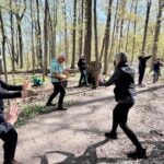
Pace: Medium 3- 4 km/hr Terrain: Moderate: some hills and some poor footing Distance: 5-6km
Description Seeking balance, calm and strength without high impact exercise? Join us for a short hike. Tai Chi Master, Mike Van Natter will instruct us on the benefits of Tai Chi as well as lead us through several Tai Chi movements along our way.
Hosting Club: Iroquoia Category: General Hike Location (Google Maps): Duncan Escarpment Provincial Park – small parking lot on Side Road 9. If you would like to carpool from Mississauga, please contact the Hike Leader.
Pace: Medium – 3 to 4 km/hr Terrain: Strenuous – Hilly with steep climbs and some poor footing Distance: 11 kms
Description Time for an adventure in the Beaver Valley section! This loop hike is challenging and so rewarding! Takes about 2 hours drive from the GTA. We’ll hike on the main trail and a couple of side trails in a loop. There are hilly parts and plenty of rocks and roots. Bring water and a snack/lunch. If you would like to carpool from Mississauga, I am happy to have a few people ride with me. I will send an email a couple of days prior to the hike.
Hosting Club: Iroquoia, Beaver Valley Category: Stained Glass Badge End to End Fundraiser Hike Location (Google Maps): Registered participants will receive a WhatsApp invitation (optional)which can be used for photo share and other pertinent information. June 9 – Meet at the Kolopore Uplands Parking Lot Grey Rd 2 located 650m south of the Trail 44.422919, -80.405597 (30) Shuttle to Roadside Parking along the north side of Maple Lane 44.504973, -80.331780 (4) 26km June 10 – Meet at Kolopore Uplands, Shuttle to Roadside Parking on the northern shoulder of Sideroad 7B where the main trail enters the forest. 44.395310, -80.518495 (6) 20km June 11 – Meet at Hogg’s Falls parking lot 44.285307, -80.543081 (16) Shuttle to Sideroad 7B 21km June 12 – Meet at Hogg’s Falls Shuttle to John Muir Epping Lookout – Enter from Grey Rd 7, 300 m north of 19 Sideroad 44.461522, -80.554756 (40) 29km June 13 – Meet at John Muir Lookout. Shuttle to BTC parking lot on the east side of Grey Rd 12 where the trail crosses the road. 44.500537, -80.632902 (15) 24km
Pace: Brisk – 4 to 5 km/hr, Medium – 3 to 4 km/hr Terrain: Dependent on Conditions, Moderate – Some hills and/or some poor footing, Strenuous – Hilly with steep climbs and some poor footing Distance: 20-29 per day
Description Beaver Valley Stained Glass Badge Fundraiser End 2 End
Everyone who is registered for this hike series will be invited to join an optional WhatsApp which can be used to share photos and other information.
In this series of 5 hikes you will get a chance to test your strength, endurance and perseverance! You will be rewarded with the breathtaking views of spring in the valley, good company and of course the Beaver Valley Stained Glass badge ETE badge. This is a monetized hike – proceeds go to the Beaver Valley Bruce Trail Club to continue to maintain infrastructure along the trail. There are no refunds.
This E2E is intended for strong hikers only. We will be hiking at a steady pace with very few short breaks It will be tough hiking due to the distances involved so be sure of your physical ability before signing up for this hike. We will take only a few short breaks and lunch. Photo stops, as well. It is expected that everyone keep pace with the person in front of them. Bio breaks are as you need; please let the sweep know and they will wait for you.
Please do not register for this hike unless you can commit to all 5 days. If you need to miss one day, please make it up before this hike begins.
The Stained Glass ETE Beaver Valley Club series can only be completed with a club leader.
All hikes in this series will include a car shuttle and everyone will take a turn as a shuttle driver. Please have your vehicle passenger-ready with at least 4 available seatbelts.
If you have any questions please email me.
Please bring all snacks/lunch and at least 2l of water as well as all the other things you require for a long day hike including a first aid kit, bug spray, sunscreen and poles, if you use them.
No dogs. Do not show up unregistered.
Any questions may be directed through contact on this form. If you cannot make it, please remove yourself from registration.
To cancel your registration, here is a step by step: – Sign into your account on the BTC website – Click on My Hikes under your account – This will take you to a list of hikes you have registered for – Scroll down to the appropriate hike and cursor over to the far right hand column under the Action column. – Click Cancel under the hike you wish to cancel
There are no drop outs. If for some reason you are unable to complete the days’ hike, you will be responsible for finding your way back to your vehicle. Badges will be presented on the last day, hopefully. If not, a list of finishers will be sent to the club for mailing out.
Location (Google Maps): Short Hills Wiley Road, Thorold
Hike Leader(s): Alan Laver
Pace: Fast 5+ km/hr Terrain: Moderate: some hills and some poor footing : 10k+
Description Back to our regular Spot for the Tuesday Long Hike. Note the new location. We will hike the trails around Short Hills Dress for the weather and bring sunscreen bug spray, poles snack and drink
Pace: Brisk (4-5 km/hr) Terrain: Level 3 (Advanced – steep hills and some scrambling over boulders) Distance (km): 14.2 km.
Description Second hike of the series to complete the Dufferin section. Please be in the parking area at 8;15 and be ready to shuttle by 8:30. Bring 2 litres of water, food, bug repellent, sun screen. Hiking boots. We will shuttle to km 14.1 and walk back. Everyone is expected to participate in the car shuttle during the 4 days hike.
Pace: Leisurely Terrain: Moderate Distance: Long Hike 5 km Short Hike 2.7 km
Description From roadside parking at km 54.9, we will hike west via the Peter Beecham Side Trail and Main Trail until we reach 3rd Line EHS. At this point, we will retrace our steps and return to the parking lot, taking the Griffith Ravine Side Trail at Km 56.2. The short hike will take the Griffith Ravine Side Trail when we first meet it to return to the parking.
Bring water, snacks, and sunscreen. Hiking poles are recommended.
Pace: Medium 3- 4 km/hr Terrain: Moderate: some hills and some poor footing Distance: 7 km
Description Hike the main and side trails of Short Hills Provincial Park. Please wear appropriate footwear, bring water and hiking poles. Check yourself for ticks following the hike.
Location (Google Maps): Parking lot is off Sycamore Drive, East of Bayview , across Starbucks plaza Bus 91 from Finch East station stops at Sycamore station.
Pace: Moderate (3-4 km/hr) Terrain: Hilly, Level 2 (Intermediate – some hills and uneven surfaces, rocks and roots underfoot) Distance (km): 6-7 km
Description We will explore Valleyview and Maple View parks, and walk along German Mill Creak, in return we stop in Huntington park and have snack under beautiful shed.
Although this is considered an “Urban Walk”, you can expect some hills up and down and uneven surfaces with tree roots. Please bring hiking poles, Ice cleats water and snacks.
Location (Google Maps): Meet at the Roadside parking on Mulmur-Nottawasaga Townline, 550 m east of Lavender Rd at the Cemetery. Km 54.9 Map 21 Ed 31 Shuttle to BT parking off of 15th Sideroad.
Pace: Brisk, Medium Terrain: Moderate, Some rocky footing, Some steep sections, Strenuous Length of Hike: 18km
Description This Dufferin E2E will take place over 3 Tuesdays. Come out for all of them and earn you Dufferin E2E badge (you can apply for this independenly) or just come to the ones that interest you. We will start at km 0 and make our way north to km 55.5 covering the entire Dufferin section.
This will be a car shuttle hike so please come with your car passenger ready. We will all take turns being the shuttle driver.
This time of year we can expect all types of trail conditions. Please be prepared with for the condition of the day.
Hosting Club: Sydenham Category: General Hike Location (Google Maps): Click the Google Maps link to take you there. Meet and park at the Owen Sound Transportation parking lot 200 m north of Springmount. In the Bruce Trail Reference, Edition 31, meet at the Merle Gunby Side Trail trailhead, west of km 101.8 on Map 32
Pace: Medium: 3 to 4 km/h Terrain: Moderate: Some hills and/or poor footing Distance: 5 km
Description Tuesday evening WINS summer hikes begin at 6:30 p.m. as a way to enjoy the daylight and nice weather of summer evenings. Join us on this evening hike to view Jones Falls both from above and below. Enjoy the tranquil beauty of the forests of the Pottawatomi Convservation area on the Merle Gunby side trail atop the escarpment and the Memorial Forest side trail along the base of the escarpment.
Pace: Medium – 3 to 4 km/hour Terrain: Moderate – some hills and/or some poor footing Distance: 9.8 km
Description Meet at the Beer Store Parking lot we will start on the Sandrock Creek Greenway connecting to the Forest Heights loop trail detouring to Waldau Woods then returning to the Forest Heights loop trail to walk back to our cars. Sturdy boots, water, snacks and a good attitude are mandatory. Hiking poles may help with the hills.
Pace: Medium Terrain: Moderate, Some rocky footing, Some steep sections Length of Hike: 5.5kms
Description We will meet in the Metcalfe Rock parking lot and then arrange ourselves to shuttle to the Kolapore Parking lot. The hike starts by getting some road walking out of the way. Then it’s a varied walk past pasture/field/meadow, through cedar stands and under deciduous forest canopy to the base of Metcalfe Rock. Please bring water.
Hosting Club: Iroquoia Category: Good Companions Location (Google Maps): Parking lot behind St. John’s Anglican Church. 272 Wilson Street East. Enter off Halson Street and park by the entrance to the trail.
Pace: Medium – 3 to 4 km/hr Terrain: Easy – Mostly flat and usually good footing, Moderate – Some hills and/or some poor footing, Strenuous – Hilly with steep climbs and some poor footing Distance: 9.5 km
Description We will begin our hike behind the St. John’s Anglican Church graveyard at the entrance to the Ancaster Radial Line Trail. After a smooth, flat, 3 km walk along the trail and Filman Road we meet up with the Bruce Trail (rugged and steep) which takes us down into Tiffany Falls (poles recommended!) over to Sherman and Canterbury Falls and back along the Heritage Trail to Wilson Street. Heading back up Wilson we will pass both the Trails Cafe and the Caniche French Bakery for optional croissants, treats, sandwiches etc.
Pace: Brisk (4-5 km/hr) Terrain: Challenging, Level 3 (Advanced – steep hills and some scrambling over boulders), Variable Distance (km): 12.4 km
Description 3ed hike towards the completion of the Dufferin E2E. Hikers are expected to arrive 15 minutes early and be ready to shuttle. We will shuttle to km 40.7 and hike back. Bring food, 2 litres of water, bug repellent, sun screen. Hiking boots. Everyone is expected to participate in the car shuttle during the 4 days hike.
Pace: Medium – 3 to 4 km/hr Terrain: Moderate – Some hills and/or some poor footing Distance: 8 kms
Description You’d like to explore new trails but aren’t sure of where you’re going? This hike will provide experience and tips on how to navigate hikes using the All Trails app. Be sure to download it and come prepared to participate in navigating the unmarked trails of the Halton Agreement Forest.
Location (Google Maps): Parking lot is off Sycamore Drive, East of Bayview , across Starbucks plaza Bus 91 from Finch East station stops at Sycamore station.
Pace: Moderate (3-4 km/hr) Terrain: Hilly, Level 2 (Intermediate – some hills and uneven surfaces, rocks and roots underfoot) Distance (km): 6-7 km
Description We will explore Valleyview and Maple View parks, and walk along German Mill Creak, in return we stop in Huntington park and have snack under beautiful shed.
Although this is considered an “Urban Walk”, you can expect some hills up and down and uneven surfaces with tree roots. Please bring hiking poles, Ice cleats water and snacks.
Jack Layton Ferry Terminal, by the gate to the Wards Island Ferry. Please arrive 20 minutes prior to departure to check in with hike leader.
From Union Station take the LRT and get off at the stop Ferry Docks.Walk up to the Ferry Docks on Queens Quay West, street level. at the foot of Bay Street.
Pace: Leisurely (2-3 km/hr) Terrain: Flat, Level 1 (Easy – mostly on flat, well maintained trails with hard-packed surface) Distance (km): 6-9 km
Description After a day’s work come and “cool off” on the Toronto Islands free of fumes and traffic. Enjoy the view of the city skyline and Toronto’s beautiful island parkland. Pack a dinner for a sit down picnic. Also bring a warm jacket and flashlight. Return fare ticket for the ferry is $9.57 for adults, $6.15 for seniors Please check the hike schedule for weather related cancellations (hike will be updated by 11:00 AM day of the hike if any changes) Toronto Island evening hikes will take place every Thursday in May and June 2026. Same time and same meeting place. No preregistration is required – just show up at the ferry docks at 5:40 PM and sign in with the hike leader.
Pace: Leisurely (2-3 km/hr) Terrain: Level 2 (Intermediate – some hills and uneven surfaces, rocks and roots underfoot) Distance (km): 10 – 12 Km
Description We continue Greg Vincent’s legacy of weekends away. Please join Jeanette Vincent, Brenda Menezes and David Royle as we explore the Tip o’ the Bruce, Tobermory in search of orchids and other flowers. Our search will extend to Flowerpot Island (cost approx. $65.00 for the glass bottom ferry and Parks Canada fee). The wildflowers in the Tobermory area at this time of year are wonderful and our slow paced walks will focus on these and other flowers and the area’s great views. We stay and have our meals at a comfortable hotel overlooking Little Tub Harbour. Approximately 10/12km/day.
Before registering at the hotel please contact us for the price package of the hotel for the weekend.
This outing is restricted to those staying with us at the Princess Hotel in Tobermory for the weekend – the hotel fills quickly. You will need a car to access this outing. Please contact the Princess Hotel for a reservation.1-519-592-8282 or info@tobermoryprincesshotel.com and mention Vincent/Royle Excellent Orchid weekend.
Pace: Brisk (4-5 km/hr) Terrain: Challenging, Level 3 (Advanced – steep hills and some scrambling over boulders), Variable Distance (km): 14.8 kms
Description Last to to complete the Dufferin E2E section. Bring food, water, bug repellent, sun screen. We will shuttle to km 55.5 and walk back. Everyone is expected to participate in the car shuttle during the 4 days hike. Badge day, treats day.
Hosting Club: Niagara Category: Urban Location (Google Maps): Park on King St near Centre at the entrance to Veteran’s Memorial Park, Niagara-on-the-Lake
Pace: Medium 3- 4 km/hr Terrain: Easy: mostly flat, good footing Distance: 6-7km
Description Each Friday we will explore Niagara-on-the-Lake while getting a moderate paced walk. Discover where the Niagara River meets Lake Ontario. Experience the Heritage District, woods and the Niagara Parkway.
Some weeks may be totally on sidewalks and roads while others may include a mix of trail and paved pathways.
Great way to build up endurance for longer more strenuous hikes.
Plan to stay for conversation and a coffee at Sweets & Swirls, Community Centre, Niagara Stone Rd., NOTL
Hosting Club: Sydenham Category: General Hike Location (Google Maps): Click the Google Maps link to take you there. Meet and park in the Bruce Trail off-road parking lot on Lindenwood Road, 1 km east of Grey Rd 17. In the Bruce Trail Reference, Edition 31, meet at km 125.7 on Map 33.
Pace: Brisk: 4 to 5 km/h Terrain: Moderate: Some hills and/or poor footing Distance: 18 km
Description Brisk Fridays hikes are, um, brisk-paced, fun and energetic. We do take time to stop and appreciate points of interest. This hike is a challenging, brisk hike through the beautiful forests of several BTC properties, Lindenwood Pond side trail, The Gap side trail, then to trails of The Glen Management Area, around the Ron Savage side trail and returning to parking northbound along the white-blazed trail.
Hosting Club: Iroquoia Category: Afternoon/Evening Hikes Location (Google Maps): Meet at 4:15 pm on 10 Line, between Terra Cotta and Silver Creek Conservation Areas.
Pace: Medium – 3 to 4 km/hr Terrain: Moderate – Some hills and/or some poor footing Distance: 6 kms
Description A short afternoon hike, we will carpool from 10 Line to Winston Churchill Blvd and hike back through Terra Cotta CA along the main trail and then on the Walking Fern Side Trail, which is very technical (rocky). Bring bug spray/bug net and sufficient water and sturdy hiking boots.
Pace: Leisurely (2.0 – 3.0 km/h): A relaxed pace with frequent breaks and a focus on enjoyment. Terrain: Easy: Flat forested sections or lowland trails., Moderate: Rolling hills, mild slopes and rocky paths. Distance: ~6 km
Description Experience the magic of dawn on the Bruce Trail with the Sunrise Hike Series offered by the Peninsula Bruce Trail Club. These early morning hikes provide a perfect opportunity to awaken your senses, boost your energy, and immerse yourself in the tranquility of nature as the sun paints the sky with breathtaking hues. As we make our way through scenic forest trails, we’ll pause to witness the first light shimmering on the turquoise waters of Georgian Bay – a sight that will surely leave you in awe!
Beyond the beauty, morning light helps regulate your circadian rhythm, elevating your mood, boosting energy levels and improving sleep quality. Whether you’re looking to start your day with a sense of calm, capture stunning sunrise photos, or simply reconnect with nature, these hikes offer a unique and inspiring way to greet the day.
On Saturday June 13th, join us in hiking the Burnt Point Loop where we’ll experience the sun rising over the Bay from the edge of the shoreline as well as the iconic Bruce Peninsula National Park Visitor’s Center Lookout Tower. We’ll have the joy of taking in the stunning colours of the sky as the first light sparkles on the stunning turquoise waters. This peaceful sunrise hike is the perfect way to connect with nature, capture some incredible photos, and start the day with fresh air and inspiration. Whether you’re a morning person or just love a good adventure, come experience the magic of dawn from one of the best vantage points on the Bruce Peninsula!
Don’t forget to bring a headlamp or flashlight (preferably with a red light setting) as we begin our adventure in the pre-dawn quiet. Join us and discover how a sunrise hike can nourish your mind, body, and spirit – setting the tone for a brighter, more balanced day.
This hike is approximately 6 kms in length. Expect to be on the trail for 2-3 hours. Pace will be leisurely with ample time to enjoy the sunrise, take some photographs, and nourish yourself!
How to prepare
Get a good night’s sleep
Bring lots of water and a snack (breakfast and/or coffee are recommended if that’s your thing!)
Bring a headlamp or flashlight (preferably with a red light setting)
Wear waterproof hiking boots (There will be mud!)
Hiking poles are recommended but not necessary
Bring insect repellant or wear protective clothing
Bring sunscreen
In the event of cloudy/rainy weather, the hike will be held on Sunday, June 14th. Please watch your emails for a confirmation the week of the hike!
Description This is a self-led hike. Hike along the Bruce Trail from Laura Secord’s Homestead in Queenston to Decew House in Thorold. Participants will be transported by bus from check in at Niagara Region office to the start of the hike and will hike at their own pace to the final checkpoint. There will be volunteer drivers available to drive you back to your car once the hike is over. You may be asked to wear a mask in the car.
Bring snacks, water and bug spray. We also recommend sunscreen, basic first aid supplies, spare socks and a cell phone. There will be 3 checkpoints (2 along the trail and one at the end) to replenish water and snacks and anyone wishing to drop out of the hike should do so at a checkpoint. Hikers are responsible for informing club volunteers of their intention to drop out.
You will receive a reminder email two days before the event with further details about the hike.
Hosting Club: Toronto Category: Car Hike Location (Google Maps): Limehouse parking lot north of km21.6 map12, edition31 across from the school on the south side of 22 Sideroad. GPS N43.638113, W79.979272
Pace: Brisk (4-5 km/hr), Moderate (3-4 km/hr) Terrain: Hilly, Level 2 (Intermediate – some hills and uneven surfaces, rocks and roots underfoot), Rocky, Variable Distance (km): 28
Description Join us on this two day monetized fundraiser event with the proceeds going towards the Toronto Bruce Trail Club dedicated on “Preserving a Ribbon of Wilderness for Everyone Forever”. Your eagerness joining in the conservation and preservation effort will be rewarded with coveted Stained Glass E2E Badge. Prior to signing please qualify your physical capacity as there’s no opportunity for dropping out and trail will be under mixed condition and of varying pace. Ensure you bring sufficient snacks/lunch, preferred hydration liquid, sunscreen and sun head protection. Bug spray in the event our friendly mosquitoes welcome us. Comfortable hiking shoe, poles are highly recommended. Make sure you have your personal medication/first aid kit (if any) and health card at all times.
This a multi day hike June 13 and June 14 and joiners must register for both days. We’ll cover 28kms on Day One and 22kms on Day Two. There’s no perfect way to predict the weather so please dress accordingly as weather forecast. Please make sure your car is shuttle ready. Please have your enthusiasm at all times. Arrive fifteens minutes early for shuttling schedule. Registration fee is not refundable if dropping out less than a week prior to start of hike.
Hosting Club: Toronto Category: TBTC Special Events Location (Google Maps): Evergreen Brickworks Farmers Market
Description The TBTC will have a space within the Saturday Farmer’s Market at the Evergreen Brickworks. We’ll be hosting introductory hikes in the wetlands and adjacent ravine trails as well as a “Hiking 101 Workshop” in the BMO Atrium. Details TBA. Please stop by or send a couple of friends for them to learn about our club and the Bruce Trail and join one of our hike leaders on a short hike.
Pace: Brisk – 4 to 5 km/hour, Medium – 3 to 4 km/hour Terrain: Moderate – some hills and/or some poor footing Distance: 21 km
Description Earn the Hart’s Tongue Stained Glass / Fundraiser badge, which is part of the collectable Bruce Trail Clubs stained glass-themed fundraiser set. This is a special series of 8 hikes in 4 weekends to complete the Sydenham section of 166 kms. Hike distances range from 18 to 23 km each day with about 4 km/hour pace. The hike is intended to be moderate to brisk.
Please dress according to the weather presented that day. Bring at least 2 liters of water and electrolytes, lunch, snack, hat, sunscreen and bug spray for the long day of hike.
This is a car shuttle hike. Please have your vehicle ready as everyone will be taking a turn either to drive to the start point of our hike or to get our drivers back at the end of the day.
Pace: Moderate (3-4 km/hr) Terrain: Hilly, Level 2 (Intermediate – some hills and uneven surfaces, rocks and roots underfoot), Rocky, Variable Distance (km): 14
Description Join us as we explore the trails in Forks of the Credit park. We’ll follow a mixture of side trails and the main Bruce Trail, visiting Cataract Falls along the way. After leaving the park, we’ll board the bus to skip some road walking, and then hike an in-and-out to the iconic Cheltenham Badlands. Our route spans across Bruce Trail Maps #14 and 15.
There are a few hills to navigate, plus approximately 2.5 km of road walking.
The total hike distance is approximately 14 km, and there will be a dropout point after approximately 11 km. Time permitting, we will have a refreshment stop at Spirit Tree Estate Cidery (https://spirittreecider.com/), which offers non-alcoholic options and various food/gift items for purchase.
Wet and muddy trail conditions are possible. Hiking boots, poles, and gaiters are recommended. Also bring at least 2L of water, a lunch/snacks, sunscreen, and insect repellent.
Pace: Moderate (3-4 km/hr) Terrain: Hilly, Level 2 (Intermediate – some hills and uneven surfaces, rocks and roots underfoot) Distance (km): 14-15 km
Description We will hike Vista trail and part of orchard trail, will enjoy look outs between Rouge river and Little Rouge creek • Please dress appropriately for the weather. • We will have short water ,picture and a 15 minute snack break. Everyone is welcome!
Please bring lots of water and snacks ,hiking poles are recommended
Hosting Club: Caledon Hills Category: General Location (Google Maps): Meet at Bruce Trail Lindenwood Parking lot, 125.7 km, Bruce Trail Reference Guide Edition 31.
Pace: Medium – 3 to 4 km/hour Terrain: Moderate – some hills and/or some poor footing Distance: 22.2 km
Description First stage in a two stage hike to Wiarton where Sydenham meets the Peninsula Section. We will shuttle to Graham’s Hill Rd. and hike 22.2 km back. Bring sufficient water, lunch, snacks, bug repellent. Hiking poles may be helpful in this area.
Hosting Club: Dufferin Hi-Land Category: General Hike Location (Google Maps): Noisy River Blue Mountains Section Map 21 Parking: roadside at km 6.1 on County Road 9 south of Dunedin.
Description – Today we will Hike from the road side parking on County Rd 9 south bound on the main trail. We will cross the Noisy river and hike through the forest and along the escarpment where we will have the opportunity to observe many crevices and older growth trees. Once we arrive in Lavender we will reach the end of the Dufferin Hi Land section then return north bound to the cars.
Please be prepared for the weather, we will hike rain or shine. Ensure you have enough water,lunch and snacks, sunscreen and bug repellent. Hats and sunglasses are recommended as are poles and sturdy shoes.
For those wishing to earn their 7 Rivers – complete all 7 hikes, badges will be available on the last day from the hike leaders at a cost of $10 for members and $15 for non members.
Anyone completing make-up hikes may log their hikes and apply directly to the Dufferin Highlands BT Club for the badge.
Pace: Leisurely – 3km/hr or less, Medium – 3 to 4 km/hr Terrain: Moderate – Some hills and/or some poor footing Distance: 13 KM approximately
Description This queer-led, all-inclusive 2SLGBTQIA+ hike starts in downtown Ancaster, connects with the Bruce Trail—stopping at three waterfalls—then follows a mishmash of sidetrails with lunch at the Trail Centre/Historic Train Station (indoor washrooms). Arrive by 9:30 a.m. for a 9:45 a.m. start. Optional (all invited) post-hike refreshment stop: the gay-owned and operated Trails Cafe close to starting/end point.
Fully accessible by Hamilton Public Transit or car. We’ll start and end in the same spot, no shuttle or carpooling required.
What’s a Rainbow Hike: The aim of the Bruce Trail’s Rainbow Hikes is to create a safe, welcoming space for 2SGBTQIA+ hikers—including trans, gay, lesbian, bisexual, queer, Two-Spirit, intersex, asexual, and straight friends—to show up and be themselves in a safe and friendly outdoor setting. Our hiking group typically includes 20 to 25 people representing a full spectrum of sexual orientations, ages. gender identities, and expressions. Diversity Rules 🙂
Highlights for this hike: Three waterfalls (Tiffany, Sherman and Canterbury), Hermitage ruins, Dundas Valley Conservation nature interpretation centre. Bonus: The Basadinaa Experience—the relatively new Indigenous-led trail-signage journey along the BT main Trail in Dundas Valley.
Where to meet: We’ll rendezvous at the small parking lot right the corner of Wilson Street East and Academy in Ancaster (put 392 Wilson Street East into your GPS).
Coming by Hamilton Transit: Take the 5A MEADOWLANDS via McMASTER bus from King and Bay (in downtown Hamilton), get off at Rousseaux at Wilson (in Ancaster), and walk 5 minutes (max) up Wilson street to our meeting spot.
Parking at corner of Wilson Street East and Academy. Just look for the unpaved parking lot right at the corner. Free. If full, there’s also parking across the street.
If you arrive early and you need to visit the loo, there’s a Tim Horton’s (370 Wilson). You need to ask for the washroom key and they may prioritize people who are buying something. Try your luck!
Bring sufficient water (1 L minimum–There’s a fountain to replenish at half-way point) and proper lunch, energizing snacks. Hiking boots or sturdy shoes. Avoid shorts during tick season. Hat, sunblock, insect repellent.
Get your complimentary Bruce Trail Rainbow badge!
Feel free to reach out to the Hike Leader Doug if you have any questions “Click here to contact Hike Leader” on this form.
Pace: Leisurely: 3 km/h or less Terrain: Moderate: Some hills and/or poor footing, Strenuous: Hilly with steep climbs and some poor footing., There might be muddy sections. Distance: 3 km. approx
Description This is Geology Hike #7 (Memorial Forest and Jones Falls loop) following Beth Gilhespy’s book “Walking Through Time” in the Sydenham Bruce Trail Section. You will be hiking below and then along the top of the escarpment, viewing house-sized talus boulders, stunning Jones Falls from below and scampering up a rock wall to the top dolostone layer. Several outliers of rock show the effects of cambering separations from the escarpment face.
This is a loop hike, starting from the roadside parking area along Youngs Drive and the Pottawatomi Memorial Forest (accessed from Grey Road 17B aka Nicol’s Gully Road.)
Copies of Beth’s book will be available for purchase. Special member’s only price of $37.00 . Cash or etransfer. If paying with cash, please bring exact change. A special guest may join us ! Please bring water and a snack if you wish. Proper hiking footwear and hiking poles are recommended.
Hosting Club: Niagara Category: Loop Location (Google Maps): Meet in the upper parking lot of Fireman’s Park, Dorchester and Mountain Rds, Niagara Falls
Pace: Medium (3.0 – 4.5 km/h): A comfortable pace for most hikers with steady progress. Terrain: Difficult: Steep ascents/descents, rocky scrambling, and some rugged escarpment paths. Distance: ~26.6
Description Lindsay Rd 40 to Halfway Log dump
This hike is part of the Peninsula BT Makeup Hikes, intended for hikers completing missed sections of the Peninsula Bruce Trail. Each hike requires individual registration.
To hike the entire Peninsula Section, please register for the Full Peninsula End-to-End Series (single registration for all 10 hikes): https://hikes.brucetrail.org/event/peninsula-end2end-in-10-series/2026-05-01/
Hikers may register for all 10 Makeup Hikes if they wish.
Expectations: Expect ~9 hours on the trail, depending on the terrain, weather, and group pace. The hike leader sets the pace, aiming for 3–4 km/h, and may adjust as needed for group ability and trail conditions. Breaks will be taken throughout the day.
For safety, participants must remain between the hike leader and the hike sweep at all times.
Fees:
Registration fee does not include Bruce Peninsula National Park entry fees and parking fees
Fundraising: This hike is a fundraiser to support the Peninsula Bruce Trail Club’s volunteer-run hike program.
Location (Google Maps): Meet at the east end of Maple Lane, park on the north side of the street, Map 24, Edition 30, check Google Maps in hike listing for coordinates
Pace: Medium Terrain: Moderate, Some rocky footing, Some steep sections Length of Hike: 14.3 km
Description We will hike from Maple Lane to reach the Loree Forest Loop, hike on to the Loree side Trail then return to our cars on the main trail. We’ll be above the ski hills, with views of Nottawasaga Bay before we head down to the Loree Forest Side Trail and over a lovely creek. Please ensure you arrive at 8:15 a.m for an 8:30 a.m. start. Bring water and snacks. We’ll have a couple of short breaks and a mid hike break for snacks. Dress appropriately for the weather and trail conditions. Bring sunscreen and insect repellent or protective covering like a bug hat and long sleeves. You can use the “Click here to contact the hike leader” option in the hike listing if you have any questions.
Pace: Medium – 3 to 4 km/hr Terrain: Moderate – Some hills and/or some poor footing Distance: 9 kms
Description Meeting roadside at 9:15 on Second Line, we will carpool to Fourth Line and hike back. The trail takes us through the forest and the grounds of the Hockley Valley Resort, across a golf course and bike trails, down to Second Line. We will continue into Riverside Woods and hike a loop along the side trails there, back to the cars.
Bring sufficient water and a snack, as needed, as well as bug spray/bug net.
Pace: Leisurely (2.0 – 3.0 km/h): A relaxed pace with frequent breaks and a focus on enjoyment. Terrain: Moderate: Rolling hills, mild slopes and rocky paths. Distance: 5.2
Description Join the adventure and earn the inaugural Peninsula Geology Badge! Over a stretch of 13 hikes and a couple of extra stops, we will explore the fascinating geology of the Peninsula to learn about the rocks, the shoreline features, glaciation, fossils and all things earthy. The 13 hikes are from the book “Walking Through Time – Exploring the Geology of the Saugeen (Bruce) Peninsula”. Having a copy will give you a lot of great information, but you do not have to purchase the book to attend and enjoy the hikes. Just bring your curiosity! We will make sure to hit all the locations that qualify for the beautiful new Walking Through Time – Saugeen (Bruce) Peninsula geology hike badge. If you would like to purchase a book I will have some available on the hikes, or you can pick one up from the BTC Head Office, at Ginger Press in Owen Sound, Suntrail Source for Adventure in Hepworth, the Shop at 84 Main in Lion’s Head and at Reader’s Haven in Tobermory.
You are welcome to come on just a few of the hikes or on all of them, and the dates and hikes are as follows:
Date Geology Hike km
Saturday May 2, 2026 Colpoy’s Bay 9.0
Saturday May 9, 2026 Gravelly Point (am) and Rural Rocks (pm) 8.6
Saturday May 16, 2026 Malcolm Bluff 7.3
Sunday May 17, 2026 White Bluff/Smokey Head 11.8
Sunday May 24, 2026 Crooked Toe Road 5.5
Sunday May 31, 2026 Hope Bay 8.1
Sunday June 14, 2026 Boundary Bluffs 5.2
Saturday July 4, 2026 Cape Dundas 6.2
Saturday July 11, 2026 Beth Gilhespy Side Trail 7.6
Saturday August 8, 2026 Lion’s Head 11.0
Saturday August 15, 2026 Dyer’s Bay Loops 7.5
Saturday August 22, 2026 North Saugeen (Bruce) Shoreline 8.0
Meeting times will vary depending on the hike, but will generally be some time between 9 am and 10 am. Information on exact meeting times and locations will be sent out a few days prior to the hike.
Hosting Club: Caledon Hills Category: General Location (Google Maps): Parking Lot beside the Guelph Lawn Bowling Club. Loop hike around the Eramosa River, mostly flat, shaded, with some interesting points of interest.
Pace: Moderate (3-4 km/hr) Terrain: Flat Distance (km): 9 km
Description Please join me at the south east corner of Overlea Blvd and Don Mills Rd by 10 AM. We will hike south on the Don Trail to the Distillery District (km 62.4 to km 71.4). Here is an online map with km markings of our route for all 7 hikes for the Toronto Urban Badge: https://onthegomap.com/s/c2c1hf3n
Please make sure you bring at least 2 liters of water, a lunch, bug spray and sunscreen.
Pace: Leisurely: 3 km/h or less Terrain: Moderate: Some hills and/or poor footing, There might be muddy sections., There might be sections with water on the trail. Distance: 6 km
Description We will carpool from Owen Sound to do a loop hike of the Maple Cross Ridge side trail. This is hike 41 in the book Exploring Sydenham. There will be one secret to find. If you do not have a book and would like one ($30) let me know by using the “Contact hike leader” link.
Pace: Leisurely (2.0 – 3.0 km/h): A relaxed pace with frequent breaks and a focus on enjoyment. Terrain: Easy: Flat forested sections or lowland trails. Distance: ~2 km
Description Explore Nature’s Garden of Wildflowers and Orchids with Nature Conservancy Canada’s (NCC) Jacob Kloeze, Acting Program Director Midwestern Ontario and Alex Duszczyszyn, Assistant Conservation Biologist at Ontario Nature’s Petrel Point Nature Reserve on Monday, June 15th. Rain date – Tuesday, June 16th.
This pretty nature reserve managed by Ontario Nature is home to many native wildflowers, orchids, ferns and carnivorous plants. Due to the unique conditions in this Great Lakes Coastal Meadow Marsh, special plants have adapted to live in this environment. Learn about the characteristics of this ecosystem and how these plants depend on it for survival.
Several orchid and fern species thrive here. During this hike you will learn about orchid viewing etiquette, definition of an orchid and our responsibility to protect them. Observations on this hike, will qualify toward earning the PBTC Orchid and Fern badges: https://pbtc.ca/badges/
John Grandy, neighbour and local conservationist will also join us to share historical highlights of this unique property.
This “walk-and-talk” hike is a loop hike meandering through the nature reserve on terrain which is generally flat, mostly boardwalk with some natural, uneven forest hiking trail. Boardwalks can be slippery when wet. Be prepared to walk approximately 2 km. Hike duration will be about 1 ½ -2 hours.
Please bring a light back pack with snacks and water. Wear a hat, long-sleeved sun protective clothing, and sturdy hiking boots. Be prepared for flying insects. Bring a net hat and insect repellent.
Bring binoculars and/or a camera. If planning to post photos or using your I-Naturalist app, please turn off your location identifiers.
If you have reference sheets or books – bring them along. Excellent local references include the Orchids of Bruce Grey and Ferns of Bruce Grey County, available through Owen Sound Field Naturalists. You may also want to view the BTC webinar Spring Ephemerals: https://brucetrail.org/events/#webinars .
If you wish to linger longer, there are a few benches placed along the boardwalk.
Thank you to Ontario Nature for protecting this beautiful nature reserve
Location (Google Maps): Short Hills Wiley Road, Thorold
Hike Leader(s): Alan Laver
Pace: Fast 5+ km/hr Terrain: Moderate: some hills and some poor footing : 10k+
Description Back to our regular Spot for the Tuesday Long Hike. Note the new location. We will hike the trails around Short Hills Dress for the weather and bring sunscreen bug spray, poles snack and drink
Pace: Medium 3- 4 km/hr Terrain: Moderate: some hills and some poor footing Distance: 6 kms
Description Hike the main and side trails of Short Hills Provincial Park. Please bring water and hiking poles. Ticks are active right now so remember to check yourself after the hike.
Location (Google Maps): Parking lot is off Sycamore Drive, East of Bayview , across Starbucks plaza Bus 91 from Finch East station stops at Sycamore station.
Pace: Moderate (3-4 km/hr) Terrain: Hilly, Level 2 (Intermediate – some hills and uneven surfaces, rocks and roots underfoot) Distance (km): 6-7 km
Description We will explore Valleyview and Maple View parks, and walk along German Mill Creak, in return we stop in Huntington park and have snack under beautiful shed.
Although this is considered an “Urban Walk”, you can expect some hills up and down and uneven surfaces with tree roots. Please bring hiking poles, Ice cleats water and snacks.
Hosting Club: Sydenham Category: General Hike Location (Google Maps): Click the Google Maps link to take you there. Meet and park roadside on the west side of the road on 8th Concession North, 1 km north of Hwy 26 in the former Sydenham Township. In the Bruce Trail Reference, Edition 31, meet at km 71.1 on Map 31
Pace: Medium: 3 to 4 km/h Terrain: Moderate: Some hills and/or poor footing Distance: 5 km
Description Tuesday evening WINS summer hikes begin at 6:30 p.m. as a way to enjoy the daylight and nice weather of summer evenings. Join us as we loop aroung 2 adjacent side trails- the Pines Side Trail and the Clearview Side Trail. The Pines trail is level and passes through an intersting reforested pine plantation and past an old barn foundation. Clearview follows the slope of a hill to a sparkling creek and back up the hill to track along the base of the escarpment. Our hike includes a stop at the special and historic Polish Solier Tree.
You are signing up for the following dates and times: 2026-06-17 at 07:00 2026-06-18 at 2026-06-19 at 2026-06-20 at 2026-06-21 at 2026-06-22 at 2026-06-25 at 2026-06-26 at 2026-06-27 at 2026-06-28 at 2026-06-29 at 2026-06-30 at
Hosting Club: Iroquoia, Sydenham Category: Stained Glass Badge End to End Fundraiser Hike Location (Google Maps): Sydenham Bruce Trail Club – Stained Glass Badge; Side Trails Badge and Walking Through Time Badge – 12 day hike – (2x6days). We are meeting in the parking lot at Blantyre on the first morning. East side of Grey Rd 12 Registered participants will receive a WhatsApp invitation (optional)which can be used for photo share and other pertinent information.
Pace: Brisk – 4 to 5 km/hr, Medium – 3 to 4 km/hr Terrain: Dependent on Conditions, Moderate – Some hills and/or some poor footing Distance: Main trail is about 170km; Side Trails are 117km. Some parts will have to be hiked twice. The total will be divided across the 12 days of hiking as equitably as possible.
Description Please read all information contained in this hike description before registering for this series of hikes. You cannot show up to participate without first registering. There will be a WhatsApp invitation to join for this multi day/series hike. This 2×6 day hiking series is for endurance hikers. Please know your physical limit before signing up. If you are unable to finish a days’ hike, you will need to find your way back to your vehicle and resources are limited in this section of trail.
You will earn your 1 – Sydenham Stained-glass fundraiser badge, 2 – Side Trail badge and 3 – Walking Through Time badge (the 3rd badge will be earned simultaneously with permission from the Sydenham Hike Director), and if you are collecting the secret codes, we can assist with that too since some of them are on the side trails and we will be covering all of the side trails.
This is a car shuttle hike series – everyone will be asked to volunteer to participate fairly and in rotation. If you come to the hike with 2 people in your car, your vehicle goes into rotation twice. Please ensure your vehicle has at least 4 useable seatbelts including the driver’s. Please, no food or drink in other people’s vehicles unless you have permission.
The hikes are early to start and will move at a steady pace. A clothing adjustment, morning break, lunch break and an afternoon break will all be built into the day’s hike. Bio-breaks are as you need them, please let the sweep know who will wait for you. We hike as a group so it is important to keep pace with the person in front of you. If there are any health concerns, please communicate them to the hike leader ahead of time, privately. Please sign up with the intention of being present on each day. If your schedule means you absolutely must miss a couple of days, please let the Hike Leader know a week in advance of our start date through the link on this form.
Please bring at least 2l of water, snacks, lunch, sunscreen, hat, bug spray, first aid kit and poles if you use them and anything else you need for a long day-hike.
If your schedule changes and you cannot make it, please remove yourself from registration to allow someone else to join.
To cancel your registration, here is a step by step: – Sign into your account on the BTC website – Click on My Hikes under your account – This will take you to a list of hikes you have registered for – Scroll down to the appropriate hike and cursor over to the far right hand column under the Action column. – Click Cancel under the hike you wish to cancel
Optional, but recommended is purchasing the book associated with the Walking Through Time badge which is available through the BTC store or other retailers listed here. https://walkingthroughtime.ca/home/how-to-buy
A specific schedule will be provided to all registered participants via email in May about a month before we start. It will incorporate all the side trails that are required as well as all geology stops. Some side trail hiking will take place after we finish hiking the main trail. Please note, it might be possible that we will need one or two more days to complete these shorter pieces. Daily distances might be up to 30km occasionally.
Members $50 Non-members $70 – Proceeds go the Sydenham Bruce Trail Club to maintain the trail infrastructure. The costs include your badges, the guidance and all logistics.
There are no refunds within 30 days of the hike start date.
If you have any questions, please click the link on this form for the Hike Leader.
Location (Google Maps): Meet in the small parking lot of Duncan Crevice Caves Provincial Nature Reserve on the 9th Sideroad near Duncan. km 33.3, map 25, Edition 31
Pace: Medium Terrain: Moderate, Some rocky footing Length of Hike: 4.4 km
Description This hike takes us along a pleasant flat forest pathway to the impressive Duncan Crevices. There’s a walk along a field and then it’s on to the massive Pinnacle Rock. We then return to our original parking lot. Please bring water.
Pace: Medium – 3 to 4 km/hr Terrain: Moderate – Some hills and/or some poor footing Distance: 7 kms
Description Meeting roadside on Fallbrook Trail at Silver Creek Conservation Area, we will hike the Roberts Side Trail to the main trail almost to Tenth Line. Turning back along the main trail to the Irwin Quarry Side Trail and to the cars. This hike has some rocky spots and a few hilly bits. Come with sufficient water as well as bug spray/bug net.
Pace: Leisurely – 3 km/hr. or less Terrain: Easy – Mostly flat and usually good footing Distance: See hike description
Description 2026 CAKE WALK HIKE A decade ago, our club initiated an annual hike to remember members who have passed on and to celebrate the summer hiking season. Join us for this year’s picnic party. Two groups will meet at the picnic table for celebratory cake and fellowship. LONGER HIKE 8 KM Depart 9:00 . We will drive to km 11.9 on con 10 and hike to the picnic table at km 16 for cake before returning to the cars. Bring lunch and water. We supply the cake. Leader Hart Fischer Pace – medium , Terrain – easy , Distance – 8 km
Pace: Medium – 3 to 4 km/hr Terrain: Moderate – Some hills and/or some poor footing Distance: 4km
Description This is a 2-hike day. You can choose between the two hikes. This is the easier, shorter hike. We will drive to km 14.1 to park on the 9/10 Sideroad and begin hiking. We will hike north to km 16 and meet the faster, longer hikers at the picnic table. After Cake and a visit, we will retrace our steps and return to our cars. Please bring water and a snack. The Club provides the cake! Hike registration is preferred but all are welcome to meet at Tim’s.
Hosting Club: Sydenham Category: General Hike Location (Google Maps): 11th Concession – north of 83.9 km where the road intersects the Owen Sound Rail Trail. BTC Map #32.
Hike Leader(s): Ian Mills
Pace: Medium: 3 to 4 km/h Terrain: Moderate: Some hills and/or poor footing, There might be muddy sections., There might be sections with water on the trail. Distance: 5+ km
Description In and out hike to the giant dolostone blocks where we will have a quick break for snacks. Proper hiking footwear required and a walking stick may be helpful. BTC Map #32.
Jack Layton Ferry Terminal, by the gate to the Wards Island Ferry. Please arrive 20 minutes prior to departure to check in with hike leader.
From Union Station take the LRT and get off at the stop Ferry Docks.Walk up to the Ferry Docks on Queens Quay West, street level. at the foot of Bay Street.
Pace: Leisurely (2-3 km/hr) Terrain: Flat, Level 1 (Easy – mostly on flat, well maintained trails with hard-packed surface) Distance (km): 6-9 km
Description After a day’s work come and “cool off” on the Toronto Islands free of fumes and traffic. Enjoy the view of the city skyline and Toronto’s beautiful island parkland. Pack a dinner for a sit down picnic. Also bring a warm jacket and flashlight. Return fare ticket for the ferry is $9.57 for adults, $6.15 for seniors Please check the hike schedule for weather related cancellations (hike will be updated by 11:00 AM day of the hike if any changes) Toronto Island evening hikes will take place every Thursday in May and June 2026. Same time and same meeting place. No preregistration is required – just show up at the ferry docks at 5:40 PM and sign in with the hike leader.
Hosting Club: Niagara Category: Urban Location (Google Maps): Meet in the upper parking lot of Fireman’s Park, Dorchester and Mountain Rds, Niagara Falls
Description Enjoy the benefits of pausing for a yoga practice as we tour through the trails, parkland and Historic Niagara-on-the-Lake. No mat required. Movement will focus on a flow of standing poses designed especially for hikers. Plan to stay for conversation and a warm cup of coffee or tea at Sweets & Swirls, Community Centre, Niagara Stone Road, NOTL.
Hosting Club: Iroquoia Category: Afternoon/Evening Hikes Location (Google Maps): Meet at 4:15 at Rattlesnake Conservation Area in the first (upper) parking lot (reserve your time at conservationhalton.ca).
Pace: Medium – 3 to 4 km/hr Terrain: Easy – Mostly flat and usually good footing Distance: 6 kms
Description Meet at 4:15 at Rattlesnake Conservation Area in the first (upper) parking lot (reserve your time at conservationhalton.ca). We will hike along the side trails for about 6 kms. This is a fairly easy hike.
Pace: Medium – 3 to 4 km/hr Terrain: Moderate – Some hills and/or some poor footing Distance: 14.7 kilometers
Description We will be hiking the Bruce Trail from Lavender Cemetery to Nottawasaga 9/10 Sideroad. At the moderate pace of 3 to 4 Km per hour the 14.7-kilometer hike should take about 5 hours with nutrition breaks. There are two strenuous climbs out of valleys, varied terrain, rolling escarpment views and peaceful meadows on this hike. Please bring lunch or snacks for a nutritional break. Bug protection is advised. We will need to car jockey from 9/10 Sideroad to Lavender. We can carpool from Tim Horton’s at 8:00 a.m. or meet at Concession 9/10 Sideroad at 8:30 a.m. Dates for six-pack hikes are as follows; 20 June 2026 27 June 2026 12 Sept 2026 19 Sept 2026 26 Sept 2026 17 Oct 2026
Pace: Moderate (3-4 km/hr) Terrain: Level 2 (Intermediate – some hills and uneven surfaces, rocks and roots underfoot) Distance (km): About 10 km
Description Join us on this trip to beautiful Awenda Provincial Park, on the shores of Georgian Bay, where we’ll enjoy a lovely circular route, the Bluff Trail, and take a detour down the staircase to the beach for lunch. Afterwards, we’ll make the short drive to Highway 12, where you’ll have the opportunity to visit one of two local gems:
Saint-Marie among the Hurons, an historic site and Huronia education centre
OR
Wye Marsh Wildlife Centre,
Please note that while there will not be time for a refreshment stop, Sainte-Marie has an onsite restaurant and patio.
From June 19 to 30, Saint-Marie is also offering free online Indigenous-led learning resources here.
Hosting Club: Dufferin Hi-Land Category: General Hike Location (Google Maps): Pine River Dufferin Hi Land Section Map 20 Parking: new BT parking lot on 15th side Rd just west of Prince of Wales Rd.
Pace: Medium Terrain: Moderate Distance: Short Hike 8.63 Longer hike 12.45
Description Today we will hike south bound on the main trail from the parking are to where the main trail intersects with the Pine River Valley Side Trail. We will hike the Pine River Valley side trail to the second intersection with the Carl Alexander Side Trail. Take the Carl Alexander Side Trail back to the Pine River Valley Side trail then proceed back to the main trail. From there we will hike south bound to the Bell Look out side Trail, enjoy the view then return to the main trail to continue hiking south bound past the Pine River Fishing area and then along the river . We will the cross River Road and pick up the Kilgore side Trail on the north side and return to the main trail and the parking lot. Total distance to this point is approximately 8.63 Km. For enthusiasts we can continue north bound on Prince of Wales Rd from the parking are to the intersection with the Melodonna Side Trail. From there we will follow the side trail back to the main trail and return to the cars. With the added distance the total would be 12.45 km.
Please be prepared for the weather, we will hike rain or shine. Ensure you have enough water,lunch and snacks, sunscreen and bug repellent. Hats and sunglasses are recommended as are poles and sturdy shoes.
For those wishing to earn their 7 Rivers – complete all 7 hikes, badges will be available on the last day from the hike leaders at a cost of $10 for members and $15 for non members.
Anyone completing make-up hikes may log their hikes and apply directly to the Dufferin Highlands BT Club for the badge.
Hosting Club: Toronto Category: Car Hike Location (Google Maps): Coordinates: 42.829197, -80.298343 Parking and departure: Meet for a 9:30 am departure from Simcoe Memorial Park parking lot, 273 Owen St. Simcoe, ON, N3Y 2V3 Norfolk County. (Simcoe ON Hwy 24 south) If you want the shorter hike of 15 km arrive at 8:50 am to do a car shuttle to drop off your car and return to the start.
Pace: Moderate (3-4 km/hr) Terrain: Flat, Level 1 (Easy – mostly on flat, well maintained trails with hard-packed surface), Level 2 (Intermediate – some hills and uneven surfaces, rocks and roots underfoot) Distance (km): 15km or 24km
Description 🇨🇦 HISTORIC HIKE – LYNN VALLEY TRAIL – SIMCOE TO PORT DOVER – 15 KM OR 24 KM
About the historic hike: The rail trail in Carolinian Canada is one of Canada’s best, following the Lynn River to Lake Erie, We will hike the trail to Dover approximately 3 1/2 – 4 km per hour, flat easy terrain. The Historic talk by Bob Rennie will begin at noon once we are at the parking lot on Prospect St. in Dover and we will hike for an hour throughout the town approximately 3 km hearing Dover’s history. Lunch stop will be approximately at 1pm, you can purchase your “fish” lunch at a local restaurant or bring your lunch and sit on benches at the lighthouse pier and enjoy the view. After lunch those of us hiking back to Simcoe will continue on with the hike and those with their cars on Prospect St. can enjoy the ambience of Dover a little longer.
Originally part of the Grand Trunk Railway line, the rail line was still very much operational when Bob lived there (until his 20s). It became the former CNR rail line which was established along the pioneer river trail in 1873 as the Lake Huron and Port Dover Railway. The rail line was abandoned in 1988.
Bob, guest of this hike, will share Dover’s early “discovery” by French priests in 1669 previously inhabited by Algonquins and Neutrals. – Dover’s founding by his ancestor and early development of Dover Mills. – War of 1812 Brock’s attack on Detroit out of Dover, and the burning/redevelopment as Port Dover. – Rum running days in the prohibition era. – The importance of the largest fresh water fishing fleet in the world.
Pace: Leisurely: 3 km/h or less Terrain: Easy: Mostly flat and good footing., Moderate: Some hills and/or poor footing, Strenuous: Hilly with steep climbs and some poor footing., There might be muddy sections., There might be sections with water on the trail. Distance: 4.2 km combined
Description This is a combination of 2 hikes as described in “Walking Through Time” , Beth Gilhespy’s book that explores the geology of the Niagara Escarpment in the Sydenham Bruce Trail section. We will park and meet at the first hike (1.6 km loop): Indian Falls, accessed from the Grey Sauble Conservation Area parking lot. This trail features a magnificent example of the falls tumbling over layers of rock from the Manitoulin dolostone layer down to Queenston shale. (This is not on the Bruce Trail, but is part of the GSCA trails.) At times this trail is closed due to slippery conditions, so this part of our hike will be decided at the parking lot on the day of the hike.
We will then carpool from this location a short distance north to our second hike of the day, # 11 Lindenwood Nature Reserve. The parking lot ( 44.685276 -80.995970 ) is located on Lindenwood Road between Grey Road 17 and Grey Road 1. This is a loop hike of 2.6 km featuring impressive erratic boulders, a prime example of an alvar and a newly constructed donor arch recognizing the generosity of our Bruce Trail supporters.
Bring water and a pack lunch to enjoy between the hikes . The hike leader will have a supply of Beth’s Sydenham geology book for purchase (cash, or etransfer). A Sydenham Bruce Trail Geology Badge has been developed. Details can be shared from hike leader during hike.
Pace: Moderate (3-4 km/hr) Terrain: Challenging, Hilly, Level 2 (Intermediate – some hills and uneven surfaces, rocks and roots underfoot) Distance (km): 14 km
Description We will complete a loop hike through the nature preserve along one of the hilliest sections of the Trail.
After the hike those interested can meet for refreshments in the local area.
To get to the meeting point drive north on Hwy 10 past Orangeville to Hockley Road. Turn right and go about 6 km to the parking area. It is across the road from the Black Birch restaurant.
Hosting Club: Blue Mountains Category: Organized Hike Location (Google Maps): Hike meets in the parking lot behind Tim Hortons on First St. in Collingwood.
Pace: Leisurely – 3 km/hr. or less Terrain: Moderate – Some hills and/or some poor footing Distance: 5Km
Description RESCHEDULED FROM 28 MARCH 2026. Join us this spring for our first Blue Mountains Bruce Trail Club Stargazing hike event. This is a evening hike followed by viewing of night sky features at the E.C. Carr Astronomical Observatory. We will meet behind Tim Hortons on First Street in Collingwood and carpool to the Observatory off Blue Mountains 6th Sideroad in Loree. There we will hike a loop around the Margaret Paull Sidetrail returning to the observatory approximately 8:30 for light refreshments and viewing of night sky objects. There will be a host astronomer on site from the Royal Astronomical Society of Canada to direct this activity. Note sunset is just before 9 PM so our hike will be in low light conditions. There is a $25 fee ($30 for non-members) to cover the observatory rental cost and refreshments. This hike is weather dependent and in overcast or rainy conditions may be cancelled and rescheduled for a future date.
Pace: Medium (3.0 – 4.5 km/h): A comfortable pace for most hikers with steady progress. Terrain: Moderate: Rolling hills, mild slopes and rocky paths. Distance: 6 km
Description Peninsula BTC is offering a series of hikes covering all of the side trails on the Peninsula section of the Bruce Trail. These hikes are a great opportunity for those who want to do some hiking but don’t want to commit to a full end-to-end; for those who have completed an end-to-end and want to explore more of the beautiful trails on the Peninsula and for locals and visitors who want to get out on the trail on the weekend.
The series will include 27 hikes on Sundays (and maybe the odd Saturday) over 2026 and 2027, covering more than 150 km of side trails or 78 trails! We will be offering hikes on a roughly biweekly basis, with hikes posted approximately two months in advance. The hikes will generally be loop hikes, although car shuttling may be required for a few hikes. Register for each hike individually – no need to commit to all 27 hikes!
For those who would like to earn the Peninsula Side Trails badge, these hikes provide a chance to join a group for some or all of the side trail hikes.
This hike features the Ivan Lemcke Side Trail and a section of the main trail along the shore near Rush Cove to create a 6 km loop hike. The hike features some nice views of the headlands on Georgian Bay, interesting geology along the shore and a mature forest with lots of spring action like emerging ferns and birds.
If you would like to be notified when the side trail hikes are posted, go to the bottom of the Hikes page on the PBTC website to sign-up for hike notifications.
Hosting Club: Caledon Hills Category: End-to-End Location (Google Maps): Roadside parking southwest of km 48.4 at Boston Mills Rd. just west of the Mississauga Rd. intersection. 866 Boston Mills Rd., Terra Cotta, ON L7C 0L7, Canada
Pace: Medium – 3 to 4 km/hour Terrain: Strenuous – hilly with steep climbs and some poor footing Distance: 18.34 km
Description Meet at Boston Mills Road west of Mississauga Road at 8:45 a.m.. We will shuttle to Willoughby Road at 9:00 a.m. This is an End-to-End hike series to complete the Caledon section of the Bruce Trail in 4 hikes. We will be hiking from the north end to the south end. Join for all or as many hikes as desired – you will need to register for each hike in the series which will take place on the following dates: May 17, 24, June 7, 21 Since this is a group hike, please consider your fitness level before registering. We will be walking at a pace of 3 km – 4 km per hour and hikers will need to keep up with the person in front of them for the duration of the hike. The hike series will also involve car shuttles and every hiker is expected to participate as drivers.
Weather conditions can be variable, dressing in layers is recommended. Hiking boots are required and hiking poles are strongly recommended. Bring plenty of fluids, electrolytes and a snack. This section is challenging with many hills.
Pace: Medium – 3 to 4 km/hr Terrain: Moderate – Some hills and/or some poor footing Distance: 9 kms
Description Come explore the side trails just north of Limehouse. We will meet roadside on 5th Line and hike the Beeney Creek Side Trail to the main trail. Then down the Ridge Side Trail to the main trail and around the Todd Bardes ST loop back to the main trail to Ancient Maple ST and back to the main trail, finishing along the Beeney Creek ST. Bring sufficient water as well as bug spray/bug net.
Pace: Brisk, Medium Terrain: Moderate Distance: 11.5kms
Description Take Rockway ST to the end. Hike back to where it meets the Main Trail @ km 47.9 Take Main Trail until it meets Lower Falls Side trail. Take Lower Falls Side Trail until it meets main trail again then continue up Midway Side Trail until it meets the Main trail again. Take Main trail up the hill until it meets Staff Ave Side Trail. Take Staff Ave Side Trail out and back. Then take Louth Side trail until it meets Main Trail at km 51.2. Turn right and follow Main trail back to Rockway.
Pace: Leisurely: 3 km/h or less Terrain: Easy: Mostly flat and good footing., Moderate: Some hills and/or poor footing Distance: 4 km
Description We will carpool from Owen Sound to do a loop hike of a short piece of the main trail returning on the road. This is hike 44 in the book Exploring Sydenham. There will be one secret to find. If you do not have a book and would like one ($30) let me know by using the “Contact hike leader” link.
Pace: Leisurely: 3 km/h or less Terrain: Easy: Mostly flat and good footing., Moderate: Some hills and/or poor footing Distance: 4 km approx
Description Join tree enthusiast and Inglis Falls Arboretum volunteer Nan Brown and Carol Graham-Mullin for this leisurely Share and Learn hike at the Inglis Falls Arboretum near Owen Sound. Nan will guide us in identifying and learning about amazing trees, shrubs and woody vines of the Bruce Trail as we stroll through the arboretum and adjoining forest. Please bring your curiosity and cameras !
We will begin at the Inglis Falls Arboretum on the trail in the section that features trees and shrubs that are native to Grey and Bruce Counties. Then we’ll stretch out our legs on the Bruce trail to practise our identification skills. After we’ll head back to the arboretum to check out the Trees of the World for a cool down stroll through an area more typical of the Carolinian forest found at the southern extent of the Bruce Trail.
Location (Google Maps): Short Hills Wiley Road, Thorold
Hike Leader(s): Alan Laver
Pace: Fast 5+ km/hr Terrain: Moderate: some hills and some poor footing : 10k+
Description Back to our regular Spot for the Tuesday Long Hike. Note the new location. We will hike the trails around Short Hills Dress for the weather and bring sunscreen bug spray, poles snack and drink
For car pooling, meet at parking on the east side of Party City/Winners building in Orangeville, Hwy 10 and 4th Ave. at 8:30 am. Or meet at Cold Creek Conservation Area on 11th Concession, King, 3.5 km north of King Rd. Park in front of entrance gate for 9:30 am start.
Pace: Leisurely Terrain: Easy Distance: Long hike 6.6 km Short hike 2.5km or 4 km
Description We will hike the outer loop, experiencing various types of ecosystems– forests, meadows, wetlands and pine plantations. The shorter hike will return to the parking lot by way of one of the connector trails– South Connector 4 km.
Bring snacks and water.
Optional refreshment stop at Coffee Time in Bolton after the hike.
Pace: Medium 3- 4 km/hr Terrain: Moderate: some hills and some poor footing Distance: 7 km
Description Hike the main and side trails of Short Hills Provincial Park. Please wear appropriate footwear, bring water and hiking poles. Check yourself for ticks following the hike,
Hosting Club: Iroquoia Category: Afternoon/Evening Hikes Location (Google Maps): Meet roadside on 10 Side Road, just east of Guelph Line, north of Campbellville.
Pace: Medium – 3 to 4 km/hr Terrain: Moderate – Some hills and/or some poor footing Distance: About 7 kms
Description Meet roadside on 10 Side Road, just north of Campbellville. We will hike around several of the bike trails. Please bring bug spray/bug net, as this Forest is very buggy.
Hosting Club: Sydenham Category: General Hike Location (Google Maps): Click the Google Maps link to take you there. Meet and Park at the dead end of Concession 24, 1 km east of Kemble Rock Rd in Georgian Bluffs. In the Bruce Trail Reference, Edition 31, meet just west of km 144.8 on Map 34.
Pace: Medium: 3 to 4 km/h Terrain: Moderate: Some hills and/or poor footing, Strenuous: Hilly with steep climbs and some poor footing. Distance: 5 km
Description Tuesday evening WINS hikes begin at 6:30 p.m. as a way to enjoy the daylight and nice weather of summer evenings. Explore the Dodds Hill area of Kemble Mountain by circling atop the escarpment through a maple forest and the moss-lined Porcupine Crevice, past an ancient Ironwood tree and returning to parking via Dodd’s Hill side trail.
Hosting Club: Caledon Hills Category: General Location (Google Maps): We will meet at the Walmart/Winners parking lot located in the Boardwalk area off of Glasgow Street.
Pace: Medium – 3 to 4 km/hour Terrain: Moderate – some hills and/or some poor footing Distance: 13 km
Description Join the Waterloo Wednesday Walkers as we continue to explore Waterloo Region trails. Today is a special treat: The Petersburg Hydrocut. We will meet at the Walmart/Winners parking lot located in the Boardwalk area off of Glasgow Street. We will walk to the Glasgow Street Hydrocut Trailhead, then follow the actual hydrocut on the ultility vehicle road (warning: may be rough in places) where we will connect with the Synder’s Road part of the Hydrocut Mountain Biker complex. We will explore the complex on the main multi-use trail. (Please stay off the narrow side trails. These are reserved for bikers and hiking on them can be dangerous). Bring sturdy boots, snacks, lunch, insect repellent, electrolytes, an explorer’s curiousity and a “can-do” attitude. Poles may be helpful but not required.
Location (Google Maps): Meet at the end of Fox Ridge Road where there is official parking, km 39.3 Map 25, Edition 31. We will take a couple vehicles to the start of our hike at Km 37.9 on Fox Ridge Road.
Pace: Medium Terrain: Moderate, Some rocky footing Length of Hike: 5 km
Description Our hike begins by walking through a hedgerow. Then we walk through a forested area and across some small streams. The Trail opens up to meadow with some views into the Valley. We’ll be experiencing land that was a fairly recent BTC land acquisition. On our return we will be walking along the pleasant Fox Ridge Road. Please bring water.
Pace: Medium – 3 to 4 km/hr Terrain: Moderate – Some hills and/or some poor footing Distance: 7 km
Description We will walk the North Shore trails from and to the Arboretum at the Royal Botanical Gardens. Mostly flat with a few hills. Earlier Start – please be at the start point by 9:15am and we will leave by 9:30 am. RBG parking pass or paid parking at Princess Point. Bring water and sunscreen. I will cancel in the case of inclement weather – please check your email the evening before the hike. I will email you the day before the hike with contact information for cancellations after 3:30 pm on the day prior to the hike.
Pace: Medium – 3 to 4 km/hr Terrain: Easy – Mostly flat and usually good footing Distance: 7.5 KM
Description Please join me on a hike at the Tiny Marsh Provincial Wildlife Area. We will follow the trails through the marsh and return through the forested trails. This is s prime site for viewing waterfowl, including a variety of ducks, geese and swans. We should be able to see turtle eggs. The forest trails are cool and offer great shade. The trails are flat, with no roots or rocks. There may be some mud, depending on the weather.
We will meet at the main parking lot by on the Tiny Floss Townline.
Jack Layton Ferry Terminal, by the gate to the Wards Island Ferry. Please arrive 20 minutes prior to departure to check in with hike leader.
From Union Station take the LRT and get off at the stop Ferry Docks.Walk up to the Ferry Docks on Queens Quay West, street level. at the foot of Bay Street.
Pace: Leisurely (2-3 km/hr) Terrain: Flat, Level 1 (Easy – mostly on flat, well maintained trails with hard-packed surface) Distance (km): 6-9 km
Description After a day’s work come and “cool off” on the Toronto Islands free of fumes and traffic. Enjoy the view of the city skyline and Toronto’s beautiful island parkland. Pack a dinner for a sit down picnic. Also bring a warm jacket and flashlight. Return fare ticket for the ferry is $9.57 for adults, $6.15 for seniors Please check the hike schedule for weather related cancellations (hike will be updated by 11:00 AM day of the hike if any changes) Toronto Island evening hikes will take place every Thursday in May and June 2026. Same time and same meeting place. No preregistration is required – just show up at the ferry docks at 5:40 PM and sign in with the hike leader.
Hosting Club: Niagara Category: Urban Location (Google Maps): Park on King St near Centre St at the entrance to Veteran’s Memorial Park, Niagara-on-the-Lake
Pace: Medium 3- 4 km/hr Terrain: Easy: mostly flat, good footing Distance: 6-7km
Description
Each Friday we will explore some history of Niagara-on-the-Lake while getting a moderate paced walk. Discover where the Niagara River meets Lake Ontario. Experience the Heritage District, woods and the Niagara Parkway.
Some weeks may be totally on sidewalks and roads while others may include a mix of trail and paved pathways.
Great way to build up endurance for longer more strenuous hikes.
Plan to stay for conversation and a coffee at Sweets & Swirls, Community Centre, Niagara Stone Rd., NOTL
Hosting Club: Sydenham Category: General Hike Location (Google Maps): Click the Google Maps link to take you there. Meet and park at the dead end of 2nd Conc S from Grey Rd 18 in the former Sydenham Township. In the Bruce Trail Reference, Edition 31, meet at the trailhead of the Silent Valley Side Trail that leads to km 34.5 on Map 30
Pace: Brisk: 4 to 5 km/h Terrain: Moderate: Some hills and/or poor footing, Strenuous: Hilly with steep climbs and some poor footing. Distance: 15 km
Description Brisk Fridays hikes are, um, brisk-paced, fun and energetic. We do take time to stop and appreciate points of interest. A varied, strenuous, brisk hike alongside boulders, escarpment vistas, forests and marshland. We will hike all the side trails and main trails of both Silent Valley Nature Reserve and the Bognor Marsh management Area and traverse the main trail in both directions between the two natural areas ending back at parking.
Pace: Medium – 3 to 4 km/hr Terrain: Moderate – Some hills and/or some poor footing Distance: 8 kms
Description Meeting at 9:15 am in the parking lot of Mono Centre Community Centre, we will hike the main trail and around the Turnbull, Springwater, Whitetail Refuge and Third Outlier Side Trails and back along the main trail into Mono Cliffs to the Laidlaw Side Trail to the cars. Bring sufficient water, a snack as needed, and bug spray/bug net.
Pace: Leisurely – 3km/hr or less Terrain: Easy – Mostly flat and usually good footing Distance: Approx. 8-9 km.
Description This hike takes us into the north end of Bronte Creek Provincial Park and along the banks of Bronte Creek. We will use urban trails to get to the fields at the northern end of the park and then hike to the Creek’s banks. Meet in Elephant Park playground at 9:45 for a 10:00 am. start. Bring water, a snack, insect repellent and sunscreen. I suggest long pants as we will be moving through some grassy areas. I will send out a message the day before with me contact information in the event you need to cancel the night before or the morning of the hike.
Pace: Moderate (3-4 km/hr) Terrain: Hilly, Level 2 (Intermediate – some hills and uneven surfaces, rocks and roots underfoot) Distance (km): Fast (16 to 18 km), moderate (13 km)
Description Join us for a fun and challenging hike through Nottawasaga Lookout Provincial Nature Reserve and Pretty River Valley Provincial Park. Our efforts will be rewarded with great views and hopefully the forest floor will be dotted with wildflowers. From Osler Bluff and the Petun Side Trail we should have amazing views of Georgian Bay. Afterwards cool off with a swim, an ice cream, or a cold beer in Little River Beach Park in downtown Thornbury.
We will split into two groups. The moderate group will do about 13 km at a pace of approximately 3 km/hr. The fast group will hike 16 to 18 km at a 4 km/hr pace (including on hills).
Pack lunch, water (about 2 litres), sun -, rain -, and bug protection, and your swimming gear.
Departure 1: 10 York Mills Rd at 8 AM.
Departure 2: HWY 400 and Major Mac Park and Ride at 8:20 AM
Pace: Medium – 3 to 4 km/hr Terrain: Moderate – Some hills and/or some poor footing Distance: 7.7km
Description Please join us for the Six Pack Of Blue! This is an End-to-End of the Blue Mountains section of the Bruce Trail completed in 6 hikes – see below for dates. You can do as many of the six hikes as you wish. Hike distances in this six-hike series range from 8 km to 14.6 km. This is Hike #2. The route is from 9/10 Sideroad Nottawasaga to the Nottawasaga Bluffs Parking Lot, covering approximately 7.7 km. The pace will be 3–4 km/hour, and all hikers must be able to maintain this speed. The terrain is hilly with uneven, rocky footing. Sturdy hiking footwear is required, and hiking poles are recommended. Please bring water and a snack. Due to limited parking at trailheads, this hike will involve a car shuttle. All hikers are expected to carpool and share the associated costs. Arrive at the meeting location by 8:15 a.m. The car shuttle will depart promptly at 8:30 a.m. Further details will be provided to registered hikers a few days before the hike. Please refer to each individual hike date as outlined below for specific details of that hike. Register for each hike you plan to attend. The hikes are on the following dates: 20 June 2026 27 June 2026 12 Sept 2026 19 Sept 2026 26 Sept 2026 17 Oct 2026
Hosting Club: Caledon Hills Category: End-to-End Location (Google Maps): Meet at Bluewater Park, 502 George St., Wiarton, ON. We will shuttle to Graham’s Hill Rd 44.764911, -80.944925 and hike back.
Pace: Medium – 3 to 4 km/hour Terrain: Strenuous – hilly with steep climbs and some poor footing Distance: 22.2 km
Description Experience Skinner’s Bluff, Big Bay and the walk to Bluewater Park on gorgeous Colpoy’s Bay. From our meeting point we will shuttle to Graham’s Hill Road and enjoy one of the most spectacular hikes on the Bruce! Bring sufficient water, lunch, snacks, bug repellent. Hiking poles may be helpful. Note: this section includes Colpoy’s Range Road which is often very wet. I will be wearing high rise boots.
Hosting Club: Dufferin Hi-Land Category: General Hike Location (Google Maps): Boyne River Dufferin Hi Land Section Map 20 Parking: lot and Roadside parking at km 18.7 (Map Edition 31) the south end of Centre Road from Sideroad 5, north of Primrose.
Description Today we will hike from the Centre Rd Parking area on the main trail to the Mulmur Lookout . We will take a short break here to admire the valley then return on the main trail to 1st Line where we will pick up the Boyne Valley Side Trail southbound on 1st Line. The side trail eventually heads into the woods and back to the main trail . From this junction we will hike north bound on the main trail with an opportunity to cross the Boyne River before climbing out of the valley. We will take a break at the top of Murphy’s Pinnacle to enjoy lunch and the view before heading back to the parking area.
Please be prepared for the weather, we will hike rain or shine. Ensure you have enough water,lunch and snacks, sunscreen and bug repellent. Hats and sunglasses are recommended as are poles and sturdy shoes.
For those wishing to earn their 7 Rivers Badge – complete all 7 hikes-, badges will be available on the last day from the hike leaders at a cost of $10 for members and $15 for non members.
Anyone completing make-up hikes may log their hikes and apply directly to the Dufferin Highlands BT Club for the badge.
Pace: Moderate (3-4 km/hr) Terrain: Challenging, Hilly, Level 3 (Advanced – steep hills and some scrambling over boulders) Distance (km): about 19.2 km
Description Please join me for a challenging hike on the Bruce Trail (main and side trails) in the Beaver Valley. We will be following the Beaver Valley Short loop of ca 19.2 km from the Hogg’s Falls Parking lot (170491-172753, Lower Valley Rd, Flesherton, ON N0C 1E0). From there, we will start hiking the main Bruce Trail toward Eugenia Falls and continue with the loop counter-clockwise. We will make short water and pit breaks and one long (at least 45 min) lunch break to eat, rest and enjoy, and we should finish the hike before 5 pm. After the hike, we will have a stop at a brewery or cidery (we will decide on the hike) before we head home.
For more information (including technical details) about this loop, please check “Beaver Valley Short Loop” on the Alltrails app on your phone or click on this link to the website: https://www.alltrails.com/trail/canada/ontario/beaver-valley-short-loop
Please note that this is a long hike and a relatively long day trip if you are coming from the GTA.
We will try to keep a moderate pace of about 3 km/h while slowing down uphill. The trail is challenging with a few uphill sections after which we will stop for short water breaks.
Please be dressed for the weather, wear hiking shoes/boots, bring extra layers and pack your rain gear (just in case), at least 2 L of water, light lunch and several snacks, your sunglasses and/or hut.
We will meet at the Hogg’s Falls Parking lot (170491-172753, Lower Valley Rd, Flesherton, ON N0C 1E0)
Please note that this hike is not suitable for a rainy/stormy day and will be cancelled in case of inclement weather.
Pace: Medium (3.0 – 4.5 km/h): A comfortable pace for most hikers with steady progress. Terrain: Difficult: Steep ascents/descents, rocky scrambling, and some rugged escarpment paths. Distance: ~17.8
Description Halfway Log dump to Little Cove parking lot
This hike is part of the Peninsula BT Makeup Hikes, intended for hikers completing missed sections of the Peninsula Bruce Trail. Each hike requires individual registration.
To hike the entire Peninsula Section, please register for the Full Peninsula End-to-End Series (single registration for all 10 hikes): https://hikes.brucetrail.org/event/peninsula-end2end-in-10-series/2026-05-01/
Hikers may register for all 10 Makeup Hikes if they wish.
Expectations: Expect ~6 hours on the trail, depending on the terrain, weather, and group pace. The hike leader sets the pace, aiming for 3–4 km/h, and may adjust as needed for group ability and trail conditions. Breaks will be taken throughout the day.
For safety, participants must remain between the hike leader and the hike sweep at all times.
Fees:
Registration fee does not include Bruce Peninsula National Park entry fees and parking fees
Parking costs will be shared equally among participants.
Fundraising: This hike is a fundraiser to support the Peninsula Bruce Trail Club’s volunteer-run hike program.
Location (Google Maps): Meet in the Epping/John Muir Lookout on Grey Road 7, km 94.3, Map 27, Edition 31, check Google Maps in hike listing for coordinates. We will shuttle to Sideroad 7A, Talisman.
Pace: Medium Terrain: Moderate, Some rocky footing, Some steep sections Length of Hike: 11.9 km
Description We’ll experience hiking by a beaver pond and along the edges of fields as we make our way along the escarpment, through forest, to end up at the BTC recently acquired section of the old Talisman Ski Club property, with more great views. Please ensure you arrive ready for the car shuttle at 8:15 a.m for an 8:30 a.m. start. Bring water and snacks. We’ll have a couple of short breaks and a mid hike break for snacks. Dress appropriately for the weather and trail conditions. Bring sunscreen and insect repellent or protective covering like a bug hat and long sleeves. You can use the “Click here to contact the hike leader” option in the hike listing if you have any questions.
Pace: Medium – 3 to 4 km/hr Terrain: Moderate – Some hills and/or some poor footing Distance: 9 kms
Description We will meet at the end of Boston Mills Rd (off Mississauga Rd) at 9:15 am and carpool to 10th Line and hike back on the main trail through Terra Cotta Conservation Area, across Winston Churchill Blvd and Heritage Rd and back to the cars. Bring a snack as needed. As well as bug spray/bug net. There are some technical (rocky) parts to this hike. as well as a couple of hilly bits.
Hosting Club: Iroquoia Category: Moonlight Hikes Location (Google Maps): We will meet at Dundas Driving Park, at 71 Cross St, Dundas. Proceed through the gate and take the road on the right to available parking on the east side of the park. I will have my tailgate up on my white Nissan Qashqai. Please plan to arrive by 9:00 pm so we can get everyone registered and head out at 9:30 pm.
Pace: Medium – 3 to 4 km/hr Terrain: Dependent on Conditions, Slippery and Steep Sections, Strenuous – Hilly with steep climbs and some poor footing Distance: 7.5 km
Description The Full Strawberry Moon hike is the seventh full moon of 2026. We’ll meet at the parking area inside Dundas Driving Park (71 Cross St Dundas) on the east side of the park. Please plan to arrive by 9:00 pm to get everyone registered and on our way by 9:30 pm.
We will hike out of the park along Alma St and pick up the main trail/Tews Fall Side Trail, climbing the escarpment, hiking along the top to Dundas Peak – there will many views overlooking Dundas and afford us some good views of the Full Worm Moon. A short pause for pics at the Peak and back down along the Glen Ferguson Side Trail/Tews Fall Side Trail and back to the park and our cars.
Be sure to wear layered clothing, bring water, icers and poles if you use them. The ascent might be icy as this is a popular trail to the Dundas Peak.
If this is your third hike in the series you qualify for the Iroquoia Full Moon badge – new for 2026! Cost is $10 for BTC Members and $15 for non-members. Badges can be picked up at this hike if you pre-order and pay through Iroquoia Bruce Trail Club Badges – Iroquoia Bruce Trail Club
Members / Click to Purchase Your Badges https://www.zeffy.com/en-CA/ticketing/1de4dba1-aca4-44e2-b0b0-d94f1c826c42
Non-Members / Click to Purchase Your Badges https://www.zeffy.com/en-CA/ticketing/93131d23-cc73-44fe-913d-e4938ee174c6
Pace: Medium – 3 to 4 km/hr Terrain: Dependent on Conditions, Moderate – Some hills and/or some poor footing Distance: 12.9 km
Description NOTE: This is a make-up hike for the 3rd in the Blue Mountains E2E series that was cancelled due to weather.
This is an End-to-End hike series to complete the Blue Mountains section of the Bruce Trail in 5 hikes. Join for all or as many hikes as desired – you will need to register for each hike in the series which will take place on the following dates in April: 17, 18, 19, 24 and 25.
Since this is a group hike, please consider your fitness level before registering. We will be walking at a pace of 3km – 4km per hour and hikers will need to keep up with the person in front of them for the duration of the hike. The hike series will also involve car shuttles and every hiker is expected to participate as drivers.
Weather conditions in the spring can be changeable, so it’s best to dress in layers and come prepared for varying conditions throughout the day. Hiking boots are required and hiking poles are strongly recommended. Bring plenty of fluids and a snack.
This third hike of the series will be 12.9 km long. Plan to arrive at the meeting place by 8:15 a.m. as we will start the car shuffle to the hike starting point at 8:30 a.m. sharp. Further details will be provided to registered hikers a few days prior to the hike.
Hosting Club: Niagara Category: Leisurely Location (Google Maps): 8215 Heartland Forest Rd, Niagara Falls, ON L2H 0L5 (Park in large lot near entrance )
Moonlight Night Hike – Take in the magic of the rising moon over Lake Ontario and the Niagara River. This hike includes a stop to connect with your senses – sights, sounds, smells and the rhythm of your breath. Counts towards your night hike badge (5 night hikes).
Pace: Leisurely – 3km/hr or less, Medium – 3 to 4 km/hr Terrain: Dependent on Conditions, Moderate – Some hills and/or some poor footing Distance: 7-8km
Description This full moon hike is in the Peninsula Section of trail and led by an Iroquoia Hike Leader.
Welcome to more Full Moon Hike Series – This is 1/4 that will be led this summer. Details for collecting badges are at the bottom of the hike details. We will meet in the Barrow Bay parking lot and make our way out to the Barrow Bay Cliffs Nature Reserve at the lookout and make our way back on the Beth Gilhespy and John Appleton Side Trails. We will not be descending the staircase.
Sunset is at 9:17. Bring water and whatever snacks you need as well as a first aid kit, poles if you use them and most importantly, a head-lamp with a red light if you have one. 2/4 July 29 Buck Moon – Meet time is 8:30pm
3/4 August 28 Sturgeon Moon – Meet time is 7:45pm
4/4 September 26 Harvest Moon – Meet time is 6:00pm
The following is from the Bruce Trail Conservancy website regarding Hiking at Night. While most hikers choose to explore the Bruce Trail by day to take in the colourful sights and vast vistas, venturing out after dark also has its benefits. Hiking at night allows you to tap into other senses and explore nature in a whole new way. From stargazing to nocturnal animal sightings, there is a lot to see and hear when exploring the Bruce Trail after sunset. No matter your motivation for heading out for a nighttime hike, certain precautions should be taken to ensure that your time on the Trail is safe and enjoyable.
Before you go Plan your route and choose somewhere familiar. It’s easy to get turned around in the darkness. Planning your route and hiking it in daylight first will help you know what to expect. If you’ve never tried hiking at night, start with a shorter hike somewhere familiar to you. Always stay on the Trail to avoid getting lost.
Bring a headlamp or flashlight and extra batteries. The Trail can be quite rugged with uneven surfaces, rocks, and roots. A headlamp or flashlight is essential for preventing trips and falls – and both are brighter and last longer than your phone’s built-in light. A light source with different settings, including a red light, is ideal as bright lights can be hard on your eyes over time.
Bring a fully charged cell phone. You should always bring your phone with you when hitting the trails in case you need to call for help. Most phones have a flashlight function that can act as a backup to your headlamp. You can also use your phone’s GPS with apps like the Bruce Trail App and what3words for navigational and safety purposes.
Wear reflective clothing and bring a whistle. A reflective piece of clothing can help other hikers or drivers see you in the darkness. A whistle can help others hear you in case of an emergency, even if they can’t see you.
Plan to do your first hike under a full moon and a clear sky. A full moon can provide a surprising amount of light. Planning your first night hike during a full moon and clear sky can be a great way to acclimate yourself to hiking after dark.
Don’t go solo and tell someone where you are going. Always share your route with someone before heading out in case of an emergency. Bring a friend to explore the Trail together, or join one of the moonlit hikes offered by some Bruce Trail Clubs.
Bring layers. The temperature can drop quickly in the woods at night. Bring layers to stay warm and comfortable. While Hiking
Slow down and be aware of hazards. Don’t expect to hike at the same pace you would in daylight. Darkness can make the terrain more challenging. Slow down, pay attention to your surroundings, and stay away from cliff edges to prevent injuries.
Be prepared for wildlife. Many animals such as coyotes, owls, bats, salamanders, foxes, opossums, and skunks are active at night. Sightings can enhance your nighttime hiking experience but be careful not to get too close. Keep your ears open to the sounds around you to avoid unwanted interactions.
While more preparations may be needed for a hike after dusk, for many, once they find themselves in the cool of the night gazing up at the constellations or watching an owl swoop through the darkness, the effort is well worth it.
If you are collecting your badge tonight or on any of the following full moon hikes: July 29, August 28, September 26, please bring exact cash $10 for members and $15 for non-members to cover the cost of the badge. You must’ve have completed at least 4 full moon hikes. If you wish to pay by e-transfer and have your badge mailed out to you, you may also choose to receive it that way. For simplicity sake, and because it will be dark out, it would be appreciated if you could please choose one method of receiving your badge or the other. Badges are on the honour system so if this is your 4th hike, please feel free to receive your badge.
Location (Google Maps): Short Hills Wiley Road, Thorold
Hike Leader(s): Alan Laver
Pace: Fast 5+ km/hr Terrain: Moderate: some hills and some poor footing : 10k+
Description Back to our regular Spot for the Tuesday Long Hike. Note the new location. We will hike the trails around Short Hills Dress for the weather and bring sunscreen bug spray, poles snack and drink
Hosting Club: Dufferin Hi-Land Category: Tuesday Hike Location (Google Maps): Meet at the BTC Parking lot at the south end of Centre Rd at 9:00, south of 5 Sideroad in Mulmur (Dufferin Hi-Land Map 20, 17.6, BTC Edition 31)
Pace: Leisurely Terrain: Moderate Distance: Long Hike 6.3 km, Short Hike 3 km
Description We will hike a loop of the Main Trail and Boyne Valley side Trail. The short hike will return from the Boyne River bridges by way of the Centre Road road allowance.
Pace: Medium 3- 4 km/hr Terrain: Moderate: some hills and some poor footing Distance: 6 kms
Description Hike the main and side trails of Short Hills Provincial Park. Please bring water and hiking poles. Ticks are active right now so be sure to check yourself after the hike.
Location (Google Maps): Our hike will begin from the parking lot of Old Baldy. km 43.9, Map 25, Edition 31. Any hike participants who do not have a parking pass for Grey Sauble CA can park on the shoulder of Sideroad 7B by the bend in the road and then be shuttled to the parking lot.
Pace: Medium Terrain: Moderate, Some rocky footing Length of Hike: 5 km
Description Not Wednesday! To avoid Canada Day. Tuesday! Our hike takes us atop Old Baldy, the iconic outcrop. The Trail is well-used, the pathway often being “roots and rocks”. There will be a number of lookout spots to view into and across the Beaver Valley. We will hike along the main Trail and then turn back when we reach the road allowance part of the Trail. On the way back we will walk on the Mac Kirk Side Trail, under a canopy of deciduous trees.
Pace: Medium – 3 to 4 km/hr Terrain: Moderate – Some hills and/or some poor footing Distance: 8 kms
Description Meeting in the parking lot at 9:15 am, we will hike to the Falls and then across the creek to the bike trails and back along the Hilton Falls Side Trail. Reserve your time at conservationhalton.ca Bring sufficient water as well as bug spray/bug net.
Hosting Club: Sydenham Category: General Hike Location (Google Maps): Click the Google Maps link to take you there. Meet and Park roadside on the east side of Irish Block Road, 1 km north of Highway 26 in the former Sydenham Township. In the Bruce Trail Reference, Edition 31, meet at km 62.4 on Map 31.
Pace: Medium: 3 to 4 km/h Terrain: Moderate: Some hills and/or poor footing, There might be muddy sections. Distance: 4 km
Description Tuesday evening WINS hikes begin at 6:30 p.m. as a way to enjoy the daylight and nice weather of summer evenings. Explore the Beaver Springs Side Trail which circles through varied forest including maples and cedars that line the trail as it passes through ecologically-rich Beaver Springs Wetland, a Bruce Trail Conservancy Protected Natural Area. The trail crosses a pretty creek valley, a tributary of Keefer Creek, whose fresh, clean water originates in the Beaver Springs Wetland.