|
Sun | Mon | Tue | Wed | Thu | Fri | Sat |
|---|
1 - Caledon Hills E2E In 4 Hike #4
8:15 AM-2:30 PM 11/01/2026 https://hikes.brucetrail.org/event/caledon-hills-e2e-in-4-hike-4-2/2026-11-01/ 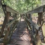 Click here for more information or to register Hosting Club: Caledon Hills
Category: End-to-End
Location (Google Maps): Roadside Parking – southwest of km 48.4 at Boston Mills Rd. just west of the Mississauga Rd. intersection. Hike Leader(s): Dan Patterson Click here to contact Hike Leader(s) Pace: Medium – 3 to 4 km/hour
Terrain: Strenuous – hilly with steep climbs and some poor footing
Distance: 15.9 km Description
Welcome to Caledon Hills In 4 Fall Edition Hike #4. Meet at Boston Mills Road where the Bruce Trail meets the road the road at 8:15 a.m. We will shuttle to Willoughby Rd. Parking at Escarpment Side Road to start the hike. This is an End-to-End series to complete the Caledon Hills section of the Bruce Trail in 4 hikes. We will be hiking from the north end to the south end. Join for as many hikes as desired – you will need to register for each hike in the series which will take place on the following dates: Sept. 20, 27, Oct. 18 & 25. Since this is a group hike, please consider your fitness level before registering. We will be walking at a pace of 3 km – 4 km per hour and hikers will need to keep up with the person in front of them for the duration of the hike. The hike series will also involve car shuttles and every hiker is expected to participate as drivers. Weather conditions can be variable, dressing in layers is recommended. Hiking boots are required and hiking poles are strongly recommended. Bring plenty of fluids, electrolytes. lunch and snacks. This section is challenging with many hills.
 Car Hike: Niagara E2E- 1 of 4 Car Hike: Niagara E2E- 1 of 4 8:30 AM-2:00 PM 11/01/2026 https://hikes.brucetrail.org/event/car-hike-niagara-e2e-1-of-4/2026-11-01/ Hike open to BTC Members only. Click here for more information or to register Hosting Club: Toronto
Category: Car Hike
Location (Google Maps): We will meet at the Grimsby pool, coordinates N 43.193201,W 79.565301 Elm street. Map # 5 Hike Leader(s): Smadar Junkin Click here to contact Hike Leader(s) Pace: Brisk (4-5 km/hr)
Terrain: Hilly, Level 3 (Advanced – steep hills and some scrambling over boulders), Variable
Distance (km): 15.5 km Description
Welcome to Niagara E2E in 4. We will shuttle to the Margaret Reed side trail and after the short walk on the side trail we will hike back to the Grimsby pool. About 15.5 kms and 2 short side trails.
make sure to dress in layers, bring 2 litres of water, lunch, snack.
everyone is expected to participate in the car shuttle one or twice during the 4 days hike.
please be 15 minutes early so we can be in the shuttle cars and move by 8:30. if you have any questions please email me on my personal email smadarjunkin@hotmail.com
- Dufferin Hi-Land End-to-End 3/4 — 1st Line East to Prince of Wales Road
9:00 AM-2:00 PM 11/01/2026 https://hikes.brucetrail.org/event/dufferin-hi-land-end-to-end-3-4-1st-line-east-to-prince-of-wales-road/2026-11-01/ Click here for more information or to register Hosting Club: Toronto
Category: Car Hike
Location (Google Maps): Roadside parking near the intersection of Prince of Wales Rd W & 20 Sideroad. Please arrive by 8:30 a.m. We will organize vehicles and shuttle south to the Bruce Trail parking lot on 1st Line East for an approximately leaving at 8:45. Hike Leader(s): Rob Schieck Click here to contact Hike Leader(s) Pace: Moderate (3-4 km/hr)
Terrain: Level 3 (Advanced – steep hills and some scrambling over boulders)
Distance (km): 12.5 Description
Join us for the third hike in our four-part Dufferin Hi-Land End-to-End. Today’s hike is approximately 12.5 km, making it the shortest of our four days, although the terrain still provides plenty of challenge. Starting from 1st Line East, we will travel north through the Kilgorie and Pine River area before finishing at Prince of Wales Road near 20 Sideroad. The landscape changes frequently as we pass through hardwood forest, river valleys and rural countryside. Several climbs and descents, along with rocky and root-covered trail, will require careful footing. This portion of the Dufferin Hi-Land section has a wonderfully quiet character and illustrates just how quickly the Bruce Trail can change from open countryside to secluded woodland and valley terrain. This is a point-to-point hike requiring a car shuttle. Please arrive by 8:30 a.m. with your vehicle passenger-ready. We plan to begin the shuttle at approximately 8:45 and start hiking at approximately 9:00. Everyone is expected to participate in the car shuttle once or twice during the 4 days hike. Hiking boots or sturdy hiking shoes are required. Hiking poles are strongly recommended, particularly if the trail is wet or covered with fallen leaves. Bring approximately 2 litres of water, lunch and snacks and be prepared for early-November weather. This is Hike 3 of 4 in our Dufferin Hi-Land End-to-End series. One more hike to go!
- Urban Dog-Friendly Walks & Hikes In Toronto
9:00 AM-1:00 PM 11/01/2026 https://hikes.brucetrail.org/event/urban-dog-friendly-walks-hikes-in-toronto/2026-11-01/ This is a Multi-Day HikeYou are signing up for the following dates:
2026-11-01, 2026-11-08, 2026-11-15, 2026-11-22, 2026-11-29 Click here for more information or to register Hosting Club: Toronto
Category: Car Hike
Location (Google Maps): In Toronto Parks & Ravines. The location will be shared with registered hikers or contact the Hike Leader to Inquire Hike Leader(s): Lindita Kalo Click here to contact Hike Leader(s) Pace: Moderate (3-4 km/hr)
Terrain: Level 2 (Intermediate – some hills and uneven surfaces, rocks and roots underfoot), Variable
Distance (km): 10-15km Description
Urban Dog-Friendly Walks & Hikes
Let’s meet and enjoy the outdoors with our best friends, our dogs!
This series of Toronto Urban Walks and hikes will feature a different location every Sunday. Each walk or hike will last approximately 2 to 4 hours and will follow either an out-and-back route or a loop.
Information about each location will be sent to registered participants on a weekly basis.
I have a 3-year-old Australian Shepherd who is friendly with both people and other dogs. I look forward to seeing you and your furry companions on our walks and hikes! Lindita.
- Plalking: Caledon Trailway
10:00 AM-11:30 AM 11/01/2026 https://hikes.brucetrail.org/event/plalking-caledon-trailway-2/2026-11-01/ 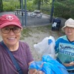 Click here for more information or to register Hosting Club: Caledon Hills
Category: General
Location (Google Maps): Meet at the Caledon East Community Complex parking lot. We’ll meet at the west end of the parking lot, close to the library branch within the complex. There are washrooms inside if needed before or after the event. Please aim to arrive around 9:50 am, so we can start plalking as close to 10:00 am as possible. Thanks! Hike Leader(s): Elizabeth Ganong Click here to contact Hike Leader(s) Pace: Leisurely – 3 km/hour or less
Terrain: Easy – mostly flat and usually good footing
Distance: 3 to 4 km Description
CHBTC and ecoCaledon invite you to come plalking! We’ll walk, chat, and pick up litter as we do a there-and-back route west along the Caledon Trailway. Gloves, bags, and grabbers are provided for participants’ use. A hat, long sleeves and pants, and insect repellent are recommended. An optional stop at a local eatery will follow. Registrants can expect a reminder/update message one or two days before the event. This is a BTC Passport to Nature event.
| 2  Dufferin Hi-Land Blues #4 Dufferin Hi-Land Blues #4 8:30 AM-1:30 PM 11/02/2026 https://hikes.brucetrail.org/event/dufferin-highland-blues-4/2026-11-02/ Click here for more information or to register Hosting Club: Iroquoia, Dufferin Hi-Land
Category: General Hike
Location (Google Maps): Bruce Trail parking: 2nd Line EHS at the beginning of the Splitrock Side Trail Hike Leader(s): Pati Greenwood, Jeff Dowsett Click here to contact Hike Leader(s) Pace: Medium – 3 to 4 km/hr
Terrain: Moderate – Some hills and/or some poor footing, Strenuous – Hilly with steep climbs and some poor footing
Distance: 14 KM Description
This is a series of five hikes in the Dufferin Hi-Land section of the Bruce Trail to complete all blue-blazed trails in the section. Hikers finishing all hikes in the series will be eligible to obtain the Dufferin Hi-Land Club’s Side Trails Badge. All hikes in the series will be loops including sections of the main trail and the entirety of several side trails. This fourth hike of the series will include completing the following side trails: Splitrock, Ralph Tremills, Narrows, 2nd Line EHS, Walter Tovell (north of Carriage), Lookout, & McCarsten’s Lake. The trail will include steep and rocky sections, please wear appropriate footwear for the terrain; hiking boots or shoes. Hiking poles are recommended. Insects are not as active at this time of year; even so, come prepared by wearing long pants and long sleeves; bring insect repellent/bug nets as needed. Weather conditions can also be changeable so dress in layers, as needed. Bring plenty to drink and a snack/lunch. Please arrive at the meeting place by 8:15 am for an 8:30 am departure.
- Car Hike: Niagara E2E, 2 of 4
8:30 AM-5:30 PM 11/02/2026 https://hikes.brucetrail.org/event/car-hike-niagara-e2e-2-of-4/2026-11-02/ Hike open to BTC Members only. Click here for more information or to register Hosting Club: Toronto
Category: Car Hike
Location (Google Maps): Roland Rd. South of km 42.3 coordinates N 43.090278,W 79.305073 map # 3 Hike Leader(s): Smadar Junkin Click here to contact Hike Leader(s) Pace: Brisk (4-5 km/hr)
Terrain: Hilly, Level 3 (Advanced – steep hills and some scrambling over boulders), Variable
Distance (km): 24.5 kms. Description
This hike is much longer then the first one, please be prepared for a longer hike with water, food and layering.
see all the details on hike #1.
- Bent Rim 2 Loop
9:30 AM-12:30 PM 11/02/2026 https://hikes.brucetrail.org/event/bent-rim-2-loop/2026-11-02/ 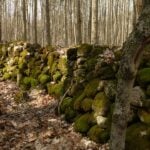 Click here for more information or to register Hosting Club: Iroquoia
Category: General Hike
Location (Google Maps): Meet in the small parking lot at 10050 6th Line. Hike Leader(s): Karen Bergmann Click here to contact Hike Leader(s) Pace: Medium – 3 to 4 km/hr
Terrain: Moderate – Some hills and/or some poor footing
Distance: 9 kms Description
We will hike the Bent Rim 2 bike trail and back through the Halton Forest. Meet at 9:15 (earlier if possible) in the small parking lot at 10050 6th Line, about 3 kms north of Campbellville Rd.
- 2 Day Falling Water Badge hike
9:30 AM-2:30 PM 11/02/2026 https://hikes.brucetrail.org/event/2-day-falling-water-badge-hike/2026-11-02/ This is a Multi-Day HikeYou are signing up for the following dates and times:
2026-11-02 at 09:30
2026-11-03 at 09:00 Click here for more information or to register Hosting Club: Beaver Valley, Sydenham
Category: General Hike
Location (Google Maps): Hogg’s Falls Parking Lot: On the west side of Lower Valley Rd., roughly 750 m north of East Back Line (44.285307, -80.543081). Hike Leader(s): Karen Buschert Click here to contact Hike Leader(s) Pace: Medium: 3 to 4 km/h
Terrain: Strenuous: Hilly with steep climbs and some poor footing.
Distance: Day 1: 16 km, Day 2: 13 km Description
Hike the lower Beaver Valley in two days and complete the Falling Water badge requirements! Each day we will meet at the Hogg’s Falls parking lot, west side of Lower Valley Rd. 750 m north of East Back Line (44.285307, -80.543081) Carpool to Beaver Valley Ski Club, Pioneer Drive, Markdale, ON, (44.357382, -80.543331) We will hike southbound each day and stop and admire all waterfalls en route.
| 3 - Car Hike: Niagara E2E 3 of 4 hikes.
8:30 AM-3:00 PM 11/03/2026 https://hikes.brucetrail.org/event/car-hike-niagara-e2e-3-of-4-hikes/2026-11-03/ Hike open to BTC Members only. Click here for more information or to register Hosting Club: Toronto
Category: Car Hike
Location (Google Maps): Roland Rd. South of km 42.3 coordinates N 43.090278,W 79.305073 map # 3 Hike Leader(s): Smadar Junkin Click here to contact Hike Leader(s) Pace: Brisk (4-5 km/hr)
Terrain: Hilly, Level 3 (Advanced – steep hills and some scrambling over boulders), Variable
Distance (km): 24.5 km Description
We will shuttle to km 18.5 and walk back. About 24.5 kms.
please see details in day 1 hike.
 NEW TIME 9:00 Long Hike Short Hills NEW TIME 9:00 Long Hike Short Hills 9:00 AM-11:30 AM 11/03/2026 https://hikes.brucetrail.org/event/new-time-900-long-hike-short-hills-4/2026-11-03/ Click here for more information or to register Hosting Club: Niagara Location (Google Maps): Short Hills Wiley Road, Thorold Hike Leader(s): Alan Laver Pace: Brisk 4-5 km/hr
Terrain: Moderate: some hills and some poor footing
: 10k+ Description
Our regular Spot for the Tuesday Long Hike. Note the new location. We will hike the trails around Short Hills Dress for the weather and bring sunscreen bug spray, poles snack and drink
 NEW TIME 9:00 am Long hike NEW Location. Bailey bridge Jordan NEW TIME 9:00 am Long hike NEW Location. Bailey bridge Jordan 9:00 AM-11:30 AM 11/03/2026 https://hikes.brucetrail.org/event/new-time-900-am-long-hike-new-location-bailey-bridge-jordan-4/2026-11-03/  Urban Walk: Valley View Park Urban Walk: Valley View Park 9:30 AM-11:45 AM 11/03/2026 https://hikes.brucetrail.org/event/urban-walk-valley-view-park-13/2026-11-03/ Click here for more information or to register Hosting Club: Toronto Location (Google Maps): Parking lot is off Sycamore Drive, East of Bayview , across Starbucks plaza
Bus 91 from Finch East station stops at Sycamore station. Hike Leader(s): MOHAMMAD AGHAMIRI Click here to contact Hike Leader(s) Pace: Moderate (3-4 km/hr)
Terrain: Hilly, Level 2 (Intermediate – some hills and uneven surfaces, rocks and roots underfoot)
Distance (km): 7-8 km Description
We will explore Valleyview and Maple View parks, and walk along German Mills Creek, in return we stop in Huntington park and have snack ,coffee,tea . Although this is considered an “Urban Walk”, you can expect some hills up and down and uneven surfaces with tree roots. Please bring hiking poles, water and snacks. phone number for the day of hike 289 588 6482
 Split Rock/Walter Tovell/Lookout Side Trails Split Rock/Walter Tovell/Lookout Side Trails 9:30 AM-12:30 PM 11/03/2026 https://hikes.brucetrail.org/event/split-rock-walter-tovell-lookout-side-trails/2026-11-03/ Click here for more information or to register Hosting Club: Dufferin Hi-Land
Category: Tuesday Hike
Location (Google Maps): Dufferin Hi-Land Section, Map 19. Meet at Split Rock parking lot on 2nd line EHS about 1.5 km north of 25 Sideroad Hike Leader(s): Inge Eckerich, Julie Daley, Tony Evangelista Les Babbage Click here to contact Hike Leader(s) Pace: Leisurely
Terrain: Moderate
Distance: Long hike 6 km, Short hike 3.7 km Description
Today’s hike will include the Split Rock, 2nd Line EHS Walter Tovell and Lookout Side Trails,short hike will only do Split Rock loop
| 4 - Car Hike: Niagara E2E – 4 of 4
8:30 AM-3:30 PM 11/04/2026 https://hikes.brucetrail.org/event/car-hike-niagara-e2e-4-of-4/2026-11-04/ Hike open to BTC Members only. Click here for more information or to register Hosting Club: Toronto
Category: Car Hike
Location (Google Maps): We will meet at Queenstone Heights in a small parking lot across from the official parking to avoid paying for parking. I’ll give the address to the hikers during the first 3 days of the hike at some point. Map 1 Hike Leader(s): Smadar Junkin Click here to contact Hike Leader(s) Pace: Brisk (4-5 km/hr)
Terrain: Hilly, Level 3 (Advanced – steep hills and some scrambling over boulders), Variable
Distance (km): 18.5 Description
badge day! We will shuttle to km 18.5 and walk to the south cairn for badges, pictures and treats.
please see details on day 1
 8:30 Niagara E2E – Hike #1 8:30 Niagara E2E – Hike #1 8:30 AM-12:30 PM 11/04/2026 https://hikes.brucetrail.org/event/830-niagara-e2e-hike-1/2026-11-04/  Click here for more information or to register Hosting Club: Niagara
Category: Car Pool
Location (Google Maps): Meet at Cave Springs Conservation Area Parking Lot Coordinates: 43.150026, -79.446539 and carpool to Parking Area off of Ridge Rd. located east of the southernmost portion of the Beamer Falls Side Trail Coordinates: 43.183648, -79.571823. Note: The boundary between the Niagara and Iroquoia sections of the Bruce Trail has been moved to Ridge Road West, at the parking area of Beamer Memorial Conservation Area. Hike Leader(s): Sam Rutherford Click here to contact Hike Leader(s) Pace: Medium 3- 4 km/hr
Terrain: Moderate: some hills and some poor footing
Distance: 17.2 kms Description
Hike the entire Niagara section in 5 hikes from Grimsby to Queenston. Please bring snacks and water. Be prepared for weather. Poles are recommended. Bring $10 for badge once you have completed all hikes.
- Nottawasaga Lookout, Standing Rock & Singhampton Caves
9:30 AM-1:30 AM 11/04/2026 https://hikes.brucetrail.org/event/nottawasaga-lookout-standing-rock-singhampton-caves/2026-11-04/ 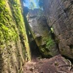 Click here for more information or to register Hosting Club: Blue Mountains
Category: Organized Hike
Location (Google Maps): Tims, First Street, Collingwood, back parking lot. Hike Leader(s): Rob Johnston Click here to contact Hike Leader(s) Pace: Medium – 3 to 4 km/hr
Terrain: Moderate – Some hills and/or some poor footing
Distance: 2.5km Description
We will meet in the lot behind Tim Horton’s on First St in Collingwood (GPS: 44.503149, -80.225683) and carpool to the trailhead of Nottawasaga Lookout Prov Nature Reserve (GPS: 44.403929, -80.263533). We will hike the loop formed by the Main Trail, the Singhampton Side Trail, and the Standing Rock & Caves Side Trail, returning to our vehicles. This area has beautiful hardwood forest and lookouts over Collingwood and Georgian Bay. Hiking the Standing Rock & Caves Side Trail can but can be difficult. There is an opportunity for those who wish to skip around this section. We should be back to our cars before 1:30PM
- Evening Hike in Owen Sound followed by an Opportunity for Refreshments
7:00 PM-8:45 PM 11/04/2026 https://hikes.brucetrail.org/event/evening-hike-in-owen-sound-followed-by-an-opportunity-for-refreshments-25/2026-11-04/ Click here for more information or to register Hosting Club: Sydenham
Category: An evening walk.
Location (Google Maps): Meet in the municipal parking lot by the river on the West side of 1st Ave East between 7th St East and 8th St East in Owen Sound. Hike Leader(s): Harriet Nixon Click here to contact Hike Leader(s) Pace: Medium: 3 to 4 km/h
Terrain: Moderate: Some hills and/or poor footing
Distance: Approx 6 km Description
Join us for a moderately paced evening walk exploring paths and neighbourhoods within the City limits of Owen Sound. If conditions are icy please wear icers. Following the hike there is an opportunity to socialize over refreshments. There is no need to show up 15 minutes early for this hike, but we will leave promptly at 7:00 pm.
| 5 - Urban Walk: Valley View Park
9:30 AM-11:45 AM 11/05/2026 https://hikes.brucetrail.org/event/urban-walk-valley-view-park-14/2026-11-05/ Click here for more information or to register Hosting Club: Toronto Location (Google Maps): Parking lot is off Sycamore Drive, East of Bayview , across Starbucks plaza
Bus 91 from Finch East station stops at Sycamore station. Hike Leader(s): MOHAMMAD AGHAMIRI Click here to contact Hike Leader(s) Pace: Moderate (3-4 km/hr)
Terrain: Hilly, Level 2 (Intermediate – some hills and uneven surfaces, rocks and roots underfoot)
Distance (km): 7-8 km Description
We will explore Valleyview and Maple View parks, and walk along German Mills Creek, in return we stop in Huntington park and have snack ,coffee,tea . Although this is considered an “Urban Walk”, you can expect some hills up and down and uneven surfaces with tree roots. Please bring hiking poles, water and snacks. phone number for the day of hike 289 588 6482
- Speyside from 4th Line
9:30 AM-12:00 PM 11/05/2026 https://hikes.brucetrail.org/event/speyside-from-4th-line-4/2026-11-05/ 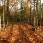 Click here for more information or to register Hosting Club: Iroquoia
Category: General Hike
Location (Google Maps): Meet at 9:15 roadside on 4th Line where the main trail crosses the road Hike Leader(s): Karen Bergmann Click here to contact Hike Leader(s) Pace: Medium – 3 to 4 km/hr
Terrain: Moderate – Some hills and/or some poor footing
Distance: 9 kms Description
A new way to hike the Speyside trails, we’ll meet roadside on Fourth Line at 9:15 am and hike the main trail to the Canada Goose ST and onto the Charles Hildebrandt ST to the “unassumed road” and into Speyside from that end. Hiking around the Cliff Hatch ST and main trail back to Fourth Line. There are some very rocky sections along these trails.
| 6 - Badlands Habitat Restoration Event – Buckthorn
9:00 AM 11/06/2026 https://hikes.brucetrail.org/event/badlands-habitat-restoration-event-buckthorn/2026-11-06/ 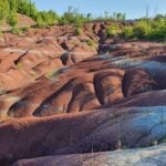 Click here for more information or to register Hosting Club: Caledon Hills
Category: Habitat Restoration Project
Location (Google Maps): Cheltenham Badlands Hike Leader(s): Richard Smythe Click here to contact Hike Leader(s) Pace: Medium – 3 to 4 km/hour
Terrain: Moderate – some hills and/or some poor footing Description
On Friday, November 6th at 9:00 a.m. volunteers are needed to continue with Habitat Restoration at the Badlands. This is a significant ongoing project that requires a large group of volunteers. The focus will be on removing the buckthorn that can be cleared with extractigators and flagging the larger trees for removal in the spring of 2027. Registration to participate will be through the BTC Hike Schedule. All volunteers will need glove, hat, long sleeves, long pants, rugged boots and a water bottle. Water and snacks will be provided along with a sense of accomplishment and pride that we are continuing the project to restore the Badlands.
This restoration will proceed rain or shine.
- Oak and Acorn Hike (Parent & Baby) #4
1:00 PM 11/06/2026 https://hikes.brucetrail.org/event/oak-and-acorn-hike-parent-baby-4/2026-11-06/  Click here for more information or to register Hosting Club: Peninsula Location (Google Maps): Black Creek Provincial Park Hike Leader(s): Beige McIntosh Click here to contact Hike Leader(s) Pace: Leisurely (2.0 – 3.0 km/h): A relaxed pace with frequent breaks and a focus on enjoyment.
Terrain: Easy: Flat forested sections or lowland trails.
Distance: 2.5 km Description
This hiking series will include short, relatively easy hikes for parents/ caregivers and their little ones (children 0-3 years old welcome). The goal is to encourage new parents to enjoy the outdoors with their little one(s), meet new friends and increase the cuteness level on the trail with our little bundles. Hike leader Beige McIntosh will be guiding you (with her 5 month old baby, Fen) and perhaps she’ll share a baby friendly song or 2. These hikes will be a nursing friendly environment, with lots of time to adjust your setup and tend to your child. Hike #4 will take start on a sandy beach on Lake Huron, then hiking through a coniferous forest with mild elevation changes. We’ll complete a 3.5km loop before returning to the parking lot. To bring: -Water and snacks for you and your child -Sturdy footwear -A carrier for your baby (reach out if you want to borrow one)
| 7   Merritthon Merritthon 6:30 AM-5:30 PM 11/07/2026 https://hikes.brucetrail.org/event/merritthon/2026-11-07/  Click here for more information or to register Hosting Club: Niagara
Category: Event Hikes
Location (Google Maps): Port Dalhousie Heritage District, Public Parking Hike Leader(s): Faye Perkins Click here to contact Hike Leader(s) Pace: Medium
Terrain: Easy
Distance: 47 km Description
The Welland Canal is an engineering achievement that has shaped the economic and transportation landscape of the Niagara Region for two centuries, and it continues to be at the center of our ongoing development. Come celebrate the history of the Welland Canal as you hike, run, jog and/or walk From Port Colborne to Port Dalhousie, This distance challenge, is a self-guided hike along a mainly paved trail. A map of the trail can be found at: http://niagarabrucetrail.club/wp/badges/ under the Merritthon badge Fee: The entry fee includes Bus transporation to the start of hike, refreshments at the checkpoints, a badge and a donation to the Bruce Trail Conservancy in its mission to preserve a ribbon of wilderness, for everyone, forever. BUS LEAVES AT 7:00 SHARP. Late arrivers will need to check in and make their own way to Port Colborne Check in: At Port Dalhousie Parking Lot St Catharines from 6:40. Buses will transport hikers to Port Colborne. Route: Follow the yellow blazes from Port Colborne to Port Dalhousie back to the parking lot
What to bring: Bring your own water and snacks. Wear comfortable sturdy shoes and dress for the weather. Extra water and snacks will be available at the checkpoints. FAQ’s What if it rains? This is a rain or shine event. What if I need to drop out? Trail Angels will be available at the checkpoints to drive you back to your car. How long will it take to finish? We estimate that the hike will take between 8 and 9 hours. If you do not reach the last checkpoint by 3:30pm you will have to withdraw Is my ticket/registration transferable/refundable? Yes. Refundable up to 30 days before the event but not transferrable. Please let us know if you cannot make it. What if I want to run the course? If you intend to run the course, please send an email to Faye Perkins (below) so that we can ensure that we have volunteers in place early. Please ensure that you bring drinks and electrolytes. Contact: Faye Perkins at faye.perkins7469@gmail.com 416 843 9274
- Car Hike: Erindale park
8:30 AM-1:15 PM 11/07/2026 https://hikes.brucetrail.org/event/car-hike-erindale-park/2026-11-07/ Click here for more information or to register Hosting Club: Toronto Location (Google Maps): Erindale park parking lot Hike Leader(s): MOHAMMAD AGHAMIRI Click here to contact Hike Leader(s) Pace: Moderate (3-4 km/hr)
Terrain: Hilly, Level 2 (Intermediate – some hills and uneven surfaces, rocks and roots underfoot), Variable
Distance (km): 14-15 km Description
We will hike Credit River North and will see nice views of Credit River and possibly some salmons heading upstream From parking lot we hike north mostly along Credit River and return to parking around 13 to 13.30 For the day of hike only my phone number is 289 588 6482.
- Beaver Valley Geology Hike Badge #7/8 Wodehouse Karst Northern Route
9:00 AM 11/07/2026 https://hikes.brucetrail.org/event/beaver-valley-geology-hike-badge-7-8-wodehouse-karst-northern-route/2026-11-07/ Click here for more information or to register Hosting Club: Blue Mountains
Category: Organized Hike
Location (Google Maps): Tim Horton’s, First Street, Collingwood Hike Leader(s): Annette Sandberg Click here to contact Hike Leader(s) Pace: Leisurely – 3 km/hr. or less
Terrain: Moderate – Some hills and/or some poor footing
Distance: 5 km Description
Wodehouse Karst (Northern Route): Barn Foundation on Stone Foundation Side Trail at Stop 6 (Pages 95- 97) Barn Foundations are wonderful places to see many different rock types, including the Escarpment’s Fossil Hill Dolostone layer, which is full of coral and other fossils.
See Hike #1 – August 26 for series description
|
8 - Niagara E2E in 3 Challenger Fall 2026
7:00 AM 11/08/2026 https://hikes.brucetrail.org/event/niagara-e2e-in-3-challenger-fall-2026/2026-11-08/ 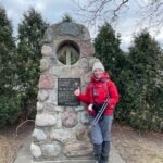 Hike open to BTC Members only. This is a Multi-Day HikeYou are signing up for the following dates:
2026-11-08, 2026-11-14, 2026-11-15 Click here for more information or to register Hosting Club: Niagara, Peninsula
Category: Bruce Trail E2E
Location (Google Maps): Hike Leader(s): Margaret O’Dell Click here to contact Hike Leader(s) Pace: Brisk (4.5 – 5.5 km/h): A faster pace for those seeking a good workout or more distance.
Terrain: Moderate: Rolling hills, mild slopes and rocky paths. Description
Join me this Fall for a challenge series to complete the 81.7 km Niagara section of the Bruce Trail in 3 hikes. There is no fee to register for the hike, but hikers must be members of the Bruce Trail. Please review the dates carefully to ensure you are able to participate fully. Registration is limited to 7 persons. Important details: - This hike series is intended for experienced distance hikers. Hikers must be able to sustain the distance and maintain a brisk pace. Be sure of your ability to join this series.
- Hikes will average 4.5 km per hour including breaks, moving pace is 5+ km per hour, depending on the terrain and conditions of the trail on the day of the hike;
- We will complete the hike in 5-6 hours with minimal breaks.
- Arrive no later than 15 minutes prior to the meeting time. We will organize shuttles and set off promptly at the meeting time.
- Hikers must carry sufficient hydration, accessible snacks and nutrition, first-aid kit, rain gear, extra socks, ID and Health card.
- All registered hikers agree to participate in shuttling hikers and drivers between the meeting location and the start of the hike. The responsibility for shuttling along with any applicable parking fees will be shared within the group.
Summary of the itinerary (km based on Bruce Trail Reference – Edition 31): - Nov 8: Beamsville Memorial CA to Glen Rd (Ball’s Fall CA) – 26 km
- Nov 14: Glen Rd to Decew House Heritage Park – 25.8 km
- Nov 15: Decew House Heritage Park to the southern cairn in Queenston Heights – 29.9 km
Itinerary is subject to change due to trail changes and possible closures in effect. A detailed schedule will be provided in advance of the series to registered hikers. If you have concerns, or questions please use the Contact Hike Leader form to inquire in advance of registering.
- Dufferin Hi-Land End-to-End 4/4 — Prince of Wales Road to Lavender
9:00 AM-2:00 PM 11/08/2026 https://hikes.brucetrail.org/event/dufferin-hi-land-end-to-end-4-4-prince-of-wales-road-to-lavender/2026-11-08/ Click here for more information or to register Hosting Club: Toronto
Category: Car Hike
Location (Google Maps): We will meet at the roadside angle parking at the Lavender Cemetery. Please arrive by 8:30 a.m. We will organize vehicles and shuttle south to Prince of Wales Road leaving at 8:45. Hike Leader(s): Rob Schieck Click here to contact Hike Leader(s) Pace: Moderate (3-4 km/hr)
Terrain: Level 3 (Advanced – steep hills and some scrambling over boulders)
Distance (km): 15.4 Description
This is it — the fourth and final hike of our Dufferin Hi-Land End-to-End. We begin at Prince of Wales Road near 20 Sideroad and hike north through the Black Bank area toward Lavender. Today’s route passes through some memorable northern Dufferin Hi-Land countryside, including forest, ravines, open fields and rural landscapes. The terrain includes several substantial climbs and descents and may be rocky, muddy or slippery. Our vehicles will be parked at Lavender Cemetery, which is approximately 0.6 km before the official Dufferin Hi-Land/Blue Mountains section boundary. To complete the entire Dufferin Hi-Land section, we will continue from the cemetery to the section boundary at Lavender and return to the vehicles. This adds approximately 1.2 km to the day’s walking distance, bringing the total to approximately 15.4 km. This small out-and-back allows us to use an established Bruce Trail parking location while still ensuring that everyone completing all four hikes has walked the full Dufferin Hi-Land section. This is a point-to-point hike requiring a car shuttle. Please arrive by 8:30 a.m. with your vehicle passenger-ready. We plan to begin the shuttle at approximately 8:45 and start hiking at approximately 9:00. Everyone is expected to participate in the car shuttle once or twice during the 4 days hike. Hiking boots or sturdy hiking shoes are required and hiking poles are strongly recommended. November conditions may include wet leaves, mud, cold temperatures or ice, so come prepared for the conditions of the day. Bring approximately 2 litres of water, lunch and snacks. Hikers completing all four hikes will have travelled the entire Dufferin Hi-Land section of the Bruce Trail from Mono Centre to the Blue Mountains section boundary at Lavender. Congratulations — approximately 55 kilometres of the Bruce Trail completed!
- Limehouse Side Trails
9:30 AM-12:30 PM 11/08/2026 https://hikes.brucetrail.org/event/limehouse-side-trails-3/2026-11-08/ 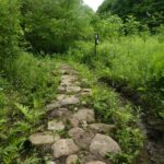 Click here for more information or to register Hosting Club: Iroquoia
Category: General Hike
Location (Google Maps): Meet roadside at 9:15 am on 5th Line, just north of Limehouse. Hike Leader(s): Karen Bergmann Click here to contact Hike Leader(s) Pace: Medium – 3 to 4 km/hr
Terrain: Moderate – Some hills and/or some poor footing
Distance: 9 kms Description
Come explore the side trails just north of Limehouse. We will meet roadside on 5th Line and hike the Beeney Creek Side Trail to the main trail. Then down the Ridge Side Trail to the main trail and around the Todd Bardes ST loop back to the main trail to Ancient Maple ST and back to the main trail, finishing along the Beeney Creek ST. Bring sufficient water and a snack, as needed.
- Plalking: Humber Valley Heritage Trail
10:00 AM-11:30 AM 11/08/2026 https://hikes.brucetrail.org/event/plalking-humber-valley-heritage-trail-2/2026-11-08/ 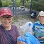 Click here for more information or to register Hosting Club: Caledon Hills
Category: General
Location (Google Maps): Meet at the Ann & Samuel Sterne Municipal Parking Lot in Bolton. This lot is at the intersection of Ann Street and Sterne Street, with the main entrance from Sterne (across from The Valley and beside Mr. Sub). There is no entrance from Ann Street. We’ll meet at the north end of the parking lot, close to the Humber River.
Please aim to arrive around 9:50 am, so we can start plalking as close to 10:00 am as possible. Thanks! Hike Leader(s): Elizabeth Ganong Click here to contact Hike Leader(s) Pace: Leisurely – 3 km/hour or less
Terrain: Easy – mostly flat and usually good footing, Moderate – some hills and/or some poor footing
Distance: 3 to 4 km Description
CHBTC and ecoCaledon invite you to come plalking! We’ll walk, chat, and pick up litter as we do a there-and-back route east along the Humber Valley Heritage Trail. Gloves, bags, and grabbers are provided for participants’ use. A hat, long sleeves and pants, and insect repellent are recommended. An optional stop at a local eatery will follow. Registrants can expect a reminder/update message one or two days before the event. This is a BTC Passport to Nature event.
| 9 - Dufferin Hi-Land Blues #5
8:30 AM-1:30 PM 11/09/2026 https://hikes.brucetrail.org/event/dufferin-highland-blues-5/2026-11-09/ Hike open to BTC Members only. Click here for more information or to register Hosting Club: Iroquoia, Dufferin Hi-Land
Category: General Hike
Location (Google Maps): Parking at Mono Community Centre – gravel lot. Hike Leader(s): Pati Greenwood, Jeff Dowsett Click here to contact Hike Leader(s) Pace: Medium – 3 to 4 km/hr
Terrain: Moderate – Some hills and/or some poor footing, Strenuous – Hilly with steep climbs and some poor footing
Distance: 12 KM Description
This is a series of five hikes in the Dufferin Hi-Land section of the Bruce Trail to complete all blue-blazed trails in the section. Hikers finishing all hikes in the series will be eligible to obtain the Dufferin Hi-Land Club’s Side Trails Badge. All hikes in the series will be loops including sections of the main trail and the entirety of several side trails. This fifth and final hike of the series will include completing the following side trails: Laidlaw, Walter Tovell (south of Carriage), Carriage, South Outlier Loop, South Outlier Loop Connector. The trail will include steep and rocky sections, please wear appropriate footwear for the terrain; hiking boots or shoes. Hiking poles are recommended. Weather conditions can be changeable at this time of year, so dress in layers, as needed. Bring plenty to drink and a snack/lunch. Please arrive at the meeting place by 8:15 am for an 8:30 am departure.
| 10 - NEW TIME 9:00 Long Hike Short Hills
9:00 AM-11:30 AM 11/10/2026 https://hikes.brucetrail.org/event/new-time-900-long-hike-short-hills-5/2026-11-10/ Click here for more information or to register Hosting Club: Niagara Location (Google Maps): Short Hills Wiley Road, Thorold Hike Leader(s): Alan Laver Pace: Brisk 4-5 km/hr
Terrain: Moderate: some hills and some poor footing
: 10k+ Description
Our regular Spot for the Tuesday Long Hike. Note the new location. We will hike the trails around Short Hills Dress for the weather and bring sunscreen bug spray, poles snack and drink
- NEW TIME 9:00 am Long hike NEW Location. Bailey bridge Jordan
9:00 AM-11:30 AM 11/10/2026 https://hikes.brucetrail.org/event/new-time-900-am-long-hike-new-location-bailey-bridge-jordan-5/2026-11-10/ - Dunedin Valley -Stick and Loop
9:00 AM 11/10/2026 https://hikes.brucetrail.org/event/dunedin-valley-stick-and-loop/2026-11-10/ Click here for more information or to register Hosting Club: Blue Mountains
Category: Organized Hike
Location (Google Maps): Tim Horton’s, First Street, Collingwood, back parking lot. Hike Leader(s): Richard Edwards Click here to contact Hike Leader(s) Pace: Leisurely – 3 km/hr. or less, Medium – 3 to 4 km/hr
Terrain: Moderate – Some hills and/or some poor footing
Distance: 6 km Description
We will carpool to cty rd 4 west of Dunedin and follow the trail north . The trail climbs for 1/2 km to an outstanding viewpoint , then edges a cornfield before descending steeply through woods to con. 10, a gravel road We then enter the Dunedin Ravine Nature Preserve and begin a loop hike via field , forest , and a sparkling stream , back to the road where we retrace our way back to cty rd 4 . The hike includes steep climbs but will be done at a relaxed pace.
- Urban Walk: Valley View Park
9:30 AM-11:45 AM 11/10/2026 https://hikes.brucetrail.org/event/urban-walk-valley-view-park-15/2026-11-10/ Click here for more information or to register Hosting Club: Toronto Location (Google Maps): Parking lot is off Sycamore Drive, East of Bayview , across Starbucks plaza
Bus 91 from Finch East station stops at Sycamore station. Hike Leader(s): MOHAMMAD AGHAMIRI Click here to contact Hike Leader(s) Pace: Moderate (3-4 km/hr)
Terrain: Hilly, Level 2 (Intermediate – some hills and uneven surfaces, rocks and roots underfoot)
Distance (km): 7-8 km Description
We will explore Valleyview and Maple View parks, and walk along German Mills Creek, in return we stop in Huntington park and have snack ,coffee,tea . Although this is considered an “Urban Walk”, you can expect some hills up and down and uneven surfaces with tree roots. Please bring hiking poles, water and snacks. phone number for the day of hike 289 588 6482
- Halton Agreement Forest
9:30 AM-11:30 AM 11/10/2026 https://hikes.brucetrail.org/event/halton-agreement-forest-12/2026-11-10/ 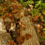 Click here for more information or to register Hosting Club: Iroquoia
Category: General Hike
Location (Google Maps): Meet roadside on 4th Line (10125 Fourth Line) at 9:15 am. Up Guelph Line from the 401, turn right on 10 Side Road and follow the curve as it becomes 4th Line. Hike Leader(s): Karen Bergmann Click here to contact Hike Leader(s) Pace: Medium – 3 to 4 km/hr
Terrain: Moderate – Some hills and/or some poor footing
Distance: 8 kms Description
Meeting at 9:15 am in the small parking lot and roadside at 10125 4th Line, we will hike several of the bike trails, including The Den and The Pines.
- Hockley Valley Nature Reserve
9:30 AM-12:30 PM 11/10/2026 https://hikes.brucetrail.org/event/hockley-valley-nature-reserve-5/2026-11-10/ Click here for more information or to register Hosting Club: Dufferin Hi-Land
Category: Tuesday Hike
Location (Google Maps): (Google Maps)Caledon Hills Section, Map 18. Meet at the parking area on 3rd Line EHS about 2 km north of Hockley Rd. for a 9:30 am start. Hike Leader(s): Tony Evangelista, Inge Eckerich, Julie Daley, Les Babbage Click here to contact Hike Leader(s) Pace: Leisurely
Terrain: Dependent on Conditions, Moderate
Distance: Long Hike 7.5 km Short Hike 4 km Description
We will explore the Isabel East Side Trail, Main Trail, Cam Snell Side Trail, and Glen Cross Side Trail. The short hike will comprise the Isabel East Side Trail and Main Trail, returning to the parking area by the Glen Cross Side Trail. Bring water and snacks. Hiking poles are recommended .
- Tuesday Trekkers – Sydenham E2E in 8
9:30 AM 11/10/2026 https://hikes.brucetrail.org/event/tuesday-trekkers-sydenham-e2e-in-8/2026-11-10/  Hike open to BTC Members only. This is a Multi-Day HikeYou are signing up for the following dates:
2026-11-10, 2026-11-11, 2026-11-17, 2026-11-18, 2026-11-24, 2026-11-25, 2026-12-08, 2026-12-09 Click here for more information or to register Hosting Club: Beaver Valley, Sydenham Location (Google Maps): First hike will meet in Wiarton in Bluewater Park parking opposite the arena.
Map 35, Ed 31
44.742514,-81.135140 Hike Leader(s): Kristina Rettie Click here to contact the hike leader. Pace: Brisk
Terrain: Moderate, Some rocky footing, Some steep sections, Strenuous
Length of Hike: hikes range between 20km – 27km (1st hike is the shortest at 17km) Description
Beaver Valley Tuesday trekkers are taking a field trip to the Sydenham section of the Bruce Trail. This is a fundraising hike. The fee goes towards supporting the Sydenham Bruce Trail Club, which in turn supports the mission of the Bruce Trail Conservancy, which is: “Preserving a ribbon of wilderness, for everyone, forever.” This particular set of 8 hikes is intended to be BRISK (4K-5K PER HOUR) Please be honest about your degree of physical fitness prior to registration. The first hike will be the easiest one with very little elevation and our shortest distance of 17km. This is a good opportunity to self evaluate. Hikers must be able to sustain the distance and maintain a brisk pace. If a hiker is unable to keep pace with the group, or finds the distance too challenging, their future hike registrations may be canceled by the hike leader. All hikes in this series will include a car shuttle and each hiker will take a turn as a shuttle driver. Please have you vehicle passenger ready. Arrive no later than 15min prior to the meeting time. We will organize shuttles and set off promptly at the meeting time. Trails will be wet at this time of year so please be prepared with extra socks and gaiters. We may also get snow and possibly require snowshoes or icers. Experience with hiking 25km/day at a brisk pace (4-5km/hr) is essential. Ideally we will hike from north (Wiarton) to south (Blantyre) over the series of 8 hikes but as conditions change and parking issues arise I will ask you to be flexible with the routes and trust our judgment. As life sometimes can be interrupted and you need to bail on a hike please don’t stress. You can make up two hikes on your own and still qualify for the badge on the final day. Please keep a log of the missed hikes and get them to me by the last day. There are no refunds for this series. You will receive an e-mail outlining meeting location and start location for each hike as well as any other information needed closer to the start of the hike event. We will have a clothing adjustment break, and 2 snack/lunch breaks of 10 min each. Please have your water accessible while hiking (water bladder recommended) There will be plenty of opportunity for photos. I recommend having your camera/phone accessible to get all those great shots. If you have concerns, or questions please use the Contact Hike Leader form to inquire in advance of registering Dogs are not allowed on this series of hikes!
| 11 - 8:30 Niagara E2E – Hike #2
8:30 AM-1:00 PM 11/11/2026 https://hikes.brucetrail.org/event/830-niagara-e2e-hike-2/2026-11-11/  Click here for more information or to register Hosting Club: Niagara
Category: Car Pool
Location (Google Maps): Meet at Rockway Conservation Area Parking Lot Coordinates: 43.111255, -79.321901and carpool to Cave Springs Conservation Area Parking lot Coordinates: 43.150026, -79.446539 Hike Leader(s): Sam Rutherford Click here to contact Hike Leader(s) Pace: Medium 3- 4 km/hr
Terrain: Moderate: some hills and some poor footing
Distance: 18.7 kms Description
Niagara E2E in 5 hikes. Hike #2 is the longest at 18.7 kms so pack snacks, lunch and lots of water. Be prepared for weather. Poles are recommended. Please bring $10 for the badge once you have completed all 5 hikes.
| 12 - Caledon North
9:30 AM-12:00 PM 11/12/2026 https://hikes.brucetrail.org/event/caledon-north/2026-11-12/  Click here for more information or to register Hosting Club: Iroquoia
Category: General Hike
Location (Google Maps): Meet in the parking lot at the Mono Centre Park at 9:15 am Hike Leader(s): Karen Bergmann Click here to contact Hike Leader(s) Pace: Medium – 3 to 4 km/hr
Terrain: Moderate – Some hills and/or some poor footing
Distance: 8 kms Description
Meeting at 9:15 am in the parking lot of Mono Centre Community Centre, we will hike the main trail and around the Turnbull, Springwater, Whitetail Refuge and Third Outlier Side Trails and back along the main trail into Mono Cliffs to the Laidlaw Side Trail to the cars. Bring sufficient water, a snack as needed.
- Urban Walk: Valley View Park
9:30 AM-11:45 AM 11/12/2026 https://hikes.brucetrail.org/event/urban-walk-valley-view-park-16/2026-11-12/ Click here for more information or to register Hosting Club: Toronto Location (Google Maps): Parking lot is off Sycamore Drive, East of Bayview , across Starbucks plaza
Bus 91 from Finch East station stops at Sycamore station. Hike Leader(s): MOHAMMAD AGHAMIRI Click here to contact Hike Leader(s) Pace: Moderate (3-4 km/hr)
Terrain: Hilly, Level 2 (Intermediate – some hills and uneven surfaces, rocks and roots underfoot)
Distance (km): 7-8 km Description
We will explore Valleyview and Maple View parks, and walk along German Mills Creek, in return we stop in Huntington park and have snack ,coffee,tea . Although this is considered an “Urban Walk”, you can expect some hills up and down and uneven surfaces with tree roots. Please bring hiking poles, water and snacks. phone number for the day of hike 289 588 6482
- Looking for Snakes
10:00 AM-12:45 PM 11/12/2026 https://hikes.brucetrail.org/event/looking-for-snakes/2026-11-12/ 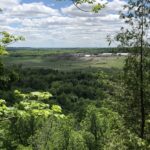 Click here for more information or to register Hosting Club: Iroquoia
Category: Good Companions
Location (Google Maps): Rattlesnake Point Conservation Area, 7200 Appleby Line Hike Leader(s): Anne Armstrong Click here to contact Hike Leader(s) Pace: Leisurely – 3km/hr or less
Terrain: Moderate – Some hills and/or some poor footing
Distance: Approx. 8.5 km. Description
Please join this hike as we explore the beautiful area of Rattlesnake Conservation Area. Hopefully most of the snakes will have retreated to their hibernaculums for the winter. We will hike north using a combination of Bruce Trail and Conservation Area trails, descend into Nassagaweya Canyon and then ascend back to Rattlesnake Point. We will get swiping views over the canyon to Crawford Lake CA and from the canyon we can look up to the escarpment with its soaring rock faces. Please meet in the lower parking lot at 9:45 am. for a 10:00 am. start. You will need to make a reservation with Halton Parks to enter and park here. Bring water, a snack, sunscreen and hiking poles if using. I will send an email with my contact information a few days ahead.
| 13 - Duncan Crevice Caves Provincial Nature Reserve loop via Main trail Chuck & Pat Grant side trail
12:00 PM 11/13/2026 https://hikes.brucetrail.org/event/duncan-crevice-caves-provincial-nature-reserve-loop-via-main-trail-chuck-pat-grant-side-trail/2026-11-13/ 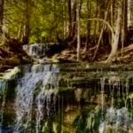 Click here for more information or to register Hosting Club: Beaver Valley, Sydenham
Category: General Hike
Location (Google Maps): Parking Area on the edge of 9th Sideroad BTC Map # 25 @ km 33.3. Hike Leader(s): Ian Mills Pace: Medium: 3 to 4 km/h
Terrain: Moderate: Some hills and/or poor footing, There might be muddy sections., There might be sections with water on the trail.
Distance: 10+ km Description
We will be looping through Duncan Crevice Caves Provincial Nature Reserve providing loads of interesting scenery including a lovely small waterfall. We will have plenty of stops to enjoy the views. Pack a light snack if you like and bring extra water. Proper hiking footwear is mandatory and a hiking stick may be helpful. I plan to send out an email one week prior checking if anyone is interested in dropping into Heart’s in Kimberley after 3:00 pm. Check out the interesting features of this hike on BTC map # 25.
| 14 - Car Hike: Happy Valley
8:30 AM-1:00 PM 11/14/2026 https://hikes.brucetrail.org/event/car-hikel-happy-valley/2026-11-14/ Click here for more information or to register Hosting Club: Toronto Location (Google Maps): Happy Valley, Oak Ridges Trail 16th Sideroad & Weston Road Please park along 16th Side road Hike Leader(s): Mohammad Aghamiri Click here to contact Hike Leader(s) Pace: Moderate (3-4 km/hr)
Terrain: Hilly, Level 2 (Intermediate – some hills and uneven surfaces, rocks and roots underfoot), Variable
Distance (km): 14-15 km Description
Come and join us to view nice scenery and look outs of Happy valley
- Beaver Valley Geology Hike Badge series #8/8 Griersville to Webwood Falls
9:00 AM 11/14/2026 https://hikes.brucetrail.org/event/beaver-valley-geology-hike-badge-series-8-8-griersville-to-webwood-falls/2026-11-14/ Click here for more information or to register Hosting Club: Blue Mountains
Category: Organized Hike
Location (Google Maps): Tim Horton’s, First Street, Collingwood Hike Leader(s): Annette Sandberg Click here to contact Hike Leader(s) Pace: Fast – 5+ km/hr, Leisurely – 3 km/hr. or less
Terrain: Easy – Mostly flat and usually good footing, Moderate – Some hills and/or some poor footing
Distance: 7.5 Description
Griersville to Webwood Falls: Erratic boulders at Stop 4 (Page 109) Glacial erratics are rocks picked up by glaciers and transported great distances to be left behind as the glacier melts. These erratic boulders are 1 billion years older than the local sedimentary bedrock, and originally came from the Canadian Shield.
See Hike #1 – August 26 for series description
- Niagara Falls Historical Hike
9:30 AM-11:30 AM 11/14/2026 https://hikes.brucetrail.org/event/niagara-falls-historical-hike/2026-11-14/  Click here for more information or to register Hosting Club: Niagara, Iroquoia
Category: Historical Hike
Location (Google Maps): Car pool from GoBus carpool parking lot in Grimsby at 8:30am. Please let me know if you would like a ride. Please note: I plan to stay for lunch after the hike. Another opportunity may be available from a location in Niagara Falls. Please email the Hike Leader and I will put you in touch with a participant who may be able to pick you up in NF.
Or, you can meet us in Parking Lot B at the Floral Showhouse. 7200 Niagara River Parkway. The fee for this lot, if you do not have a pass, is approx $30-$40 flat rate. Hike Leader(s): Ruth Moffatt Click here to contact Hike Leader(s) Pace: Leisurely – 3km/hr or less
Terrain: Easy – Mostly flat and usually good footing
Distance: Approximately 5km Description
Have you ever wondered about the history of Niagara Falls? Please join us for a guided tour along Niagara Parkway in Niagara Falls. We will start at Parking Lot B by the Floral Showhouse and make our way north along Niagara Parkway taking in the waterfalls (and the Iron Scow that has been rusting away stuck in the river rapids since 1918) and all the other history along the way. Our guest historian and local resident is Paul Wintemute, assisted by Kate Profijt and Ruth Moffatt This is an out and back hike and will be a leisurely pace on flat, paved terrain and affectionately called “What Is and What Was” – Footsteps into our past. The distance is likely to be about 5km. Please bring your hiking poles if you use them, water and any snacks you may need. This hike has not been officially accessed as a low-barrier hike or by someone who uses mobility devices and may contain unforeseen hazards or minor inclines. If you have any questions, please use the Click here to contact Hike Leader via this form. After the hike, we are planning a lunch at Queen’s Coach Family Restaurant at 2845 St. Paul Avenue, Niagara Falls. This hike is open to 20 people. If you would like to join for lunch, please let me know by email by Nov 7th at the latest through the Click here to contact Hike Leader via this form so we can make appropriate reservation.
- Passport to Nature: A March and a Market
10:00 AM-2:00 PM 11/14/2026 https://hikes.brucetrail.org/event/passport-to-nature-a-march-and-a-market/2026-11-14/  Click here for more information or to register Hosting Club: Toronto
Category: Car Hike
Location (Google Maps): We will meet at roadside parking on Heritage Road (coordinates are 43.734079, -79.944033). Hike Leader(s): Monica Pasquali Click here to contact Hike Leader(s) Pace: Leisurely (2-3 km/hr)
Terrain: Level 2 (Intermediate – some hills and uneven surfaces, rocks and roots underfoot)
Distance (km): 5 km Description
Celebrate autumn and the upcoming holidays with a march along the Bruce Trail and a visit to a local artisan market! This hike is part of the Bruce Trail Conservancy’s “Passport to Nature” initiative. First, we’ll do a leisurely march along the Bruce Trail, using the main trail and the Rockside Side Trail to make a 5 km loop. After returning to our cars, those who would like to join me in extending their day of fun will make the 10-minute drive to Spirit Tree Estate Cidery to visit their “Handcrafted with Love” artisan market and to enjoy some post-hike refreshments including cider (both alcoholic and non-alcoholic varieties are available), pizza, and sweet bakery treats. You should bring enough water and food for a 2-hour hike, comfortable hiking shoes, appropriate clothing for the weather, and cash/debit/credit if you intend to join us for shopping and lunch at Spirit Tree Estate Cidery (https://spirittreecider.com/) after the hike.
- Urban Walk: Humber River/Swansea Theatre Hike
3:00 PM-6:00 PM 11/14/2026 https://hikes.brucetrail.org/event/urban-walk-humber-river-swansea-theatre-hike-6/2026-11-14/  Click here for more information or to register Hosting Club: Toronto
Category: Urban Walk
Location (Google Maps): Meet by the TTC Stop on the Southeast Corner of Scarlett Road and Eglinton Avenue West. Take the #79 Scarlett Road bus from Runnymede Station to Eglinton or the Eglinton West #32A from Mount Dennis Station to Scarlett Road. Please note that we will leave the TTC bus stop at Scarlett Road and Eglinton PUNCTUALLY at 3:00 PM. Hike Leader(s): Miriam Stevens Click here to contact Hike Leader(s) Pace: Leisurely (2-3 km/hr)
Terrain: Level 1 (Easy – mostly on flat, well maintained trails with hard-packed surface), Variable
Distance (km): 10-12 km Description
Leisurely hike (3 kms/hour – No Racers Please) suitable for beginners and families.
Hike along the Humber River trail and into the Swansea village at Runnymede road and Bloor street west. The hike will end opposite Runnymede Subway near the Village Playhouse Theatre and local restaurants and pubs. Distance may vary according to the weather and trail conditions and how people feel. Early dropout is possible at Old Mill Subway Station. After the hike you are invited to join us for dinner at around 6 PM at Ali Baba Mediterranean restaurant.
We will attend the play “To Die For” (Mystery/Romantic Comedy) at 8 PM at The Bloor West Village Players theatre, 2190 Bloor Street West, Toronto.
Call the Theatre directly at (416) 767 7702 to reserve your ticket, cost $29- $32.00. Please do mention that you’re with the Bruce Trail Conservancy, Toronto Club so they know we are supporting them. Paid parking is available off Kennedy Avenue north of Bloor Street West (behind the Village Playhouse Theatre building). There is no parking available at the start of the hike. Please feel free to join us just for the hike, the hike and dinner, or all three.
|
15 - Urban Dog-Friendly Walks & Hikes In Toronto
9:00 AM-1:00 PM 11/15/2026 https://hikes.brucetrail.org/event/urban-dog-friendly-walks-hikes-in-toronto-2/2026-11-15/ Click here for more information or to register Hosting Club: Toronto Location (Google Maps): Location will be shared with registered hikers or contact the hike leader to inquire. Hike Leader(s): Lindita Kalo Click here to contact Hike Leader(s) Pace: Moderate (3-4 km/hr)
Terrain: Level 2 (Intermediate – some hills and uneven surfaces, rocks and roots underfoot), Variable
Distance (km): 10-15km Description
Urban Dog-Friendly Walks & Hikes
Let’s meet and enjoy the outdoors with our best friends, our dogs!
This series of urban walks and hikes will feature a different location every Sunday. Each walk or hike will last approximately 2 to 4 hours and will follow either an out-and-back route or a loop.
Information about each location will be sent to registered participants on a weekly basis.
I have a 3-year-old Australian Shepherd who is friendly with both people and other dogs. I look forward to seeing you and your furry companions on our walks and hikes!
- Scotsdale Farm Big loop
9:30 AM-12:30 PM 11/15/2026 https://hikes.brucetrail.org/event/scotsdale-farm-big-loop-3/2026-11-15/  Click here for more information or to register Hosting Club: Iroquoia
Category: General Hike
Location (Google Maps): Meet in the main parking lot at Scotsdale Farm. Hike Leader(s): Karen Bergmann Click here to contact Hike Leader(s) Pace: Medium – 3 to 4 km/hr
Terrain: Moderate – Some hills and/or some poor footing
Distance: 9 kms Description
This hike will take us down a variety of side trails (Snows Creek, Reservoir, Silver Creek, and Maureen Bennett) with a bit on the main trail and finishing on the Bennett Heritage Trail. Bring sufficient water and a snack, as needed.
| 16 | 17 - NEW TIME 9:00 am Long hike NEW Location. Bailey bridge Jordan
9:00 AM-11:30 AM 11/17/2026 https://hikes.brucetrail.org/event/new-time-900-am-long-hike-new-location-bailey-bridge-jordan-6/2026-11-17/ - NEW TIME 9:00 Long Hike Short Hills
9:00 AM-11:30 AM 11/17/2026 https://hikes.brucetrail.org/event/new-time-900-long-hike-short-hills-6/2026-11-17/ Click here for more information or to register Hosting Club: Niagara Location (Google Maps): Short Hills Wiley Road, Thorold Hike Leader(s): Alan Laver Pace: Brisk 4-5 km/hr
Terrain: Moderate: some hills and some poor footing
: 10k+ Description
Our regular Spot for the Tuesday Long Hike. Note the new location. We will hike the trails around Short Hills Dress for the weather and bring sunscreen bug spray, poles snack and drink
- Riverside Woods Nature Reserve
9:30 AM-11:30 AM 11/17/2026 https://hikes.brucetrail.org/event/riverside-woods-nature-reserve-3/2026-11-17/ Click here for more information or to register Hosting Club: Dufferin Hi-Land
Category: Tuesday Hike
Location (Google Maps): Caledon Hills Section, Map 18. Park in the BTC lot at the end of 1st line EHS, north of 5 Sideroad (near Orangeville Fairgrounds). Hike Leader(s): Julie Daley, Les Babbage, Tony Evangelista, Inge Eckerich Click here to contact Hike Leader(s) Pace: Leisurely
Terrain: Moderate
Distance: Long Hike 5 km, Short Hike 2.2 km Description
We will hike a loop consisting of the Uplands, Goodyear and Rushing River Side Trails, including the trail connecting to 2nd line EHS. Short hike will turn back at second intersection of Uplands and Goodyear STs. Bring water, snack and hiking poles, as desired. Icers may by helpful, depending on conditions.
- Urban Walk: Valley View Park
9:30 AM-11:45 AM 11/17/2026 https://hikes.brucetrail.org/event/urban-walk-valley-view-park-17/2026-11-17/ Click here for more information or to register Hosting Club: Toronto Location (Google Maps): Parking lot is off Sycamore Drive, East of Bayview , across Starbucks plaza
Bus 91 from Finch East station stops at Sycamore station. Hike Leader(s): MOHAMMAD AGHAMIRI Click here to contact Hike Leader(s) Pace: Moderate (3-4 km/hr)
Terrain: Hilly, Level 2 (Intermediate – some hills and uneven surfaces, rocks and roots underfoot)
Distance (km): 7-8 km Description
We will explore Valleyview and Maple View parks, and walk along German Mills Creek, in return we stop in Huntington park and have snack ,coffee,tea . Although this is considered an “Urban Walk”, you can expect some hills up and down and uneven surfaces with tree roots. Please bring hiking poles, water and snacks. phone number for the day of hike 289 588 6482
| 18 - 8:30 Niagara E2E – Hike #3
8:30 AM-12:30 PM 11/18/2026 https://hikes.brucetrail.org/event/830-niagara-e2e-hike-3/2026-11-18/  Click here for more information or to register Hosting Club: Niagara
Category: Car Pool
Location (Google Maps): Meet at Decew House Heritage Park Parking Lot Coordinates: 43.107568, -79.249598 and carpool to Rockway Conservation Area Parking Lot Coordinates: 43.111255, -79.321901 Hike Leader(s): Sam Rutherford Click here to contact Hike Leader(s) Pace: Medium 3- 4 km/hr
Terrain: Moderate: some hills and some poor footing
Distance: 16.9 kms Description
Niagara E2E in 5 hikes. Hike#3 is 16.9 kms so please bring enough snacks and water. Be prepared for the weather. Poles are recommended. Please bring $10 for badge once you have completed all 5 hikes.
- Mount Nemo (reservation required)
9:30 AM-11:30 AM 11/18/2026 https://hikes.brucetrail.org/event/mount-nemo-reservation-required-4/2026-11-18/  Click here for more information or to register Hosting Club: Iroquoia
Category: General Hike
Location (Google Maps): Meet in the main parking lot at Mount Nemo at 9:15 am. Reserve your time at conservationhalton.ca Hike Leader(s): Karen Bergmann Click here to contact Hike Leader(s) Pace: Medium – 3 to 4 km/hr
Terrain: Moderate – Some hills and/or some poor footing
Distance: 7 kms Description
Meeting at 9:15 am in the parking lot on Guelph Line, we will hike the basic loop and a side trail. Reserve your time at conservationhalton.ca
- Balsam Wetlands Biodiversity
9:30 AM-12:30 PM 11/18/2026 https://hikes.brucetrail.org/event/balsam-wetlands-biodiversity/2026-11-18/ Click here for more information or to register Hosting Club: Blue Mountains
Category: Organized Hike
Location (Google Maps): Parking lot behind Tim Horton’s Hike Leader(s): Myra Campbell Click here to contact Hike Leader(s) Pace: Leisurely – 3 km/hr. or less
Terrain: Moderate – Some hills and/or some poor footing
Distance: 6 Description
Please meet at Tim Horton’s on 1st St. in Collingwood at 9:30. Please be there at least 15 minutes prior to the meet time (9:15). This is a shuttle. We’ll car pool to the small parking lot on Hwy 91 west of Duntroon (37.4 km), from there we will shuttle cars to the end point at the Devils’s Glen Viewing Platform parking lot (31.7 km) on Hwy 124.
There are lots of interesting things to see along the trail. The Biodiversity of the Escarpment on this hike includes a quarry, ski trails, farm fields as well as forest. Be prepared for all weather conditions & have proper hiking gear including water & snacks.
| 19 - Urban Walk: Valley View Park
9:30 AM-11:45 AM 11/19/2026 https://hikes.brucetrail.org/event/urban-walk-valley-view-park-18/2026-11-19/ Click here for more information or to register Hosting Club: Toronto Location (Google Maps): Parking lot is off Sycamore Drive, East of Bayview , across Starbucks plaza
Bus 91 from Finch East station stops at Sycamore station. Hike Leader(s): MOHAMMAD AGHAMIRI Click here to contact Hike Leader(s) Pace: Moderate (3-4 km/hr)
Terrain: Hilly, Level 2 (Intermediate – some hills and uneven surfaces, rocks and roots underfoot)
Distance (km): 7-8 km Description
We will explore Valleyview and Maple View parks, and walk along German Mills Creek, in return we stop in Huntington park and have snack ,coffee,tea . Although this is considered an “Urban Walk”, you can expect some hills up and down and uneven surfaces with tree roots. Please bring hiking poles, water and snacks. phone number for the day of hike 289 588 6482
| 20  Rucking for Beginners Series Rucking for Beginners Series 9:30 AM-12:00 PM 11/20/2026 https://hikes.brucetrail.org/event/rucking-for-beginners-series-3/2026-11-20/ Click here for more information or to register Hosting Club: Iroquoia
Category: Rucking: Hikes/Walks with Weight
Location (Google Maps): Meet up at 9:30am SHARP at Kilbride Public School (6611 Panton St., North Burlington) in back parking by tennis club (ignore one-way arrows). Hike Leader(s): Karen Capindale-Smith Click here to contact Hike Leader(s) Pace: Medium – 3 to 4 km/hr
Terrain: Dependent on Conditions, Moderate – Some hills and/or some poor footing
Distance: +/- 6 km Description
This is a progressive rucking series – starting off slow and building as you are able. I will be starting with a village street route as you learn the subtle skills of rucking and progressing from there to close by main and side hiking trails of the Bruce Trail. Information covered over the 4 weeks will include: the uses of rucking, its health benefits, proper posture and “stability” when rucking and tips on how to safely progress your rucking. Prerequisite of participants: Please sign up for this fun and encouraging rucking series ONLY IF: 1) YOU CAN MAKE ALL 4 WEEKS OF THE SERIES 2) You have (or can borrow) a backpack with both a hip (padded is recommended) and chest strap. A cover for your pack is optional but recommended for wet conditions; 3) you walk or hike 6km+ regularly (2-3 times a week) and can maintain a moderate pace (3-4km/hr); and, 4) you have NO unresolved joint issues (especially hip, knee, ankle and feet joints). What to Bring: your backpack ;), water and a snack. Please dress according to the weather (layers are best). Proper icers must accompany you each week (please contact me if you do not know what this means). Note: wearing a backpack (especially with weight) will keep you warmer than without. I will be contacting you closer to the first week with information about how to prepare you backpacks. This series will run RAIN OR SHINE…. OR SNOW. Extreme weather will always be taken into consideration. The continuation and expansion of this series will be dependent on its success. We have had a great turnout for last 3 Beginner Series. Always feel free to join me again as there is a lot of information to take-in/implement the first time around and the Fall definitely can throw some weather at you that can help take your rucking to that next level. Hope to see you there!
- Valley Road to Smokey Hollow (Waterdown)
9:30 AM-12:30 PM 11/20/2026 https://hikes.brucetrail.org/event/valley-road-to-smokey-hollow-waterdown/2026-11-20/  Click here for more information or to register Hosting Club: Iroquoia
Category: General Hike
Location (Google Maps): Meet at 9:15 am in the parking lot at Smokey Hollow in Waterdown. Hike Leader(s): Karen Bergmann Click here to contact Hike Leader(s) Pace: Medium – 3 to 4 km/hr
Terrain: Moderate – Some hills and/or some poor footing
Distance: 8 kms Description
We will meet in the Smokey Hollow parking lot in Waterdown at.9:15. Then carpool to Valley Road and hike back along the main trail to the cars. Bring sufficient water and a snack, as needed. There are some hilly bits to this hike.
| 21 - Car Hike:Glasgow Village
8:30 AM-1:15 PM 11/21/2026 https://hikes.brucetrail.org/event/car-hike-glasgow-village-uxbridge-12/2026-11-21/ Click here for more information or to register Hosting Club: Toronto Location (Google Maps): Glasgow Trail, Concession Road 2 Park in parking lot at the head of trail Hike Leader(s): MOHAMMAD AGHAMIRI Click here to contact Hike Leader(s) Pace: Moderate (3-4 km/hr)
Terrain: Hilly, Level 2 (Intermediate – some hills and uneven surfaces, rocks and roots underfoot), Variable
Distance (km): 14-15 km Description
Lets explore Goodwood conservation area and visit Secord forest and pond
|
22 - Urban Dog-Friendly Walks & Hikes In Toronto
9:00 AM-1:00 PM 11/22/2026 https://hikes.brucetrail.org/event/urban-dog-friendly-walks-hikes-in-toronto-3/2026-11-22/ Click here for more information or to register Hosting Club: Toronto Location (Google Maps): The location in a Toronto park or ravine will be shared with registered hikers or contact the hike leader to inquire. Hike Leader(s): Lindita Kalo Click here to contact Hike Leader(s) Pace: Moderate (3-4 km/hr)
Terrain: Level 2 (Intermediate – some hills and uneven surfaces, rocks and roots underfoot), Variable
Distance (km): 10-15km Description
Urban Dog-Friendly Walks & Hikes
Let’s meet and enjoy the outdoors with our best friends, our dogs!
This series of urban walks and hikes will feature a different location every Sunday. Each walk or hike will last approximately 2 to 4 hours and will follow either an out-and-back route or a loop.
Information about each location will be sent to registered participants on a weekly basis.
I have a 3-year-old Australian Shepherd who is friendly with both people and other dogs. I look forward to seeing you and your furry companions on our walks and hikes!
| 23 - St. Helena Forest
9:30 AM-12:00 PM 11/23/2026 https://hikes.brucetrail.org/event/st-helena-forest-4/2026-11-23/ 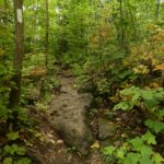 Click here for more information or to register Hosting Club: Iroquoia
Category: General Hike
Location (Google Maps): Meet in the Pear Tree parking lot at Speyside on 15 Side Road at 9:15 am Hike Leader(s): Karen Bergmann Click here to contact Hike Leader(s) Pace: Medium – 3 to 4 km/hr
Terrain: Moderate – Some hills and/or some poor footing
Distance: 9 kms Description
Meeting at 9:15 am in the Pear Tree parking lot, we will hike the main trail into the St. Helena forest and along the trails, which are VERY rocky. This is a dense forest that takes us around a large marsh pond and back up the Al Shaw Side Trail. This hike is about 90% technical (on rocks), so be prepared for that. Not for first time hikers.
| 24 - Pretty River Valley Provincial Park/Petun Conservation Area
8:30 AM-12:30 PM 11/24/2026 https://hikes.brucetrail.org/event/pretty-river-valley-provincial-park-petun-conservation-area-2/2026-11-24/ Click here for more information or to register Hosting Club: Dufferin Hi-Land
Category: Tuesday Hike
Location (Google Maps): Blue Mountains Section, Map 23. Meet at SuperBurger (north-west corner of Hwy 10/Hwy 89 intersection) at 8:30 am for car pooling or at Petun Conservation Area parking area on the east side of 2nd Line, 320 metres north of 6th Sideroad (near to Km 55.7) at 9:30 am. Hike Leader(s): Les Babbage, Inge Eckerich, Julie Daley, Tony Evangelista Click here to contact Hike Leader(s) Pace: Leisurely
Terrain: Moderate
Distance: 8.4 km. Short hike: 4.2 km Description
After car pooling to the start of the hike in Petun CA, we will take Black Ash Side Trail to the Main Trail, then hike east, south and west to the John Haigh Side Trail, which will take us back to parking. The short hike will turn back where the Main Trail turns onto 6th Sideroad road allowance. Bring water and snacks. Hiking poles recommended.
- NEW TIME 9:00 Long Hike Short Hills
9:00 AM-11:30 AM 11/24/2026 https://hikes.brucetrail.org/event/new-time-900-long-hike-short-hills-7/2026-11-24/ Click here for more information or to register Hosting Club: Niagara Location (Google Maps): Short Hills Wiley Road, Thorold Hike Leader(s): Alan Laver Pace: Brisk 4-5 km/hr
Terrain: Moderate: some hills and some poor footing
: 10k+ Description
Our regular Spot for the Tuesday Long Hike. Note the new location. We will hike the trails around Short Hills Dress for the weather and bring sunscreen bug spray, poles snack and drink
- NEW TIME 9:00 am Long hike NEW Location. Bailey bridge Jordan
9:00 AM-11:30 AM 11/24/2026 https://hikes.brucetrail.org/event/new-time-900-am-long-hike-new-location-bailey-bridge-jordan-7/2026-11-24/ - Urban Walk: Valley View Park
9:30 AM-11:45 AM 11/24/2026 https://hikes.brucetrail.org/event/urban-walk-valley-view-park-19/2026-11-24/ Click here for more information or to register Hosting Club: Toronto Location (Google Maps): Parking lot is off Sycamore Drive, East of Bayview , across Starbucks plaza
Bus 91 from Finch East station stops at Sycamore station. Hike Leader(s): MOHAMMAD AGHAMIRI Click here to contact Hike Leader(s) Pace: Moderate (3-4 km/hr)
Terrain: Hilly, Level 2 (Intermediate – some hills and uneven surfaces, rocks and roots underfoot)
Distance (km): 7-8 km Description
We will explore Valleyview and Maple View parks, and walk along German Mills Creek, in return we stop in Huntington park and have snack ,coffee,tea . Although this is considered an “Urban Walk”, you can expect some hills up and down and uneven surfaces with tree roots. Please bring hiking poles, water and snacks. phone number for the day of hike 289 588 6482
| 25 - 8:30 Niagara E2E – Hike #4
8:30 AM-12:30 PM 11/25/2026 https://hikes.brucetrail.org/event/830-niagara-e2e-hike-4/2026-11-25/  Click here for more information or to register Hosting Club: Niagara
Category: Car Pool
Location (Google Maps): Meet at Woodend Conservation Area Taylor Road and carpool to Decew House Heritage Park Hike Leader(s): Sam Rutherford Click here to contact Hike Leader(s) Pace: Medium 3- 4 km/hr
Terrain: Moderate: some hills and some poor footing
Distance: 14.5 kms Description
Niagara E2E in 5 hikes. Hike#4 covers 14.5 kms. Bring snacks and water. Poles are recommended. Please bring $10 for badge once you have completed all 5 hikes.
- Hockleycrest to Glen Cross
9:30 AM-12:00 PM 11/25/2026 https://hikes.brucetrail.org/event/hockleycrest-to-glen-cross-2/2026-11-25/ 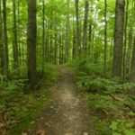 Click here for more information or to register Hosting Club: Iroquoia
Category: General Hike
Location (Google Maps): Meet at 9:15 am in the Bruce Trail parking lot on 5th Line, just down from Hockley Rd. Hike Leader(s): Karen Bergmann Click here to contact Hike Leader(s) Pace: Medium – 3 to 4 km/hr
Terrain: Moderate – Some hills and/or some poor footing
Distance: 7.5 kms Description
Meeting at 9:15 am in the Bruce Trail parking lot on 5th Line (just below Hockley Rd), we will carpool to Hockleycrest on Side Road 5 and hike back along the main trail and the Hemlock Ridge Side Trail. There are a few hills along the way. Bring sufficient water.
| 26 - Urban Walk: Valley View Park
9:30 AM-11:45 AM 11/26/2026 https://hikes.brucetrail.org/event/urban-walk-valley-view-park-20/2026-11-26/ Click here for more information or to register Hosting Club: Toronto Location (Google Maps): Parking lot is off Sycamore Drive, East of Bayview , across Starbucks plaza
Bus 91 from Finch East station stops at Sycamore station. Hike Leader(s): MOHAMMAD AGHAMIRI Click here to contact Hike Leader(s) Pace: Moderate (3-4 km/hr)
Terrain: Hilly, Level 2 (Intermediate – some hills and uneven surfaces, rocks and roots underfoot)
Distance (km): 7-8 km Description
We will explore Valleyview and Maple View parks, and walk along German Mills Creek, in return we stop in Huntington park and have snack ,coffee,tea . Although this is considered an “Urban Walk”, you can expect some hills up and down and uneven surfaces with tree roots. Please bring hiking poles, water and snacks. phone number for the day of hike 289 588 6482
| 27 | 28 - Car Hike: Rouge Park
8:30 AM-1:15 PM 11/28/2026 https://hikes.brucetrail.org/event/car-hike-rouge-national-park-scarborough-on-7/2026-11-28/ Click here for more information or to register Hosting Club: Toronto Location (Google Maps): Free parking in Mast Trail parking Lot off Kingston Road Hike Leader(s): MOHAMMAD AGHAMIRI Click here to contact Hike Leader(s) Pace: Moderate (3-4 km/hr)
Terrain: Hilly, Level 2 (Intermediate – some hills and uneven surfaces, rocks and roots underfoot)
Distance (km): 12-14 km Description
We will hike Vista trail and part of orchard trail, will enjoy look outs between Rouge river and Little Rouge creek
• Please dress appropriately for the weather.
• We will have short water ,picture and a 15 minute snack break. Everyone is welcome! Please bring lots of water and snacks ,hiking poles are recommended phone number for the day of hike 289 588 6482
|
29 - Crawford Lake (reservation required)
12:00 AM 11/29/2026 https://hikes.brucetrail.org/event/crawford-lake-reservation-required/2026-11-29/ 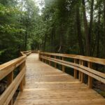 Click here for more information or to register Hosting Club: Iroquoia
Category: General Hike
Location (Google Maps): Meet at 9:15 in the first parking lot at Crawford Lake. Hike Leader(s): Karen Bergmann Click here to contact Hike Leader(s) Pace: Medium – 3 to 4 km/hr
Terrain: Moderate – Some hills and/or some poor footing
Distance: 6 kms Description
Meeting in the first parking lot at Crawford Lake, we will hike around the loop and include the new boardwalk around the lake. Reserve your time at conservationhalton.ca
- Urban Dog-Friendly Walks & Hikes In Toronto
9:00 AM-1:00 PM 11/29/2026 https://hikes.brucetrail.org/event/urban-dog-friendly-walks-hikes-in-toronto-4/2026-11-29/ Click here for more information or to register Hosting Club: Toronto Location (Google Maps): In a Toronto park or ravine. Location will be shared with registered hikers or contact hike leader to inquire. Hike Leader(s): Lindita Kalo Click here to contact Hike Leader(s) Pace: Moderate (3-4 km/hr)
Terrain: Level 2 (Intermediate – some hills and uneven surfaces, rocks and roots underfoot), Variable
Distance (km): 10-15km Description
Urban Dog-Friendly Walks & Hikes
Let’s meet and enjoy the outdoors with our best friends, our dogs!
This series of urban walks and hikes will feature a different location every Sunday. Each walk or hike will last approximately 2 to 4 hours and will follow either an out-and-back route or a loop.
Information about each location will be sent to registered participants on a weekly basis.
I have a 3-year-old Australian Shepherd who is friendly with both people and other dogs. I look forward to seeing you and your furry companions on our walks and hikes!
| 30 | December | December | December | December | December |
