
Hike Schedule
Join us for a hike! Registration required.
All hikes available to BTC members. Some hikes are open to non-members.
See Refund Policy for Paid Hikes >
TIP: The calendar view displays up to 7 hikes on a day, but often there are more. Click “View more events” to see them all.
Categories
- 01October 1, 2026
8:00 am Long hike NEW Location. Bailey bridge Jordan
https://hikes.brucetrail.org/event/800-am-long-hike-new-location-bailey-bridge-jordan-14/Hike open to BTC Members only.
Registration Required:
Click here to register for this hike (24 spots remaining)Hosting Club: Niagara
Category: In and Out
Location (Google Maps):Bailey bridge Jordan
Hike Leader(s): Alan Laver Click here to contact Hike Leader(s)
Pace: Brisk 4-5 km/hr
Distance: ~10k
Description
This will be our permanent location . Hike up from the Bailey bridge to Balls Falls and explore the trailsYou must register for each hike. Bring Poles, snack and a drink. Dress for the weather
- 01October 1, 2026
Hiking around Jordan
https://hikes.brucetrail.org/event/hiking-around-jordan-74/
Registration Required:
Click here to register for this hike (22 spots remaining)Hosting Club: Niagara
Category: Loop
Location (Google Maps): Sho’arishon Park, JordanHike Leader(s): Bill Russell Click here to contact Hike Leader(s)
Pace: Medium 3- 4 km/hr
Terrain: Moderate: some hills and some poor footing
Distance: 6 kmsDescription
Hiking in and around Jordan, the Jim Rainforth Trail and Balls Falls, alternating every 3 weeks. Please bring hiking poles and water. - 01October 1, 2026
Toronto Fall Series Hike 5 of 9
https://hikes.brucetrail.org/event/toronto-fall-series-hike-5-of-9/
Registration Required:
Click here to register for this hike (2 spots remaining)Hosting Club: Caledon Hills
Category: End-to-End
Location (Google Maps): Meet at Limehouse across from the school. Map 12, north of km 21.6 on the south side of 22 Sideroad.Hike Leader(s): Nancy Mooney Click here to contact Hike Leader(s)
Pace: Medium – 3 to 4 km/hour
Terrain: Easy – mostly flat and usually good footing, Moderate – some hills and/or some poor footing
Distance: 13.6 km loopDescription
This is the fifth hike of the series. We will visit the Toronto Club Seed Orchard, Todd Bardes, Meadowland, Beeney Creek, Ancient Maple, and Ridge Side Trails. - 01October 1, 2026
Twiss Rd to Crawford Lake return
https://hikes.brucetrail.org/event/twiss-rd-to-crawford-lake-return-3/
Registration Required:
Click here to register for this hike (8 spots remaining)Hosting Club: Iroquoia
Category: General Hike
Location (Google Maps): Meet roadside on Twiss Road at 9:15 am.Hike Leader(s): Karen Bergmann Click here to contact Hike Leader(s)
Pace: Medium – 3 to 4 km/hr
Terrain: Strenuous – Hilly with steep climbs and some poor footing
Distance: 10 kmsDescription
Meeting roadside at 9:15 am on Twiss Road, we will hike to Crawford Lake and around the trails and back to Twiss Road. There are some rocky sections along the way. Please bring water and a snack. - 01October 1, 2026
Urban Walk : Valley View Park
https://hikes.brucetrail.org/event/urban-walk-valley-view-park-4/
Registration Required:
Click here to register for this hike (11 spots remaining)Hosting Club: Toronto
Location (Google Maps): Parking lot is off Sycamore Drive, East of Bayview , across Starbucks plaza
Bus 91 from Finch East station stops at Sycamore station.Hike Leader(s): MOHAMMAD AGHAMIRI Click here to contact Hike Leader(s)
Pace: Moderate (3-4 km/hr)
Terrain: Hilly, Level 2 (Intermediate – some hills and uneven surfaces, rocks and roots underfoot)
Distance (km): 7-8 kmDescription
We will explore Valleyview and Maple View parks, and walk along German Mills Creek, in return we stop in Huntington park and have snack ,coffee,tea .Although this is considered an “Urban Walk”, you can expect some hills up and down and uneven surfaces with tree roots. Please bring hiking poles, water and snacks.
phone number for the day of hike 289 588 6482
- 02October 2, 2026
Tobermory Fall Weekend
https://hikes.brucetrail.org/event/car-hike-tobermory-fall-hiking-weekend-2or3-overnights/Sorry, the registration cut-off time for this hike has been reached.Not a member? Click here to join today!This is a Multi-Day Hike
You are signing up for the following dates and times:
2026-10-02 atHosting Club: Toronto, Peninsula
Category: Car Hike
Location (Google Maps):Princess Hotel
34 Bay St, Tobermory, ON N0H 2R0Hike Leader(s): Jeanette Vincent. Click here to contact Hike Leader(s)
Pace: Moderate (3-4 km/hr)
Terrain: Level 2 (Intermediate – some hills and uneven surfaces, rocks and roots underfoot), Variable
Distance (km): 13 -15kmDescription
Greg Vincent’s legacy of weekends away continue. Please join me, Jeanette Vincent as we explore the Tip o’ the Bruce, Tobermory in the Fall. The beauty of this area of the Bruce Peninsula every season is wonderful! We will take in a number of walks using side trails and the Bruce Trail. Approximately 13-15km/day. We stay and have our meals at a comfortable hotel overlooking Little Tub Harbour. This outing is restricted to those staying with us at the Princess Hotel in Tobermory for the weekend – the hotel fills quickly. You will need a car to access this outing. Please contact the Princess Hotel for a reservation.1-519-596-8282 or info@tobermoryprincesshotel.com and mention Vincent/Royle Fall weekend.Before registering at the hotel please contact us for the price package for accommodations and more details.
- 02October 2, 2026

2026 Peninsula Hiking Festival
https://hikes.brucetrail.org/event/2026-peninsula-hiking-festival/This is a Multi-Day Hike
You are signing up for the following dates and times:
2026-10-02 at
2026-10-03 at
Registration Required:
Click here to register for this hike (2 spots remaining)Hosting Club: Peninsula
Category: Peninsula E2E
Location (Google Maps):Hike Leader(s): Randy Vanderlaan Click here to contact Hike Leader(s)
Pace: Fast (5.5 – 7.0 km/h+): A quick pace maintained by experienced hikers or trail runners., Leisurely (2.0 – 3.0 km/h): A relaxed pace with frequent breaks and a focus on enjoyment., Medium (3.0 – 4.5 km/h): A comfortable pace for most hikers with steady progress.
Terrain: Difficult: Steep ascents/descents, rocky scrambling, and some rugged escarpment paths., Easy: Flat forested sections or lowland trails., Moderate: Rolling hills, mild slopes and rocky paths.
Distance: variousDescription
Join us for the 2026 Peninsula Hiking Festival from October 2–4, 2026 on the beautiful Bruce Peninsula — a weekend celebration of hiking, nature, community, and connection along Canada’s iconic Bruce Trail.With more than 20 guided hikes for a variety of skill levels and interests, the festival offers unforgettable experiences through forests, shoreline vistas, and escarpment landscapes. Enjoy a lively weekend featuring a welcome reception, inspiring keynote dinner with renowned outdoorsman Kevin Callan, local art, community events, and a silent auction — all centered around this year’s theme: “Common Ground: A Celebration of Trail, Place, and Belonging.”
Whether you’re a seasoned hiker or simply love the outdoors, the festival is a chance to explore the Peninsula, meet fellow trail enthusiasts, and celebrate the natural beauty and conservation spirit of the Bruce Trail community.
🎟️ Tickets & festival details: https://peninsula.brucetrail.org/2026-hiking-festival/
Come hike, connect, and celebrate the trail together.
- 02October 2, 2026

Queenston Tour
https://hikes.brucetrail.org/event/queenston-tour-3/
Registration Required:
Click here to register for this hike (16 spots remaining)Hosting Club: Niagara
Category: Urban
Location (Google Maps): Park in Locust Grove Parking, Niagara River Parkway, Queenston.Hike Leader(s): Margaret Northfield Click here to contact Hike Leader(s)
Pace: Medium 3- 4 km/hr
Terrain: Easy: mostly flat, good footing
Distance: 6-7kmDescription
We will explore the Queenston area by walking down the escarpment into the village of Queenston. Of course, we will be hiking back up the escarpment to Queenston Heights Park and back to the cars. - 02October 2, 2026
Beaver Valley E2E in 8 - Hike 5
https://hikes.brucetrail.org/event/beaver-valley-e2e-in-8-hike-5/Hike open to BTC Members only.
REGISTRATION FULL: This hike has reached the maximum number of hikers.
Click here to be added to the Wait List.Hosting Club: Iroquoia, Beaver Valley
Category: General Hike
Location (Google Maps): Bruce Trail Parking Lot – Graham’s Hill Road 60 meters west of where the trail crosses the road.Hike Leader(s): Pati Greenwood, Jeff Dowsett Click here to contact Hike Leader(s)
Pace: Medium – 3 to 4 km/hr
Terrain: Moderate – Some hills and/or some poor footing, Strenuous – Hilly with steep climbs and some poor footing
Distance: 15.5 kmDescription
This is hike 5 of the End-to-End hike series to complete the Beaver Valley section of the Bruce Trail in 8 hikes. Join for all or as many hikes as desired – you will need to register for each hike in the series which will take place on the following dates: August 28, August 29, September 11, September 12, October 2, October 3, October 16 & October 17. Hikers completing the entire series will be eligible to obtain an end-to-end badge from the BTC Beaver Valley Club.Since this is a group hike, please consider your fitness level before registering. This section of the trail has numerous hills and rough terrain in spots. We will be walking at a pace of 3km – 4km per hour and hikers will need to keep up with the person in front of them for the duration of the hike. The hike series will also involve car shuttles and every hiker is expected to participate as drivers.
Weather conditions in the late summer can still be quite warm, but the hike schedule will extend to mid-October so it’s best come prepared for varying weather conditions. Hiking boots are required and hiking poles are strongly recommended. Bring plenty of fluids and a snack. Insects and ticks will still be active at this time of year, long pants and long sleeves are recommended as is insect repellent.
Specific hike details will be provided to registered hikers a few days prior to each hike.
- 02October 2, 2026
Jones Falls to Inglis Falls
https://hikes.brucetrail.org/event/jones-falls-to-inglis-falls/
Registration Required:
Click here to register for this hike (10 spots remaining)Hosting Club: Toronto, Sydenham
Category: Car Hike
Location (Google Maps): The parking lot is behind the Grey-Bruce Tourist Information Office. Enter from Highway 6, just north of the junction of Highway 6 and 21.Hike Leader(s): Stewart Fleming Click here to contact Hike Leader(s)
Pace: Brisk (4-5 km/hr), Moderate (3-4 km/hr)
Terrain: Hilly, Level 2 (Intermediate – some hills and uneven surfaces, rocks and roots underfoot), Variable
Distance (km): 21 kmDescription
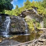
We will hike south to Inglis Falls. After a snack break, we’ll return north and take the rocky side trail to explore Jones Falls. This hike includes crossing busy Hwy 6, the up and down rocky trail through Springmount Forest with some views of Georgian Bay, the less rocky West Rocks, and about 2 km of road before the woods near Inglis Falls.Our pace will be Brisk through the open areas but Moderate through the many rocky and hill climbing sections.
Please bring enough water (at least 2 litres) and food to maintain your energy for a 6-hour hike.
Comfortable hiking shoes or boots are a must. A rain shell is recommended in case of a wet weather forecast, along with a hat, sunscreen, and bug repellent for sunny weather or buggy trail conditions.