
The BTC office will be closed on Mon. Oct. 12 for the holiday. Thank you for your understanding.
Hike Schedule
Join us for a hike! Registration required.
All hikes available to BTC members. Some hikes are open to non-members.
See Refund Policy for Paid Hikes >
TIP: The calendar view displays up to 7 hikes on a day, but often there are more. Click “View more events” to see them all.
Niagara
Iroquoia
Toronto
Caledon Hills
Dufferin Hi-Land
Blue Mountains
Beaver Valley
Sydenham
Peninsula
All Clubs
Show Filters
Categories
Reset Filters
- 01November 1, 2026
Caledon Hills E2E In 4 Hike #4
https://hikes.brucetrail.org/event/caledon-hills-e2e-in-4-hike-4-2/
Registration Required:
Click here to register for this hike (1 spots remaining)Hosting Club: Caledon Hills
Category: End-to-End
Location (Google Maps): Roadside Parking – southwest of km 48.4 at Boston Mills Rd. just west of the Mississauga Rd. intersection.Hike Leader(s): Dan Patterson Click here to contact Hike Leader(s)
Pace: Medium – 3 to 4 km/hour
Terrain: Strenuous – hilly with steep climbs and some poor footing
Distance: 15.9 kmDescription
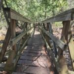
Welcome to Caledon Hills In 4 Fall Edition Hike #4. Meet at Boston Mills Road where the Bruce Trail meets the road the road at 8:15 a.m. We will shuttle to Willoughby Rd. Parking at Escarpment Side Road to start the hike. This is an End-to-End series to complete the Caledon Hills section of the Bruce Trail in 4 hikes. We will be hiking from the north end to the south end. Join for as many hikes as desired – you will need to register for each hike in the series which will take place on the following dates: Sept. 20, 27, Oct. 18 & 25. Since this is a group hike, please consider your fitness level before registering. We will be walking at a pace of 3 km – 4 km per hour and hikers will need to keep up with the person in front of them for the duration of the hike. The hike series will also involve car shuttles and every hiker is expected to participate as drivers. Weather conditions can be variable, dressing in layers is recommended. Hiking boots are required and hiking poles are strongly recommended. Bring plenty of fluids, electrolytes. lunch and snacks. This section is challenging with many hills. - 01November 1, 2026
Car Hike: Niagara E2E- 1 of 4
https://hikes.brucetrail.org/event/car-hike-niagara-e2e-1-of-4/Hike open to BTC Members only.
Registration Required:
Click here to register for this hike (3 spots remaining)Hosting Club: Toronto
Category: Car Hike
Location (Google Maps): We will meet at the Grimsby pool, coordinates N 43.193201,W 79.565301 Elm street. Map # 5Hike Leader(s): Smadar Junkin Click here to contact Hike Leader(s)
Pace: Brisk (4-5 km/hr)
Terrain: Hilly, Level 3 (Advanced – steep hills and some scrambling over boulders), Variable
Distance (km): 15.5 kmDescription
Welcome to Niagara E2E in 4. We will shuttle to the Margaret Reed side trail and after the short walk on the side trail we will hike back to the Grimsby pool. About 15.5 kms and 2 short side trails.
make sure to dress in layers, bring 2 litres of water, lunch, snack.
everyone is expected to participate in the car shuttle one or twice during the 4 days hike.
please be 15 minutes early so we can be in the shuttle cars and move by 8:30.if you have any questions please email me on my personal email smadarjunkin@hotmail.com
- 01November 1, 2026
Dufferin Hi-Land End-to-End 3/4 — 1st Line East to Prince of Wales Road
https://hikes.brucetrail.org/event/dufferin-hi-land-end-to-end-3-4-1st-line-east-to-prince-of-wales-road/
Registration Required:
Click here to register for this hike (1 spots remaining)Hosting Club: Toronto
Category: Car Hike
Location (Google Maps): Roadside parking near the intersection of Prince of Wales Rd W & 20 Sideroad. Please arrive by 8:30 a.m. We will organize vehicles and shuttle south to the Bruce Trail parking lot on 1st Line East for an approximately leaving at 8:45.Hike Leader(s): Rob Schieck Click here to contact Hike Leader(s)
Pace: Moderate (3-4 km/hr)
Terrain: Level 3 (Advanced – steep hills and some scrambling over boulders)
Distance (km): 12.5Description
Join us for the third hike in our four-part Dufferin Hi-Land End-to-End.Today’s hike is approximately 12.5 km, making it the shortest of our four days, although the terrain still provides plenty of challenge.
Starting from 1st Line East, we will travel north through the Kilgorie and Pine River area before finishing at Prince of Wales Road near 20 Sideroad.
The landscape changes frequently as we pass through hardwood forest, river valleys and rural countryside. Several climbs and descents, along with rocky and root-covered trail, will require careful footing.
This portion of the Dufferin Hi-Land section has a wonderfully quiet character and illustrates just how quickly the Bruce Trail can change from open countryside to secluded woodland and valley terrain.
This is a point-to-point hike requiring a car shuttle. Please arrive by 8:30 a.m. with your vehicle passenger-ready. We plan to begin the shuttle at approximately 8:45 and start hiking at approximately 9:00. Everyone is expected to participate in the car shuttle once or twice during the 4 days hike.
Hiking boots or sturdy hiking shoes are required. Hiking poles are strongly recommended, particularly if the trail is wet or covered with fallen leaves.
Bring approximately 2 litres of water, lunch and snacks and be prepared for early-November weather.
This is Hike 3 of 4 in our Dufferin Hi-Land End-to-End series. One more hike to go!
- 01November 1, 2026
Urban Dog-Friendly Walks & Hikes In Toronto
https://hikes.brucetrail.org/event/urban-dog-friendly-walks-hikes-in-toronto/This is a Multi-Day Hike
You are signing up for the following dates:
2026-11-01, 2026-11-08, 2026-11-15, 2026-11-22, 2026-11-29
Registration Required:
Click here to register for this hike (8 spots remaining)Hosting Club: Toronto
Category: Car Hike
Location (Google Maps): In Toronto Parks & Ravines. The location will be shared with registered hikers or contact the Hike Leader to InquireHike Leader(s): Lindita Kalo Click here to contact Hike Leader(s)
Pace: Moderate (3-4 km/hr)
Terrain: Level 2 (Intermediate – some hills and uneven surfaces, rocks and roots underfoot), Variable
Distance (km): 10-15kmDescription
Urban Dog-Friendly Walks & Hikes
Let’s meet and enjoy the outdoors with our best friends, our dogs!
This series of Toronto Urban Walks and hikes will feature a different location every Sunday. Each walk or hike will last approximately 2 to 4 hours and will follow either an out-and-back route or a loop.
Information about each location will be sent to registered participants on a weekly basis.
I have a 3-year-old Australian Shepherd who is friendly with both people and other dogs. I look forward to seeing you and your furry companions on our walks and hikes! Lindita. - 01November 1, 2026
Plalking: Caledon Trailway
https://hikes.brucetrail.org/event/plalking-caledon-trailway-2/
Registration Required:
Click here to register for this hike (8 spots remaining)Hosting Club: Caledon Hills
Category: General
Location (Google Maps): Meet at the Caledon East Community Complex parking lot. We’ll meet at the west end of the parking lot, close to the library branch within the complex. There are washrooms inside if needed before or after the event. Please aim to arrive around 9:50 am, so we can start plalking as close to 10:00 am as possible. Thanks!Hike Leader(s): Elizabeth Ganong Click here to contact Hike Leader(s)
Pace: Leisurely – 3 km/hour or less
Terrain: Easy – mostly flat and usually good footing
Distance: 3 to 4 kmDescription
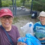
CHBTC and ecoCaledon invite you to come plalking! We’ll walk, chat, and pick up litter as we do a there-and-back route west along the Caledon Trailway. Gloves, bags, and grabbers are provided for participants’ use. A hat, long sleeves and pants, and insect repellent are recommended. An optional stop at a local eatery will follow. Registrants can expect a reminder/update message one or two days before the event. This is a BTC Passport to Nature event. - 01November 1, 2026
Urban Walk: Claireville Conservation Area, Brampton
https://hikes.brucetrail.org/event/urban-walk-claireville-conservation-area-brampton/
Registration Required:
Click here to register for this hike (24 spots remaining)Hosting Club: Toronto
Category: Urban Walk
Location (Google Maps): 3805 Queen Street East, Brampton. Toronto Transit Users – from Finch Subway Station take bus 939B at 9:05 am to Finch West Subway. Change to northbound train to Vaughan Metropolitan Centre Station. At 9:43 take Brampton 501 Zum Queen Westbound to McVean Station stop. Going direct, from HWY 427 take HWY 7 westbound to McVean & Queen (HWY 7) Turn left onto Claireville Conservation Road and right into Parking lot.Hike Leader(s): Andrew Proczek Click here to contact Hike Leader(s)
Pace: Moderate (3-4 km/hr)
Terrain: Level 1 (Easy – mostly on flat, well maintained trails with hard-packed surface), Level 2 (Intermediate – some hills and uneven surfaces, rocks and roots underfoot), Variable
Distance (km): 11.5 kmDescription
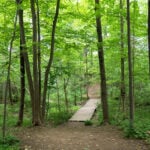
Join me for a scenic loop along Claireville Conservation Area trails for end of Fall colors hike.Claireville Conservation Area is 540 hectares of natural and forested area that straddles Peel Region and Toronto. The natural landscape of CCA boasts wetlands, valleys, forests, grasslands, and the west branch of the Humber River and its tributaries.
We will stop for lunch at the Nature Centre. Packed gravel and dirt trails on rolling terrain. No pubic washrooms.
- 01November 1, 2026
Rainbow Hike
https://hikes.brucetrail.org/event/rainbow-hike-3/
Registration Required:
Click here to register for this hike (25 spots remaining)Hosting Club: Sydenham, Peninsula
Category: Rainbow Hike
Location (Google Maps): Meet in the Owen Sound Transportation lot located on Hwy 6 just 300 m north of the Springmount traffic lights.Hike Leader(s): Laurie Linseman Click here to contact Hike Leader(s)
Pace: Leisurely: 3 km/h or less, Medium: 3 to 4 km/h
Terrain: Moderate: Some hills and/or poor footing, There might be icy and slippery sections., There might be muddy sections.
Distance: 2.3 or 4.8 kmDescription
What better way to kick off November than gathering for a hike under the rainbow! Kim Snel, RMT, will lead us in a short warm-up prior to our hike. Re-energized and relaxed, we’ll explore the unique features of nature in the Pottawatomi Conservation Area along the Merle Gunby side trail.Afterward, we’ll return to our start point to socialize and enjoy a warm beverage. Bring a blanket, a snack, and a reusable mug – creature comforts – to create that warm feeling.
Participants are welcome to continue socializing, or for those who wish, we’ll resume the hike along the main trail and the Memorial Forest Side Trail leading us to a wonderful view at the base of Jones Falls.
Bring water for the hike. Wear sturdy footwear/hiking boots. Poles, particularly for the extended hike, may be helpful.
This inclusive, family-friendly 2SLGBTQIA+ hike offers a safe and supportive space for trans, gay, lesbian, bisexual, queer, 2Spirit, intersex, asexual people, as well as allies and friends.
The Bruce Trail Conservancy Pride Badge which represents a celebration of 2SLGBTQIA+ inclusion will be available to participants.
- 02November 2, 2026
Car Hike: Niagara E2E, 2 of 4
https://hikes.brucetrail.org/event/car-hike-niagara-e2e-2-of-4/Hike open to BTC Members only.
Registration Required:
Click here to register for this hike (8 spots remaining)Hosting Club: Toronto
Category: Car Hike
Location (Google Maps): Roland Rd. South of km 42.3 coordinates N 43.090278,W 79.305073 map # 3Hike Leader(s): Smadar Junkin Click here to contact Hike Leader(s)
Pace: Brisk (4-5 km/hr)
Terrain: Hilly, Level 3 (Advanced – steep hills and some scrambling over boulders), Variable
Distance (km): 24.5 kms.Description
This hike is much longer then the first one, please be prepared for a longer hike with water, food and layering.
see all the details on hike #1. - 02November 2, 2026
Dufferin Hi-Land Blues #4
https://hikes.brucetrail.org/event/dufferin-highland-blues-4/
Registration Required:
Click here to register for this hike (1 spots remaining)Hosting Club: Iroquoia, Dufferin Hi-Land
Category: General Hike
Location (Google Maps): Bruce Trail parking: 2nd Line EHS at the beginning of the Splitrock Side TrailHike Leader(s): Pati Greenwood, Jeff Dowsett Click here to contact Hike Leader(s)
Pace: Medium – 3 to 4 km/hr
Terrain: Moderate – Some hills and/or some poor footing, Strenuous – Hilly with steep climbs and some poor footing
Distance: 14 KMDescription
This is a series of five hikes in the Dufferin Hi-Land section of the Bruce Trail to complete all blue-blazed trails in the section. Hikers finishing all hikes in the series will be eligible to obtain the Dufferin Hi-Land Club’s Side Trails Badge. All hikes in the series will be loops including sections of the main trail and the entirety of several side trails.This fourth hike of the series will include completing the following side trails: Splitrock, Ralph Tremills, Narrows, 2nd Line EHS, Walter Tovell (north of Carriage), Lookout, & McCarsten’s Lake.
The trail will include steep and rocky sections, please wear appropriate footwear for the terrain; hiking boots or shoes. Hiking poles are recommended. Insects are not as active at this time of year; even so, come prepared by wearing long pants and long sleeves; bring insect repellent/bug nets as needed. Weather conditions can also be changeable so dress in layers, as needed. Bring plenty to drink and a snack/lunch.
Please arrive at the meeting place by 8:15 am for an 8:30 am departure.
- 02November 2, 2026
Bent Rim 2 Loop
https://hikes.brucetrail.org/event/bent-rim-2-loop/
Registration Required:
Click here to register for this hike (10 spots remaining)Hosting Club: Iroquoia
Category: General Hike
Location (Google Maps): Meet in the small parking lot at 10050 6th Line.Hike Leader(s): Karen Bergmann Click here to contact Hike Leader(s)
Pace: Medium – 3 to 4 km/hr
Terrain: Moderate – Some hills and/or some poor footing
Distance: 9 kmsDescription
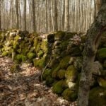
We will hike the Bent Rim 2 bike trail and back through the Halton Forest. Meet at 9:15 (earlier if possible) in the small parking lot at 10050 6th Line, about 3 kms north of Campbellville Rd.