Hike Schedule
Join us for a hike! Registration required.
All hikes available to BTC members. Some hikes are open to non-members.
See Refund Policy for Paid Hikes >
TIP: The calendar view displays up to 7 hikes on a day, but often there are more. Click “View more events” to see them all.
Categories
- 18January 18, 2026
Frosty Five Weekend - Hike Two
https://hikes.brucetrail.org/event/frosty-five-weekend-hike-two/Sorry, the registration cut-off time for this hike has been reached.Not a member? Click here to join today!Hosting Club: Caledon Hills
Category: General
Location (Google Maps): Meet at the BTC parking lot on the east side of 5th Line EHS, just south of Hockley Road. 43.993572, -80.014057.Directions: From ON-10 turn east onto Hockley Rd./Dufferin County Rd. 7. Drive for 9.4 kilometres. Turn south/right onto 5th Line E. Drive for 100 metres.
Hike Leader(s): Sandy Green Click here to contact Hike Leader(s)
Pace: Medium – 3 to 4 km/hour
Terrain: Strenuous – hilly with steep climbs and some poor footing
Distance: 9.5 kmDescription
Beat the winter blues! Register individually for one, a few, or all of the Frosty Five Blues hikes. Participants who complete all five hikes are eligible to receive a CHBTC Winter badge and a Sideways badge on the final hike. Hike Two explores parts of the main Trail and Hemlock Ridge, Griffith Ravine and Glacier Valley Side Trails in the Hockley Valley south area. Bring your choice of hydration and snacks. Hiking boots and icers/crampons are required. See Sundays 25, February 1 and 8 for details about the other hikes in the series. (Note: If you wish to purchase badges, the cost of each badge is $10.00 for BTC members and $15.00 for non-members.) Everyone is welcome to join!
Halton Regional Forest
https://hikes.brucetrail.org/event/halton-regional-forest-3/Sorry, the registration cut-off time for this hike has been reached.Not a member? Click here to join today!Hosting Club: Iroquoia
Category: General Hike
Location (Google Maps): Side road parking lot at Fourth Line Nassagaweya & Ten Side Rd, Milton, ONHike Leader(s): IgorT Click here to contact Hike Leader(s)
Pace: Medium – 3 to 4 km/hr
Terrain: Moderate – Some hills and/or some poor footing
Distance: 10kmDescription
We will hike thru the forest and stop by waterfalls.Meet at 8:15am to start hike at 8:30am.
Please pack whatever food you will require for a hike including snacks; 1l of water minimum; first aid kit; poles if you use them; and icers; I.D. and your health card. You may also wish to pack extra socks and rain gear. Remember to dress in layers. Gloves/mitts, scarf / neck gator, a toque and a puffy jacket.
Please leave dogs at home.
We will break for a 15 min break.
Bio-breaks are as you need them – please let the sweep know who will wait for you.
We will help each other and wait for one another but please consider your physical ability before signing up for this hike. There are no drop outs.
Please note, the hike might be canceled due to extreme weather, if so you will get email notification.
Any questions may be directed through contact on this form.
If you cannot make it, please remove yourself from registration by following these steps:To cancel your registration, here is a step by step:
– Sign into your account on the BTC website
– Click on My Hikes under your account
– This will take you to a list of hikes you have registered for
– Scroll down to the appropriate hike and cursor over to the far right hand column under the Action column.
– Click Cancel under the hike you wish to cancel
Hockleycrest
https://hikes.brucetrail.org/event/hockleycrest/Sorry, the registration cut-off time for this hike has been reached.Not a member? Click here to join today!Hosting Club: Iroquoia
Category: General Hike
Location (Google Maps): Meet at 9:15 am in the Bruce Trail parking lot on 5 Side Road, off Airport Rd.Hike Leader(s): Karen Bergmann Click here to contact Hike Leader(s)
Pace: Medium – 3 to 4 km/hr
Terrain: Moderate – Some hills and/or some poor footing
Distance: About 7 kmsDescription
Meeting at 9:15 to start hiking at 9:30, we will hike around the main and side trails. There are a few hills but not a lot of rocks. Bring icers for your boots.Hike is dependent on weather.
Car Hike: Hike #2 of 5 to earn the Toronto Side Trails Badge!
https://hikes.brucetrail.org/event/car-hike-hike-2-of-5-to-earn-the-toronto-side-trails-badge/Sorry, the registration cut-off time for this hike has been reached.Not a member? Click here to join today!Hosting Club: Toronto
Category: Car Hike
Location (Google Maps): We will meet at the Trafalgar & 401 Commuter Lot (43.571569, -79.831797) and then carpool to the start of each hike.Hike Leader(s): Monica Pasquali Click here to contact Hike Leader(s)
Pace: Leisurely (2-3 km/hr), Moderate (3-4 km/hr)
Terrain: Level 2 (Intermediate – some hills and uneven surfaces, rocks and roots underfoot)
Distance (km): 9.14 kmDescription
This is the second in a series of five hikes that will be offered approximately one Sunday per month so that participants can earn the Toronto Side Trails Badge during the winter and early spring. Each out-and-back hike will cover a distance of 8-11 km and be hiked at a leisurely to moderate pace (approximately 3 km/h). Please note that the hikes will be posted separately on the BTC calendar – you will have to register for each hike that you’re interested in joining.For this second hike we will explore three side trails in the Toronto section of the Bruce Trail: Eighth Line Side Trail, Great Esker Side Trail, and part of the Trafalgar Side Trail.
Please dress appropriately for a winter hike by dressing in layers (wear an inner layer that wicks sweat away from your skin, a middle layer that keeps you warm, and an outer layer that protects you from wind and snow), wearing gloves/mittens and a toque, and wearing warm and comfortable footwear that has good traction in snow/ice (icers placed over your boots work great!). Hiking poles or walking sticks are an asset since they will help keep you balanced if the ground is slippery. As well, make sure you bring enough water and food for a 3-4 hour hike since we’ll be covering a total distance of 9.14 km over terrain that has some hills and exposed rocks.
Since parking might be limited at the places we’ll be hiking in this hike series, we will meet at the Trafalgar & 401 Commuter Lot (43.571569, -79.831797) and then carpool to the start of each hike. Please be prepared to participate in each carpool by ensuring you have space in your car if you are not already carpooling with others to the Commuter Lot meeting point.
After the hike, interested participants can join me at the Tim Horton’s on Trafalgar Road just a bit south of Highway 401 for some post-hike refreshment.
Looking forward to exploring some of Toronto’s side trails with you!
Urban Walk: Downtown Toronto PATH
https://hikes.brucetrail.org/event/urban-walk-downtown-toronto-path-2/Sorry, the registration cut-off time for this hike has been reached.Not a member? Click here to join today!Hosting Club: Toronto
Category: Urban Walk
Location (Google Maps):Meet in the Great Hall of Union Station by the information desk with the clock over it.
Hike Leader(s): Tom Swales Click here to contact Hike Leader(s)
Pace: Leisurely (2-3 km/hr)
Terrain: Flat, Level 1 (Easy – mostly on flat, well maintained trails with hard-packed surface)
Distance (km): 6 kmDescription
Join us to explore underground Toronto through the PATH network discovering art, museums, and other hidden secrets of the PATH.
Walk In Nature Series (WINS) - Rocklyn Creek Management Area near Walter's Falls
https://hikes.brucetrail.org/event/walk-in-nature-series-wins-rocklyn-creek-management-area-near-walters-falls/Sorry, the registration cut-off time for this hike has been reached.Not a member? Click here to join today!Hosting Club: Sydenham
Category: Snowshoe Hike
Location (Google Maps): Roadside parking on the St. Vincent-Sydenham Townline, near Walter’s Falls. Click on the P at this location on the Bruce Trail app. This meet location is found near km 7.0 on Map 29 of Edition 31 of the Bruce Trail Reference.
If you don’t have the Bruce Trail app, you can use Google Maps on your device to direct you to the meet location’s GPS coordinates by clicking the link “(Google Maps)” which is found right after the title Location in this description. Alternatively, copy the coordinates from here: 44.506378, -80.705344.Hike Leader(s): Stewart Brown Click here to contact Hike Leader(s)
Pace: Medium: 3 to 4 km/h
Terrain: Moderate: Some hills and/or poor footing
Distance: 4.3 kmDescription
The Walk In Nature Series (WINS) consists of 2 hour hikes in the Sydenham section of the Bruce Trail that combine nature appreciation with fitness in a safe and welcoming group environment led by an experienced hike leader. Consider these hikes to be appointments with yourself in nature that promote health and fitness.On this snowshoe hike, explore the understated, remote beauty of the Rocklyn Creek Management Area. After meeting at parking, we will shuttle to Deviation Road to the hike start and snowshoe to our vehicles. The good news is that we will follow the Rocklyn Creek, downstream!
Arrive 15 min early, dress in layers with good footwear. Bring your snowshoes for sure and hiking poles may be helpful. Bring water and a snack. See you there!
- 19January 19, 2026
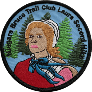
Laura Secord Hike in 2, #2
https://hikes.brucetrail.org/event/laura-secord-hike-in-2-2/Sorry, the registration cut-off time for this hike has been reached.Not a member? Click here to join today!Hosting Club: Niagara
Category: Car Pool
Location (Google Maps): Meet at DeCew House, 2370 DeCew Rd, FonthillHike Leader(s): Margaret Northfield Click here to contact Hike Leader(s)
Pace: Medium
Terrain: Moderate
Distance: 15 kmDescription
Earn the Laura Secord badge by completing two hikes. Bring water and snack. Poles, icers and gaiters recommended. Wear weather appropriate layers.Badge can be purchased at the end of this hike. $10 for members, $15 for non-members.
- 20January 20, 2026
Urban Walk: Valley View Park Thornhill
https://hikes.brucetrail.org/event/urban-walk-valley-view-park-thornhill-135/Sorry, the registration cut-off time for this hike has been reached.Not a member? Click here to join today!Hosting Club: Toronto
Location (Google Maps): Parking lot is off Sycamore Drive, East of Bayview , across Starbucks plaza
Bus 91 from Finch Regional Bus Terminal stops at Sycamore Drive.Hike Leader(s): Mohammad Aghamiri Click here to contact Hike Leader(s)
Pace: Moderate (3-4 km/hr)
Terrain: Hilly, Level 2 (Intermediate – some hills and uneven surfaces, rocks and roots underfoot), Variable
Distance (km): 6-7 kmDescription
We will explore Valleyview and Maple View parks, and walk along German Mill Creak, in return we stop in Huntington park and have snack under beautiful shed.Although this is considered an “Urban Walk”, you can expect some hills up and down and uneven surfaces with tree roots. Please bring hiking poles, Ice cleats water and snacks.
phone number for the day of hike 289 588 6482
9:00 Long Hike Wiley Road Short Hills NEW TIME
https://hikes.brucetrail.org/event/900-long-hike-wiley-road-short-hills-new-time-14/Sorry, the registration cut-off time for this hike has been reached.Not a member? Click here to join today!Hosting Club: Niagara
Category: Loop
Location (Google Maps):Short Hills Wiley Road Entrance
Hike Leader(s): Lynskie Click here to contact Hike Leader(s)
Pace: Brisk
Terrain: Moderate, Strenuous
Distance: 10kmDescription
Explore Short Hills and the majestic side trails of Scarlett Tanager, Hemlock. Swayze Falls and Terrace. Register for each hikeBring Poles, snack, and dress for the weather
9:15 Short Hike - Short Hills Park, Pelham Rd
https://hikes.brucetrail.org/event/915-short-hike-short-hills-park-pelham-rd-37/Sorry, the registration cut-off time for this hike has been reached.Not a member? Click here to join today!Hosting Club: Niagara
Category: Loop
Location (Google Maps): Short Hills Provincial Park, Pelham Rd lotHike Leader(s): Debbie Demizio Click here to contact Hike Leader(s)
Pace: Medium
Terrain: Moderate
Distance: ~ 6kmsDescription
Hike the main and side trails of Short Hills Provincial Park. Please note that there are some steep hills and rocky sections, so you should have some hiking experience before joining this hike. Please bring water, hiking poles and icers, as the trails can be icy at times.Terra Cotta
https://hikes.brucetrail.org/event/terra-cotta-4/Sorry, the registration cut-off time for this hike has been reached.Not a member? Click here to join today!Hosting Club: Caledon Hills
Category: Tuesday Hikers
Location (Google Maps): Meet at Winston Churchill Blvd. intersection with Caledon Trailway.
Driving direction: North on Highway 410, continue north on Highway 10, left on King Street, right on Winston Churchill Blvd.; drive 1 kilometre to roadside parking at Caledon Trailway crossing.Hike Leader(s): Mohammad Shafiq Click here to contact Hike Leader(s)
Pace: Medium – 3 to 4 km/hour
Terrain: Moderate – some hills and/or some poor footing
Distance: 8 kmDescription
(This is rescheduled hike from previous Tuesday hike that was canceled due to weather conditions).
Will hike Terra Cotta Side Trail, main Bruce Trail and parts of Terra Cotta Conservation Area trails.
Bring water, snack, poles, dress according to weather in layers.
Arrive 10 minutes early to complete preliminaries and car parking, carpool if possible as there are limited spots.
Hike Leaders phone contact for the day of hike: 416-566-0503.Scottsdale Farm/Duff Pit side Trail
https://hikes.brucetrail.org/event/scottsdale-farm-duff-pit-side-trail/Sorry, the registration cut-off time for this hike has been reached.Not a member? Click here to join today!Hosting Club: Dufferin Hi-Land
Category: Tuesday Hike
Location (Google Maps): Scottsdale Farm Bruce Trail Parking Lot
Toronto Section, Map 13, Km 29.8Hike Leader(s): Julie Daley, Les Babbage, Tony Evangelista, Inge Eckerich Click here to contact Hike Leader(s)
Pace: Leisurely
Terrain: Moderate, Slippery Sections Likely
Distance: Long Hike 8 km, Short hike: 4.6 kmDescription
From the Scottsdale Farm parking lot, we will hike southwest along the mail trail, cross Hwy 7, and enter the Duff Pit Side Trail to the Reservoir Side Trail Loop. We will return along the same trail. The shorter hike will turn around at Hwy 7. Bring snack. Poles and icers recommended, snowshoes may be needed.Car Pool Option: Meet at Party City in Orangeville at 8:45
- 21January 21, 2026

8:30 Niagara Winter End to End #3 Glen Road to Roland Road
https://hikes.brucetrail.org/event/830-niagara-winter-end-to-end-3-glen-road-to-roland-road-3/Sorry, the registration cut-off time for this hike has been reached.Not a member? Click here to join today!Hosting Club: Niagara
Category: Car Pool
Location (Google Maps): Short Hills Parking Lot at Roland Road. Car Pool to Glen RoadHike Leader(s): Sam Rutherford Click here to contact Hike Leader(s)
Pace: Medium
Terrain: Moderate
Distance: 13 kmsDescription
We will be car pooling, Bring Icers and poles. No dogs. To earn your Niagara Winter End to End badge, it must be completed between December 21, 2025 to March 21, 2026.
Because of the potential for bad winter trail conditions we have broken this e2e into 6 hikes rather than 5
Halton Agreement Forest
https://hikes.brucetrail.org/event/halton-agreement-forest-13/Sorry, the registration cut-off time for this hike has been reached.Not a member? Click here to join today!Hosting Club: Iroquoia
Category: General Hike
Location (Google Maps): Meet at the corner of 10 Side Road and 4th Line at 9:15 am.Hike Leader(s): Karen Bergmann Click here to contact Hike Leader(s)
Pace: Medium – 3 to 4 km/hr
Terrain: Moderate – Some hills and/or some poor footing
Distance: 8 kmsDescription
We will meet at 9:15 am at the corner of 10 SR and 4th Line, just north of Campbellville, off Guelph Line and hike the bike trails around a big loop.Bring icers for your boots. Hike is dependent on weather conditions.
Humpday Hikers
https://hikes.brucetrail.org/event/humpday-hikers/Sorry, the registration cut-off time for this hike has been reached.Not a member? Click here to join today!Hike open to BTC Members only.
Hosting Club: Caledon Hills
Category: General
Location (Google Maps): Hockley Road Parking Lot located on the north side of Hockley Road at the Hockley Road Side Trail.Hike Leader(s): Mel Thornley; Jennie Greenfield Click here to contact Hike Leader(s)
Pace: Medium – 3 to 4 km/hour
Terrain: Strenuous – hilly with steep climbs and some poor footing
Distance: 10 – 11 kmDescription
This is the third hike in some new bi-monthly hikes – the Humpday Hikers. The hikes will be from 8 – 11 km in length with a short snack break. Option to join the group post hike at a local spot for refreshments and some comraderie.This is a loop hike in the Hockley Valley south area. This hike has some big hills and can be strenuous. The plan is to hike the Tom East Side Trail, Isabel East Side Trail and Glen Cross Side Trail, starting at Hockley Road Side Trail. We may shorten if needed due to conditions.
Bring your choice of hydration and snack. Hiking boots, poles and carry your icers/crampons as there is snow this time of year.
If you can plan to come for a warm drink and treat, we’re meeting at Hockley General Store after the hike.
Participants will be notified the night before if a hike must be cancelled due to inclement weather.

Snowshoe on the Huron shore at MacGregor Point Provincial Park
https://hikes.brucetrail.org/event/snowshoe-on-the-huron-shore-at-macgregor-point-provincial-park/Sorry, the registration cut-off time for this hike has been reached.Not a member? Click here to join today!Hosting Club: Sydenham
Category: Snowshoe Hike
Location (Google Maps): Visitor Center in MacGregor Point Provincial Park, 1593 Bruce Road 33, south of Port Elgin. Day use fee appliesHike Leader(s): Danuta Valleau Click here to contact Hike Leader(s)
Pace: Leisurely: 3 km/h or less
Terrain: Easy: Mostly flat and good footing.
Distance: approx 4 kmDescription
This is an annual guided hike along the lakeshore and through the woods. We hope for enough snow to snow shoe but come prepared for anything. Poles are a good idea. A day fee per car is payable at the Park Office where maps of the Park are available. We will leave from the Visitors Centre. Dress for the weather and bring water, snacks, and a lunch if you would like to join us around a fire after the hike. There are usually groomed ski trails and if cold enough, ice skating on a loop through the woods.Winter Wednesday Walkers - McCluskey's Rock
https://hikes.brucetrail.org/event/winter-wednesday-walkers-mccluskeys-rock-3/Sorry, the registration cut-off time for this hike has been reached.Not a member? Click here to join today!Hosting Club: Beaver Valley
Location (Google Maps): Meet on the shoulder of Sideroad 7B on the curve where the trail enters the forest, km 43.5, Map 25, Edition 31. Do not attempt to drive up 7B from Grey Road 13, there is no winter maintenance. Instead access 7B from south of Kimberley – Grey Road 13 to Artemesia-Euphrasia Townline to 3rd Line A, then 7B.
Hike Leader(s): Glenda Collings Click here to contact the hike leader.
Pace: Medium
Terrain: Some rocky footing, Some steep sections
Length of Hike: approx. 4 kmDescription
Margaret Yaraskavitch will be leading this hike. We will hike north along the top of the escarpment on the main trail to McCluskey’s Rock and then back, taking in the Ken Young Side Trail. Views to be had. On winter hikes we may encounter bare ground, light snow, deep snow, or ice. Please bring snowshoes and icers to our Winter Wednesday Walkers outings. Wear appropriate clothing for the weather plus water and a snack.COVID-19 Precautions Before, During and After your Hike
- Each hiker joining a Bruce Trail Club organized hike must perform a self-screening check before hiking.
Find Ontario’s self-assessment tool here: https://covid-19.ontario.ca/self-assessment/ - If you are experiencing COVID-19 symptoms, stay home.
Other Guidelines
- Arrive 15 minutes before the start of the hike.
- Wear sturdy footwear and appropriate attire for the weather and the terrain.
Hiking poles are a good idea in any season, especially if the terrain is rocky or slippery. In winter, snowshoes or icers/crampons are needed when conditions dictate.
Wearing appropriate clothing and footwear prevents injuries and shows consideration for a safe and positive group hiking experience. - Always carry I.D. and your health card.
- Bring sufficient water and snacks (or lunch if indicated). A minimum of 1L of water is recommended on all hikes, and 3L is recommended for long, challenging hikes in the heat of the summer.
- Bring sunscreen and insect repellent (for spring and summer hikes).
- Bring your own first aid kit.
- Please leave dogs at home.
- Each hiker joining a Bruce Trail Club organized hike must perform a self-screening check before hiking.
- 22January 22, 2026

Frosty Five Weekday - Hike Three
https://hikes.brucetrail.org/event/frosty-five-weekday-hike-three/Sorry, the registration cut-off time for this hike has been reached.Not a member? Click here to join today!Hosting Club: Caledon Hills
Category: General
Location (Google Maps): Meet at roadside parking on Coolihans Sideroad, east of where the Trail crosses the road. 43.937967, -79.934650.Directions: From ON-10 head east for 8.0 km. Turn left onto Airport Rd./Peel Regional Rd. 7 and drive for 2.0 km. Turn right onto Coolihans Side Rd. Parking is in 1.5 km.
Hike Leader(s): Sandy Green Click here to contact Hike Leader(s)
Pace: Medium – 3 to 4 km/hour
Terrain: Strenuous – hilly with steep climbs and some poor footing
Distance: 12 kmDescription
Beat the winter blues! Register individually for one, a few, or all of the Frosty Five Blues hikes. Participants who complete all five hikes are eligible to receive a CHBTC Winter badge and a Sideways badge on the final hike. Hike Three explores main Trail and the Glen Haffy Side Trail. Bring your choice of hydration and snacks. Hiking boots and icers/crampons are required. See Thursday, January 29, & February 5 for details about the other hikes in the series. (Note: If you wish to purchase badges, the cost of each badge is $10.00 for BTC members and $15.00 for non-members.) Everyone is welcome to join!
Makeup Hike - Laura Secord #2 of 2
https://hikes.brucetrail.org/event/makeup-hike-laura-secord-2-of-2/Sorry, the registration cut-off time for this hike has been reached.Not a member? Click here to join today!Hosting Club: Niagara
Category: Car Pool
Location (Google Maps): Meet at DeCew House, 2370 DeCew Rd, ThoroldHike Leader(s): Margaret Northfield Click here to contact Hike Leader(s)
Pace: Medium
Terrain: Moderate
Distance: 15kmDescription
Due to inclement weather, this hike never took place on Monday Jan 19. The makeup hike is set for Thursday, January 22, 2026.Park at DeCew House and carpool to Woodend Conservation area. Bring water and snack. Poles, gaiters and icers recommended.
Hikers who have completed both hikes may purchase the Laura Secord badge at the end of the hike.
9:00 am Long hike NEW LOCATION!!! Sho' aríshon Park, in Jordan Hollow, across from Boo's
https://hikes.brucetrail.org/event/900-am-long-hike-new-location-bailey-bridge-jordan-11/Sorry, the registration cut-off time for this hike has been reached.Not a member? Click here to join today!Hosting Club: Niagara
Category: In and Out
Location (Google Maps): Shoʻ aríshon Park, Jordan HollowHike Leader(s): Alan Laver Click here to contact Hike Leader(s)
Pace: Brisk
Terrain: Strenuous
Distance: 10kDescription
- Hi hub This will be our permanent location . Hike up from the Bailey bridge to Balls Falls and explore the trails
You must register for each hike. Bring Poles, snack and a drink. Dress for the weather
Hiking around Jordan
https://hikes.brucetrail.org/event/hiking-around-jordan-43/Sorry, the registration cut-off time for this hike has been reached.Not a member? Click here to join today!Hosting Club: Niagara
Location (Google Maps): Glen Road Parking Lot
3640 Glen Road, Jordan LOR 1SOHike Leader(s): Bill Russell Click here to contact Hike Leader(s)
Pace: Medium
Terrain: Moderate
Distance: 7 kmDescription
Hiking in and around Jordan including Jim Rainforth Trail, Bailey Bridge and Balls Falls (alternating every 3 weeks).Bestview park Toronto
https://hikes.brucetrail.org/event/urban-walk-valley-view-park-thornhill-136/Sorry, the registration cut-off time for this hike has been reached.Not a member? Click here to join today!Hosting Club: Toronto
Location (Google Maps): Parking lot in front of Tim Hortons 1515 Steeles Ave. East
Hike Leader(s): Mohammad Aghamiri Click here to contact Hike Leader(s)
Pace: Moderate (3-4 km/hr)
Terrain: Hilly, Level 2 (Intermediate – some hills and uneven surfaces, rocks and roots underfoot), Variable
Distance (km): 6-7 kmDescription
Although this is considered an “Urban Walk”, you can expect some hills up and down and uneven surfaces with tree roots. Please bring hiking poles, Ice cleats water and snacks.phone number for the day of hike 289 588 6482
- 23January 23, 2026
City View Park Loop
https://hikes.brucetrail.org/event/city-view-park-loop/Sorry, the registration cut-off time for this hike has been reached.Not a member? Click here to join today!Hosting Club: Iroquoia
Category: General Hike
Location (Google Maps): City View Park Parking Lot – near City View Park Side TrailHike Leader(s): Pati Greenwood, Jeff Dowsett Click here to contact Hike Leader(s)
Pace: Medium – 3 to 4 km/hr
Terrain: Dependent on Conditions, Moderate – Some hills and/or some poor footing, Slippery Sections Likely
Distance: 11 kmDescription
This hike will follow the main trail and explore the Eric Best, King, and City View Park Side Trails in an 11 km loop.Bring a snack and plenty of water, and other hydration as needed. Wear clothing appropriate for winter wether conditions, wear hiking boots and bring hiking poles. Icers may also be required.
Please arrive at the meeting place by 8:15 am as we will leave promptly at 8:30 am.
Niagara-on-The-Lake Tour
https://hikes.brucetrail.org/event/niagara-on-the-lake-tour-22/Sorry, the registration cut-off time for this hike has been reached.Not a member? Click here to join today!Hosting Club: Niagara
Category: Urban
Location (Google Maps): Park on King St near Centre St at the entrance to Veteran’s Memorial Park, Niagara-on-the-LakeHike Leader(s): Margaret Northfield Click here to contact Hike Leader(s)
Pace: Medium
Terrain: Easy
Distance: 6kmDescription
Each Friday we will explore some history of Niagara-on-the-Lake while getting a moderate paced walk. Discover where the Niagara River meets Lake Ontario. Experience the Heritage District, woods and the Niagara Parkway.Some weeks may be totally on sidewalks and roads while others may include a mix of trail and paved pathways.
Great way to build up endurance for longer more strenuous hikes.
Plan to stay for conversation and a coffee at Sweets & Swirls, Community Centre, Niagara Stone Rd., NOTL
- 24January 24, 2026
Iroquoia End to End for the Stained Glass Badge - Fundraiser Multi-day Hike Series - Jan 24, 25 31, Feb 1, 7 and 8th, 2026 - Meet time is 7:45am
https://hikes.brucetrail.org/event/35028/Sorry, the registration cut-off time for this hike has been reached.Not a member? Click here to join today!This is a Multi-Day Hike
You are signing up for the following dates:
2026-01-24, 2026-01-25, 2026-01-31, 2026-02-01, 2026-02-07, 2026-02-08Hosting Club: Iroquoia
Category: Stained Glass Badge End to End Fundraiser Hike
Location (Google Maps): Please arrive by 7:45 to ready yourself for the hike and attend any announcements. This hike is limited to 8 participants.Hike Leader(s): Ruth Moffatt Click here to contact Hike Leader(s)
Pace: Brisk – 4 to 5 km/hr, Medium – 3 to 4 km/hr
Terrain: Dependent on Conditions, Moderate – Some hills and/or some poor footing, Slippery and Steep Sections, Strenuous – Hilly with steep climbs and some poor footing
Distance: 14.5km shortest day – 25km longest dayDescription
This is a monetized hike with the proceeds going towards the Iroquoia Bruce Trail Club – “Preserving a ribbon of wilderness for everyone, forever.” Your badge depicting species at risk, either the Jefferson Salamander or the Butternut Tree, the hike logistics, shared shuttle driving and hike guidance are all included in your fee. Since it is the intention to run a similar hike in all sections this year, why not join or renew your membership with the Bruce Trail Conservancy if you are not already a member? Please use my code 67abd1234c568 until the end of 2025 to receive free digital maps as well as all the other great benefits included with membership.Membership details here: https://brucetrail.org/product-category/memberships/
Please read all details for this hike to ensure it is suitable for you. The pace and terrain are particularly important details.
Registered participants will receive a WhatsApp invitation (optional) which can be used for photo share.This is a multi 6 day hike – Jan 24, 25, 31, Feb 1, 7, 8, 2026. Please save February 14 and 15th for potential make up days in case of inclement weather on the first three weekends.
You must be registered to participate in this group hike. You cannot just show up as there are often people on the waitlist.
Day 1 – Jan 24/26 ~ 23km
Meet in the parking lot at Kilbride School at the north end of Panton St. https://maps.app.goo.gl/fgTy9dLa8tA7moT97
Car shuttle to Hilton Falls entrance off of Campbellville Rd (paid parking unless you have a pass-we will take just two vehicles, drivers do not pay)
https://maps.app.goo.gl/dejn4JafcHXYeaaq9
Day 2 – January 25/26 ~ 25km
Meet in the parking lot at Kilbride School at the north end of Panton St. https://maps.app.goo.gl/fgTy9dLa8tA7moT97
Car shuttle to City View Park off of Kerns Rd https://maps.app.goo.gl/NUn9AiCc9wdWfnwG6
Day 3 – January 31 /26 ~ 22.5km
Meet at roadside parking on Davidson Blvd. https://maps.app.goo.gl/B6vQJxntq1f247Us6
Car shuttle to City View Park off of Kerns Rd https://maps.app.goo.gl/NUn9AiCc9wdWfnwG6
Day 4 – Feb 1 /26 ~ 17km
Meet at roadside parking at east end of Hillcrest Ave https://maps.app.goo.gl/dEojFPccyxGMb4DHA
Car shuttle to Davidson Blvd. https://maps.app.goo.gl/B6vQJxntq1f247Us6
Day 5 – Feb 7 / 26 ~ 23.5km
Meet at roadside parking at east end of Hillcrest Ave https://maps.app.goo.gl/dEojFPccyxGMb4DHA
Car shuttle to roadside parking at south end of Jones Rd https://maps.app.goo.gl/zPGoY95m5UdjDCrw8
Day 6 – Feb 8/26 ~ 14.5km
Meet in Grimsby Lions Club Pool Parking lot at 1 Elm St https://maps.app.goo.gl/cfr3dRrcrQhFPGJm9
Car shuttle to roadside parking at south end of Jones Rd https://maps.app.goo.gl/zPGoY95m5UdjDCrw8
Please ensure your car is car shuttle-ready with at least 4 available seatbelts including the driver’s. We will take turns either being the shuttle driver or driving the drivers back to their cars after the hike is over.
Please pack whatever food you will require for a long day hike including lunch and snacks; 2l of water minimum; first aid kit; poles if you use them; and icers. You may also wish to pack extra socks and rain gear. Remember to dress in layers. Gloves/mitts, scarf / neck gator, a toque and a puffy jacket. Consider lined pants as well.
We will break for a morning clothing adjustment, a 10min break around 10am, 15 min lunch and an afternoon break if we are finishing after 2pm. Bio-breaks are as you need them – please let the sweep know who will wait for you. This is a 6 day group hike so it is important you keep pace with the person in front of you. We will help each other and wait for one another but please consider your physical ability before signing up for this hike. There are no drop outs – if you are not able to finish the hike you will need to arrange for transportation back to your car via taxi or Uber at your cost.
One of the Iroquoia stained-glass badges will be presented on the last day. If you have to miss one of these hiking days, you may make it up on your own before the last day of the series. Since it is a group hike, it is intended that everyone who registers be present on all days.
Any questions may be directed through contact on this form.
If you cannot make it, please remove yourself from registration (or have the person who registered you remove your registration) by following these steps:To cancel your registration, here is a step by step:
– Sign into your account on the BTC website
– Click on My Hikes under your account
– This will take you to a list of hikes you have registered for
– Scroll down to the appropriate hike and cursor over to the far right hand column under the Action column.
– Click Cancel under the hike you wish to cancelCANCELLED DUE TO EXTREME COLD: Coach Trip: Skiers Highlands Nordic, Hikers Guided Hike on Bruce Trail or Highlands Nordic
https://hikes.brucetrail.org/event/coach-trip-skiers-highlands-nordic-hikers-guided-hike-on-bruce-trail-or-highlands-nordic/Sorry, the registration cut-off time for this hike has been reached.Not a member? Click here to join today!Trip Information
Departure Time: 08:30
Return to City Time: 18:00
Departure Point: York Mills Bus PickupTrip Activities
X-Country Ski ($.01)
Snowshoe-Trail ($0.01)
Snowshoe-Resort ($.01)
Optional Items
P/U Hwy 400 & Major Mac ($.01)Hosting Club: Toronto
Category: Coach Trips
Location (Google Maps): Highlands Nordic, DuntroonHike Leader(s): Michael Humpage; David Royle; Brenda Menezes; Tim Wainwright; Ted Moriarty Click here to contact Hike Leader(s)
Pace: Moderate (3-4 km/hr)
Terrain: Level 2 (Intermediate – some hills and uneven surfaces, rocks and roots underfoot), Rocky, VariableDescription
Join us for an awesome day of winter fun in Duntroon.Cross-country skiers: Glide through forests and fields on 25 km of trails groomed for classic and skate skiing. Enjoy amazing views (you can see Georgian Bay) and warm up with a hot drink and fresh baked treat in Highlands’ cozy chalet. Classic ($30) and skate ski ($55) rentals available. All cross-country skiing is self-guided. Ski passes are $33 per person.
Winter hikers, Option 1: Join Michael Humpage, David Royle and Brenda Menezes for a fun guided hike on the Bruce Trail with great views and good company. The group will be out all day and eat lunch on the trail. Depending on conditions you may need snowshoes, microspikes, or just boots. Option 2: Join Tim Wainwright and Ted Moriarty for a guided snowshoe hike on Highlands’ trails. Those staying on resort will need to purchase trail passes ($14); snowshoe rentals ($18) are available for those who stay on resort.
Trail fees will be collected in cash on the bus. We will leave the resort at 4 PM.
Departure 1: 8:30 AM, 10 York Mills Rd
Departure 2: 8:50 AM, HWY 400 and Major Mackenzie Dr Park and Ride
Please arrive at the pick-up location 15 minutes before departure. The bus waits for no one.
Policy for running this trip: To run this trip we need 40 registrants 8 days in advance. We may cancel the trip on short notice if there is substantial risk of trail or resort closure due to major weather warnings. If there is enough snow to ski and conditions are marginal or better, we will go. Marginal conditions mean not ideal skiing conditions. For example, wet snow, a thin bumpy base, or some icy patches. If TBTC cancels the trip, we will refund your coach fare. No refund if you cancel.
Bethesda Trail Richmond Hill
https://hikes.brucetrail.org/event/car-hike-east-point-park-bird-sanctuary-scarborough-on-5/Sorry, the registration cut-off time for this hike has been reached.Not a member? Click here to join today!Hosting Club: Toronto
Category: Car Hike
Location (Google Maps): Oak Ridges Corridor, Bethesda Trail Head Parking Lot, Bethesda Side Road, Richmond Hill, OntarioHike Leader(s): Mohammad Aghamiri Click here to contact Hike Leader(s)
Pace: Moderate (3-4 km/hr)
Terrain: Flat, Level 2 (Intermediate – some hills and uneven surfaces, rocks and roots underfoot), Variable
Distance (km): 10-12 kmDescription
Join us to explore the trails of York Regional Forest and the Oak Ridges Corridor at Jefferson Forest and Bond lake,From parking lot we hike thought Jefferson forest and continue to Bond Lake and have snack beside the lake and return to parking around 13 to 13.30
Please bring lots of water and snacks ,hiking poles are recommended
phone number for the day of hike 289 588 6482
Car Hike: Caledon Hills E2E #6 of 6
https://hikes.brucetrail.org/event/car-hike-caledon-hills-btc-e2e-6-of-6/Sorry, the registration cut-off time for this hike has been reached.Not a member? Click here to join today!Hosting Club: Toronto, Caledon Hills
Category: Car Hike
Location (Google Maps):Meet at Mono Community Center parking lot. GPS N44.026195, W80.071516. 200 meters south of Mono Center. Please park at the gravel surface lot.
Hike Leader(s): Ross Estrella Click here to contact Hike Leader(s)
Pace: Brisk (4-5 km/hr)
Terrain: Challenging, Hilly, Level 2 (Intermediate – some hills and uneven surfaces, rocks and roots underfoot), Variable
Distance (km): 10kmDescription
This is an End2End hiking series to cover the Caledon Hills section of the Bruce Trail in 6 hikes. As it is time of year with unsettled weather we will undertake this event at approximately 4 km/hour. Caledon Hills have numerous steep hills and deep valleys so the hikes require consistent stamina. Please consider your hiking fitness level prior to registering as this is a group hike and everyone is expected to keep pace. We will be travelling south to north and will require car shuttling. Please make sure yourself and car shuttle ready, where everyone is expected to participate. Please arrive fifteen minutes early for shuttling schedule. Things to bring: lunch/snacks, liquid hydration, sunscreen, layered clothing, personal medication (if any) health card. Hiking boots, icers, gaiters and hiking poles are highly recommended. This series hikes must be completed to receive the CHBTC E2E and Winter E2E. Don’t forget to bring your happy face and enthusiasm.NOTE: Cost of Badge is 10 dollars for BTC members and 15 dollars for Non BTC members. If you want to receive two CHBTC E2E badges, the Club E2E and Winter E2E badge there’s an additional 10 dollars for BTC members and 15 dollars for Non BTC members.
Mountainview Conservation Parking Lot to Cave Springs return
https://hikes.brucetrail.org/event/mountainview-conservation-parking-lot-to-cave-springs-return/Sorry, the registration cut-off time for this hike has been reached.Not a member? Click here to join today!Hosting Club: Niagara
Category: Loop
Location (Google Maps): Mountainview Conservation Area Parking lotHike Leader(s): Lauren Doig Click here to contact Hike Leader(s)
Pace: Medium
Terrain: Moderate
Distance: 14 kmDescription
Hike from Mountainview Conservation Area past a few wineries , through Kinsmen Park to Cave Springs and back.
Cancelled- Dundas Valley Winter Hike Jan24, 2026
https://hikes.brucetrail.org/event/dundas-valley-winter-hike-4/Sorry, the registration cut-off time for this hike has been reached.Not a member? Click here to join today!Hosting Club: Dufferin Hi-Land
Category: Cancelled
Location (Google Maps): Please note the meeting point location- it’s at the Dundas Valley Conservation parking lot at the end of Lions Club Rd. Follow this road to the end, then enter the gates leading to the parking lot. Paid entrance by credit card at the gate. Please note that the Bruce Trail app if used will take you to a different Dundas Valley parking lot. Use Google to find Lions Club Road and proceed as instructed above. (and not Lower Lions Club Road)Hike Leader(s): Gilles Gagnon Click here to contact Hike Leader(s)
Pace: Medium
Terrain: Slippery and Steep Sections
Distance: 8.5 to 15 depending on conditions. Drop out options available at about 9 km markDescription
Circular hike within the Dundas Valley Conservation area taking in Canterbury, Sherman, and Tiffany Falls. Icers are required/ snowshoes (to be advised depending on conditions ). Optional pub stop afterwards.Soup's On Hike - Fairmount Area
https://hikes.brucetrail.org/event/soups-on-hike-fairmount-area-3/Sorry, the registration cut-off time for this hike has been reached.Not a member? Click here to join today!Hosting Club: Beaver Valley
Location (Google Maps): Meet in the laneway of Bob and Joan’s property, 806492 Side Road 25, between Webwood Falls and 3rd Line
Hike Leader(s): Glenda Collings Click here to contact the hike leader.
Pace: Medium
Terrain: Moderate
Length of Hike: Approx. 5 kmDescription
SOUP’S ON! Join us for a lovely snowshoe through woods and fields on the property of Bob Hann & Joan Nuffield, followed by a warming lunch in their home. They will provide the soup, plus coffee & tea and you’ll bring a sandwich, or your choice of accompaniment to go with it. If you’d like to bring goodies to share for dessert, feel free! Folks are welcome to show up just for the lunch, or conversely, just for the hike, or both. If you are there just for lunch, please arrive between 12:00 and 12:30 p.m. Depending on the conditions, we may use snowshoes, icers or just boots, so please come prepared. If you have any questions please contact beavervalleytrailactivities@gmail.com. The hike leader will inform the group in the morning on Jan. 24 if weather conditions preclude the hike. Hope to see you there! Please car pool if possible.