Pace: Brisk – 4 to 5 km/hr, Medium – 3 to 4 km/hr Terrain: Strenuous – Hilly with steep climbs and some poor footing Distance: Varies
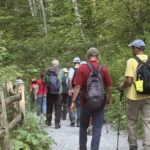
Description Is the Steeltown Stomp on your bucket list! Come join us! For anyone who has done stair climbing workouts, you will know what calf pain is like, especially when you first start. Want to get in shape of the Steeltown Stomp on October 4, 2025? Practise with us! We will start off easy and gradually build up our strength and stamina over the course of the summer. Climbing Chedoke staircase will be combined with a hike on most days. We will use both Chedoke and Dundurn Stairs as our practise stairs and buildup to at least 2,000 steps.
Bring a reusable water bottle (there are fountains at the bottom of both Chedoke and Dundurn) and any snacks you may like. Pace will be moderate, but steady to begin. We will start with a warm up hike and finish with a cool down stretch. Post stomp coffee is optional .
It’ll be fun and will lessen the pain on the day of the event, promise!
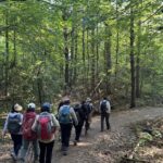
Description We will be starting at Kinsman park, hiking to Locust Lane and then back.
This is an age 12+ hike. A responsible adult must accompany youth 12-18 in a max ratio of 2 youth per adult. This hike has little road and lots of shade! Waivers must be completed for everyone in attendance (adults and youth). Bug spray, sunscreen, water and a snack are encouraged. Must wear appropriate footwear. For hikers 15 and under interested in earning a youth badge, they will be available on the hike for $6 please bring cash.
The Young Trail Blazer Badge requires the completion of one hike (at least 3km in length) conducted on the Niagara Bruce Trail. Hikes can be completed with the club on an official scheduled hike or with family on their own.
To earn the Young Nature Blazers Badge you must complete a 90 minute hike on the Niagara Bruce Trail. Afterwards, chat with the hike leader describing how you used one or more of your five senses on the hike – what did you see, touch, taste, smell or hear during your hike?
Pace: Moderate (3-4 km/hr) Terrain: Flat Distance: 9.1 or 13.7 km
Description We will explore the northern section of the Rouge National Urban Park, in the section of the park in Markham, starting at the Black Walnut Day Use Area. We will explore the Central Trail.
The meeting point will be the York Mills Bus Pickup location. There is an additional pickup location at Unionville GO Station – select that option when registering if you would like to be picked up there.
The meeting time is 8:30 AM at the York Mills pickup location and 8:45 AM at the Unionville GO Station pickup location.
This will be a relatively easy and leisurely hike. The terrain is relatively flat. The surface condition consists of compacted granular trails. The pace will be a moderate pace of 3-4 km/hr.
Depending on time and weather conditions we will cover 9.1 km (drop-out point) or 13.7 km.
After the hike there will be a stop at the Sunflower Fields of Markham. You need to bring $7 cash for the ticket and the hike leaders will purchase the tickets for the group at the gate. This is a discounted price.
The trip ends with a refreshment stop at Historic Main Street Unionville.
Hosting Club: Dufferin Hi-Land Category: General Hike Location (Google Maps): We will now meet at the parking lot at Pretty River Rd N 44.430927, W 80.275390 then car pool up to the start at the parking area on 2nd line at the Black Ash Creek Side Trail Map 23. N44.449741, W 80.307524
Today we will be hiking from north to south the reverse of our original plan.
The change will reduce the overall distance of this hike by 2 km today. We will add that to the next hike.
Please note the parking lot on 2nd line is managed by the Petune Conservation area and there is a charge to park there. Information on the parking app and charges available at nvca.on.ca
Note we will only leave 2 cars in the 2nd line lot as we are car pooling up to this lot to start the hike.
Description Hike 5: We will car pool back to the parking lot on 2nd line at the Black Ash Creek Side Trail. Today we will hike from North to South through the Petun Conservaton Area and the Pretty River Provincial Park . We will have the opportunity to catch some views of Georgian Bay and possibly Collingwood from the top of Osler Bluffs. Also we will pass the highest point on the Bruce Trail today.
We may encounter some muddy sections and possibly some mountain cyclists who share some of the trails in the Park. Bug spray, sunblock and sturdy hiking shoes/boots are recommended. Bring sufficient water and lunch. Note this is a car pool hike, registration is limited and the hike leaders will have 2 dogs with them.
Pace: Medium – 3 to 4 km/hr Terrain: Moderate – Some hills and/or some poor footing Distance: 8.5
Description Fox Ridge and McClusky’s Rock: Badland at Stop 4 (Pages 72/73) Queenston Shale is the bottom-most layer of the Niagara Escarpment. Where vegetation is removed, the shale appears as a “badland”. The brick-red shale has long been excavated along the Niagara Escarpment to make bricks.
Pace: Brisk – 4 to 5 km/hr, Medium – 3 to 4 km/hr Terrain: Strenuous – Hilly with steep climbs and some poor footing Distance: Varies
Description Is the Steeltown Stomp on your bucket list! Come join us! For anyone who has done stair climbing workouts, you will know what calf pain is like, especially when you first start. Want to get in shape of the Steeltown Stomp on October 4, 2025? Practise with us! We will start off easy and gradually build up our strength and stamina over the course of the summer. Climbing Chedoke staircase will be combined with a hike on most days. We will use both Chedoke and Dundurn Stairs as our practise stairs and buildup to at least 2,000 steps.
Bring a reusable water bottle (there are fountains at the bottom of both Chedoke and Dundurn) and any snacks you may like. Pace will be moderate, but steady to begin. We will start with a warm up hike and finish with a cool down stretch. Post stomp coffee is optional .
It’ll be fun and will lessen the pain on the day of the event, promise!
2499 Brock Rd, Uxbridge, ON L9P 1R4. We will meet at the East Duffins Headwaters parking lot at the WILDER FOREST trail head. As soon as you got off the Brock Road, passing the horse back riding facility, there is a free designated parking lot 70 meters down the lane to your right. It includes a sign board for East Duffins Headwaters with a map of the trails. Please do not park on the lane or in the horse back riding property.
Pace: Moderate (3-4 km/hr) Terrain: Flat, Hilly, Level 2 (Intermediate – some hills and uneven surfaces, rocks and roots underfoot), Variable Distance: Approx.15-16 Km
Description Join us for a delightful hike in Uxbridge, as we explore Wilder Forest, Walker Woods, and Glen Major Forest on a scenic loop starting from Brock Road. We’ll pass Concession Road 6, heading west and back, while also venturing onto several side trails for even more stunning views.
What to Expect:
•Beautiful scenic views and lookouts facing south
•A mix of hilly and flat terrain
•Frequent 2-minute breaks for hydration and photos, with a 10-20 minute lunch/snack stop
•Stay on designated trails at all time
What to Bring and Wear:
•Hiking Boots and poles (recommended) and be prepared for the bugs
•At least 2 liters of water
•Your favorite snacks and lunch (pack your own refreshments for an outdoor meal)
•Dress according to variable weather conditions!
Important Details:
•Stay on the designated trails
•Be prepared for the elements and enjoy the adventure!
Looking forward to seeing you on the trail!
Don’t forget your camera and a smile as we explore the beauty of the Uxbridge trails!
This is a joint hike with the Oak Ridges Trail Association (ORTA).
Pace: Medium – 3 to 4 km/hr Terrain: Moderate – Some hills and/or some poor footing Distance: 10 kms
Description Meet in the parking lot off 8 Line at 9:15 am. We’ll hike the Maureen Smith Side Trail to the main trail and around the Great Esker Side Trail, back to the main trail and the Bennet Heritage Side Trail for a total of about 10 kms. There are some hills. Bring bug spray/bug net, water and a snack.
Hosting Club: Toronto Category: Urban Walk Location (Google Maps): Meet on the Southeast corner of Bayview and York Mills in front of the arena (a short ride on the York Mills 95 Bus from York Mills Station)
Pace: Moderate (3-4 km/hr) Terrain: Level 2 (Intermediate – some hills and uneven surfaces, rocks and roots underfoot), Variable Distance: 12 km
Description This weekend marks the 10th anniversary of my starting to lead hikes for the TBTC. Today’s hike will follow my original route south through Windsfield Farm Park, on Banbury Road, lunch at Edwards Gardens, then south on Wilket Creek. From the West Don we will make our way to Leaside and Corks Beer & Wine Bar in the Longo’s store. Non-alcoholic options are available. The route is mostly flat but there will be a small hill to exit from the valley at the end. I would also like to use this hike to pay tribute to everyone who has supported my hikes which led to my current role and impact on the hiking program.
Pace: Leisurely: 3 km/h or less Terrain: Moderate: Some hills and/or poor footing, Strenuous: Hilly with steep climbs and some poor footing. Distance: 4 km
Description We will do a short 600 m loop hike on the west rocks using the 7th St. W. and Chalmers Quarry side trails. There is no secret on this short loop. We will then each drive to the Grey Bruce Tourist Information Office parking lot at Springmount and do a 2.5 km loop of the Merle Gunby Side trail including a look at Jones Falls when we get near it. This loop has one secret. If you do not have a book and would like one ($30) let me know by using the “Contact hike leader” link.
Description This challenging “hike” is intended for those wishing to train for future challenging hikes. Choose your own pace to go up and down the moderately steep hill over 60 minutes. The terrain is a hard packed gravel surface. Feel free to bring light weights to increase the intensity of your training. Bring water, hiking poles, snack and dress for the weather.
Pace: Leisurely Terrain: Moderate Distance: 5.6 km
Description We will be starting at Glen road and head to Ball’s Falls historical village (including the massive stairway up the escarpment!) we will check out Dug out Pond and see if any turtles or frogs are hanging out, then back down the stairs and back to Glen road. For those not tired yet, we’ll cross the street and follow the Bruce to 17th, turn around and take the Jim Rainforth side trail back to the parking lot.
This is an age 12+ hike. A responsible adult must accompany youth 12-18 in a max ratio of 2 youth per adult. This hike has little road and lots of shade. Glen road the Ball’s Falls is quite rocky and the stairs up to the falls are long and steep. Waivers must be completed for everyone in attendance (adults and youth). Bug spray, sunscreen, water and a snack are encouraged. Must wear appropriate footwear. For hikers 15 and under interested in earning a youth badge, they will be available on the hike for $6 please bring cash.
The Young Trail Blazer Badge requires the completion of one hike (at least 3km in length) conducted on the Niagara Bruce Trail. Hikes can be completed with the club on an official scheduled hike or with family on their own.
To earn the Young Nature Blazers Badge you must complete a 90 minute hike on the Niagara Bruce Trail. Afterwards, chat with the hike leader describing how you used one or more of your five senses on the hike – what did you see, touch, taste, smell or hear during your hike?
Terrain: Moderate – Some hills and/or some poor footing Distance: 15 km
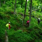
Description This will be a loop hike starting and ending on the Rattlesnake Point Side Trail. We will hike along the main trail as well as BT side trails to Crawford Lake, we hike the main trail loop at Crawford Lake and head back through the Nottawasaga Canyon. This route will feature a few hills and some uneven, rocky terrain.
August weather can be hot, muggy and buggy! Dress for the weather, keeping in mind that insects, including ticks, will be out in full force. Take appropriate precautions to avoid insect bites, including using repellent and wearing clothing that covers the legs and arms. Hiking boots are required and poles and recommended. Bring plenty of water and/or other hydration and a snack.
Parking reservations must be obtained from Conservation Halton (https://www.conservationhalton.ca/) . Please arrive at 8:15 am as we will leave promptly at 8:30 am.
Location (Google Maps): Parking lot is off Sycamore Drive East of Bayview , across Starbucks plaza Bus 91 from Finch east station stops at Sycamore station.
Pace: Moderate (3-4 km/hr) Terrain: Hilly, Level 2 (Intermediate – some hills and uneven surfaces, rocks and roots underfoot), Variable Distance: 6-7 km
Description We will explore Valleyview and Maple View parks, and walk along German Mill Creak, in return we stop in Huntington park and have snack under beautiful shed ,
Even it is considered Urban walk, it is urban hike as we have some up and down hills and tree roots, please bring your hiking poles, water and snacks,
Description Hike the main and sidetrails in Shorthills Provincial Park. Please wear hiking boots, bring water and insect repellant. Check yourself for ticks following the hike.
Hosting Club: Caledon Hills Category: Tuesday Hikers Location (Google Maps): 17 Sideroad Side Trail parking lot From HWY 401 in Milton, take Road 25 north approx. 9.5 km, turn right on 17 Sideroad Follow to the dead end.
Hosting Club: Sydenham Category: An evening walk. Location (Google Maps): Meet at the municipal parking lot by the river on the west side of 1st Ave E between 7th St E and 8th St E in Owen Sound
Hike Leader(s): Harriet Nixon
Pace: Brisk: 4 to 5 km/h Terrain: Moderate: Some hills and/or poor footing Distance: Approx 6 km
Description Join us for a brisk evening hike during the Sturgeon Full Moon exploring Owen Sound paths and neighbourhoods. Hikers are invited to the Hike Leader`s home for refreshments following the hike. There is no need to show up 15 minutes early for this hike, but we will leave promptly at 7:00 pm.
Description This will be our permanent Thursday Location until Bridge repairs complete. From Cave Spring Conservation Area explore the trail network on the escarpment towards Kinsman Park and Moyer Road.
You must register for each hike. Bring Poles, snack bug spray, sunscreen and a drink. Dress for the weather
Pace: Medium – 3 to 4 km/hr Terrain: Moderate – Some hills and/or some poor footing Distance: 15 Km
Description We will hike through the Mono Cliffs Provincial Park on the main Bruce Trail and several side trails. Footing should be good for most of the hike, with a few areas with exposed roots, there are a few steep hills on the route.
August weather can be hot, muggy and buggy! Dress for the weather conditions, keeping in mind that insects, including ticks, will be active. Take appropriate precautions to avoid insect bite, including using repellent and wearing clothing that covers the legs and arms. Hiking boots are required and poles are recommended.
Bring patently of water / and/or other hydration and snacks.
Park in the gravel lot at the Mono Community Centre, Mono Centre Road (County Road 8). Please arrive by 8:15 am as we will leave promptly at 8:30 am.
Location (Google Maps): Parking lot is off Sycamore Drive East of Bayview , across Starbucks plaza Bus 91 from Finch east station stops at Sycamore station.
Pace: Moderate (3-4 km/hr) Terrain: Hilly, Level 2 (Intermediate – some hills and uneven surfaces, rocks and roots underfoot), Variable Distance: 6-7 km
Description We will explore Valleyview and Maple View parks, and walk along German Mill Creak, in return we stop in Huntington park and have snack under beautiful shed ,
Even it is considered Urban walk, it is urban hike as we have some up and down hills and tree roots, please bring your hiking poles, water and snacks,
Pace: Leisurely – 3 km/hour or less Terrain: Easy – mostly flat and usually good footing Distance: 3 km
Description Discover the fascinating world of butterflies, dragonflies, damselflies and more on this leisurely stroll through the Riverside Woods Nature Reserve. We’ll attempt to find as many species as we can and learn how to record their location using iNaturalist. The following apps will assist with your learning: iNaturalist, Seek and Merlin. Dress for the weather and bring water, snacks, insect repellant, sun screen, binoculars and camera.
Pace: Moderate (3-4 km/hr) Terrain: Level 2 (Intermediate – some hills and uneven surfaces, rocks and roots underfoot), Variable Distance: 14.3k
Description This is a summer-time End-to-End hike to complete the Toronto section of the Bruce Trail in 4 hikes.
This 3rd hike of the series will take us from the the Walking Fern ST on 10th Line, to the end of the Toronto Section, continuing through the Badlands, to 2.8k into the Caledon section. As with previous hikes in this series, the terrain will vary, there will be some hilly sections and sections with uneven, rocky terrain, making footing tricky to navigate.
Early August weather can be hot, muggy and buggy! So, dress for the weather, keeping in mind that insects, including ticks, will be out in full force. Take appropriate precautions to avoid insect bites, including using repellant and clothing that covers the legs and arms. Hiking shoes/boots are required and hiking poles are recommended.
Bring plenty of fluids, including electrolytes, and a snack/lunch.
Since this is a group hike, please consider your fitness level before registering. We will be walking at a pace of 3.5km – 4km per hour and everyone is expected to keep up with the person in front of them for the duration of the hike.
Plan to arrive at the meeting place by 9:15 a.m. as we will start the car shuffle to the hike starting point at 9:30 a.m. sharp. Further details will be provided to registered hikers a few days prior to the hike.
Pace: Brisk – 4 to 5 km/hr, Medium – 3 to 4 km/hr Terrain: Strenuous – Hilly with steep climbs and some poor footing Distance: Varies
Description Is the Steeltown Stomp on your bucket list! Come join us! For anyone who has done stair climbing workouts, you will know what calf pain is like, especially when you first start. Want to get in shape of the Steeltown Stomp on October 4, , 2025? Practise with us! We will start off easy and gradually build up our strength and stamina over the course of the summer. Climbing Chedoke staircase will be combined with a hike on most days. We will use both Chedoke and Dundurn Stairs as our practise stairs and buildup to at least 2,000 steps.
Bring a reusable water bottle (there are fountains at the bottom of both Chedoke and Dundurn) and any snacks you may like. Pace will be moderate, but steady to begin. We will start with a warm up hike and finish with a cool down stretch. Post stomp coffee is optional .
It’ll be fun and will lessen the pain on the day of the event, promise!
Description Each Friday we will explore some history of Niagara-on-the-Lake while getting a moderate paced walk. Discover where the Niagara River meets Lake Ontario. Experience the Heritage District, woods and the Niagara Parkway.
Some weeks may be totally on sidewalks and roads while others may include a mix of trail and paved pathways.
Great way to build up endurance for longer more strenuous hikes.
Plan to stay for conversation and a coffee at Sweets & Swirls, Community Centre, Niagara Stone Rd., NOTL
Hosting Club: Peninsula Category: Sunrise Hike Location (Google Maps): Parking lot at Dyers Bay Rd & Hwy 6, Northern Bruce Peninsula, ON N0H 1Z0
Hike Leader(s): Kathleen Stahlbaum
Pace: Leisurely (2.0 – 3.0 km/h): A relaxed pace with frequent breaks and a focus on enjoyment. Terrain: Difficult: Steep ascents/descents, rocky scrambling, and some rugged escarpment paths., Easy: Flat forested sections or lowland trails., Moderate: Rolling hills, mild slopes and rocky paths. Distance: ~4km
Description Experience the magic of dawn on the Bruce Trail with the Sunrise Hike Series offered by the Peninsula Bruce Trail Club. These early morning hikes provide a perfect opportunity to awaken your senses, boost your energy, and immerse yourself in the tranquility of nature as the sun paints the sky with breathtaking hues. As we make our way through scenic forest trails, we’ll pause to witness the first light shimmering on the turquoise waters of Georgian Bay – a sight that will surely leave you in awe!
Beyond the beauty, morning light helps regulate your circadian rhythm, elevating your mood, boosting energy levels and improving sleep quality. Whether you’re looking to start your day with a sense of calm, capture stunning sunrise photos, or simply reconnect with nature, these hikes offer a unique and inspiring way to greet the day.
On Saturday August 9th, join us in hiking the Georgian Bay Trail to the Grotto at Indian Head Cove, where we’ll experience the sun rising over the Bay from the iconic shoreline before returning via the Marr Lake Trail. We’ll have the joy of taking in the stunning colours of the sky as the first light sparkles on the stunning turquoise waters. This peaceful sunrise hike is the perfect way to connect with nature, capture some incredible photos, and start the day with fresh air and inspiration. Whether you’re a morning person or just love a good adventure, come experience the magic of dawn from one of the best vantage points on the Bruce Peninsula!
Don’t forget to bring a headlamp or flashlight (preferably with a red light setting) as we begin our adventure in the pre-dawn quiet. Join us and discover how a sunrise hike can nourish your mind, body, and spirit—setting the tone for a brighter, more balanced day.
This hike is approximately 4 kms in length. Expect to be on the trail for 2.5-3 hours. Pace will be leisurely with ample time to enjoy the sunrise, take some photographs, and nourish yourself!
How to prepare
Get a good night’s sleep
Bring lots of water and a snack (breakfast and/or coffee are recommended if that’s your thing!)
Bring a headlamp or flashlight (preferably with a red light setting)
Wear waterproof hiking boots
Hiking poles are recommended but not necessary
Bring insect repellant or wear protective clothing
Bring sunscreen
LIMITED SPACE AVAILABLE! We will be meeting at the parking lot at the corner of Highway 6 & Dyer’s Bay road and carpooling in 3 vehicles to Bruce Peninsula National Park. You will be required to pay for entry to the Park.
Pace: Leisurely – 3km/hr or less Terrain: Easy – Mostly flat and usually good footing Distance: About and hour of yoga followed by an easy hike
Description Cost: By donation. All proceeds go to the Iroquoia Bruce Trail Club who will use the funds towards “Preserving a ribbon of Wilderness, for Everyone, Forever.”
Join Certified Yoga Instructor Kristy and Certified Hike Leader Ruth, both Iroquoia Bruce Trail Club volunteers, for a morning of gentle yoga and an easy hike. Please bring your yoga mat and water and any props you like to have and afterwards you will need comfortable hiking shoes or running shoes for the hike as well as water and snacks if you need. Everyone is welcome but you must register.
Time: 8:00am to 10:00am
Date: August 9, 2025
Location: Cliffview Park 26 Upper Paradise Rd, Hamilton. (You may also park at the bottom of the Chedoke Stairs off of Beddoe Dr but you will have to walk up the staircase to join us).
Hosting Club: Caledon Hills Category: General Location (Google Maps): Boyne Valley Provincial Park, Map 20 of the BTC Trail Guide. County Rd. 19 (Prince of Wales Rd.) Parking Area – west of km 15.2 – approximately 80 metres south of the Prince of Wales Side Trail.
Pace: Brisk – 4 to 5 km/hour Terrain: Strenuous – hilly with steep climbs and some poor footing Distance: 17 km
Description Join us for an invigorating hike starting from the parking lot on Prince of Wales Rd. We’ll explore the Prince of Wales Side Trail, Primrose Loop Side Trail, main trail, and Boyne Valley Side Trail, looping back via the main trail and Prince of Wales Side Trail. Along the way, we’ll hike up the short side trail to Murphy’s Pinnacle, where you’ll be rewarded with a stunning view of the surrounding landscape – great for Instagram!
Bring lunch, plenty of water, and hiking poles if you use them, as the trail is hilly. Dress for the weather.
PACE IS BRISK
This hike is a 2SLGBTQIA+ friendly space. Everyone is welcome to join us for this adventure and enjoy the beauty of the trails together.
Pace: Moderate (3-4 km/hr) Terrain: Flat, Level 1 (Easy – mostly on flat, well maintained trails with hard-packed surface) Distance: 8 km
Description Join us to visit the towns of Elora and Fergus of Wellington County, known as “Ontario’s most beautiful village”.
We will walk into the town of Elora ample free time will be given to roam the streets of Elora or visit the Elora Quarry Conservation Area (you need to purchase your own tickets online before the trip for the 10AM – 2 PM slot).
After free time, we will walk on into the town of Fergus, where we will visit the Templin Gardens, Confederation Park, and downtown Fergus before stopping for refreshments.
Description Hike 6: . We will car pool back to 3rd line south of New Mountain Rd. Today we will start with significant road walking, extreme caution should be exercised on New Mountain Rd. We will have the opportunity to catch some views of Georgian Bay and Collingwood from the top of the Blue Mountain Ski hills.
We very likely encounter allot of pedestrian and bicycle traffic in the Swiss Meadows area as this is a popular short walk for many visitors to the area. Be prepared to share the trails in this area. Bug spray, sunblock and sturdy hiking shoes/boots are recommended. Bring sufficient water and lunch. Note this is a car pool hike, registration is limited and the hike leaders will have 2 dogs with them.
Location (Google Maps): Meet at Bethesda Trail Head Parking on Bethesda Sideroad off Bayview Avenue, across from Lake Wilcox. This parking lot is free.
Hosting Club: Peninsula Category: Rainbow Hike Location (Google Maps): Hope Bay Nature Reserve. Meet at the south end of Cathedral Drive, at the entrance to Hope Bay Nature Reserve. Arrive a few minutes early, please.
Pace: Leisurely (2.0 – 3.0 km/h): A relaxed pace with frequent breaks and a focus on enjoyment., Medium (3.0 – 4.5 km/h): A comfortable pace for most hikers with steady progress. Terrain: Easy: Flat forested sections or lowland trails., Moderate: Rolling hills, mild slopes and rocky paths. Distance: ~4 km
Description Ferns can tell you a lot about the forest habitat. They are considered an “eco-indicator” – telling us about the type, moisture, nutrients and temperature of soil. The type of fern can also tell you about what kind of wildflowers to look for in the same area. Ferns are one of the oldest plants on earth. Did you know they existed at the time of dinosaurs, some growing to over 100 feet tall! While you won’t see ferns that tall, PBTC Conservation Ambassador Rhiannon Carruthers will help us to identify ferns on this hike. We like to learn from one another too – so please share your Nature knowledge throughout the hike, too. Ferns identified on this hike will contribute toward the PBTC Fern Badge. You can learn more about the Fern Badge here: https://pbtc.ca/badges/. If time allows, we will see the Hope Bay Glacial Potholes located here, too. This hike is a hike-stop-talk paced hike over uneven and at times more demanding terrain. Good balance is required.
Bring a back pack for snacks and lunch, water bottle. Wear sturdy footwear with closed toes, hat, sun-protective clothing. Bring sunscreen. Hiking poles, binoculars, insect repellent (optional),
For those wishing to remain after the hike, consider staying for refreshments with us at a nearby farm or visit nearby Hope Bay Ice Cream Shop.
The closest public toilet is at the Hope Bay parking lot at 10 Hope Bay Road (about 10 minute drive).
Pace: Brisk – 4 to 5 km/hr, Medium – 3 to 4 km/hr Terrain: Strenuous – Hilly with steep climbs and some poor footing Distance: Varies
Description Is the Steeltown Stomp on your bucket list! Come join us! For anyone who has done stair climbing workouts, you will know what calf pain is like, especially when you first start. Want to get in shape of the Steeltown Stomp on October 4, 2025? Practise with us! We will start off easy and gradually build up our strength and stamina over the course of the summer. Climbing Chedoke staircase will be combined with a hike on most days. We will use both Chedoke and Dundurn Stairs as our practise stairs and buildup to at least 2,000 steps.
Bring a reusable water bottle (there are fountains at the bottom of both Chedoke and Dundurn) and any snacks you may like. Pace will be moderate, but steady to begin. We will start with a warm up hike and finish with a cool down stretch. Post stomp coffee is optional .
It’ll be fun and will lessen the pain on the day of the event, promise!
Hosting Club: Toronto Category: Car Hike Location (Google Maps):
2499 Brock Rd, Uxbridge, ON L9P 1R4. We will meet at the East Duffins Headwaters parking lot at the WILDER FOREST trail head. As soon as you got off the Brock Road, passing the horse back riding facility, there is a free designated parking lot 70 meters down the lane to your right. It includes a sign board for East Duffins Headwaters with a map of the trails. Please do not park on the lane or in the horse back riding property.
Pace: Moderate (3-4 km/hr) Terrain: Flat, Hilly, Level 2 (Intermediate – some hills and uneven surfaces, rocks and roots underfoot), Variable Distance: Approx.15-16 Km
Description Join us for a delightful hike in Uxbridge, as we explore Wilder Forest, Walker Woods, and Glen Major Forest on a scenic loop starting from Brock Road. We’ll pass Concession Road 6, heading west and back, while also venturing onto several side trails for even more stunning views.
What to Expect:
•Beautiful scenic views and lookouts facing south
•A mix of hilly and flat terrain
•Frequent 2-minute breaks for hydration and photos, with a 10-20 minute lunch/snack stop
•Stay on designated trails at all time
What to Bring and Wear:
•Hiking Boots and poles (recommended) and be prepared for the bugs
•At least 2 liters of water
•Your favorite snacks and lunch (pack your own refreshments for an outdoor meal)
•Dress according to variable weather conditions!
Important Details:
•Stay on the designated trails
•Be prepared for the elements and enjoy the adventure!
Looking forward to seeing you on the trail!
Don’t forget your camera and a smile as we explore the beauty of the Uxbridge trails!
This is a joint hike with the Oak Ridges Trail Association (ORTA).
Pace: Medium: 3 to 4 km/h Terrain: Moderate: Some hills and/or poor footing, There might be muddy sections. Distance: 5 km
Description The Walk In Nature Series (WINS) consists of short loop hikes in the Sydenham section of the Bruce Trail that combine nature appreciation with fitness in a safe and welcoming group environment led by an experienced hike leader. Hikes occur at least twice monthly on either Sunday mornings or early Tuesday evenings. Consider these hikes to be 90 or 120 minute reset appointments with yourself in nature that promote health and fitness. WINS hikes are open to all ages and levels of hiking experience whether members or non-members of the Bruce Trail Conservancy (BTC).
A Sunday morning hike is a great way to start your day. On this hike, explore the rugged beauty and cultural history of the Silent Valley Nature Reserve. After meeting and parking at the Concession 2 South dead-end roadside parking, we then hike through the massive boulders under the escarpment on Avalanche Side Trail. After climbing then descending the escarpment we survey the remnants of an old farm homestead and the historic wreckage of a plane crash. In this 5 km loop hike, Silent Valley Side Trail leads us back to our vehicles.
Be prepared for mosquitoes by covering up and possible mud depending on the weather. Bring good footwear, some water, a snack and hiking poles if you so choose.
If you need help with transportation, please contact the hike leader who will coordinate carpooling.
Pace: Medium – 3 to 4 km/hr Terrain: Moderate – Some hills and/or some poor footing Distance: 8 kms
Description Meeting at 9:15 am roadside on 15 Side Road at Speyside, we will carpool to the Bruce Trail parking lot on 22 Side Road and hike back along the main trail. There are some rocky parts to this hike. Bring bug spray/bug net and plenty of water.
Description We will hike on the main trail from Vineland Estates Winery towards Cave Springs Conservation Area and return back to Vineland Estates Winery by 11:30. Upon return we will enjoy a private structured wine tasting led by one of the knowledgeable and friendly winery staff from 11:30 to 12:15 pm. The cost for the tasting experience is $15.00 per person. Please bring your $15.00 with you as I will collect it prior to the tasting to simplify the payment to Vineland Estates Winery. Thank you.
Pace: Medium – 3 to 4 km/hr Terrain: Easy – Mostly flat and usually good footing
Description All LGBTQ2SIA+ peeps and allies are welcome! Novice hikers, too.
With most Hamilton Pride activities on the Friday & Saturday, we”ll head out on late morning(11 a.m.) Rainbow Hike on Sunday, Aug. 10. — followed by a (TOTALLY OPTIONAL) opportunity to cheer on your favourite 2SLGBTQIA baseball team.
We”ll aim for a 2-hour waterfront walk (as far as Princess Point to see the swans) and then head over to Eastwood Park to a catch a Steel City Inclusive Softball Association game—it’s Hamilton’s hugely popular 2SLGBTQIA+ slo-pitch league.
Meet at the benches in front of West Harbour GO Station, close to the McNab street entrance at 10:45 a.m. for an 11 a.m. start. We’ll hike a mix of paved and dirt paths. Then it’s an easy 20-minute walk to the ball park.
Everyone gets a complimentary Bruce Trail Rainbow Badge or sticker. This urban hike is a great way to learn more about our queer-led, queer-friendly Bruce Trail hikes.
Bring water, energizing snacks/lunch, sunscreen. Sturdy shoes are recommended. We’ll be mostly on paved paths.
Email any questions to the Hike Leader – “Click here to contact Hike Leader” on this form.
Hosting Club: Toronto Category: Car Hike Location (Google Maps): Km 0.0 Bluewater Park, Wiarton opposite the arena. Coordinates N 44.742514,W 81.135140 map 35.
Description First of 8 hikes to complete the Peninsula E2E. The Peninsula section is hilly with a lot of rocks. Please be aware of the difficulty of the section and the pace this hike series will be moving. Before registering make sure that you are physically able to do it. Hikers need to register to each hike separately. Bring 2-2.5 litres of water, snacks, lunches, a hat, bug repellent, sun screen. We will car shuttle to km 24.4 and hike back. All hikers are expected to participate in the car shuttles as many times as needed throughout the 8 days.
Please arrive at least 15 minutes prior to the start time so we are ready leave by 9:00.
The goal of this hike is to introduce newcomers to hiking in Niagara and to provide experienced hikers with the opportunity to learn from newcomers about their culture and insights into their adjustment to Canadian culture. We will meet at the upper parking lot – do introductions and the move to the lower parking lot with the hike starting at 5:30.
Pace: Brisk (4-5 km/hr) Terrain: Challenging, Level 3 (Advanced – steep hills and some scrambling over boulders), Variable Distance: 19.3 km
Description Day 2 of the Peninsula E2E. See details on hike #1 August 11. We will shuttle to km 24.4 and hike back. Please arrive at least 15 minutes prior to the start time so that we will be ready to leave by 8:30. There is a beach in Hope Bay. If you would like to swim after the hike, bring a bathing suit.
Pace: Medium – 3 to 4 km/hr Terrain: Moderate – Some hills and/or some poor footing, Strenuous – Hilly with steep climbs and some poor footing Distance: 14.5 km
Description This is a summer-time End-to-End hike to complete the Toronto section of the Bruce Trail in 4 hikes. Join for all or as many hikes as desired.
This third hike will take us from Limehouse to the Silver Creek Trail Head. The terrain will vary, there will be some hilly sections and sections with uneven, rocky terrain, making footing tricky to navigate.
July weather can be hot, muggy and buggy! So, dress for the weather, keeping in mind that insects, including ticks, will be out in full force. Take appropriate precautions to avoid insect bites, including using repellant and clothing that covers the legs and arms. Hiking boots are required and hiking poles are recommended.
Bring plenty of fluids, including electrolytes, and a snack.
As this is a group hike, please consider your fitness level before registering. We will be walking at a pace of 3km – 4km per hour and everyone is expected to keep up with the person in front of them for the duration of the hike.
Plan to arrive at the meeting place by 8:15 a.m. as we will start the car shuffle to the hike starting point at 8:30 a.m. sharp. Further details will be provided to registered hikers a few days prior to the hike.
Location (Google Maps): Parking lot is off Sycamore Drive East of Bayview , across Starbucks plaza Bus 91 from Finch east station stops at Sycamore station.
Pace: Moderate (3-4 km/hr) Terrain: Hilly, Level 2 (Intermediate – some hills and uneven surfaces, rocks and roots underfoot), Variable Distance: 6-7 km
Description We will explore Valleyview and Maple View parks, and walk along German Mill Creak, in return we stop in Huntington park and have snack under beautiful shed ,
Even it is considered Urban walk, it is urban hike as we have some up and down hills and tree roots, please bring your hiking poles, water and snacks,
Hosting Club: Caledon Hills Category: Tuesday Hikers Location (Google Maps): Parking at Boston Mills Rd., west of its intersection with Mississauga Rd. See Map 14. Driving directions: From Highway 410 north, continue on Highway 10, left on King Street, right on Mississauga Rd., left on Boston Mills Rd. to the parking at dead end.
Pace: Medium – 3 to 4 km/hour Terrain: Moderate – some hills and/or some poor footing Distance: 12 km
Description Main Bruce Trail and Rockside Trail, there and back; will hike about 6 km reaching into Terra Cotta and return after snack break. Bring sufficient hydration drink, snack; poles are recommended. After hike there is optional refreshment stop at nearby coffee place, Higher Ground. During summer ice-cream also available.
Pace: Brisk (4-5 km/hr) Terrain: Challenging, Level 3 (Advanced – steep hills and some scrambling over boulders), Variable Distance: 23.8 km
Description Third day of the Peninsula E2E. Please look at day 1 August 11 for details. We will car shuttle to km 67.9 and hike back. Please be at the meeting point at least 15 minutes prior to the start time so that we are in the cars and ready to leave by 8:30. If you wish to swim after the hike you can bring a bathing suit. There is a beach in Hope Bay.
Description This is a series of hikes which will take place on 3 Wednesday evenings in July and August. We will hike around Niagara-on-the-Lake and surrounds (1.5 hrs) stopping for a shared picnic on the lawns of St Andrews. At 7 pm others will join us on the lawns and you will have your choice of some delicious cakes. Then we will go inside to enjoy Toronto’s classical trumpeter Paul Sanvidotti and a short reflection on “Grace”.
Bring a folding chair and some savoury food to share (dessert is provided). Dress so you’ll be comfortable hiking and picnicking. A change of clothes is not required. Bathrooms will be available.
Description This will be our permanent Thursday Location until Bridge repairs complete. From Cave Spring Conservation Area explore the trail network on the escarpment towards Kinsman Park and Moyer Road.
You must register for each hike. Bring Poles, snack bug spray, sunscreen and a drink. Dress for the weather
Pace: Medium – 3 to 4 km/hr Terrain: Moderate – Some hills and/or some poor footing Distance: 12 km
Description We will follow the BT main trail from King Road to Smoky Hollow and along Grindstone Creek to Snake Road. We will then turn around and make our back, taking in the McNally Side Trail on the return route. The terrain will feature a number of hills and some tricky sections with exposed tree roots.
The weather in August can be hot, muggy and buggy! Dress for the weather, keeping in mind that insects, including ticks, will be out in full force. Take appropriate precautions to avid insect bites, including using insect repellent and wearing clothing that covers the legs and arms. Hiking boots are required and poles are recommended.
Bring plenty of water and snacks. We will take regular hydration and snack breaks along the way.
Please arrive at 8:15 am as we will leave promptly at 8:30 am.
Hosting Club: Toronto Category: Car Hike Location (Google Maps): Barrow Bay km 67.9 Rd 9just south of West Shore Rd. Coordinates N 44.958825,W 81.266168 map 38.
Terrain: Challenging, Level 3 (Advanced – steep hills and some scrambling over boulders), Variable Distance: 19.3 kms.
Description Fourth hike of the Peninsula E2E series. Please see details on hike 1, August 11. We will shuttle to km 87.4 and hike back. Please arrive at least 15 minutes prior to the start time so that we can leave by 8:30.
Location (Google Maps): Parking lot is off Sycamore Drive East of Bayview , across Starbucks plaza Bus 91 from Finch east station stops at Sycamore station.
Pace: Moderate (3-4 km/hr) Terrain: Hilly, Level 2 (Intermediate – some hills and uneven surfaces, rocks and roots underfoot), Variable Distance: 6-7 km
Description We will explore Valleyview and Maple View parks, and walk along German Mill Creak, in return we stop in Huntington park and have snack under beautiful shed ,
Even it is considered Urban walk, it is urban hike as we have some up and down hills and tree roots, please bring your hiking poles, water and snacks,
Pace: Moderate (3-4 km/hr) Terrain: Hilly, Level 2 (Intermediate – some hills and uneven surfaces, rocks and roots underfoot), Rocky, Variable Distance: 11.9k
Description This is a make-up hike for the 4 of 4 End to End group series of the Toronto Section (July 17 date was cancelled due to thunderstorms), however, anyone may register for this hike. Our route will take us from the start of the Toronto Section just south of Hilton Falls Conservation area to the Bruce Trail Pear Tree Park. The terrain is not too hilly, but the footing is tricky with many uneven, rocky sections to navigate.
Dress for the weather, keeping in mind that insects, including ticks, will be out in full force. Take appropriate precautions to avoid insect bites, including using repellant and clothing that covers the legs and arms. Hiking shoes/boots are required and hiking poles are recommended.
Bring plenty of fluids, including electrolytes, and a snack/lunch.
As this is a group hike, please consider your fitness level before registering. We will be walking at a pace of 3km – 4km per hour and everyone is expected to keep up with the person in front of them for the duration of the hike.
Plan to arrive at the meeting place by 9:15 a.m. as we will start the car shuffle to the hike starting point at 9:30 a.m. sharp. Further details will be provided to registered hikers a few days prior to the hike.
Pace: Leisurely – 3km/hr or less Terrain: Moderate – Some hills and/or some poor footing Distance: 8.5 km.
Description Dundas Valley is always a lovely hiking destination with its easy to moderate terrain but enough hills to provide a good cardiac workout. Meet in the parking lot on Artaban Rd. off of Lion’s Club Rd. at 9:45 am. for a 10:00 am. start. ( Paid parking or a Conservation Area pass). We will do a circuit stopping to see Sherman and Canterbury Falls and then head over to Tiffany Falls and return to the parking lot. (Expect some rocky trail on the way to Tiffany Falls) Bring water, a snack, sunscreen and insect repellent. I will send out and email with my contact information.
Hosting Club: Toronto Category: TBTC Special Events Location (Google Maps): Online
Hike Leader(s): Alina Lin
Distance: 0
Description To attract and encourage people from Chinese community to explore the entire Bruce Trail, I am hosting this Zoom webinar in Chinese language.
Pace: Brisk – 4 to 5 km/hr, Medium – 3 to 4 km/hr Terrain: Strenuous – Hilly with steep climbs and some poor footing Distance: Varies
Description Is the Steeltown Stomp on your bucket list! Come join us! For anyone who has done stair climbing workouts, you will know what calf pain is like, especially when you first start. Want to get in shape of the Steeltown Stomp on October 4, 2025? Practise with us! We will start off easy and gradually build up our strength and stamina over the course of the summer. Climbing Chedoke staircase will be combined with a hike on most days. We will use both Chedoke and Dundurn Stairs as our practise stairs and buildup to at least 2,000 steps.
Bring a reusable water bottle (there are fountains at the bottom of both Chedoke and Dundurn) and any snacks you may like. Pace will be moderate, but steady to begin. We will start with a warm up hike and finish with a cool down stretch. Post stomp coffee is optional .
It’ll be fun and will lessen the pain on the day of the event, promise!
Description Enjoy the benefits of pausing for a yoga practice as we tour through the trails, parkland and Historic Niagara-on-the-Lake. No mat required. Movement will focus on a flow of standing poses designed especially for hikers. Plan to stay for conversation and a warm cup of coffee or tea at Sweets & Swirls, Community Centre, Niagara Stone Road, NOTL.
Hosting Club: Toronto Category: Bus Hike Location (Google Maps): Niagara Glen Trails, Queenston Heights Park/General Brock Side Trail, Niagara On The Lake
Pace: Moderate (3-4 km/hr) Terrain: Hilly, Level 2 (Intermediate – some hills and uneven surfaces, rocks and roots underfoot), Rocky, Variable Distance: 10 km
Description Join us to visit Niagara Glen (https://www.niagaraparks.com/visit/attractions/niagara-glen), Queenston Heights, and Niagara-on-the-Lake (https://www.niagaraonthelake.com/).
There will be 4-5 km of trails at Niagara Glen (excluding the rocky Whirlpool Trail). The terrain is Moderate (Difficulty Level 2) trails suitable for most hikers with basic trail experience and with infrequent obstacles and gently rolling areas with some short, steep sections. A loop will bring us through the Devil’s Arch. There are steep staircases going down into the gorge and coming back up.
After Niagara Glen the bus will take us to Queenston Heights Park where there is a beautiful view over the Niagara River towards Lake Ontario and where we will hike part of the General Brock Side Trail.
Finally we head to the town of Niagara On The Lake where you will have free time to spend as you wish (refreshments, shopping, etc) in the historic town before heading back to Toronto.
The pro-rated parking fee of $1.35 for bus parking at Niagara On The Lake will be added to the bus fare when registering.
Hosting Club: Caledon Hills Category: General Location (Google Maps): Mono Cliffs Provincial Park, Map 19. To reach the meeting place, drive north on Hwy 10 past Orangeville. Continue to Mono Centre Road (crossroad name is Camilla). Turn right and follow this road into Mono Centre. The Community Centre parking lot is on your right, about 200 meters before you reach the crossroads.
Pace: Medium – 3 to 4 km/hour Terrain: Moderate – some hills and/or some poor footing Distance: 15 km
Description Join us for a delightful loop hike through the Provincial Park, we will be hiking to McCarston’s Lake and looping back down through the side trails. This route is mostly flat with a few small hills at the start, making it an easy and enjoyable hike for everyone. Please dress accordingly.
This hike is a 2SLGBTQIA+ friendly space. Everyone is welcome to join, enjoy the trail, and share in the beauty of the Provincial Park!
Pace: Moderate (3-4 km/hr) Terrain: Hilly, Level 2 (Intermediate – some hills and uneven surfaces, rocks and roots underfoot), Variable Distance: 14-15 km
Description We will hike Vista trail and part of orchard trail, will enjoy look outs between Rouge river and Little Rouge creek • Please dress appropriately for the weather. • We will have short water ,picture and a 15 minute snack break. Everyone is welcome!
Hosting Club: Niagara Category: Loop Location (Google Maps): Meet in the upper parking lot of Fireman’s Park, Mountain Rd & Dorchester Rd, Niagara Falls
Hosting Club: Toronto Category: Car Hike Location (Google Maps): Queenston Heights Park
Hike Leader(s): Alina Lin
Pace: Brisk (4-5 km/hr) Terrain: Challenging, Hilly, Level 2 (Intermediate – some hills and uneven surfaces, rocks and roots underfoot), Rocky Distance: 19 km
Description The Niagara region is one of Canada’s most productive fruit-growing areas. Strolling along country roads lined with farms and orchards, you’ll see ripe peaches, plums, and grapes hanging from the trees and smell the sweet fragrance of the harvest in the air—you’ll truly understand why it’s called a Fruit Paradise. To make the most of the short harvest season, let’s hike the Niagara section of the Bruce Trail and if you are interested, visit local farms afterward—perhaps even enjoy some fruit picking!
This is the first of a five-hike End-to-End series covering the entire Niagara section of the Bruce Trail. The full section stretches over 80 kilometers from Niagara-on-the-Lake to Grimsby. I am using Map Edition 29, so please note that kilometer markings may not be fully up to date, and actual hiking distances may vary slightly.
Meeting Point: Bruce Trail Southern Terminus Cairn at KM 0.0 GPS: 43.157826, -79.052045 Please note: Parking fees apply (charged by the park). Please arrive before 9:15am to give yourself time to coordinate the car shuttle.
We will car shuttle to the starting point of the hike at KM 18.2 GPS: 43.145572, -79.191214 (Off-road parking available on the north side of Glendale Ave, approximately 50 m east of the Welland Canal).
The group will then hike from KM 18.2 back to KM 0.0. All drivers are expected to participate in the car shuttle, either before or after the hike.
Important Notes:
Wear sturdy hiking boots and dress appropriately for the weather
Pace: Leisurely: 3 km/h or less Terrain: Moderate: Some hills and/or poor footing, Strenuous: Hilly with steep climbs and some poor footing. Distance: 3.5 km
Description We will do a Saturday loop hike that includes Jones falls. This is hike 29 in the book Exploring Sydenham. There will be one secret to find. If you do not have a book and would like one ($30) let me know by using the “Contact hike leader” link.
Pace: Brisk – 4 to 5 km/hr, Medium – 3 to 4 km/hr Terrain: Strenuous – Hilly with steep climbs and some poor footing Distance: Varies
Description Is the Steeltown Stomp on your bucket list! Come join us! For anyone who has done stair climbing workouts, you will know what calf pain is like, especially when you first start. Want to get in shape of the Steeltown Stomp on October 4, 2025? Practise with us! We will start off easy and gradually build up our strength and stamina over the course of the summer. Climbing Chedoke staircase will be combined with a hike on most days. We will use both Chedoke and Dundurn Stairs as our practise stairs and buildup to at least 2,000 steps.
Bring a reusable water bottle (there are fountains at the bottom of both Chedoke and Dundurn) and any snacks you may like. Pace will be moderate, but steady to begin. We will start with a warm up hike and finish with a cool down stretch. Post stomp coffee is optional .
It’ll be fun and will lessen the pain on the day of the event, promise!
Pace: Moderate (3-4 km/hr) Terrain: Flat, Hilly, Level 2 (Intermediate – some hills and uneven surfaces, rocks and roots underfoot), Variable Distance: 13-14 km
Description Join us for a wonderful hike in Jefferson Forest and have a snack/lunch beside the Bond Lake. We will hike among tall trees and bushes of the Jefferson Forest and across the Bayview-Yonge corridor to reach to the Bond Lake. Boots mandatory, poles recommended, bring at least 2L of water, bug spray, sunscreen, snack/lunch and dress according to the weather conditions. Please avoid parking along the road. Difficulty Level: 2 (Moderate)
Please arrive @7:45 AM for start of 8:00AM.
This is a joint hike with the Oak Ridges Trail Association (ORTA).
Hosting Club: Toronto, Beaver Valley Category: Car Hike Location (Google Maps): Duncan Crevices Caves Provincial Nature Reserve. Meet at the edge of 9th Sideroad, east of The Blue Mountain-Euphrasia Townline. KM 33.3 Map 25, Edition 31. GPS N423216, W80.469565
Pace: Moderate (3-4 km/hr) Terrain: Hilly, Level 2 (Intermediate – some hills and uneven surfaces, rocks and roots underfoot), Rocky Distance: 11km
Description At a moderate pace we’ll hike Duncan Crevices Caves Provincial Nature Reserve and Chuck & Pat Grant Side Trail. We’ll have plenty of opportunity for photo shoot along the amazing beauty of the landscape passing thru Metcalf and Pinnacle Rocks. Please equip yourself with durable hiking shoe/boot and hiking poles if using it. Carry sufficient amount of liquid for hydration, snacks/lunch. Bring sunscreen, sun hat protection and bug repellent as our friendly mosquitos may welcome us.
Please arrive fifteen minutes early at meet location at Km 33.3 on the edge of 9th Sideroad slightly east of Blue Mountain-Euphrasia Townline. GPS Coordinates: N44.423216, W80.469565 Map 25, Edition 31.
Pace: Medium – 3 to 4 km/hr Terrain: Moderate – Some hills and/or some poor footing Distance: 9 kms
Description Meeting at the end of Jones Rd at 9:15 am, we will carpool to Woolverton Rd and hike back. There are plenty of rocks and roots and a few hills.
Bring bug spray/bug net, plenty of water and a snack, as needed.
Description This challenging “hike” is intended for those wishing to train for future challenging hikes. Choose your own pace to go up and down the moderately steep hill over 60 minutes. The terrain is a hard packed gravel surface. Feel free to bring light weights to increase the intensity of your training. Bring water, hiking poles, snack and dress for the weather.
Hosting Club: Iroquoia, Toronto Category: General Hike Location (Google Maps): Roadside parking at Boston Mills Road, just west of Mississauga Road intersection.
Pace: Brisk – 4 to 5 km/hr, Medium – 3 to 4 km/hr Terrain: Moderate – Some hills and/or some poor footing, Strenuous – Hilly with steep climbs and some poor footing Distance: 14 km
Description This is a summer-time End-to-End hike to complete the Toronto section of the Bruce Trail in 4 hikes. Join for all or as many hikes as desired.
This fourth and final hike of the series will take us from the Siver Creek Trail Head to the end of the Toronto Section on Mississauga Road. As with previous hikes in this series, the terrain will vary, there will be some hilly sections and sections with uneven, rocky terrain, making footing tricky to navigate.
July weather can be hot, muggy and buggy! So, dress for the weather, keeping in mind that insects, including ticks, will be out in full force. Take appropriate precautions to avoid insect bites, including using repellant and clothing that covers the legs and arms. Hiking boots are required and hiking poles are recommended.
Bring plenty of fluids, including electrolytes, and a snack.
Since this is a group hike, please consider your fitness level before registering. We will be walking at a pace of 3km – 4km per hour and everyone is expected to keep up with the person in front of them for the duration of the hike.
Plan to arrive at the meeting place by 8:15 a.m. as we will start the car shuffle to the hike starting point at 8:30 a.m. sharp. Further details will be provided to registered hikers a few days prior to the hike.
Pace: Leisurely – 3 km/hr. or less Terrain: Moderate – Some hills and/or some poor footing Distance: 5 km
Description 🌿 Join Us for a Local Fern Hike! 🌿 Come explore the lush greenery of Petun Conservation Area on Monday, August 18, 2025! This 5 km out-and-back hike (2.5 km each way) features a short but energizing 200m uphill stretch at the beginning and end — perfect for getting the blood flowing and warming up those legs.
👣 The hike will be led by Annette Sandberg with special Guest Kayla Jakobszen, BMBTC Conservation Ambassadors, who will guide us through the beautiful trails and help us spot some fantastic local fern species!
Pace: Brisk (4-5 km/hr) Terrain: Challenging, Level 3 (Advanced – steep hills and some scrambling over boulders), Variable Distance: 18.6 kms
Description 5th hike of the Peninsula E2E series. Please refer to hike number one on August 11 for details. Please arrive at least 15 minutes prior to the start time so that we can leave at 9:00. We will car shuttle to km 106.0 and hike back.
Pace: Leisurely – 3km/hr or less Terrain: Easy – Mostly flat and usually good footing Distance: 7- 8 km.
Description Join in this “easy does it hike” at Rock Chapel Sanctuary. The route consists of Rock Chapel Sanctuary and Main Bruce Trails. The route follows the escarpment edge so we may get some good views where there is a break in the tree canopy. We’ll cross a delightful stone arched bridge before turning back and going east to Borers Falls and beyond. Meet in the parking lot on Rock Chapel Rd. at 9:45 am. for a 10:00 am. start. (Paid parking or an RBG pass) Bring plenty of water, sunscreen, insect repellent and and a snack. I will send out contact information a couple of days before the hike
Pace: Brisk (4-5 km/hr) Terrain: Challenging, Level 3 (Advanced – steep hills and some scrambling over boulders), Variable Distance: 10.8 km
Description Sixth hike of the Peninsula E2E series. 10.8 kms. Please note that this hike is short, I may look at changing this hike distance if other parking options will be available. Please refer to hike #1 on August 11 for details. We will car shuttle to km 106.0 and hike back.
Location (Google Maps): Parking lot is off Sycamore Drive East of Bayview , across Starbucks plaza Bus 91 from Finch east station stops at Sycamore station.
Pace: Moderate (3-4 km/hr) Terrain: Hilly, Level 2 (Intermediate – some hills and uneven surfaces, rocks and roots underfoot), Variable Distance: 6-7 km
Description We will explore Valleyview and Maple View parks, and walk along German Mill Creak, in return we stop in Huntington park and have snack under beautiful shed ,
Even it is considered Urban walk, it is urban hike as we have some up and down hills and tree roots, please bring your hiking poles, water and snacks,
Pace: Leisurely (2.0 – 3.0 km/h): A relaxed pace with frequent breaks and a focus on enjoyment. Terrain: Easy: Flat forested sections or lowland trails., Moderate: Rolling hills, mild slopes and rocky paths. Distance: ~9km
Description This loop hike in the Dyer’s Bay area offers a diverse and scenic experience, starting from the Borchard Road parking lot (paid parking) and following the main trail through a mix of forest, wetlands, and dramatic geological features. You’ll explore a series of side trails like the Devil’s Monument, Lillie Family, Minhinnick, and Cottrill Lake, each showcasing unique aspects of the Niagara Escarpment—from a dolostone arch and glacial pothole to stunning views of Georgian Bay. The hike combines rocky, slippery sections with more gentle forested paths, making it ideal for those looking for varied terrain. The pace will be leisurely to moderate, adjusted for conditions, and hiking poles are recommended due to rocky and wet areas. Bug spray, sunscreen, and plenty of water are essential, and a light snack or lunch is a good idea. Enjoy this tranquil, geologically rich corner of the Saugeen (Bruce) Peninsula!
Description Hike the main and sidetrails in Shorthills Provincial Park. Please wear hiking boots, bring water and insect repellant. Check yourself for ticks following the hike.
Hosting Club: Sydenham Category: Health & Nature Hike Location (Google Maps): At the trailhead, 498699 8th Concession N; take Hwy 26 and drive 2.5 km east of Van Dolders, Owen Sound then turn north onto 8th Concession N
Pace: Medium: 3 to 4 km/h Terrain: Easy: Mostly flat and good footing., Moderate: Some hills and/or poor footing Distance: 5 km
Description The Walk In Nature Series (WINS) consists of short loop hikes in the Sydenham section of the Bruce Trail that combine nature appreciation with fitness in a safe and welcoming group environment led by an experienced hike leader. Hikes occur at least twice monthly on either Sunday mornings or early Tuesday evenings. Consider these hikes to be 90 or 120 minute reset appointments with yourself in nature that promote health and fitness. WINS hikes are open to all ages and levels of hiking experience whether members or non-members of the Bruce Trail Conservancy (BTC).
An early evening hike is a great way to cool down on a summer day. This hiking gem is located near Owen Sound and consists of 2 loop Side Trails, Pines and Clearview, which lead us back to our vehicles. The forested Pines loop is level with a smooth path. Clearview Side Trail slopes down through a diverse forest to a pretty creek and climbs back to the main Bruce Trail where our hike follows along the foot of the escarpment affording close inspection of the interesting rock face. We will visit the Polish Soldier tree on a section of the Main Trail, a fascinating place of historical significance.
There is a small parking lot for 3-4 vehicles. Other vehicles are to park on the west side of the road, facing back towards Highway 26.
If you need help with transportation to and from the hike, please contact the hike leader who will coordinate carpooling.
Come out and enjoy a summer evening after a day of work or leisure. Be prepared for mosquitoes by covering up and possible mud depending on the weather. Bring good footwear, some water, a snack and hiking poles if you so choose.
Pace: Brisk (4-5 km/hr) Terrain: Challenging, Level 3 (Advanced – steep hills and some scrambling over boulders), Variable Distance: 21.7 + 930 meters side trail.
Description 7th hike of the Peninsula E2E series. Please note that the hike meeting time is 7:30. We need to get to Half Way Dump early to get parking spots. Please bring your BTC membership card to display on your car dashboard. Bruce Trail parking is limited. We need to pay for parking per car/ per person. We will car shuttle to km 139.5 and walk back.
Pace: Leisurely – 3 km/hr. or less Terrain: Moderate – Some hills and/or some poor footing Distance: 3.2
Description Falling Waters: Waterfall on Stew Hilts Side Trail at Stop 3 (Page 86) At the lovely waterfall on the Stew Hilts Side Trail water trickles over the hard Manitoulin Dolostone layer and falls onto the soft Queenston Shale.
Hosting Club: Toronto Category: Car Hike Location (Google Maps): Torbermory, ON. Hikers will be told about the exact location to avoid parking payment before the hike. Map 42.
Pace: Brisk (4-5 km/hr) Terrain: Challenging, Level 3 (Advanced – steep hills and some scrambling over boulders), Variable Distance: 22.3 kms + 930 meters ST
Description Last day of Peninsula E2E, badge day. Treats day. We will finish this series at the Northern Terminus Cairn. We will car shuttle to Half Way Dump and hike back. Please make sure to be in Tobermory at 7:15 so we can secure parking spots at Half Way Dump. Please refer to hike # 1 on August 11 for details.
Description This will be our permanent Thursday Location until Bridge repairs complete. From Cave Spring Conservation Area explore the trail network on the escarpment towards Kinsman Park and Moyer Road.
You must register for each hike. Bring Poles, snack bug spray, sunscreen and a drink. Dress for the weather
Pace: Medium – 3 to 4 km/hr Terrain: Moderate – Some hills and/or some poor footing Distance: 10 km
Description Today’s hike will be a loop through the Dundas Valley Conservation Area on the main Bruce Trail, Conservation trails and BT side trails. Bring plenty of water and snacks.
The weather in August can be hot, muggy and buggy! Dress for the weather, keeping in mind that insects, including ticks, will be out in full force. Take appropriate precautions to avid insect bites, including using insect repellent and wearing clothing that covers the legs and arms. Hiking boots are required and poles are recommended.
Park in the main Parking lot located at 650 Governor’s Road. Parking fees will be required. See the Hamilton Conservation Authority for more information: https://conservationhamilton.ca/admissions-fees/
Please arrive at 8:15 am as we will leave promptly at 8:30 am.
Location (Google Maps): Parking lot is off Sycamore Drive East of Bayview , across Starbucks plaza Bus 91 from Finch east station stops at Sycamore station.
Pace: Moderate (3-4 km/hr) Terrain: Hilly, Level 2 (Intermediate – some hills and uneven surfaces, rocks and roots underfoot), Variable Distance: 6-7 km
Description We will explore Valleyview and Maple View parks, and walk along German Mill Creak, in return we stop in Huntington park and have snack under beautiful shed ,
Even it is considered Urban walk, it is urban hike as we have some up and down hills and tree roots, please bring your hiking poles, water and snacks,
Pace: Brisk – 4 to 5 km/hr, Medium – 3 to 4 km/hr Terrain: Strenuous – Hilly with steep climbs and some poor footing Distance: Varies
Description Is the Steeltown Stomp on your bucket list! Come join us! For anyone who has done stair climbing workouts, you will know what calf pain is like, especially when you first start. Want to get in shape of the Steeltown Stomp on October 4, 2025? Practise with us! We will start off easy and gradually build up our strength and stamina over the course of the summer. This is our last practise session and today we will meet at the bottom of Chedoke as usual but we will then travel to where the actual event starts at Mohawk 4 Ice then hike/climb stairs for the planned route all the way back to Chedoke. A couple of modifications might be necessary.
Bring a reusable water bottle (there are fountains at the bottom of some of the staircases) and any snacks you may need. Pace will be moderate. We will start with a warm up hike and finish with a cool down stretch. Post stomp coffee is optional .
It’ll be fun and will lessen the pain on the day of the event, promise!
Hosting Club: Caledon Hills Category: General Location (Google Maps): Meet at the BTC parking area (20 cars) northeast of km 8.9 in the Dufferin section off of 2nd Line EHS at the beginning of the Splitrock Side Trail. The lot is north of 25 Sideroad. This hike is just north of Mono Cliffs Provincial Park. It is best to aim for arriving around 8:45, so we can start hiking as close to 9 am as possible. Thanks!
Pace: Leisurely – 3 km/hour or less Terrain: Easy – mostly flat and usually good footing Distance: Approximately 4 km
Description Let’s rock it out and explore the geology of Splitrock Narrows. We’ll hike at a leisurely pace over the approximately 4 km route as we look at Splitrock Narrows in a whole new way. Dr. Kathy Wallace will provide an introductory-level look at the geology of the area that welcomes your curiosity. Plan on a total time out less than two hours, a short snack/water break, and having your way of engaging with the trail expanded. You may wish to consider the following in your preparation: hat, sunscreen, insect repellent, poles, water, snack, rain gear. This interactive hike was created for a small group. No dogs please.
Hosting Club: Niagara, Dufferin Hi-Land Category: Urban Location (Google Maps): Meet on King St and Centre St near the entrance to Veteran’s Memorial Park, Niagara-on-the-Lake
Description Each Friday we will explore some history of Niagara-on-the-Lake while getting a moderate paced walk. Discover where the Niagara River meets Lake Ontario. Experience the Heritage District, woods and the Niagara Parkway.
Some weeks may be totally on sidewalks and roads while others may include a mix of trail and paved pathways.
Great way to build up endurance for longer more strenuous hikes.
Plan to stay for conversation and a coffee at Sweets & Swirls, Community Centre, Niagara Stone Rd., NOTL
Hosting Club: Iroquoia Category: Afternoon/Evening Hikes Location (Google Maps): Parking lot on 6th Line, about 3 kms up from Campbellville Rd. Small parking lot so plan to arrive between 4 and 4:15 pm.
Location (Google Maps): Meet in the Kolapore Uplands skiers parking lot on Grey County Road 2, 650 m south of where the trail crosses the road at km 23.8, Map 24, Edition 30 N44.422919, W80.405597. Plan to be there at 7:30 a.m. for sign in and bus loading. The bus will leave promptly at 8:00 a.m.
Pace: Medium Terrain: Moderate, Strenuous, Some steep sections, Some rocky footing Length of Hike: The 5 hikes range from approx. 22 km 26 km. You set your own pace but medium will get the job done in a timely fashion.
Description Beaver Valley 2025 End-to-End August 23, 24, 30, 31 and September 1 Please note that the event will be subject to current COVID protocols.
Registration will be through the Bruce Trail Conservancy Online Calendar and will open at 8:30 a.m. on March 3, 2025. Registration is limited to 50 people because of parking area availability. Once registration is full, names will be added to a wait list by the Online Calendar software. The registration fee of $120.00 includes the online registration fee, bus shuttle, checkpoint refreshments and the End-to-End badge. Hikers should have experience with hiking 20+ km in a day on challenging terrain.
Complete details of the event will be emailed to participants once registration is received. For more information contact beavervalleytrailactivities@gmail.com
Hosting Club: Caledon Hills Category: General Location (Google Maps): Meet at 8 am at the parking area (10 cars) on 3rd Line, north of Hockley Road. (Note: We are not meeting at the main parking area on Hockley Road. Go north on 3rd Line. The parking area is on the east side of the road.) It is best to aim for arriving around 7:45, so we can start hiking as close to 8 am as possible. Thanks!
Pace: Leisurely – 3 km/hour or less Terrain: Moderate – some hills and/or some poor footing Distance: Approximately 4 km
Description Looking to get out on a Saturday but not give up your whole day? Saturday Shorts, a hiking series, will get you out in a small group on a short hike. This Saturday’s hike is a hilly challenge as we use side trails and the main trail to make a 4 km loop in the Hockley Valley Nature Reserve. Planning for a possibly hot or humid day, we’ll be hiking at a leisurely pace – around 3 km per hour – and taking short breaks. If you’re out for a fast-paced fitness hike, this plan for a hot day might not be the best one for you. Your preparations should include or at least consider: sunscreen, a hat, insect repellent, water, a snack, poles. No dogs please.
Registrants can expect a reminder/update message one or two days before the hike.
Pace: Leisurely (2-3 km/hr) Terrain: Level 1 (Easy – mostly on flat, well maintained trails with hard-packed surface) Distance: 8.5 km
Description Rama PowWow is one of the biggest and best in Ontario. We have planned this hike to take in the Grand Entry at 1 pm when all the contestants will be dressed and dancing in their finest. Our morning hike takes place in the Scout Valley Park along part of the Ganaraska Trail. We will provide a shorter hike of 3 km for naturalists and photographers to observe the flowers and vegetation and birdlife in its woodlands of pine and hardwood with scattered wetlands. There is an option as well for a longer hike of 5.5 km. After a short noon-hour bus ride to the nearby Rama Reserve, we will have a couple of hours to watch the festivities and shop in the market stalls. We will then return to Orillia to begin our hiking again at the site of the remains of 5000-year-old Mnjikaning fish weirs. A late-afternoon 3 km hike along the Ganaraska Trail will take us past the Gordon Lightfoot sculpture park to a stop for ice cream before we head back to Toronto.
Bus departs 10 York Mills Rd at 8:00 AM and Major Mackenzie Dr and HWY 400 Park and Ride at 8:20 AM. If you wish to be picked up at the Major Mackenzie Dr and HWY 400 Park and Ride, type ‘yes’ in the additional information field. Please arrive 15 minutes before departure. The bus waits for no one.
Admission to the pow-wow is $10 each, but it is free for those who are 60 or older and for those who are veterans. Payment will be collected on the bus (exact change please)
Description Enjoy a slightly longer Saturday hike. It’s time to add some distance to our hikes. This hike is quite strenuous, with lots of rocks and ups and downs. If we are feeling especially energetic, we could ad some extra distance and continue to the border of Iroquoia, adding an extra 2 km to the hike.
Pace: Medium – 3 to 4 km/hr Terrain: Easy – Mostly flat and usually good footing Distance: 10 km (plus whatever distance you swim!)
Description Join us for an LGBTQ-friendly, all-inclusive hike with beach time at beautiful Christie Lake Conservation Area, a short drive from downtown Dundas—with optional swimming time.
(Note: this hike includes a very short carpool component; see below).
Hike & Swim We’ll do a scenic 10 km hike that includes the 6-km trail around Christie Lake with an additional 3-4 km along Spencer Creek Trail, parallel to Crooks’ Hollow Road. Those eager to swim can do the 6 km, and the rest will tackle a longer hike. Expect about 2.5-3 hours of hiking. Christie Lake features change rooms, washrooms, and pavilions, where we can have lunch. Full amenities listed here: https://conservationhamilton.ca/conservation-areas/christie-lake/
Meeting Place: We’ll rendezvous no later than 9:15 a.m. beside the Ed & Shawn’s Brewery parking lot (65 Hatt St., Dundas, off Sydenham). Gather by the benches outside the TD Bank at the far end of the lot. We’ll organize ourselves into a handful of cars for the short drive to Christie Lakes Conservation Area.
Carpool Plan: To avoid every driver paying the $11.50 Christie Lake Conservation fee, we can carpool from the rendezvous spot in Dundas to Christie Lake. My Hamilton Conservation membership will cover the entrance fee for two cars and we can chip in to share costs of other cars. It will be minimal.
Getting to Dundas by Transit HSR bus routes: 05–Head Street (via Downtown Dundas) or 5B–Pirie at Governors, depending on your origin. Please arrive by 9:20 a.m. at the latest.
What to Bring: • Water (at least 2L), snacks, and lunch • Sunscreen, insect repellent, hiking boots/sturdy shoes, and a cap • Swim gear, towel, sunglasses, and any beach extras
Free Bruce Trail Rainbow badges and stickers for all participants! Questions for Doug? Simply click “Contact Hike Leader” on the registration form.
Hosting Club: Toronto Category: Car Hike Location (Google Maps): Parking lot at Glendale Ave & Welland Canal
Hike Leader(s): Alina Lin
Pace: Brisk (4-5 km/hr) Terrain: Challenging, Hilly, Level 2 (Intermediate – some hills and uneven surfaces, rocks and roots underfoot), Rocky, Variable Distance: 16 km
Description The Niagara region is one of Canada’s most productive fruit-growing areas. Strolling along country roads lined with farms and orchards, you’ll see ripe peaches, plums, and grapes hanging from the trees and smell the sweet fragrance of the harvest in the air—you’ll truly understand why it’s called a Fruit Paradise. To make the most of the short harvest season, let’s hike the Niagara section of the Bruce Trail and if you are interested, visit local farms afterward—perhaps even enjoy some fruit picking!
This is the second of a five-hike End-to-End series covering the entire Niagara section of the Bruce Trail. The full section stretches over 80 kilometers from Niagara-on-the-Lake to Grimsby. I am using Map Edition 29, so please note that kilometer markings may not be fully up to date, and actual hiking distances may vary slightly.
Meeting Point: Roadside parking lot at KM 18.2 GPS: 43.145572, -79.191214 (Off-road parking available on the north side of Glendale Ave, approximately 50 m east of the Welland Canal). Please arrive before 9:15am to give yourself time to coordinate the car shuttle.
We will car shuttle to the starting point of the hike at KM 33.5 GPS: 43.109881, -79.264384. Parking area off Decew Rd.
The group will then hike from KM33.5 back to KM 18.2. All drivers are expected to participate in the car shuttle, either before or after the hike.
Important Notes:
Wear sturdy hiking boots and dress appropriately for the weather
Pace: Moderate (3-4 km/hr) Terrain: Hilly, Level 2 (Intermediate – some hills and uneven surfaces, rocks and roots underfoot) Distance: 8 km
Description Hike starts & ends at St. Clair Subway station in Toronto. We will go downhill via Park Road Reservation Trail (Vale of Avoca) to Evergreen Brick Works (550 Bayview Ave). (Brick Works has TTC to either Davisville or Broadview subway stations.) We will return going uphill via Kay Gardner Beltline Trail through Mount Pleasant Cemetery.
After hike at St. Clair & Yonge St. are Popeye’s, Tim Hortons, Pizza Pizza, Loblaws cafeteria, Swiss Chalet and other restaurants.
There will NOT be a lunch stop, but bring lots of water and snacks or energy bars. Hat, sunglasses and sunscreen are recommended.
Please check your emails by 8AM (two hours before hike) to see if hike has been cancelled due to weather.
Hosting Club: Beaver Valley, Sydenham Category: General Hike Location (Google Maps): Meet in the north-east corner of the parking lot at Home Depot on Highway 26 on the east side of Owen Sound.
Hike Leader(s): Ian Mills
Pace: Medium: 3 to 4 km/h Terrain: Moderate: Some hills and/or poor footing, There might be muddy sections., There might be sections with water on the trail. Distance: 10+ km
Description We will be looping through Duncan Crevice Caves Provincial Nature Reserve providing loads of interesting scenery with plenty of stops to enjoy the wonderful views. Pack a light snack and bring extra water. Proper hiking footwear is mandatory and a hiking stick may be helpful. If you live close by you may want to meet up at the trail head. Please email me for directions if that is the case. I will send out an email one week prior to check if anyone is interested in lunch @ Heart’s in Kimberly after the hike. Check out the interesting features of this hike in BTC Map # 25.
Hosting Club: Toronto Category: Car Hike Location (Google Maps):
2499 Brock Rd, Uxbridge, ON L9P 1R4. We will meet at the East Duffins Headwaters parking lot at the WILDER FOREST trail head. As soon as you got off the Brock Road, passing the horse back riding facility, there is a free designated parking lot 70 meters down the lane to your right. It includes a sign board for East Duffins Headwaters with a map of the trails. Please do not park on the lane or in the horse back riding property.
Pace: Moderate (3-4 km/hr) Terrain: Flat, Hilly, Level 2 (Intermediate – some hills and uneven surfaces, rocks and roots underfoot), Variable Distance: Approx.15-16 Km
Description Join us for a delightful hike in Uxbridge, as we explore Wilder Forest, Walker Woods, and Glen Major Forest on a scenic loop starting from Brock Road. We’ll pass Concession Road 6, heading west and back, while also venturing onto several side trails for even more stunning views.
What to Expect:
•Beautiful scenic views and lookouts facing south
•A mix of hilly and flat terrain
•Frequent 2-minute breaks for hydration and photos, with a 10-20 minute lunch/snack stop
•Stay on designated trails at all time
What to Bring and Wear:
•Hiking Boots and poles (recommended) and be prepared for the bugs
•At least 2 liters of water
•Your favorite snacks and lunch (pack your own refreshments for an outdoor meal)
•Dress according to variable weather conditions!
Important Details:
•Stay on the designated trails
•Be prepared for the elements and enjoy the adventure!
Looking forward to seeing you on the trail!
Don’t forget your camera and a smile as we explore the beauty of the Uxbridge trails!
This is a joint hike with the Oak Ridges Trail Association (ORTA).
Hosting Club: Toronto Category: GO Train Hike Location (Google Maps):
Markham Pan Am Centre, Kennedy Rd & YMCA Blvd. Meet inside main lobby by the coffee shop for 10:00 departure after those who travelled by GO Transit arrive.
Pace: Moderate (3-4 km/hr) Terrain: Flat, Level 2 (Intermediate – some hills and uneven surfaces, rocks and roots underfoot) Distance: 13 km
Description The villages of Unionville & Markham are connected by the Rouge Valley Trail System following the Rouge River and running behind the historic buildings on Main Street Unionville, by Walden Pond in Austin Drive Park, through Milne Dam Conservation Area, and ending with a 143 metre long suspension bridge over the dam. We will walk into the village of Markham and finish with a short boardwalk trail through Tannery Pond which is close to the Markham GO Station. We begin the hike at Unionville GO Station hiking north to the historic Main Street and picking up the Rouge Valley Trail at Carlton Road. Return to Toronto or the starting point by GO Train or York Region Transit bus. Optional stop at the Rouge River Craft Brewery after the hike.
Terrain is easy, mostly paved path/boardwalk with some dirt trails.
On The Go Maps Link:
https://onthegomap.com/s/g5rhpj1s
Those wishing to arrive by GO Train may choose to meet us in the Great Hall of Union Station by the information desk (with the clock over it) to depart from the meeting point at 8:45 AM to take the Stouffville Line train departing at 9:00 AM
If traveling from the north end of Toronto by public transit contact hike leader for directions from Finch Subway Station.
Description This challenging “hike” is intended for those wishing to train for future challenging hikes. Choose your own pace to go up and down the moderately steep hill over 60 minutes. The terrain is a hard packed gravel surface. Feel free to bring light weights to increase the intensity of your training. Bring water, hiking poles, snack and dress for the weather.
Pace: Brisk (4-5 km/hr) Terrain: Challenging, Variable Distance: 14.1 km
Description First hike of 4 to complete the Dufferin section. We will shuttle to km 14.1 and hike back. Hikers are expected to in the parking area and ready to shuttle by 8:15. Everyone needs to take part in the car shuttle. Bring 2 litres of water, snacks and lunch, bug repellent , sun screen. Hiking boots.
Pace: Brisk (4-5 km/hr) Terrain: Challenging, Hilly Distance: 14.2 km.
Description Second hike of the series to complete the Dufferin section. Please be in the parking area at 8;15 and be ready to shuttle by 8:30. Bring 2 litres of water, food, bug repellent, sun screen. Hiking boots. We will shuttle to km 14.1 and walk back. Everyone is expected to participate in the car shuttle during the 4 days hike.
Location (Google Maps): Parking lot is off Sycamore Drive East of Bayview , across Starbucks plaza Bus 91 from Finch east station stops at Sycamore station.
Pace: Moderate (3-4 km/hr) Terrain: Hilly, Level 2 (Intermediate – some hills and uneven surfaces, rocks and roots underfoot), Variable Distance: 6-7 km
Description We will explore Valleyview and Maple View parks, and walk along German Mill Creak, in return we stop in Huntington park and have snack under beautiful shed ,
Even it is considered Urban walk, it is urban hike as we have some up and down hills and tree roots, please bring your hiking poles, water and snacks,
Pace: Medium – 3 to 4 km/hr Terrain: Moderate – Some hills and/or some poor footing Distance: 10 kms
Description Meet at 9:15 am in the Borer’s Falls dog park parking lot on York Rd. We will carpool to Waterdown (Great Falls) and hike back along the main trail and then the Ray Lowes Side Trail back to the cars. Bring bug spray/bug net and plenty of water. There are some hills and technical (rocky) parts to this hike. Bring a snack as needed.
Hosting Club: Caledon Hills Category: Tuesday Hikers Location (Google Maps): Meet at the corner of Prince of Wales Rd. and 20 Sideroad. Map 21, km 40.7. Possible to come from the south on Prince of Wales Rd. but I suggest a simpler route is — drive north on Hwy 10. At Primrose turn left and then after 4 km (before entering Shelburne) turn right on Hwy 124. Follow 124 north for 15 km then turn right on Road 21 toward Honeywood. Pass through Honeywood and then turn right on Prince of Wales Rd. Follow 3 km to roadside parking at 20 Sideroad. GPS coordinates are of course part of the hike description if you like to do things that way. Some directions might refer to the county of “Mulmur” instead of “Honeywood”.
Pace: Medium – 3 to 4 km/hour Terrain: Moderate – some hills and/or some poor footing Distance: 12 km
Description This is car shuttle hike. From our meeting place at km 40.7, map 21 we will do a shuttle north to the parking lot at 30 Sideroad and 1st Line EHS. Note 10 am start time.
Pace: Brisk (4-5 km/hr) Terrain: Challenging, Variable Distance: 12.4 km
Description 3ed hike towards the completion of the Dufferin E2E. Hikers are expected to arrive 15 minutes early and be ready to shuttle. We will shuttle to km 40.7 and hike back. Bring food, 2 litres of water, bug repellent, sun screen. Hiking boots. Everyone is expected to participate in the car shuttle during the 4 days hike.
Pace: Brisk – 4 to 5 km/hr, Medium – 3 to 4 km/hr Terrain: Dependent on Conditions, Moderate – Some hills and/or some poor footing Distance: Day 1 – Approx 22km Day 2 – Approx 17km
Description Occasionally hikes are offered by the Iroquoia Bruce Trail Club to engage members and non-members who live in other parts of the province. This is one such 2- day hike.
This two day hike is perfect for people who live near the Township of Uxbridge, Whitchurch- Stouville.
It is a group hike with a car shuttle. Please be prepared to participate in the shuttle by ensuring you have 4 available seatbelts, including the driver’s. Please bring enough food and water for a full day hike hike, including lunch as well as bug spray, sunscreen, first aid and appropriate clothing for possible wet weather. Depending on the terrain, we will hike at a fairly steady, quick pace. Please ensure you are physically able for the distance and the pace before signing up for this hike. There are no dropouts – if you cannot complete the hike, you will be responsible for your own way back and expense to your car.
There is a badge available. $5 – TBA If you cannot make it, please remove yourself from registration by following these steps:
To cancel your registration, here is a step by step: – Sign into your account on the BTC website – Click on My Hikes under your account – This will take you to a list of hikes you have registered for – Scroll down to the appropriate hike and cursor over to the far right hand column under the Action column. – Click Cancel under the hike you wish to cancel
Pace: Medium Terrain: Moderate, Some rocky footing, Some steep sections Length of Hike: 5 kms
Description Our hike takes us along a route that showcases much of the new(ish) construction that has recently been completed in the Hogg’s Falls area. Multiple bridges across the Boyne River allow for hiking loops. We will walk southward from the parking lot along the Main Trail and then we will cross the Boyne River. The Trail rises well above the Boyne River meaning there’s some steep inclines. Another bridge is crossed to return to the other side of the Boyne and then we include a loop into uplands. A visit to see the Falls is a special view.
Pace: Brisk – 4 to 5 km/hr Terrain: Strenuous – Hilly with steep climbs and some poor footing Distance: 8KM
Description We will meet at the trail head on Veterans Way in Wasaga Beach. This hike will wind through various sections of the park, from old beaches to the tops of old sand dunes. We will hike east towards Klondike Park Road using various trails to the top of Monument Hill. Then we will return to our vehicles using some of the winter ski trails and staying on the flat section of the park. Footing is mostly smooth packed sand with a few trip roots. Some loose sand but no mud or stones. We will be walking through some tall ferns, so make sure you protect yourself from ticks.
Pace: Medium: 3 to 4 km/h Terrain: Moderate: Some hills and/or poor footing Distance: Approximately 6 km
Description We will begin on the Memorial Forest Side Trail field and hike along the base of the escarpment to the base of Jones Falls. We will then ascend through a crevasse to the Main Trail along the top of the escarpment. We will hike to Jones Falls and explore the area. We will then take the Merle Gunby Side Trail loop and join up with the Main Trail again. This hike ends with a steep descent back to the parking lot. We will gather for a pot luck lunch following the hike. We will be leaving precisely at 10:00. Please contact me through the built in Contact the Hike Leader option if you have any questions or unable to register.
This is a series of hikes which will take place on 3 Wednesday evenings in July and August. We will hike around Niagara-on-the-Lake and surrounds (1.5 hrs) stopping for a shared picnic on the lawns of St Andrews. At 7 pm others will join us on the lawns and you will have your choice of some delicious cakes. Then we will go inside to enjoy music from a vocal duo, Katie and Greg Walshaw and a short reflection on “Grace”.
Bring a folding chair and some savoury food to share (dessert is provided). Dress so you’ll be comfortable hiking and picnicking. A change of clothes is not required. Bathrooms will be available.
Pace: Leisurely – 3km/hr or less, Medium – 3 to 4 km/hr Terrain: Easy – Mostly flat and usually good footing, Strenuous – Hilly with steep climbs and some poor footing Distance: 8.5 to 9.5 km
Description Everyone is welcome on this uber-friendly, all-inclusive 2SLGBTQAI+ Rainbow Hike. Tonight’s hike, mostly along the Bruce Trail Rail Trail (close to downtown), includes an (optional) intro to Japanese interval walking (Nihon-shiki)—which we’ll try for at east one 30-minute segment. The rest of the evening you simply walk at your regular pace.
How it works: • Alternate 3 minutes of brisk walking (enough to raise your heart rate and make talking difficult) with 3 minutes of slower, recovery walking • One cycle = 6 minutes; we’ll repeat it five times for a total of 30 minutes • If everyone agrees, we’ll try another 30-minute interval toward the end of our evening hike. • No one gets left behind 🙂
Meeting point & route: •We’ll meet at the TOP of Wentworth Stairs (one block below Concession Street) at Mountain Park, along Mountain Brow. From there, we’ll: • Walk down Wentworth Stairs • Join the Bruce Trail Rail Trail at Charlton Avenue • Follow the flat trail east to Margate Stairs • Climb back up to Mountain Brow, hike west along top of escarpment back to where we started.
What to bring: Bring water (750 ml) and energizing snacks—especially if you don’t eat beforehand. Insect repellent and sunblock also recommended. Sturdy shoes or runners are recommended.
Parking details: Some parking on Mountain Park Avenue near Juravinski Hospital in a few designated areas. Or try the Shoppers DrugMart Parking lot at Concession & Wentworth, or along Concession.
Coming by transit: From downtown, take Route 23, 24 or 25 up the mountain and get off at Shoppers DrugMart at the corner of Concession and Wentworth. The meeting spot is a 4-minute walk from there.
Everyone gets a Bruce Trail Rainbow Badge! Again, this is NOT a high-intensive evening. The Japanese interval walking is 30-minutes of the hike.
Email any questions to Doug – “Click here to contact Hike Leader” on this form.
Location (Google Maps): Parking lot is off Sycamore Drive East of Bayview , across Starbucks plaza Bus 91 from Finch east station stops at Sycamore station.
Pace: Moderate (3-4 km/hr) Terrain: Hilly, Level 2 (Intermediate – some hills and uneven surfaces, rocks and roots underfoot), Variable Distance: 6-7 km
Description We will explore Valleyview and Maple View parks, and walk along German Mill Creak, in return we stop in Huntington park and have snack under beautiful shed ,
Even it is considered Urban walk, it is urban hike as we have some up and down hills and tree roots, please bring your hiking poles, water and snacks,
Description This will be our permanent Thursday Location until Bridge repairs complete. From Cave Spring Conservation Area explore the trail network on the escarpment towards Kinsman Park and Moyer Road.
You must register for each hike. Bring Poles, snack bug spray, sunscreen and a drink. Dress for the weather
Description Last to to complete the Dufferin E2E section. Bring food, water, bug repellent, sun screen. We will shuttle to km 55.5 and walk back. Everyone is expected to participate in the car shuttle during the 4 days hike. Badge day, treats day.
Pace: Leisurely – 3km/hr or less Terrain: Easy – Mostly flat and usually good footing Distance: 4-5 km.
Description Summer is nearly over and soon our children and grandchildren will be back in the classroom. Why not have them join this easy hike to be in a much larger classroom, the outside world of nature? Join this Junior Hiker adventure, learn about nature and also earn a summer badge, part of a series of Junior Hiker badges. Meet at 9:45 for a 10:00 start at the Rock Chapel RBG property on Rock Chapel Rd. There is a parking fee or use your RBG membership parking pass. Bring water, a snack and sunscreen. Please wear appropriate footwear (good running shoes). Children should be accompanied by an adult.
Hosting Club: Niagara Category: Urban Location (Google Maps): Meet on King St near Centre St at the entrance to Veteran’s Memorial Park, Niagara-on-the-Lake
Hosting Club: Sydenham Category: General Hike Location (Google Maps): Meet in the north-east corner of the parking lot at Home Depot on Highway 26 on the east side of Owen Sound.
Hike Leader(s): Ian Mills
Pace: Medium: 3 to 4 km/h Terrain: Moderate: Some hills and/or poor footing, There might be muddy sections., There might be sections with water on the trail. Distance: 5 km
Description Join us for a nice pleasant loop north of Woodford to see interesting terrain surrounded by forest. For those that are interested we can do a second slightly more challenging loop south of Woodford. Please bring water, possibly a light snack and hiking footwear. Check out the description BTC Map # 30.
Pace: Medium – 3 to 4 km/hr Terrain: Moderate – Some hills and/or some poor footing Distance: 6.5 kms
Description We will hike the Maureen Smith Side Trail, the main trail and the Bennett Heritage Side Trail. Bring bug spray/bug net and plenty of water.
Pace: Brisk, Medium Terrain: Strenuous Distance: 18-20 km
Description This hike will follow the main trail from one conservation area to another, going from Jordan to Beamsville. To start, after a gentle decline, we will climb a long set of stairs, and pass through Ball’s Falls historical village with a short detour to look at the lower Ball’s Falls*. The trail follows along the top of the escarpment with beautiful views of the vineyards below, with numerous steep ascents/descents. Once we reach Cave Springs we will have a short rest/break before turning around and retracing our steps.
*Hikers new to the area may want to plan to spend more time here after the hike.
Pace: Brisk – 4 to 5 km/hour Terrain: Moderate – some hills and/or some poor footing Distance: 15 km
Description
We’ll be heading out on a scenic loop hike that begins and ends at the Rattlesnake Point Side Trail. Our route will take us along both the main Bruce Trail and connecting side trails all the way to Crawford Lake. There, we’ll explore the main trail loop before continuing back through the beautiful Nottawasaga Canyon. Expect some rolling hills and a mix of rocky, uneven terrain—nothing too extreme, but definitely a good workout.
August can bring heat, humidity, and plenty of bugs, so be sure to dress accordingly. Long sleeves and pants are a great idea to help protect against mosquitoes and ticks, and insect repellent is highly recommended. Sturdy hiking boots are a must, and trekking poles can be helpful on the rockier sections. Bring enough water to stay hydrated, plus a snack for the trail.
Please book your parking spot in advance through Conservation Halton.
Pace: Moderate (3-4 km/hr) Terrain: Hilly, Level 2 (Intermediate – some hills and uneven surfaces, rocks and roots underfoot) Distance: 14-15 km
Description Will explore through the happy valley forest and visit nice look out ,We have short stops for water, bio, photo and 15-20 minutes for snack,
Hosting Club: Caledon Hills Category: General Location (Google Maps): Meet at 17963 Mountainview Road. Park on the grass beside the driveway. Google Maps GPS Coordinates: 43.90027, -79.93036 Directions: From Highway #10, turn east onto Olde Base Line Road/Peel Regional Road 12. Drive for approximately 7 kilometres. Turn north/left onto Mountainview Road. Drive for approximately 8 kilometres. The driveway is on the right. Don’t be surprised by the old house and farm buildings on the property.
Pace: Leisurely – 3 km/hour or less Terrain: Easy – mostly flat and usually good footing Distance: 5 kilometres
Description Enjoy exploring the newest Bruce Trail Conservancy Protected Natural Area in the Caledon Hills section – Meltwater Moraine. Bring snacks and beverages to keep you energized. Sturdy footwear is highly recommended. All are welcome!
Hosting Club: Iroquoia Category: Special Event Location (Google Maps): We will meet at Sainte Marie Among the Hurons and proceed to the north end of Tiny Trail Please arrive by 8:45am for a 9am departure to our hike start. https://maps.app.goo.gl/JJRFGkZWG1zrpUD58
Pace: Brisk – 4 to 5 km/hr, Medium – 3 to 4 km/hr Terrain: Moderate – Some hills and/or some poor footing, Strenuous – Hilly with steep climbs and some poor footing Distance: 18km
Description Occasionally hikes are offered off the Iroquoia Bruce Trail Club to engage members and non-members who live in other parts of the province. This is one such hike.
This hike is offered as a postponement of a previous hike which had to be cancelled. It is a group hike with a car shuttle. Please be prepared to participate in the shuttle by ensuring you have 4 available seatbelts, including the driver’s. Please bring enough food and water for an 18km hike, including lunch as well as bug spray, sunscreen, first aid and appropriate clothing for possible wet weather. I will try to ensure that the badges will be available on completion with proceeds going to the Ganaraska Hiking Club. Please bring $7 exact change for the badge. Depending on the terrain, we will hike at a fairly steady, quick pace. Please ensure you are physically able for the distance and the pace before signing up for this hike. There are no dropouts – if you cannot complete the hike, you will be responsible for your own way back and expense to your car. The terrain is varied – trail and asphalt. If you cannot make it, please remove yourself from registration by following these steps:
To cancel your registration, here is a step by step: – Sign into your account on the BTC website – Click on My Hikes under your account – This will take you to a list of hikes you have registered for – Scroll down to the appropriate hike and cursor over to the far right hand column under the Action column. – Click Cancel under the hike you wish to cancel
Hosting Club: Blue Mountains Category: Organized Hike Location (Google Maps): Option 1: Tim Horton parking lot on First Street at 9:00 a.m. Option 2: Nottawasaga Bluffs Conservation Area, 8861 Sideroad 15/16 Nottawasaga, Singhampton at 9:30 a.m.
Pace: Leisurely – 3 km/hr. or less Terrain: Easy – Mostly flat and usually good footing Distance: 3 KM
Description Nottawasaga Bluffs Conservation Area, 8861 Sideroad 15/16 Nottawasaga, Singhampton, ON. This is a family friendly hike suitable for school aged children, but all are welcome. There are some steeper inclines when passing through the caverns of the Keyhole Side Trail. Meet at Tim Horton’s, First Street, Collingwood at 9am OR Nottawasaga Bluffs 8862 Sideroad 15 & 16 Nottawasaga, Glen Huron, ON L0M 1H0, Canada, 9:30 AM
Hosting Club: Toronto Category: Car Hike Location (Google Maps): Decew House Heritage Park
Hike Leader(s): Alina Lin
Pace: Brisk (4-5 km/hr) Terrain: Challenging, Hilly, Level 2 (Intermediate – some hills and uneven surfaces, rocks and roots underfoot), Rocky, Variable Distance: 17 km
Description The Niagara region is one of Canada’s most productive fruit-growing areas. Strolling along country roads lined with farms and orchards, you’ll see ripe peaches, plums, and grapes hanging from the trees and smell the sweet fragrance of the harvest in the air—you’ll truly understand why it’s called a Fruit Paradise. To make the most of the short harvest season, let’s hike the Niagara section of the Bruce Trail and if you are interested, visit local farms afterward—perhaps even enjoy some fruit picking!
This is the third of a five-hike End-to-End series covering the entire Niagara section of the Bruce Trail. The full section stretches over 80 kilometers from Niagara-on-the-Lake to Grimsby. I am using Map Edition 29, so please note that kilometer markings may not be fully up to date, and actual hiking distances may vary slightly.
Meeting Point: Decew House Heritage Park parking lot at KM29.8 GPS: N43.107568, W79.249598. Enter from Decew Rd, 500 m west of Merrittville Hwy. Please arrive before 9:15am to give yourself time to coordinate the car shuttle.
We will car shuttle to the starting point of the hike at KM 49.3 GPS: N43.121706, W79.351235. Parkig Area at Louth Conservation Area. Enter from Staff Ave, Louth, 500 m noth of Pelham Rd (Regional Rd 69).
The group will then hike from KM49.3 to KM33.5, and then take Decew Rd back to KM29.8. All drivers are expected to participate in the car shuttle, either before or after the hike.
Important Notes:
Wear sturdy hiking boots and dress appropriately for the weather
Pace: Moderate (3-4 km/hr) Terrain: Flat, Level 1 (Easy – mostly on flat, well maintained trails with hard-packed surface) Distance: 7 km
Description Enjoy the scenic views of the cliffs at Scarborough’s Bluffers Park and hike along the beach to the east. Meet at Kennedy Station on the bus platform for Route #201 Bluffers Park at 10:00 to take the bus scheduled to depart at 10:20 AM to arrive at the park approximately 20 minutes later. Taking transit is strongly recommended as the park gets very busy on the weekends. (free parking is available at Kennedy Station). Optional pub stop after the hike at the Dogfish Pub in the park. Great chicken wings!
Hosting Club: Sydenham Category: General Hike Location (Google Maps): The Owen Sound Galaxy Cinema parking lot. Meet at the tall “Galaxy Centre” sign next to the traffic lights.
Pace: Leisurely: 3 km/h or less Terrain: Moderate: Some hills and/or poor footing, Strenuous: Hilly with steep climbs and some poor footing. Distance: 2 km
Description We will carpool to do a loop hike of Sarawak Woods. This is hike 30 in the book Exploring Sydenham. There will be one secret to find. If you do not have a book and would like one ($30) let me know by using the “Contact hike leader” link.