Hike Schedule
Join us for a hike! Registration required:
All hikes available to BTC members. Some hikes are open to non-members.
TIP: The calendar view displays up to 7 hikes on a day, but often there are more. Click “More events” to see them all.
Categories
- 13July 13, 2025
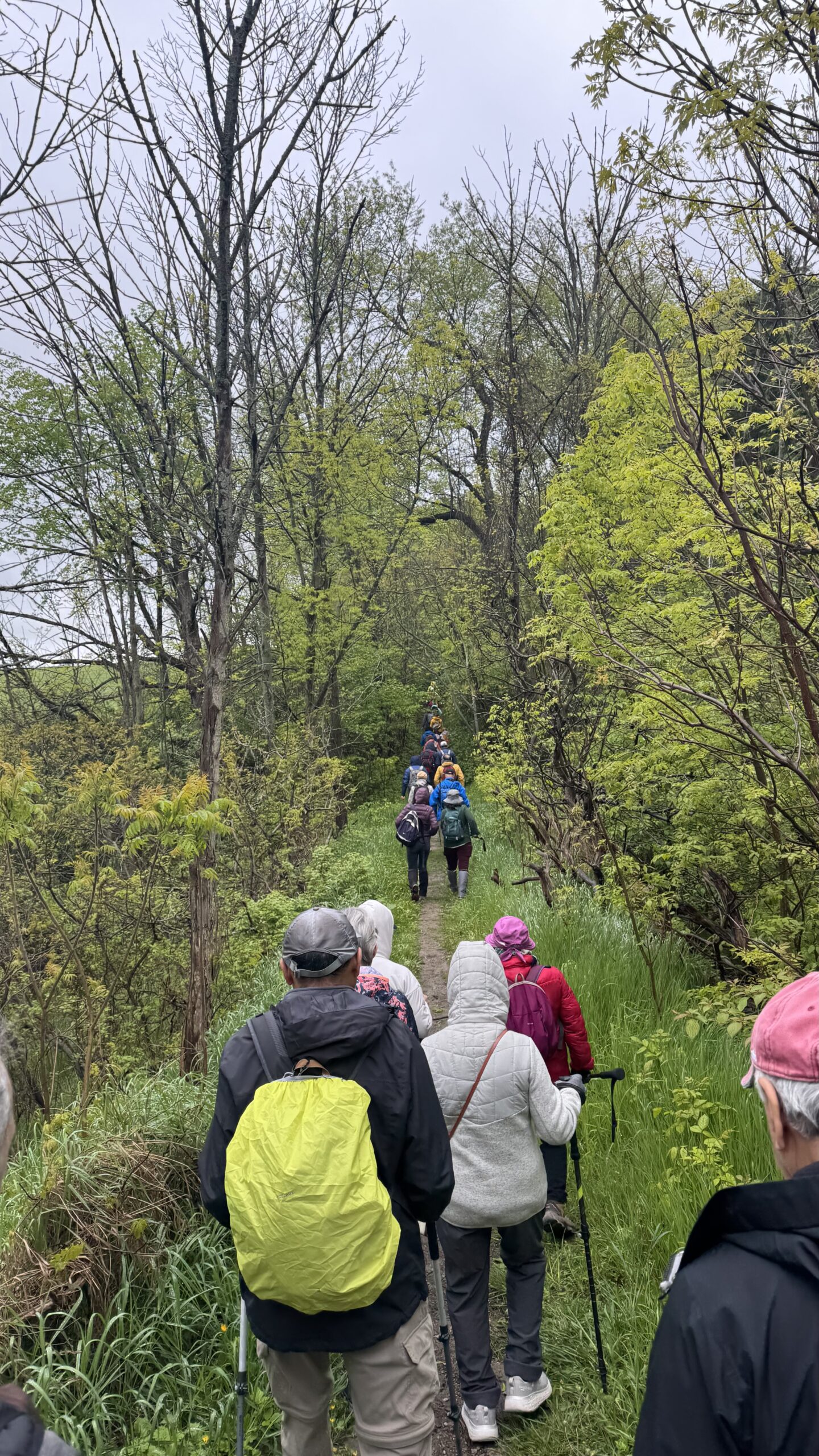
Car Hike: Jefferson Forest and Bond Lake (Richmond Hill)
https://hikes.brucetrail.org/event/car-hike-jefferson-forest-and-bond-lake-richmond-hill/Sorry, the registration cut-off time for this hike has been reached.Not a member? Click here to join today!Hosting Club: Toronto
Category: Car Hike
Location (Google Maps):1245 Bethesda Side Rd, Richmond Hill, ON L4E 1A2 ( Bethesda Trail Head Parking lot)
Hike Leader(s): Amir Alemohammad Click here to contact Hike Leader(s)
Pace: Moderate (3-4 km/hr)
Terrain: Flat, Hilly, Level 2 (Intermediate – some hills and uneven surfaces, rocks and roots underfoot), Variable
Distance: 13-14 kmDescription
Join us for a wonderful hike in Jefferson Forest and have a snack/lunch beside the Bond Lake. We will hike among tall trees and bushes of the Jefferson Forest and across the Bayview-Yonge corridor to reach to the Bond Lake. Boots mandatory, poles recommended, bring at least 2L of water, bug spray, sunscreen, snack/lunch and dress according to the weather conditions. Please avoid parking along the road. Difficulty Level: 2 (Moderate)Please arrive @7:50 AM for start of 8:00AM.
This is a joint hike with the Oak Ridges Trail Association (ORTA).
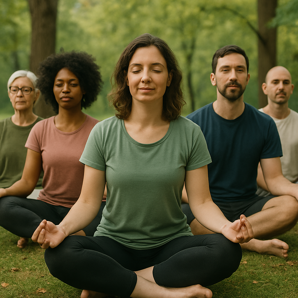
Walking Within: Nature’s Meditation Walk.
https://hikes.brucetrail.org/event/walking-within-natures-meditation-walk-2/Sorry, the registration cut-off time for this hike has been reached.Not a member? Click here to join today!Hosting Club: Niagara, Toronto
Category: Event Hikes
Location (Google Maps): Colonel Danforth Park, 73 Colonel Danforth Trail, Toronto, ON M1C 1P8, CanadaHike Leader(s): Mehrnoush Ahmadi Click here to contact Hike Leader(s)
Pace: Leisurely
Terrain: Easy
Distance: ~6 kmDescription
Take a mindful break from daily life and immerse yourself in nature during this 3-hour guided meditation walk. Through gentle movement, breathwork, and stillness, we will reconnect with the present moment and the natural world around us
The experience includes a slow, intentional walk with guided breathing exercises, sensory awareness practices, and a 30-minute silent forest sitting meditation to ground and restore. Behrang, an experienced hiker and psychotherapist, will be accompanying us on this mindful journey.
No prior meditation experience is needed. Please wear comfortable shoes, dress for the weather, and bring water and a cushion or mat for sitting, if you wish.Car Hike: Murphy's Pinnacle - Boyne Valley Provincial Park
https://hikes.brucetrail.org/event/car-hike-murphys-pinnacle-boyne-valley-provincial-park/Sorry, the registration cut-off time for this hike has been reached.Not a member? Click here to join today!Hosting Club: Toronto, Dufferin Hi-Land
Category: Car Hike
Location (Google Maps):County Road 19 (Prince of Wales Rd) Parking Area. This parking is 80 meters south of the Prince of Wales Side Trail. GPS Coordinates N44.100049, W80.137339.
Hike Leader(s): Ross Estrella Click here to contact Hike Leader(s)
Pace: Brisk (4-5 km/hr), Moderate (3-4 km/hr)
Terrain: Hilly, Level 2 (Intermediate – some hills and uneven surfaces, rocks and roots underfoot), Rocky
Distance: 14 kmDescription
Hiking is not a race, it’s a journey to refuel your body, mind and spirit and a chance to connect with nature and other souls. A time to cherish the views and savour the experience. Every step is another moment to breathe the fresh air and feel the earth under your feet. This is hiking beauty, it’s simplicity. Go hike alone or let nature and me guide you. At a moderate to brisk pace we’ll hike the Prince of Wales, Primrose Loop and Boyne Valley Side Trails and portion of the Main Trail at Boyne Valley Provincial Park. Atop Murphy’s Pinnacle you’ll enjoy and love the panoramic view of the surrounding landscape. Please bring your favorite liquid fuel, snacks/lunch and personal medications (if any) and health card. Equipped yourself with sun screen, bug repellent and hat for sun protection. Hiking poles and proper footwear is always recommended. Dress appropriately for the hike day weather. Please arrive fifteen minutes early.Beaver Valley E2E hike #2/5
https://hikes.brucetrail.org/event/beaver-valley-e2e-hike-2-5/Sorry, the registration cut-off time for this hike has been reached.Not a member? Click here to join today!Hike open to BTC Members only.
Hosting Club: Toronto
Category: Car Hike
Location (Google Maps): Same as day 1Hike Leader(s): Smadar Junkin Click here to contact Hike Leader(s)
Pace: Brisk (4-5 km/hr)
Terrain: Challenging, Hilly, Level 3 (Advanced – steep hills and some scrambling over boulders)
Distance: 26kms and a bit of road walking on each end.Description
Please see hike instructions on day 1.we will shuttle to north of km 50.0 and walk back.

10:00 Hidden Bench Estate Winery Hike and Wine Tasting Experience
https://hikes.brucetrail.org/event/1000-hidden-bench-estate-winery-hike-and-wine-tasting-experience/Sorry, the registration cut-off time for this hike has been reached.Not a member? Click here to join today!Hike open to BTC Members only.
Hosting Club: Niagara
Category: In and Out
Location (Google Maps): Hidden Bench Estate Winery , 4152 Locust Lane, Beamsville . Please park at the warehouse (right across the road from the winery) .Hike Leader(s): Sam Rutherford Click here to contact Hike Leader(s)
Pace: Medium
Terrain: Moderate
Distance: 6kDescription
We will pick up the main trail from Locust Lane and head out towards Kinsmen Park and return back to Hidden Bench Estate Winery by 11:30. Upon return we will enjoy a private structured tasting led by one of the knowledgeable and friendly winery staff from 11:30 to 12:00 noon. The cost for the tasting experience is $18.00 per person. Please bring your $18.00 with you as I will collect it prior to the tasting to simplify the payment to Hidden Bench Estate Winery. Thank you.Exploring Sydenham Hike #26 Derby Forest Loops
https://hikes.brucetrail.org/event/exploring-sydenham-hike-26-derby-forest-loops/Sorry, the registration cut-off time for this hike has been reached.Not a member? Click here to join today!Hosting Club: Sydenham
Category: General Hike
Location (Google Maps): Parking area at the north end of Georgian Bluffs Conc. 3Hike Leader(s): Bill Snel Click here to contact Hike Leader(s)
Pace: Leisurely: 3 km/h or less
Terrain: Moderate: Some hills and/or poor footing
Distance: 5 kmDescription
We will do a loop hike from the end of Georgian Bluffs Concession 3 north of Grey Rd. 5 of the Derby Forest / Springmount Forest RED trail. This is hike 26 in the book, Exploring Sydenham. There are no secrets to locate. If you do not have a book and would like one ($30) let me know by using the “Contact hike leader” link. - 14July 14, 2025
Shorthills Roland Rd to Rockway
https://hikes.brucetrail.org/event/shorthills-roland-rd-to-rockway/Sorry, the registration cut-off time for this hike has been reached.Not a member? Click here to join today!Hosting Club: Niagara
Category: In and Out
Location (Google Maps): Roland Road parking lot Shorthills Provincial Park Parking Lot BHike Leader(s): Erin Lyttle Click here to contact Hike Leader(s)
Pace: Medium
Terrain: Strenuous
Distance: 11kmDescription
Meet at the Shorthills Provincial Park Lot B (Roland Road) There is an outhouse available at the parking lot (bring your own hand sanitizer). We will head west towards Rockway Conservation area. Note that there are steep and rocky inclines and proper footwear is REQUIRED, poles are HIGHLY RECOMMENDED. This hike has ups and downs and will be mostly in the shade. Bug spray highly recommended.8:30 am Hydro Hill Training
https://hikes.brucetrail.org/event/830-am-hydro-hill-training/Sorry, the registration cut-off time for this hike has been reached.Not a member? Click here to join today!Hosting Club: Niagara
Category: In and Out
Location (Google Maps):Lockhart Drive, St Catharines, by the large yellow swing gate.
Hike Leader(s): Suzanne Gourluck Click here to contact Hike Leader(s)
Pace: Brisk
Terrain: Strenuous
Distance: 6 kmsDescription
This challenging “hike” is intended for those wishing to train for future challenging hikes. Choose your own pace to go up and down the moderately steep hill in 30 min with a brief flat walk partway through. The terrain is a hard packed gravel surface. Feel free to bring light weights to increase the intensity of your training. Bring water, hiking poles, snack and dress for the weather.Beaver Valley E2E 3/5
https://hikes.brucetrail.org/event/beaver-valley-e2e-3-5/Sorry, the registration cut-off time for this hike has been reached.Not a member? Click here to join today!Hike open to BTC Members only.
Hosting Club: Toronto
Category: Car Hike
Location (Google Maps): Graham Hill Rd 60 meters to the west of km 74.2. Coordinates N 44.333807,W 80.554916 map # 26.Hike Leader(s): Smadar Junkin Click here to contact Hike Leader(s)
Pace: Brisk (4-5 km/hr)
Terrain: Challenging, Hilly, Level 3 (Advanced – steep hills and some scrambling over boulders)
Distance: 24 kms.Description
Please see hike notes on hike #1. We will shuttle to km 50.0 and hike back. - 15July 15, 2025
8:00 Long Hike Wiley Road Short Hills
https://hikes.brucetrail.org/event/800-long-hike-wiley-road-short-hills-4/Sorry, the registration cut-off time for this hike has been reached.Not a member? Click here to join today!Hosting Club: Niagara
Location (Google Maps):
Short Hills Wiley Road Entrance
Pace: Medium
Terrain: Moderate
: 10kmDescription
Explore Short Hills and the majestic side trails of Scarlett Tanager, Hemlock. Swayze Falls and Terrace. Register for each hikeBring Poles, Sun Screen Bug Spray, snack, and dress for the weather
Beaver Valley E2E 4/5
https://hikes.brucetrail.org/event/beaver-valley-e2e-4-5/Sorry, the registration cut-off time for this hike has been reached.Not a member? Click here to join today!Hike open to BTC Members only.
Hosting Club: Toronto
Category: Car Hike
Location (Google Maps): Same as day 3.Hike Leader(s): Smadar Junkin Click here to contact Hike Leader(s)
Pace: Brisk (4-5 km/hr)
Terrain: Challenging, Hilly, Level 3 (Advanced – steep hills and some scrambling over boulders)
Distance: 21.5 kmsDescription
Please look at hike 1 for the instructions. We will shuttle to km 95.7 and walk back.9:15 Short Hike - Short Hills Park, Pelham Rd
https://hikes.brucetrail.org/event/915-short-hike-short-hills-park-pelham-rd-24/Sorry, the registration cut-off time for this hike has been reached.Not a member? Click here to join today!Hosting Club: Niagara
Category: Hike
Location (Google Maps): Shorthills Provincial Park, Pelham Rd, St. CatharinesHike Leader(s): Debbie Demizio Click here to contact Hike Leader(s)
Pace: Medium
Terrain: Moderate
Distance: ~ 6kmsDescription
Hike the main and side trails in Shorthills Provincial Park. Wear hiking boots, bring water and insect repellent. Please check yourself for ticks following the hike.West of Scotsdale
https://hikes.brucetrail.org/event/west-of-scotsdale-2/Sorry, the registration cut-off time for this hike has been reached.Not a member? Click here to join today!Hosting Club: Caledon Hills
Category: Tuesday Hikers
Location (Google Maps): Take Trafalgar Rd. north to where it connects with Hwy 7. Turn left and follow Hwy 7 north for about 1 km and then turn right on 22 Sideroad. In 1.5 km turn left where SR 22 meets Eighth Line. Follow Eighth Line north about 2 km to roadside parking at 8th Line ST.Hike Leader(s): Peter Leeney Click here to contact Hike Leader(s)
Pace: Medium – 3 to 4 km/hour
Terrain: Moderate – some hills and/or some poor footing
Distance: 10 kmDescription
From the meeting place on 8th Line we will hike west on the Great Esker Side Trail to the Trafalgar ST and the new “North Rim Side Trail”. Will also do the Reservoir ST before returning to 8th Line.Cell phone is 905-301-4091.
- 16July 16, 2025
Beaver Valley E2E 5/5
https://hikes.brucetrail.org/event/beaver-valley-e2e-5-5/Sorry, the registration cut-off time for this hike has been reached.Not a member? Click here to join today!Hike open to BTC Members only.
Hosting Club: Toronto
Category: Car Hike
Location (Google Maps): Km 117.3 grey Rd 12. Coordinates N 44.500537,W 80.632902 map 28. Please note that this parking is not marked on the map. It is marked on the Bruce Trail App.Hike Leader(s): Smadar Junkin Click here to contact Hike Leader(s)
Pace: Brisk (4-5 km/hr)
Terrain: Challenging, Hilly, Level 3 (Advanced – steep hills and some scrambling over boulders)
Distance: 21.6Description
Last day, badge day, treats day. We will shuttle to km 95.7 and hike back. See hike notes on day 1.
8:30 am Woodend Conservation Area Hike
https://hikes.brucetrail.org/event/830-am-woodend-conservation-area-hike-2/Sorry, the registration cut-off time for this hike has been reached.Not a member? Click here to join today!Hosting Club: Niagara
Category: In and Out
Location (Google Maps):Woodend Conservation Area
Hike Leader(s): Suzanne Gourluck Click here to contact Hike Leader(s)
Pace: Medium
Terrain: Moderate
Distance: 10 kmDescription
Starting in Woodend we will enjoy an in and out hike along the Wetland Ridge Trail and the Bruce Trail as far as the Screaming Tunnel (and possibly beyond) before returning.
Bring bug spray, poles, water and a snack if needed.Quarry to Cherry YOUTH 12+ WELCOME
https://hikes.brucetrail.org/event/quarry-to-cherry-youth-12-welcome/Sorry, the registration cut-off time for this hike has been reached.Not a member? Click here to join today!Hosting Club: Niagara
Category: Youth Hike
Location (Google Maps): Quarry Road parking lot (Google Maps-“Parking for Cave Springs Conservation Area”) 3768 Quarry Rd, Lincoln, ON L0R 1B2Hike Leader(s): Erin Lyttle Click here to contact Hike Leader(s)
Pace: Leisurely
Terrain: Moderate
Distance: 4.6kmDescription
We will be starting at Quarry road, hiking to Cherry and then back.This is an age 12+ hike. A responsible adult must accompany youth 12-18 in a max ratio of 2 youth per adult. This hike has little road and lots of shade! Waivers must be completed for everyone in attendance (adults and youth). Bug spray, sunscreen, water and a snack are encouraged. Must wear appropriate footwear. For hikers 15 and under interested in earning a youth badge, they will be available on the hike for $6 please bring cash.
The Young Trail Blazer Badge requires the completion of one hike (at least 3km in length) conducted on the Niagara Bruce Trail. Hikes can be completed with the club on an official scheduled hike or with family on their own.
To earn the Young Nature Blazers Badge you must complete a 90 minute hike on the Niagara Bruce Trail. Afterwards, chat with the hike leader describing how you used one or more of your five senses on the hike – what did you see, touch, taste, smell or hear during your hike?
WEDNESDAY WALKERS - Old Baldy
https://hikes.brucetrail.org/event/wednesday-walkers-old-baldy-3/Sorry, the registration cut-off time for this hike has been reached.Not a member? Click here to join today!Hosting Club: Beaver Valley
Location (Google Maps): Our hike will begin from the parking lot of Old Baldy. km 43.9, Map 25, Edition 31. Any hike participants who do not have a parking pass for Grey Sauble CA can park on the shoulder of Sideroad 7B by the bend in the road and then be shuttled to the parking lot.
Hike Leader(s): Margaret Yaraskavitch Click here to contact the hike leader.
Pace: Medium
Terrain: Moderate, Some rocky footing
Length of Hike: 5 kmDescription
Our hike takes us atop Old Baldy, the iconic outcrop. The Trail is well-used, the pathway often being “roots and rocks”. There will be a number of lookout spots to view into and across the Beaver Valley. We will hike along the main Trail and then turn back when we reach the road allowance part of the Trail. On the way back we will walk on the Mac Kirk Side Trail, under a canopy of deciduous trees. - 17July 17, 2025
8:00 am Long Hike Cave Spring Conservation Area
https://hikes.brucetrail.org/event/800-am-long-hike-cave-spring-conservation-area-3/Sorry, the registration cut-off time for this hike has been reached.Not a member? Click here to join today!Hosting Club: Niagara
Location (Google Maps):
Cave Spring Conservation Area
Pace: Medium
Terrain: Moderate
: 10kDescription
This will be our permanent Thursday Location until Bridge repairs complete. From Cave Spring Conservation Area explore the trail network on the escarpment towards Kinsman Park and Moyer Road.You must register for each hike. Bring Poles, snack bug spray, sunscreen and a drink. Dress for the weather
Hiking around Jordan and Balls Falls
https://hikes.brucetrail.org/event/hiking-around-jordan-and-balls-falls-3/Sorry, the registration cut-off time for this hike has been reached.Not a member? Click here to join today!Hosting Club: Niagara
Location (Google Maps): Glen Road, Jordan
Hike Leader(s): Bill Russell Click here to contact Hike Leader(s)
Pace: Medium
Terrain: Moderate
Distance: 6-7 kmDescription
Hiking from Glen Road and following Jim Rainforth Trail and trails to Balls Falls and Bailey BridgeCar Hike: Toronto Section End to End (1 of 4) CANCELLED
https://hikes.brucetrail.org/event/car-hike-toronto-section-end-to-end-1-of-4/Sorry, the registration cut-off time for this hike has been reached.Not a member? Click here to join today!Hosting Club: Toronto
Category: Cancelled
Location (Google Maps): Bruce Trail Pear Tree Park – 15th Sideroad, 200m southwest of Regional Rd 25 (11.4k marker, Edition 31)Hike Leader(s): David Rowney Click here to contact Hike Leader(s)
Pace: Moderate (3-4 km/hr)
Terrain: Level 2 (Intermediate – some hills and uneven surfaces, rocks and roots underfoot), Variable
Distance: 11.9kDescription
*Cancelled Due To Hazardous Weather Conditions*This is a summer-time End-to-End hike to complete the Toronto section of the Bruce Trail in 4 hikes. Join for all or as many hikes as desired. You may use this hike towards your E2E Fundraiser Badge (you must complete at least 3 of the 4 hikes with the group to qualify) or a regular E2E badge.
This first hike will take us from the start of the Toronto Section just south of Hilton Falls Conservation area to the Bruce Trail Pear Tree Park. The terrain is not too hilly, but the footing is tricky with many uneven, rocky sections to navigate.
July weather can be hot, muggy and buggy! So, dress for the weather, keeping in mind that insects, including ticks, will be out in full force. Take appropriate precautions to avoid insect bites, including using repellant and clothing that covers the legs and arms. Hiking shoes/boots are required and hiking poles are recommended.
Bring plenty of fluids, including electrolytes, and a snack/lunch.
As this is a group hike, please consider your fitness level before registering. We will be walking at a pace of 3km – 4km per hour and everyone is expected to keep up with the person in front of them for the duration of the hike.
Plan to arrive at the meeting place by 9:15 a.m. as we will start the car shuffle to the hike starting point at 9:30 a.m. sharp. Further details will be provided to registered hikers a few days prior to the hike.
Georgian Bluffs - top of Kemble Mountain
https://hikes.brucetrail.org/event/georgian-bluffs-top-of-kemble-mountain-4/Sorry, the registration cut-off time for this hike has been reached.Not a member? Click here to join today!Hosting Club: Sydenham
Category: General Hike
Location (Google Maps): Meet at the The Owen Sound Galaxy Cinema parking lot. Meet at the tall “Galaxy Centre” sign next to the traffic lights.Hike Leader(s): Ian Mills Click here to contact Hike Leader(s)
Pace: Medium: 3 to 4 km/h
Terrain: Moderate: Some hills and/or poor footing, There might be muddy sections., There might be sections with water on the trail.
Distance: 9 kmDescription
This hike is a great opportunity for fresh air and exercise. Plan for 3 hours plus on the trail. Please pack a snack or lunch as we will be taking a break at the halfway point . We will start @ 142.6 km BTC Map # 34 taking the Main Trail south and looping with the following Side Trails (Mystery Cabin, Don Richards, Coles, Maple Cross Ridge & Nels Maher). Proper hiking footwear is required, a stick could be helpful, pack lots of water and insect repellent. - 18July 18, 2025
School Bus Hike: Ferris Provincial Park
https://hikes.brucetrail.org/event/school-bus-hike-ferris-provincial-park/Sorry, the registration cut-off time for this hike has been reached.Not a member? Click here to join today!Trip Information
Departure Time: 08:30
Return to City Time: 18:00
Departure Point: York Mills Bus PickupOptional Items
Hosting Club: Toronto
Category: Bus Hike
Location (Google Maps): Ferris Provincial ParkHike Leader(s): Celia Ho, Tom Swales Click here to contact Hike Leader(s)
Pace: Moderate (3-4 km/hr)
Terrain: Flat, Level 1 (Easy – mostly on flat, well maintained trails with hard-packed surface), Variable
Distance: 10-11 kmDescription
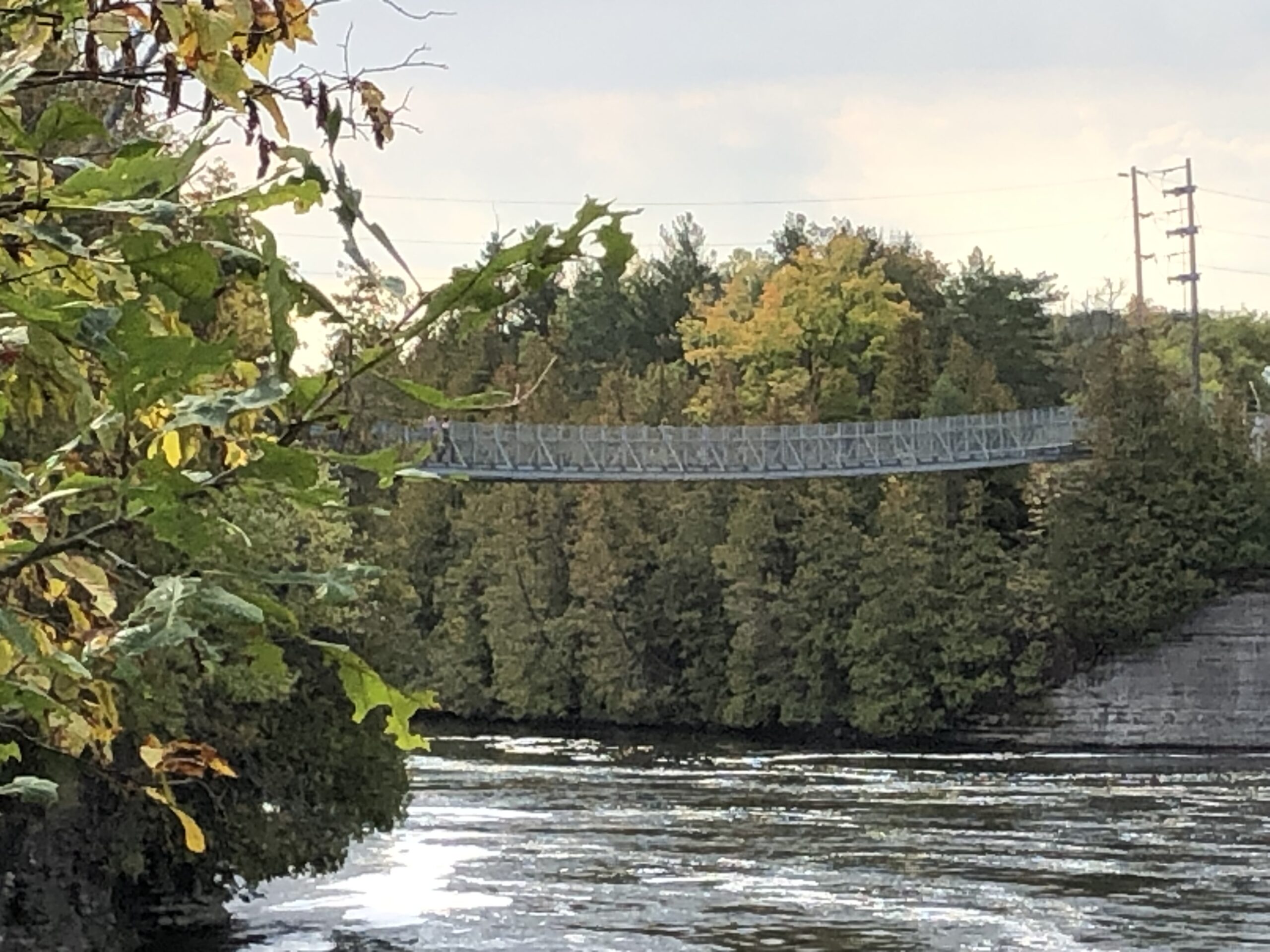
Join us on our first Friday bus hike of 2025 to celebrate Healthy Parks Healthy People Day and explore Ferris Provincial Park near Campbellford, ON. We will be hiking the Drumlin Trail System – 3 interconnecting looped trails (6.2 km), the Ranney Falls Trail (1 km) along the Trent river, where there are magnificent views of the Ranney Gorge Suspension Bridge and Ranney Falls, and the River Gorge Trail (3.5 km) with magnificent views of the Trent River gorge from the Ranney Gorge Suspension Bridge.There will be a refreshment stop in Campbellford after the hike before returning to Toronto. The town of Campbellford features the giant toonie and Dooher’s Bakery (some of the best donuts around).
Note: No Fee will be charged for the Provincial Park entry since it is Healthy Parks Healthy People Day (free admission to Ontario provincial parks).
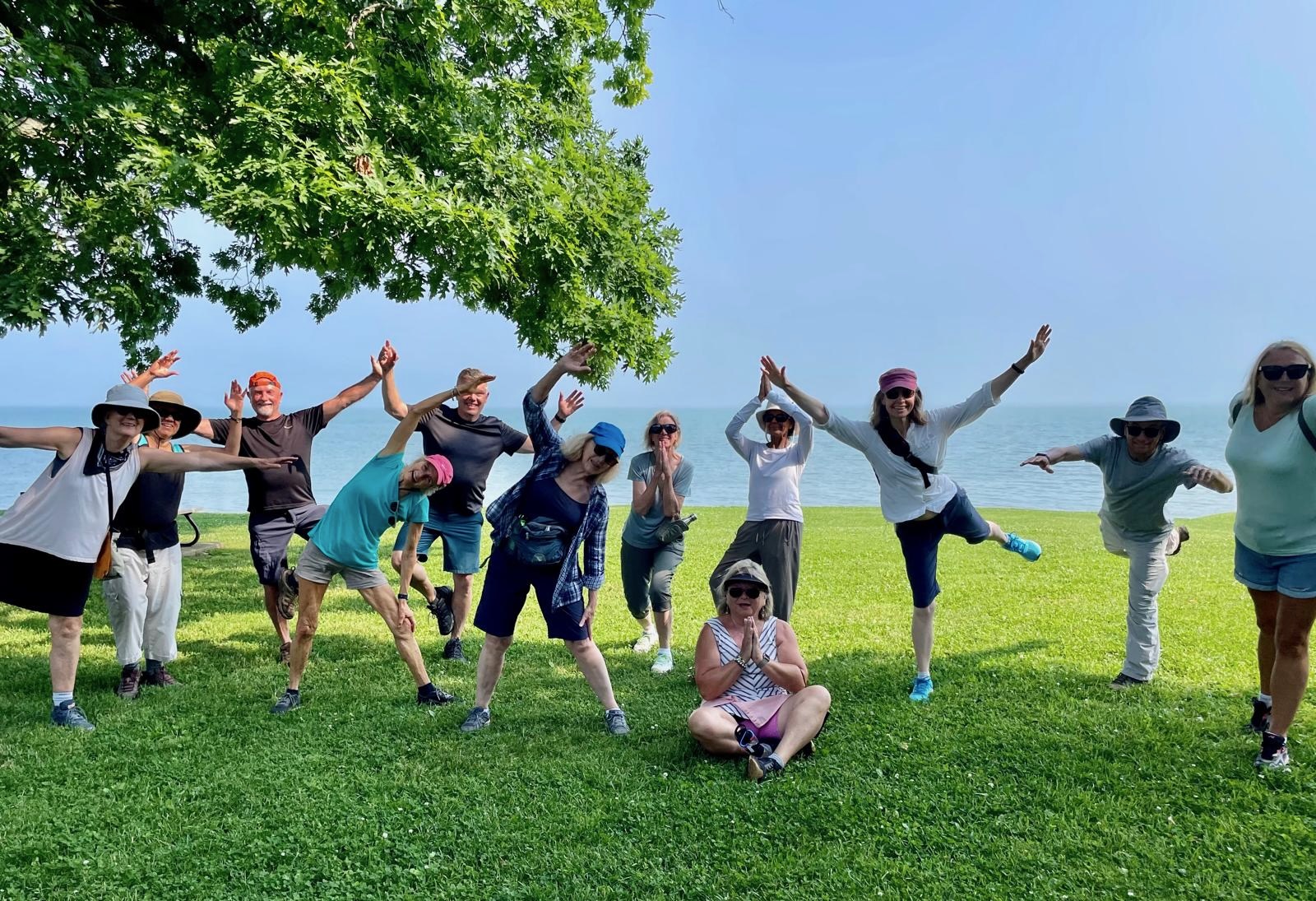
9:00 am Niagara on the Lake Tour & Some Yoga
https://hikes.brucetrail.org/event/900-am-niagara-on-the-lake-tour-some-yoga-3/Sorry, the registration cut-off time for this hike has been reached.Not a member? Click here to join today!Hosting Club: Niagara
Category: Urban
Location (Google Maps):Veteran’s Memorial Park, park just outside the park on King St.
Hike Leader(s): Robin Garrett Click here to contact Hike Leader(s)
Pace: Medium
Terrain: Easy
Distance: 6 kmDescription
Enjoy the benefits of pausing for a yoga practice as we tour through the trails, parkland and Historic Niagara-on-the-Lake. No mat required. Movement will focus on a flow of standing poses designed especially for hikers. Plan to stay for conversation and a warm cup of coffee or tea at Sweets & Swirls, Community Centre, Niagara Stone Road, NOTL. - 19July 19, 2025
Coach Trip: Silent Lake Provincial Park
https://hikes.brucetrail.org/event/coach-trip-silent-lake-provincial-park-2/Sorry, the registration cut-off time for this hike has been reached.Not a member? Click here to join today!Trip Information
Departure Time: 07:30
Return to City Time: 19:30
Departure Point: York Mills Bus PickupTrip Activities
Fast group ($0.01)
Moderate hike ($0.01)
Slow hike ($0.01)
Paddle ($0.01)
Optional ItemsHosting Club: Toronto
Category: Coach Trips
Location (Google Maps): Silent Lake Provincial ParkHike Leader(s): Martina Furrer, Brenda Dalglish, Marie-Josée Roy, Robin Crombie, Roland Mark and Tom Swales Click here to contact Hike Leader(s)
Pace: Brisk (4-5 km/hr), Moderate (3-4 km/hr)
Terrain: Level 2 (Intermediate – some hills and uneven surfaces, rocks and roots underfoot), Rocky, Variable
Distance: 15Description
Join us for a fun summer day at beautiful Silent Lake Provincial Park in the heart of the Kawarthas. Hike the Silent Lake loop (15 km, 4.5 km/hr pace, no dropouts) with Martina and Marie-Josée , then cool off with a dip in Silent Lake. Or hike around Silent Lake at a slightly slower pace with Brenda and Roland; this group will not have time for swimming. Enjoy gorgeous views and some challenging rocks. Or join Robin and Tom for a shorter hike (Lakeshore Trail plus Bonnie’s Pond Loop) at a slower pace and then relax on the beach. Or come and enjoy a day on the water (self-guided) on a motorboat free lake. Canoes and kayaks can be rented at Silent Lake, or bring along your inflatable SUP.Bring lunch, water, snacks, and your swimming gear.
No refreshment stop but there are washrooms and drinking water taps by the day use beach, and you can purchase ice cream and cold drinks in the park store.
Bus departs 10 York Mills Rd at 7:30 AM. We hope to be back in the city by 8 PM. Registration cost includes bus fare and park admission.
Car Hike: Oak Ridges Trail King City
https://hikes.brucetrail.org/event/car-hike-oak-ridges-trail-king-city-2/Sorry, the registration cut-off time for this hike has been reached.Not a member? Click here to join today!Hosting Club: Toronto
Location (Google Maps): Around 14020 Keele Street
Park along Road
Hike Leader(s): Mohammad Aghamiri Click here to contact Hike Leader(s)
Pace: Moderate (3-4 km/hr)
Terrain: Hilly, Level 2 (Intermediate – some hills and uneven surfaces, rocks and roots underfoot)
Distance: 10-12kmDescription
We will hike both sides of Oak ridges trail ,first we hike to Seneca Lake and Eaton Hall on the east side ,Then we hike to Mary Lake and Pine farm where you can have coffee, tea and delicious apple pie and food,
For the day of hike phone number 289 588 6482
Hike 3 Blue Mountain Series in 6 Hikes
https://hikes.brucetrail.org/event/hike-3-blue-mountain-series-in-6-hikes/Sorry, the registration cut-off time for this hike has been reached.Not a member? Click here to join today!Hosting Club: Dufferin Hi-Land
Category: General Hike
Location (Google Maps): Lime Kiln Access Side Trail Parking on RR91 approximately km 37.4Hike Leader(s): Patrcia Foley and Tristan Goguen Click here to contact Hike Leader(s)
Pace: Medium
Terrain: Moderate
Distance: 14.4KmDescription
Hike 3. We will car pool back to Nottawasaga Bluffs Conservation area parking Concession Rd 10 South ( paid parking ) We will start our hike on Hamilton Brothers side trail to the main trail then hike north through Devil’s Glenn and the Mad River area. Be prepared for lots of climbing today. We may encounter some muddy sections and will definitely be in open fields/roads for some time. Bug spray, sunblock and sturdy hiking shoes/boots are recommended. Bring sufficient water and lunch. Note this is a car pool hike, registration is limited and the hike leaders will have 2 dogs with them.Car Hike: Side Rd. 5 to Hockley Rd. Loop
https://hikes.brucetrail.org/event/car-hike-side-rd-5-to-hockley-rd-loop/Sorry, the registration cut-off time for this hike has been reached.Not a member? Click here to join today!Hosting Club: Caledon Hills
Category: General
Location (Google Maps): Mono Side Rd. 5 at km 45.4 on the north side of the road where the trail crosses.Hike Leader(s): Dylan “Lana” Hubbard Click here to contact Hike Leader(s)
Pace: Brisk – 4 to 5 km/hour
Terrain: Strenuous – hilly with steep climbs and some poor footing
Distance: 15 kmDescription
Join us for a 15 km loop hike from Side Rd. 5 to Hockley Rd. Get ready for a workout. We will be hiking at a brisk pace and PLEASE BRING BUG SPRAY AND A LUNCH!We are committed to providing an inclusive and welcoming environment. This hike is an 2SLGBTQIA+ safe space, and everyone is welcome to join us!
Woodend to Fireman's and Back
https://hikes.brucetrail.org/event/woodend-to-firemans-and-back/Sorry, the registration cut-off time for this hike has been reached.Not a member? Click here to join today!Hosting Club: Niagara
Category: Loop
Location (Google Maps): Meet at entrance to Woodend Conservation Area, Taylor Rd, Niagara-on-the-LakeHike Leader(s): Margaret Northfield Click here to contact Hike Leader(s)
Pace: Medium
Terrain: Moderate
Distance: 13-14kmDescription
Hike a loop from Woodend to Fireman’s Park and back. Poles, water and snacks recommended.
Rainbow Hike: One-Hike-Fits All (8, 13 or 20 kms)
https://hikes.brucetrail.org/event/rainbow-hike-one-hike-fits-all-8-13-or-20-km/Sorry, the registration cut-off time for this hike has been reached.Not a member? Click here to join today!Hosting Club: Iroquoia
Category: Rainbow Hike
Location (Google Maps): Hillcrest LoopHike Leader(s): Doug O’Neill Click here to contact Hike Leader(s)
Pace: Medium – 3 to 4 km/hr
Terrain: Moderate – Some hills and/or some poor footing
Distance: 8 km, 13 km or 20 km (Beginner to Advanced)Description
This LGBTQ2SIA+ Rainbow Hike is for hikers of all abilities: beginner, intermediate and more advanced hikers.You don’t have to be a BTC member for this hike.
You get to choose: 8 kms, 13 kms or 20 kms. Each drop-off will be close to an HRT Bus Stop for easy and straightforward bus ride back to the Dundurn neighbourhood where you will have left your car—if you’re driving. Note: This hike is completely do-able by public transit, if you decide not to drive your car.
We’ll rendezvous at 9 a.m. sharp at Hillcrest Loop, Hamilton, near the base of Dundurn Stairs, close to Dundurn and Hillcrest, beside the bus loop.
Parking near the starting point: Search for parking along Dundurn, Hillcrest and other side streets.
PHASE I: Hillcrest Loop to Tiffany Falls (8 kms): We’ll follow the Chedokee Rail Trail (Bruce Trail Main Trail) then cross over the pedestrian bridge above HWY 403. Expect at least one steep, rocky climb as we make our way to Tiffany Falls.
If want to finish at the 8 km mark: A 5-minute walk along Wilson Street will take you to the bus stop where you’ll take the (05) 5-A Greenhill /McMaster bus to the Main @ Dundurn, then a relatively short walk to your car. Bus fare: $2.80 if using your Presto Card; $3.50 if paying by cash. Have appropriate change.PHASE II: Tiffany Falls to Dundas Valley Trail Centre (5 kms): After checking out Tiffany Falls, we’ll pass by Sherman Falls and Canterbury Falls on our way to the Dundas Valley Trail Centre (650 Governor’s Rd.), where we’ll stop for lunch and a good break. (There are flush toilets and a water fountain.)
If you plan to finish at this 13 km mark: Walk 10 minutes to the Gatehouse at 650 Governors Rd, turn right and head to the corner of Governors & Pirie. Take the 5B Mount Albion Loop bus. Get off at Main & Dundurn, then walk to your car.PHASE III: Dundas Valley Trail Centre to Downtown Dundas (approx. 7 kms): After an energizing break at the Trail Centre, we’ll follow the Bruce Trail all the way to downtown Dundas. Optional pub or ice cream stop to reward ourselves!
Bus directions back to starting point: Two options: Catch the 05-King at Highway 8 bus at King and Ogilvie (across from our favourite pub), or walk 5 minutes to Governor and Ogilvie and catch the (05) 5 – King at Highway 8/Stoney Creek Bus. Get off at Main & Dundurn, then walk to your car.Everyone gets a complimentary Bruce Trail Rainbow Badge or sticker.
We’re happy to welcome members of the Out & Out Club of Toronto on this hike. You’ll have a chance to learn about their outdoor activities—which range from cycling to skiing.
Bring at least 1 litre of water, snacks/lunch, sunscreen, insect repellent. Hiking boots or sturdy footwear as well a cap. To avoid tickets, wear long pants.
Email any questions to the Hike Leader – “Click here to contact Hike Leader” on this form.