Hike Schedule
Join us for a hike! Registration required.
All hikes available to BTC members. Some hikes are open to non-members.
See Refund Policy for Paid Hikes >
TIP: The calendar view displays up to 7 hikes on a day, but often there are more. Click “View more events” to see them all.
Categories
- 23July 23, 2023
Discovery Badge Series 5/5 Shuttle Hike
https://hikes.brucetrail.org/event/discovery-badge-series-5-5-shuttle-hike/Sorry, the registration cut-off time for this hike has been reached.Not a member? Click here to join today!Hosting Club: Caledon Hills
Category: General
Location (Google Maps): Meet at roadside parking on the east side of Creditview Rd., immediately north of the Grange Sideroad intersection, 43.791491, -79.975229Directions for the Meeting Location: From ON-10 turn west onto The Grange Sideroad for 2.3 kilometres. Turn right onto Creditview Road.
Shuttle to km 2.8, roadside parking at the turnaround at the north end of Chinguacousy Rd., 43.785429, -79.943325
Hike Leader(s): Sandy Green and Dominique Garceau Click here to contact Hike Leader(s)
Pace: Medium – 3 to 4 km/hour
Terrain: Strenuous – hilly with steep climbs and some poor footing
Distance: 12.0 kmDescription
Register individually for one, a few, or all of the five Discovery Badge Series hikes. Participants who complete all five hikes will be eligible to receive a CHBTC Discovery Badge. Hike Five explores main Trail, the Badlands, and the Devil’s Pulpit and Ring Kiln Side Trails in the Forks of the Credit area. Bring your choice of hydration and snacks. Hiking boots are highly recommended. See June 18, June 25, July 2, and July 16 for details pertaining to the other hikes in the series. (Note: If you wish to purchase badges, the cost of each badge is $10.00 for BTC members and $15.00 for non-members.)
Toronto Urban Badge Hike - 4 of 7
https://hikes.brucetrail.org/event/toronto-urban-badge-hike-4-of-7-2/Sorry, the registration cut-off time for this hike has been reached.Not a member? Click here to join today!Hosting Club: Toronto
Location (Google Maps): Toronto
Hike Leader(s): Brian Rideout Click here to contact Hike Leader(s)
Pace: Moderate
Terrain: Flat
Distance: 11.4 kmDescription
Please join me at the north west corner of Finch and Weston by 10 AM. We will hike east along the Finch Hydro Corridor Trail to Bathurst St (N of Finch) (km 30.2 to km 41.6). Here is an online map with km markings of our route for all 7 hikes for the Toronto Urban Badge.Please make sure you bring at least 2 liters of water, a lunch, bug spray and sunscreen.
Sunday Social Hike - Sydenham Nature Reserve
https://hikes.brucetrail.org/event/sunday-social-hike-sydenham-nature-reserve/Sorry, the registration cut-off time for this hike has been reached.Not a member? Click here to join today!Hosting Club: Sydenham
Category: General Hike
Location (Google Maps): Roadside parking on Grey Rd. 18 / Derry Line at the Owen Sound Rail Trail / Keeling Side Trail just east of Rockford, east of km 94.5 (Map 32)Hike Leader(s): Bill Snel Click here to contact Hike Leader(s)
Pace: Leisurely: 3 km/h or less
Terrain: Moderate: Some hills and/or poor footing
Distance: 4 kmDescription
We will start and end the hike by using the rail trail. The Sydenham Nature Reserve contains variety of terrain along with a disappearing stream. You can bring your Secrets of Sydenham book to find secret 16 on page 27. If you are unable to register, please call the hike leader at 519-470-0584 (landline). - 24July 24, 2023No events
- 25July 25, 2023
8:00 Long Hike Wiley Road Short Hills
https://hikes.brucetrail.org/event/800-long-hike-wiley-road-short-hills-24/Sorry, the registration cut-off time for this hike has been reached.Not a member? Click here to join today!Hosting Club: Niagara
Location (Google Maps):
Short Hills Wiley Road Entrance
Pace: Medium
Terrain: Moderate
: 10kmDescription
Explore Short Hills and the majestic side trails of Scarlett Tanager, Hemlock. Swayze Falls and Terrace. Register for each hike
Bring Poles water, snack, sunscreen and bug spray and dress for the weather
9:15 Short Hike - Pelham Road, Short Hills
https://hikes.brucetrail.org/event/915-short-hike-pelham-road-short-hills-53/Sorry, the registration cut-off time for this hike has been reached.Not a member? Click here to join today!Hosting Club: Niagara
Location (Google Maps): Pelham Road entrance, Short Hills Provincial Park
Hike Leader(s): janet davey Click here to contact Hike Leader(s)
Pace: Medium
Terrain: Moderate
Distance: 6 kmsDescription
Hike the main and side trails in Short Hills Provincial Park. Bring hiking boots, water, sunscreen and bug spray.Waterdown Loop including Grindstone Creek and The Great Falls
https://hikes.brucetrail.org/event/waterdown-loop-including-grindstone-creek-and-the-great-falls/Sorry, the registration cut-off time for this hike has been reached.Not a member? Click here to join today!Hosting Club: Caledon Hills
Category: Tuesday Hikers
Location (Google Maps): City View Park off of Kerns Rd..Hike Leader(s): Ralph Shapiro Click here to contact Hike Leader(s)
Pace: Medium – 3 to 4 km/hour
Terrain: Moderate – some hills and/or some poor footing
Distance: 12 kmDescription
From City View parking we will use a combination of side trails and main trail to loop down to Grindstone Creek and then climb to Smokey Hollow and back to City View. This hike includes some very unique places on the Bruce Trail.East Linton, Frank Holley, Ron Savage Side Trail Loop
https://hikes.brucetrail.org/event/east-linton-frank-holley-ron-savage-side-trail-loop-2/Sorry, the registration cut-off time for this hike has been reached.Not a member? Click here to join today!Hosting Club: Sydenham
Category: General Hike
Location (Google Maps): The Owen Sound Galaxy Theatre parking lot. Meet at the tall “Galaxy Centre” sign next to the traffic lights.Hike Leader(s): Franziska Edney Click here to contact Hike Leader(s)
Pace: Medium: 3 to 4 km/h
Terrain: Moderate: Some hills and/or poor footing, Strenuous: Hilly with steep climbs and some poor footing.
Distance: 8.2 kmsDescription
We will walk up to the top of the escarpment, then follow the white trail, and return via the Ron Savage and Frank Holley Side Trail. This is a beautiful wooded area with a nice large swamp, some crevices and interesting rock formations. Poles advised, bring water, and a snack if you wish. Map 33. If you are unable to register, please call or text the leader at 519 379 2573. - 26July 26, 2023
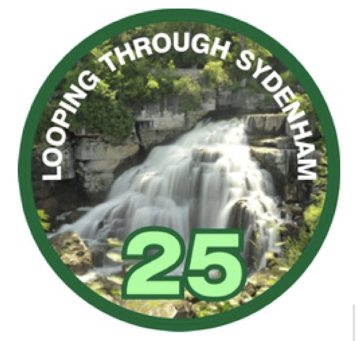
Looping Through Sydenham -- Series of 9 hikes
https://hikes.brucetrail.org/event/looping-through-sydenham-series-of-9-hikes/Sorry, the registration cut-off time for this hike has been reached.Not a member? Click here to join today!This is a Multi-Day Hike
You are signing up for the following dates and times:
2023-07-26 at 07:30
2023-08-05 at 08:30
2023-08-16 at 08:30
2023-08-19 at 08:30
2023-09-02 at 08:30
2023-09-23 at 08:30
2023-10-07 at 08:30
2023-10-14 at 08:30
2023-10-21 at 08:30Hosting Club: Blue Mountains
Category: Organized Hike
Location (Google Maps): Hike meets in the parking lot behind Tim Hortons on First St. in Collingwood.Hike Leader(s): Allison Thomas Click here to contact Hike Leader(s)
Pace: Medium – 3 to 4 km/hr
Terrain: Moderate – Some hills and/or some poor footing
Distance: 12.5kmDescription
Participants must complete and log all 9 hikes to qualify for a Looping through Sydenham badge. Hikers MUST register on-line for the first hike (prior to July 24, 2023) in order to be registered for all nine hikes. You will NOT need to register for all nine hikes individually. There is a limited number of spots for this series. Hikers are encouraged to arrange their own carpooling for the following eight hikes. Some of these hikes involve driving to different locations on the day of the hike as more than one Side Trail is completed in a day. All nine hikes MUST be completed by participating in this BMBTC organized hike series. The leader will contact registrants in advance to confirm the exact meet up location. Please go to the Blue Mountains Bruce Trail Club website at bmbtc.org for the specific details of each hike.
WEDNESDAY WALKERS - Loree Forest
https://hikes.brucetrail.org/event/wednesday-walkers-loree-forest/Sorry, the registration cut-off time for this hike has been reached.Not a member? Click here to join today!Hosting Club: Beaver Valley
Location (Google Maps): Paid parking on the shoulder of the 21st Side Road. Map 24, Edition 30 (Arrangements can be made in advance to shuttle to the trailhead.)
Hike Leader(s): Margaret Yaraskavitch Click here to contact the hike leader.
Pace: Medium
Terrain: Easy
Length of Hike: 6.5 kmsDescription
We will take the access road into Loree Forest where we will then walk a loop. Most of the Trail is flat. There will be views of Nottawasaga Bay and a walk through a mature deciduous forest. Then we take the access road back to our parking area. A popular well-enjoyed route. Please bring water and a snack.6:00 pm Niagara Glen (Gorge)
https://hikes.brucetrail.org/event/600-pm-niagara-glen-gorge/Sorry, the registration cut-off time for this hike has been reached.Not a member? Click here to join today!Hosting Club: Niagara
Category: Loop
Location (Google Maps): Niagara GlenHike Leader(s): Heather Howkins Click here to contact Hike Leader(s)
Pace: Medium
Terrain: Moderate
Distance: 5 – 6kDescription
Evening hike in Niagara Gorge. We will take the metal stairs into the gorge and follow the trail down to the river and return up the metal stairs.Please bring poles, water and bug spray.
- 27July 27, 2023
8:00 am Long Hike Jordan to Moyer / Louth
https://hikes.brucetrail.org/event/800-am-long-hike-jordan-to-moyer-louth-51/Sorry, the registration cut-off time for this hike has been reached.Not a member? Click here to join today!Hosting Club: Niagara
Location (Google Maps):
Jordan Hollow Park 3039 King St Jordan
Pace: Medium
Terrain: Moderate
: 10kDescription
From Jordan Hollow Hike the main trail to Upper and Lower Balls Falls, Moyer Road or Louth and Return. You must register for each hike. Bring Poles, sunscreen, bug spray , snack and a drink and dress for the weather
Sydenham E2E Hike 14 of 14
https://hikes.brucetrail.org/event/sydenham-e2e-hike-14-of-14/Sorry, the registration cut-off time for this hike has been reached.Not a member? Click here to join today!Hosting Club: Caledon Hills
Category: End-to-End
Location (Google Maps): Meet at km 0.0 in Blantyre off road parking on the east side of Grey Road 12. Shuttle to start at km 14.4 on 2nd Concession S.Hike Leader(s): Nancy Mooney Click here to contact Hike Leader(s)
Pace: Medium – 3 to 4 km/hour
Terrain: Moderate – some hills and/or some poor footing, Strenuous – hilly with steep climbs and some poor footing
Distance: From km 14.4 to 0.0, total 14.4 km.Description
This is the final hike of the series! We will hike through the Walters Falls and Rocklyn Management Areas through forests, alongside creeks and fields and over boardwalks.9:15 Short Hike - Jordan Hollow
https://hikes.brucetrail.org/event/915-short-hike-jordan-hollow-67/Sorry, the registration cut-off time for this hike has been reached.Not a member? Click here to join today!Hosting Club: Niagara
Location (Google Maps): Jordan Hollow Park, Jordan Station
Hike Leader(s): Bill Russell Click here to contact Hike Leader(s)
Pace: Medium
Terrain: Strenuous
Distance: 6 kmsDescription
Hike the main and side trails around Jordan and Balls Falls. Bring hiking boots, water, sunscreen and bug spray.Bronte Creek
https://hikes.brucetrail.org/event/bronte-creek/Sorry, the registration cut-off time for this hike has been reached.Not a member? Click here to join today!Hosting Club: Iroquoia
Category: Thursday Group
Location (Google Maps): Orchard Park parking lot off Blue Spruce Ave, BurlingtonHike Leader(s): Colleen Mabalay Click here to contact Hike Leader(s)
Pace: Medium – 3 to 4 km/hr
Terrain: Easy – Mostly flat and usually good footing
Distance: Approx 7kmDescription
Bring water, snack, sunscreen and bug spray.Urban Walk - Evening Ramble - Don/West Don
https://hikes.brucetrail.org/event/urban-walk-evening-ramble-don-west-don/Sorry, the registration cut-off time for this hike has been reached.Not a member? Click here to join today!Hosting Club: Toronto
Category: Urban Walk
Location (Google Maps): Meet west side of Broadview Avenue at Mortimer Avenue at the top of the hill going down Pottery Road
Take Bus #87, #62, or #8 from Broadview Subway Station.Hike Leader(s): Tom Swales Click here to contact Hike Leader(s)
Pace: Moderate
Terrain: Flat
Distance: 8 KMDescription
On this 4th of series of evening rambles we will hike the Don Valley trail from Pottery Road to the Forks Of The Don and then the West Don past the Ontario Science Centre to Eglinton Avenue and Leslie Street. Each Thursday evening during the Summer we will hike a different trail around the city of Toronto. The hikes will incorporate parts of the route for our urban hike badge. - 28July 28, 2023

Blue Series Hike : 5 Side trails combo in Colpoy's Bluff
https://hikes.brucetrail.org/event/blue-series-hike-5-side-trails-combo-in-colpoys-bluff/Sorry, the registration cut-off time for this hike has been reached.Not a member? Click here to join today!Hike open to BTC Members only.
Hosting Club: Peninsula
Location (Google Maps): Colpoy’s Bluff Area
Hike Leader(s): Saabir Sohrab Click here to contact Hike Leader(s)
Pace: Medium
Terrain: Moderate
Distance: ~14kmDescription
Join us for a captivating hike adventure at Colpoy’s Bluff. We will gather at Crawford Drive (44.819242,-81.072797) before embarking on a thrilling exploration of the five side trails. This scenic loop traverses Colpoy’s Bluff, Crawford Drive, Gatis, Whicher, and Mallory Beach trails, each offering unique sights and experiences. As we hike the trails, be prepared to encounter mesmerizing views of the surrounding landscape. One interesting highlight is the intriguing vanishing stream on the Whicher Side Trail, named after one of the founding families of Colpoys’s Bay, adding an air of mystery to our journey. Additionally, the Colpoy’s Bluff side trail follows the path of an old logging road, while the Gatis side trail is named after a former president of the Peninsula Club, who generously granted permission in the 1960s for locals to hike on his land. Get ready for an unforgettable hiking experience filled with natural wonders and historical significance.This hike is approximately 14 kilometers at a moderate pace of 3km/h, in rough terrain with ascents and descents navigating rocks and tree roots along the path. Wear sturdy footwear, bring sunscreen, bug repellent and most import of all bring water and snack/lunch. Allow 6 hours for the hike.All kilometre map references are based on the Bruce Trail Guide Book Edition 30, Map #36/36.
Niagara-on-the-Lake Tour
https://hikes.brucetrail.org/event/niagara-on-the-lake-tour-41/Sorry, the registration cut-off time for this hike has been reached.Not a member? Click here to join today!Hosting Club: Niagara
Category: Urban
Location (Google Maps): Park on King St near Centre St, just outside of Veteran’s Memorial ParkHike Leader(s): Margaret Northfield Click here to contact Hike Leader(s)
Pace: Medium
Terrain: Easy
Distance: 6-7kmDescription
Each Friday we will explore some history of Niagara-on-the-Lake while getting a moderate paced walk. Discover where the Niagara River meets Lake Ontario. Experience the Heritage District, woods and the Niagara Parkway.
Some weeks may be totally on sidewalks and roads while others may include a mix of trail and paved pathways.
Great way to build up endurance for longer more strenuous hikes.
Plan to stay for conversation and a coffee at Sweets & Swirls, Community Centre, Niagara Stone Rd., NOTL20
- 29July 29, 2023
Rim2Rim: #2 Mad River Rim - 2nd in a series of 3 for the R2R badge
https://hikes.brucetrail.org/event/rim2rim-2-mad-river-rim-2nd-in-a-series-of-3-for-the-r2r-badge/Sorry, the registration cut-off time for this hike has been reached.Not a member? Click here to join today!Hosting Club: Blue Mountains
Category: Organized Hike
Location (Google Maps): Devil’s Glen Provincial Park parking lotHike Leader(s): Hart Fischer Click here to contact Hike Leader(s)
Pace: Medium – 3 to 4 km/hr, Brisk – 4 to 5 km/hr
Terrain: Moderate – Some hills and/or some poor footing, Strenuous – Hilly with steep climbs and some poor footing
Distance: 10kmDescription
Hikers must register on-line for this hike. No morning sign-ins on this series as hikers will meet at the trailhead. About 10 km with almost 400m elevation gain. From the parking lot, we will follow the white blazed trail south and down to the Devil’s Glen Country Club parking lot. We then proceed east on the blue blazed Mad River Side Trail, continuing parallel to the Mad River, through Glen Huron and south on Conc 8 S/CR #62 until we come to Sideroad 15/16 Nottawasaga. Here we will see both white and blue blazes as this is a shared Bruce Trail/ Ganaraska Trail section. We continue up the hill until reaching the Ganaraska Trail End Marker – a large boulder close to the Devil’s Glen Country Club Gate. We then turn around and head back to the cars. Contact the hike leader if registration is closed.
Bus Hike: Palgrave Forest and Wildlife Area Hike
https://hikes.brucetrail.org/event/bus-hike-palgrave-forest-and-wildlife-area-hike/Sorry, the registration cut-off time for this hike has been reached.Not a member? Click here to join today!Trip Information
Departure Time: 08:00
Return to City Time: 17:30
Departure Point: York Mills Bus PickupOptional Items
Hosting Club: Toronto
Category: Bus Hike
Location (Google Maps): Palgrave Forest and Wildlife AreaHike Leader(s): Lisa R. Lifshitz, Nijole Mockevicius Click here to contact Hike Leader(s)
Pace: Moderate
Terrain: Variable
Distance: 13kDescription
Join us for a relaxed and scenic hike at Palgrave Forest and Wildlife Area, a 306 hectare greenspace located in Peel Region. Palgrave is a small gem – it has a pond, meadows, enough changes of terrain to keep it interesting, pretty flowers and lots of tree cover. We will hike all of the key trails in the park, including some Oak Ridges Moraine Trail, starting from Duffy’s lane. The pace will be steady but not fast- around 3.5 km/hour given the temperature. We will stop for lunch. The plan will be to finish by 2.00 pm- 2.30 pm so that we have time to go into Bolton for a pub/refreshment stop before heading back to Toronto by 5.30 pm. While parts of the trail are flat and broad, there are some hills, narrow/winding trails and 1 steep ascent and descent. Be aware that we may run into bikers. Hiking boots are essential. Please bring at least 2 litres of water, your lunch, a hat, sunscreen and mosquito repellant.East Point Park Bird Sanctuary, Lake front hike ,Scarborough
https://hikes.brucetrail.org/event/lake-front-hike-scarborough/Sorry, the registration cut-off time for this hike has been reached.Not a member? Click here to join today!Hosting Club: Toronto
Category: Car Hike
Location (Google Maps): East Point Park Bird Sanctuary, Scarborough, ON
There is a parking lot at the end of Beechgrove Dr. there is a free parking lotHike Leader(s): Mohammad Aghamiri , 19 Willowbrook Rd Click here to contact Hike Leader(s)
Pace: Moderate
Terrain: FlatDescription
We will hike along lake Ontario to Scarborough Bluffs.We may have a few hills on trails,
Please carefully read safety procedures during the hike:
1-Hikers must stay between the leader and the sweep.
2-Hikers must advise the leader or the sweep if they wish to leave the group.
3- Hikers must follow the whistle instructions: 1 blast- stay where you are; 2 blasts come to the leader; 3 blasts – come to the leader quickly.
4-Hike leader may request volunteers to stop at trail intersections, they need to help hikers to the direction the group walk and wait till they see the sweep .
5-Hikers have to make sure they can see the persons behind and in front of them.
At the end of hike you have a chance to swim in lake in beaches close by
Balsam Wetlands Nature Reserve
https://hikes.brucetrail.org/event/balsam-wetlands-nature-reserve-2/Sorry, the registration cut-off time for this hike has been reached.Not a member? Click here to join today!Hosting Club: Blue Mountains
Category: Register in person the morning of hike.
Location (Google Maps): Hike meets in the parking lot behind Tim Hortons on First St. in Collingwood.Hike Leader(s): Jennifer Roy Click here to contact Hike Leader(s)
Pace: Leisurely – 3 km/hr. or less
Terrain: Easy – Mostly flat and usually good footing, Moderate – Some hills and/or some poor footing
Distance: 6.5kmDescription
This hike is through the 284 acres of Balsam Wetlands. We will park at km 34.2 on Concession 10 South and proceed hiking across a farmer’s field and continue through a pine forest. This hike has recently been realigned so that it no longer follows the Highlands Nordic cross country ski trail and now goes through woodlands and some interesting rock formations to the Duntroon Quarry. We will then follow the white trail passing some deep crevices to the Bruce Trail parking lot off 91. Hikers will then be shuttled back to the cars. Bring a snack and water.
Ferns and Wildfolowers
https://hikes.brucetrail.org/event/ferns-and-wildfolowers/Sorry, the registration cut-off time for this hike has been reached.Not a member? Click here to join today!Hike open to BTC Members only.
Hosting Club: Peninsula
Location (Google Maps): Meet up at the south end of Cathedral Drive at the entrance to Hope Bay Nature Reserve. Map 37 (Bruce Trail Reference Guide 30th Edition) There is a small parking lot here and roadside parking available. Carpool if possible.
Hike Leader(s): Marg Glendon Click here to contact Hike Leader(s)
Pace: Leisurely
Terrain: Moderate
Distance: 7.5 kmDescription
Ferns are one of the oldest living groups of plants. Along the Bruce Trail at Hope Bay Nature Reserve, you will find many different ferns and wildflowers. Hike with Lynn Allen and Hamish Duthie, botany enthusiasts, to learn more about wildflowers, ferns and fern habitat. This is a slow-paced hike, covers some uneven terrain, and may include periods of standing when we are introduced to a fern on the trail. The hike distance is about 7.5 km. Bring your camera, binoculars, water, lunch and notebook (optional). There are no facilities here. Facilities are available at Hope Bay municipal parking area. Working on your PBTC Fern Badge? This is a great hike for you! After the hike, you may want to celebrate with an ice cream or swim at nearby Hope Bay. Please contact me if you have questions or would like to request some extra support during the hike.Toronto Urban Badge Hike - 7 of 7
https://hikes.brucetrail.org/event/toronto-urban-badge-hike-7-of-7/Sorry, the registration cut-off time for this hike has been reached.Not a member? Click here to join today!Hosting Club: Toronto
Category: Urban Walk
Location (Google Maps): TorontoHike Leader(s): Brian Rideout Click here to contact Hike Leader(s)
Pace: Moderate
Terrain: Flat
Distance: 9 kmDescription
Please join me at the south east corner of Overlea Blvd and Don Mills Rd by 10 AM. We will hike south on the Don Trail to the Distillery District (km 62.4 to km 71.4). Here is an online map with km markings of our route for all 7 hikes for the Toronto Urban Badge.Please make sure you bring at least 2 liters of water, a lunch, bug spray and sunscreen.
Car Hike: Scotsdale Farm
https://hikes.brucetrail.org/event/car-hike-scotsdale-farm-3/Sorry, the registration cut-off time for this hike has been reached.Not a member? Click here to join today!Hosting Club: Toronto
Category: Car Hike
Location (Google Maps): Scotsdale Farm and Georgetown Farmers Market, Map 13Hike Leader(s): Al Brown Click here to contact Hike Leader(s)
Pace: Moderate
Terrain: Variable
Distance: 10 kmDescription
We will have a leisurely 10 km hike along the main and side trails around Scotsdale Farm. Most of this trail is under the forest canopy. After the hike we will find a patio to sit on and enjoy some after hike refreshments.The start time for this hike is set to allow attendees to go to the Georgetown Farmers Market before the hike. It is open in the centre of old Georgetown from 8:00 am to 12:30 pm. I invite hikers to come a bit early and partake. Parking in the vicinity of the Farmers Market is on adjacent streets. You can check for locations on line by going to the event’s website https://www.farmersmarketgeorgetown.com/
Directions: North on Trafalgar Road to past Georgetown where it connects to Hwy 7. Continue north on Hwy 7 to Silver Creek . Turn right and go about 1.5 km to the entrance to Scotsdale Farm. The parking area is about half a km from the road, next to the farmstead.