Hike Schedule
Join us for a hike! Registration required.
All hikes available to BTC members. Some hikes are open to non-members.
See Refund Policy for Paid Hikes >
TIP: The calendar view displays up to 7 hikes on a day, but often there are more. Click “View more events” to see them all.
Categories
- 16July 16, 2023
Urban Walk: Inspirational Steps event
https://hikes.brucetrail.org/event/urban-walk-inspirational-steps-event/Sorry, the registration cut-off time for this hike has been reached.Not a member? Click here to join today!Hosting Club: Toronto
Category: Urban Walk
Location (Google Maps): Sandalwood parkway and Dixie. Brampton Soccer centerHike Leader(s): Mike Dhesi Click here to contact Hike Leader(s)
Pace: Leisurely
Terrain: Flat
Distance: 6 KMDescription
We will follow the Chinguacousy Trail going SouthInspirational Steps is a run/walk that hopes to challenge individuals to better themselves and bring together the community to celebrate all the things that inspire us.

Discover Badge Series 4/5 Shuttle Hike
https://hikes.brucetrail.org/event/discover-badge-series-4-5-shuttle-hike/Sorry, the registration cut-off time for this hike has been reached.Not a member? Click here to join today!Hosting Club: Caledon Hills
Category: General
Location (Google Maps): Meet at Hockley Road Parking Area – east of km 60.1 (43.972857, -80.056330).
Located on the north side of Hockley Road, approx. 2.5 km east of Hwy 10.Directions to Meeting Location: From ON-10 turn east onto Hockley Road/Dufferin County Road 7 for 5 kilometre. The parking lot is on the left hand side.
Shuttle to Parking Area – north of km 50.8 on the east side of 5th Line EHS, just south of
Hockley Road (43.993572, -80.014057).Hike Leader(s): Sandy Green and Dominique Garceau Click here to contact Hike Leader(s)
Pace: Medium – 3 to 4 km/hour
Terrain: Strenuous – hilly with steep climbs and some poor footing
Distance: 9.5 kilometresDescription
Register individually for one, a few, or all of the five Discovery Badge Series hikes. Participants who complete all five hikes will be eligible to receive a CHBTC Discovery Badge. Hike Four explores main Trail and the Hemlock Ridge and the Griffith Ravine Side Trails in the Hockley Valley south area. Bring your choice of hydration and snacks. Hiking boots are highly recommended. See June 18, June 25, July 2, and July 23 for details pertaining to the other hikes in the series. (Note: If you wish to purchase badges, the cost of each badge is $10.00 for BTC members and $15.00 for non-members.)
Beaver Valley E2E #8 - Griersville to Rocklyn Creek
https://hikes.brucetrail.org/event/beaver-valley-e2e-8-griersville-to-rocklyn-creek/Sorry, the registration cut-off time for this hike has been reached.Not a member? Click here to join today!Hike open to BTC Members only.
Hosting Club: Dufferin Hi-Land
Category: General Hike
Location (Google Maps): Where the main trail meets St. Vincent – Sydenham Townline between Sideroad 3 and the Holland – Sydenham Townline about 2 km north of Walters Falls. Km 7.4 BTC map 29. 44.506378, -80.705344Hike Leader(s): Stuart Law, Susan Bate Click here to contact Hike Leader(s)
Pace: Medium
Terrain: Moderate
Distance: 14 kmDescription
Join us on Hike 8 of our Human Hiking Beaver Valley section E2E. This is a lovely gentle peaceful hike which includes one of the little known jewels of the Bruce Trail – Rocklyn Creek. Please bring 2L of water, bug spray, sunscreen, a snack, a lunch and a smile. Please be ready for the car shuttle at 9:15 am sharp.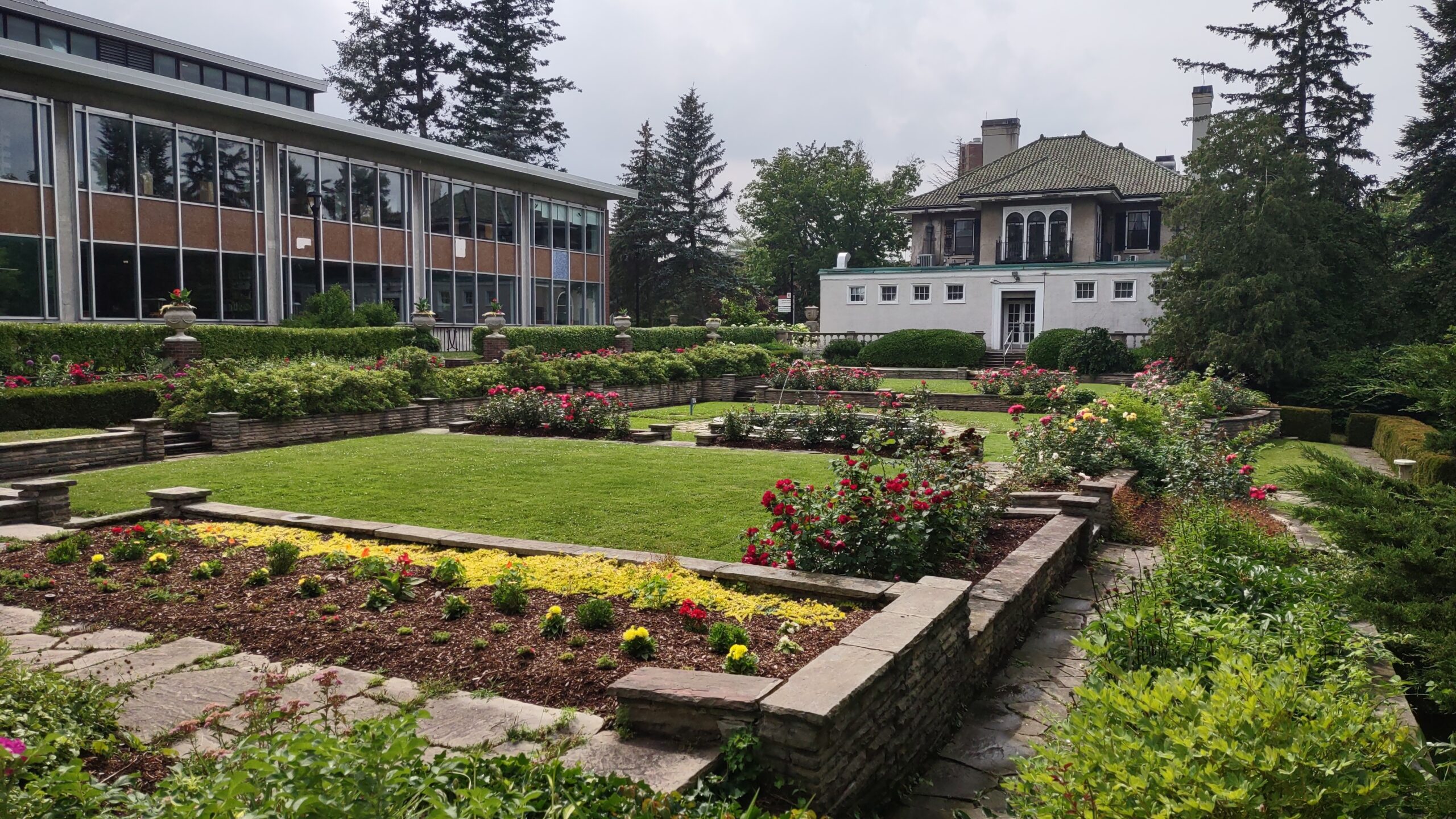
Urban Walk: St. Andrew to Sunnybrook Park Loop Hike
https://hikes.brucetrail.org/event/urban-wall-st-andrew-to-sunnybrook-park-loop-hike/Sorry, the registration cut-off time for this hike has been reached.Not a member? Click here to join today!Hosting Club: Toronto
Category: Urban Walk
Location (Google Maps): Transit users meet hike leader(s) at TTC York Mills bus platforms by 9 am to take the 9:05 bus 78 (St. Andrew’s to Bayview). We will be commencing the hike from Toba Dr. & Legacy Cr at 9:17 to arrive at Irving Paisley Park by 9:45.
Car users arrive at Irving Paisley Park, 2539 Bayview Ave (SE corner of Bayview Avenue and York Mills Road, behind the Arena) by 9:35 to meet the transit group arriving at 9:45. Entrance to Parking Lot is off of York Mills Road.
Transit users wishing a later start time can take the 95 A or B, York Mills bus from York Mills Station leaving every 10 minutes and arriving at Bayview & York Mills in 7 minutes.Hike Leader(s): Andrew Proczek; Tiffany Harding; Steve Harding Click here to contact Hike Leader(s)
Pace: Moderate
Terrain: Flat, Other (Refer to Description), Variable
Distance: 13 km (transit users); 14 km (car users)Description
Join us for a pleasant walk along Wilket Creek and West Don River through Glendon Forest as we loop around the playing fields of Sunnybrook Park and hike north picking up Wilket Creek to Edwards Gardens.Important note: this hike has a creek crossing. Under normal conditions we can keep our feet dry by stepping on flat stones to cross the shallow stream. It is an easy crossing. The stones are evenly spaced and sturdy. If it should rain prior to the hike, we will need to take our shoes off and wade across. Even then it will still be shallow. Bring a small towel or handkerchief to dry your feet.
Transit users, here are your options (car users will finish the loop back to their cars for a 14 km trip):
Option 1: St. Andrew’s Park to Edwards Gardens (13 km)
Option 2: Irving Paisley Park to Edwards Gardens (11 km)
Option 3: St. Andrew’s Park and loop back with car users to Irving Paisley Park (16 km)
The route: https://onthegomap.com/s/gidabt1r
Lunch stop at Frost Library Garden, Glendon College Campus (York University).
Please pack a lunch or snacks and 2 litres water. Water fountain by the washrooms in Sunnybrook Park. Bring insect repellant, sun screen and a hat.
Public Washrooms at Glendon College, Sunnybrook Park and Edwards Gardens as well as bio breaks along the trail. For anyone arriving early to Irving Paisley Park there are washrooms at the Metro across Bayview Ave (west side) and there is also a coffee shop.
Photo is of Frost Library Garden.

Toronto Urban Badge Hike - 3 of 7
https://hikes.brucetrail.org/event/toronto-urban-badge-hike-3-of-7-2/Sorry, the registration cut-off time for this hike has been reached.Not a member? Click here to join today!Hosting Club: Toronto
Location (Google Maps): Toronto, Ontario, Canada
Hike Leader(s): Brian Rideout Click here to contact Hike Leader(s)
Pace: Moderate
Terrain: Flat
Distance: 10.4 kmDescription
Please join me at the south west corner of Lakeshore Blvd West and Ellis by 10 AM. We will hike east along the Waterfront Trail to the Distillery District (km 8.3 to km 71.4). Here is an online map with km markings of our route for all 7 hikes for the Toronto Urban Badge.Please make sure you bring at least 2 liters of water, a lunch, bug spray and sunscreen.

Rattlesnake Point Loop
https://hikes.brucetrail.org/event/rattlesnake-point-loop-5/Sorry, the registration cut-off time for this hike has been reached.Not a member? Click here to join today!Hosting Club: Iroquoia
Category: General Hike
Location (Google Maps): Rattlesnake Point Conservation Area, Appleby Line (Reservations required) https://www.conservationhalton.ca/parks/rattlesnake-point/Hike Leader(s): Anne Armstrong Click here to contact Hike Leader(s)
Pace: Fast – 5+ km/hr, Leisurely – 3km/hr or less
Terrain: Moderate – Some hills and/or some poor footing
Distance: 8-9 Km.Description
Join us to hike this gorgeous area with its amazing views. We will hike the top of the escarpment, descend into Nassagaweya Canyon, hike the canyon and then ascend to the top to return to our starting point. Meet in the lower parking lot of Rattlesnake Point Conservation Area on Appleby Line, north of Derry Rd. at 9:45 am. for a 10:00 am. start. bring water, a snack, sunscreen and insect repellent. Poles may be useful.
Leader: Anne Armstrong 905 617 3937 hikingrandma@gmail.comSunday Social Hike - Harrison Park loop
https://hikes.brucetrail.org/event/sunday-social-hike-harrison-park-loop/Sorry, the registration cut-off time for this hike has been reached.Not a member? Click here to join today!Hosting Club: Sydenham
Category: General Hike
Location (Google Maps): Parking lot at Harrison Park, Owen Sound, in front of Harrison Park Inn, north of 96.7km (Map 32)Hike Leader(s): Ian Mills Click here to contact Hike Leader(s)
Pace: Leisurely: 3 km/h or less
Terrain: Moderate: Some hills and/or poor footing, There might be muddy sections.
Distance: 6 kmDescription
Hike Harrison Park side trail to Palisades side trail then to the main trail and returning via Harrison Park side trail. If folks are up to it we can see if it is possible to grab a refreshment at Harrison Park Inn – completely optional. If you are unable to register, please call or text hike leader @ 416-848-8818. - 17July 17, 2023
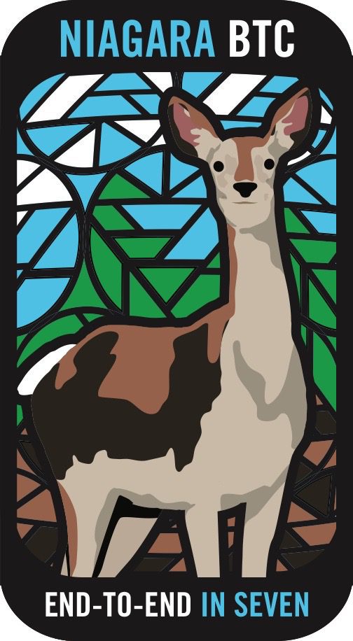
Niagara ETE in Seven - Brisk Pace - Led by Ruth Moffatt - Please read all details before registering.
https://hikes.brucetrail.org/event/niagara-ete-in-seven-brisk-pace-led-by-ruth-moffatt-please-read-all-details-before-registering/Sorry, the registration cut-off time for this hike has been reached.Not a member? Click here to join today!Hike open to BTC Members only.
This is a Multi-Day Hike
You are signing up for the following dates and times:
2023-07-17 at 07:00
2023-07-18 at 07:00
2023-07-19 at 07:00
2023-07-20 at 07:00
2023-07-21 at 07:00
2023-07-22 at 07:00
2023-07-23 at 07:00Hosting Club: Niagara
Category: Event Hikes
Location (Google Maps): 17 Jul: Meet at Woodend Conservation Area, Taylor Road, Niagara-on-the-Lake, 43.1432995, -79.1672588
Carpool to 14184 Niagara River Pkwy, Niagara-on-the-Lake, 43.1602848, -79.052315.18 Jul: Meet at Woodend Conservation Area, Taylor Road, Niagara-on-the-Lake, 43.1432995, -79.1672588
Carpool to Decew House, Thorold. 43.1078074, -79.249845819 Jul: Meet at Decew House, Decew Rd Thorold. 43.1078074, -79.2498458 Carpool to Roland Rd parking lot east of Effingham St 43.090278, -79.305073
20 Jul: Meet at 3640 Glen Rd Jordan 43.1390306, -79.373893232.
Carpool to Roland Rd parking lot east of Effingham St 43.090278, -79.30507321 Jul: Meet at 3640 Glen Rd Jordan 43.1390306, -79.373893232.
Carpool to Quarry Rd, Beamsville 43.14279969065385, -79.45892212012937.22Jul: Meet at 3774 Quarry Rd Beamsville, 43.14279969065385, -79.45892212012937.
Carpool to Mountainview Road, Beamsville 43.1577899 -79.497406223 Jul: Meet at Grimsby Lions Club Pool 1 Elm St 43.193201, -79.565301
Carpool to Mountainview Conservation Area, Beamsville 43.1577899 -79.4974062Hike Leader(s): Niagara Hike Leader Click here to contact Hike Leader(s)
Pace: Brisk
Terrain: Moderate
Distance: 12 – 15k per dayDescription
Meet time is 7am. This is so that we can hopefully avoid the hottest part of the day. This is a special series of 7 hikes to complete the Niagara section of the Bruce Trail. There will be a new accomplishment badge, included in the registration fee featuring the White-tailed deer – which has been designed by Joe Borges and will hopefully be made available on our last day. The White-tailed deer is common throughout Niagara. For this E2E in 7, we will be following the main trail east to west eventually finishing in Grimsby. Some days we will hike east to west and other days, west to east depending on parking availability. Please note that you are signing up for the entire series of 7 hikes as a Group Hike. The Niagara in 7 series is geared to experienced long distance hikers with the expectation of a 3 to 5.0 km/ hr. pace maintained over a day up to 15km. The section is approximately 85km so daily distances will be based on available parking. No dropout points have been established and therefore hikers who must drop out, will be responsible for their own transportation back to their vehicle. Please be honest about your hiking abilities. We will hike at a steady pace but there will be plenty of time to take pictures and to enjoy the flora and fauna of this beautiful but challenging section.Again, this particular set of 7 hikes is intended to be Moderate/Brisk. Please be honest about your degree of physical fitness prior to registration. It is a group hike so it is important you are able to keep pace with the person in front of you.
Attire and Daily Hikes.
Hikers will be expected to be wearing proper hiking boots and layered clothing with the expectation of hot and humid weather. Sufficient food and 2 litres of water for a full day of hiking is required as well as hiking poles (if you use them). Check the daily forcast and prepare for wet weather, as well. Bug spray is strongly suggested. Clothing adjustments, bio-breaks are as needed. Please let the sweep person know and they will wait for you. A morning break around 10am and a 10-15 minute on-trail lunch break will be scheduled. An afternoon break will be based on our expected finish time. Depending on weather conditions, these times may vary. Please check for ticks everyday. Wear a wide brimmed hat and hang your backpack up off the ground. This area is endemic to black-legged ticks.
Fee
The fee goes towards supporting the Niagara Bruce Trail Club, which in turn supports the mission of the Bruce Trail Conservancy, which is: “Preserving a ribbon of wilderness, for everyone, forever.” For the time being, registration for the Niagara E2E-in-seven will be limited to members of the Bruce Trail Conservancy. Hikers may be a member of any section.
Car Shuttles and Missing Hikes
A maximum of 2 (of the 7) hikes can be self-completed as a result of scheduling challenges, but it is intended that this badge be earned while hiking as part of a group led by a certified hike leader. Car shuttles are shared amongst all hikers. If you intend to arrive at the meeting locations with more than yourself in your vehicle, please let the hike leader know in advance. Car pooling to our meeting spot with 2 people in the car is generally ok but we would like to minimize and equalize the driving/shuttling as much as possible so it is fair for all participants. If you know you will miss more than 2 of the hikes, it’s likely best to sign up for another end to end, however, whatever hikes are completed on this series may go toward completion of an independent ETE for the regular Niagara section. If you are able to complete the hikes you know you will miss ahead of time, all the better.
Transportation
This series will be through-hikes and will require car shuttling. You must be willing to drive and/or to be a passenger. Some parking locations require paid parking, and hikes that enter Niagara Parks. The fee for this E2E-in-7 does not include any parking/entry fees for hikers. These costs, where applicable, will be shared amongst all participants unless you have a parking or park pass.
Leave No Trace
Please remember, like all hikes, this is a Leave No Trace hike. Pack out whatever you pack in. Do not toss anything onto or into any sections of the trail. We will also try to leave the trail better than we found it so we will be collecting collectable garbage we might see along the way. Daily volunteers to collect trail trash will be supplied with a bag. Dogs will not be welcome on this hike.
Daily
We meet for each hike by at least 6:45am each day. The schedule is subject to change. Please set aside July 24th as a potential alternate day in the event of weather related postponement.
This hike is limited to 12 participants including the hike leader.

Blue Series Hike- Rural Roots ST and Gravelly Point ST
https://hikes.brucetrail.org/event/blue-series-hike-rural-roots-st-and-gravelly-point-st/Sorry, the registration cut-off time for this hike has been reached.Not a member? Click here to join today!Hike open to BTC Members only.
Hosting Club: Peninsula
Location (Google Maps): Meet up at Colpoy’s Bay Dock Parking Lot. We will carpool to Rural Rocks ST for our morning hike. Map 35 (Bruce Trail Reference Guide 30th Edition)
Hike Leader(s): Owen Glendon Click here to contact Hike Leader(s)
Pace: Medium
Terrain: Moderate
Distance: 9 km totalDescription
Working on your PBTC Blue Series Bear Badge? This is perfect day hike combination for you. Join this moderately paced hike which includes two side trails – Rural Roots Side Trail (4 ½ km) and Gravelly Point Side Trail (4 ½ km). Meet at Colpoy’s Bay Government Dock parking lot at 8:30 a.m. We will carpool to Rural Roots Side Trail, from here. Rural Roots Side Trail is the only part of the Bruce Trail which is not connected to the main trail. The sidetrails found here follow some difficult terrain – passing through cathedral type rock formations, over verdant patches of moss and fern, and passing by an active beaver pond. Learn about Rural Rootz Nature Reserve and be inspired by its history! Leaving Rural Rootz Nature Reserve, we will drive to Colpoys Bay and stop at the dock for a short lunch break. Porta potties are available here. From Colpoys Bay, we will carpool and make the short drive to the Mallory Beach parking lot. Gravelly Point Side Trail will be a moderately paced hike on fairly even terrain, following an old logging road. Gravelly Point Side Trail is found in the Malcolm Bluff Nature Reserve – a lovely area protected by three Conservation groups – Ontario Nature, Bruce Trail Conservancy and Nature Conservancy Canada. The end of this sidetrail leads us down to the water’s edge. Then, we retrace our steps to our vehicles. Bring a light backpack with plenty of water, snacks, lunch, insect repellent, sunscreen, hiking poles (recommended but not required). Wear a hat and sturdy footwear. - 18July 18, 2023
8:00 Long Hike Wiley Road Short Hills
https://hikes.brucetrail.org/event/800-long-hike-wiley-road-short-hills-23/Sorry, the registration cut-off time for this hike has been reached.Not a member? Click here to join today!Hosting Club: Niagara
Location (Google Maps):
Short Hills Wiley Road Entrance
Pace: Medium
Terrain: Moderate
: 10kmDescription
Explore Short Hills and the majestic side trails of Scarlett Tanager, Hemlock. Swayze Falls and Terrace. Register for each hike
Bring Poles water, snack, sunscreen and bug spray and dress for the weather
Dodds Hill to Nels Maher Side Trail
https://hikes.brucetrail.org/event/dodds-hill-to-nels-maher-side-trail/Sorry, the registration cut-off time for this hike has been reached.Not a member? Click here to join today!Hosting Club: Sydenham
Category: General Hike
Location (Google Maps): Parking area on Kemble Rock Road, north of km 145.3 at the Nels Maher Side Trail (Map 34)Hike Leader(s): Maureen McFarland Click here to contact Hike Leader(s)
Pace: Medium: 3 to 4 km/h
Terrain: Moderate: Some hills and/or poor footing, There might be sections with water on the trail.
Distance: 7 kmDescription
After a short car shuttle north to Dodds Hill, we start our hike south on the main trail. This is a beautiful area, rocky with one large crevice that we walk through. There is one climb down the escarpment and back up again. There are lots of great views to be enjoyed from the escarpment edge. Bring sun screen, bug repellant, lots of water and a snack. If you are unable to register, call or text the hike leader at 647-918-4180.9:15 Short Hike - Pelham Road, Short Hills
https://hikes.brucetrail.org/event/915-short-hike-pelham-road-short-hills-52/Sorry, the registration cut-off time for this hike has been reached.Not a member? Click here to join today!Hosting Club: Niagara
Location (Google Maps): Pelham Road entrance, Short Hills Provincial Park
Hike Leader(s): janet davey Click here to contact Hike Leader(s)
Pace: Medium
Terrain: Moderate
Distance: 6 kmsDescription
Hike the main and side trails in Short Hills Provincial Park. Bring hiking boots, water, sunscreen and bug spray.
Discovery Walk – GeoHike at Mono Cliffs
https://hikes.brucetrail.org/event/discovery-walk-geohike-at-mono-cliffs/Sorry, the registration cut-off time for this hike has been reached.Not a member? Click here to join today!Hosting Club: Dufferin Hi-Land
Category: General Hike
Location (Google Maps): Dufferin Hi-Land Section, Map 19. Meet at the Splitrock Narrows Nature Reserve Parking Lot on 2nd Line EHS, approximately 1.3 km north of 25 Sideroad, Mono. From Hwy 10 north of Orangeville, turn right onto 25 Sideroad. Turn left at the third intersection onto 2nd Line EHS. Parking is on your right in 1.3 km. (Note: GoogleMaps may provide incorrect directions to this location)
We will shuttle to parking on 2nd Line EHS north of 20 Sideroad. Please do not go directly to this location as parking is very limited.Hike Leader(s): Lynda Bloom Click here to contact Hike Leader(s)
Pace: Leisurely
Terrain: Moderate
Distance: 5 kmDescription
Why are there cliffs in the park? Are there any fossils? This leisurely hike will make many stops to look at rocks and talk about the geological history of the area. Don’t forget to bring your camera.We will use several side trails, mostly the Walter Tovell and Carriage Trails, to visit the north and south Outlier exposures.
Please wear sturdy footwear as there are hills and stairs. Pack water, snacks and dress for the weather.
Suitable for children over 8 years old.
Please complete the waiver online if you are not a member.
Terra Cotta
https://hikes.brucetrail.org/event/terra-cotta-9/Sorry, the registration cut-off time for this hike has been reached.Not a member? Click here to join today!Hosting Club: Caledon Hills
Category: Tuesday Hikers
Location (Google Maps): Meet at Winston Churchill Blvd., intersection with Caledon Trailway.
Driving direction: North on Highway 410, continue north on Highway 10, left on King Street, right on Winston Churchill Blvd; drive 1 kilometre to roadside parking on either side of the road.Hike Leader(s): Mohammad Shafiq Click here to contact Hike Leader(s)
Pace: Medium – 3 to 4 km/hour
Terrain: Moderate – some hills and/or some poor footing
Distance: 13 kmDescription
Will hike Terra Cotta Side Trail and main Bruce Trail. Bring water, snack, poles, sunscreen and bug sprayPhone contact for the day of hike: 416-566-0503.
- 19July 19, 2023
Bibbulmun Friendship Trail
https://hikes.brucetrail.org/event/bibbulmun-friendship-trail-2/Sorry, the registration cut-off time for this hike has been reached.Not a member? Click here to join today!Hosting Club: Blue Mountains
Category: Register in person the morning of hike.
Location (Google Maps): Hike meets in the parking lot behind Tim Hortons on First St. in Collingwood.Hike Leader(s): Mary-Lynne Chenard Click here to contact Hike Leader(s)
Pace: Medium – 3 to 4 km/hr
Terrain: Moderate – Some hills and/or some poor footing
Distance: 7kmDescription
This is one of our Friendship trails running along BTC trails and other conserved land north of Boyne Valley Provincial Park. We will park at km 29.4 on 1st Line E in the Dufferin Hi-Land section. The 7 km figure eight hike will follow the white blazed trail to km 25.4, looping back to the parking lot via the Oliver Creek Side Trail and the Moss Haven Side Trail. Bring a lunch or snack and water. *The Bibbulmun Track in Western Australia stretches 1,000 km from Kalamunda in the Perth Hills to the historic town of Albany on the south coast.
Double Looping Dundas Valley
https://hikes.brucetrail.org/event/double-looping-dundas-valley/Sorry, the registration cut-off time for this hike has been reached.Not a member? Click here to join today!Hosting Club: Iroquoia
Category: Good Companions
Location (Google Maps): Dundas Valley Conservation Area, 650 Governor’s Rd.Hike Leader(s): Anne Armstrong Click here to contact Hike Leader(s)
Pace: Leisurely – 3km/hr or less
Terrain: Moderate – Some hills and/or some poor footing
Distance: 5 or 10 km.Description
Join us as we loop through the Valley. We will complete two loops with an option of doing only one. We will meet at the trail centre at 9:15 am. for a 9:30 am. start. Park in the last parking lot and make your way up to the Trail Centre. There are bathrooms here. We will hike Sawmill Valley loop and after a snack at the Trail Centre we will hike the main loop. Bring water, a snack or lunch, sunscreen and insect repellent. Poles may be useful. Entrance fee or Conservation Area pass.
Leader: Anne Armstrong 905 617 3937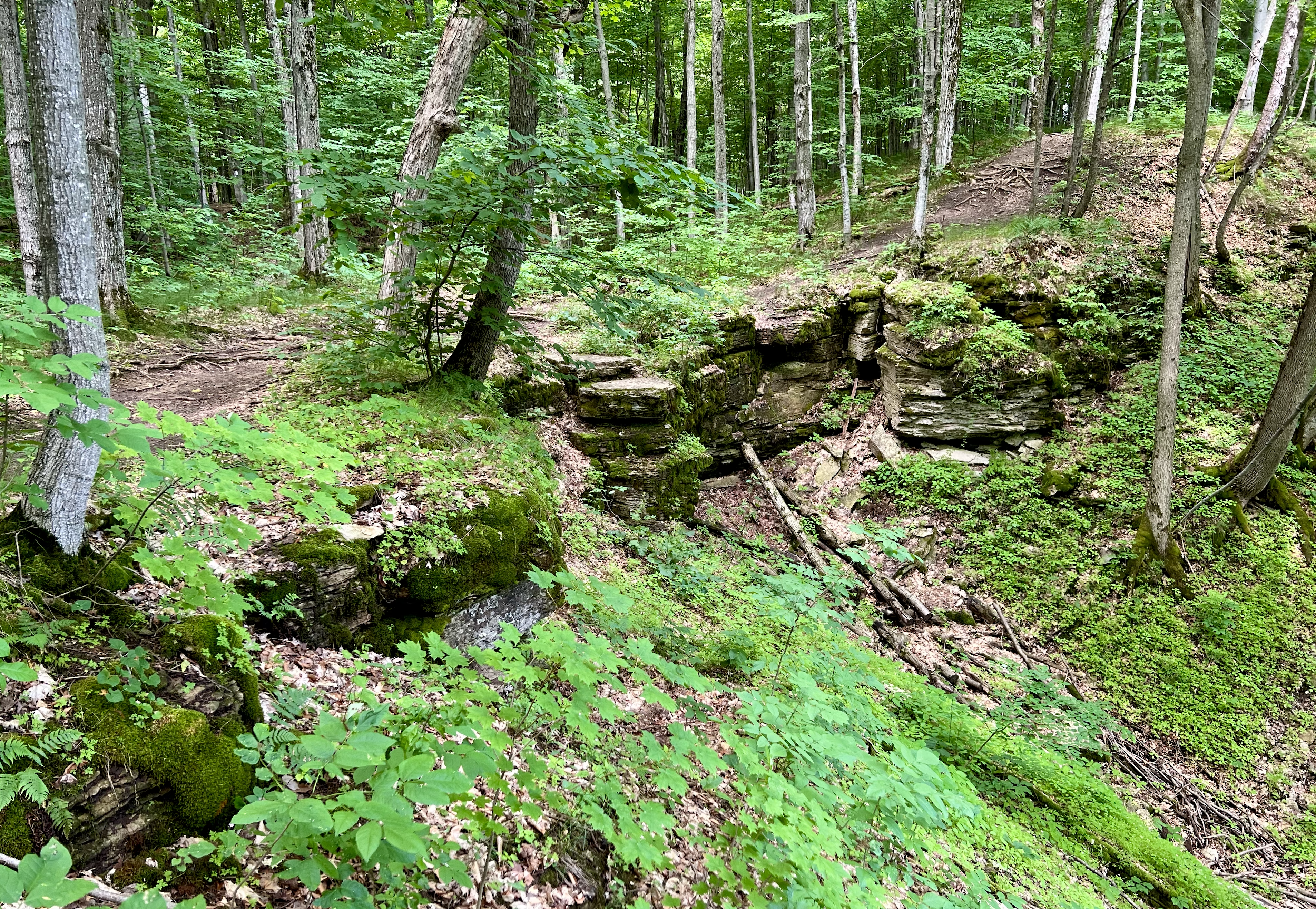
WEDNESDAY WALKERS - Start at the Very Beginning (of BV)
https://hikes.brucetrail.org/event/wednesday-walkers-start-at-the-very-beginning-of-bv/Sorry, the registration cut-off time for this hike has been reached.Not a member? Click here to join today!Hosting Club: Beaver Valley
Location (Google Maps): Park at the end of Maple Lane at BV Km 0.0, Map 24, Edition 30
Hike Leader(s): Margaret Yaraskavitch Click here to contact the hike leader.
Pace: Medium
Terrain: Easy, Moderate
Length of Hike: 5.0 kmDescription
This hike will be a there-and-back walk. Views from the edge of the Escarpment will show Collingwood and Nottawasaga Bay. We’ll pass Craigleith Ski Club and head towards a deep valley but then it is time to return. Often, views look different when walking in the opposite direction, promising another chance to experience wide open views of the shores of Nottawasaga Bay. Please bring water and a snack. - 20July 20, 2023
8:00 am Long Hike Jordan to Moyer / Louth
https://hikes.brucetrail.org/event/800-am-long-hike-jordan-to-moyer-louth-50/Sorry, the registration cut-off time for this hike has been reached.Not a member? Click here to join today!Hosting Club: Niagara
Location (Google Maps):
Jordan Hollow Park 3039 King St Jordan
Pace: Medium
Terrain: Moderate
: 10kDescription
From Jordan Hollow Hike the main trail to Upper and Lower Balls Falls, Moyer Road or Louth and Return. You must register for each hike. Bring Poles, sunscreen, bug spray , snack and a drink and dress for the weather
9:15 Short Hike - Jordan Hollow
https://hikes.brucetrail.org/event/915-short-hike-jordan-hollow-66/Sorry, the registration cut-off time for this hike has been reached.Not a member? Click here to join today!Hosting Club: Niagara
Location (Google Maps): Jordan Hollow Park, Jordan Station
Hike Leader(s): Bill Russell Click here to contact Hike Leader(s)
Pace: Medium
Terrain: Strenuous
Distance: 6 kmsDescription
Hike the main and side trails around Jordan and Balls Falls. Bring hiking boots, water, sunscreen and bug spray.Sydenham E2E Hike 13 of 14
https://hikes.brucetrail.org/event/sydenham-e2e-hike-13-of-14/Sorry, the registration cut-off time for this hike has been reached.Not a member? Click here to join today!Hosting Club: Caledon Hills
Category: End-to-End
Location (Google Maps): Meet at roadside parking at km 14.4 on the shoulder of the 2nd Concession S. Shuttle to start at Bognor Marsh Conservation Area, km 29.4.Hike Leader(s): Nancy Mooney Click here to contact Hike Leader(s)
Pace: Medium – 3 to 4 km/hour
Terrain: Easy – mostly flat and usually good footing, Moderate – some hills and/or some poor footing
Distance: From km 29.4 to 14.4, total 15 km.Description
This hike begins with road walking then a pleasant change through forests and fields for a while before finishing off on the road.- James Gardens to Old Mill ** CANCELLED **
https://hikes.brucetrail.org/event/evening-ramble-james-gardens-to-old-mill/Sorry, the registration cut-off time for this hike has been reached.Not a member? Click here to join today!Hosting Club: Toronto
Category: Cancelled
Location (Google Maps): Meet on east side of Scarlett Road at Edenbridge Drive (south of Eglinton) opposite the gas station.. Take Bus #79A from Runnymede Station scheduled to depart at 5:25 pmHike Leader(s): Tom Swales Click here to contact Hike Leader(s)
Pace: Moderate
Terrain: Flat
Distance: 7 KMDescription
** Canceled due to forecast of powerful thunderstorms **On this third of our series of evening rambles we will hike south on the Humber through James Gardens and Lambton Woods to the Old Mill Subway Station. Each Thursday evening in the Summer there will be an evening ramble on park trails around Toronto.
- 21July 21, 2023
Cape Chin South to Cape Chin North Loop
https://hikes.brucetrail.org/event/cape-chin-south-to-cape-chin-north-loop/Sorry, the registration cut-off time for this hike has been reached.Not a member? Click here to join today!Hosting Club: Peninsula
Location (Google Maps): Roadside parking on the north side of Cape Chin South Road Map 39
Hike Leader(s): Barbara Reuber Click here to contact Hike Leader(s)
Pace: Medium
Terrain: Moderate
Distance: 7 kmDescription
Hike from parking on Cape Chin South to lookout at Cape Chin North. Return via Cape Chin Meadows Side Trail and Pat Daunt Side Trail. Map 39Please wear sturdy shoes and bring water and snack.
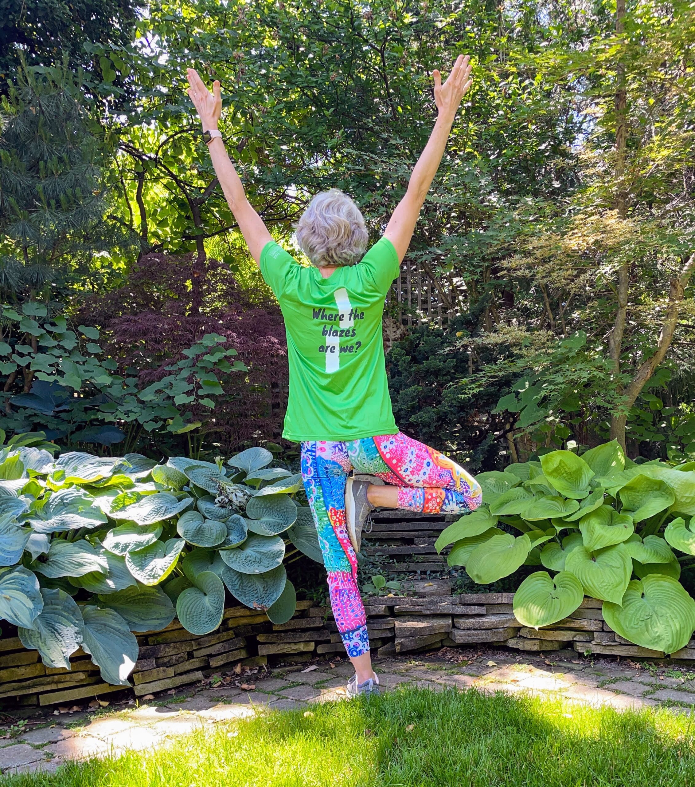
9:00 am Niagara on the Lake Tour & Some Yoga
https://hikes.brucetrail.org/event/900-am-niagara-on-the-lake-tour-some-yoga-11/Sorry, the registration cut-off time for this hike has been reached.Not a member? Click here to join today!Hosting Club: Niagara
Location (Google Maps): Veteran’s Memorial Park, park just outside the park on King St.
Hike Leader(s): Robin Garrett Click here to contact Hike Leader(s)
Pace: Medium
Terrain: Easy
Distance: 6 kmDescription
Enjoy the benefits of pausing for a yoga practice as we tour through the trails, parkland and Historic Niagara-on-the-Lake. No mat required. Movement will focus on a flow of standing poses designed especially for hikers. Plan to stay for conversation and a warm cup of coffee or tea at Sweets & Swirls, Community Centre, Niagara Stone Road, NOTL. - 22July 22, 2023
Coach Trip: Silent Lake Provincial Park
https://hikes.brucetrail.org/event/coach-trip-to-silent-lake-provincial-park-2/Sorry, the registration cut-off time for this hike has been reached.Not a member? Click here to join today!Trip Information
Departure Time: 07:30
Return to City Time: 19:30
Departure Point: York Mills Bus PickupTrip Activities
Hiking ($0.01)
Optional ItemsHosting Club: Toronto
Category: Coach Trips
Location (Google Maps):Silent Lake Provincial Park
Hike Leader(s): Martina Furrer, Duro Vukman, George Lennon, Tom Swales Click here to contact Hike Leader(s)
Pace: Moderate
Terrain: Hilly, Variable
Distance: 15Description
Register by June 23rdJoin us for a fun summer day at beautiful Silent Lake Provincial Park in the heart of the Kawarthas. Hike the Silent Lake loop (15 km, 4 km/hr or more pace, no dropouts) with Martina, then cool off with a dip in Silent Lake. Or hike the Silent Lake loop at slightly slower pace with George and Duro, with no time for swimming. Enjoy gorgeous views and some challenging rocks. Or join Tom for a shorter hike at a slightly slower pace and then enjoy the beach. Or come and enjoy a day on the water (self-guided) on a motorboat free lake. Canoes and kayaks can be rented at Silent Lake, or bring along your inflatable SUP.
Bring lunch, water, snacks, and your swimming gear.
No refreshment stop but there are washrooms and drinking water taps by the day use beach, and you can purchase ice cream and cold drinks in the park store.
Car Hike: Seaton Trail North
https://hikes.brucetrail.org/event/car-hike-seaton-trail-north-2/Sorry, the registration cut-off time for this hike has been reached.Not a member? Click here to join today!Hosting Club: Toronto
Category: Car Hike
Location (Google Maps): Free parking lot at 1 Mutual Street PickeringHike Leader(s): Mohammad Aghamiri Click here to contact Hike Leader(s)
Pace: Moderate
Terrain: Variable
Distance: 14-15KMDescription
We will hike along Seaton trail and enjoy the lovely sceneries of forest and river at the same timePine River
https://hikes.brucetrail.org/event/pine-river/Sorry, the registration cut-off time for this hike has been reached.Not a member? Click here to join today!Hosting Club: Blue Mountains
Category: Register on-line or sign-in morning of hike
Location (Google Maps): Hike meets in the parking lot behind Tim Hortons on First St. in Collingwood.Hike Leader(s): Michael Treuman Click here to contact Hike Leader(s)
Pace: Leisurely – 3 km/hr. or less
Terrain: Moderate – Some hills and/or some poor footing
Distance: 7kmDescription
We will drive to Kilgorie in the Dufferin Hi-Land section and park the cars at km 34.9 on Centre Road. From here, we will hike a figure eight loop utilizing the white blazed trail, the new Pine River Valley Side Trail and the Kilgorie Side Trail. This hike boasts a wonderful view from the Bell Tower Side Trail, ruins of an old powerhouse, the stunning Pine River, lake views, ponds, and more! The ruins of the old powerhouse along the Pine River are almost all that remain of the Dufferin Light and Power Company. Nearby is the old flume that brought water from a dam, which was constructed in 1909 and was the largest of its kind in Ontario. The plant provided power until 1923. Bring a snack or lunch and water.
Run the Trail!
https://hikes.brucetrail.org/event/run-the-trail/Sorry, the registration cut-off time for this hike has been reached.Not a member? Click here to join today!Hosting Club: Peninsula
Location (Google Maps): Cemetery Road – Ilse Hanel Side Trail
Hike Leader(s): Leslie McBeth Click here to contact Hike Leader(s)
Pace: Brisk, Fast
Terrain: Moderate
Distance: 5-6kmDescription
Have you ever tried to run the Bruce Trail? If you have, you know it’s more like fast hiking than running, and if you haven’t, well this is your chance! We’ll use the term running lightly – often it’s more like a fast hike. And, we’ll adjust the pace according to the abilities in the group, aiming for about 6-8 min/km (8-10km/hr).No trail running experience necessary. However, a baseline level of fitness and ability to run 5km would be advantageous. A great introduction to the trails for anyone planning to run the Tobermory Trail Marathon in September!
The Ilse Hanel Side Trail is well suited for running with a wider path, somewhat less technical terrain than found elsewhere in the Peninsula section, and gentle rolling hills. Still, be prepared for some rocky terrain, potential for poison ivy (wear long socks or pants), and roots that are just waiting to twist your ankle. 🙂 Trail running shoes offer better grip than sneakers, but regular running shoes will work on this trail.
In case of rain, we’ll reschedule as the trail can be slippery.
Car Hike: Hockley Valley
https://hikes.brucetrail.org/event/car-hike-hockley-valley-4/Sorry, the registration cut-off time for this hike has been reached.Not a member? Click here to join today!Hosting Club: Toronto
Category: Car Hike
Location (Google Maps): Meet at parking lot along 5 Sideroad North of Airport Road, GPS Coordinates N43.974055, W79.984988 BTC Map 18.Hike Leader(s): Ross Estrella Click here to contact Hike Leader(s)
Pace: Brisk
Terrain: Challenging, Hilly
Distance: 16 kmsDescription
Ready for Cardio exercise? Join us at Hockley Valley, one of the hilliest section of the Bruce Trail and the Crown Jewel of the Caledon Hills BTC. This hike is on a brisk pace so please be honest about your hiking abilities and come prepared with at least two liters of water, snacks, lunch, bug spray, sun screen, first aid kit and poles if you use it. Please wear appropriate clothing and footwear. Strongly recommend to wear light long sleeve shirt and pants as Tick population is on the increase. We’ll have occasional short stop to hydrate. Please arrive 15 minutes early as we’ll start on time for car shuttle and will not wait for latecommers.
Laura Secord in 2 hikes (2of2)
https://hikes.brucetrail.org/event/laura-secord-in-2-hikes-2of2/Sorry, the registration cut-off time for this hike has been reached.Not a member? Click here to join today!Hosting Club: Niagara
Category: Car Pool
Location (Google Maps): Meet at DeCew House Heritage Park, DeCew Rd, ThoroldHike Leader(s): Margaret Northfield Click here to contact Hike Leader(s)
Pace: Medium
Terrain: Easy
Distance: 15kmDescription
We will be carpooling from DeCew House to Woodend Conservation Area to start the hike. Hiking poles, water, snacks are recommended. Bug spray and sunscreen may be needed.The Laura Secord badge will be available for purchase at the end of the hike. You must complete both hikes to qualify (July 15 & 22 or have done a makeup on your own). $10 for members, $15 for non-members
Toronto Urban Badge Hike - 6 of 7
https://hikes.brucetrail.org/event/toronto-urban-badge-hike-6-of-7/Sorry, the registration cut-off time for this hike has been reached.Not a member? Click here to join today!Hosting Club: Toronto
Category: Urban Walk
Location (Google Maps): Toronto, Ontario, CanadaHike Leader(s): Brian Rideout Click here to contact Hike Leader(s)
Pace: Moderate
Terrain: Flat
Distance: 9 kmDescription
Please join me at the south east corner of Sheppard Ave East and Leslie by 10 AM. We will hike south through several parks to Don Mills (S of Overleigh) (km 51.7 to km 62.4). Here is an online map with km markings of our route for all 7 hikes for the Toronto Urban Badge.Please make sure you bring at least 2 liters of water, a lunch, bug spray and sunscreen.
Hibou Conservation Area
https://hikes.brucetrail.org/event/hibou-conservation-area/Sorry, the registration cut-off time for this hike has been reached.Not a member? Click here to join today!Hosting Club: Sydenham
Category: Family Hike
Location (Google Maps): Meet in the municipal parking lot by the river on the west side of 1st Ave. E between 7th St. E and 8th St. E in Owen Sound.Hike Leader(s): Danuta Valleau Click here to contact Hike Leader(s)
Pace: Leisurely: 3 km/h or less
Terrain: Easy: Mostly flat and good footing.
Distance: about 4 kmDescription
Meet by 14:00 in Municipal Parking Lot on 1st Ave East in Owen Sound. We will carpool to parking area on east side of road at Hibou Conservation Area and take the interpretive hike along the boardwalk in a loop eventually crossing the road to the shore and follow the shoreline back to the cars. If you are unable to register, please call or text the hike leader at 519-378-5630.