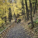
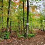
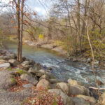
Hosting Club: Niagara Category: Loop Location (Google Maps): We will meet each other at Short Hills Parking Lot A. Pelham Rd, St. Catharines, ON L0S1E0
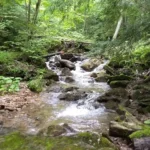
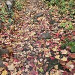
Description Join us for an exhilarating adventure on Bruce Trail Day! Immerse yourself in the breathtaking beauty of the Bruce Trail as we hike through lush forests, past Swayze Waterfalls, and visit Terrace Falls. Whether you’re a seasoned hiker or a nature enthusiast looking for an exciting outdoor experience, this event is perfect for you. Discover the hidden gems of this iconic trail, connect with fellow nature lovers, and create lasting memories. Don’t miss this opportunity to celebrate the wonders of the Bruce Trail and the great outdoors!
Pace: Leisurely – 3 km/hr. or less, Medium – 3 to 4 km/hr Terrain: Moderate – Some hills and/or some poor footing Distance: 3km or 7km
Description This year’s theme will be “Bruce Trail for All.” This theme centres on our commitment to welcoming diverse communities and fostering inclusivity and belonging among all who explore our trail system. Everyone is welcome on the Bruce Trail; we invite nature lovers, hikers of all levels, and anyone wanting to venture onto the Trail for the first time or experienced hikers to join us on Bruce Trail Day, Sunday, October 1, 2023.
The BMBTC is offering two hikes on Bruce Trail Day that will start at 10:00 AM and end at approximately 12:00PM. We will explore the Nottawasaga Bluffs portion of our section. Choose Hike #1 – a 3-5km hike through the Bluffs to the Lookout, once here learn about the geology and some history of the Blue Mountains section of trail then loop back around on the white blazed trail to your car. This hike is a family oriented hike and is great for beginner hikers and young hikers.
Or choose Hike #2 – a 7km trek through the Bluffs, climb through the Keyhole and carry on along the Betty Carter Side Trail, eventually heading back to your car.
Want directions, meet behind Tim Hortons on First Street in Collingwood at 8:45am. Otherwise everyone can meet at the Nottawasaga Bluffs trailhead (8861 Sideroad 15 & 16 Nottawasaga access by taking Mill Town Rd, Singhampton) for 9:45am.
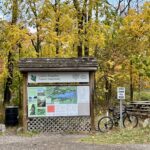
Check out the BMBTC table with literature regarding the BTC before or after your hike. We are there to answer any questions you may have about our club and the goals of the Bruce Trail Conservancy. Help celebrate all the wonderful things the Bruce Trail Conservancy does. We encourage you to think about joining the Bruce Trail Conservancy or to make a donation and support their mission goal in preserving a ribbon of wilderness, for everyone, forever.
Description Join us for a pre event hike on Bruce Trail Day. This hike will take us on the trail at Woodend, through the Screaming Tunnel towards Fireman’s Park It will be at a brisk pace with a few stops for water. The Bruce Trail with its irregular footing and undulating hills is ideal terrain to improve your fitness, balance and mental health without the confines of a stuffy gymnasium or a busy pavement.
Hosting Club: Toronto Category: Urban Walk Location (Google Maps): Meet at MiWay Kipling Terminal Platform 16 for 9:10 a.m. departure MiWay Bus #1. Walk 5 minutes west from Kipling Subway Station to the Terminal. Or if going directly to the hike, meet the rest of us by the washrooms at Erindale Park. The entrance to Erindale Park is 1695 Dundas Street West, just east of Mississauga Road. Try to arrive 10-15 minutes ahead of time.
Hike Leader(s): Andrew Proczek
Pace: Moderate Terrain: Flat, Variable Distance: 12.3 km
Description Come out and celebrate Bruce Trail Day in Mississauga with a beautiful walk high above the Credit River on UTM trails followed by an end to end of the attractive Sawmill Valley Trail. The hike will originate and finish at Erindale Park with a loop on each end. The Credit River Valley is a significant feature of the Bruce Trail and the Credit Valley Footpath an unfinished side trail that once completed all the way to Port Credit will be a way to access the Bruce Trail from the Lake Ontario waterfront. The river valley was a major trading route for native peoples as well as home and hunting grounds for the Mississaugas of the Credit.
The terrain is relatively easy without any major hills. We will be walking on a variety of dirt, packed gravel, and paved paths with some grass and boardwalks. Public washrooms available at Erindale Park only, but nature stops will be offered during the hike.
We at the Toronto Bruce Trail Club value and welcome everyone who wants to join our hikes. We are an inclusive organization and we love diversity of participants at all our events. Positive vibes and good feelings live here.
Hosting Club: Toronto Category: Bus Hike Location (Google Maps): The school bus will depart from the north parking lot of Kipling Subway station at 10 am.
Hike Leader(s): Peter Leeney and Celia Ho
Pace: Leisurely Terrain: Flat, Rocky Distance: 11 km. Drop-out possible after 5 km and 7 km.
Description
“Hikers are required to bring a mask and wear it on the bus. Masks must fit properly and cover the nose, mouth and chin. For the highest level of protection against Covid-19, respiratory viruses or the flu, KN95 or N95 masks are recommended.”
The theme for this year’s Bruce Trail Day is Welcoming. Whether you are a newcomer or have never hiked before, we welcome you to join us. “Nature is for everyone. All are welcome!”
We will start the hike at Scotsdale Farm and follow the Maureen Smith Side Trail to where it joins the Main Trail. Then we will continue west on the Trail to Limehouse. There will be two possible drop-out points — after 5 km and after 7 km. We will go through Limehouse Conservation Area and “Hole in the Wall”. The hike will end in Limehouse where snacks will be available as part of Bruce Trail Day. But bring lunch and water with you.
The bus fare is subsidized by the Toronto Club — It is the same for both members and non-members:$20 for adults, $10 for children. No charge for parking at Kipling Station on Sunday.
Current Toronto Bruce Trail Club members are welcome to join but are asked to wait until Sunday September 17th (two weeks prior to the hike) before registering so we can allow priority for non-members wishing to join the hike.
Hosting Club: Iroquoia Category: Special Event Location (Google Maps): Burlington City View Park- Take Dundas Rd to Kerns – take 2nd(south) entrance off Kerns road-south of soccer field
Pace: Leisurely – 3km/hr or less Terrain: Easy – Mostly flat and usually good footing Distance: 6-8 kms
Description Join us for Bruce Trail Day at City View Park in Burlington-No Pre-Registration required
This year’s theme is “Bruce Trail for All.” This theme centres our commitment to welcoming diverse communities and fostering inclusivity and belonging among all who explore our trail system. Everyone is welcome on the Bruce Trail; we invite nature lovers, hikers of all levels, and anyone wanting to venture onto the Trail for the first time to join us on Sunday, October 1st.
Hosting Club: Toronto Category: TBTC Special Events Location (Google Maps): All Bruce Trail Day hikes will start from the LImehouse Community Center 22nd Side Rd and Fifth LIne.
Hike Leader(s): KJ Chong
Pace: Leisurely Terrain: Variable Distance: 3-5 Km
Description The theme for 2023 Bruce Trail Day is ” Welcoming” Everyone is welcome on the Bruce Trail. Ask a friend or neighbour to come out and join you today on one of the BTC Day hikes. Ideal hike for families. This hike will be lead by members of the TBTC Biodiversity team. It will be a nature walk through two of the BTC properties. It will follow the main trail and some of the blue side trails. There is lots to see as the seasons change and the fall colours come into their beauty. The leaders will explain the I naturalist app and how to identify plants and trees along the trail.
Description Join us on this Nature Hike led by Adam Brylowski, Bruce Trail Conservancy Manager of Conservation & Trail as well as other NBTC hike leaders & learn about the ecosystems in this area in CELEBRATION of 2023 BRUCE TRAIL DAY!
Please meet at the Greenhouse and we will split into smaller groups depending on numbers.
Hosting Club: Niagara Category: Leisurely Location (Google Maps): Niagara College Garden Nursery, Taylor Road, Niagara-on-the-lake (near the Outlet Collection at Niagara Mall and White Oaks Conference Resort and Spa, just off the QEW)
Description Join us on Bruce Trail Day for a leisurely hike in the beautiful natural environment of Niagara. The theme for this year’s Bruce Trail Day is BRUCE TRAIL FOR ALL. This hike celebrates the unifying and connecting power of nature to bring us all together.
We will walk together on the side trails around the wetlands by Niagara College, and then enjoy light food and drinks as part of the Bruce Trail Day celebration.
This hike is suitable for beginners and folks who want to explore with a leisurely pace on fairly flat terrain. It’s perfect for those who want to walk, enjoy nature and the company of others!
This is one of a series of “Welcome Hikes” that invite first time/new hikers to try out the trail, enjoy an organized hike experience and learn more about the Niagara Bruce Trail club.
We especially welcome folks who are joining via the CANOO App.
Children are welcome with a guardian.
Important note: Those hiking for the first time on the Bruce Trail can earn the special “My First Hike” badge by participating in this hike. You can expect to develop a passion for badges after this!
In order to be comfortable on the hike, please:
wear comfortable hiking shoes or boots
comfortable clothing, be prepared for weather changes
carry water for drinking
Advance registration is encouraged, but it is also possible to show up and register on-site. Please arrive 10 minutes before the scheduled hike time to check in with the hike leaders. We will meet by the Niagara college greenhouse.
Hosting Club: Toronto Category: TBTC Special Events Location (Google Maps): Meet by the exit of Davisville Subway Station west side of Yonge Street at Chaplin Crescent.
Description “Join us to celebrate Bruce Trail Day with a hike on trails right in the heart of Toronto through the scenic Rosedale Ravines, Evergreen Brickworks, and Mount Pleasant Cemetery. This will be an opportunity to hear and learn about the Bruce Trail, the conservation work of the Bruce Trail Conservancy, and the Toronto Bruce Trail Club’s year round hiking program. Beginners and families welcome on this Level 1 Hike. There will be a break at the Evergreen Brickworks for lunch and washrooms before continuing on the Moore Park Ravine. Bring lunch, water, and rain gear (if applicable). Sturdy walking shoes or runners recommended.
The theme for this year’s Bruce Trail Day is Welcoming. Whether you are a newcomer or you have never hiked before we welcome you to join us. “Nature is for all. All are welcome!”
Pace: Leisurely, Medium Terrain: Easy, Moderate Length of Hike: Approx. 4 km
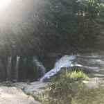
Description Bring the kids and join us for a family friendly hike to Webwood Falls and back. There will be fun, on the trail activities for the young ones, not to mention viewing the beautiful little falls.
Pace: Medium Terrain: Easy, Moderate Distance: ~2 1/2 KM
Description All PBTC hikes welcome 2S-LGBTQQIAP+ participants and community allies. This hike is collaboratively planned by Grey Bruce Pride and Peninsula Bruce Trail Club.
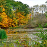
Bruce Trail Day is the first Sunday in October. On this day, hikes and activities help us to celebrate the longest and oldest marked footpath in Canada -The Bruce Trail. Celebrate by joining this popular PBTC Fall hike. The wetland here is a favourite spot for migrating waterfowl! We will hike to the pond, then through a gentle meadow toward the beautiful colours of the Fall Forest found here. A short, steep climb here will lead us to the top of the hill before our gentle return walk down Boundary Road to our parked vehicles. This hike is about 2 ½ km, has some uneven terrain, long grass and one short, steep climb. It is not wheelchair accessible.
What to bring: Wear a hat and long sleeved/legged pants. Bring a light backpack with snacks and water. Hiking poles are not essential, but would be helpful. Binoculars and camera – if you wish.
Parking: Free – thank you to Chippewas of Nawash. Roadside parking at the meeting location. Car pool if possible.
Hosting Club: Niagara Category: Loop Location (Google Maps): We will meet each other at Short Hills Parking Lot A. Pelham Rd, St. Catharines, ON L0S1E0
Description Join us for an exhilarating adventure on Bruce Trail Day! Immerse yourself in the breathtaking beauty of the Bruce Trail as we hike through lush forests, past Swayze Waterfalls, and visit Terrace Falls. Whether you’re a seasoned hiker or a nature enthusiast looking for an exciting outdoor experience, this event is perfect for you. Discover the hidden gems of this iconic trail, connect with fellow nature lovers, and create lasting memories. Don’t miss this opportunity to celebrate the wonders of the Bruce Trail and the great outdoors!
Pace: Leisurely – 3 km/hr. or less, Medium – 3 to 4 km/hr Terrain: Moderate – Some hills and/or some poor footing Distance: 3km or 7km
Description This year’s theme will be “Bruce Trail for All.” This theme centres on our commitment to welcoming diverse communities and fostering inclusivity and belonging among all who explore our trail system. Everyone is welcome on the Bruce Trail; we invite nature lovers, hikers of all levels, and anyone wanting to venture onto the Trail for the first time or experienced hikers to join us on Bruce Trail Day, Sunday, October 1, 2023.
The BMBTC is offering two hikes on Bruce Trail Day that will start at 10:00 AM and end at approximately 12:00PM. We will explore the Nottawasaga Bluffs portion of our section. Choose Hike #1 – a 3-5km hike through the Bluffs to the Lookout, once here learn about the geology and some history of the Blue Mountains section of trail then loop back around on the white blazed trail to your car. This hike is a family oriented hike and is great for beginner hikers and young hikers.
Or choose Hike #2 – a 7km trek through the Bluffs, climb through the Keyhole and carry on along the Betty Carter Side Trail, eventually heading back to your car.
Want directions, meet behind Tim Hortons on First Street in Collingwood at 8:45am. Otherwise everyone can meet at the Nottawasaga Bluffs trailhead (8861 Sideroad 15 & 16 Nottawasaga access by taking Mill Town Rd, Singhampton) for 9:45am.
Check out the BMBTC table with literature regarding the BTC before or after your hike. We are there to answer any questions you may have about our club and the goals of the Bruce Trail Conservancy. Help celebrate all the wonderful things the Bruce Trail Conservancy does. We encourage you to think about joining the Bruce Trail Conservancy or to make a donation and support their mission goal in preserving a ribbon of wilderness, for everyone, forever.
Description Join us for a pre event hike on Bruce Trail Day. This hike will take us on the trail at Woodend, through the Screaming Tunnel towards Fireman’s Park It will be at a brisk pace with a few stops for water. The Bruce Trail with its irregular footing and undulating hills is ideal terrain to improve your fitness, balance and mental health without the confines of a stuffy gymnasium or a busy pavement.
Hosting Club: Toronto Category: Urban Walk Location (Google Maps): Meet at MiWay Kipling Terminal Platform 16 for 9:10 a.m. departure MiWay Bus #1. Walk 5 minutes west from Kipling Subway Station to the Terminal. Or if going directly to the hike, meet the rest of us by the washrooms at Erindale Park. The entrance to Erindale Park is 1695 Dundas Street West, just east of Mississauga Road. Try to arrive 10-15 minutes ahead of time.
Hike Leader(s): Andrew Proczek
Pace: Moderate Terrain: Flat, Variable Distance: 12.3 km
Description Come out and celebrate Bruce Trail Day in Mississauga with a beautiful walk high above the Credit River on UTM trails followed by an end to end of the attractive Sawmill Valley Trail. The hike will originate and finish at Erindale Park with a loop on each end. The Credit River Valley is a significant feature of the Bruce Trail and the Credit Valley Footpath an unfinished side trail that once completed all the way to Port Credit will be a way to access the Bruce Trail from the Lake Ontario waterfront. The river valley was a major trading route for native peoples as well as home and hunting grounds for the Mississaugas of the Credit.
The terrain is relatively easy without any major hills. We will be walking on a variety of dirt, packed gravel, and paved paths with some grass and boardwalks. Public washrooms available at Erindale Park only, but nature stops will be offered during the hike.
We at the Toronto Bruce Trail Club value and welcome everyone who wants to join our hikes. We are an inclusive organization and we love diversity of participants at all our events. Positive vibes and good feelings live here.
Hosting Club: Toronto Category: Bus Hike Location (Google Maps): The school bus will depart from the north parking lot of Kipling Subway station at 10 am.
Hike Leader(s): Peter Leeney and Celia Ho
Pace: Leisurely Terrain: Flat, Rocky Distance: 11 km. Drop-out possible after 5 km and 7 km.
Description
“Hikers are required to bring a mask and wear it on the bus. Masks must fit properly and cover the nose, mouth and chin. For the highest level of protection against Covid-19, respiratory viruses or the flu, KN95 or N95 masks are recommended.”
The theme for this year’s Bruce Trail Day is Welcoming. Whether you are a newcomer or have never hiked before, we welcome you to join us. “Nature is for everyone. All are welcome!”
We will start the hike at Scotsdale Farm and follow the Maureen Smith Side Trail to where it joins the Main Trail. Then we will continue west on the Trail to Limehouse. There will be two possible drop-out points — after 5 km and after 7 km. We will go through Limehouse Conservation Area and “Hole in the Wall”. The hike will end in Limehouse where snacks will be available as part of Bruce Trail Day. But bring lunch and water with you.
The bus fare is subsidized by the Toronto Club — It is the same for both members and non-members:$20 for adults, $10 for children. No charge for parking at Kipling Station on Sunday.
Current Toronto Bruce Trail Club members are welcome to join but are asked to wait until Sunday September 17th (two weeks prior to the hike) before registering so we can allow priority for non-members wishing to join the hike.
Hosting Club: Iroquoia Category: Special Event Location (Google Maps): Burlington City View Park- Take Dundas Rd to Kerns – take 2nd(south) entrance off Kerns road-south of soccer field
Pace: Leisurely – 3km/hr or less Terrain: Easy – Mostly flat and usually good footing Distance: 6-8 kms
Description Join us for Bruce Trail Day at City View Park in Burlington-No Pre-Registration required
This year’s theme is “Bruce Trail for All.” This theme centres our commitment to welcoming diverse communities and fostering inclusivity and belonging among all who explore our trail system. Everyone is welcome on the Bruce Trail; we invite nature lovers, hikers of all levels, and anyone wanting to venture onto the Trail for the first time to join us on Sunday, October 1st.
Hosting Club: Toronto Category: TBTC Special Events Location (Google Maps): All Bruce Trail Day hikes will start from the LImehouse Community Center 22nd Side Rd and Fifth LIne.
Hike Leader(s): KJ Chong
Pace: Leisurely Terrain: Variable Distance: 3-5 Km
Description The theme for 2023 Bruce Trail Day is ” Welcoming” Everyone is welcome on the Bruce Trail. Ask a friend or neighbour to come out and join you today on one of the BTC Day hikes. Ideal hike for families. This hike will be lead by members of the TBTC Biodiversity team. It will be a nature walk through two of the BTC properties. It will follow the main trail and some of the blue side trails. There is lots to see as the seasons change and the fall colours come into their beauty. The leaders will explain the I naturalist app and how to identify plants and trees along the trail.
Description Join us on this Nature Hike led by Adam Brylowski, Bruce Trail Conservancy Manager of Conservation & Trail as well as other NBTC hike leaders & learn about the ecosystems in this area in CELEBRATION of 2023 BRUCE TRAIL DAY!
Please meet at the Greenhouse and we will split into smaller groups depending on numbers.
Hosting Club: Niagara Category: Leisurely Location (Google Maps): Niagara College Garden Nursery, Taylor Road, Niagara-on-the-lake (near the Outlet Collection at Niagara Mall and White Oaks Conference Resort and Spa, just off the QEW)
Description Join us on Bruce Trail Day for a leisurely hike in the beautiful natural environment of Niagara. The theme for this year’s Bruce Trail Day is BRUCE TRAIL FOR ALL. This hike celebrates the unifying and connecting power of nature to bring us all together.
We will walk together on the side trails around the wetlands by Niagara College, and then enjoy light food and drinks as part of the Bruce Trail Day celebration.
This hike is suitable for beginners and folks who want to explore with a leisurely pace on fairly flat terrain. It’s perfect for those who want to walk, enjoy nature and the company of others!
This is one of a series of “Welcome Hikes” that invite first time/new hikers to try out the trail, enjoy an organized hike experience and learn more about the Niagara Bruce Trail club.
We especially welcome folks who are joining via the CANOO App.
Children are welcome with a guardian.
Important note: Those hiking for the first time on the Bruce Trail can earn the special “My First Hike” badge by participating in this hike. You can expect to develop a passion for badges after this!
In order to be comfortable on the hike, please:
wear comfortable hiking shoes or boots
comfortable clothing, be prepared for weather changes
carry water for drinking
Advance registration is encouraged, but it is also possible to show up and register on-site. Please arrive 10 minutes before the scheduled hike time to check in with the hike leaders. We will meet by the Niagara college greenhouse.
Hosting Club: Toronto Category: TBTC Special Events Location (Google Maps): Meet by the exit of Davisville Subway Station west side of Yonge Street at Chaplin Crescent.
Description “Join us to celebrate Bruce Trail Day with a hike on trails right in the heart of Toronto through the scenic Rosedale Ravines, Evergreen Brickworks, and Mount Pleasant Cemetery. This will be an opportunity to hear and learn about the Bruce Trail, the conservation work of the Bruce Trail Conservancy, and the Toronto Bruce Trail Club’s year round hiking program. Beginners and families welcome on this Level 1 Hike. There will be a break at the Evergreen Brickworks for lunch and washrooms before continuing on the Moore Park Ravine. Bring lunch, water, and rain gear (if applicable). Sturdy walking shoes or runners recommended.
The theme for this year’s Bruce Trail Day is Welcoming. Whether you are a newcomer or you have never hiked before we welcome you to join us. “Nature is for all. All are welcome!”
Pace: Leisurely, Medium Terrain: Easy, Moderate Length of Hike: Approx. 4 km
Description Bring the kids and join us for a family friendly hike to Webwood Falls and back. There will be fun, on the trail activities for the young ones, not to mention viewing the beautiful little falls.
Pace: Medium Terrain: Easy, Moderate Distance: ~2 1/2 KM
Description All PBTC hikes welcome 2S-LGBTQQIAP+ participants and community allies. This hike is collaboratively planned by Grey Bruce Pride and Peninsula Bruce Trail Club.
Bruce Trail Day is the first Sunday in October. On this day, hikes and activities help us to celebrate the longest and oldest marked footpath in Canada -The Bruce Trail. Celebrate by joining this popular PBTC Fall hike. The wetland here is a favourite spot for migrating waterfowl! We will hike to the pond, then through a gentle meadow toward the beautiful colours of the Fall Forest found here. A short, steep climb here will lead us to the top of the hill before our gentle return walk down Boundary Road to our parked vehicles. This hike is about 2 ½ km, has some uneven terrain, long grass and one short, steep climb. It is not wheelchair accessible.
What to bring: Wear a hat and long sleeved/legged pants. Bring a light backpack with snacks and water. Hiking poles are not essential, but would be helpful. Binoculars and camera – if you wish.
Parking: Free – thank you to Chippewas of Nawash. Roadside parking at the meeting location. Car pool if possible.
Pace: Brisk Terrain: Some steep sections, Strenuous Length of Hike: approx 30k
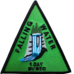
Description Introducing a new independent Falling Water badge! (cost of badge is $10 for members, $12 non-members)
Lets get out and enjoy the beautiful colors the valley has to offer this time of year.
In this challenging loop we will hike the east and west sides of the valley from Beaver Valley Ski Club, connecting them with the Valley Crossover Side Trail.
This hike is for experienced hikers only. You must be able to hike 4-5km per hour for 30km.
This will be a long day and we will stay together as a group.
Bring lots of water and food
Please no dogs
Please text Kristina @ 519-410-9077 for morning of cancelations
COVID-19 Precautions Before, During and After your Hike
Each hiker joining a Bruce Trail Club organized hike must perform a self-screening check before hiking. Find Ontario’s self-assessment tool here: https://covid-19.ontario.ca/self-assessment/
If you are experiencing COVID-19 symptoms, stay home.
Transportation
It is the Bruce Trail Conservancy’s current policy that car shuttles are allowed. It is at the discrepancy of individual hike leaders to make that decision.
Other Guidelines
Arrive 15 minutes before the start of the hike.
Wear sturdy footwear and appropriate attire for the weather and the terrain. Hiking poles are a good idea in any season, especially if the terrain is rocky or slippery. In winter, snowshoes or icers/crampons are needed when conditions dictate. Wearing appropriate clothing and footwear prevents injuries and shows consideration for a safe and positive group hiking experience.
Always carry I.D. and your health card.
Bring sufficient water and snacks (or lunch if indicated). A minimum of 1L of water is recommended on all hikes, and 3L is recommended for long, challenging hikes in the heat of the summer.
Bring sunscreen and insect repellent (for spring and summer hikes).
Hosting Club: Blue Mountains Category: Register on-line or sign-in morning of hike Location (Google Maps): Hike meets in the parking lot behind Tim Hortons on First St. in Collingwood.
Pace: Medium – 3 to 4 km/hr Terrain: Moderate – Some hills and/or some poor footing Distance: 16.5
Description Record your final hike and submit your log of both Falling Water hikes to BVBTC for your badge. http://beavervalleybrucetrail.org/hikes/badges.html We will drive our cars and park at the Beaver Valley Ski Club lower parking lot off Grey Road 30. We will then shuttle to Hoggs Falls at km 67.5 on the Lower Valley Road in the Beaver Valley section to begin the hike. Following the white blazed trail north up the east side of the valley to km 52.2, we will take the Valley Crossover Side Trail back to the cars. On this section, one is never far from the sight or sound of falling water as we pass Hogg’s Falls and Eugenia Falls. Bring a lunch and water.
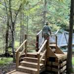
Pace: Medium Terrain: Moderate, Some steep sections Length of Hike: 5 km
Description Our hike takes us along a route that showcases much of the new construction that has recently been completed in the Hogg’s Falls area. Multiple bridges across the Boyne River allow for hiking loops. We will walk southward from the parking lot along the Main Trail and then we will cross the Boyne River. The Trail rises well above the Boyne River meaning there’s some steep inclines. Another bridge is crossed to return to the other side of the Boyne and then we include a loop into uplands. A visit to see the Falls is a special view.
Pace: Leisurely – 3km/hr or less Terrain: Moderate – Some hills and/or some poor footing Distance: 6K
Description We will meet at Delottville Park on Newcombe Road. Dundas. Take Governors Road from Dundas and turn right onto Davidson Blvd. Left onto Pirie and then right onto Newcombe. There is plenty of on street parking. From the park we walk north to the Davidson Blvd. entrance for the Bruce Trail. After a walk through the woods we reach the McCormack trails. There are a couple of hills but easy walking under foot. Great views at top of hill.
Hosting Club: Sydenham Category: An evening walk. Location (Google Maps): Meet in the municipal parking lot by the river on the west side of 1st Ave. E between 7th St. E and 8th St. E in Owen Sound.
Pace: Brisk: 4 to 5 km/h Terrain: Moderate: Some hills and/or poor footing Distance: Approx 5 km
Description Join us for an evening hike exploring Owen Sound trails and neighbourhoods, followed by an opportunity for refreshments. There is no need to show up 15 minutes early. The hike will leave at 7:00 pm. For further information contact Hike Leader Harriet Nixon at harrietnixon@bmts.com or Cell 519-373-6598.
From Jordan Hollow Hike the main trail to Upper and Lower Balls Falls, Moyer Road or Louth and Return. You must register for each hike. Bring Poles, sunscreen, bug spray , snack and a drink and dress for the weather
Pace: Medium – 3 to 4 km/hour Terrain: Moderate – some hills and/or some poor footing, Strenuous – hilly with steep climbs and some poor footing Distance: From 76.9 to 65.8 plus City View Side Trail, 11.4 km. Map 9
Description This is the fifth hike of ten and takes us through Kerncliff Park and Waterdown Woods to Great Falls and a lookout. The hike continues along valley slopes, crosses a bridge then Snake Rd., passes through woods and along an old quarry to then pass through the Highway 6 tunnel to vehicles.
Hosting Club: Dufferin Hi-Land Category: General Hike Location (Google Maps): Where the Purple Valley Access Trail meets Wright’s Crescent .5 km north of km 15.6, BTC Map 36.
Pace: Medium Terrain: Slippery and Steep Sections, Slippery Sections Likely, Strenuous Distance: 16.1 kms
Description Join us rain or shine for this series of Peninsula shuttle hikes from Wiarton to Lion’s Head. The terrain is demanding but stunning. Hikes range from 15 to 19 km. See individual hike descriptions for details. Please be ready for rocks, poison ivy, bugs and ticks. Hiking boots and poles mandatory. Lots of climbing, some mud and a lot of laughs. Please arrive 15 minutes ahead of time because our departure times are firm. Please bring your own first aid kit with moleskin, 2.5L water, lunch, snack and a change of footwear and a garbage bag (for the shuttle). Please be prepared to use your vehicle for the shuttle. No dogs and no dropouts. Km references are to 31st Edition Bruce Trail Reference.
Description Each Friday we will explore different neighbourhoods, trails and parkland throughout Historic Niagara-on-the-Lake.
Moderate pace with some weeks entirely on sidewalks and roads while others may include a mix of trails and paved pathways. Great way to build up endurance for longer more strenuous hikes.
Prepare for cooler windy conditions on open parkland and along Lake Ontario and Niagara River trails.
Plan to stay for conversation and a warm cup of coffee or tea at Sweets & Swirls, Community Centre, Niagara Stone Road, NOTL
Pace: Medium Terrain: Slippery and Steep Sections, Slippery Sections Likely, Strenuous Distance: 18.2 kms
Description Join us rain or shine for this series of Peninsula shuttle hikes from Wiarton to Lion’s Head. The terrain is demanding but stunning. Hikes range from 15 to 19 km. See individual hike descriptions for details. Please be ready for rocks, poison ivy, bugs and ticks. Hiking boots and poles mandatory. Lots of climbing, some mud and a lot of laughs. Please arrive 15 minutes ahead of time because our departure times are firm. Please bring your own first aid kit with moleskin, 2.5L water, lunch, snack and a change of footwear and a garbage bag (for the shuttle). Please be prepared to use your vehicle for the shuttle. No dogs and no dropouts. Km references are to 31st Edition Bruce Trail Reference.
Hosting Club: Sydenham Category: General Hike Location (Google Maps): Kemble Arena parking lot for carpooling. 319897 Kemble Rock Road. Meet at 12:45. Limited parking at the trail head.
Pace: Medium: 3 to 4 km/h Terrain: Moderate: Some hills and/or poor footing Distance: 5.5 km
Description President’s Path and Slough of Despond loop with an optional add on to view Skinner’s Bluff. This hike is relatively flat through fields and forests. Note : 3 stiles to climb, no walk around. Some crevices. Magnificent views of the bay and Slough of Despond. We can choose to take a short extension at the end to the lookout over Skinner’s Bluff (extra 30 minutes). If you are unable to register, please call or text the leader at 226-787-8804.
Hosting Club: Caledon Hills Category: End-to-End Location (Google Maps): Fung Loy Kok Taoist Tai Chi-International Centre, 248305 Side Road 5, Mono, ON L9W 6C3 GPS Co-ordinates: 43.975421, -79.989252.
From Airport Road, turn east onto Side Road 5. Drive 270 metres to the entrance of the International Centre on the left. Turn right onto the first gravel road and proceed towards the pagoda-styled building. Park on the shoulder of this circular driveway. Please do not park in the main parking lot near the office. The buildings and facilities of the International Centre are off limits to participants during this Bruce Trail event.
Meeting Locations for Day 2 and Day 3 are noted in the hike description.
Pace: Brisk – 4 to 5 km/hour Terrain: Strenuous – hilly with steep climbs and some poor footing Distance: 72.5 kilometres
Description Make plans to complete the full 72.5 kilometres of the Caledon Hills section over the Thanksgiving long weekend.
The bus will leave at 8:00 a.m. sharp, each day. Please plan to arrive at least 20 – 30 minutes before the departure time.
On Saturday, meet at the Fung Loy Kok Taoist Tai Chi-International Centre, 248305 Side Road 5, Mono, ON, 43.975421, -79.989252.
The bus will take participants to the northern end of the Caledon Hills section, at County Rd. 8 and 3rd Line EHS. The group will then hike south, back to the International Centre. Checkpoints are located 11 km, 17 km [Cut-off Time: 1:00 pm], and 26.5 into the hike.
On Sunday, meet at km 21.0, the north/east corner of Escarpment Side Road and Heart Lake Road. Park on the north side of Escarpment Side Road, well off of the road, 43.859911, -79.947606.
The bus will take hikers to km 0.0 on Creditview Road. Participants will then hike back to the meeting place on Escarpment Side Road.
Checkpoints are located 9.5 km [Cut-off Time:11:00] and 21.0 km into the hike.
On Monday, meet at the Fung Loy Kok Taoist Tai Chi-International Centre.
The bus will take participants to Escarpment Side Road and Heart Lake Road. Everyone will then hike back to the International Centre.
Checkpoints are located 7.0 km, 14. km [Cut-off Time:12:15 pm], and 25.0 km into the hike.
Please note that on Saturday and Monday, the final checkpoint (the end of the hike) is slightly off the Bruce Trail. There will be signs in place to direct hikers. Also note that the meeting place on Sunday is different than the other two days.
Hosting Club: Toronto Category: Car Hike Location (Google Maps): Erindale Park Dundas Street west and Mississauga Road Please park in parking lot after entering the park
Description Please join us to hike along Credit river and see how salmon fishes go upstream and see the view of widest river around GTA,
Some safety procedures during the hike:
1-Hikers must stay between the leader and the sweep.
2-Hikers must advise the leader or the sweep if they wish to leave the group.
3- Hikers must follow the whistle instructions: 1 blast- stay where you are; 2 blasts come to the leader; 3 blasts – come to the leader quickly.
4-Hike leader may request volunteers to stop at trail intersections, they need to help hikers to the direction the group walk and wait till they see the sweep .
5-Hikers have to make sure they can see the persons behind and in front of them.
Pace: Medium – 3 to 4 km/hr Terrain: Moderate – Some hills and/or some poor footing Distance: 11km
Description Glen Side Trail, Ron Savage Side Trail, Lindenwood Side Trail and Ross McLean Side Trail 7 of 9 hikes Start time: 8:30AM Hikers meet at trailhead at 8:30AM, arrange your own carpooling. Contact hike leader for details where to meet up
Pace: Moderate Terrain: Hilly, Rocky, Variable Distance: 15 km
Description Join us to hike the Toronto section of the Bruce Trail in a series of four moderate pace/moderate distance Level 2 hikes (15-16 km a day). Those who complete all 4 hikes will qualify for the Toronto club’s diamond E2E badge. The badge fee ($5 members/$15 non-members) will be collected on Hike #3.
Members may alternatively choose to use the hikes to earn the new stained glass Limehouse stone bridge fundraiser badge. Available to members only the badge fee is $30 and proceeds go to protecting and preserving the Bruce Trail. Please contact the Hike Leader if you are interested in earning the fundraiser badge for further instructions. This badge can be earned only on one of the series of special group hikes led by a BTC Hike Leader and not individually.
Hikers who complete all 4 hikes will qualify for either the diamond badge or stained glass fundraiser badge, as they have chosen.
Any hikers are welcome to join the hikes regardless of working towards one of E2E badges.
There will be a refreshment/social stop in Georgetown after the hike before returning to the Kipling Station departure point by 5:30 PM
** Hikers are required to bring a mask and wear it on the bus. Masks must fit properly and cover the nose, mouth and chin. For the highest level of protection against Covid-19, respiratory viruses or the flu, KN95 or N95 masks are recommended. **
Description Discover the history of the 19th Century Quarry Pioneers and the Cave Spring Witch. Complete this hike and count it towards the Screaming Tunnel Badge
Hosting Club: Dufferin Hi-Land Category: General Hike Location (Google Maps): BTC parking lot on Jackson’s Cove Road at the top of the hill just west of the trail. Km 51.9 BTC Map 37.
Pace: Medium Terrain: Slippery and Steep Sections, Slippery Sections Likely, Strenuous Distance: 18.6 kms
Description Join us rain or shine for this series of Peninsula shuttle hikes from Wiarton to Lion’s Head. The terrain is demanding but stunning. Hikes range from 15 to 19 km. See individual hike descriptions for details. Please be ready for rocks, poison ivy, bugs and ticks. Hiking boots and poles mandatory. Lots of climbing, some mud and a lot of laughs. Please arrive 15 minutes ahead of time because our departure times are firm. Please bring your own first aid kit with moleskin, 2.5L water, lunch, snack and a change of footwear and a garbage bag (for the shuttle). Please be prepared to use your vehicle for the shuttle. No dogs and no dropouts. Km references are to 31st Edition Bruce Trail Reference.
Description This urban hike will form a loop, first crossing over Martindale Pond, then winding through town to the Green Ribbon Trail and then back close to Lake Ontario.
Pace: Medium Terrain: Moderate, Some rocky footing, Some steep sections, Strenuous Length of Hike: 10.4 km
Description This is a series of 7 hikes to earn the Beaver Valley Geology badge. We will use the criteria listed in Beth Gilhespy’s book, Walking Through Time, Exploring Niagara Escarpment Geology in the Beaver Valley Bruce Trail Section. We’ll boost our knowledge of the local geology along the way as we take the required photos. Hikers are welcome to join any or all of the hikes, however, they must complete all 7 hikes to earn the badge. Bring sufficient water and snacks.
Hike Three: The Mill Creek Valley
COVID-19 Precautions Before, During and After your Hike
Each hiker joining a Bruce Trail Club organized hike must perform a self-screening check before hiking. Find Ontario’s self-assessment tool here: https://covid-19.ontario.ca/self-assessment/
If you are experiencing COVID-19 symptoms, stay home.
Personal Protective Equipment:
Hikers may choose to wear masks
Transportation
It is the Bruce Trail Conservancy’s current policy that car shuttles are allowed. It is at the discrepancy of individual hike leaders to make that decision.
Other Guidelines
Arrive 15 minutes before the start of the hike.
Wear sturdy footwear and appropriate attire for the weather and the terrain. Hiking poles are a good idea in any season, especially if the terrain is rocky or slippery. In winter, snowshoes or icers/crampons are needed when conditions dictate. Wearing appropriate clothing and footwear prevents injuries and shows consideration for a safe and positive group hiking experience.
Always carry I.D. and your health card.
Bring sufficient water and snacks (or lunch if indicated). A minimum of 1L of water is recommended on all hikes, and 3L is recommended for long, challenging hikes in the heat of the summer.
Bring sunscreen and insect repellent (for spring and summer hikes).
Hosting Club: Toronto Category: Urban Walk Location (Google Maps): Start at Victoria Park subway station ticket collector. Several dropouts along the way. Final destination is Lawrence subway station on Yonge Street.
Description From Victoria Park subway we shall walk northeast along the Taylor Creek to the Don River, follow the West Don River to Sunnybrook Park, then to Sherwood Park and then to Alexander Muir Memorial Park ending up at Lawrence subway station on Yonge Street. We shall have a picnic halfway so bring a sandwich and a thermos.
Pace: Leisurely, Moderate Terrain: Flat, Variable Distance: 6 KM
Description This is the second walk in a 4 part series of fall colour walks in Toronto Parks and Ravines. You may sign up for any or all walks in the series. Join us in hiking Crothers Woods trails and enjoy the beautiful fall colours. The trail is variable and narrow in some sections which are also popular with mountain bikers. Sun Valley and Cotton Wood sections are flat where we can enjoy a leisurely walk and see sections of the Lower Don River. Wear hiking boots or comfortable running shoes, bring water and snacks.
Hosting Club: Dufferin Hi-Land Category: General Hike Location (Google Maps): Barrow Bay BTC parking lot on County Road #9 just south of McKague Road. Km 67.9 BTC Map 38.
Pace: Medium Terrain: Slippery and Steep Sections, Slippery Sections Likely, Strenuous Distance: 16.3 kms.
Description Join us rain or shine for this series of Peninsula shuttle hikes from Wiarton to Lion’s Head. The terrain is demanding but stunning. Hikes range from 15 to 19 km. See individual hike descriptions for details. Please be ready for rocks, poison ivy, bugs and ticks. Hiking boots and poles mandatory. Lots of climbing, some mud and a lot of laughs. Please arrive 15 minutes ahead of time because our departure times are firm. Please bring your own first aid kit with moleskin, 2.5L water, lunch, snack and a change of footwear and a garbage bag (for the shuttle). Please be prepared to use your vehicle for the shuttle. No dogs and no dropouts. Km references are to 31st Edition Bruce Trail Reference.
Pace: Moderate Terrain: Other (Refer to Description) Distance: 15 km
Description Not a big fan of dry turkey or your in-laws? Tell them you can’t attend, you have booked a hike for Thanksgiving Sunday and it is too late to cancel!
This hike explores the Lion’s Valley ravine created by the 16-Mile Creek in Oakville. The hike starts and ends at the Oakville GO Station.
If you are planning to travel by GO train to Oakville from Union Station, you will be taking the 8:44 am westbound train. Please use the bathroom while on the GO train as there is little time for it at the Oakville GO station.
We will all meet at 9:25 am at the Oakville Transit Bus Platform 27 at the Oakville GO Station (click here for station diagram.) From here we will board Bus 13 at 9:40 am and take a short bus ride to the start point of our hike. Oakville Transit buses accept Presto, and if you have paid for the GO train, the fare for the Oakville bus will register as zero. We will walk a 15 km looping trail through the 16-Mile Creek ravine (click here for route map), stopping at the halfway point for lunch (port-a-potties only; bring hand sanitizer and tp) and return to the Oakville GO Station. The trail is stone dust gravel or asphalt and mostly flat except for two steep declines and two long climbs. There is one long set of stairs to descend. The after-hike pub stop is at the Beertown Public House (click here for menu) near the Oakville GO Station.
You can also drive to the Oakville Station and meet us there. Parking is free on the weekends. You may also choose to park in a parking lot located at the intersection of McCraney St. W. and Old Upper Middle Road approximately 1 km from where we enter the trail system. Please park by 9:30 am and walk to the trail entry to meet us there by 9:50 am.
Pace: Leisurely: 3 km/h or less Terrain: Moderate: Some hills and/or poor footing, Strenuous: Hilly with steep climbs and some poor footing. Distance: 1.8 km
Description A figure 8 hike on the east side of Owen Sound with many interesting rock formations. It also contains 1 Secret of Sydenham. For more information contact Bill Snel at w.snel2@gmail.com or call landline (519) 470-0584. If unable to register phone the hike leader.
Pace: Medium Terrain: Slippery and Steep Sections, Slippery Sections Likely, Strenuous Distance: 16.5 kms.
Description Join us rain or shine for this series of Peninsula shuttle hikes from Wiarton to Lion’s Head. The terrain is demanding but stunning. Hikes range from 15 to 19 km. See individual hike descriptions for details. Please be ready for rocks, poison ivy, bugs and ticks. Hiking boots and poles mandatory. Lots of climbing, some mud and a lot of laughs. Please arrive 15 minutes ahead of time because our departure times are firm. Please bring your own first aid kit with moleskin, 2.5L water, lunch, snack and a change of footwear and a garbage bag (for the shuttle). Please be prepared to use your vehicle for the shuttle. No dogs and no dropouts. Km references are to 31st Edition Bruce Trail Reference. Paid parking $20.00. Please contact hike leader for details.
Description Thanksgiving hike. Meet 9:45am for TTC rides at south/west corner of Ellesmere Rd & Morningside Av. 10:00am for drivers at 390 Morningside Av Parking. This lovely paved section include Highland Creek trail through forest, Waterfront trail along lake Ontario, some road walking to connect the loop. Please bring water and lunch. Optional drop at Guildwood station intersection of Kingston Rd & Celeste Dr.
Hosting Club: Sydenham Category: General Hike Location (Google Maps): Roadside parking on Sideroad 22B just east of Grey Road 7 at Km 98.3 (Map 27). We will meet at the Blue sign for the Fairmount side trail.
Pace: Brisk: 4 to 5 km/h Terrain: Strenuous: Hilly with steep climbs and some poor footing. Distance: 11.5 km
Description This is a popular hike due to the spectacular vistas of the Beaver Valley. However, it includes several long and steep uphills and downhills, so is not for inexperienced hikers. We begin at the top of the Escarpment and descend into the Beaver Valley, then travel beside a pretty stream along the Siegerman side trail. We climb back out of the valley and make our way to the very scenic Webwood Falls where we will enjoy a break and snack. Then we hike back to the cars via the Fairmount side trail which offers gorgeous views of the Beaver Valley.
Hosting Club: Dufferin Hi-Land Category: Tuesday Hike Location (Google Maps): Beaver Valley Section, Map 26. Meet at SuperBurger (Intersection of Hwy 10 and 89 in Primrose) at 9:30 am or at Hogg’s Falls parking lot on Lower Valley Rd, north of Flesherton at 10:00 am.
Pace: Leisurely Terrain: Moderate, Slippery and Steep Sections Distance: 7.2 or 2.6 kms
Description We will explore a new loop created by construction of a bridge across the Boyne River, joining Main Trail on the east and west banks. After returning to the parking lot, the longer hike will continue around the Uplands Meadow/Upper Beaver Valley Side Trails loop. Bring water, snacks.
Hosting Club: Caledon Hills Category: Car Hike Location (Google Maps):
Parking lot at km 31.7 Map 22.Take Hwy 10 North. At Primrose turn left then in 5 km turn right on County Rd. 124. Follow for 30 km. In village of Singhampton turn right and follow #124 for 4 km to Devil’s Glen parking on the right. Leader’s cell phone 905-301-4091.
Description This is a loop hike going south from the Devil’s Glen parking lot on the Main Trail to the Mad River Side Trail. We will return on the Mad River Side Trail to the Devil’s Glen parking. Note: Because of a re-route, this hike is about 2 km shorter than in previous years and a bit less hilly.
Hosting Club: Iroquoia Category: Special Event Location (Google Maps): Frontenac Provincial Park is about 3.5 -4 hours from Toronto and about 1 hour north of Kingston
Pace: Brisk – 4 to 5 km/hr Terrain: Moderate – Some hills and/or some poor footing, Slippery and Steep Sections Distance: 4.5km – 27km
Description This is a special, 7 day, 6 night trip to Frontenac Provincial Park. This special hiking event is a series of loop hikes called the Frontenac Challenge held in Frontenac Provincial Park. Frontenac Provincial Park is about 3.5 hours from Toronto. The 11 loops are from 1.5km to about 27km including the trail to access the trail head. Each loop has a special password which you keep track of to submit for a badge. The cost for registering for the Challenge in 2022 was $5. This includes a badge (1st, 5th, 10th etc) and certificate. A certificate for all other completions. A self-addressed 9×12”stamped envelope must be left at the park office if you want a badge/certificate.
Accommodation is at Snug Harbour Resort, a short distance from the park. Four shareable cabins (#2,10,11 & 12) have been blocked off for the Bruce Trail hikers. Please contact Rob at relax@snugharbour.on.ca. Choose one of the cabins or another one of your choosing if another is available. http://snugharbour.on.ca/accommodations.htm Once you register, please let me know if you want your name shared with others to share your cabin. The rate per cabin should be $110 plus tax no matter if there are two or four sharing. This rate also includes access to boats (at your own risk), fire pits and GBBQs as needed.
Check in is October 11,2023 and check out is October 17,2023 or you may stay longer if you wish. Let Rob know you are with the Bruce Trail Group. He has agreed to give us a favourable rate ($110) as well as access to resort amenities without charge. You may also choose to stay elsewhere. Parking fees at the Frontenac Provincial Park also apply. Since we hike the first day, you may wish to check-in first and carpool from Snug Harbour over to the park for our 2:30pm start on our first day. See below. You can obtain your parking passes from the park office. Everyone will need a pass for the last day of hiking as most people drive straight home after our last hike. Borrowing a park pass from your local library, if available, or purchasing an annual pass, is encouraged. https://www.ontarioparks.com/fees/dayuse/2023 Purchase of the Frontenac Provincial Park map is strongly recommended. www.frontenacpark.ca
Please note, this hike is for those who wish to complete the Frontenac Challenge, not the Frontenac Trek. There may be other hikes on the schedule for the Frontenac Trek, however,
On our first day we will meet at the provincial park to complete two short loops on the afternoon of arrival at 2:30pm. You may choose to meet at Snug Harbour and check-in before hand and car shuttle from there. Please confirm that you would like to do this with Rob at Snug Harbour.
Frontenac Challenge is a very popular hiking event – there is often wild life and the trees are in full colour. Evenings are often spent around the campfire where we will have a hotdog roast and a pot luck, or two. This will be the my 5th and last Frontenac Challenge but I’m hopeful another hike leader will continue to lead them in 2024.
If you have any questions, please email ruthdmoffatt@gmail.com
Description This hike will recognize the contribution of the Six Nations during the Battle of Queenston Heights, Oct 13, 1812. We will take the main trail down the escarpment, the Upper Canada Heritage Side Trail, the Major Teyoninhokarawen (“Tey-oh-nin-hock-ah-RAW-wen”) John Norton Side Trail up the escarpment, and then the main trail. A final stop at the Landscape of Nations Memorial will be included. It should take 2.5-2.75 hours depending on the conditions. The climbs up and down the escarpment can be slippery and offer poor footing, particularly if there has been rain. Hiking poles are recommended.
Right click on/Open the link below to view a short video on the subject.
Note: Hikes are offered by volunteers who have committed to their own learning, to be able to offer informative and contemplative hike experiences. These hikes are open to all and offered in a spirit of mutual learning and inclusion.
Pace: Medium – 3 to 4 km/hr Terrain: Strenuous – Hilly with steep climbs and some poor footing Distance: 16 km
Description We will hike a loop including the main trail and BT side trails in the Hockley Valley. Bring lunch and plenty of water. Wear sturdy footwear and clothing appropriate to conditions. Please arrive by 8:45 am as we will leave promptly at 9:00 AM.
Hosting Club: Blue Mountains Category: Register in person the morning of hike. Location (Google Maps): Hike meets in the parking lot behind Tim Hortons on First St. in Collingwood.
Pace: Leisurely – 3 km/hr. or less Terrain: Easy – Mostly flat and usually good footing Distance: 6km
Description We will drive to the junction of the 2nd Line and the 6th Sideroad and commence a loop hike through the upper level of the Pretty River Valley Provincial Park. Following the John Haigh Side Trail, we will head south to join the white blazed trail, then head north to km 52.6. From here we proceed west to the cars. Bring water and a snack.
Pace: Medium Terrain: Moderate, Some rocky footing, Some steep sections Length of Hike: 5.9 km
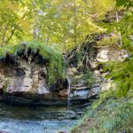
Description This hike takes us through BTC protected land. We will walk through a mature deciduous forest on the Main Trail and then we’ll walk the Stew Hilt’s Side Trail. Crossing a stream, we reach a waterfall, usually trickling in the fall. Our route will have us return on the higher Main Trail which provides a beautiful view of the Cuckoo Valley, showcasing fall colour.
Pace: Leisurely – 3km/hr or less Terrain: Moderate – Some hills and/or some poor footing Distance: Approx 6-7 km.
Description Come join me for this hike to discover what the fuss about Crawford Lake is all about (if you don’t know already). It has been in the news a lot lately. Please meet in the LOWER parking lot of Crawford Lake Conservation Area on Guelph Line at 9:45 am. for a 10:00 am. start. Bring a snack, sunscreen and hiking poles if using. You will need to make a reservation to enter. (Check out the Halton Conservation Authority website.) Leader: Anne Armstrong 905 617 3937 hikingrandma@gmail.com
From Jordan Hollow Hike the main trail to Upper and Lower Balls Falls, Moyer Road or Louth and Return. You must register for each hike. Bring Poles, sunscreen, bug spray , snack and a drink and dress for the weather
Pace: Medium Terrain: Moderate, Some rocky footing, Some steep sections Length of Hike: 8.5 km
Description This is a series of 7 hikes to earn the Beaver Valley Geology badge. We will use the criteria listed in Beth Gilhespy’s book, Walking Through Time, Exploring Niagara Escarpment Geology in the Beaver Valley Bruce Trail Section. We’ll boost our knowledge of the local geology along the way as we take the required photos. Hikers are welcome to join any or all of the hikes, however, they must complete all 7 hikes to earn the badge. Bring sufficient water and snacks.
Hike Five: Fox Ridge & McCluskey’s Rock
COVID-19 Precautions Before, During and After your Hike
Each hiker joining a Bruce Trail Club organized hike must perform a self-screening check before hiking. Find Ontario’s self-assessment tool here: https://covid-19.ontario.ca/self-assessment/
If you are experiencing COVID-19 symptoms, stay home.
Personal Protective Equipment:
Hikers may choose to wear masks
Transportation
It is the Bruce Trail Conservancy’s current policy that car shuttles are allowed. It is at the discrepancy of individual hike leaders to make that decision.
Other Guidelines
Arrive 15 minutes before the start of the hike.
Wear sturdy footwear and appropriate attire for the weather and the terrain. Hiking poles are a good idea in any season, especially if the terrain is rocky or slippery. In winter, snowshoes or icers/crampons are needed when conditions dictate. Wearing appropriate clothing and footwear prevents injuries and shows consideration for a safe and positive group hiking experience.
Always carry I.D. and your health card.
Bring sufficient water and snacks (or lunch if indicated). A minimum of 1L of water is recommended on all hikes, and 3L is recommended for long, challenging hikes in the heat of the summer.
Bring sunscreen and insect repellent (for spring and summer hikes).
Pace: Medium – 3 to 4 km/hour Terrain: Moderate – some hills and/or some poor footing Distance: From 65.8 to 54.9 plus Davidson Blvd. access trail, 11.0 km. Maps 9, 8.
Description This is the sixth hike of ten and takes us up the escarpment and along the top, through the Royal Botanical Gardens property, past Borer’s Falls and through the conservation area to the Sydenham lookout and views over Hamilton. The trail follows roads and nears the Bruce Trail Conservancy Office and the edge of the Dundas Golf and Country Club.
Pace: Leisurely – 3km/hr or less Terrain: Moderate – Some hills and/or some poor footing Distance: Approx. 6 – 7 Km.
Description From rocky sections to spectacular views and a hidden quarry, this hike has something for everyone. We will challenge ourselves with rocky sections to the lookout to see beautiful views which should be rich with Fall colours. We should get views of the old quarry both from above and below. Meet in the parking lot of Mount Nemo Conservation Area at 9:45 am. for a 10:00 am. start. Bring water, a snack and sunscreen. Poles would be very useful. Reservations are necessary and can be made through Conservation Halton Parks reservation system. Please note that there are some rocky sections. Leader: Anne Armstrong 905 617 3937 hikingrandma@gmail.com
Description Each Friday we will explore different neighbourhoods, trails and parkland throughout Historic Niagara-on-the-Lake.
Moderate pace with some weeks entirely on sidewalks and roads while others may include a mix of trails and paved pathways. Great way to build up endurance for longer more strenuous hikes.
Prepare for cooler windy conditions on open parkland and along Lake Ontario and Niagara River trails.
Plan to stay for conversation and a warm cup of coffee or tea at Sweets & Swirls, Community Centre, Niagara Stone Road, NOTL
Location (Google Maps): Bluewater Outdoor Education Centre 3092 Bruce Road 13 Wiarton, ON N0H 2T0
Description The Peninsula Hiking Festival is a two-day event that highlights the beauty, biodiversity and resilience of the natural environment of the Saugeen (Bruce) Peninsula, while strengthening interest and support in local conservation efforts.
Join us at the Bluewater Outdoor Education Centre on October 13 and 14 to connect with fellow outdoor enthusiasts and learn more about local culture and ecology. Focusing on the theme of Forest Ecology, festival attendees will be invited to participate in a variety of interpretive hikes and workshops, along with social opportunities to connect with one another.
Description Bus departs 10 York Mills Rd at 8:00 AM and Major Mackenzie Dr and HWY 400 Park and Ride at 8:20 AM. If you wish to be picked up at the Major Mackenzie Dr and HWY 400 Park and Ride, type ‘yes’ in the additional information field. Please arrive 15 minutes before departure. The bus waits for no one.
On this hike we will be going east from km 55.7 through the Petun Conservation Area. The Conservation Area was named for the indigenous peoples that inhabited the land during the early 1600’s. As the Bruce Trail winds its way through rock faces, cliffs and crevices, one of the highlights of the trail are lookouts from Osler Bluff. The view is especially beautiful in the fall when the leaves change colors. There are also unique fern and moss communities. We will continue through the Pretty River Valley Provincial Park. Here we will take a short climb of a few hundred metres on the John Haigh Side Trail to the highest point along the Bruce Trail at 540m above sea level. We will stop in Creemore on our way back to Toronto for a chance to walk its heritage trail or to visit bakeries, a craft brewery, art galleries, museums and parks.
** Hikers are required to bring a mask and wear it on the bus. Masks must fit properly and cover the nose, mouth and chin. For the highest level of protection against Covid-19, respiratory viruses or the flu, KN95 or N95 masks are recommended. **
Pace: Moderate Terrain: Variable Distance: 14-15 KM
Description
Some safety procedures during the hike:
1-Hikers must stay between the leader and the sweep.
2-Hikers must advise the leader or the sweep if they wish to leave the group.
3- Hikers must follow the whistle instructions: 1 blast- stay where you are; 2 blasts come to the leader; 3 blasts – come to the leader quickly.
4-Hike leader may request volunteers to stop at trail intersections, they need to help hikers to the direction the group walk and wait till they see the sweep .
5-Hikers have to make sure they can see the persons behind and in front of them.
Hike through Woodend along the Main Trail and Side Trails visiting the Screaming Tunnel and on to Fireman’s Park before returning. This hike qualifies for the hike required regarding the screaming tunnel badge
Hosting Club: Dufferin Hi-Land Category: Special Events Location (Google Maps): Dufferin Hi-Land Section, Map 20, Km 28.3. The hike starts from the BTC Rock Hill parking lot on 1st Line EHS, Mulmur, 6.0 km north from Hwy 89, east of Hwy10. You will be directed to parking on the west side of the road, just opposite the meeting site. We ask that you do not park on the road.
Pace: Brisk Terrain: Dependent on Conditions, Slippery and Steep Sections Distance: 25 kilometers
Description This is a loop hike, hiking south beginning and ending at km 28.3. A detailed map will be handed out at the start. There will be one checkpoint along the route where snacks and water will be available. Please bring your own refillable water bottle.
There will be hotdogs and snacks at the finish line along with photos taken with your new accomplishment!
Note: Adult Members are considered 12 years old and older. Children under the age of 12 may not register due to the strenuous nature of this challenge.
Check-in will begin at 8:00 am, continuing until 9:00.am. Registrants may leave as soon as 8:20am after they check in and receive any further instructions.
Participants will earn the Boyne Valley 25 K badge.
Pace: Medium – 3 to 4 km/hr Terrain: Moderate – Some hills and/or some poor footing Distance: 10.6km
Description Nels Maher Side Trail, Slough of Desmond Side Trail, Presidents Path Side Trail and Chris Walker Side Trail 8 of 9 hikes Start time: 8:30AM Hikers meet at trailhead at 8:30AM Contact hike leader to confirm start up point.
Pace: Medium – 3 to 4 km/hr Terrain: Moderate – Some hills and/or some poor footing Distance: Approximately 12 kms
Description A There and Back-starting out on the old quarry trails behind the shopping centre we will pick up the BT main trail through Clappison Woods – and along Grindstone Creek – to Smokey Hollow Falls
Some steep and rocky trail as well as staircase climb to view the Great Falls – Pack water, snack/lunch- wear weather appropriate clothing, hiking poles, boots recommended as well
Description We will complete a loop hike through the Provincial Park including the north outlier (Splitrock and Ralph Tremills side trails). The route is mostly flat with some small hills in the first part and generally easy hiking. There should still be a bit of fall colours to see. Hiking boots are recommended. For those wishing it there is an option for a shorter 8 km hike.
After the hike you are invited to join me at the Hockley Resort for refreshments.
To get to the meeting place drive north on Hwy 10 past Orangeville. Continue to Mono Centre Road (crossroad name is Camilla). Turn right and take this road into Mono Centre. Community Centre parking is on your right about 200 meters before you get to the crossroads.
Join us for the last hike of this series of four 2023 NBTC Nature Hikes to learn more about the biodiversity along the Niagara Escarpment. We will explore the trails throughout Louth Conservation area which offer beauty in all four seasons. Hikes will be held January, May, August & October – it will be amazing to see all the changes throughout the seasons. Your hike leaders, members of the NBTC Biodiversity Committee, will share their knowledge of the amazing flora & fauna along the trail as well as any biodiversity projects in the works for this year.
Be sure to register in advance as space is limited & the hike will be rescheduled in the event of heavy rains or heavy snow.
Contact Alicia Aitchison, aliciaaitchison1@gmail.com, with any questions.
Pace: Medium: 3 to 4 km/h Terrain: Moderate: Some hills and/or poor footing Distance: 4 – 6 kms
Description We will hike the blue trail up from 7th St. W. , then take the main trail south to Concession 3. From there we will either take the hydro line back to the main trail, or add some distance in Springmount Forest. There are crevasses and holes in the area. Map 32 If you are unable to register, please call or text leader at 519 379 2573.
Description Embark on a scenic journey along the Humber River, where nature’s spectacle unfolds during the annual salmon run. Explore the riverside trails to witness the breathtaking sight of salmon leaping upstream amidst vibrant fall colors. Don’t forget your camera to capture this enchanting chapter of nature’s autumn show in action!
Hosting Club: Toronto Category: Urban Walk Location (Google Maps): Glen Stewart Park Entrance – Kingston Rd. West of Malvern Avenue
Hike Leader(s): Sajedeh Zahraei
Pace: Leisurely, Moderate Terrain: Flat, Variable Distance: 6-8 KM
Description This is the third walk in a 4 part series of fall colour walks in Toronto Parks and Ravines. You may sign up for any or all walks in the series. enjoy the beautiful fall colours in Glen Stewart Ravine and walk down to the Beaches Board Walk. We will have a lunch break at Kew Beach then you have the option to walk back to Glen Stewart Ravine where we started or drop-off at Queen Street East. Bring water, snacks, lunch, and wear comfortable foot wear.
Hosting Club: Iroquoia Category: Iroquoia E2E-in-Six Location (Google Maps): Day 1 – October 15th, 2023-Kilbride School, Panton St, Burlington – Please park in the back 43.427756, -79.937991
Pace: Medium – 3 to 4 km/hr Terrain: Moderate – Some hills and/or some poor footing Distance: Varies but about 15km per outing
Description Join us in the Iroquoia End to End this fall starting in October, 2023 for 6 hikes. Each hike will be approximately 15-26 kms at a moderate pace. This is suitable for intermediate to advanced hikers.
We will be using hiker’s vehicles to shuttle between our start and end point for each hike. As well, there will be costs at Hilton Falls.
Proper hiking boots is a must! Bring hiking poles, food/snacks, water, hat, and rain gear.
Arrive at 9:30am for roll call/check in/drive to the starting point. Hike will start at 10 am sharp
It is important to complete each section within a time frame to consider the shorter days.
Hikers will receive their End to End badge upon completion. If you must miss a day but can make it up before the last scheduled hike, you will still qualify for this special Jefferson Salamander badge which was designed by Joe Borges and represents an endangered species sometimes seen in the Iroquoia section. This is a fundraising hike for the Iroquoia Bruce Trail Club. Proceeds go to the mission of protecting this ribbon of wilderness, the Bruce Trail.
Please, no dogs. All logistics/scheduling/start/stop and parking (shared cost if there is a fee)and a hike leader to guide you, is included.
__________
Day 1 – October 15th, 2023-Kilbride School, Panton St, Burlington – Please park in the back 43.427756, -79.937991 (20). Car shuttle to Hilton Falls Conservation Area.4985 Campbellville Rd, Milton 43.505705, -79.961589 (100) 26.68km
Day 2 – October 20th, 2023- City View Park Waterdown (2nd entrance off Kerns Rd. South of Dundas St.) N43.352308, W79.862585 (50) 22.64km
Day 3 – October 21st, 2023- Davidson Blvd. Dundas N43.265251, W79.990490 (5) 21.94km
Day 4 – November 18th, 2023 – Chedoke Golf Club parking lot, Hamilton N43.246205, W79.906935 (40)15.24km
Day 5 – November 19th,, 2023 – Glover Mountain Rd. Side Trail roadside parking, Stoney Creek N43.209155, W79.773801 (10) 17.58km
Day 6 – November 26th, 2023 – Grimsby Lions Community Pool 1 Elm St, Grimsby. N43.193201, W79.565301 (30) 21.33km
Hosting Club: Toronto Category: Car Hike Location (Google Maps):
Scotsdale Farm Parking. Take Trafalgar Road north to where it merges with Highway 7. Continue north on Highway Trafalgar/Highway 7 to Halton Regional Road 3 (Signs for Regional Rd 3/Trafalgar Road N/Ballinafad/Brisbane) and turn right. Continue on Trafalgar/Regional Road 3 for 600 metres and driveway for Scotsdale Farm will be on the right. There is a blue and white sign.
Join Maureen’s family and friends and the Toronto Bruce Trail Club to celebrate her life and years of service to the club on a gentle Level 2 loop hike suitable for beginners. Bring a lunch to enjoy on the trail as well as water (2L is recommended). The hike will follow the Bennett Heritage Trail, Maureen Smith Trail, the main Bruce Trail, and Irwin Quarry Trail. We will return to the Scotsdale Heritage Farm by 2:00 PM. At the beginning of the hike Toronto Bruce Trail Club President David Royle will say a few words about one of our club’s most influential volunteers. Anyone is welcome to join us for the presentation. After the hike there will be the option of post-hike refreshments at the Copper Kettle pub in Glen Williams. Registration for the hike is currently open.
Hosting Club: Caledon Hills Category: Nature Walks Location (Google Maps): Meet at the Hockley Road Parking Lot: Located on the north side of Hockley Road at the Hockley Road Side Trail. Google Map Coordinates: 43.972857, -80.056330 Directions: From ON-10, turn east onto Hockley Road/Dufferin County Road 7. Drive for 5 kilometres. The parking lot is on the lefthand side.
Pace: Leisurely – 3 km/hour or less Terrain: Moderate – some hills and/or some poor footing Distance: 5.5 km
Description Plan to enjoy the fall colours and good company on this leisurely exploration of a section of the Hockley Valley Provincial Nature Reserve. Our route will take us along the Hockley Road Side Trail, sections of the main Trail, and the Tom East Side Trail. Bring your choice of hydration and snacks. Sturdy footwear is highly recommended.
Hosting Club: Sydenham Category: General Hike Location (Google Maps): 11th Concession – north of Km 86.5 where the road intersects with the Owen Sound Rail Trail. Map 32
Pace: Leisurely: 3 km/h or less Terrain: Moderate: Some hills and/or poor footing, There might be muddy sections. Distance: 6+ km
Description This will be an in and out hike leading to some giant dolostone blocks separated by spectacular crevices. If you are unable to register please text/call the hike leader 416-848-8818.
Hosting Club: Peninsula Category: Hike & Picnic Location (Google Maps): Permitted parking at Colpoy`s Bay barn foundation, just North of km 6.8 (map 35)
Pace: Medium: 3 to 4 km/h Terrain: Moderate: Some hills and/or poor footing Distance: 8 km
Description Join members of the Peninsula Bruce Trail Club and members of the Sydenham Bruce Trail Club for an 8 km fall colours hike from km 6.8 (map 35) to the Corran. There is an opportunity to descend the spiral staircase and back up before we stop lunch (bring your own) at the Corran. After lunch it`s the same way back to our cars. For further information please contact Hike Leader Harriet Nixon at harrietnixon@bmts.com or Cell 519-373-6598.
Hosting Club: Sydenham, Peninsula Category: Hike & Picnic Location (Google Maps): Permitted parking at Colpoy`s Bay barn foundation just north of km 6.8 (Map 35)
Pace: Medium: 3 to 4 km/h Terrain: Moderate: Some hills and/or poor footing Distance: 8 km
Description Join members of the Peninsula Bruce Trail Club and the Sydenham Bruce Trail Club for a Fall Colours Hike from Km 6.8 to the Corran. There is an opportunity to descend the spiral staircase and back up before we stop for lunch (bring your own) at the Corran. After lunch it’s the same way back to the cars. For further information or if you are unable to register, contact Hike Leader Harriet Nixon at harrietnixon@bmts.com or cell 519-373-6598.
Pace: Leisurely Terrain: Moderate, Slippery and Steep Sections Distance: Long hike: 7.5 km; Short: 5 km
Description Both hikes will take the Laidlaw Side Trail to the Main Trail, then the South Outlier side trial. The short hike will continue around the South Outlier loop, returning by way of Main Trail and Laidlaw Side Trail. The longer hike will continue down the South Outlier Connector to the Carriage Side trail returning by way of the Spillway, Clifftop and Laidlaw Side Trails .
Pace: Leisurely – 3km/hr or less Terrain: Moderate – Some hills and/or some poor footing Distance: Approx. 8 km.
Description This hike takes us for a pleasant walk through the Halton Agreement Forest on mostly flat trails with one rocky section. Meet in the northeast corner of Woodbine Mohawk Casino Raceway on Guelph Line at 9:45 am. for a 10:00 am. start. Bring water, a snack and hiking poles if using. We will do a there and back with a small loop at the top. Leader: Anne Armstrong 905 617 3937 hikingrandma@gmail.com
Pace: Brisk: 4 to 5 km/h Terrain: Moderate: Some hills and/or poor footing Distance: Approximately 10 km
Description On this 10 km hike, we encounter a variety of terrain. We start on the Harrison Park Side Trail which meets both the main trail (upper) and the Palisades Side Trail (lower). The main trail is quite spectacular with rocky and steep sections. Weather permitting, we will do this section but if it appears too slippery we will do the Palisades Side Trail. Both trails will take us back to the main trail. From there we will head to Inglis Falls and return via the Creamery Side Trail to Harrison Park. After the hike, there will be an opportunity to enjoy lunch at the Harrison Park Inn. Please arrive 15 minutes before the start time.
Hosting Club: Blue Mountains Category: Register in person the morning of hike. Location (Google Maps): Hike meets in the parking lot behind Tim Hortons on First St. in Collingwood.
Pace: Medium – 3 to 4 km/hr Terrain: Moderate – Some hills and/or some poor footing, Strenuous – Hilly with steep climbs and some poor footing Distance: 11.5km
Description We will drive to the start of the hike at a roadside parking area near the cemetery located 1 km east of Lavender on Mulmur/Nottawasaga Townline. We will hike along the road until we reach Lavender where km 0.0 is the start of the Blue Mountains section. We will continue hiking until we reach the bridge at the Noisy River Nature Reserve and then retrace our steps. This hike offers a variety of terrain as we proceed along crevices, through forest, fields, and beautiful wetlands before reaching the Noisy River. Bring lunch and water.
Location (Google Maps): Park in the small BTC parking lot on the north side of Graham’s Hill Road, just west of where the Trail crosses Graham’s Hill Road at km 74.2, Map 26, Edition 31
Pace: Medium Terrain: Moderate Length of Hike: 4.2 km
Description This is a there-and-back hike along a varied stretch of Valley edge. Karst topography, old growth forest and streams with waterfalls are on our route as well as meadow and wild fruit trees. There are long views across the Valley.
Pace: Leisurely – 3 km/hour or less Terrain: Easy – mostly flat and usually good footing Distance: 8 km
Description This hike will start at the Cheltenham Brickyards parking area (free parking, address and GPS above). We will cross the street from the parking lot and be on the Trans Canada Trail from Mississauga Road to Chinguacousy Road. It will be an out and back, turning around at 4 km. The surface is hard packed; easy walking without any roots, rocks or hills. Hikers can wear running shoes or hiking shoes. The pace is leisurely. There are tree canopy sections and open sections. After the hike participants will have the option of gathering at Cheltenham General Store for a coffee or sweet treat.
From Jordan Hollow Hike the main trail to Upper and Lower Balls Falls, Moyer Road or Louth and Return. You must register for each hike. Bring Poles, sunscreen, bug spray , snack and a drink and dress for the weather
Hosting Club: Caledon Hills Category: Nature Walks Location (Google Maps): Meet at the Hockley Road Parking Lot: Located on the north side of Hockley Road at the Hockley Road Side Trail. Google Map Coordinates: 43.972857, -80.056330 Directions: From ON-10, turn east onto Hockley Road/Dufferin County Road 7. Drive for 5 kilometres. The parking lot is on the lefthand side.
Pace: Leisurely – 3 km/hour or less Terrain: Moderate – some hills and/or some poor footing Distance: 5.5 km
Description
Plan to enjoy the fall colours and good company on this leisurely exploration of a section of the Hockley Valley Provincial Nature Reserve. Our route will take us along the Hockley Road Side Trail, sections of the main Trail, and the Tom East Side Trail. Bring your choice of hydration and snacks. Sturdy footwear is highly recommended.
Hosting Club: Caledon Hills Category: End-to-End Location (Google Maps): Meet at Scenic Dr., west of Chateau Crt. at km 40.5. Shuttle to start at Davidson Blvd.
Pace: Medium – 3 to 4 km/hour Terrain: Moderate – some hills and/or some poor footing, Strenuous – hilly with steep climbs and some poor footing Distance: From 54.9 – 40.5, plus walk from parking, 14.5 km Map 8.
Description This is the seventh hike of ten and takes us through the Dundas Valley Conservation Area, from Sherman Falls along Ancaster Creek, through a wooded and rocky area, to Tiffany Falls Side Trail, across Highway 403 and through the Iroquoia Heights Conservation Area to parking.
Hosting Club: Dufferin Hi-Land Category: General Hike Location (Google Maps): Bruce Trail parking lot off Bruce Road 9 in Barrow Bay just south of West Shore Road. km 67.9 BTC Map 38.
Pace: Medium Terrain: Dependent on Conditions, Slippery and Steep Sections, Slippery Sections Likely, Strenuous Distance: 16 kms
Description Join us for this series of Peninsula shuttle hikes from Jackson’s Cove to Cape Chin South on the Bruce Peninsula. The terrain is as demanding as it gets but stunning. Hikes range from 12 to 19.5 km. See individual hike descriptions for details. Please be ready for slippery rocks, cliff tops, poison ivy, bugs and ticks. Hiking boots and poles mandatory. Lots of climbing, some mud and a lot of laughs. Please arrive 15 minutes ahead of time because our departure times are firm. Please bring your own first aid kit with moleskin, 2.5L water, lunch, snack and a change of footwear and a garbage bag (for the shuttle). Please be prepared to use your vehicle for the shuttle. No dogs and no dropouts. Km references are to 31st Edition Bruce Trail Reference.
Hosting Club: Niagara Category: Car Pool Location (Google Maps): Meet at lavender on Mulmur-Nottawasaga Townline Rd. by the cemetery, and carpool to km 41.7, 20 Sideroad, and Prince of Wales RD.
Pace: Medium: 3 to 4 km/h Terrain: Moderate: Some hills and/or poor footing, Strenuous: Hilly with steep climbs and some poor footing. Distance: 5-6 km
Description Two loops, Kemble Wetlands and Kemble Rock Reserve . Poles, water and snack suggested. Several options and final route can be decided at trail head. If you are unable to register, please call or text the leader at 226-787-8804.
Join us for an awesome fall hike with spectacular views of the Algonquin Park wilderness. We will split into two groups and hike the Centennial Ridges Trail in opposite directions. Both groups will hike the entire trail at similar paces so that we finish around the same time. The trail is hilly and challenging, with some rocks and routes underfoot. We hope to complete the loop in about 5 hours (including all breaks), no drop-outs. There will be many great view and water stops along the way, and a scenic lunch spot.
Bring lunch, snacks, water (at least 2 litres), sun and rain protection. We will be travelling in a washroom equipped highway coach.
The cost (to be determined) includes coach fare and park admission/bus parking fee.
Pace: Brisk – 4 to 5 km/hr Terrain: Dependent on Conditions, Moderate – Some hills and/or some poor footing, Strenuous – Hilly with steep climbs and some poor footing Distance: 11-15 km
Description This is a special series of 10 hikes to complete the entire Iroquoia section of the Bruce Trail over five weekends. There is an accomplishment badge, included in the registration fee – which was designed by Joe Borges and features the butternut tree.
We will be following the main trail southbound starting in Milton and finishing in Grimsby. Please note that you are signing up for the entire series of ten hikes as a Group Hike. The Iroquoia in 10 series is geared to experienced hikers with the expectation of a 3.5 to 5.0 km/hr pace maintained over an 11 to 15 km hike.
Hikers will be expected to wear proper hiking footwear and have layered clothing. Sufficient snacks, water, hiking poles, and wet weather gear (if necessary) are recommended.
The fee goes towards supporting the Iroquoia Bruce Trail Club, which in turn supports the mission of the Bruce Trail Conservancy, which is: “Preserving a ribbon of wilderness, for everyone, forever.”
A maximum of 2 of the 10 hikes can be self-completed as a result of scheduling challenges, but it is intended that this badge be earned while hiking as part of a group led by a certified hike leader. Car shuttles are shared amongst the hikers.
Please note there are no refunds!
TRANSPORTATION
This series will be through hikes and will require car shuttling, you must be willing to drive or to be a passenger. Some parking locations require paid parking, and hikes that enter Conservation Areas (CA) will require reservations. The fee for the E2E-in-Ten does not cover any parking/entry fees for hikers who are not members of the Halton CA and/or Hamilton CA. If the group has enough hikers who are members of a CA, those will be the cars chosen to park in those areas so as to minimize costs but since conservation passes are not free, please consider nominal compensation to the pass holder. At least one hike starts at one CA and possibly ends at another, so parking fees are unavoidable for non-CA members.
Remember, you can only miss two hikes to qualify for this special Butternut Tree badge. You must still complete the distance you have missed. If you miss more than two but still complete the distances on your own, you may apply for the regular club End to End badge.
Description We will explore Wilder forest and the beautiful sceneries of fall in wilder forest in Uxbridge .
Some safety procedures during the hike:
1-Hikers must stay between the leader and the sweep.
2-Hikers must advise the leader or the sweep if they wish to leave the group.
3- Hikers must follow the whistle instructions: 1 blast- stay where you are; 2 blasts come to the leader; 3 blasts – come to the leader quickly.
4-Hike leader may request volunteers to stop at trail intersections, they need to help hikers to the direction the group walk and wait till they see the sweep .
5-Hikers have to make sure they can see the persons behind and in front of them.
Hosting Club: Dufferin Hi-Land Category: General Hike Location (Google Maps): Bruce Trail parking lot at the end of the Richardson Access Trail with access from Forty Hills Road. Isthmus Bay Road north of Lion’s Head may be closed for construction so please access via Caudle Sideroad off Hwy 6. Near km 87.4 BTC Map 38.
Pace: Medium Terrain: Dependent on Conditions, Slippery and Steep Sections, Slippery Sections Likely, Strenuous Distance: 19.5 kms
Description Join us for this series of Peninsula shuttle hikes from Jackson’s Cove to Cape Chin South on the Bruce Peninsula. The terrain is as demanding as it gets but stunning. Hikes range from 12 to 19.5 km. See individual hike descriptions for details. Please be ready for slippery rocks, cliff tops, poison ivy, bugs and ticks. Hiking boots and poles mandatory. Lots of climbing, some mud and a lot of laughs. Please arrive 15 minutes ahead of time because our departure times are firm. Please bring your own first aid kit with moleskin, 2.5L water, lunch, snack and a change of footwear and a garbage bag (for the shuttle). Please be prepared to use your vehicle for the shuttle. No dogs and no dropouts. Km references are to 31st Edition Bruce Trail Reference.
Pace: Medium – 3 to 4 km/hr Terrain: Moderate – Some hills and/or some poor footing
Description Len Holley Side Trail, Curly Harnden Side Trail and Bruce’s Caves 9 of 9 hikes Start time:8:30AM Hikers meet at trailhead at 8:30AM Contact hike leader to confirm start up point.
Pace: Leisurely, Medium Terrain: Moderate Distance: 6k
Description Discover the history of the 19th Century Quarry Pioneers and the Cave Spring Witch. Complete this hike and count it towards the Screaming Tunnel Badge.
Bring poles and wear good hikers as the terrain is rocky and hilly in parts.
Pace: Medium Terrain: Moderate, Some rocky footing, Some steep sections, Strenuous Length of Hike: 6.8 km
Description This is a series of 7 hikes to earn the Beaver Valley Geology badge. We will use the criteria listed in Beth Gilhespy’s book, Walking Through Time, Exploring Niagara Escarpment Geology in the Beaver Valley Bruce Trail Section. We’ll boost our knowledge of the local geology along the way as we take the required photos. Hikers are welcome to join any or all of the hikes, however, they must complete all 7 hikes to earn the badge. Bring sufficient water and snacks.
Hike Five: Falling Waters Trail
COVID-19 Precautions Before, During and After your Hike
Each hiker joining a Bruce Trail Club organized hike must perform a self-screening check before hiking. Find Ontario’s self-assessment tool here: https://covid-19.ontario.ca/self-assessment/
If you are experiencing COVID-19 symptoms, stay home.
Personal Protective Equipment:
Hikers may choose to wear masks
Transportation
It is the Bruce Trail Conservancy’s current policy that car shuttles are allowed. It is at the discrepancy of individual hike leaders to make that decision.
Other Guidelines
Arrive 15 minutes before the start of the hike.
Wear sturdy footwear and appropriate attire for the weather and the terrain. Hiking poles are a good idea in any season, especially if the terrain is rocky or slippery. In winter, snowshoes or icers/crampons are needed when conditions dictate. Wearing appropriate clothing and footwear prevents injuries and shows consideration for a safe and positive group hiking experience.
Always carry I.D. and your health card.
Bring sufficient water and snacks (or lunch if indicated). A minimum of 1L of water is recommended on all hikes, and 3L is recommended for long, challenging hikes in the heat of the summer.
Bring sunscreen and insect repellent (for spring and summer hikes).
Description This hike follows the Don River south through Toronto to the Distillery District, through a series of ravines and several parks. We will detour to street level when we cross the 401 (trail closed due to construction) and again south of Pottery Rd where we take the Bayview Ave Extension (trail closed due to construction).
Please bring a lunch and at least two liters of water. Be prepared for cool / wet weather.
Pace: Moderate Terrain: Challenging, Hilly Distance: 14 km
Description We will complete a loop hike through the Nature reserve on the main and side trails. This is one of the hilliest sections of the Bruce Trail and one of my favorites.
After the hike we will stop at the Hockley Resort for refreshments.
To get to the meeting point drive north on Hwy 10 past Orangeville to Hockley Road. Turn right (east) and go about 5 km to the parking area on your left, across from the Black Birch Restaurant.
Hosting Club: Toronto Category: Urban Walk Location (Google Maps):
Hike will start from McMaster University GO Bus Terminal. We will meet at Toronto’s Union Station 8:30 AM to take the 8:44 AM Train to Aldershot where we will transfer to the GO Bus for a short ride to McMaster University. On the return we take the GO Train to Toronto from West Harbour GO Train Station. If you have a smart phone then the return fare is just $10 with GO’s Weekend Pass. Seniors fare return from Union is $11.44. Hikers without a smartphone may purchase pass from Hike Leader at Union Station. If meeting us at McMaster you will have to make your way back to start by local transit or Uber and parking fee would apply.
Pace: Moderate Terrain: Variable Distance: 12-13 km
Description This will be a one way hike through the trails of the RBG’s (Royal Botanical Gardens) South Shore Cootes Paradise Trails to Princess Point and then continuing on Hamilton’s Waterfront Trail along Burlington Bay to Bayfront Park which is a 7 minute walk to the West Harbour GO Station. Cootes Paradise is the largest and most diverse of RBG’s sanctuaries. Nestled between the Niagara Escarpment and Lake Ontario the picturesque area is significant as a migratory bird flyover zone and home to a wide variety of flora and fauna. There will be a few hills including one steeper one. Come and enjoy the last part of the fall colour season in the Hamilton area with me and hike leader apprentices Tiffany and Steve Harding.
Hosting Club: Dufferin Hi-Land Category: General Hike Location (Google Maps): North side of the curved shoulder of Cape Chin South Road. km 99.3 BTC Map 39. GPS coordinates and address only approximate.
Pace: Medium Terrain: Dependent on Conditions, Slippery and Steep Sections, Slippery Sections Likely, Strenuous Distance: 12 kms.
Description Join us for this series of Peninsula shuttle hikes from Jackson’s Cove to Cape Chin South on the Bruce Peninsula. The terrain is as demanding as it gets but stunning. Hikes range from 12 to 19.5 km. See individual hike descriptions for details. Please be ready for slippery rocks, cliff tops, poison ivy, bugs and ticks. Hiking boots and poles mandatory. Lots of climbing, some mud and a lot of laughs. Please arrive 15 minutes ahead of time because our departure times are firm. Please bring your own first aid kit with moleskin, 2.5L water, lunch, snack and a change of footwear and a garbage bag (for the shuttle). Please be prepared to use your vehicle for the shuttle. No dogs and no dropouts. Km references are to 31st Edition Bruce Trail Reference.
Hosting Club: Caledon Hills Category: General Location (Google Maps): Meet at the Hockley Road Parking Lot: Located on the north side of Hockley Road at the Hockley Road Side Trail. Google Map Coordinates: 43.972857, -80.056330 Directions: From ON-10, turn east onto Hockley Road/Dufferin County Road 7. Drive for 5 kilometres. The parking lot is on the lefthand side.
Pace: Medium – 3 to 4 km/hour Terrain: Moderate – some hills and/or some poor footing Distance: 11.5 km
Description Plan to enjoy the fall colours and explore a section of the Hockley Valley Provincial Nature Reserve. Our route will take us along the Hockley Road Side Trail, sections of the main Trail, and the Glen Cross, Isabel East, and Tom East Side Trails. Bring your choice of hydration and snacks. Sturdy footwear is highly recommended.
Pace: Leisurely, Moderate Terrain: Flat Distance: 5.1 KM
Description This is the last walk in a 4 part series of fall colour walks in Toronto Parks and Ravines. Come enjoy a walk in beautiful High Park! We will start at the Nature Centre and do a loop around the park exploring different habitats and gardens within the park and discussing different nature initiatives led by the Nature Centre. Wear comfortable shoes, bring water, snacks, and lunch.
Hosting Club: Toronto Category: Car Hike Location (Google Maps): We will meet at the Artaban Road parking lot of the Dundas Valley Conservation Area – coordinates are 43.240974, -79.975582. (Map 8 of the Bruce Trail Reference Guide, Edition 30).
Description Enjoy two terrific things in one day: promenading along the beautiful trails within the Dundas Valley Conservation Area followed by a visit to Dyment’s Glen Drummond Farm for lunch and to pick out the perfect pumpkin for Halloween! First we’ll do a loop hike that incorporates Artaban Road Side Trail, Canterbury Falls Side Trail, and the main Bruce Trail within the Dundas Valley Conservation Area, stopping to admire a couple of waterfalls along the way. After returning to our cars, those who would like to join me in extending their day of fun will make the 15-minute drive to reach Dyment’s Glen Drummond Farm for their annual “Pumpkin Patch Festival.” Before departing the farm, you might also want to purchase some delicious baked goods to enjoy at home.
Children under 13 years of age are encouraged to join their parents/guardians on this hike so they can fulfill the requirements for the Iroquoia Bruce Trail Club’s Fall Junior Hiker Badge (https://www.iroquoia.on.ca/index.php/hiking/junior-hiker-program/) – all family members who are planning on joining us should register for the hike, including children. You should bring enough water and food for a 2-hour hike, comfortable hiking shoes, sun and bug protection, appropriate clothing for the weather, and money if you intend to join us at Dyment’s Glen Drummond Farm after the hike (please note that the farm only accepts cash as a form of payment).
Note that there is a pay-and-display cost associated with parking at the Artaban Road parking lot within the Dundas Valley Conservation Area. The cost is $11 per vehicle.
Also note that there is a fee to visit the “Pumpkin Patch Festival” at Dyment’s Glen Drummond Farm (http://www.dyments.com/pumpkin-patch/pumpkins.aspx). This year’s entrance fee has not yet been advertised, but last year’s entrance fee was $16 (HST included) per person aged 2 years and older. These fees can only be paid in cash upon entering the farm.
Hosting Club: Toronto Category: Urban Walk Location (Google Maps): Meet me Kipling Terminal for a 9:02 am departure on MiWay bus #11. Or drive direct to Credit Valley Conservation Authority Parking.
Pace: Leisurely, Moderate Terrain: Flat Distance: 12.5 km
Description
Come join me for our annual pumpkin pie hike/tour with gifted storyteller, Terry Wilson. Take in the fall colors and be charmed by Terry’s stories. This year we will once again visit Terry’s little pioneer village that he constructed with his mother, Rosemary, over two decades. This will be followed with a highlights tour of Meadowvale Village and a trek to the pioneer cemetery of Churchville to the north. Pumpkin pie and hot chocolate will be offered at the cemetery where we will stop for lunch. Copies of Terry’s latest book of short stories will be raffled for 1 dollar a ticket. Bring your loonies or better yet a fiver for a greater chance to win. Most importantly we will honor the memory of Rosemary Wilson. You will get to know this gentle soul, who had such a welcoming heart.
Pace: Leisurely – 3km/hr or less Terrain: Easy – Mostly flat and usually good footing Distance: 2-3 km
Description
Postponed as per guest leader. Join Logan Mercier, Conservation Halton, Landowner Outreach & Restoration Team member for an informative tour of Courtcliffe Park – a City of Hamilton park that was once farmland then a trailer park, and now a public park. More information, including an interactive story map is available at https://www.conservationhalton.ca/restoration/courtcliffe-park-restoration/ Much as been done to restore Mountsberg Creek and Bronte Creek back to cold water creeks suitable for species like Brook Trout. As an education walk there will be several stops where Logan will explain the restoration processes that have taken place over the years to restore this park. There will be lots of opportunities for questions. *Note there are no facilities. Closest public restroom is the Tim Hortons at the Corner of Carlisle Road and Highway 6. Bring snacks, water, bug repellent and personal first aid kit. Hike boots recommended. Note ticks are still active. More information on ticks https://conservationhamilton.ca/ticks-and-lyme-disease/ Registration is not required but I would appreciate an email or text with your name saying you are coming. Please arrive before at 12:15 pm so we can get started on our walk promptly at 12:30 pm. You will need to sign a waiver on arrival and have contact information. Bring binoculars if you have them because this is a great birding area. Thank you!Bron brontreg@cogeco.ca text 905-334-4013
Hosting Club: Niagara Category: Car Pool Location (Google Maps): Meet at Mono Centre, off 2nd Line EHS, south of Reg Rd. 8 and carpool to km 20.5 on 1st Line E. south of 5 Sideroad.
Hosting Club: Sydenham Category: General Hike Location (Google Maps): The Owen Sound Galaxy Theatre parking lot. Meet at the tall “Galaxy Centre” sign next to the traffic lights.
Pace: Medium: 3 to 4 km/h Terrain: Moderate: Some hills and/or poor footing, Strenuous: Hilly with steep climbs and some poor footing. Distance: 14 kms
Description
We will carpool to the start of the Len Holley Side Trail. We hike the Len Holley Side Trail to the Skinners Woods Side Trail then follow the Skinners Woods Side Trail to the main trail. We then hike west along the escarpment edge to the Bruce’s Caves Access Trail. We follow the Bruce’s Caves Side Trail down to the caves, then continue east to the new Colpoy’s Cavern Side Trail. The Colpoy’s Cavern Side Trail involves climbing around big part way up the escarpment. If you like this sort of thing, it is a of fun, but it is optional. Those who wish to skip it, can wait at the picnic area at Bruce’s Caves where will stop for an early lunch or snack. We return via the Bruce’s Caves Access Trail to the main trail, then take the Curly Harnden Side Trail back to the cars. There are beautiful view from the top of the escarpment overlooking Colpoy’s Bay. Bring a lunch. Map 35
Hosting Club: Dufferin Hi-Land Category: Tuesday Hike Location (Google Maps): (Google Maps)Caledon Hills Section, Map 18. Meet at the parking area on 3rd Line EHS about 2 km north of Hockley Rd. for a 9:30 am start.
Pace: Medium Terrain: Moderate, Slippery and Steep Sections Distance: Long Hike 7.5 km Short Hike 4 km
Description We will experience the wonderful fall colour burst at its peak as we travel the Isabel East Side Trail, the Main Trail, The Cam Snell Side Trail, and the Glen Cross Side Trail.
The short hike will comprise the Isabel East Side Trail, and the Main Trail returning to the parking area by the Glen Cross Side Trail.
Bring water and snacks. Hiking poles are recommended.
Optional refreshment stop after the hike at The Hockley General Store in the village of Hockley.
Hosting Club: Caledon Hills Category: Car Hike Location (Google Maps): Meet at the BTC parking lot at Map 21 km 53.1. Take Hwy 10 north and turn left at Primrose. In 4 km turn right on Road 124. Follow for 15 km to Road 21 (Honeywood) and turn right. In 5 km turn left onto Centre Road. Follow Centre Rd for 4 km to 30 Sideroad. Turn right at 30 Sideroad and go 1.5 km to parking lot at 1st Line EHS. Leader’s phone no. 905-301-4091.
Pace: Brisk Terrain: Some rocky footing, Some steep sections, Strenuous Length of Hike: 12.9km
Description Please join us as we chip away through the Sydenham section. This will be a series of 11 hikes that range between 13-19kms with one longer hike of 24km. We will begin our journey at the northern end of Sydenham and work our way south to try and avoid the dangers the falling leaves and snow will bring.
If you complete the 11 hikes in this series you will qualify for Sydenham’s new independent badge. Please keep track of your hikes as each hiker will be submitting their own badge request.
All hikes in this series will include a car shuttle and everyone will take a turn as a shuttle driver. Please have your vehicle passenger ready.
Oct 24 hike – meet@km128.4 carpool to 115.5
If you have any questions please text me @ 519-410-9077 (this is the most efficient way)
Please bring plenty of water and snacks/lunch
No dogs
Please text Kristina @ 519-410-9077 for morning of cancelations
COVID-19 Precautions Before, During and After your Hike
Each hiker joining a Bruce Trail Club organized hike must perform a self-screening check before hiking. Find Ontario’s self-assessment tool here: https://covid-19.ontario.ca/self-assessment/
If you are experiencing COVID-19 symptoms, stay home.
Transportation
It is the Bruce Trail Conservancy’s current policy that car shuttles are allowed. It is at the discrepancy of individual hike leaders to make that decision.
Other Guidelines
Arrive 15 minutes before the start of the hike.
Wear sturdy footwear and appropriate attire for the weather and the terrain. Hiking poles are a good idea in any season, especially if the terrain is rocky or slippery. In winter, snowshoes or icers/crampons are needed when conditions dictate. Wearing appropriate clothing and footwear prevents injuries and shows consideration for a safe and positive group hiking experience.
Always carry I.D. and your health card.
Bring sufficient water and snacks (or lunch if indicated). A minimum of 1L of water is recommended on all hikes, and 3L is recommended for long, challenging hikes in the heat of the summer.
Bring sunscreen and insect repellent (for spring and summer hikes).
Pace: Leisurely – 3km/hr or less, Medium – 3 to 4 km/hr Terrain: Easy – Mostly flat and usually good footing, Moderate – Some hills and/or some poor footing, Strenuous – Hilly with steep climbs and some poor footing Distance: Approx 10km per day over 6 concurrent days
Description Please join hike leaders Les Babbage from Dufferin Hi-Land Club and Ruth Moffatt from Iroquoia Club for this special event, six day, end to end, group hike of the Dufferin Hi-Land Club for the newest and latest stained-glass-designed badge. This is a leisurely to medium paced hike for up to 15 people. 3-4km an hour; about 10km per day. We should finish by about noon each day and will take time to enjoy the flora and fauna of this section, perhaps even enjoy the fall colours. Please meet at Mono Community Centre by at least 8:45am on October 25/23, our first day. A hiking schedule will be emailed to all who are registered prior to our start date. Please bring enough water and snacks for each hike as well as any other necessities you may need. First aid kit, camera, rain gear if it’s forecast, etc. Since this is a group hike, please prepare to attend each day for this special badge and participate in the car shuttles. Your fee will include the new yellow lady slipper orchid stained glass badge designed by Joe Borges. If your schedule does not permit attending each day and you have to miss one day, you can make this day up another time and still qualify for this badge. If you have to miss more than one day, you can still make the days up and qualify for the regular Dufferin ETE trillium badge.
Hosting Club: Blue Mountains Category: Register in person the morning of hike. Location (Google Maps): Hike meets in the parking lot behind Tim Hortons on First St. in Collingwood.
Pace: Brisk – 4 to 5 km/hr, Fast – 5+ km/hr Terrain: Moderate – Some hills and/or some poor footing Distance: 11km
Description We will carpool to Duncan parking lot on 9th Sideroad at km 33.3 in the Beaver Valley section. This is a loop hike and we will get fine views from Pinnacle Rock and Metcalfe Rock. We will hike first along the white blazed trail and then along the Chuck Grant Sidetrail, eventually returning to the parking lot via the white blazed trail. Bring water and lunch. Please note: the PACE is Brisk-Fast, ensure you are able to maintain this pace. This hike is not for Leisurely hikers.
Location (Google Maps): Park in the lower parking lot of the Beaver Valley Ski Club, near the Valley Crossover Side Trail. From there, a few vehicles will be needed to shuttle to our starting point on Sideroad 7A.
Pace: Medium Terrain: Moderate Length of Hike: 5 km
Description After shuttling to Sideroad 7A, our hike begins as we walk through the BTC’s Kimberley Springs Nature Reserve, which includes beautiful Bill’s Creek. We also see the Stone Foundation Side Trail. After returning to the Main Trail, we then take the Kimberley Forest Side Trail. The Kimberley Forest is a beautiful multi-use and multi-trail area. Much of the walk is downhill as it finishes at the base of Beaver Valley Ski Club.
From Jordan Hollow Hike the main trail to Upper and Lower Balls Falls, Moyer Road or Louth and Return. You must register for each hike. Bring Poles, sunscreen, bug spray , snack and a drink and dress for the weather
Pace: Medium Terrain: Moderate, Some rocky footing, Some steep sections, Strenuous Length of Hike: Approx. 13.5 km
Description This is a series of 7 hikes to earn the Beaver Valley Geology badge. We will use the criteria listed in Beth Gilhespy’s book, Walking Through Time, Exploring Niagara Escarpment Geology in the Beaver Valley Bruce Trail Section. We’ll boost our knowledge of the local geology along the way as we take the required photos. Hikers are welcome to join any or all of the hikes, however, they must complete all 7 hikes to earn the badge. Bring sufficient water and snacks.
COVID-19 Precautions Before, During and After your Hike
Each hiker joining a Bruce Trail Club organized hike must perform a self-screening check before hiking. Find Ontario’s self-assessment tool here: https://covid-19.ontario.ca/self-assessment/
If you are experiencing COVID-19 symptoms, stay home.
Personal Protective Equipment:
Hikers may choose to wear masks
Transportation
It is the Bruce Trail Conservancy’s current policy that car shuttles are allowed. It is at the discrepancy of individual hike leaders to make that decision.
Other Guidelines
Arrive 15 minutes before the start of the hike.
Wear sturdy footwear and appropriate attire for the weather and the terrain. Hiking poles are a good idea in any season, especially if the terrain is rocky or slippery. In winter, snowshoes or icers/crampons are needed when conditions dictate. Wearing appropriate clothing and footwear prevents injuries and shows consideration for a safe and positive group hiking experience.
Always carry I.D. and your health card.
Bring sufficient water and snacks (or lunch if indicated). A minimum of 1L of water is recommended on all hikes, and 3L is recommended for long, challenging hikes in the heat of the summer.
Bring sunscreen and insect repellent (for spring and summer hikes).
Hosting Club: Caledon Hills Category: End-to-End Location (Google Maps): Meet at Greenhill Ave. at Cortina Cres., km 28.7. Shuttle to start at Scenic Dr.
Pace: Medium – 3 to 4 km/hour Terrain: Moderate – some hills and/or some poor footing, Strenuous – hilly with steep climbs and some poor footing Distance: From 40.5 to 28.7, 11.8 km Map 7.
Description This is the eighth hike of ten and the trail begins along the Chedoke Radial Trail through Chedoke Park. It then goes through the woods to the Dundurn steps, the James St. steps, along “the Mountain”, down the Wentworth Steps, across a railway bridge before returning to vehicles.
Pace: Leisurely – 3km/hr or less Terrain: Easy – Mostly flat and usually good footing Distance: Approx. 9 km.
Description Please join us for a hike in this jewel of a valley, rich in history and natural features. Mostly flat with easy footing there are two hills to descend and ascend. Meet in the southeast parking lot at the intersection of River Glen and Neyagawa Blvd. at 9:45 am. for a 10:00 am. start. Bring a snack and water. Leader: Anne Armstrong 905 617 3937 hikingrandma@gmail.com
Each Friday we will explore different neighbourhoods, trails and parkland throughout Historic Niagara-on-the-Lake.
Moderate pace with some weeks entirely on sidewalks and roads while others may include a mix of trails and paved pathways. Great way to build up endurance for longer more strenuous hikes.
Prepare for cooler windy conditions on open parkland and along Lake Ontario and Niagara River trails.
Plan to stay for conversation and a warm cup of coffee or tea at Sweets & Swirls, Community Centre, Niagara Stone Road, NOTL25
Hosting Club: Niagara Category: Car Pool Location (Google Maps): Meet on 20 Sideroad and Prince of Wales Rd, Km 41.7 and carpool to km 20.5, on 1st Lien E. south of 5Sideroad
Description We are honoured to host a small group, special Owling evening facilitated by Saugeen Ojibway Nation (SON) Knowledge Holders Miptoon and Jarmo Jalava.
People are fascinated with owls – whether because of their unique head movement, big eyes or mysterious night time behaviour. Join us for an evening of owling, to learn more about these wonderful nocturnal hunters.
This is a carpool hike. We will meet together near Mar and then carpool to nearby locations to watch and listen for different species of owls. Exact meet up location will be emailed to you before the hike.
This is a “donate what you can” hike. If you can make a donation, please donate what you can when registering for the hike. The proceeds will be directed toward the Peninsula Bruce Trail Club for birding events and protection of bird habitat on the Saugeen (Bruce) Peninsula.
Hosting Club: Blue Mountains Category: Register in person the morning of hike. Location (Google Maps): Hike meets in the parking lot behind Tim Hortons on First St. in Collingwood.
Pace: Brisk – 4 to 5 km/hr, Fast – 5+ km/hr Terrain: Strenuous – Hilly with steep climbs and some poor footing Distance: looong
Description This will be a challenging and grueling hike! Guaranteed to be super strenuous! Come prepared for a workout. ONLY for hikers that are experienced in longer distance hikes as well as managing various terrains. This will be extreme. Bring lots of water, snacks and lunch and maybe even dinner!!
Description Bus departs 10 York Mills Rd at 8:00 AM and Major Mackenzie Dr and HWY 400 Park and Ride at 8:20 AM. If you wish to be picked up at the Major Mackenzie Dr and HWY 400 Park and Ride, type ‘yes’ in the additional information field. Please arrive 15 minutes before departure. The bus waits for no one.
From km 44.5 we will head south into the Nottawasaga Lookout Nature Reserve. We begin with an ascent up a hill to the edge of the Escarpment. From there we will have stunning panoramic views of the surrounding landscape, with quick glimpses of Georgian Bay before we are submerged again in the lush forest. The reserve protects over 20 different species of fern. Moss-covered rock lines narrow and deep crevice caves. Eventually we come out into a farm field and then the newly-acquired BTC property of the Balsam Wetlands that adjoins the Highlands Nordic Ski Area. We will stop in Creemore on our way back to Toronto.
** Hikers are required to bring a mask and wear it on the bus. Masks must fit properly and cover the nose, mouth and chin. For the highest level of protection against Covid-19, respiratory viruses or the flu, KN95 or N95 masks are recommended. **
Description Come and join the group to view nice sceneries and look out of Happy valley
Some safety procedures during the hike:
1-Hikers must stay between the leader and the sweep.
2-Hikers must advise the leader or the sweep if they wish to leave the group.
3- Hikers must follow the whistle instructions: 1 blast- stay where you are; 2 blasts come to the leader; 3 blasts – come to the leader quickly.
4-Hike leader may request volunteers to stop at trail intersections, they need to help hikers to the direction the group walk and wait till they see the sweep .
5-Hikers have to make sure they can see the persons behind and in front of them.
Hosting Club: Toronto Category: Car Hike Location (Google Maps): GPS N43.133587, W79.385233 Ball’s Falls Conservation Area. Enter from Sixth Ave, 1km north of Seventh Ave and 500 meters East of Victoria Ave. (regional rd 24), parking fee is charged. Please don’t enter the parking lot upon arrival until we decide how many cars will park to avoid parking charges. Wait along the gate entrance or the roadside.
Description We will hike approximately 14.5 kms of the Niagara section of the Bruce Trail starting from the Southeast perimeter of Short Hills PP, passing thru Rockway Conservation Area and Louth Conservation Area to Ball’s Falls. We may not see the golden colours of the Autumn leaves up the trees but we’ll enjoy them in the ground. Please check the forecast weather for day of hike and dress appropriately including footwear and armed yourself with proper hiking gear. Please bring enough water for hydration, snacks and lunch. Please arrive at least twenty minutes early. Hike we’ll proceed on time and there are no dropouts.
Hosting Club: Blue Mountains Category: Register in person the morning of hike. Location (Google Maps): Hike meets in the parking lot behind Tim Hortons on First St. in Collingwood.
Pace: Leisurely – 3 km/hr. or less Terrain: Moderate – Some hills and/or some poor footing Distance: 5km
Description We will drive to and park at km 46.8 on Cty. Rd.13 in the Beaver Valley section. We begin a long climb with magnificent views of the Beaver Valley before reaching the top of the Escarpment. We will explore the MacKirk Side Trail and follow the white blazed trail back to the cars. The trail passes lookouts where you can watch for turkey vultures and buteo hawks. Bring a snack and water.
Pace: Medium – 3 to 4 km/hr Terrain: Moderate – Some hills and/or some poor footing Distance: 17 km
Description First of a two-day weekend hiking experience in the Peninsula section of the Bruce Trail. Join us for one or both.
Today’s hike will be a loop around Lion’s Head Provincial Nature Reserve following the main trail and side trails. The route will include a visit to MacKay’s Harbour. Bring a lunch, snacks and plenty of water. Wear sturdy footwear and clothing appropriate to conditions.
Hosting Club: Toronto Category: Urban Walk Location (Google Maps): Rosedale TTC subway station ticket collector
Hike Leader(s): Ray Berzins
Pace: Moderate Terrain: Flat Distance: 11 km
Description Hike shall go through Ramsden Park, Roycroft Park, Sir Winston Churchill Park, Nordheimer Ravine, Cedarvale Ravine, Kay Gardner Beltline Park to Mount Pleasant Cemetery South Entrance on Yonge Street.
Bring water, juice or a thermos of hot beverage and light snacks to nibble on, but there will not be a sit-down mealtime as we shall eat immediately after the hike.
Swiss Chalet restaurant at Yonge & St. Clair has been suggested for 1 PM lunch (approx.$20).
You will receive a hike status email from hike leader by 8AM on day of hike to indicate whether hike will proceed or whether hike is cancelled due to rain.
Pace: Leisurely – 3km/hr or less Terrain: Moderate – Some hills and/or some poor footing Distance: Approx. 9 km.
Description This “there and back” hike will take us through the Limehouse Conservation Area and beyond and will include negotiating the “hole in the wall”. The area is rich in history of quarrying limestone and has the remains of lime kilns and an explosives magazine. We will also visit the Todd Bardes SideTrail and the Ridge Side Trail. Meet at 9:45 am. in the parking lot of the Conservation area on Fifth Line for a 10:00 am. start. Bring water, a snack/lunch, sunscreen. Hiking poles will be useful. Leader: Anne Armstrong 905 617 3937 hikingrandma@gmail.com
Description This work party is to continue with our invasive buckthorn removal at St.Pauls Nature Reserve.
We are hoping to get lots of volunteers out and tackle this area in one work party per year.
Volunteers make a difference – come out & join us!
Invasive buckthorn removal methods vary based on how big the buckthorn is – small plants can be pulled by hand and hung upside down so the roots dry out and die. Medium sized are removed with the help of extractigators – special shovel like tools that make pulling much easier & large buckthorn “trees” must be cut with a chainsaw.
BTC Ecologists as well as certified chain sawyers will be there to help us.
Plan on arriving so we can all walk in together at 10am but it’s an easy walk out if anybody wants to leave after a shorter amount of time.
Remember to wear long pants, long sleeves, work gloves, bring lots of water & bring a lunch if you are staying for the duration!
Please register so you will be included in any relevant correspondence.
Hosting Club: Blue Mountains Category: Register in person the morning of hike. Location (Google Maps): Hike meets in the parking lot behind Tim Hortons on First St. in Collingwood.
Pace: Brisk – 4 to 5 km/hr, Fast – 5+ km/hr Terrain: Strenuous – Hilly with steep climbs and some poor footing Distance: looong
Description This will be a challenging and grueling hike! Guaranteed to be super strenuous! Come prepared for a workout. ONLY for hikers that are experienced in longer distance hikes as well as managing various terrains. This will be extreme. Bring lots of water, snacks and lunch and maybe even dinner!!
Description Bus departs 10 York Mills Rd at 8:00 AM and Major Mackenzie Dr and HWY 400 Park and Ride at 8:20 AM. If you wish to be picked up at the Major Mackenzie Dr and HWY 400 Park and Ride, type ‘yes’ in the additional information field. Please arrive 15 minutes before departure. The bus waits for no one.
From km 44.5 we will head south into the Nottawasaga Lookout Nature Reserve. We begin with an ascent up a hill to the edge of the Escarpment. From there we will have stunning panoramic views of the surrounding landscape, with quick glimpses of Georgian Bay before we are submerged again in the lush forest. The reserve protects over 20 different species of fern. Moss-covered rock lines narrow and deep crevice caves. Eventually we come out into a farm field and then the newly-acquired BTC property of the Balsam Wetlands that adjoins the Highlands Nordic Ski Area. We will stop in Creemore on our way back to Toronto.
** Hikers are required to bring a mask and wear it on the bus. Masks must fit properly and cover the nose, mouth and chin. For the highest level of protection against Covid-19, respiratory viruses or the flu, KN95 or N95 masks are recommended. **
Description Come and join the group to view nice sceneries and look out of Happy valley
Some safety procedures during the hike:
1-Hikers must stay between the leader and the sweep.
2-Hikers must advise the leader or the sweep if they wish to leave the group.
3- Hikers must follow the whistle instructions: 1 blast- stay where you are; 2 blasts come to the leader; 3 blasts – come to the leader quickly.
4-Hike leader may request volunteers to stop at trail intersections, they need to help hikers to the direction the group walk and wait till they see the sweep .
5-Hikers have to make sure they can see the persons behind and in front of them.
Hosting Club: Toronto Category: Car Hike Location (Google Maps): GPS N43.133587, W79.385233 Ball’s Falls Conservation Area. Enter from Sixth Ave, 1km north of Seventh Ave and 500 meters East of Victoria Ave. (regional rd 24), parking fee is charged. Please don’t enter the parking lot upon arrival until we decide how many cars will park to avoid parking charges. Wait along the gate entrance or the roadside.
Description We will hike approximately 14.5 kms of the Niagara section of the Bruce Trail starting from the Southeast perimeter of Short Hills PP, passing thru Rockway Conservation Area and Louth Conservation Area to Ball’s Falls. We may not see the golden colours of the Autumn leaves up the trees but we’ll enjoy them in the ground. Please check the forecast weather for day of hike and dress appropriately including footwear and armed yourself with proper hiking gear. Please bring enough water for hydration, snacks and lunch. Please arrive at least twenty minutes early. Hike we’ll proceed on time and there are no dropouts.
Hosting Club: Blue Mountains Category: Register in person the morning of hike. Location (Google Maps): Hike meets in the parking lot behind Tim Hortons on First St. in Collingwood.
Pace: Leisurely – 3 km/hr. or less Terrain: Moderate – Some hills and/or some poor footing Distance: 5km
Description We will drive to and park at km 46.8 on Cty. Rd.13 in the Beaver Valley section. We begin a long climb with magnificent views of the Beaver Valley before reaching the top of the Escarpment. We will explore the MacKirk Side Trail and follow the white blazed trail back to the cars. The trail passes lookouts where you can watch for turkey vultures and buteo hawks. Bring a snack and water.
Pace: Medium – 3 to 4 km/hr Terrain: Moderate – Some hills and/or some poor footing Distance: 17 km
Description First of a two-day weekend hiking experience in the Peninsula section of the Bruce Trail. Join us for one or both.
Today’s hike will be a loop around Lion’s Head Provincial Nature Reserve following the main trail and side trails. The route will include a visit to MacKay’s Harbour. Bring a lunch, snacks and plenty of water. Wear sturdy footwear and clothing appropriate to conditions.
Hosting Club: Toronto Category: Urban Walk Location (Google Maps): Rosedale TTC subway station ticket collector
Hike Leader(s): Ray Berzins
Pace: Moderate Terrain: Flat Distance: 11 km
Description Hike shall go through Ramsden Park, Roycroft Park, Sir Winston Churchill Park, Nordheimer Ravine, Cedarvale Ravine, Kay Gardner Beltline Park to Mount Pleasant Cemetery South Entrance on Yonge Street.
Bring water, juice or a thermos of hot beverage and light snacks to nibble on, but there will not be a sit-down mealtime as we shall eat immediately after the hike.
Swiss Chalet restaurant at Yonge & St. Clair has been suggested for 1 PM lunch (approx.$20).
You will receive a hike status email from hike leader by 8AM on day of hike to indicate whether hike will proceed or whether hike is cancelled due to rain.
Pace: Leisurely – 3km/hr or less Terrain: Moderate – Some hills and/or some poor footing Distance: Approx. 9 km.
Description This “there and back” hike will take us through the Limehouse Conservation Area and beyond and will include negotiating the “hole in the wall”. The area is rich in history of quarrying limestone and has the remains of lime kilns and an explosives magazine. We will also visit the Todd Bardes SideTrail and the Ridge Side Trail. Meet at 9:45 am. in the parking lot of the Conservation area on Fifth Line for a 10:00 am. start. Bring water, a snack/lunch, sunscreen. Hiking poles will be useful. Leader: Anne Armstrong 905 617 3937 hikingrandma@gmail.com
Description This work party is to continue with our invasive buckthorn removal at St.Pauls Nature Reserve.
We are hoping to get lots of volunteers out and tackle this area in one work party per year.
Volunteers make a difference – come out & join us!
Invasive buckthorn removal methods vary based on how big the buckthorn is – small plants can be pulled by hand and hung upside down so the roots dry out and die. Medium sized are removed with the help of extractigators – special shovel like tools that make pulling much easier & large buckthorn “trees” must be cut with a chainsaw.
BTC Ecologists as well as certified chain sawyers will be there to help us.
Plan on arriving so we can all walk in together at 10am but it’s an easy walk out if anybody wants to leave after a shorter amount of time.
Remember to wear long pants, long sleeves, work gloves, bring lots of water & bring a lunch if you are staying for the duration!
Please register so you will be included in any relevant correspondence.
Hosting Club: Niagara Category: Loop Location (Google Maps): We will meet each other at the end of Holland River Blvd, Holland Landing, ON L9N 1C3 and we will park on Side-road Parking.
Description Embark on a journey that seamlessly connects nature and urban charm as Nokiidaa Trail winds its way through the heart of the city. This unique hiking experience lets you witness the juxtaposition of towering trees against the backdrop of cityscapes. As you traverse the trail, catch glimpses of city life while still immersing yourself in the peaceful embrace of green corridors. Nokiidaa Trail is not just a hike; it’s a dynamic exploration where the urban and natural worlds coalesce in a captivating dance.
Pace: Medium – 3 to 4 km/hr Terrain: Strenuous – Hilly with steep climbs and some poor footing Distance: 8 km
Description Day two of two-day weekend hiking experience in the Bruce Peninsula. Join us for one or both hikes.
Today’s loop hike takes us to Rush Cove and around Cape Dundas and backon the main BT and side trails. Although shorter than yesterday’s hike, there are a few hilly sections that will make this hike somewhat strenuous.
Bring snack and water and wear sturdy footwear and clothing appropriate for the conditions.
Hosting Club: Toronto Category: Urban Walk Location (Google Maps): Yonge and St. Clair to Kensington Market (Walk will begin from 11 St. Clair Ave. East — in front of the small McDonald’s and next to St. Clair Subway Station)
Description Come us join on a pleasant walk though various parts of downtown Toronto, including the lower Beltline Trail, Ramsden Park, and some streets in the beautiful and historical neighbourhoods of Rosedale and the Annex in addition to sections of the University of Toronto. We will end our walk in Kensington Market where you can enjoy the final Pedestrian Sunday of 2023 (live music and other happenings taking place there).
Pace: Leisurely: 3 km/h or less Terrain: Moderate: Some hills and/or poor footing Distance: 4 km
Description We will start and end the hike by using the rail trail. The Sydenham Nature Reserve contains variety of terrain along with a disappearing stream. You can bring your Secrets of Sydenham book to find secret 16 on page 27. If you are unable to register phone the hike leader at 519-470-0584.
Hosting Club: Niagara Category: Hike Location (Google Maps): Ball’s Falls Conservation Area – Centre for Conservation, Elgin Room – 3292 Sixth Ave. Lincoln. Park in the main parking area it is free for the event.
Description Attention all pastry chefs and fans of the Great Canadian Baking Show! Why not use your culinary skills to impress our valued landowners? We are looking for hand held treats (ex. squares, tarts, cookies, shortbreads, brownies) for our annual Landowner Appreciation Celebration. We are asking bakers to bring along some homemade sweets for 6-8 people to enjoy. The event will feature biodiversity hikes which you can sign up for on the day along with information from the biodiversity committee and BTC land stewardship. NBTC merchandise will be available for purchase at the event. Appetizers catered by Antipastos. Cash bar. Prize draws. Come out and say thank you to our landowners for allowing us to hike across their private properties.
Hosting Club: Niagara Category: Loop Location (Google Maps): Ball’s Falls Conservation Area, Centre for Conservation, Elgin Room, 3292 Sixth Ave., Lincoln. Park in the main parking area it is free for the event.
Description Join us on this Biodiversity Hike led by Lyndsey Wilkerson, Landowner Stewardship Coordinator as well as other NBTC hike leaders & learn about the ecosystems in this area in recognition of our LANDOWNER APPRECIATION CELEBRATION! Please meet at the Elgin Room and we will split into smaller groups leaving at 3:00 and 3:30 pm depending on numbers.
Come for the hike but stay for the celebration! There will be food by Antipastos, a cash bar, prize raffle, biodiversity displays, merchandise sales and much more! A great opportunity to meet our Niagara landowners and to say thank you for allowing us to cross their private properties.
Pace: Medium – 3 to 4 km/hr Terrain: Moderate – Some hills and/or some poor footing Distance: 13k
Description We will meet at the Dundas Valley Trail Centre parking lot (entry fee required) and start out on the main trail. We will then take the Headwaters trail and return to the main parking lot.
Bring lunch, water, hiking boots and no dogs please.
RSVP using the BTC website.
Cancellations the morning of the hike please call 289 456 3498
please note: there is a fee at the gate for parking unless you have a pass
Pace: Medium – 3 to 4 km/hour Terrain: Moderate – some hills and/or some poor footing Distance: 9 Km
Description We will follow the main trail from the parking lot on Boston Mills Road, to Winston Churchill, turn around there and loop back up Heritage Road to the side trail and ultimately back to the main trail. There are roots, rocky sections, pine plantation, some climbing, mixed forest sections and some meadow. Poles are recommended. Halloween attire highly desired. Follow the witch into the forest. Treats provided at the end of the hike! Who in the group will have the most spirit….time will tell!
Description Moonlight Night Hike – Take in the magic of the rising moon over Lake Ontario and the Niagara River. This hike includes a stop to connect with your senses – sights, sounds, smells and the rhythm of your breath. Counts towards your night hike badge (5 night hikes).
Hosting Club: Caledon Hills Category: Tuesday Hikers Location (Google Maps): Crawford Lake Conservation Area; roadside parking on Twiss Rd. by Calcium Pits; km 101.6 Map 11 of the Bruce Trail Reference Guide Edition 31. To access the parking area: From the 401, exit south on to Guelph Line. Turn right onto Conservation Rd., (across from the entrance to Crawford Lake Conservation Area). Turn left (south) onto Twiss Rd. The road side parking area is about 1.2 km down the road just past the side trail marker.
Pace: Medium – 3 to 4 km/hour Terrain: Moderate – some hills and/or some poor footing Distance: 13 km
Description We will hike the trail through Yaremko -Ridley Park, then Crawford Forestry Tract into Crawford Lake Conservation Area. We will have lunch at Crawford Lake then hike back to the cars. Approximately 13 km.
It’s Halloween!, so if you like, wear orange, a costume, share a treat or just enjoy the trail.
Bring, water, lunch, snacks, poles. Dress for the weather.
Car pool if you can, parking can be limited.
Please check email before leaving home. Hike may be cancelled due to inclement weather.
If you need to cancel hiking for any reason, please let hike leader know so we don’t wait for you, or wonder where you are. Thanks!
Caledon Hills, Map 18. Meet at 7th Line BTC parking lot about 1.5 km north of Hwy 9 (near Km 43.4) . Entrance to the lot is just off of Airport Rd on 7th Line, Mono.
Pace: Leisurely Terrain: Slippery and Steep Sections, Moderate Distance: 7 or 3.6 km
Description We will hike the Main Trail south to Km 41.8, then take the Glen Haffy Side Trail as far as the Mono Adjala Townline and back. The shorter hike will turn back at Km 41.8.