- HikeType Car Hike
- HikeIcon https://hikes.brucetrail.org/wp-content/uploads/formidable/7/marker_car-hikes.png
- PaceTypes ,Brisk (4-5 km/hr),Moderate (3-4 km/hr)
- TerrainTypes ,Hilly,Rocky,Variable
- PaidOuting No
Hosting Club: Toronto, Blue Mountains
Category: Car Hike
Location (Google Maps): GPS N:404107, W: 80.263577 Meet at km 42.4, Map 23, Edition 31. Park on the North end of Osprey-Clearview Townline at Eagle Crescent.
Hike Leader(s): Ross Estrella (4163056771) Click here to contact Hike Leader(s)
Pace: Brisk (4-5 km/hr), Moderate (3-4 km/hr)
Terrain: Hilly, Rocky, Variable
Distance: 13.4km
Description
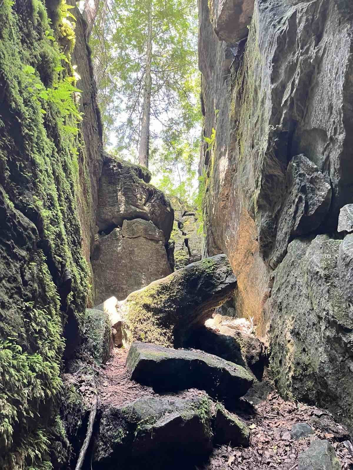
The beauty of hiking give us the oppurtunity to come close and connect with nature and other living souls. From the jumpstart will hike the Main and Side Trails reaching the highest point of the Bruce Trail. The cliffs, crevices and ravine inhabitants along the forested slope area of Pretty River Valley Provincial Park and Nottawasaga Lookout Provincial Nature Reserve offers scenic the cross section of the Escarpment topograhy. Navigating the Standing Rock and Caves will make your mind ponder the power of erosion during the melting of ice that once covered Southern Ontario over eons ago. So join us and experience nature's work of art. Please bring enough H2O for hydration, break and lunch fuel to sustained our body and spirit. Sturdy and comfortable hiking shoe and poles are highly recommended. Please equip yourself with sunscreen, hat protection and bugspray as we may be welcome by our nasty mosquitoe friends. Please dress appropriately as to weather forecast and have your personal medications and health card at all times.
Please arrive fifteen minutes early to allow time for car shuttling.
Note: Please be on time as we will not wait for latecomers.
My cell number during hike - 416-305-6771