|
Sun | Mon | Tue | Wed | Thu | Fri | Sat |
|---|
June | June | June | 1  Canada Day Parade & Hike (Glen Williams) Canada Day Parade & Hike (Glen Williams) 9:00 AM-1:00 PM 07/01/2026 https://hikes.brucetrail.org/event/canada-day-parade-and-hike-in-glen-williams/2026-07-01/ 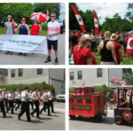 Click here for more information or to register Hosting Club: Toronto
Category: Car Hike
Location (Google Maps): Ainley Trail, Glen Williams Hike Leader(s): David Rowney Click here to contact Hike Leader(s) Pace: Leisurely (2-3 km/hr)
Terrain: Level 2 (Intermediate – some hills and uneven surfaces, rocks and roots underfoot), Variable
Distance (km): 7 km Description
Looking for something fun to do on Canada Day? We’re offering you a chance to go on a hike along the Credit River footpath, then march with the Halton Hills Chapter of the Toronto Club at the Glen Williams Canada Day parade! This tiny hamlet known as the Glen, puts on a fantastic, small-town patriotic parade, just like in the movies. Afterwards, you can attend the celebration in the park, grab some food and picnic, listen to music, and tour various booths at the market. To sign up for this hike, you must also commit to participate in the parade (and bring a flag if you have one, and wear red colours!). The hike will be approximately 5k in length with an additional 2k related to the parade. Bring snacks (and a lunch if you don’t want to buy it at the park). There are washrooms at the park and we will stop for a bio break on the trail. The terrain is relatively flat with some uneven ground and a few modest hills. Wear sunscreen, hat, bring bug spray and lots of water. Dress appropriately for the weather. The pace will be moderate and relaxed. Your itinerary for the day: 9:00 a.m. – 10 a.m.
Hike out from Glen Williams, along the Credit Valley footpath 10:00 a.m. – 11:00 a.m.
Head back (there and back hike) to Glen Williams 11:00 a.m. -11:30 a.m.
Walk over to the parade start on Beaver St. 12:00 noon – 12:45 p.m.
March in the Canada Day parade 1:00 p.m. – 3 p.m.
Enjoy the Canada Day celebrations in the park Contact David Rowney for more information 289-924-0713; david.rowney@gmail.com
(If you would like to only participate in the parade, contact Angelika Sommer: ASommer46@outlook.com)
- Car Hike: Forks of the Credit
10:00 AM-3:00 PM 07/01/2026 https://hikes.brucetrail.org/event/car-hike-forks-of-the-credit-7/2026-07-01/ Click here for more information or to register Hosting Club: Toronto, Caledon Hills
Category: Car Hike
Location (Google Maps): Forks of the Credit Provincial Park, Map 15 Hike Leader(s): Al Brown Click here to contact Hike Leader(s) Pace: Moderate (3-4 km/hr)
Terrain: Hilly, Level 2 (Intermediate – some hills and uneven surfaces, rocks and roots underfoot)
Distance (km): 14-15 km Description
We will complete a loop hike through the Park, crossing the Credit River above the Cataract Falls. Then we will follow the trail down into the valley to a viewpoint of the Falls itself. The hike will take us by the east bank of the Credit River south then turning east and then north through the main park past glacial features and old homesteads. Natural features include kettle lakes and milkweed fields where we might spot monarch butterflies. Refreshments in Belfountain or Erin after the hike. The meeting point is the intersection of Mississauga Road and Cataract Road. Parking is located on both sides of the road. Park in marked areas only. To get to this point drive north on Mississauga Road about 3 km past Belfountain.
- RAINBOW HIKE🌈: Lollipop Loop to Limehouse🍭
10:00 AM-12:00 PM 07/01/2026 https://hikes.brucetrail.org/event/rainbow-hike%f0%9f%8c%88-lollipop-loop-to-limehouse%f0%9f%8d%ad/2026-07-01/  Click here for more information or to register Hosting Club: Toronto
Category: Car Hike
Location (Google Maps): We will meet at the Limehouse parking lot on 22 Sideroad (coordinates are 43.638113, -79.979272) Hike Leader(s): Monica Pasquali (she/her); Talise Liang (she/her) Click here to contact Hike Leader(s) Pace: Leisurely (2-3 km/hr)
Terrain: Level 2 (Intermediate – some hills and uneven surfaces, rocks and roots underfoot)
Distance (km): 4 km Description
This hike is part of our Rainbow Hike program🌈, which aims to foster connection, visibility, and community among 2SLGBTQIA+ hikers and allies. We’ll be joined by Doug O’Neill, who leads Rainbow Hikes with the Iroquoia Bruce Trail Club, and Lana Hubbard, a transgender hike leader with the Caledon Bruce Trail Club. After everyone checks in with me at the meeting location, we will hike the main Bruce Trail towards Limehouse Conservation Area. We will then use the Black Creek Side Trail and the main trail to create a loop to visit the oldest draw kiln in Ontario, the infamous stone arch, and the “Hole-in-the-Wall” through escarpment rock. After our exploration of Limehouse Conservation Area we will retrace our steps back along the main trail to return to our parked cars. The complete 4 km route will resemble the shape of a lollipop, hence the name of this hike.🍭 Everyone who participates in this hike will receive a FREE Bruce Trail Pride Badge as well as a sweet rainbow treat from me! You should bring 2 litres of water and enough food for a 2-hour hike, comfortable hiking shoes and socks, a hat, a breathable shirt, and lightweight long pants (to minimize the risk of a tick bite). If rain is in the forecast then a rain jacket would also be a great idea. Sunblock and bug repellent are also useful if it’s a sunny and buggy day. After the hike, anyone who is interested in joining me for some après-hike refreshments at nearby Spirit Tree Estate Cidery (https://spirittreecider.com) is more than welcome to do so. And if you don’t want to purchase your lunch at Spirit Tree then no worries — we’ll be eating at picnic tables in their outdoor Cider Gardens so you can bring your lunch and still enjoy some great post-hike vibes. Looking forward to hiking with you on July 1st! And feel free to share this page/link with your 2SLGBTQIA+ friends and family. For more information on Bruce Trail’s 2SLGBTQIA+ hikes, and to get information on upcoming Rainbow Hikes, please see the following webpage: https://brucetrail.org/pride-2026/
| 2  Urban Walk: Valley View/Huntington Park Urban Walk: Valley View/Huntington Park 9:30 AM-11:45 AM 07/02/2026 https://hikes.brucetrail.org/event/urban-walk-valley-view-huntington-park-5/2026-07-02/ Click here for more information or to register Hosting Club: Toronto Location (Google Maps): Parking lot is off Sycamore Drive, East of Bayview , across Starbucks plaza
Bus 91 from Finch East station stops at Sycamore station. Hike Leader(s): Mohammad Aghamiri Pace: Moderate (3-4 km/hr)
Terrain: Hilly, Level 2 (Intermediate – some hills and uneven surfaces, rocks and roots underfoot)
Distance (km): 6-7 km Description
We will explore Valleyview and Maple View parks, and walk along German Mill Creak, in return we stop in Huntington park and have snack under beautiful shed. Although this is considered an “Urban Walk”, you can expect some hills up and down and uneven surfaces with tree roots. Please bring hiking poles, water and snacks.
| 3 | 4 - Car Hike: Jefferson Forest/Bond Lake
8:00 AM-11:30 AM 07/04/2026 https://hikes.brucetrail.org/event/car-hike-jefferson-forest-bond-lake-3/2026-07-04/ 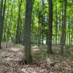 Click here for more information or to register Hosting Club: Toronto
Category: Car Hike
Location (Google Maps): 1245 Bethesda Side Rd, Richmond Hill, ON L4E 1A2 ( Bethesda Trail Head Parking lot) Hike Leader(s): Amir Alemohammad Click here to contact Hike Leader(s) Pace: Moderate (3-4 km/hr)
Terrain: Flat, Hilly, Level 2 (Intermediate – some hills and uneven surfaces, rocks and roots underfoot), Variable
Distance (km): 12-13Km Description
Let’s roll the hills of the Jefferson Forest and around the Bond Lake. Every week we hike in Jefferson Forest, located in the heart of Richmond Hill, it boasts numerous hiking trails. This 3.5 hour hike can range from 14 to 15 kilometres, depending on the weather conditions. Remember to bring water, snacks, hiking boots, poles, and your camera. Not recommended for beginners. Park in the free Bethesda parking lot and avoid parking along the road. Dress appropriately for the weather. Difficulty Level: 2 (Moderate). Please arrive @7:45AM for start of 8:00AM. This is a joint hike with the Oak Ridges Trail Association (ORTA). what3words: https://w3w.co/twisting.mailer.awakes
- Car Hike: Hollad River Trail
8:30 AM-1:00 PM 07/04/2026 https://hikes.brucetrail.org/event/car-hike-hollad-river-trail/2026-07-04/ Click here for more information or to register Hosting Club: Toronto
Category: Car Hike
Location (Google Maps): We start the hike from Evans park ,you may park along benville cres off Bayview Hike Leader(s): MOHAMMAD AGHAMIRI Click here to contact Hike Leader(s) Pace: Moderate (3-4 km/hr)
Terrain: Level 2 (Intermediate – some hills and uneven surfaces, rocks and roots underfoot), Variable
Distance (km): 14-15 km Description
We start the hike from Evans park ,walking north along Holland River , passing Sheppard’s Bush Conservation Area to Newmarket trails and return
  School Bus Hike: Long Sault C.A. School Bus Hike: Long Sault C.A. 8:30 AM-6:00 PM 07/04/2026 https://hikes.brucetrail.org/event/school-bus-hike/2026-07-04/ Trip Information
Departure Time: 08:30
Return to City Time: 18:00
Departure Point: York Mills Bus Pickup Click here for more information or to register Optional Items
Hosting Club: Toronto
Category: Bus Hike
Location (Google Maps): Long Sault Conservation Area Hike Leader(s): Tom Swales, Celia Ho Click here to contact Hike Leader(s) Pace: Moderate (3-4 km/hr)
Terrain: Level 2 (Intermediate – some hills and uneven surfaces, rocks and roots underfoot), Variable
Distance (km): 11-12 km Description
Join us for an 11 km hike in Long Sault Conservation Area on the Barred Owl, Eastern Bluebird, Wild Turkey, and Oak Ridges Moraine Trails. Once part of the Agreement Forest program operated by the Ontario Ministry of Natural Resources, the Conservation area includes close to 400 hectares of matures forest, plantation, wetland, and Meadow. The trails range from gently sloping and straight to technical rolling and quickly turning. After our hike we will drive to Port Perry on Lake Scugog for free time to enjoy the park, the historic main street, cafes, or the Old Flame craft brewery. Don’t miss Hank’s Pastries, a bakery with a 100+ year tradition known for their specialty donuts and “big as your face” apple fritters (online ordering is available).
- Car Hike: Duncan Crevice Caves , Pinnacle and Metcalf Rocks
8:30 AM-1:30 PM 07/04/2026 https://hikes.brucetrail.org/event/car-hike-duncan-crevice-caves-pinnacle-and-metcalf-rocks/2026-07-04/ 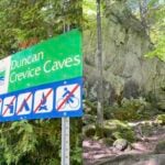 Click here for more information or to register Hosting Club: Toronto, Beaver Valley
Category: Car Hike
Location (Google Maps): Duncan Crevice Caves Provincial Nature Reserve parking lot on the edge of 9th Sideroad east of Blue Mountain-Euphrasia Townline. GPS N44.423216, W80.469565. Km33.3, map25, edition31. Hike Leader(s): Mr Ross Click here to contact Hike Leader(s) Pace: Brisk (4-5 km/hr), Moderate (3-4 km/hr)
Terrain: Challenging, Level 2 (Intermediate – some hills and uneven surfaces, rocks and roots underfoot), Rocky, Variable
Distance (km): 12.5 km Description
At a moderate to brisk pace we’ll hike Duncan Crevice Caves Provincial Nature Reserve and explore Pinnacle Rock and Metcalfe Rock stunning formation. We’ll have plenty of time for picture taking of the amazing landscape. Please equip yourself with durable hiking shoe and bring poles if you’re using. Carry sufficient hydration fluid, snacks and lunch. Bring sunscreen and head covering for sun protection and bug repellent in the event our friendly mosquitos welcome us. Carry your personal medication (if any) first aid kit and health card. Don’t forget your enthusiasm. Please arrive fifteen minutes early.
|
5 - Car Hike: Jefferson Forest/Bond Lake
8:00 AM-11:30 AM 07/05/2026 https://hikes.brucetrail.org/event/car-hike-jefferson-forest-bond-lake-4/2026-07-05/ Click here for more information or to register Hosting Club: Toronto
Category: Car Hike
Location (Google Maps): 1245 Bethesda Side Rd, Richmond Hill, ON L4E 1A2 ( Bethesda Trail Head Parking lot) Hike Leader(s): Amir Alemohammad Click here to contact Hike Leader(s) Pace: Moderate (3-4 km/hr)
Terrain: Flat, Hilly, Level 2 (Intermediate – some hills and uneven surfaces, rocks and roots underfoot)
Distance (km): 12-13Km Description
Let’s roll the hills of the Jefferson Forest and around the Bond Lake. Every week we hike in Jefferson Forest, located in the heart of Richmond Hill, it boasts numerous hiking trails. This 3.5 hour hike can range from 14 to 15 kilometres, depending on the weather conditions. Remember to bring water, snacks, hiking boots, poles, and your camera. Not recommended for beginners. Park in the free Bethesda parking lot and avoid parking along the road. Dress appropriately for the weather. Difficulty Level: 2 (Moderate). Please arrive @7:45AM for start of 8:00AM. This is a joint hike with the Oak Ridges Trail Association (ORTA). what3words: https://w3w.co/twisting.mailer.awakes
- Waterfront Trail 2/11 – Mississauga WF Trail
10:00 AM-1:00 PM 07/05/2026 https://hikes.brucetrail.org/event/waterfront-trail-2-11-mississauga-wf-trail-2/2026-07-05/  Click here for more information or to register Hosting Club: Toronto
Category: Urban Walk
Location (Google Maps): Mississauga Waterfront Trail Hike Leader(s): Brian Rideout Click here to contact Hike Leader(s) Pace: Moderate (3-4 km/hr)
Terrain: Flat
Distance (km): 8.9 km Description
Please join me at Union Station under the clock inside the Great Hall no later than 9:00 am. We will take the Lakeshore West train departing 9:14 am, arriving 9:42 am (subject to GO Transit schedule changes). If you want to meet us in Port Credit, please be there by 9:42 am. We start hiking no later than 10:00 am. Consider purchasing the $10 day pass for the GO train for use with your smart phone. Some of you may find the regular senior rate is cheaper. Purchase your ticket / pass in advance. We will hike from Port Credit to Long Branch along the shoreline. The estimated distance is 8.9 km. Here is an online map of our route – Port Credit to Long Branch https://onthegomap.com/s/8dml9cim Bring a snack, at least 2 liters of water, sun screen and bug spray.
| 6 - Car Hike: Beaver valley E2E #1/5
8:30 AM-3:00 PM 07/06/2026 https://hikes.brucetrail.org/event/car-hike-beaver-valley-e2e-hike-1-5/2026-07-06/ Click here for more information or to register Hosting Club: Toronto, Beaver Valley
Category: Car Hike
Location (Google Maps): Meet at Kolapore parking, south of km 23.8 Grey Rd 2. Coordinates N 44.422919,W 80.405597 map 25 Hike Leader(s): Smadar Junkin Click here to contact Hike Leader(s) Pace: Brisk (4-5 km/hr)
Terrain: Challenging, Hilly, Level 3 (Advanced – steep hills and some scrambling over boulders)
Distance (km): About 24kms. A little longer then the map shows because of a reroute. Description
This is the first of 5 consecutive days to complete the Beaver Valley section. Beaver Valley is beautiful and challenging section. Please note that these hikes are long and are at the height of summer. Please assess your ability to keep up with the pace and distance of these hikes series before registering.
we will shuttle to km 0.0 and hike back. Bring at least 2 litres of water, snacks and lunch. Bug repellent and sun screen. make sure to arrive at 8:15 for each hike so we can be in the cars and ready to go by 8:30. All participants need to drive car shuttles as many times as needed at the duration of these hikes. Please note that you need to register to each hike individually. this is a no reply email. If you need to get in touch with me, please use my personal email address above.
| 7 - Car Hike: Beaver Valley E2E #2/5
8:30 AM-3:00 PM 07/07/2026 https://hikes.brucetrail.org/event/car-hike-beaver-valley-e2e-hike-2-5/2026-07-07/ Click here for more information or to register Hosting Club: Toronto, Beaver Valley
Category: Car Hike
Location (Google Maps): Same as day 1 Hike Leader(s): Smadar Junkin Click here to contact Hike Leader(s) Pace: Brisk (4-5 km/hr)
Terrain: Challenging, Hilly, Level 3 (Advanced – steep hills and some scrambling over boulders)
Distance (km): 26kms and a bit of road walking on each end. Description
Please see hike instructions on day 1. we will shuttle to north of km 50.0 west side of Grey Rd 13 and walk back.
- Urban Walk: Valley View/Huntington Park
9:30 AM-11:45 AM 07/07/2026 https://hikes.brucetrail.org/event/urban-walk-valley-view-huntington-park-thornhill/2026-07-07/ Click here for more information or to register Hosting Club: Toronto Location (Google Maps): Parking lot is off Sycamore Drive, East of Bayview , across Starbucks plaza
Bus 91 from Finch East station stops at Sycamore station. Hike Leader(s): Mohammad Aghamiri Click here to contact Hike Leader(s) Pace: Moderate (3-4 km/hr)
Terrain: Hilly, Level 2 (Intermediate – some hills and uneven surfaces, rocks and roots underfoot)
Distance (km): 6-7 km Description
We will explore Valleyview and Maple View parks, and walk along German Mill Creak, in return we stop in Huntington park and have snack under beautiful shed. Although this is considered an “Urban Walk”, you can expect some hills up and down and uneven surfaces with tree roots. Please bring hiking poles, water and snacks.
- Urban Walk: ET Seton/Taylor Creek
9:30 AM-12:30 PM 07/07/2026 https://hikes.brucetrail.org/event/urban-walk-et-seton-taylor-creek/2026-07-07/ Click here for more information or to register Hosting Club: Toronto
Category: Urban Walk
Location (Google Maps): ET Seton Park and Taylor Creek Park. Meet at Sunnybrook Park Station on Line 5 (Eglinton Crosstown) at the interection of Eglionton Avenue and Leslie Street Hike Leader(s): Tom Swales Click here to contact Hike Leader(s) Pace: Moderate (3-4 km/hr)
Terrain: Flat, Level 1 (Easy – mostly on flat, well maintained trails with hard-packed surface)
Distance (km): 8 km Description
Join us for a morning urban walk through ET Seton and Taylor Creek Parks. Map of route: https://onthegomap.com/s/bq3rdkfc The hike will finish at Victoria Park Subway Station on Line 2. There is no washrooms at Sunnybrook Park Station (the nearest facilities are at Eglinton Station on Line 1 and Line 5). We will stop at facilities in the park at 1.6 km and 6.0 km.
| 8 - Car Hike: Beaver Valley E2E 3/5
8:30 AM-3:00 PM 07/08/2026 https://hikes.brucetrail.org/event/car-hike-beaver-valley-e2e-3-5/2026-07-08/ Click here for more information or to register Hosting Club: Toronto, Beaver Valley
Category: Car Hike
Location (Google Maps): Graham Hill Rd 60 meters to the west of km 74.2. Coordinates N 44.333807,W 80.554916 map # 26. Hike Leader(s): Smadar Junkin Click here to contact Hike Leader(s) Pace: Brisk (4-5 km/hr)
Terrain: Challenging, Hilly, Level 3 (Advanced – steep hills and some scrambling over boulders)
Distance (km): 24 kms. Description
Please see hike notes on hike #1. We will shuttle to km 50.0 and hike back.
| 9 | 10 - Car Hike: Beaver Valley E2E 5/5
8:30 AM-3:00 PM 07/10/2026 https://hikes.brucetrail.org/event/car-hike-beaver-valley-e2e-5-5/2026-07-10/ Click here for more information or to register Hosting Club: Toronto, Beaver Valley
Category: Car Hike
Location (Google Maps): Km 117.3 grey Rd 12. Coordinates N 44.500537,W 80.632902 map 28. Please note that this parking is not marked on the map. It is marked on the Bruce Trail App. Hike Leader(s): Smadar Junkin Click here to contact Hike Leader(s) Pace: Brisk (4-5 km/hr)
Terrain: Challenging, Hilly, Level 3 (Advanced – steep hills and some scrambling over boulders)
Distance (km): 21.6 Description
Last day, badge day, treats day. We will shuttle to km 95.7 and hike back. See hike notes on day 1.
| 11 - Car Hike: Exploring Uxbridge Trails
8:00 AM-12:00 PM 07/11/2026 https://hikes.brucetrail.org/event/car-hike-exploring-uxbridge-trails/2026-07-11/  Click here for more information or to register Hosting Club: Toronto
Category: Car Hike
Location (Google Maps): 2499 Brock Rd, Uxbridge, ON L9P 1R4. We will meet at the East Duffins Headwaters parking lot at the WILDER FOREST trail head. As soon as you got off the Brock Road, passing the horse back riding facility, there is a free designated parking lot 70 meters down the lane to your right. It includes a sign board for East Duffins Headwaters with a map of the trails. Please do not park on the lane or in the horse back riding property. Hike Leader(s): Amir Alemohammad Click here to contact Hike Leader(s) Pace: Moderate (3-4 km/hr)
Terrain: Flat, Hilly, Variable
Distance (km): Approx.15-16 Km Description
Join us for a delightful hike in Uxbridge, as we explore Wilder Forest, Walker Woods, and Glen Major Forest on a scenic loop starting from Brock Road. We’ll pass Concession Road 6, heading east and back, while also venturing onto several side trails for even more stunning views. What to Expect: •Beautiful scenic views and lookouts facing south •A mix of hilly and flat terrain •Frequent 2-minute breaks for hydration and photos, with a 10 minute snack stop •Stay on designated trails at all time What to Bring and Wear: •Hiking Boots (mandatory), poles (recommended) and be prepared for the ticks on the trail, keep your bug spray handy. •At least 2 liters of water •Your favorite snacks (pack your own refreshments for an outdoor meal) •Dress according to variable weather conditions! Important Details: •Stay on the designated trails •Be prepared for the elements and enjoy the adventure! This hike is not recommended for beginners. Looking forward to seeing you on the trail! Don’t forget your camera and a smile as we explore the beauty of the Uxbridge trails! This is a joint hike with the Oak Ridges Trail Association (ORTA).
- School Bus Hike: Lynn Valley Trail
8:30 AM-7:00 PM 07/11/2026 https://hikes.brucetrail.org/event/school-bus-hike-pathways-to-port-dover-lynn-valley-trail/2026-07-11/ Trip Information
Departure Time: 08:30
Return to City Time: 19:00
Departure Point: Kipling Departure Point Click here for more information or to register Optional Items
Hosting Club: Toronto
Category: Bus Hike
Location (Google Maps): Lynn Valley Trail Hike Leader(s): Tom Swales & Felix Wan Click here to contact Hike Leader(s) Pace: Moderate (3-4 km/hr)
Terrain: Flat, Level 1 (Easy – mostly on flat, well maintained trails with hard-packed surface)
Distance (km): 12 km Description
Join us for a scenic and easy paced walk, a regular summer favorite along the trails running through Norfolk County from downtown Simcoe ending at historic Port Dover. The route is primarily on rail trails so is ideal for those who favor a flatter and easier route in the summer heat. Dropout at 8km. We will stop at the Simcoe Recreation Centre before the hike to use the facilities. After the hike there will be the opportunity to indulge in the local perch fish and chips or hang out at the beach which together make Port Dover famous. Long Distance Bus Fare applies and there will be a late return (after 6:00 Pm).
- Boyd Conservation park247
8:30 AM-1:15 PM 07/11/2026 https://hikes.brucetrail.org/event/car-hike-boyd-conservation-park-vaughan-15/2026-07-11/ Click here for more information or to register Hosting Club: Toronto Location (Google Maps): Free Parking lot before entrance of park on Islington Ave. Hike Leader(s): Mohammad Aghamiri Click here to contact Hike Leader(s) Pace: Moderate (3-4 km/hr)
Terrain: Hilly, Level 2 (Intermediate – some hills and uneven surfaces, rocks and roots underfoot), Variable
Distance (km): 12-14 km Description
Let’s hike Boyd conservation park trails through beautiful valleys. Please bring lots of water and snacks ,hiking poles are recommended phone number for the day of hike 289 588 6482
- Waterfront Trail 3/11 – Long Branch
10:00 AM-1:00 PM 07/11/2026 https://hikes.brucetrail.org/event/waterfront-trail-3-11-long-branch/2026-07-11/  Click here for more information or to register Hosting Club: Toronto
Category: Urban Walk
Location (Google Maps): Etobicoke Waterfront Trail Hike Leader(s): Brian Rideout Click here to contact Hike Leader(s) Pace: Moderate (3-4 km/hr)
Terrain: Flat
Distance (km): 9 km Description
Please join me at Kipling Station by 9:15 am. We will take the 123 bus departing 9:30 am, arriving 9:53 am. If you want to meet us at the Long Branch loop, be there by 9:53 am. We start hiking at 10:00 am. We will hike to the lake and then east to Parklawn. There we can catch a bus to Old Mill Station or take the Lakeshore bus / streetcar. The estimated distance is 9 km. Here is an online map of our route – Long Branch to Parklawn Bring a snack, at least 2 liters of water, sun screen and bug spray.
|
12 - Car Hike: Jefferson Forest/Bond Lake
8:00 AM-12:00 PM 07/12/2026 https://hikes.brucetrail.org/event/car-hike-jefferson-forest-bond-lake-5/2026-07-12/  Click here for more information or to register Hosting Club: Toronto
Category: Car Hike
Location (Google Maps): 1245 Bethesda Side Rd, Richmond Hill, ON L4E 1A2 ( Bethesda Trail Head Parking lot) Hike Leader(s): Amir Alemohammad Click here to contact Hike Leader(s) Pace: Moderate (3-4 km/hr)
Terrain: Challenging, Flat, Hilly, Level 2 (Intermediate – some hills and uneven surfaces, rocks and roots underfoot), Variable
Distance (km): 14-16Km Description
Let’s roll the hills of the Jefferson Forest and around the Bond Lake. Every week we hike in Jefferson Forest, located in the heart of Richmond Hill, it boasts numerous hiking trails. This 4 hour hike can range from 14 to 16 kilometres, depending on the weather conditions. Remember to bring water, snacks, hiking boots (mandatory), poles, and your camera. Not recommended for beginners. Park in the free Bethesda parking lot and avoid parking along the road. Dress appropriately for the weather. Difficulty Level: 2 (Moderate). Please arrive @7:45AM for start of 8:00AM. This is a joint hike with the Oak Ridges Trail Association (ORTA). what3words: https://w3w.co/twisting.mailer.awakes
- Car Hike; Mono Cliffs, Map 19
10:00 AM-2:30 PM 07/12/2026 https://hikes.brucetrail.org/event/car-hike-mono-cliffs-9/2026-07-12/ Click here for more information or to register Hosting Club: Toronto, Caledon Hills, Dufferin Hi-Land
Category: Car Hike
Location (Google Maps): Mono Cliffs Provincial Park, Map 19 Hike Leader(s): Al Brown Click here to contact Hike Leader(s) Pace: Moderate (3-4 km/hr)
Terrain: Level 2 (Intermediate – some hills and uneven surfaces, rocks and roots underfoot), Variable
Distance (km): 9 km Description
We will complete a loop hike through Mono Cliffs PP. The route will be about 80% under forest canopy. We will stop at several viewpoints and natural features along the way. After the hike those interested may gather at a local establishment for refreshments. To get to the meeting point take Hwy 10 north past Orangeville to County Rd 8 (Mono Centre Road). Proceed east about 6 km to Mono Centre. The parking area for the community centre is 200 meters south of the T-intersection if you go too far. The entrance to the parking area is on your right just before a tennis court.
| 13 | 14 - Urban Walk – , Toronto Waterfront
9:30 AM-12:30 PM 07/14/2026 https://hikes.brucetrail.org/event/urban-walk-toronto-waterfront-2/2026-07-14/ Click here for more information or to register Hosting Club: Toronto
Category: Urban Walk
Location (Google Maps): Meet at Beaty Boulevard Park at the south side of the intersection of Roncesvalles and Queen Street near the pedestrian bridge crossing the Gardiner Expressway Hike Leader(s): Tom Swales Click here to contact Hike Leader(s) Pace: Moderate (3-4 km/hr)
Terrain: Flat, Level 1 (Easy – mostly on flat, well maintained trails with hard-packed surface)
Distance (km): 8 KM Description
Join us for a morning walk along the Toronto Waterfront Trail from the foot of Roncesvalles to Bay Street/Union Station. Bring snack to have along the way.
- Urban Walk: Valley View /Huntington Park
9:30 AM-11:45 AM 07/14/2026 https://hikes.brucetrail.org/event/urban-walk-valley-view-huntington-park-7/2026-07-14/ Click here for more information or to register Hosting Club: Toronto Location (Google Maps): Parking lot is off Sycamore Drive, East of Bayview , across Starbucks plaza
Bus 91 from Finch East station stops at Sycamore station. Hike Leader(s): Mohammad Aghamiri Pace: Moderate (3-4 km/hr)
Terrain: Hilly, Level 2 (Intermediate – some hills and uneven surfaces, rocks and roots underfoot)
Distance (km): 6-7 km Description
We will explore Valleyview and Maple View parks, and walk along German Mill Creak, in return we stop in Huntington park and have snack under beautiful shed. Although this is considered an “Urban Walk”, you can expect some hills up and down and uneven surfaces with tree roots. Please bring hiking poles, water and snacks.
| 15 - Car Hike: Toronto Section End to End (1 of 4)
9:30 AM-2:00 PM 07/15/2026 https://hikes.brucetrail.org/event/car-hike-toronto-section-end-to-end-1-of-4-2/2026-07-15/ Click here for more information or to register Hosting Club: Toronto
Category: Car Hike
Location (Google Maps): Bruce Trail Pear Tree Park – 15th Sideroad, 200m southwest of Regional Rd 25 (11.4k marker, Edition 31) Hike Leader(s): David Rowney Click here to contact Hike Leader(s) Pace: Moderate (3-4 km/hr)
Terrain: Variable
Distance (km): 11.9k Description
This is a summer-time End-to-End hike to complete the Toronto section of the Bruce Trail in 4 hikes. Join for all or as many hikes as desired. You may use this hike towards your E2E Fundraiser Badge (you must complete at least 3 of the 4 hikes with the group to qualify) or a regular E2E badge. This first hike will take us from the start of the Toronto Section just south of Hilton Falls Conservation area to the Bruce Trail Pear Tree Park. The terrain is not too hilly, but the footing is tricky with many uneven, rocky sections to navigate. July weather can be hot, muggy and buggy! So, dress for the weather, keeping in mind that insects, including ticks, will be out in full force. Take appropriate precautions to avoid insect bites, including using repellant and clothing that covers the legs and arms. Hiking shoes/boots are required and hiking poles are recommended. Bring plenty of fluids, including electrolytes, and a snack/lunch. As this is a group hike, please consider your fitness level before registering. We will be walking at a pace of 3km – 4km per hour and everyone is expected to keep up with the person in front of them for the duration of the hike. Plan to arrive at the meeting place by 9:15 a.m. as we will start the car shuffle to the hike starting point at 9:30 a.m. sharp. Further details will be provided to registered hikers a few days prior to the hike.
| 16 - Urban Walk: Valley View/Huntington Park
9:30 AM-11:45 AM 07/16/2026 https://hikes.brucetrail.org/event/urban-walk-valley-view-huntington-park-8/2026-07-16/ Click here for more information or to register Hosting Club: Toronto Location (Google Maps): Parking lot is off Sycamore Drive, East of Bayview , across Starbucks plaza
Bus 91 from Finch East station stops at Sycamore station. Hike Leader(s): Mohammad Aghamiri Pace: Moderate (3-4 km/hr)
Terrain: Hilly, Level 2 (Intermediate – some hills and uneven surfaces, rocks and roots underfoot)
Distance (km): 6-7 km Description
We will explore Valleyview and Maple View parks, and walk along German Mill Creak, in return we stop in Huntington park and have snack under beautiful shed. Although this is considered an “Urban Walk”, you can expect some hills up and down and uneven surfaces with tree roots. Please bring hiking poles, water and snacks.
- Car Hike: Silver Creek Conservation Area
10:00 AM-1:30 PM 07/16/2026 https://hikes.brucetrail.org/event/car-hike-silver-creek-conservation-area/2026-07-16/ 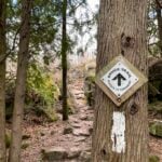 Click here for more information or to register Hosting Club: Toronto
Category: Car Hike
Location (Google Maps): We will meet at the trailhead and park our cars along the street, roadside parking along 13479 Fallbrook Trail (coordinates are 43.6921, -79.9668). Hike Leader(s): Talise Liang & Monica Pasquali Click here to contact Hike Leader(s) Pace: Moderate (3-4 km/hr)
Terrain: Level 2 (Intermediate – some hills and uneven surfaces, rocks and roots underfoot)
Distance (km): 11 Description
Hi everyone! Hike with me at Silver Creek Conservation Area! We will begin by hiking a loop that follows the Irwin Quarry Side Trail and the main Bruce Trail north, climbing the escarpment before descending south along Roberts Side Trail, where we will hopefully spot some wildlife around a small pond. This loop returns to our parked cars, allowing hikers who prefer a shorter hike to drop out here. Those who would like a longer hike can continue south with me along the main Bruce Trail, crossing 27 Sideroad before connecting with the Maureen Smith Side Trail. From there, we will head north on the Bennett Heritage Side Trail, enjoying scenic escarpment terrain and several bridges along the way. After a short stretch of road walking along 27 Sideroad, we will return to our parked cars. You should bring enough water and food for a 3-4 hour hike that is hiked at a moderate pace of about 4 km/h, comfortable hiking shoes, sun and bug protection, and appropriate clothing for the weather. Looking forward to seeing you then!
| 17 - School Bus Hike: Sandbanks Provincial Park
8:30 AM-6:00 PM 07/17/2026 https://hikes.brucetrail.org/event/school-bus-hike-sandbanks-provincial-park/2026-07-17/  Trip Information
Departure Time: 08:30
Return to City Time: 18:00
Departure Point: York Mills Bus Pickup Click here for more information or to register Optional Items
Hosting Club: Toronto
Category: Bus Hike
Location (Google Maps): Sandbanks Provincial Park Hike Leader(s): Celia Ho, Tom Swales Click here to contact Hike Leader(s) Pace: Moderate (3-4 km/hr)
Terrain: Level 1 (Easy – mostly on flat, well maintained trails with hard-packed surface), Variable
Distance (km): 10-11 km Description
Join us on our a Friday bus hike to celebrate Healthy Parks Healthy People Day 2026 and explore Sandbanks Provincial Park in Picton, Prince Edward County, ON. We will be enjoying the world’s largest baymouth barrier dune formation, sandy beaches and breathtaking views along the edge of Lake Ontario. There will be a refreshment stop in Main Street Wellington after the hike before returning to Toronto. The village of Wellington features the Wellington Heritage Museum, the Wellington beach with a beautiful boardwalk along the shore to a lighthouse, and local restaurants, cafes and breweries. Note: No Fee will be charged for the Provincial Park entry since it is Healthy Parks Healthy People Day (free admission to Ontario provincial parks).
| 18 - Winery Tasting & Tour Hike (Cancelled Due To Low Registration0
8:30 AM-6:00 PM 07/18/2026 https://hikes.brucetrail.org/event/swayze-falls-to-short-hills-provincial-park-tracing-rim-of-africa-bruce-trail-friendship-trail/2026-07-18/ 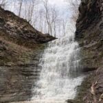 Click here for more information or to register Hosting Club: Toronto
Category: Cancelled
Location (Google Maps): Kipling Subway Departure Point Hike Leader(s): Mr Ross Click here to contact Hike Leader(s) Pace: Moderate (3-4 km/hr)
Terrain: Hilly, Level 2 (Intermediate – some hills and uneven surfaces, rocks and roots underfoot), Variable
Distance (km): 8.5 km Description
** Due to the fact that we have not been able to secure a sufficient number of registrations to cover enough of the cost of the bus charter, this bus hike has been cancelled ** Join us at a moderate pace hike at Short Hills Provincial Park tracing the Rim of Africa Bruce Trail Friendship Trail. Along the way we’ll see the beauty of Terrace Creek Falls and Swayze Falls and it’s surrounding landscape. The trail is ideal for a moderate cardio exercise for the wellness of our mind, body and spirit. Day hike essentials to bring; snack/lunch, hydration fuel, sunscreen, full brim hat for sun protection and insect repellent in the event our friendly mosquitoes welcome us. Hiking shoe and poles are highly recommended. From the finish of our hike the bus will take us to Pillitteri Estate Winery (official wine supplier of Canada’s Olympic Team). We’ll experience and enjoy a private structured wine tasting (four wines selected by the host) and tour by one or more of their knowledgeable and friendly staff where we’ll learn the art of winemaking from the vineyard to the wine lounge. The cost per person of tasting and tour is $20.00 (tax & tip included) and must be paid at time of registration via Interac E-Transfer to ross.estrella@rogers.com. Registration starts June 19 and if the minimum required participants is not achieved by July 10th, this event will be cancelled and registered participant’s bus and tasting/tour fees will be refunded. Register early don’t missed out and delay. Thank you and see you at the trail and winery lounge. Please arrive at least fifteen minutes prior to the bus departure time. The bus will not wait for latecomers.
- Car Hike: Rouge Park
8:30 AM-1:15 PM 07/18/2026 https://hikes.brucetrail.org/event/car-hike-rouge-national-park-scarborough-on-3/2026-07-18/ Click here for more information or to register Hosting Club: Toronto Location (Google Maps): Free parking in Mast Trail parking Lot off Kingston Road Hike Leader(s): MOHAMMAD AGHAMIRI Click here to contact Hike Leader(s) Pace: Moderate (3-4 km/hr)
Terrain: Hilly, Level 2 (Intermediate – some hills and uneven surfaces, rocks and roots underfoot)
Distance (km): 14-15 km Description
We will hike Vista trail and part of orchard trail, will enjoy look outs between Rouge river and Little Rouge creek
• Please dress appropriately for the weather.
• We will have short water ,picture and a 15 minute snack break. Everyone is welcome! Please bring lots of water and snacks ,hiking poles are recommended phone number for the day of hike 289 588 6482
- (To be postponed due to weather) RAINBOW HIKE🌈: Hilly Hike in Caledon Hills
10:00 AM-2:00 PM 07/18/2026 https://hikes.brucetrail.org/event/rainbow-hike%f0%9f%8c%88-hilly-hike-in-caledon-hills/2026-07-18/ 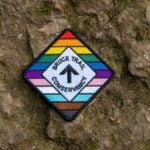 Click here for more information or to register Hosting Club: Toronto, Caledon Hills
Category: Cancelled
Location (Google Maps): We will meet at the Hockley Road Parking Area (coordinates are 43.972857, -80.056330). Hike Leader(s): Monica Pasquali Click here to contact Hike Leader(s) Pace: Leisurely (2-3 km/hr), Moderate (3-4 km/hr)
Terrain: Hilly, Level 2 (Intermediate – some hills and uneven surfaces, rocks and roots underfoot), Level 3 (Advanced – steep hills and some scrambling over boulders)
Distance (km): 10 km Description
This hike is part of our Rainbow Hike program🌈, which aims to foster connection, visibility, and community among 2SLGBTQIA+ hikers and allies. We’ll be joined by Doug O’Neill, who leads Rainbow Hikes with the Iroquoia Bruce Trail Club, and Lana Hubbard, a transgender hike leader with the Caledon Bruce Trail Club. After everyone checks in with me at the meeting location we’ll do a 10 km out-and-back hike of the main trail through beautiful Hockley Valley Provincial Nature Reserve. Our route will follow a very hilly part of the Bruce Trail, but don’t worry — we’ll summit the hills slowly and take lots of breaks along the way, so any fit Rainbow Hiker is welcome to join us. Everyone who participates in this hike will receive a FREE Bruce Trail Pride Badge! Please bring at least 2 litres of water, your lunch, and enough snacks for a 4-hour hike. You should wear comfortable hiking shoes and socks, a hat, a breathable shirt, and lightweight long pants (to minimize the risk of a tick bite). If rain is in the forecast then a rain jacket would also be a great idea. Sunblock and bug repellent are also useful if it’s a sunny and buggy day. After the hike, anyone who is interested in joining me for a refreshing mocktail at nearby Hockley Valley Resort (https://hockley.com/eat/) is more than welcome to do so. Looking forward to hiking with you on July 18th! And feel free to share this page/link with your 2SLGBTQIA+ friends and family. For more information on Bruce Trail’s 2SLGBTQIA+ hikes, and to get information on upcoming Rainbow Hikes, please see the following webpage: https://brucetrail.org/pride-2026/
|
19 - Car Hike: Jefferson Forest/Bond Lake
8:00 AM-12:00 PM 07/19/2026 https://hikes.brucetrail.org/event/car-hike-jefferson-forest-bond-lake-6/2026-07-19/ Click here for more information or to register Hosting Club: Toronto
Category: Cancelled
Location (Google Maps): 1245 Bethesda Side Rd, Richmond Hill, ON L4E 1A2 ( Bethesda Trail Head Parking lot) Hike Leader(s): Amir Alemohammad Click here to contact Hike Leader(s) Pace: Moderate (3-4 km/hr)
Terrain: Challenging, Flat, Hilly, Level 2 (Intermediate – some hills and uneven surfaces, rocks and roots underfoot), Variable
Distance (km): 14-16Km Description
The hike is canceled due to the weather conditions.
Let’s roll the hills of the Jefferson Forest and around the Bond Lake. Every week we hike in Jefferson Forest, located in the heart of Richmond Hill, it boasts numerous hiking trails. This 4 hour hike can range from 14 to 16 kilometres, depending on the weather conditions. Remember to bring water, snacks, hiking boots (mandatory), poles, and your camera. Not recommended for beginners. Park in the free Bethesda parking lot and avoid parking along the road. Dress appropriately for the weather. Difficulty Level: 2 (Moderate). Please arrive @7:45AM for start of 8:00AM. This is a joint hike with the Oak Ridges Trail Association (ORTA). what3words: https://w3w.co/twisting.mailer.awakes
- Waterfront Trail 3/11 – Long Branch
10:00 AM-1:00 PM 07/19/2026 https://hikes.brucetrail.org/event/waterfront-trail-3-11-long-branch-2/2026-07-19/  Click here for more information or to register Hosting Club: Toronto
Category: Urban Walk
Location (Google Maps): Etobicoke Waterfront Trail Hike Leader(s): Brian Rideout Click here to contact Hike Leader(s) Pace: Moderate (3-4 km/hr)
Terrain: Flat
Distance (km): 9 km Description
Please join me at Kipling Station by 9:15 am. We will take the 123 bus departing 9:30 am, arriving 9:53 am. If you want to meet us at the Long Branch loop, be there by 9:53 am. We start hiking at 10:00 am. We will hike to the lake and then east to Parklawn. There we can catch a bus to Old Mill Station or take the Lakeshore bus / streetcar. The estimated distance is 9 km. Here is an online map of our route – Long Branch to Parklawn https://onthegomap.com/s/h1dkuq9t Bring a snack, at least 2 liters of water, sub screen and bug spray.
| 20 | 21 - Urban Walk: East Don Trail
9:30 AM-12:30 PM 07/21/2026 https://hikes.brucetrail.org/event/urban-walk-east-don-trail/2026-07-21/ Click here for more information or to register Hosting Club: Toronto
Category: Urban Walk
Location (Google Maps): Meet in front of the East York Memorial Arena (Cosburn Avenue & Cedarvale, one block east of Woodbine Avenue). From Woodbine Station take the #91 Woodbine or #93 Parkview Hills bus to Cosborn and walk one block east. Or from Brodview Station or Main Street Station take the Cosburn #87A or #87C Bus to Cedarvale Avenue. Main Street Station is closer. Pubic washrooms are available in the park. Hike Leader(s): Tom Swales Click here to contact Hike Leader(s) Pace: Moderate (3-4 km/hr)
Terrain: Flat, Hilly, Level 2 (Intermediate – some hills and uneven surfaces, rocks and roots underfoot), Variable
Distance (km): 8 km Description
Join me in one of a series of weekday morning urban hikes in Toronto. We will hike part of Taylor Creek Park towards the Forks Of The Don and then explore the newly opened trail connection on the East Don taking us north to Eglinton (Sloane Station on Line 5) It is a paved path which oficially opens July 13th. This is Phase 1 of the trail which will eventually connect the trail to the Gataineau Hydro Corridor (The MeadowWay), Wigmore Park, Moccasin Trail Park, and the East Don Trail to Lawrence. If you would like to join us for lunch (optional) my pick for this hike is Best Hakka Chinese Restaurant (https://besthakka.ca/c/lunch-special/)
- Urban Walk: Valley View/Huntington Park
9:30 AM-11:45 AM 07/21/2026 https://hikes.brucetrail.org/event/urban-walk-valley-view-huntington-park-9/2026-07-21/ Click here for more information or to register Hosting Club: Toronto Location (Google Maps): Parking lot is off Sycamore Drive, East of Bayview , across Starbucks plaza
Bus 91 from Finch East station stops at Sycamore station. Hike Leader(s): Mohammad Aghamiri Pace: Moderate (3-4 km/hr)
Terrain: Hilly, Level 2 (Intermediate – some hills and uneven surfaces, rocks and roots underfoot)
Distance (km): 6-7 km Description
We will explore Valleyview and Maple View parks, and walk along German Mill Creak, in return we stop in Huntington park and have snack under beautiful shed. Although this is considered an “Urban Walk”, you can expect some hills up and down and uneven surfaces with tree roots. Please bring hiking poles, water and snacks.
| 22 - Car Hike: Toronto Section E2E (2 of 4)
9:30 AM-4:30 PM 07/22/2026 https://hikes.brucetrail.org/event/car-hike-toronto-section-e2e-2-of-4-2/2026-07-22/ Click here for more information or to register Hosting Club: Toronto
Category: Car Hike
Location (Google Maps): Sixth Line Halton Hills, Bruce Trail Parking Lot, North of Limehouse, South of Highway 7 (26.6k marker, Edition 31) Hike Leader(s): David Rowney Click here to contact Hike Leader(s) Pace: Moderate (3-4 km/hr)
Terrain: Variable
Distance (km): 15k Description
This is a summer-time End-to-End hike to complete the Toronto section of the Bruce Trail in 4 hikes. Join for all or as many hikes as desired. This second hike will take us from the Bruce Trail Pear Tree Park to the Sixth Line, north of Limehouse. Once again, the terrain is not too hilly, but the footing is tricky with uneven, rocky sections to navigate. July weather can be hot, muggy and buggy! So, dress for the weather, keeping in mind that insects, including ticks, will be out in full force. Take appropriate precautions to avoid insect bites, including using repellant and clothing that covers the legs and arms. Hiking shoes/boots are required and hiking poles are recommended. Bring plenty of fluids, including electrolytes, and a snack and lunch. As this is a group hike, please consider your fitness level before registering. We will be walking at a pace of 3km – 4km per hour and everyone is expected to keep up with the person in front of them for the duration of the hike. Plan to arrive at the meeting place by 9:15 a.m. as we will start the car shuffle to the hike starting point at 9:30 a.m. sharp. Further details will be provided to registered hikers a few days prior to the hike.
| 23 - Urban Walk: Valley View/Huntington Park 215
9:30 AM-11:45 AM 07/23/2026 https://hikes.brucetrail.org/event/urban-walk-valley-view-huntington-park-10/2026-07-23/ Click here for more information or to register Hosting Club: Toronto Location (Google Maps): Parking lot is off Sycamore Drive, East of Bayview , across Starbucks plaza
Bus 91 from Finch East station stops at Sycamore station. Hike Leader(s): Mohammad Aghamiri Pace: Moderate (3-4 km/hr)
Terrain: Hilly, Level 2 (Intermediate – some hills and uneven surfaces, rocks and roots underfoot)
Distance (km): 6-7 km Description
We will explore Valleyview and Maple View parks, and walk along German Mill Creak, in return we stop in Huntington park and have snack under beautiful shed. Although this is considered an “Urban Walk”, you can expect some hills up and down and uneven surfaces with tree roots. Please bring hiking poles, water and snacks.
| 24 | 25 -
 Coach Trip: Silent Lake Provincial Park Coach Trip: Silent Lake Provincial Park 7:30 AM-7:30 PM 07/25/2026 https://hikes.brucetrail.org/event/coach-trip-silent-lake-provincial-park-3/2026-07-25/ 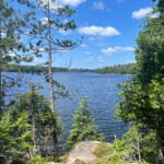 Trip Information
Departure Time: 07:30
Return to City Time: 19:30
Departure Point: York Mills Bus Pickup Click here for more information or to register Trip Activities
Fast hike & swim ($0.01)
Moderate hike ($0.01)
Short hike & swim ($0.01)
Optional Items
Hosting Club: Toronto
Category: Coach Trips
Location (Google Maps): Silent Lake Provincial Park Hike Leader(s): Martina Furrer, Marie-Josée Roy, Leonora Rochwerger, Leila Damband, Janet McColeman, Celia Ho Click here to contact Hike Leader(s) Pace: Brisk (4-5 km/hr), Moderate (3-4 km/hr)
Terrain: Hilly, Level 2 (Intermediate – some hills and uneven surfaces, rocks and roots underfoot), Variable
Distance (km): Fast (16 km at greater than 4 km/hr), moderate (16 km at 3 km/hr), short hike (10 to 12 km at 3 km/hr) Description
Join us for a fun summer day at beautiful Silent Lake Provincial Park in the heart of the Kawarthas. Choose your own adventure: - Fast hike and swim: Hike the Silent Lake loop (16 km, 4.5 km/hr pace, no dropouts) with Martina and Marie-Josée , then cool off with a dip in Silent Lake.
- Moderate hike: Hike the Silent Lake loop (16 km, 3 km/hr pace, no dropouts) with Leonora and Leila. This group will not have time for swimming.
- Short hike and swim: An in an out hike (10 to 12 km, 3 km/hr pace) along the Lakeshore and Bonnie’s pond trails with Janet and Celia.
- A self-guided day on the water: Float with the loons as you paddle and swim on peaceful Silent Lake. Canoe, kayak, and stand up paddleboard rentals available ($25 + HST for two hours, $40 + HST for six hours).
All three hiking options include gorgeous views and some challenging rocks. Bring lunch, water, snacks, and your swimming gear. No refreshment stop but there are washrooms and drinking water taps by the day use beach, and you can purchase ice cream and cold drinks in the park store. Bus departs 10 York Mills Rd at 7:30 AM. We hope to be back in the city by 8 PM. Registration cost includes bus fare and park admission.
- Car Hike: Uxbridge-Brock Track
8:00 AM-12:00 PM 07/25/2026 https://hikes.brucetrail.org/event/car-hike-uxbridge-brock-track-7/2026-07-25/ Click here for more information or to register Hosting Club: Toronto
Category: Car Hike
Location (Google Maps): Meet at the 1401 Brock Rd, Brock Tract parking lot on the east side of Durham 1/Brock Rd., approximately 5 km south of Coppin’s Corners, Uxbridge or 1 km north of Uxbridge Pickering Town Line. 1401. (Free parking). Hike Leader(s): Amir Alemohammad Click here to contact Hike Leader(s) Pace: Moderate (3-4 km/hr)
Terrain: Flat, Hilly, Level 2 (Intermediate – some hills and uneven surfaces, rocks and roots underfoot), Variable
Distance (km): 14-15 km Description
Join us for a wonderful hike in Uxbridge starting from Brock Track parking lot. We will hike the Brock Track and Wilder Forest among the amazing trails of Uxbridge. Boots mandatory, poles recommended, bring 2 litres of water and dress according to weather conditions. Please arrive at 7:45 for a 8:00 start. Beware, Iphone Maps may take you to the wrong location. Check the location with Google Maps the previous night. This is a joint hike with Oak Ridges Trail Association (ORTA).
- Car Hike: Forks of the Credit – Devil’s Pulpit
8:30 AM-1:30 PM 07/25/2026 https://hikes.brucetrail.org/event/car-hike-forks-of-the-credit-devils-pulpit-2/2026-07-25/ 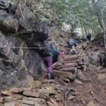 Click here for more information or to register Hosting Club: Toronto, Caledon Hills
Category: Car Hike
Location (Google Maps): Devil’s Pulpit – Meet at roadside parking, at intersection of Creditview Road and Grange Sideroad. N43.791491, W-79.975229. Map 14 Edition 31. Please arrive fifteen minutes early. Hike Leader(s): Mr Ross Click here to contact Hike Leader(s) Pace: Brisk (4-5 km/hr), Moderate (3-4 km/hr)
Terrain: Challenging, Level 2 (Intermediate – some hills and uneven surfaces, rocks and roots underfoot), Level 3 (Advanced – steep hills and some scrambling over boulders), Rocky
Distance (km): 12-13 kms Description
Hiking’s beauty is it’s simplicity. You set your destination and start the journey. Hiking is the most natural way of fueling your body, mind and spirit while savoring the beauty of the landscape around you. You feel the breathe of fresh air and the earth under your feet. So join me and others explore and visit the Devil at the – Devil’s Pulpit and it’s nearby Side Trails. A comfortable, sturdy hiking shoe/boot and hiking poles are highly recommended to tackle the rocky section. Please bring sufficient hydration liquid, snack and lunch. Bring sunscreen, bug repellent and sun head protection. Always carry your personal medication (if any) and health card at all time. Don’t forget your enthusiasm. Please arrive fifteen minutes early for 8:30 start.
- Milne Dam Conservation park/ Hike and picnic
9:15 AM-11:45 AM 07/25/2026 https://hikes.brucetrail.org/event/car-hike-glasgow-village-uxbridge-8/2026-07-25/ Click here for more information or to register Hosting Club: Toronto Location (Google Maps): Milne Dam Conservation park,Park entry fee is $12.50 per car ,it is also possible to park outside park in commercial parking lots or streets around park and enter the park for free. Hike Leader(s): MOHAMMAD AGHAMIRI Click here to contact Hike Leader(s) Pace: Moderate (3-4 km/hr)
Terrain: Hilly, Level 2 (Intermediate – some hills and uneven surfaces, rocks and roots underfoot), Variable
Distance (km): 8-10 Description
This is a hike for 2,5 hours and it is opttional for hikers to join our annual picnic for lunch, You can bring your own food or order your food from a persian restaurent ,the cost is $20 to 30 tax included depends on type of food u order. for order message me @416 616 4105
- Urban Walk: Waterfront Trail 4/11 – Parklawn
10:00 AM-1:00 PM 07/25/2026 https://hikes.brucetrail.org/event/urban-walk-waterfront-trail-4-11-parklawn-3/2026-07-25/  Click here for more information or to register Hosting Club: Toronto
Category: Urban Walk
Location (Google Maps): Toronto Waterfront Trail West Hike Leader(s): Brian Rideout Click here to contact Hike Leader(s) Pace: Moderate (3-4 km/hr)
Terrain: Flat
Distance (km): 9.1 km Description
Please join me at Old Mill Station no later than 9:12 am. We will take the 66 bus departing 9:27 am, arriving 9:40 am. If you want to meet us at Parklawn and Lakeshore, please be there by 9:40 am. We start hiking at 9:50 am. We will hike east along the lake to Spadina. The estimated distance is 9.1 km. Here is an online map of our route Parklawn to Spadina Bring a snack, at least 2 liters of water, sun screen and bug spray
|
26 - Car Hike: Jefferson Forest/Bond Lake
8:00 AM-12:00 PM 07/26/2026 https://hikes.brucetrail.org/event/car-hike-jefferson-forest-bond-lake-7/2026-07-26/  Click here for more information or to register Hosting Club: Toronto
Category: Car Hike
Location (Google Maps): 1245 Bethesda Side Rd, Richmond Hill, ON L4E 1A2 ( Bethesda Trail Head Parking lot) Hike Leader(s): Amir Alemohammad Click here to contact Hike Leader(s) Pace: Moderate (3-4 km/hr)
Terrain: Flat, Hilly, Level 2 (Intermediate – some hills and uneven surfaces, rocks and roots underfoot), Variable
Distance (km): 14-16Km Description
Let’s roll the hills of the Jefferson Forest and around the Bond Lake. Every week we hike in Jefferson Forest, located in the heart of Richmond Hill, it boasts numerous hiking trails. This 4 hour hike can range from 14 to 15 kilometres, depending on the weather conditions. Remember to bring water, snacks, hiking boots (mandatory), poles, and your camera. Not recommended for beginners. Park in the free Bethesda parking lot and avoid parking along the road. Dress appropriately for the weather. Difficulty Level: 2 (Moderate). Please arrive @7:45AM for start of 8:00AM. This is a joint hike with the Oak Ridges Trail Association (ORTA). what3words: https://w3w.co/twisting.mailer.awakes
- Urban Walk: Warden Woods–Taylor Creek–Don River
9:30 AM-1:30 PM 07/26/2026 https://hikes.brucetrail.org/event/urban-walk-warden-woods-taylor-creek-don-river/2026-07-26/ 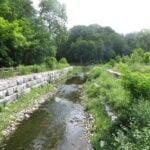 Click here for more information or to register Hosting Club: Toronto
Category: Urban Walk
Location (Google Maps): Kennedy Rd. and St. Clair Ave. E. Hike Leader(s): Felix Wan; Tom Swales Click here to contact Hike Leader(s) Pace: Moderate (3-4 km/hr)
Terrain: Hilly, Level 2 (Intermediate – some hills and uneven surfaces, rocks and roots underfoot)
Distance (km): 12.5 Description
Join us on a walk through scenic Warden Woods Park and Taylor Creek Park. We will never be far from water as we walk alongside Taylor-Massey Creek and the Don River. We will see wetlands, woodlands, and many species of plants and birds. Route map: https://onthegomap.com/s/lcjp9dir The terrain features a mixture of paved paths, dirt trails, and road walking. There are a couple of descents, and a couple of uphill climbs. Depending on weather conditions, parts of the trail may be muddy or wet. Bring a good pair of hiking/walking shoes, as well as a lunch/snacks and at least 2L of drinking water. Travel to the trailhead: - By TTC: Meet Felix and Tom at Kennedy subway station by 9:25 a.m. to take the route 113 Danforth bus departing at 9:38 a.m., and arriving at Kennedy Rd. and St. Clair Ave. E. at 9:46 a.m.
- By GO: Take the Lakeshore East Line train departing Union station at 9:20 a.m. and arriving at Scarborough station at 9:38 a.m. Walk across St. Clair Ave. E. to the north side, to catch the route 102 Markham TTC bus departing Linden Ave. westbound at 9:44 a.m., arriving at Kennedy Rd. (two stops later) at 9:45 a.m. The TTC transfer will be free if you tap with your PRESTO card. Cross to the northwest corner of the intersection to meet the group.
- By car:
- Free parking is available at the Thomas Hauser Memorial Trailhead (the end point of the hike) at 35 Redway Rd. (https://maps.app.goo.gl/9QtAgAdmnXB8C8zw6). Note that you will still need to find your way to the trailhead to meet the group, given that this is a linear hike.
- Free parking is available at Scarborough GO station. To reach the trailhead, see “By GO” instructions above. Note that you will need to find your way back to Scarborough station at the end of the hike, given that this is a linear hike.
Washrooms: Washrooms are available at Kennedy station (east end of the level above the Line 2 subway, as well as just across the west staircase from/to the Line 5 LRT boarding platform), or on the GO train/at Scarborough GO station, before the start of the hike. During the hike, we will stop at public washrooms at km 5.7. Washrooms are also available at the end of the hike at Loblaws. Après-hike: There will be an optional après-hike stop at Corks Beer & Wine Bar at Leaside Village (93 Laird Dr.), a 20-minute walk from the end point of the hike.
| 27  CANCELLED – Terra Cotta Loop CANCELLED – Terra Cotta Loop 8:30 AM-2:00 PM 07/27/2026 https://hikes.brucetrail.org/event/terra-cotta-loop-4/2026-07-27/ Click here for more information or to register Hosting Club: Iroquoia, Toronto
Category: General Hike
Location (Google Maps): Boston Mills Road – Roadside Parking Hike Leader(s): Pati Greenwood, Jeff Dowsett Click here to contact Hike Leader(s) Pace: Medium – 3 to 4 km/hr
Terrain: Moderate – Some hills and/or some poor footing
Distance: 15 km Description
Starting from Boston Mills Road, we will take the main trail and side trails to form a large loop through the Terra Cotta Conservation Area. Our route will include some rocky and uneven terrain, which may be tricky to navigate. Wear hiking boots and bring poles. Ticks and other insects are active at this time of year, so wearing clothing covering the legs are arms is recommended as is insect repellent. Bring plenty to drink and a snack. Please arrive at the meeting place by 8:15 am for an 8:30 am departure.
| 28 - Urban Walk: Valley View/Huntington Park
9:30 AM-11:45 AM 07/28/2026 https://hikes.brucetrail.org/event/urban-walk-valley-view-huntington-park-11/2026-07-28/ Click here for more information or to register Hosting Club: Toronto Location (Google Maps): Parking lot is off Sycamore Drive, East of Bayview , across Starbucks plaza
Bus 91 from Finch East station stops at Sycamore station. Hike Leader(s): Mohammad Aghamiri Pace: Moderate (3-4 km/hr)
Terrain: Hilly, Level 2 (Intermediate – some hills and uneven surfaces, rocks and roots underfoot)
Distance (km): 6-7 km Description
We will explore Valleyview and Maple View parks, and walk along German Mill Creak, in return we stop in Huntington park and have snack under beautiful shed. Although this is considered an “Urban Walk”, you can expect some hills up and down and uneven surfaces with tree roots. Please bring hiking poles, water and snacks.
| 29 - Car Hike: Toronto Section E2E (3 of 4 )
9:30 AM-2:30 PM 07/29/2026 https://hikes.brucetrail.org/event/car-hike-toronto-section-e2e-3-of-4-2/2026-07-29/ Click here for more information or to register Hosting Club: Toronto
Category: Car Hike
Location (Google Maps): Walking Fern ST (38.8k marker, Edition 31) on 10th Line Hike Leader(s): David Rowney Click here to contact Hike Leader(s) Pace: Moderate (3-4 km/hr)
Terrain: Variable
Distance (km): 12.2 k Description
This is a summer-time End-to-End hike to complete the Toronto section of the Bruce Trail in 4 hikes. Join for as many hikes as desired. This third hike will take us from Sixth Line, north of Limehouse to the entrance of the Walking Fern ST (on the 10th Line). The terrain will vary, there will be some hilly sections and sections with uneven, rocky terrain, making footing tricky to navigate. July weather can be hot, muggy and buggy! So, dress for the weather, keeping in mind that insects, including ticks, will be out in full force. Take appropriate precautions to avoid insect bites, including using repellant and clothing that covers the legs and arms. Hiking shoes/boots are required and hiking poles are recommended. Bring plenty of fluids, including electrolytes, and a snack/lunch. As this is a group hike, please consider your fitness level before registering. We will be walking at a pace of 3km – 4km per hour and everyone is expected to keep up with the person in front of them for the duration of the hike. Plan to arrive at the meeting place by 9:15 a.m. as we will start the car shuffle to the hike starting point at 9:30 a.m. sharp. Further details will be provided to registered hikers a few days prior to the hike.
| 30 - Toronto Waterfront Urban Hike: Port Credit Go Station to Union GO Train Station
6:15 AM-12:00 PM 07/30/2026 https://hikes.brucetrail.org/event/toronto-waterfront-urban-hike-danforth-go-station-to-union-go-train-station/2026-07-30/  Click here for more information or to register Hosting Club: Toronto, Caledon Hills
Category: General
Location (Google Maps): At 6:15 a.m. meet at Union Station Go Train Station platform #4 stairs in the concourse-not on the tracks!!!! We will be taking the 6:35 a.m. Lakeshore West train to Port Credit Go Station and walking back to Union. Hike Leader(s): Daniel Patterson, Tom Swales Click here to contact Hike Leader(s) Pace: Medium – 3 to 4 km/hour
Terrain: Easy – mostly flat and usually good footing
Distance: 21 Km Description
Enjoy the amazing Toronto waterfront from Port Credit to Union Station on this early morning urban hike. Bring snacks, water, sun screen and your natural curiousity! Should you decide to leave the hike early you MUST talk to the leaders. No dogs.
- Urban Walk: Valley View/Huntington Park
9:30 AM-11:45 AM 07/30/2026 https://hikes.brucetrail.org/event/urban-walk-valley-view-huntington-park-12/2026-07-30/ Click here for more information or to register Hosting Club: Toronto Location (Google Maps): Parking lot is off Sycamore Drive, East of Bayview , across Starbucks plaza
Bus 91 from Finch East station stops at Sycamore station. Hike Leader(s): Mohammad Aghamiri Pace: Moderate (3-4 km/hr)
Terrain: Hilly, Level 2 (Intermediate – some hills and uneven surfaces, rocks and roots underfoot)
Distance (km): 6-7 km Description
We will explore Valleyview and Maple View parks, and walk along German Mill Creak, in return we stop in Huntington park and have snack under beautiful shed. Although this is considered an “Urban Walk”, you can expect some hills up and down and uneven surfaces with tree roots. Please bring hiking poles, water and snacks.
| 31 - Toronto Waterfront Danforth GO Station to Union GO Station
6:15 AM-11:30 AM 07/31/2026 https://hikes.brucetrail.org/event/toronto-waterfront-davenport-go-station-to-union-station/2026-07-31/  Click here for more information or to register Hosting Club: Toronto, Caledon Hills
Category: General
Location (Google Maps): Meet at Union Station Go Train Station Platform 4 (in the concourse not on the tracks!) by 6:15 a.m. We are taking the 6:35 a.m. Lakeshore East Go Train to Danforth Go Station to start the hike. The hike will end at Union Station. If you want to leave the hike before Union Station, it is necessary to inform the leaders! Hike Leader(s): Daniel Patterson, Tom Swales Click here to contact Hike Leader(s) Pace: Medium – 3 to 4 km/hour
Terrain: Easy – mostly flat and usually good footing
Distance: 21 km Description
Join us for an urban hike on the Toronto East waterfront along the beaches, through Tommy Thompson Park, the Port Lands and Harbour Front. Bring snacks, sturdy shoes, sunblock and an adventerous attitude! And of course your Presto Card!
| August |
