|
Sun | Mon | Tue | Wed | Thu | Fri | Sat |
|---|
April | April | April | April | April | 1   Sydenham Weekend in Owen Sound, May 1 to 3 Sydenham Weekend in Owen Sound, May 1 to 3 7:30 AM-8:00 PM 05/01/2026 https://hikes.brucetrail.org/event/sydenham-weekend-in-owen-sound-may-1-to-3/2026-05-01/  Trip Information
Departure Time: 07:30
Return to City Time: 20:00
Departure Point: York Mills Bus Pickup Click here for more information or to register Trip Activities
Hiking ($.01)
Optional Items
Hosting Club: Toronto
Category: Coach Trips
Location (Google Maps): Owen Sound Hike Leader(s): George Lennon, Martina Furrer, Roland Mark, Robin Crombie Click here to contact Hike Leader(s) Pace: Mixed (See Hike Description)
Terrain: Challenging, Hilly, Level 2 (Intermediate – some hills and uneven surfaces, rocks and roots underfoot), Rocky, Variable
Distance (km): 12-18 km Description
Join us for three days of hiking on what many consider the most rugged section of the Bruce Trail. Overnight group will be lodging at the Best Western Inn On The Bay in Owen Sound. This will be a challenging three days of hiking with some strenuous climbs and sometimes difficult footing over tree roots, rocks and crevasses. All fit, experienced hikers comfortable walking on this type or terrain are welcome. For your safety and enjoyment as well as the group’s, before registering we strongly encourage you to join some of our day hikes on the Bruce Trail. This will give you a chance to get to know us and assess your abilities. We will split the group and offer two levels of hikes each day. The moderate group will hike about 12 km each day. and the fast group 15 km or more. The specific trails will be determined closer to the date. Accommodation at the hotel is no longer available at the discounted group rate. Rooms at the Best Western will be at their regular rate given on the hotel’s website and/or registration desk. Coach fare is $170 for members; $190.00 for non-members; $100 for children. Registration instructions: If you wish to share accommodation, please find a roommate, then book your hotel room, and then book your seats on the coach. To avoid problems make sure you and your roommate reserve your seats at the same time. - Book your room online using the Best Western Inn on the Bay’s website (https://bwowensound.com/) or through their reservation desk (519) 371-9200. Make arrangements with your roommate to split the cost.
- To reserve your seat on the bus, register here starting on Thursday January 15 at 8 PM.
Cancellation policy: While we are hoping for sunshine, the trip cannot be cancelled due to weather. Coach fare is non-refundable if cancellation is made less than 30 days in advance of the departure date. Our coach will depart at 7:30 AM on Friday May 1. We plan to be back in Toronto between 7 and 8 PM on Sunday May 3. Departure locations: 10 York Mills Rd and HWY 400 and Major Mackenzie Park and Ride.
| 2  Boyd Conservation Park ,Vaughan Boyd Conservation Park ,Vaughan 8:30 AM-1:00 PM 05/02/2026 https://hikes.brucetrail.org/event/car-hike-boyd-conservation-park-vaughan-13/2026-05-02/ Click here for more information or to register Hosting Club: Toronto
Category: Car Hike
Location (Google Maps): Free Parking lot before entrance of park on Islington Ave. Hike Leader(s): Mohammad Aghamiri Click here to contact Hike Leader(s) Pace: Moderate (3-4 km/hr)
Terrain: Hilly, Level 2 (Intermediate – some hills and uneven surfaces, rocks and roots underfoot), Variable
Distance (km): 12-14 km Description
Let’s hike Boyd conservation park trails through beautiful valleys. Please bring lots of water and snacks ,hiking poles are recommended phone number for the day of hike 289 588 6482
- Loop hike exploring Glasgow, Goodwood, Secord Forest Trails at Durham Region
8:30 AM-12:00 PM 05/02/2026 https://hikes.brucetrail.org/event/loop-hike-exploring-glasgow-goodwood-secord-forest-trails-at-durham-region/2026-05-02/ Click here for more information or to register Hosting Club: Toronto
Category: Car Hike
Location (Google Maps): Meet in the parking lot east side of Concession 2, (Whitchurch-Stouffville), 200m south of Webb Rd. This is a free Parking lot. Hike Leader(s): Amir Alemohammad Click here to contact Hike Leader(s) Pace: Moderate (3-4 km/hr)
Terrain: Flat, Hilly, Level 2 (Intermediate – some hills and uneven surfaces, rocks and roots underfoot), Variable
Distance (km): 14-16 Km Description
Join us to explore the nature of Goodwood Conservation Area and Secord Forest. The trail is fairly level lowland wetlands with many boardwalks making an otherwise inaccessible terrain traversable. There are a few meadows and upland woods thrown in there though. Although mostly a flat trail, expect some hills and sharp steep trails in between. In this season a mix of birds sounds and spring flowers adds to the beauty of the scene. Secord Forest, Pond and dog cemetery will be on our way to the hike. Bring at least two litters of water and your favorite snacks. Boots mandatory, poles highly recommended. Dress according to the spring humid. Be prepared for the rise of the bugs and ticks and make your spray ready on hand.
 Urban Walk; Tommy Thompson Park Urban Walk; Tommy Thompson Park 9:30 AM-2:00 PM 05/02/2026 https://hikes.brucetrail.org/event/urban-walk-tommy-thompson-park/2026-05-02/  Click here for more information or to register Hosting Club: Toronto
Category: Urban Walk
Location (Google Maps): Tommy Thompson Park Hike Leader(s): Leila Damband Click here to contact Hike Leader(s) Pace: Moderate (3-4 km/hr)
Terrain: Flat, Level 1 (Easy – mostly on flat, well maintained trails with hard-packed surface)
Distance (km): 12 Km Description
Hi my dear hikers, I’m inviting you to join us on the first Saturday of the beautiful month of May for an enjoyable walk at Tommy Thompson Park, Toronto’s urban wilderness. It’s a unique spot near downtown Toronto to experience nature and one of the best places for birdwatching—so bring your binoculars if you have them. Notes: - It’s May, and showers can be expected at any time, so come prepared.
- Bring 2L of drinking water and a lunch/snack.
- Feel free to invite your family members and friends to join.
- Please be on time. If you need to cancel, kindly do so via the website to give an opportunity to waitlisted hikers.
- TTC users can take Bus #83 from Donlands Subway Station (check https://www.ttc.ca/ for any updates or closures). Free public parking is available at the trailhead on a first-come, first-served basis. Washrooms are located at the trailhead, with some additional vault toilets available on the trails. You will receive an update email on Thursday, April 30.
Fingers crossed for a nice sunny day—see you all soon!
- Urban Walk: Toronto Urban Badge Hike – 6 of 7
10:00 AM-1:15 PM 05/02/2026 https://hikes.brucetrail.org/event/urban-walk-toronto-urban-badge-hike-6-of-7-3/2026-05-02/  Click here for more information or to register Hosting Club: Toronto
Category: Urban Walk
Location (Google Maps): Toronto, Ontario, Canada Hike Leader(s): Brian Rideout Click here to contact Hike Leader(s) Pace: Moderate (3-4 km/hr)
Terrain: Flat
Distance (km): 9 km Description
Please join me at the south east corner of Sheppard Ave East and Leslie by 10 AM. We will hike south through several parks to Don Mills (S of Overlea) (km 51.7 to km 62.4). Here is an online map with km markings of our route for all 7 hikes for the Toronto Urban Badge: https://onthegomap.com/s/c2c1hf3n Please make sure you bring at least 2 liters of water, a lunch, bug spray and sunscreen.
|
3  Rainbow Hike Rainbow Hike 8:00 AM-11:00 AM 05/03/2026 https://hikes.brucetrail.org/event/rainbow-hike-2/2026-05-03/ Click here for more information or to register Hosting Club: Iroquoia, Toronto
Category: Rainbow Hike
Location (Google Maps): Meet at the parking lot on 22nd Sideroad. Hike Leader(s): Anita Bergsma Click here to contact Hike Leader(s) Pace: Leisurely – 3km/hr or less, Medium – 3 to 4 km/hr
Terrain: Easy – Mostly flat and usually good footing
Distance: 10 Kms Description
Bruce Trail Rainbow Hike Celebrate the beauty of the Bruce Trail and the spirit of community on our Rainbow Hike! 🌈🥾 Join us for a welcoming group hike along one of Ontario’s most scenic sections of the Bruce Trail. Whether you’re a seasoned hiker or just getting started, this event is all about enjoying nature, meeting new people, and sharing a positive outdoor experience together. What to Expect - A guided group hike along a picturesque section of the Bruce Trail
- Beautiful forest paths, escarpment views, and fresh spring air
- A friendly, inclusive atmosphere where everyone is welcome
- Opportunities to connect with fellow hikers and outdoor enthusiasts
Hike Details - Distance: Approximately 10 km
- Pace: Easy to moderate, with plenty of breaks
- Terrain: Mixed forest trails with some gentle elevation changes
- Duration: About 2–3 hours
What to Bring - Comfortable and appropriate hiking shoes or boots
- Water and light snacks
- Weather-appropriate clothing
- Your positive energy and rainbow spirit! 🌈
Whether you come solo or with friends, the Rainbow Hike is a chance to explore nature, celebrate diversity, and build community on the trail. The rainbow badge will be provided at the end of our hike.
- Car Hike: Jefferson Forest and Bond Lake (Richmond Hill)
8:30 AM-12:00 PM 05/03/2026 https://hikes.brucetrail.org/event/car-hike-jefferson-forest-and-bond-lake-richmond-hill-10/2026-05-03/  Click here for more information or to register Hosting Club: Toronto
Category: Car Hike
Location (Google Maps): 1245 Bethesda Side Rd, Richmond Hill, ON L4E 1A2 ( Bethesda Trail Head Parking lot) Hike Leader(s): Amir Alemohammad Click here to contact Hike Leader(s) Pace: Moderate (3-4 km/hr)
Terrain: Flat, Hilly, Level 2 (Intermediate – some hills and uneven surfaces, rocks and roots underfoot)
Distance (km): 14-15 km Description
Let’s roll the hills of the Jefferson Forest and around the Bond Lake. Every week we hike in Jefferson Forest, located in the heart of Richmond Hill, it boasts numerous hiking trails. This 3.5 hour hike can range from 14 to 15 kilometres, depending on the weather conditions. Remember to bring water, snacks, hiking boots, poles, and your camera. Not recommended for beginners. Park in the free Bethesda parking lot and avoid parking along the road. Dress appropriately for the weather. Difficulty Level: 2 (Moderate). Please arrive @8:15AM for start of 8:30AM. This is a joint hike with the Oak Ridges Trail Association (ORTA). what3words: https://w3w.co/twisting.mailer.awakes
- Urban Walk: Sherwood Park/Sunnybrook Park
10:30 AM-1:30 PM 05/03/2026 https://hikes.brucetrail.org/event/urban-walk-sherwood-park-sunnybrook-park-6/2026-05-03/ Click here for more information or to register Hosting Club: Toronto
Category: Urban Walk
Location (Google Maps): NE Corner Yonge & Lawrence (by subway exit) Hike Leader(s): Tom Swales Click here to contact Hike Leader(s) Pace: Moderate (3-4 km/hr)
Terrain: Hilly, Level 2 (Intermediate – some hills and uneven surfaces, rocks and roots underfoot), Variable
Distance (km): 12 KM Description
Join us for a hike through scenic ravines from Yonge & Lawrence to Sunnybrook & Serena Gundy parks to end at Laird Station of TTC Line 5. Hopefully there will be the chance to enjoy spring wildflowers in the woods of Sunnybrook Park.
| 4 | 5 - Car Hike: Spring Birding Hike
9:00 AM-12:00 PM 05/05/2026 https://hikes.brucetrail.org/event/car-hike-spring-birding-hike/2026-05-05/  Click here for more information or to register Hosting Club: Toronto
Category: Car Hike
Location (Google Maps): Limehouse – Meet at the parking lot opposite Limehouse Public School, on the south side of 22 Sideroad, just north of Fifth Line. Hike Leader(s): Janet Patterson Click here to contact Hike Leader(s) Pace: Leisurely (2-3 km/hr)
Terrain: Variable
Distance (km): approx 3 – 4 km Description
Join BTC ecologist Mara McHaffie and members of the TBTC Biodiversity Team on a leisurely walk along the main trail and some side trails, listening and watching for birds returning from their southern wintering grounds. You need not be a bird expert – we welcome beginning birders! This area features a mix of open areas, thickets, and forest, so we anticipate encountering a good variety of species. The BTC’s protected natural areas, such as the one we will visit, aim to preserve the Escarpment’s unique biodiversity and provide nature-based solutions to addressing climate change. During the hike, we will discuss how you can use apps like iNaturalist, Merlin Bird ID and eBird to enhance your birding experience. If you haven’t done so already, please download these apps ahead of time, as cell service can be spotty at this location. You may also want to record what you see as you earn points towards the TBTC Naturalist badge. Along with your curiosity, please bring water and snacks/lunch. End time and distance we will travel are estimates, depending on weather, trail conditions and what we observe!Note that due to the slow pace and frequent stops, you may want to dress more warmly than you would for a faster-paced hike. This hike is brought to you by the TBTC’s Biodiversity Team. We endeavour to promote the critical role we can all play in protecting and conserving the Niagara Escarpment. Maximum 10 people
- Urban Walk: Valley View Park Thornhill
9:30 AM-12:00 PM 05/05/2026 https://hikes.brucetrail.org/event/urban-walk-valley-view-park-thornhill-165/2026-05-05/ Click here for more information or to register Hosting Club: Toronto Location (Google Maps): Parking lot is off Sycamore Drive, East of Bayview , across Starbucks plaza
Bus 91 from Finch East station stops at Sycamore station. Hike Leader(s): MOHAMMAD AGHAMIRI Click here to contact Hike Leader(s) Pace: Moderate (3-4 km/hr)
Terrain: Hilly, Level 2 (Intermediate – some hills and uneven surfaces, rocks and roots underfoot)
Distance (km): 6-7 km Description
We will explore Valleyview and Maple View parks, and walk along German Mill Creak, in return we stop in Huntington park and have snack under beautiful shed. Although this is considered an “Urban Walk”, you can expect some hills up and down and uneven surfaces with tree roots. Please bring hiking poles, Ice cleats water and snacks.
| 6 | 7 - Urban Walk: Valley View Park Thornhill
9:30 AM-12:00 PM 05/07/2026 https://hikes.brucetrail.org/event/urban-walk-valley-view-park-thornhill-166/2026-05-07/ Click here for more information or to register Hosting Club: Toronto Location (Google Maps): Parking lot is off Sycamore Drive, East of Bayview , across Starbucks plaza
Bus 91 from Finch East station stops at Sycamore station. Hike Leader(s): MOHAMMAD AGHAMIRI Click here to contact Hike Leader(s) Pace: Moderate (3-4 km/hr)
Terrain: Hilly, Level 2 (Intermediate – some hills and uneven surfaces, rocks and roots underfoot)
Distance (km): 6-7 km Description
We will explore Valleyview and Maple View parks, and walk along German Mill Creak, in return we stop in Huntington park and have snack under beautiful shed. Although this is considered an “Urban Walk”, you can expect some hills up and down and uneven surfaces with tree roots. Please bring hiking poles, Ice cleats water and snacks.
- Urban Walk: Toronto Islands Evening Walk
6:00 PM-8:45 PM 05/07/2026 https://hikes.brucetrail.org/event/urban-walk-toronto-islands-evening-walk-19/2026-05-07/  Click here for more information or to register Hosting Club: Toronto
Category: Urban Walk
Location (Google Maps): Jack Layton Ferry Terminal, by the gate to the Wards Island Ferry. Please arrive 20 minutes prior to departure to check in with hike leader. From Union Station take the LRT and get off at the stop Ferry Docks.Walk up to the Ferry Docks on Queens Quay West, street level. at the foot of Bay Street. Hike Leader(s): Miriam Stevens Click here to contact Hike Leader(s) Pace: Leisurely (2-3 km/hr)
Terrain: Flat, Level 1 (Easy – mostly on flat, well maintained trails with hard-packed surface)
Distance (km): 6-9 km Description
After a day’s work come and “cool off” on the Toronto Islands free of fumes and traffic. Enjoy the view of the city skyline and Toronto’s beautiful island parkland.
Pack a dinner for a sit down picnic. Also bring a warm jacket and flashlight.
Return fare ticket for the ferry is $9.57 for adults, $6.15 for seniors
Please check the hike schedule for weather related cancellations (hike will be updated by 11:00 AM day of the hike if any changes)
Toronto Island evening hikes will take place every Thursday in May and June 2026.
Same time and same meeting place. No preregistration is required – just show up at the ferry docks at 5:40 PM and sign in with the hike leader.
| 8 | 9 -
 School Bus Hike: Iroquoia E2E #7/8 (Map 10 Mount Nemo) School Bus Hike: Iroquoia E2E #7/8 (Map 10 Mount Nemo) 8:30 AM-6:30 PM 05/09/2026 https://hikes.brucetrail.org/event/school-bus-hike-iroquia-e2e-7/2026-05-09/ Trip Information
Departure Time: 08:30
Return to City Time: 18:30
Departure Point: Kipling Departure Point Click here for more information or to register Optional Items
Hiking ($.01)
Hosting Club: Toronto
Category: Bus Hike
Location (Google Maps): Mount Nemo, Kilbride (Map #10) Hike Leader(s): Tom Swales, Marina Wray Click here to contact Hike Leader(s) Pace: Moderate (3-4 km/hr)
Terrain: Hilly, Level 2 (Intermediate – some hills and uneven surfaces, rocks and roots underfoot), Rocky, Variable
Distance (km): 17 km Description
The seventh hike in our Iroquia E2E will take us through Mount Nemo Conservation Area (scenic view on top of the escarpment), Maple Cross Nature Reserve and Kilbride Pass to Crawford Lake Conservation Area. We begin with a steep climb up the escarment to Mount Nemo Conservation area but it will level out for the rest of the hike. There will be a stop for refreshments and socializing in Milton before returning to Kipling Station. Dropouts at 10 km and 15 km. Anyone is welcome regardless if doing the E2E or not.
- Trillium hike Richmond hill
8:30 AM-1:00 PM 05/09/2026 https://hikes.brucetrail.org/event/car-hike-rouge-national-park-scarborough-on-8/2026-05-09/ Click here for more information or to register Hosting Club: Toronto
Category: Car Hike
Location (Google Maps): Oak Ridges Corridor, Bethesda Trail Head Parking Lot, Bethesda Side Road, Richmond Hill, Ontario Hike Leader(s): MOHAMMAD AGHAMIRI Click here to contact Hike Leader(s) Pace: Moderate (3-4 km/hr)
Terrain: Hilly, Level 2 (Intermediate – some hills and uneven surfaces, rocks and roots underfoot), Variable
Distance (km): 12-14 km Description
Join us to explore the trails of York Regional Forest and the Oak Ridges Corridor at Jefferson Forest and Bond lake, Now is the trillium time come and view thousands of this beautiful flower. The White Trillium became Ontario’s official flower in 1937. The Trillium blooms in early spring throughout the province, with its white blossom associated with peace and hope. From parking lot we hike thought Jefferson forest and continue to Bond Lake and have snack beside the lake and return to parking around 13 to 13.30 Please bring lots of water and snacks ,hiking poles are recommended phone number for the day of hike 289 588 6482
- Loop Hike Hockley Rd 5th Line EHS to 3rd Line EHS
8:30 AM-12:15 PM 05/09/2026 https://hikes.brucetrail.org/event/car-hike-loop-hike-hockley-rd-5th-ehs-to-3rd-ehs/2026-05-09/  Click here for more information or to register Hosting Club: Toronto, Caledon Hills
Category: Car Hike
Location (Google Maps): Bruce Trail parking lot on the east side of 5th Line EHS, just south of Hockley Rd. (873603 5 EHS LINE, Mono, ON L9W 6N3) Hike Leader(s): Amir Alemohammad Pace: Moderate (3-4 km/hr)
Terrain: Hilly, Level 2 (Intermediate – some hills and uneven surfaces, rocks and roots underfoot), Variable
Distance (km): 12-14 Description
Join us for a loop hike along the trails of the Hockley Rd region, one of the most beautiful hiking areas in Caledon. Known for its rolling hills, forested trails, and ever-changing seasonal scenery, this hike takes you through a mixed hardwood forest, providing ample shade—perfect for this time of year. You’ll also encounter moderate elevation changes, with some sections following ridge lines and valleys that offer occasional breathtaking scenic viewpoints. We will hike main and side trails between 5th and 3rd Line EHS. Boots mandatory, poles recommended, bring two litres of water, your snack and dress according to weather conditions.
- Car Hike: Scotsdale Farm
11:00 AM-2:30 PM 05/09/2026 https://hikes.brucetrail.org/event/car-hike-scotsdale-farm-19/2026-05-09/ Click here for more information or to register Hosting Club: Toronto
Category: Car Hike
Location (Google Maps): Scotsdale Farm, Map 13 Hike Leader(s): Al Brown Click here to contact Hike Leader(s) Pace: Moderate (3-4 km/hr)
Terrain: Level 2 (Intermediate – some hills and uneven surfaces, rocks and roots underfoot), Variable
Distance (km): 10-13 km Description
Come join me for on the Bruce Trail to see the spring flowers and the first buds of the forest canopy. We will complete a loop hike on the main and side trails through Scotsdale Farm. The trails offer shorter routes for those who do not want to complete the full length. After the hike all are invited to join me for refreshments at the Shepherd’s Crook in old Georgetown. To get to the meeting point from Hwy 401 go north on Trafalgar Road past Georgetown to the juncture with Hwy 7. North on Hwy 7 to Silver Creek. Turn right and back onto Trafalgar Road. Go north about 1.5 km to the entrance of Scotsdale Farm on your right. The parking area is about 0.5 km from Trafalgar Road near the old homestead.
- Urban Walk: Humber River/Swansea Theatre Hike
3:00 PM-6:00 PM 05/09/2026 https://hikes.brucetrail.org/event/urban-walk-humber-river-swansea-theatre-hike-4/2026-05-09/ Click here for more information or to register Hosting Club: Toronto
Category: Urban Walk
Location (Google Maps): Meet by the TTC Stop on the Southeast Corner of Scarlett Road and Eglinton Avenue West. Take the #79 Scarlett Road bus from Runnymede Station to Eglinton or the Eglinton West #32A from Eglinton West Station to Scarlett Road. Hike Leader(s): Miriam Stevens Click here to contact Hike Leader(s) Pace: Leisurely (2-3 km/hr)
Terrain: Level 1 (Easy – mostly on flat, well maintained trails with hard-packed surface), Variable
Distance: 10-12 km Description
Leisurely hike (3 kms/hour – No Racers Please) suitable for beginners and families.
Hike along the Humber River trail and into the Swansea village at Runnymede road and Bloor street west. The hike will end opposite Runnymede Subway near the Village Playhouse Theatre and local restaurants and pubs. Distance may vary according to the weather and trail conditions and how people feel. Early dropout is possible at Old Mill Subway Station. After the hike you are invited to join us for dinner at around 6 PM at Ali Baba Mediterranean restaurant.
We will attend the play “The Cottage” at 8 PM at The Bloor West Village Players theatre, 2190 Bloor Street West, Toronto.
Call the Theatre directly at (416) 767 7702 to reserve your ticket, cost $26- $29.00. Please do mention that you’re with the Bruce Trail Conservancy, Toronto Club so they know we are supporting them. Paid parking is available off Kennedy Avenue north of Bloor Street West (behind the Village Playhouse Theatre building). There is no parking available at the start of the hike.
|
10 - Car Hike: Jefferson Forest and Bond Lake (Richmond Hill)
8:30 AM-12:00 PM 05/10/2026 https://hikes.brucetrail.org/event/car-hike-jefferson-forest-and-bond-lake-richmond-hill-11/2026-05-10/  Click here for more information or to register Hosting Club: Toronto
Category: Car Hike
Location (Google Maps): 1245 Bethesda Side Rd, Richmond Hill, ON L4E 1A2 ( Bethesda Trail Head Parking lot) Hike Leader(s): Amir Alemohammad Click here to contact Hike Leader(s) Pace: Moderate (3-4 km/hr)
Terrain: Flat, Hilly, Level 2 (Intermediate – some hills and uneven surfaces, rocks and roots underfoot)
Distance (km): 15-16 km Description
Let’s roll the hills of the Jefferson Forest and around the Bond Lake. Every week we hike in Jefferson Forest, located in the heart of Richmond Hill, it boasts numerous hiking trails. This 3.5 hour hike can range from 14 to 15 kilometres, depending on the weather conditions. Remember to bring water, snacks, hiking boots, poles, and your camera. Not recommended for beginners. Park in the free Bethesda parking lot and avoid parking along the road. Dress appropriately for the weather. Difficulty Level: 2 (Moderate). Please arrive @8:15AM for start of 8:30AM. This is a joint hike with the Oak Ridges Trail Association (ORTA). what3words: https://w3w.co/twisting.mailer.awakes
- Canceled Car Hike: Uxbridge-Brock Track
8:30 AM-12:00 PM 05/10/2026 https://hikes.brucetrail.org/event/car-hike-uxbridge-brock-track-3/2026-05-10/ Click here for more information or to register Hosting Club: Toronto
Category: Cancelled
Location (Google Maps): Meet at the Brock Tract parking lot on the east side of Durham 1/Brock Rd., approximately 5 km south of Coppin’s Corners, Uxbridge or 1 km north of Uxbridge Pickering Town Line. 1401 Brock Rd. (Free parking). Hike Leader(s): Amir Alemohammad Click here to contact Hike Leader(s) Pace: Moderate (3-4 km/hr)
Terrain: Flat, Hilly, Level 2 (Intermediate – some hills and uneven surfaces, rocks and roots underfoot)
Distance (km): 14-15 Description
This hike canceled. Join us for a wonderful hike in Uxbridge the capital trail of Canada, in starting from Brock Track parking lot. We will hike the Brock Track and Wilder Forest among the amazing trails of Uxbridge. Boots mandatory, poles recommended, bring 2 litres of water and dress according to weather conditions. Please arrive at 8:15 for a 8:30 start. Beware, Iphone Maps may take you to the wrong location. Check the location with Google Maps the previous night. This is a joint hike with Oak Ridges Trail Association (ORTA).
- Urban Walk: Toronto Urban Badge Hike – 6 of 7
10:00 AM-1:15 PM 05/10/2026 https://hikes.brucetrail.org/event/urban-walk-toronto-urban-badge-hike-6-of-7-4/2026-05-10/  Click here for more information or to register Hosting Club: Toronto
Category: Urban Walk
Location (Google Maps): East Don Trail Hike Leader(s): Brian Rideout Click here to contact Hike Leader(s) Pace: Moderate (3-4 km/hr)
Terrain: Flat
Distance (km): 9 km Description
Please join me at the south east corner of Sheppard Ave East and Leslie by 10 AM. We will hike south through several parks to Don Mills (S of Overleigh) (km 51.7 to km 62.4). Here is an online map with km markings of our route for all 7 hikes for the Toronto Urban Badge: https://onthegomap.com/s/c2c1hf3n Please make sure you bring at least 2 liters of water, a lunch, bug spray and sunscreen.
| 11 - Sydenham E2E in 7- hike 1 of 7
9:00 AM-3:00 PM 05/11/2026 https://hikes.brucetrail.org/event/car-hike-sydenham-e2e-in-7-hike-1-of-7/2026-05-11/ Hike open to BTC Members only. Click here for more information or to register Hosting Club: Toronto, Sydenham
Category: Car Hike
Location (Google Maps): Bog or Marsh Conservation, km 27. Map 29, addition 31. Coordinates N 44.538525,W 80.782217 (paid parking) Hike Leader(s): Smadar Junkin Click here to contact Hike Leader(s) Pace: Brisk (4-5 km/hr)
Terrain: Challenging, Level 3 (Advanced – steep hills and some scrambling over boulders), Variable
Distance (km): 27 km Description
This E2E in 7 features long hikes, hikers need to move at a pace of 4-4.5 km per hour. Please register to each hike individually. We will shuttle to km 0.0 and hike back. Hikers are expected to arrive 15 minutes early. Each hiker is expected to participate in car shuttles as needed throughout the 7 days. Bring 2 litres of water, snacks, lunch. If you need to get in touch with me use the “Contact Hike Leader” Dialogue Box to send a message.
| 12 - Sydenham E2E, hike 2of 7
8:30 AM-3:00 PM 05/12/2026 https://hikes.brucetrail.org/event/car-hike-sydenham-e2e-hike-2of-7/2026-05-12/ Hike open to BTC Members only. Click here for more information or to register Hosting Club: Toronto, Sydenham
Category: Car Hike
Location (Google Maps): Km 52.7 map 30, addition 31. St. Vincent Sydenham townline. Coordinates N 44.637539,W 80.733406 Hike Leader(s): Smadar Junkin Click here to contact Hike Leader(s) Pace: Brisk (4-5 km/hr)
Terrain: Challenging, Level 3 (Advanced – steep hills and some scrambling over boulders), Rocky, Variable
Distance (km): 26 km Description
Second hike in the series. Please register to each hike individually. We will hike about 26 kms. Bring 2 litres of water, food. We will shuttle to km 27, (paid parking) and walk back. If you need to get in touch with me, send a message through the “Contact Hike Leader” Dialogue Box.
- Urban Walk: Valley View Park Thornhill
9:30 AM-12:00 PM 05/12/2026 https://hikes.brucetrail.org/event/urban-walk-valley-view-park-thornhill-167/2026-05-12/ Click here for more information or to register Hosting Club: Toronto Location (Google Maps): Parking lot is off Sycamore Drive, East of Bayview , across Starbucks plaza
Bus 91 from Finch East station stops at Sycamore station. Hike Leader(s): MOHAMMAD AGHAMIRI Click here to contact Hike Leader(s) Pace: Moderate (3-4 km/hr)
Terrain: Hilly, Level 2 (Intermediate – some hills and uneven surfaces, rocks and roots underfoot)
Distance (km): 6-7 km Description
We will explore Valleyview and Maple View parks, and walk along German Mill Creak, in return we stop in Huntington park and have snack under beautiful shed. Although this is considered an “Urban Walk”, you can expect some hills up and down and uneven surfaces with tree roots. Please bring hiking poles, Ice cleats water and snacks.
| 13 - Sydenham E2E, hike 3 of 7
8:30 AM-3:00 PM 05/13/2026 https://hikes.brucetrail.org/event/car-hike-sydenham-e2e-hike-3-of-7/2026-05-13/ Hike open to BTC Members only. Click here for more information or to register Hosting Club: Toronto, Sydenham
Category: Cancelled
Location (Google Maps): Meet at the same location as day 2. Hike Leader(s): Smadar Junkin Click here to contact Hike Leader(s) Pace: Brisk (4-5 km/hr)
Terrain: Challenging, Level 3 (Advanced – steep hills and some scrambling over boulders), Variable
Distance (km): 24 km Approx. Description
We will shuttle to km 81.3 and walk back, about 24 km. Sign to each hike individually, if you need to get in touch with me, use the “Contact Hike Leader” Dialogue box to send a message. Bring 2 litres of water, food.
| 14 - Sydenham E2E, hike 4 of 7
8:30 AM-3:00 PM 05/14/2026 https://hikes.brucetrail.org/event/car-hike-sydenham-e2e-hike-4-of-7/2026-05-14/ Hike open to BTC Members only. Click here for more information or to register Hosting Club: Toronto, Sydenham
Category: Car Hike
Location (Google Maps): East of km 103.3, Young’s drive. Coordinates N 44.568131,W 80.977042 map 32 addition 31. Hike Leader(s): Smadar Junkin Click here to contact Hike Leader(s) Pace: Brisk (4-5 km/hr)
Terrain: Challenging, Level 3 (Advanced – steep hills and some scrambling over boulders), Variable
Distance (km): 22 km. Description
We will shuttle to km 81.3 and walk back. Parts of this day’s hike are very challenging. If you need to get in touch with me, use the “Contact Hike Leader” Dialogue Box to send a message. Bring 2 litres of water, food.
- Urban Walk: Valley View Park Thornhill
9:30 AM-12:00 PM 05/14/2026 https://hikes.brucetrail.org/event/urban-walk-valley-view-park-thornhill-168/2026-05-14/ Click here for more information or to register Hosting Club: Toronto Location (Google Maps): Parking lot is off Sycamore Drive, East of Bayview , across Starbucks plaza
Bus 91 from Finch East station stops at Sycamore station. Hike Leader(s): MOHAMMAD AGHAMIRI Click here to contact Hike Leader(s) Pace: Moderate (3-4 km/hr)
Terrain: Hilly, Level 2 (Intermediate – some hills and uneven surfaces, rocks and roots underfoot)
Distance (km): 6-7 km Description
We will explore Valleyview and Maple View parks, and walk along German Mill Creak, in return we stop in Huntington park and have snack under beautiful shed. Although this is considered an “Urban Walk”, you can expect some hills up and down and uneven surfaces with tree roots. Please bring hiking poles, Ice cleats water and snacks.
- Urban Walk: Toronto Islands Evening Walk
6:00 PM-8:45 PM 05/14/2026 https://hikes.brucetrail.org/event/urban-walk-toronto-islands-evening-walk-20/2026-05-14/ Click here for more information or to register Hosting Club: Toronto Location (Google Maps): Jack Layton Ferry Terminal, by the gate to the Wards Island Ferry. Please arrive 20 minutes prior to departure to check in with hike leader. From Union Station take the LRT and get off at the stop Ferry Docks.Walk up to the Ferry Docks on Queens Quay West, street level. at the foot of Bay Street. Hike Leader(s): Miriam Stevens Click here to contact Hike Leader(s) Pace: Leisurely (2-3 km/hr)
Terrain: Flat, Level 1 (Easy – mostly on flat, well maintained trails with hard-packed surface)
Distance (km): 6-9 km Description
After a day’s work come and “cool off” on the Toronto Islands free of fumes and traffic. Enjoy the view of the city skyline and Toronto’s beautiful island parkland.
Pack a dinner for a sit down picnic. Also bring a warm jacket and flashlight.
Return fare ticket for the ferry is $9.57 for adults, $6.15 for seniors
Please check the hike schedule for weather related cancellations (hike will be updated by 11:00 AM day of the hike if any changes)
Toronto Island evening hikes will take place every Thursday in May and June 2026.
Same time and same meeting place. No preregistration is required – just show up at the ferry docks at 5:40 PM and sign in with the hike leader.
| 15 - Car Hike: Victoria Day Weekend in the Lower Bruce Peninsula (3 nights)
12:00 AM 05/15/2026 https://hikes.brucetrail.org/event/car-hike-victoria-day-weekend-in-the-lower-bruce-peninsula-3-nights-3/2026-05-15/ Click here for more information or to register Hosting Club: Toronto, Peninsula
Category: Car Hike
Location (Google Maps): Evergreen Resort (Red Bay)
139 Resort Rd.
Wiarton, ON H0H 2T0 Hike Leader(s): Jeanette Vincent, Brenda Menezes, David Royle Click here to contact Hike Leader(s) Pace: Moderate (3-4 km/hr)
Terrain: Level 2 (Intermediate – some hills and uneven surfaces, rocks and roots underfoot)
Distance (km): approx. 13-15 km Description
We continue Greg Vincent’s legacy of weekends away. Please join Jeanette Vincent, Brenda Menezes and David Royle as we explore the Lower Bruce Peninsula. The spring flowers will welcome us to the trails. We stay and have our meals at Evergreen a comfortable resort at Red Bay. Each day we will hike the Bruce Trail and its side trails to form loops with great views of Georgian Bay and its islands. The carpet of trilliums is the best along the length of the Bruce Trail along with other spring ephemerals. Approximately 15km/day. This outing is restricted to those staying with us at Evergreen Resort for the weekend. You will need a car to access this outing. Before registering at Evergreen Resort, please contact us for the price package for your accommodation and more details. Then please contact Evergreen Resort for a reservations 1-519-534-1868 or frontdesk.evergreenresort@gmail.com and mention Vincent Wild Flower Victoria Day weekend. Once you are registered at Evergreen Resort then add your name to the TBTC registration online form for this outing. Space is limited.
- Sydenham E2E, hike 5of 7
8:30 AM-3:00 PM 05/15/2026 https://hikes.brucetrail.org/event/car-hike-sydenham-e2e-hike-5of-7/2026-05-15/ Hike open to BTC Members only. Click here for more information or to register Hosting Club: Toronto, Sydenham
Category: Car Hike
Location (Google Maps): West of km 125.7, Lindenwood Rd. Coordinates N 44.685276,W 80.995970 map 33 addition 31. Hike Leader(s): Smadar Junkin Click here to contact Hike Leader(s) Pace: Brisk (4-5 km/hr)
Terrain: Challenging, Level 3 (Advanced – steep hills and some scrambling over boulders), Variable
Distance (km): 22.4 km Description
Day 5, we will shuttle to km 103.3 and hike back. Bring food and 2litres of water. If you need to get in touch with me, use the “Contact Hike Leader” Dialogue box to send a message.
- Car Hike: Fitness hike in the Hockley Valley (spring flowers hike)
10:30 AM-3:30 PM 05/15/2026 https://hikes.brucetrail.org/event/car-hike-midweek-fitness-hike-in-the-hockley-valley-spring-flowers-hike-2/2026-05-15/ Click here for more information or to register Hosting Club: Toronto, Caledon Hills
Category: Car Hike
Location (Google Maps): Hockley Valley Provincial Nature Reserve Hike Leader(s): Natalia Svechnikova Click here to contact Hike Leader(s) Pace: Moderate (3-4 km/hr) Distance (km): about 14 km Description
Please join me for an enjoyable spring flowers hike on the Bruce Trail (main and side trails). We will be following a loop of ca 14 km and try to keep a moderate pace of about 3 km/h. The trail is a bit hilly with a few uphill sections after which we will stop for short water breaks. There will be a lunch break for about 20 min. We should be back to the parking lot around 3:30 pm. Please be dressed for the weather, wear hiking shoes/boots and pack your rain gear (just in case), at least 2 L of water, light lunch and snacks, your sunglasses and/or hut. We will meet on the dedicated Hockley Valley PNR / Bruce Trail parking lot on the Hockley Road (opposit side of the Hockley Valley Resort and the Black Birch Restaurant (exact map location 43.9728974807774, -80.05570691699788) just before 10:30 am and start hiking at 10:30 am. Please note that this hike will be cancelled in case of inclement weather.
| 16 - Car Hike: Blue Mountains E2E #1/4
8:00 AM-3:30 PM 05/16/2026 https://hikes.brucetrail.org/event/car-hike-blue-mountains-e2e-1-4/2026-05-16/ Click here for more information or to register Hosting Club: Toronto, Blue Mountains
Category: Car Hike
Location (Google Maps): Meet up roadside parking on Mulmur-Nottawasaga Townline, 550 meters east of Lavender Hill Rd in front of the cemetery. GPS N44.268777, W80.156810. Hike Leader(s): Ross Estrella Click here to contact Hike Leader(s) Pace: Brisk (4-5 km/hr), Moderate (3-4 km/hr)
Terrain: Challenging, Hilly, Level 2 (Intermediate – some hills and uneven surfaces, rocks and roots underfoot), Rocky
Distance (km): 22km Description
Day 1/4 of BMBTC E2E. Hikers must complete the entire Blue Mountain section to earn and receive their badge upon completion. Missed segment/s must be made up prior to the completion of the last segment to receive your badge. Hikers who are completing their missed section of BMBTC are welcome to join. This segment will pass thru the Noisy River Provincial Nature Reserve and Nottawasaga Bluffs Conservation Area. Expect some challenging rolling hills, rocks and underfoot trail but you’ll be rewarded with stunning beauty of the surrounding landscape. We’ll be on a moderate to brisk pace. Day hike essentials to bring; lunch/snacks, sufficient liquid hydration of your choice, sun screen, bug spray, head covering for sun protection and dress appropriately for the forecasted weather. As we are in the middle of spring season some section could be muddy/slippery therefore, hiking poles, waterproof hiking shoe and gaiter are strongly recommended. Fifteen minutes early arrival is expected and please make sure your car ready for shuttling. We’ll shuttle to small parking area off 15/16 Sideroad accessible only from Con 10 South. GPS N44.342784, W80.210628 Cost of badge is ten dollars for BTC members and fifteen dollars for non members.
- Trillium hike Richmond Hill
8:30 AM-1:00 PM 05/16/2026 https://hikes.brucetrail.org/event/car-hike-bethesda-trail-richmond-hill-38/2026-05-16/ Click here for more information or to register Hosting Club: Toronto Location (Google Maps): Oak Ridges Corridor, Bethesda Trail Head Parking Lot, Bethesda Side Road, Richmond Hill, Ontario Hike Leader(s): Mohammad Aghamiri Click here to contact Hike Leader(s) Pace: Moderate (3-4 km/hr)
Terrain: Hilly, Level 2 (Intermediate – some hills and uneven surfaces, rocks and roots underfoot), Variable
Distance (km): 14-15 km Description
Join us to explore the trails of York Regional Forest and the Oak Ridges Corridor at Jefferson Forest and Bond lake, Now is the trillium time come and view thousands of this beautiful flower. The White Trillium became Ontario’s official flower in 1937. The Trillium blooms in early spring throughout the province, with its white blossom associated with peace and hope. From parking lot we hike thought Jefferson forest and continue to Bond Lake and have snack beside the lake and return to parking around 13 to 13.30 Please bring lots of water and snacks ,hiking poles are recommended phone number for the day of hike 289 588 6482
- School Bus Hike: Louth Falls and Ball’s Falls
8:30 AM-6:00 PM 05/16/2026 https://hikes.brucetrail.org/event/school-bus-hike-louth-falls-and-balls-falls/2026-05-16/  Trip Information
Departure Time: 08:30
Return to City Time: 18:00
Departure Point: Kipling Departure Point Click here for more information or to register Optional Items
Hosting Club: Toronto
Category: Bus Hike
Location (Google Maps): Balls Falls, Louth CA Hike Leader(s): Felix Wan; Tim Wainwright Click here to contact Hike Leader(s) Pace: Moderate (3-4 km/hr)
Terrain: Hilly, Level 2 (Intermediate – some hills and uneven surfaces, rocks and roots underfoot), Rocky, Variable
Distance (km): 11 Description
Join us for a hike and enjoy beautiful waterfalls in the Niagara region. We’ll start at Louth Conservation Area, looping around side trails and a falls along Sixteen Mile Creek. Next, we’ll pass by Louth Falls before we continue along the main Bruce Trail to Ball’s Falls. There, we’ll take in the spectacular sights of the lower falls (11 metres high) and upper falls (27 metres high). Our route is covered on Bruce Trail Maps #3 and 4. There are a few uphill climbs, including one up a 121-step staircase to reach Ball’s Falls. A 1.8-km stretch of road walking is also involved. The total hike distance is approximately 11 km, and there will be a dropout point after approximately 8 km. Time permitting, we will have a refreshment stop in Grimsby. It is springtime, so wet and muddy trail conditions are possible. Hiking boots, poles, and gaiters are recommended.
- Sydenham E2E hike 6 of 7
8:30 AM-3:00 PM 05/16/2026 https://hikes.brucetrail.org/event/car-hike-sydenham-e2e-hike-6-of-7/2026-05-16/ Hike open to BTC Members only. Click here for more information or to register Hosting Club: Toronto, Sydenham
Category: Car Hike
Location (Google Maps): Same location as day 5. Hike Leader(s): Smadar Junkin Click here to contact Hike Leader(s) Pace: Brisk (4-5 km/hr)
Terrain: Challenging, Level 3 (Advanced – steep hills and some scrambling over boulders), Variable
Distance (km): 23 km Description
We will shuttle to km 148.5 and walk back. We will walk about 22 kms. If you need to get in touch with me, use the “Contact Hike Leader” Dialogue Box to send a message. Bring 2 litres of water, food. Be in the meeting place 15 minutes early.
- Urban Walk: Leslie Street Spit Bird Watching
10:00 AM-2:00 PM 05/16/2026 https://hikes.brucetrail.org/event/urban-walk-leslie-street-spit-bird-watching-3/2026-05-16/ Click here for more information or to register Hosting Club: Toronto
Category: Urban Walk
Location (Google Maps): Entrance to Tommy Thompson Park at Leslie St and Unwin Ave. Hike Leader(s): Ray Berzins Click here to contact Hike Leader(s) Pace: Leisurely (2-3 km/hr)
Terrain: Flat
Distance (km): 7 km Description
Expect an email by 8AM on Day of Hike to check if hike is Cancelled due to bad weather. For first 3.5 km we will try to observe as much as possible along natural footpaths, so wear long pants, long stockings and whatever else will protect you from ticks. Bring binoculars. After lunch the nature walk will end and hikers can use the Multi-use Trail to continue walking to the end of the spit or return back to the park entrance by 2PM. It will be cooler and more windy than inland so bring warm clothing and a warm beverage with your lunch.
|
17 - Car Hike: Blue Mountains E2E #2/4
8:00 AM-3:00 PM 05/17/2026 https://hikes.brucetrail.org/event/car-hike-blue-mountains-e2e-2-4/2026-05-17/ Click here for more information or to register Hosting Club: Toronto, Blue Mountains
Category: Car Hike
Location (Google Maps): Meet up location. Parking area off 15/16 Sideroad accessible only from Con 10 South. GPS N44.342784, W80.210628 Hike Leader(s): Ross Estrella Click here to contact Hike Leader(s) Pace: Brisk (4-5 km/hr), Moderate (3-4 km/hr)
Terrain: Challenging, Hilly, Level 2 (Intermediate – some hills and uneven surfaces, rocks and roots underfoot), Rocky
Distance (km): 15.5km Description
Day 2/4 of BMBTC E2E. Hikers must complete the entire Blue Mountain section to earn and receive their badge upon completion. Missed segment/s must be made up prior to the completion of the last segment to receive your badge. Hikers who are completing their missed section of BMBTC are welcome to join. This segment will pass thru Devil’s Glen Provincial Park. Expect some challenging rolling hills, rocks and underfoot trail but you’ll be rewarded with stunning beauty of the surrounding landscape. We’ll be on a moderate to brisk pace. Day hike essentials to bring; lunch/snacks, sufficient liquid hydration of your choice, sun screen, bug spray, head covering for sun protection and dress appropriately for the forecasted weather. As we are in the middle of spring season some section could be muddy/slippery therefore, hiking poles, waterproof hiking shoe and gaiter are strongly recommended. Fifteen minutes early arrival is expected and please make sure your car ready for shuttling. We’ll shuttle to parking area on the North side of County Rd 91, 850 meters west of Concession 10. GPS N44.388871, W80.236727 Cost of badge is Ten dollars for BTC members and Fifteen dollars for non members.
- Car Hike: Uxbridge-Brock Track
8:30 AM-12:00 PM 05/17/2026 https://hikes.brucetrail.org/event/car-hike-uxbridge-brock-track-4/2026-05-17/  Click here for more information or to register Hosting Club: Toronto
Category: Car Hike
Location (Google Maps): Meet at the Brock Tract parking lot on the east side of Durham 1/Brock Rd., approximately 5 km south of Coppin’s Corners, Uxbridge or 1 km north of Uxbridge Pickering Town Line. 1401 Brock Rd. (Free parking). Hike Leader(s): Amir Alemohammad Click here to contact Hike Leader(s) Pace: Moderate (3-4 km/hr)
Terrain: Flat, Hilly, Level 2 (Intermediate – some hills and uneven surfaces, rocks and roots underfoot), Variable
Distance (km): 14-15 Description
Join us for a wonderful hike in Uxbridge the capital trail of Canada, in starting from Brock Track parking lot. We will hike the Brock Track and Wilder Forest among the amazing trails of Uxbridge. Boots mandatory, poles recommended, bring 2 litres of water and dress according to weather conditions. Please arrive at 8:15 for a 8:30 start. Beware, Iphone Maps may take you to the wrong location. Check the location with Google Maps the previous night. This is a joint hike with Oak Ridges Trail Association (ORTA).
- Sydenham E2E, hike 7 of 7.
8:30 AM-3:00 PM 05/17/2026 https://hikes.brucetrail.org/event/car-hike-sydenham-e2e-hike-7-of-7/2026-05-17/ Hike open to BTC Members only. Click here for more information or to register Hosting Club: Toronto, Sydenham
Category: Car Hike
Location (Google Maps): Blue Water Park, Wiarton, coordinates N 44.742514,W 81.135140 Hike Leader(s): Smadar Junkin Click here to contact Hike Leader(s) Pace: Brisk (4-5 km/hr)
Terrain: Challenging, Level 3 (Advanced – steep hills and some scrambling over boulders), Variable
Distance (km): 23.25 km Description
Badge day, treats or ice cream day. Another E2E will be done! Be there 15 minutes early, bring 2litres of water and food. If you need to get in touch with me use the “Contact Hike Leader” Dialogue box to send a message. We will be shuttling to km 148.5 and walking back. 😊
 GO Train Hike: Lilacs At Royal Botantical Gardens Aboretum GO Train Hike: Lilacs At Royal Botantical Gardens Aboretum 9:00 AM-4:00 PM 05/17/2026 https://hikes.brucetrail.org/event/go-train-hike-lilacs-at-royal-botantical-gardens-aboretum/2026-05-17/ Click here for more information or to register Hosting Club: Toronto
Category: GO Train Hike
Location (Google Maps): Meet in the Great Hall of Union Station by the information desk with the clock with by 8:45 AM to take the Lakeshore West Express train towards Aldershot departing at 9:04 AM . You may alternatively board the train departing Mimico GO Station at 9:03 AM that arrives 6 minutes before the 9:04 AM train from Union. Hike Leader(s): Tom Swales Click here to contact Hike Leader(s) Pace: Moderate (3-4 km/hr)
Terrain: Level 2 (Intermediate – some hills and uneven surfaces, rocks and roots underfoot), Variable
Distance (km): 10 km Description
On this trip we will visit the Katie Osborne Lilac collection, one of the world’s largest and diverse collections. Located primarily in the aboretum, peak blossom typically occurs in mid-to-late May, featuring hundreds of cultivars, including fragrant french hybrids. After the lilacs we will hike the trails of the north shore of Cootes Paradise (hilly). Please note the following before registering: (1) You will need to book a shuttle bus ticket from the RBG Centre to the Aboretum for the 10:30 – 11:00 window (non-refundable) at https://secure.rbg.ca/overview/10577 ($10.00 + $3.30 booking fee and HST). This fare applies to adults and seniors. There is no extra charge to visit the lilacs and trails at the aboretum but it does not include exhibits in the RBG Centre or other gardens. (2) We will disembark the GO Train at Burlington Station and take Hamilton Street Railroad Route #1 for 14 minutes to the RBG Centre. There is no extra cost for those using a Presto Card for the GO Train trip. The full fare return GO fare with Presto from Union Station is $20.70 (Seniors are half price). Using a Presto Card may be less than the GO $10 Day Pass as under the One Fare program your TTC and HSR fares are included. Registration will be limited due to the connecting transit bus and shuttle to the Aboretum.
- Fitness hike in the Pretty River Valley Provincial Park (spring flowers and gorgeous lookouts long hike)
10:30 AM-4:30 PM 05/17/2026 https://hikes.brucetrail.org/event/fitness-hike-in-the-pretty-river-valley-provincial-park-spring-flowers-and-gorgeous-lookouts-long-hike/2026-05-17/ Click here for more information or to register Hosting Club: Toronto, Blue Mountains
Category: Car Hike
Location (Google Maps): Pretty River Valley Provincial Park and Petun Conservation Area Hike Leader(s): Natalia Svechnikova Click here to contact Hike Leader(s) Pace: Moderate (3-4 km/hr)
Terrain: Level 3 (Advanced – steep hills and some scrambling over boulders)
Distance (km): about 17 km Description
Please join me for an enjoyable spring flowers hike on the Bruce Trail (main and side trails) in the Pretty River River Provincial Park and the Petun Conservation Area. We will be following a relatevily challenging loop of ca 17 km from the south of the park (the Pretty River Road) moving up north to the north-west following the Bruce Trail main and side trails into the Petun Conservation area and down south passing many gorgeaus lookouts. Please note that this is a long hike and a relatively long day trip if you are coming from the GTA. We will try to keep a moderate pace of about 3 km/h while slowing down uphill. The trail is challenging with a few uphill sections after which we will stop for short water breaks. There will be a lunch break for about 20 min. We should be back to the parking lot around 4:30 pm. Please be dressed for the weather, wear hiking shoes/boots, bring extra layers and pack your rain gear (just in case), at least 2 L of water, light lunch and snacks, your sunglasses and/or hut. We will meet on the dedicated Pretty River PP parking lot on the Pretty River Road (exact map location 44.43147754685496, -80.27512513140113) around 10:30 am and start hiking at 10:40 am. Please note that this hike is not suitable for a rainy/stormy day and will be cancelled in case of inclement weather.
| 18 - Car Hike: Blue Mountains E2E #3/4
8:00 AM-3:00 PM 05/18/2026 https://hikes.brucetrail.org/event/car-hike-blue-mountains-e2e-3-4/2026-05-18/ Click here for more information or to register Hosting Club: Toronto, Blue Mountains
Category: Car Hike
Location (Google Maps): Meet up location. roadside parking along the north side of Maple Lane. Parking is prohibited on the south side of the road. Do not block driveways. GPS N44.504973, W80.331780 Hike Leader(s): Ross Estrella Click here to contact Hike Leader(s) Pace: Brisk (4-5 km/hr), Moderate (3-4 km/hr)
Terrain: Challenging, Hilly, Level 2 (Intermediate – some hills and uneven surfaces, rocks and roots underfoot), Rocky
Distance (km): 12.0km Description
Day 3/4 of BMBTC E2E. Hikers must complete the entire Blue Mountain section to earn and receive their badge upon completion. Missed segment/s must be made up prior to the completion of the last segment to receive your badge. Hikers who are completing their missed section of BMBTC are welcome to join. This segment will pass thru Petun Conservation Area and Blue Mountain corridor. Expect some challenging rolling hills, rocks and underfoot trail but you’ll be rewarded with stunning beauty of the surrounding landscape. We’ll be on a moderate to brisk pace. Day hike essentials to bring; lunch/snacks, sufficient liquid hydration of your choice, sun screen, bug spray, head covering for sun protection and dress appropriately for the forecasted weather. As we are in the middle of spring season some section could be muddy/slippery therefore, hiking poles, waterproof hiking shoe and gaiter are strongly recommended. Fifteen minutes early arrival is expected and please make sure your car ready for shuttling. We’ll shuttle to parking area on the east side of 2nd Line, 320 meters north of km 55.7. GPS N44.449741, W80.307524 Cost of badge is Ten dollars for BTC members and Fifteen dollars for non members.
- Car HIke: Dog-Friendly Caledon side trail hikes
8:45 AM-3:00 PM 05/18/2026 https://hikes.brucetrail.org/event/car-hike-dog-friendly-caledon-side-trail-hikes/2026-05-18/ Click here for more information or to register Hosting Club: Toronto, Caledon Hills
Category: Car Hike
Location (Google Maps): Hockley Valley South Hike Leader(s): Lindita Kalo Click here to contact Hike Leader(s) Pace: Mixed (See Hike Description), Moderate (3-4 km/hr)
Terrain: Challenging, Level 3 (Advanced – steep hills and some scrambling over boulders), Variable
Distance (km): 20km, Optional dropout at 10km Description
Join me on the series of dog friendly to complete Caledon side trail challenge. You have the option to hike 10km, or 20km. Both hikes Hockley Valley main Bruce trail and side trail.
Those hikes have some hills. We will keep moderate speed. For those joining both hikes be true to your abilities of hiking long distance.
| 19 - Urban Walk: Valley View Park Thornhill
9:30 AM-12:00 PM 05/19/2026 https://hikes.brucetrail.org/event/urban-walk-valley-view-park-thornhill-169/2026-05-19/ Click here for more information or to register Hosting Club: Toronto Location (Google Maps): Parking lot is off Sycamore Drive, East of Bayview , across Starbucks plaza
Bus 91 from Finch East station stops at Sycamore station. Hike Leader(s): MOHAMMAD AGHAMIRI Click here to contact Hike Leader(s) Pace: Moderate (3-4 km/hr)
Terrain: Hilly, Level 2 (Intermediate – some hills and uneven surfaces, rocks and roots underfoot)
Distance (km): 6-7 km Description
We will explore Valleyview and Maple View parks, and walk along German Mill Creak, in return we stop in Huntington park and have snack under beautiful shed. Although this is considered an “Urban Walk”, you can expect some hills up and down and uneven surfaces with tree roots. Please bring hiking poles, Ice cleats water and snacks.
| 20 - Car Hike: Tiptoe through the Wildflowers
10:30 AM-3:00 PM 05/20/2026 https://hikes.brucetrail.org/event/car-hike-tiptoe-through-the-wildflowers/2026-05-20/  Click here for more information or to register Hosting Club: Toronto
Category: Car Hike
Location (Google Maps): We will meet at the roadside parking on Third Line (Map 12) Hike Leader(s): Janet Patterson; Angelika Sommer Click here to contact Hike Leader(s) Pace: Leisurely (2-3 km/hr)
Terrain: Level 1 (Easy – mostly on flat, well maintained trails with hard-packed surface), Variable
Distance (km): Approx 5 – 6 k Description
Join us for a leisurely walk through a variety of forested areas and wetlands, on the main trail and the Charles Hildebrandt Side Trail. Together with our plant experts Angelika, Gen and Rose Mary, we will search for native wildflower species that thrive before the trees fully “leaf out”, and discuss their role in the forest ecosystem. This will be an ideal opportunity to document your sightings for the club’s Biodiversity Naturalist badge. What to bring: - water (1 litre minimum), lunch, snacks
- Sun screen, hat
- Insect repellent
- Smart phone, if you plan to use iNaturalist
This hike is brought to you by the TBTC Biodiversity Team. We endeavour to promote the critical role we can all play in protecting and conserving the Niagara Escarpment. Limit of 10 participants
| 21 - Urban Walk: Valley View Park Thornhill
9:30 AM-12:00 PM 05/21/2026 https://hikes.brucetrail.org/event/urban-walk-valley-view-park-thornhill-170/2026-05-21/ Click here for more information or to register Hosting Club: Toronto Location (Google Maps): Parking lot is off Sycamore Drive, East of Bayview , across Starbucks plaza
Bus 91 from Finch East station stops at Sycamore station. Hike Leader(s): MOHAMMAD AGHAMIRI Click here to contact Hike Leader(s) Pace: Moderate (3-4 km/hr)
Terrain: Hilly, Level 2 (Intermediate – some hills and uneven surfaces, rocks and roots underfoot)
Distance (km): 6-7 km Description
We will explore Valleyview and Maple View parks, and walk along German Mill Creak, in return we stop in Huntington park and have snack under beautiful shed. Although this is considered an “Urban Walk”, you can expect some hills up and down and uneven surfaces with tree roots. Please bring hiking poles, Ice cleats water and snacks.
- Car Hike: Whistling Gardens & Waterford Ponds & Heritage Trail 12 km
10:00 AM-3:30 PM 05/21/2026 https://hikes.brucetrail.org/event/car-hike-whistling-gardens-waterford-ponds-heritage-trail-12-km/2026-05-21/  Click here for more information or to register Hosting Club: Toronto
Category: Car Hike
Location (Google Maps): Whistling Gardens Parking Lot
698 Concession 3 Townsend, Wilsonville, ON N0E 1Z0 Hike Leader(s): Jeanette Vincent Click here to contact Hike Leader(s) Pace: Moderate (3-4 km/hr)
Terrain: Level 1 (Easy – mostly on flat, well maintained trails with hard-packed surface)
Distance (km): 12km Description
Whistling Gardens & Waterford Ponds & Heritage Trail 12 km Whistling Gardens: 3 km (leisurely)
Waterford Ponds & Heritage Trail: 9 km (3 1/2 to 4 km/hr) Whistling Gardens is one of Ontario’s premier horticultural gardens. Since 2012, they have garnered regional, provincial, national and international awards and are home to North America’s largest peony collection, North America’s largest conifer collection and one of Canada’s largest computer run fountain shows. Stroll and explore over 20 acres of gardens displaying over 4,500 different plants including the rarest tree in the world; the Baishan Fir. Whistling Gardens admission adults -$16.80 (Thursday is senior day $2.00 off)
Includes a Musical Fountain show. A greenhouse for visitors to purchase a variety of plants. Spring (May thru mid-June)
Trees: Magnolia, Redbud, Crab Apples, Serviceberry, Dogwood, Fringe Tree
Shrubs: Viburnum, Ninebark, Rhododendron, Azalea, Pearl Bush, Lilac, Fothergilla, Daphne, Berberis
Flowers: Creeping Phlox, Trillium, Mayapple, Peonies, Amsonia, False Indigo, Daffodils, Hyacinth We will eat our lunch in the garden. After lunch we are off to Waterford Ponds & Heritage Trail – 9km from the gardens we will drive a 10/15 minute drive to the Waterford trail. Meeting place TBD.
Areas of interest on this hike. Black Bridge looks out onto panoramic views of the Waterford Ponds to the west, and the small, picturesque downtown area to the east ponds. The trail is a mixed paved and gravel route, relatively flat, with pedestrian bridges, exposed route through fields, urban passage with waterside sections. Bring a lunch and snacks. Where clothing suitable for the weather that day. Hiking shoes or boots, sunhat and sunscreen.
- Urban Walk: Toronto Islands Evening Walk
6:00 PM-8:45 PM 05/21/2026 https://hikes.brucetrail.org/event/urban-walk-toronto-islands-evening-walk-21/2026-05-21/ Click here for more information or to register Hosting Club: Toronto Location (Google Maps): Jack Layton Ferry Terminal, by the gate to the Wards Island Ferry. Please arrive 20 minutes prior to departure to check in with hike leader. From Union Station take the LRT and get off at the stop Ferry Docks.Walk up to the Ferry Docks on Queens Quay West, street level. at the foot of Bay Street. Hike Leader(s): Miriam Stevens Click here to contact Hike Leader(s) Pace: Leisurely (2-3 km/hr)
Terrain: Flat, Level 1 (Easy – mostly on flat, well maintained trails with hard-packed surface)
Distance (km): 6-9 km Description
After a day’s work come and “cool off” on the Toronto Islands free of fumes and traffic. Enjoy the view of the city skyline and Toronto’s beautiful island parkland.
Pack a dinner for a sit down picnic. Also bring a warm jacket and flashlight.
Return fare ticket for the ferry is $9.57 for adults, $6.15 for seniors
Please check the hike schedule for weather related cancellations (hike will be updated by 11:00 AM day of the hike if any changes)
Toronto Island evening hikes will take place every Thursday in May and June 2026.
Same time and same meeting place. No preregistration is required – just show up at the ferry docks at 5:40 PM and sign in with the hike leader.
| 22 | 23 - School Bus Hike: Iroquoia E2E #8/8 Crawford Lake/Kelso
8:30 AM-6:30 PM 05/23/2026 https://hikes.brucetrail.org/event/school-bus-hike-iroquoia-8-8/2026-05-23/ Trip Information
Departure Time: 08:30
Return to City Time: 18:30
Departure Point: Kipling Departure Point Click here for more information or to register Optional Items
Hiking ($.01)
Hosting Club: Toronto
Category: Bus Hike
Location (Google Maps): Crawford Lake/Kelso Hike Leader(s): Tom Swales, Felix Wan Click here to contact Hike Leader(s) Pace: Moderate (3-4 km/hr)
Terrain: Hilly, Level 2 (Intermediate – some hills and uneven surfaces, rocks and roots underfoot), Variable
Distance (km): 14 km/17 km Description
The final stage of our Iroquoia E2E will take us through Crawford Lake and Kelso Conservation Areas to the border between the Iroquoia and Toronto sections. For those not doing the E2E and prefer a shorter distance there will be an option to reduce the total distance by 3 km. Expect a later return (approx. 6:30 PM). We will have a stop in Milton before returning to Kipling for refreshments, socializing, and celebrating the accomplishment of finishing the Iroquoia section over the eight hikes this Spring and last Fall. Anyone is welcome regardless of doing the E2E.
- Car Hike: Hockley Crest, Airport Rd to Hockley Rd
8:30 AM-12:00 PM 05/23/2026 https://hikes.brucetrail.org/event/car-hike-hockley-crest-airport-rd-to-hockley-rd/2026-05-23/ Click here for more information or to register Hosting Club: Toronto, Caledon Hills
Category: Cancelled
Location (Google Maps): Meet at the Bruce Trail Parking Lot on Mono 5 Sideroad on the north side of the 5th Sideroad. Hike Leader(s): Amir Alemohammad Click here to contact Hike Leader(s) Pace: Moderate (3-4 km/hr)
Terrain: Flat, Hilly, Level 2 (Intermediate – some hills and uneven surfaces, rocks and roots underfoot), Variable
Distance (km): 12-14 km Description
Join us for a out and back hike in Hockley Crest. The route explores a diverse landscape of dense sugar maple and beech hardwood forests, open grassy meadows, active pine plantations, and steep ravines. We will explore the main and side trails of the Bruce Trail. Bring at least two liters of water and your favorite snacks. Boots mandatory, poles recommended. Be prepared for the ticks and bugs. This is a joint hike with the ORTA.
- Trillium hike Richmond hill 240
8:30 AM-1:00 PM 05/23/2026 https://hikes.brucetrail.org/event/car-hike-bethesda-trail-richmond-hill-37/2026-05-23/ Click here for more information or to register Hosting Club: Toronto Location (Google Maps): Oak Ridges Corridor, Bethesda Trail Head Parking Lot, Bethesda Side Road, Richmond Hill, Ontario Hike Leader(s): Mohammad Aghamiri Click here to contact Hike Leader(s) Pace: Moderate (3-4 km/hr)
Terrain: Hilly, Level 2 (Intermediate – some hills and uneven surfaces, rocks and roots underfoot), Variable
Distance (km): 14-15 km Description
Join us to explore the trails of York Regional Forest and the Oak Ridges Corridor at Jefferson Forest and Bond lake, From parking lot we hike thought Jefferson forest and continue to Bond Lake and have snack beside the lake and return to parking around 13 to 13.30 Please bring lots of water and snacks ,hiking poles are recommended phone number for the day of hike 289 588 6482
- 🇨🇦 HISTORIC HIKE – LAURA SECORD LEGACY TRAIL PART 1 – QUEENSTON TO NIAGARA COLLEGE – 15 KM
9:30 AM-4:00 PM 05/23/2026 https://hikes.brucetrail.org/event/%f0%9f%87%a8%f0%9f%87%a6-historic-hike-laura-secord-legacy-trail-part-1-queenston-to-niagara-college-15-km/2026-05-23/ Click here for more information or to register Hosting Club: Toronto
Category: Car Hike
Location (Google Maps): Parking and departure: Meet at 9:30 am, parking at Niagara College – Daniel J. Patterson Campus, 135 Taylor road, Niagara-on-the-Lake, L0S 1J0. Parking is paid, day parking fee is $6.35. Parking Lot 1A coordinates 43.152026, -79.166394. We will car shuttle from there to the start of the hike. Hike Leader(s): Jeanette Vincent Click here to contact Hike Leader(s) Pace: Moderate (3-4 km/hr)
Terrain: Flat, Level 2 (Intermediate – some hills and uneven surfaces, rocks and roots underfoot)
Distance (km): 15km Description
About the historic hike (part 1): This hike is part 1 of the series of 2 hikes. We will hike Laura Secord Legacy Trail, a modern day approximation of Laura’s actual route from her homestead in Queenston to DeCew House in Thorold where she delivered her fateful message to Lt. Fitzgibbon on June 22, 1813. Divided into five distinct stages and starts at the historic Laura Secord Homestead in picturesque Queenston, and travels along secluded Dee Road, across the Niagara Parkway, and through tranquil vineyards featuring wonderful views of the Escarpment and Brock’s Monument. Encompassing everything from ancient forested trails, open spaces of Firemen’s Park, Niagara Falls, to the edge of the Escarpment, a foot bridge, and the trail passes through the famed Screaming Tunnel, featured in Halloween ghost stories and at least one David Cronenberg horror film, to modern city sidewalks and urban parks.The 32km trail route was developed based on historical authenticity, safety, and natural ambiance. After the hike you may want to visit: Laura Secord Homestead: 29 Queenston St. Queenston, ON. Hours 10-5pm. Admission: Adult -13+ $10.50, Children 3-7 $7.00 “Laura Secord – Walk Into History” – background on Laura to outline Laura’s remarkable effort to warn a British officer about an impending attack by the invading American forces. – the impact that this one person had on the War of 1812. – the effort to commemorate Laura’s 32 km “walk” 200 years later (2013) and Bob Rennie’s involvement in the Secord Walk commemoration and unveiling of the related First Nations memorial near the DeCew house. Bob will deliver the talk in a War of 1812 uniform similar to that of Lt James Ftitzgibbon (the officer Laura went to warn). About the guest: Bob Rennie UE is an amateur historian and historical living history reenactor. Bob has given many presentations on various aspects of Canada’s early history and spends much of his time at War of 1812 enactments and commemorations. He is a quest speaker at the GVTA (Grand Valley Trails Association) AGM, Tuesday May, 12, 6:30 to 8:30 pm at the Forest Heights branch of the Kitchener Public Library. Bob will speak from 7:30 to 8:30pm.
- Urban Walk: Toronto Urban Badge Hike – 7 of 7
10:00 AM-1:00 PM 05/23/2026 https://hikes.brucetrail.org/event/urban-walk-toronto-urban-badge-hike-7-of-7-3/2026-05-23/  Click here for more information or to register Hosting Club: Toronto
Category: Urban Walk
Location (Google Maps): South Don River Trail Hike Leader(s): Brian Rideout Click here to contact Hike Leader(s) Pace: Moderate (3-4 km/hr)
Terrain: Flat
Distance (km): 9 km Description
Please join me at the south east corner of Overlea Blvd and Don Mills Rd by 10 AM. We will hike south on the Don Trail to the Distillery District (km 62.4 to km 71.4). Here is an online map with km markings of our route for all 7 hikes for the Toronto Urban Badge: https://onthegomap.com/s/c2c1hf3n Please make sure you bring at least 2 liters of water, a lunch, bug spray and sunscreen.
- Car Hike: Mono Cliffs CANCELLED
10:00 AM-2:30 PM 05/23/2026 https://hikes.brucetrail.org/event/car-hike-mono-cliffs-8/2026-05-23/ Click here for more information or to register Hosting Club: Toronto, Dufferin Hi-Land
Category: Car Hike
Location (Google Maps): Mono Cliffs Provincial Park, Map 19 Hike Leader(s): Al Brown Click here to contact Hike Leader(s) Pace: Moderate (3-4 km/hr)
Terrain: Level 2 (Intermediate – some hills and uneven surfaces, rocks and roots underfoot), Variable
Distance (km): 14 km Description
We will complete a loop hike through Mono Cliffs PP and the North Outlier. The trail is mostly flat and under forest cover. We will stop at several viewpoints and natural features along the way. After the hike those interested may gather at a local establishment for refreshments. To get to the meeting point go north on Hwy 10 past Orangeville to County Rd 8 (Mono Centre Road). Proceed east about 6 km to Mono Centre. The parking area for the community centre is 200 meters south of the T-intersection if you go too far. The entrance to the parking area is on your right just before a tennis court.
|
24 - Car Hike: Jefferson Forest and Bond Lake (Richmond Hill)
8:00 AM-11:30 AM 05/24/2026 https://hikes.brucetrail.org/event/car-hike-jefferson-forest-and-bond-lake-richmond-hill-12/2026-05-24/ Click here for more information or to register Hosting Club: Toronto
Category: Cancelled
Location (Google Maps): 1245 Bethesda Side Rd, Richmond Hill, ON L4E 1A2 ( Bethesda Trail Head Parking lot) Hike Leader(s): Amir Alemohammad Click here to contact Hike Leader(s) Pace: Moderate (3-4 km/hr)
Terrain: Flat, Hilly, Level 2 (Intermediate – some hills and uneven surfaces, rocks and roots underfoot)
Distance (km): 15-16 km Description
Let’s roll the hills of the Jefferson Forest and around the Bond Lake. Every week we hike in Jefferson Forest, located in the heart of Richmond Hill, it boasts numerous hiking trails. This 3.5 hour hike can range from 14 to 15 kilometres, depending on the weather conditions. Remember to bring water, snacks, hiking boots, poles, and your camera. Not recommended for beginners. Park in the free Bethesda parking lot and avoid parking along the road. Dress appropriately for the weather. Difficulty Level: 2 (Moderate). Please arrive @7:45AM for start of 8:00AM. This is a joint hike with the Oak Ridges Trail Association (ORTA). what3words: https://w3w.co/twisting.mailer.awakes
- Cancelled for your safety 🇨🇦 HISTORIC HIKE – LAURA SECORD LEGACY TRAIL PART 2 – NIAGARA COLLEGE TO DECEW HOUSE HERITAGE PARK, THOROLD – 17 KM
9:30 AM-4:00 PM 05/24/2026 https://hikes.brucetrail.org/event/%f0%9f%87%a8%f0%9f%87%a6-historic-hike-laura-secord-legacy-trail-part-2-niagara-college-to-decew-house-heritage-park-thorold-17-km/2026-05-24/ Click here for more information or to register Hosting Club: Toronto
Category: Car Hike
Location (Google Maps): Meet at 9:30 am, Decew House Heritage Park, 2370 Decew Rd, Thorold, ON L0S 1E6, coordinates coordinates 43.107612, -79.249647.
We will car shuttle from there to the start of the hike. Hike Leader(s): Jeanette Vincent Click here to contact Hike Leader(s) Pace: Moderate (3-4 km/hr)
Terrain: Level 2 (Intermediate – some hills and uneven surfaces, rocks and roots underfoot)
Distance (km): 17km Description
NIAGARA COLLEGE TO DECEW HOUSE HERITAGE PARK, THOROLD – 17 KM About the historic hike (part 2): This hike is part 2 of the series of 2 hikes. We will hike Laura Secord Legacy Trail, a modern day approximation of Laura’s actual route from her homestead in Queenston to DeCew House in Thorold where she delivered her fateful message to Lt. Fitzgibbon on June 22, 1813. Divided into five distinct stages and encompassing everything from ancient forested trails, a college, universities to modern city sidewalks and urban parks, to meadows, climbing the escarpment, valley descents, crossing bridges and finishing on the Bruce Trail to Laura’s final destination Decew House Heritage Park. The 32km trail route was developed based on historical authenticity, safety, and natural ambiance.
We will end Laura’s journey exploring the Thorold’s Indigenous Unity Garden which includes the First Nations Peace Monument celebrating our relationship to the Indigenous community in the Niagara Region.
Congratulations on your successful completion of the Laura Secord Legacy Trail! “Laura Secord – Walk Into History” – background on Laura to outline Laura’s remarkable effort to warn a British officer about an impending attack by the invading American forces. – the impact that this one person had on the War of 1812. – the effort to commemorate Laura’s 32 km “walk” 200 years later (2013) and Bob Rennie’s involvement in the Secord Walk commemoration and unveiling of the related First Nations memorial near the DeCew house. Bob will deliver the talk in a War of 1812 uniform similar to that of Lt James Ftitzgibbon (the officer Laura went to warn). About the guest: Bob Rennie UE is an amateur historian and historical living history reenactor. Bob has given many presentations on various aspects of Canada’s early history and spends much of his time at War of 1812 enactments and commemorations. He is a quest speaker at the GVTA (Grand Valley Trails Association) AGM, Tuesday May, 12, 6:30 to 8:30 pm at the Forest Heights branch of the Kitchener Public Library. Bob will speak from 7:30 to 8:30pm.
| 25 | 26 - Urban Walk: Valley View Park
9:30 AM-12:00 PM 05/26/2026 https://hikes.brucetrail.org/event/urban-walk-valley-view-park-thornhill-171/2026-05-26/ Click here for more information or to register Hosting Club: Toronto Location (Google Maps): Parking lot is off Sycamore Drive, East of Bayview , across Starbucks plaza
Bus 91 from Finch East station stops at Sycamore station. Hike Leader(s): MOHAMMAD AGHAMIRI Click here to contact Hike Leader(s) Pace: Moderate (3-4 km/hr)
Terrain: Hilly, Level 2 (Intermediate – some hills and uneven surfaces, rocks and roots underfoot)
Distance (km): 6-7 km Description
We will explore Valleyview and Maple View parks, and walk along German Mill Creak, in return we stop in Huntington park and have snack under beautiful shed. Although this is considered an “Urban Walk”, you can expect some hills up and down and uneven surfaces with tree roots. Please bring hiking poles, Ice cleats water and snacks.
| 27 | 28 - Urban Walk: Valley View Park
9:30 AM-12:00 PM 05/28/2026 https://hikes.brucetrail.org/event/urban-walk-valley-view-park-thornhill-172/2026-05-28/ Click here for more information or to register Hosting Club: Toronto Location (Google Maps): Parking lot is off Sycamore Drive, East of Bayview , across Starbucks plaza
Bus 91 from Finch East station stops at Sycamore station. Hike Leader(s): MOHAMMAD AGHAMIRI Click here to contact Hike Leader(s) Pace: Moderate (3-4 km/hr)
Terrain: Hilly, Level 2 (Intermediate – some hills and uneven surfaces, rocks and roots underfoot)
Distance (km): 6-7 km Description
We will explore Valleyview and Maple View parks, and walk along German Mill Creak, in return we stop in Huntington park and have snack under beautiful shed. Although this is considered an “Urban Walk”, you can expect some hills up and down and uneven surfaces with tree roots. Please bring hiking poles, Ice cleats water and snacks.
- Urban Walk: Toronto Islands Evening Walk
6:00 PM-8:45 PM 05/28/2026 https://hikes.brucetrail.org/event/urban-walk-toronto-islands-evening-walk-22/2026-05-28/ Click here for more information or to register Hosting Club: Toronto Location (Google Maps): Jack Layton Ferry Terminal, by the gate to the Wards Island Ferry. Please arrive 20 minutes prior to departure to check in with hike leader. From Union Station take the LRT and get off at the stop Ferry Docks.Walk up to the Ferry Docks on Queens Quay West, street level. at the foot of Bay Street. Hike Leader(s): Miriam Stevens Click here to contact Hike Leader(s) Pace: Leisurely (2-3 km/hr)
Terrain: Flat, Level 1 (Easy – mostly on flat, well maintained trails with hard-packed surface)
Distance (km): 6-9 km Description
After a day’s work come and “cool off” on the Toronto Islands free of fumes and traffic. Enjoy the view of the city skyline and Toronto’s beautiful island parkland.
Pack a dinner for a sit down picnic. Also bring a warm jacket and flashlight.
Return fare ticket for the ferry is $9.57 for adults, $6.15 for seniors
Please check the hike schedule for weather related cancellations (hike will be updated by 11:00 AM day of the hike if any changes)
Toronto Island evening hikes will take place every Thursday in May and June 2026.
Same time and same meeting place. No preregistration is required – just show up at the ferry docks at 5:40 PM and sign in with the hike leader.
| 29 - Car Hike: Fitness Hike in the Forks of the Credit Provincial Park (ca 10 km) Apple Trees Blossom
10:30 AM-2:30 PM 05/29/2026 https://hikes.brucetrail.org/event/car-hike-midweek-fitness-hike-in-the-forks-of-the-credit-provincial-park-ca-10-km-apple-trees-blossom-2/2026-05-29/ Click here for more information or to register Hosting Club: Toronto, Caledon Hills
Category: Car Hike
Location (Google Maps): Forks of the Credit Provincial Park (McLaren Road entrance) Hike Leader(s): Natalia Svechnikova Click here to contact Hike Leader(s) Pace: Moderate (3-4 km/hr)
Terrain: Level 2 (Intermediate – some hills and uneven surfaces, rocks and roots underfoot)
Distance (km): 10 km Description
Please join me for an enjoyable fitness hike on a hilly part of the park and, hopefully with views of apple tress blossom. We will hike a 10 km loop with one section going up hill. The trail has mostly treed sections as well as a few open areas. There will be a lunch stop near the Credit River. Be prepared wearing comfortable cloths, hiking shoes/boots. Please bring at least 2 L of water, a light lunch/snacks, sun screen and bug spray optional. We will on the parking lot at the trail head and map poster to the right of the washroom facilities. You have to drive to the main entrance on the McLaren Road and pay for the parking. This car hike will be cancelled if the there is a heavy rain, storm etc in the forecast.
| 30 - Sunrise Ceremony for the opening of Jim Tovey Lakeview Conservation Area with birding afterwards
5:30 AM-9:00 AM 05/30/2026 https://hikes.brucetrail.org/event/sunrise-ceremony-for-the-opening-of-jim-tovey-lakeview-conservation-area-with-birding-afterwards/2026-05-30/  Click here for more information or to register Hosting Club: Toronto
Category: Urban Walk
Location (Google Maps): Marie Curtis Park by the washrooms. If coming by TTC, take bus 337 from Bloor St W at Islington Ave West side at 4:39 to Lake Shore Blvd. Change to any Westbound Streetcar to Long Branch Loop. Walk 10 minutes to our meeting spot. Hike Leader(s): Andrew Proczek Click here to contact Hike Leader(s) Pace: Leisurely (2-3 km/hr)
Terrain: Flat, Level 1 (Easy – mostly on flat, well maintained trails with hard-packed surface)
Distance (km): 5-6 km Description
Please join me for the opening of the long awaited Jim Tovey Lakeview Conservation Area (10 years in the making). This will be an indigenous led ceremony to honour Grandfather Sun and open the conversation area by the Eagle Spirits of the Great Waters, starting at 6 am. The ceremony will be held in the Indigenous Teaching Amphitheater. Ceremony Schedule 5:30-6:00 am – Guests arrive and light refreshments (coffee/tea/pastries).
6:00-6:15 am – Raiden Levesque of Credit Valley Conservation will open the ceremony in a good way and conduct a pipe ceremony.
6:15-6:45 am – Eagle Spirits of the Great Waters Drummers.
6:45-7:00 am – Story telling and closing out ceremony. The Jim Tovey Lakeview Conservation Area is a newly built 26-hectare greenspace that transforms a degraded section of eastern Mississauga’s Lake Ontario shoreline. Located west of Marie Curtis Park, the site restores natural functions while reconnecting people and wildlife back to nature. This new greenspace will allow lakefront access unimpeded from Marie Curtis Park in Etobicoke all the way to Lakefront Promenade Park in Mississauga. We will be joined by expert birder, Peter Sproule, who has guided us in back to back years at Colonel Samuel Smith Park to the Arsenal lands. Starting at 7 am we will bird and hike on the new Jim Tovey Lakeview Trails as well as on the Arsenal Lands, Marie Curtis and Etobicoke Creek trails. Free parking available at Marie Curtis Park, however, the washrooms will not open until 9 am. We will make a nature stop in the woods before arriving at the Opening Ceremony. For the future, Jim Tovey Lakeview Conservation Area has no road access or parking lot. The closest parking area is the large west parking lot at Marie Curtis Park. For our hike on Saturday, we are meeting on the east side of Etobicoke Creek by the washrooms. https://cvc.ca/discover-our-parks/jim-tovey-lakeview-conservation-area/#faq
- Blue Mountains E2E #4/4
8:00 AM-3:30 PM 05/30/2026 https://hikes.brucetrail.org/event/car-hike-blue-mountains-e2e-4-4/2026-05-30/ Click here for more information or to register Hosting Club: Toronto, Blue Mountains
Category: Car Hike
Location (Google Maps): Meet up location. 320 meters north of km 55.7 a small parking area on the east side of 2nd Line. GPS N44.449741, W80.307524 Hike Leader(s): Ross Estrella Click here to contact Hike Leader(s) Pace: Brisk (4-5 km/hr), Moderate (3-4 km/hr)
Terrain: Challenging, Hilly, Level 2 (Intermediate – some hills and uneven surfaces, rocks and roots underfoot), Level 3 (Advanced – steep hills and some scrambling over boulders), Rocky
Distance (km): 18.5km Description
Day 3/4 of BMBTC E2E. Hikers must complete the entire Blue Mountain section to earn and receive their badge upon completion. Missed segment/s must be made up prior to the completion of the last segment to receive your badge. Hikers who are completing their missed section of BMBTC are welcome to join. This segment will pass thru Pretty River Valley Provincial Park and we’ll take the side trail to the Bruce Trail Highest Point. Expect some challenging rolling hills, rocks and underfoot trail but you’ll be rewarded with stunning beauty of the surrounding landscape. We’ll be on a moderate to brisk pace. Day hike essentials to bring; lunch/snacks, sufficient liquid hydration of your choice, sun screen, bug spray, head covering for sun protection and dress appropriately for the forecasted weather. As we are in the middle of spring season some section could be muddy/slippery therefore, hiking poles, waterproof hiking shoe and gaiter are strongly recommended. Fifteen minutes early arrival is expected and please make sure your car ready for shuttling. We’ll shuttle to parking area on the north side of County Rd 91, 850 meters west of Concession 10. GPS N44.388871, W80.236727. Cost of badge is Ten dollars for BTC members and Fifteen dollars for non members.
- Car Hike: Hockley Crest, Airport Rd to Hockley Rd
8:30 AM-12:00 PM 05/30/2026 https://hikes.brucetrail.org/event/car-hike-hockley-crest-airport-rd-to-hockley-rd-2/2026-05-30/ Click here for more information or to register Hosting Club: Toronto, Caledon Hills
Category: Car Hike
Location (Google Maps): Meet at the Bruce Trail Parking Lot on Mono 5 Sideroad on the north side of the 5th Sideroad. Hike Leader(s): Amir Alemohammad Click here to contact Hike Leader(s) Pace: Moderate (3-4 km/hr)
Terrain: Flat, Hilly, Level 2 (Intermediate – some hills and uneven surfaces, rocks and roots underfoot), Variable
Distance (km): 12-14 km Description
Join us for a out and back hike in Hockley Crest. The route explores a diverse landscape of dense sugar maple and beech hardwood forests, open grassy meadows, active pine plantations, and steep ravines. We will explore the main and side trails of the Bruce Trail. Bring at least two liters of water and your favorite snacks. Boots mandatory, poles recommended. Be prepared for the ticks and bugs. This is a joint hike with the ORTA.
- Seaton Trail Pickering
8:30 AM-1:00 PM 05/30/2026 https://hikes.brucetrail.org/event/car-hike-bethesda-trail-richmond-hill-36/2026-05-30/ Click here for more information or to register Hosting Club: Toronto Location (Google Maps): Seaton Trail Parking Lot, Pickering Hike Leader(s): Mohammad Aghamiri Click here to contact Hike Leader(s) Pace: Moderate (3-4 km/hr)
Terrain: Hilly, Level 2 (Intermediate – some hills and uneven surfaces, rocks and roots underfoot), Variable
Distance (km): 14-15 km Description
We will hike along Seaton trail and enjoy the lovely scenery of forest and river.
• Please dress appropriately for the weather.
• We will have short water, picture, Bio and a 15 minute snack breaks. Everyone is welcome! Please bring lots of water and snacks ,hiking poles are recommended phone number for the day of hike 289 588 6482
- Double Day: hike and work party
9:30 AM-5:00 PM 05/30/2026 https://hikes.brucetrail.org/event/double-day-hike-and-work-party/2026-05-30/ 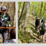 Trip Information
Departure Time: 09:30
Return to City Time: 17:00
Departure Point: York Mills Bus Pickup Click here for more information or to register Optional Items
Hosting Club: Toronto
Category: Bus Hike
Location (Google Maps): Halton Hills Hike Leader(s): Janet Patterson; Monica Pasquali; George Lennon Click here to contact Hike Leader(s) Pace: Leisurely (2-3 km/hr)
Terrain: Level 1 (Easy – mostly on flat, well maintained trails with hard-packed surface), Variable
Distance (km): approx 3 km Description
This outing is an experiment. It is a family-friendly event offering our members the chance to “give back”. NOTE: discounted bus fee ($20) and children accompanied by an adult ride the bus for free. Register your child/childern by selecting “add additional hiker” and adding their information (select “child” and no fare will be charged). The bus will deliver us to the trail head (Duff Pit), and on arrival, we will split into two groups. Group A will go off on a guided hike with members of the club’s Biodiversity Team, observing, identifying and perhaps even photographing the delightful flora and fauna we can discover. This will be a great way to gain points towards your Biodiversity Naturalist badge. Meanwhile, Group B will learn to identify and pull out the invasive garlic mustard that is proliferating there. We will have members of the Land Stewardship team and BTC Conservation Ambassadors guiding and supervising us, so no previous experience is necessary! We’ll meet back at the trail head for lunch, after which the groups will switch roles. So everyone will get a chance to explore the trails AND contribute to stewardship activities that support our ongoing efforts preserve and enhance the natural ecosystems along the trail. There’s even a badge for this! We hope you will support this new initiative. What to bring (& wear): - garden gloves if you have them
- Plenty of water (1L minimum)
- Lunch, snacks
- Sunscreen, insect repellent, wide-brimmed hat, long sleeves and long pants
- Sturdy shoes or boots
- A few reusable shopping bags if you have some
|
31 - Car Hike: Jefferson Forest and Bond Lake
8:00 AM-11:30 AM 05/31/2026 https://hikes.brucetrail.org/event/car-hike-jefferson-forest-and-bond-lake-richmond-hill-13/2026-05-31/ Click here for more information or to register Hosting Club: Toronto
Category: Car Hike
Location (Google Maps): 1245 Bethesda Side Rd, Richmond Hill, ON L4E 1A2 ( Bethesda Trail Head Parking lot) Hike Leader(s): Amir Alemohammad Click here to contact Hike Leader(s) Pace: Moderate (3-4 km/hr)
Terrain: Flat, Hilly, Level 2 (Intermediate – some hills and uneven surfaces, rocks and roots underfoot), Variable
Distance (km): 15-16 km Description
Let’s roll the hills of the Jefferson Forest and around the Bond Lake. Every week we hike in Jefferson Forest, located in the heart of Richmond Hill, it boasts numerous hiking trails. This 3.5 hour hike can range from 14 to 15 kilometres, depending on the weather conditions. Remember to bring water, snacks, hiking boots, poles, and your camera. Not recommended for beginners. Park in the free Bethesda parking lot and avoid parking along the road. Dress appropriately for the weather. Difficulty Level: 2 (Moderate). Please arrive @7:45AM for start of 8:00AM. This is a joint hike with the Oak Ridges Trail Association (ORTA). what3words: https://w3w.co/twisting.mailer.awakes
- School Bus Hike: Hockley Valley
8:30 AM-6:30 PM 05/31/2026 https://hikes.brucetrail.org/event/school-bus-hike-hockley-valley/2026-05-31/ Trip Information
Departure Time: 08:30
Return to City Time: 18:30
Departure Point: York Mills Bus Pickup Click here for more information or to register Optional Items
Pick up at HWY 400 & Major Mac ($0.01)
Hosting Club: Toronto
Category: Bus Hike
Location (Google Maps): Hockley Valley Hike Leader(s): Martina Furrer, Celia Ho, Leila Damband, Roland Mark Click here to contact Hike Leader(s) Pace: Brisk (4-5 km/hr), Moderate (3-4 km/hr)
Terrain: Hilly, Level 2 (Intermediate – some hills and uneven surfaces, rocks and roots underfoot), Variable
Distance (km): Fast (18 km), moderate (13 km) Description
Join us for an awesome hike with great views and fun hills. We will split into two groups and hike north from Hockley Valley Rd to Mono Centre. The moderate group will hike about 13 km and the fast about 18 km. Refreshments at Sonnen Hill (www.sonnenhill.com). Sit back, relax, and socialize with your hiking friends while you sip a fresh, cold, local brew (or non-alcoholic beverage) in their beautiful beer garden. Or walk up to their lookout for more great views (a 20 minute loop). Departure 1: 10 York Mills Rd at 8:30 AM Departure 2: HWY 400 & Major Mac Park and Ride at 8:50 AM We hope to be back in the city by 6:30 PM.
- Urban Walk: Humber River & High Park
10:00 AM-2:30 PM 05/31/2026 https://hikes.brucetrail.org/event/urban-walk-humber-river-valley-and-high-park-hike/2026-05-31/ 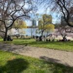 Click here for more information or to register Hosting Club: Toronto
Category: Urban Walk
Location (Google Maps): Royal York Subway Station, Grenview Blvd. exit Hike Leader(s): Ted Moriarty, Felix Wan Click here to contact Hike Leader(s) Pace: Moderate (3-4 km/hr)
Terrain: Level 2 (Intermediate – some hills and uneven surfaces, rocks and roots underfoot)
Distance (km): 11 km Description
Please join Ted on his ‘graduation hike’ to become a certified Toronto Bruce Trail Club Hike Leader. We’ll hike through some of west Toronto’s most scenic green spaces. We will begin by walking through Park Lawn Cemetery and at the Old Mill descend into the Humber River Valley. We’ll follow the valley trail south to the lakefront, walk along the Martin Goodman Trail boardwalk and explore High Park and surrounding neighbourhoods. The hike will conclude at Runnymede Station. Route map: https://onthegomap.com/?route=019c9129-e175-7169-8ed0-a3ad904bebfd&context=share The terrain is mostly flat but please note that we will be walking in to and out of two river valleys so there will be two hills to climb. Please bring a lunch or snacks and at least 2L of drinking water. Travel to the trailhead: - By TTC: Meet Ted and Felix at Royal York Station, Grenview Blvd. exit turnstiles.
- By car: Paid parking is available at two Green P lots:
- 11 Grenview Blvd. N across from the Grenview Blvd. exit.
- 7 Jackson Ave. – one block west of Grenview Blvd. running north off Bloor St.
Washrooms: There are no washrooms at Royal York Station. The closest subway washroom is at Kipling Station (two stops west of Royal York). During the 11k hike we will stop at three public washrooms located at kilometres 2, 6 and 8. Après-hike: There will be an optional après-hike stop at The Swan & Firkin (2205 Bloor St. West). Alternatively, hikers can explore the Bloor and Runnymede neighbourhood and visit one of the many pubs or cafes in the area.
| June | June | June | June | June | June |