|
Sun | Mon | Tue | Wed | Thu | Fri | Sat |
|---|
March | March | March | 1  Car Hike: Toronto End-to-End in 3 – #2 Car Hike: Toronto End-to-End in 3 – #2 8:30 AM-3:00 PM 04/01/2026 https://hikes.brucetrail.org/event/car-hike-toronto-end-to-end-in-3-2/2026-04-01/  Click here for more information or to register Hosting Club: Toronto
Category: Car Hike
Location (Google Maps): Meet again at km 17.4 on the east side of Fourth Line (GPS 43.615163, -79.975157). Please do not park in front of the junk yard. We’ll shuttle to roadside parking on the eastern shoulder of Eighth Line at the southernmost intersection with 27 Sideroad (GPS 43.686276, -79.975578) to begin our hike. Hike Leader(s): Jacqueline Van Dyke Click here to contact Hike Leader(s) Pace: Moderate (3-4 km/hr)
Terrain: Hilly, Rocky
Distance (km): 17 Description
This is the second of three hikes in this series to complete the Toronto E2E. We will be hiking in early spring conditions (mud, ice, snow) so be prepared for it all. Please have your icers, gaitors, and poles at the ready. Hiking boots/shoes are mandatory. We will stop for snacks and lunch so bring 2L of water, snacks, and your lunch. We will be shuttling to our starting point so please be prepared participate in the shuttle. Today we will be hiking past the “Hole in the Wall” in Limehouse.
| 2 - Car Hike: Toronto End-to-End in 3 – #3
8:30 AM-3:00 PM 04/02/2026 https://hikes.brucetrail.org/event/car-hike-toronto-end-to-end-in-3-3/2026-04-02/  Click here for more information or to register Hosting Club: Toronto
Category: Car Hike
Location (Google Maps): Meet at km 48.4, roadside parking at the end of Boston Mills Rd. (GPS 43.750866, -79.951452). Do not park in/on the driveway as it is private property. We’ll be creative with shuttling – doing a short shuttle to km 50.3 at the beginning, then a longer one to roadside parking on the eastern shoulder of Eighth Line at the southernmost intersection with 27 Sideroad (GPS 43.686276, -79.975578). Hike Leader(s): Jacqueline Van Dyke Click here to contact Hike Leader(s) Pace: Moderate (3-4 km/hr)
Terrain: Rocky, Variable
Distance (km): 16 Description
It’s the third of three hikes to complete the Toronto E2E and it’s badge day! Hikers may wish to visit the Spirit Tree after the hike. It’s early spring so mud may abound! Be prepared with poles and gaitors. Hiking boots/shoes are mandatory. We’ll stop for snacks and lunch so bring 2L of water, snacks, and your lunch. Be prepared to shuttle if you haven’t already had a turn.
 Urban Walk: Valley View Park Thornhill Urban Walk: Valley View Park Thornhill 9:30 AM-12:00 PM 04/02/2026 https://hikes.brucetrail.org/event/urban-walk-valley-view-park-thornhill-156/2026-04-02/ Click here for more information or to register Hosting Club: Toronto
Category: Urban Walk
Location (Google Maps): Parking lot is off Sycamore Drive, East of Bayview , across Starbucks plaza
Bus 91 from Finch East station stops at Sycamore station. Hike Leader(s): MOHAMMAD AGHAMIRI Click here to contact Hike Leader(s) Pace: Moderate (3-4 km/hr)
Terrain: Hilly, Level 2 (Intermediate – some hills and uneven surfaces, rocks and roots underfoot)
Distance (km): 6-7 km Description
We will explore Valleyview and Maple View parks, and walk along German Mill Creak, in return we stop in Huntington park and have snack under beautiful shed. Although this is considered an “Urban Walk”, you can expect some hills up and down and uneven surfaces with tree roots. Please bring hiking poles, Ice cleats water and snacks. phone number for the day of hike 289 58
| 3 | 4   School Bus Hike: Iroquoia E2E #5 of 8 School Bus Hike: Iroquoia E2E #5 of 8 8:30 AM-6:00 PM 04/04/2026 https://hikes.brucetrail.org/event/bus-hike-iroquoia-e2e-5-of-8/2026-04-04/  Trip Information
Departure Time: 08:30
Return to City Time: 18:00
Departure Point: Kipling Departure Point Click here for more information or to register Optional Items
Hiking ($.01)
Hosting Club: Toronto
Category: Bus Hike
Location (Google Maps): Dundas, ON to Waterdown, ON Hike Leader(s): Tom Swales, David Royle Click here to contact Hike Leader(s) Pace: Moderate (3-4 km/hr)
Terrain: Hilly, Level 2 (Intermediate – some hills and uneven surfaces, rocks and roots underfoot), Rocky, Variable
Distance (km): 14 km Description
We continue our Iroquoia section End-2-End series which we began in the Fall of 2025. Any capable hikers are welcome regardless if completing the End-2-End for one of the badges or not. Hikers can expect rocky portions and hills as the trail goes up and down the Niagara escarpment. The trail may be wet and muddy. We hope to maintain a steady pace of 4 km/hr. We resume whre we left off at Sydenham Lookout in Dundas. After 2,1/2 km we pass Rock Chapel Sanctuary and Borer’s Falls. We descend to Valey Road (4 km). After an asecent we continue along the escarpment to Old Guelph Rd/Hwy 6 (6 km). We continue through the Hwy 6 tunnel through Clappison Woods. and the steep ascent through Smokey Hollow to the Great Falls Lookout Point (12 km) where there will be an optional dropout. We continue another 2 km to King Road (14 km). We will reward our efforts with a refreshment stop in Waterdown, home of the Copper Kettle’s apple fritters. The distance may be modified according to our progress during the day.
- Car Hike: Bethesda Trail Richmond Hill 233
8:30 AM-1:00 PM 04/04/2026 https://hikes.brucetrail.org/event/car-hike-bethesda-trail-richmond-hill-39/2026-04-04/ Click here for more information or to register Hosting Club: Toronto Location (Google Maps): Oak Ridges Corridor, Bethesda Trail Head Parking Lot, Bethesda Side Road, Richmond Hill, Ontario Hike Leader(s): Mohammad Aghamiri Click here to contact Hike Leader(s) Pace: Moderate (3-4 km/hr)
Terrain: Hilly, Level 2 (Intermediate – some hills and uneven surfaces, rocks and roots underfoot), Variable
Distance (km): 14-15 km Description
Join us to explore the trails of York Regional Forest and the Oak Ridges Corridor at Jefferson Forest and Bond lake, From parking lot we hike thought Jefferson forest and continue to Bond Lake and have snack beside the lake and return to parking around 13 to 13.30 Please bring lots of water and snacks ,hiking poles are recommended phone number for the day of hike 289 588 6482
- Car Hike: Caledon Rail Trail
10:00 AM-3:00 PM 04/04/2026 https://hikes.brucetrail.org/event/car-hike-caledon-rail-trail-4/2026-04-04/ Click here for more information or to register Hosting Club: Toronto
Category: Car Hike
Location (Google Maps): Caledon Rail Trail from Inglewood to Caledon East. Hike Leader(s): Al Brown Click here to contact Hike Leader(s) Pace: Moderate (3-4 km/hr)
Terrain: Flat, Level 1 (Easy – mostly on flat, well maintained trails with hard-packed surface)
Distance (km): 12 km Description
This is a hike for those who have been cooped up all winter and want to get back to hiking. We will meet in Caledon East and car pool to Inglewood to start the hike. We will have a refreshment stop after in local area. The meeting place will be in the parking lot west of the Caledon Town Hall, east of the community centre. Go north on Airport Road from King Road to Caledon East. Turn east onto Old Church Road. Proceed about 1 km to the meeting spot on your right.
|
5  Hilton Falls Conservation Halton Hilton Falls Conservation Halton 8:00 AM-2:00 AM 04/05/2026 https://hikes.brucetrail.org/event/hilton-falls-conservation-halton/2026-04-05/  Click here for more information or to register Hosting Club: Iroquoia, Toronto
Category: General Hike
Location (Google Maps): Meet at Hilton Falls Conservation Park Parking lot.
Coordinates: 43.505705, -79.961589 Hike Leader(s): IgorT Click here to contact Hike Leader(s) Pace: Brisk – 4 to 5 km/hr, Medium – 3 to 4 km/hr
Terrain: Dependent on Conditions, Moderate – Some hills and/or some poor footing, Slippery and Steep Sections, Slippery Sections Likely
Distance: 16 Description
Join me to explore Hilton Falls. park entrance fee 10.50 plus tax per car, reservation required. https://www.conservationhalton.ca/parks/hilton-falls/ We going to hike thru beautiful forest, enjoy amazing views, 2 waterfalls. If you wish bring you treats, like marshmallows, hotdogs etc., we going to stop for break at campfire by the falls. Please read all details for this hike to ensure it is suitable for you. The pace and terrain are particularly important details. You must be registered to participate in this group hike. You cannot just show up as there are often people on the waitlist. Please pack whatever food you will require for a long day hike including lunch and snacks; 2l of water minimum; first aid kit; poles if you use them; and icers. You may also wish to pack extra socks and rain gear. Remember to dress in layers. Gloves/mitts, scarf / neck gator, a toque and a puffy jacket. Consider snow shoes, depending on conditions. We will help each other and wait for one another but please consider your physical ability before signing up for this hike. There are no drop outs – if you are not able to finish the hike you will need to arrange for transportation back to your car via taxi or Uber at your cost.
- Car Hike: Jefferson Forest (Richmond Hill)
9:00 AM-11:30 AM 04/05/2026 https://hikes.brucetrail.org/event/car-hike-jefferson-forest-richmond-hill-12/2026-04-05/  Click here for more information or to register Hosting Club: Toronto
Category: Car Hike
Location (Google Maps): 1245 Bethesda Side Rd, Richmond Hill, ON L4E 1A2 ( Bethesda Trail Head Parking lot) Hike Leader(s): Amir Alemohammad Click here to contact Hike Leader(s) Pace: Moderate (3-4 km/hr)
Terrain: Flat, Hilly, Level 2 (Intermediate – some hills and uneven surfaces, rocks and roots underfoot)
Distance (km): 10-11 km Description
Let’s roll the hills of the Jefferson Forest for s winter like hike in spring. Every weekend, we’ll explore the winter wonderland at this beautiful park. Located in the heart of Richmond Hill, it boasts numerous hiking trails. This 2,5 hour hike can range from 10 to 12 kilometres, depending on the weather conditions. Remember to bring water, snacks, hiking boots, icers, poles, and your camera. Not recommended for beginners. Park in the free Bethesda parking lot and avoid parking along the road. Dress appropriately for the weather. Difficulty Level: 2 (Moderate). Please arrive @8:45AM for start of 9:00AM. This is a joint hike with the Oak Ridges Trail Association (ORTA).
| 6 | 7 - Urban Walk: Valley View Park Thornhill
9:30 AM-12:00 PM 04/07/2026 https://hikes.brucetrail.org/event/urban-walk-valley-view-park-thornhill-157/2026-04-07/ Click here for more information or to register Hosting Club: Toronto Location (Google Maps): Parking lot is off Sycamore Drive, East of Bayview , across Starbucks plaza
Bus 91 from Finch East station stops at Sycamore station. Hike Leader(s): MOHAMMAD AGHAMIRI Click here to contact Hike Leader(s) Pace: Moderate (3-4 km/hr)
Terrain: Hilly, Level 2 (Intermediate – some hills and uneven surfaces, rocks and roots underfoot)
Distance (km): 6-7 km Description
We will explore Valleyview and Maple View parks, and walk along German Mill Creak, in return we stop in Huntington park and have snack under beautiful shed. Although this is considered an “Urban Walk”, you can expect some hills up and down and uneven surfaces with tree roots. Please bring hiking poles, Ice cleats water and snacks. phone number for the day of hike 289 58
| 8 | 9 - Urban Walk: Valley View Park Thornhill
9:30 AM-12:00 PM 04/09/2026 https://hikes.brucetrail.org/event/urban-walk-valley-view-park-thornhill-158/2026-04-09/ Click here for more information or to register Hosting Club: Toronto Location (Google Maps): Parking lot is off Sycamore Drive, East of Bayview , across Starbucks plaza
Bus 91 from Finch East station stops at Sycamore station. Hike Leader(s): MOHAMMAD AGHAMIRI Click here to contact Hike Leader(s) Pace: Moderate (3-4 km/hr)
Terrain: Hilly, Level 2 (Intermediate – some hills and uneven surfaces, rocks and roots underfoot)
Distance (km): 6-7 km Description
We will explore Valleyview and Maple View parks, and walk along German Mill Creak, in return we stop in Huntington park and have snack under beautiful shed. Although this is considered an “Urban Walk”, you can expect some hills up and down and uneven surfaces with tree roots. Please bring hiking poles, Ice cleats water and snacks. phone number for the day of hike 289 58
| 10 | 11 - Falling Water Badge (final hike of the series) – Cancelled Due To Low Registration
8:00 AM-6:30 PM 04/11/2026 https://hikes.brucetrail.org/event/did-someone-say-badge-two-day-falling-water-badge-school-bus-hike-2/2026-04-11/ Click here for more information or to register Hosting Club: Toronto
Category: Cancelled
Location (Google Maps): Beaver Valley Ski Club Hike Leader(s): Marijo Roy; Felix Wan Click here to contact Hike Leader(s) Pace: Brisk (4-5 km/hr)
Terrain: Challenging, Hilly, Level 3 (Advanced – steep hills and some scrambling over boulders), Variable
Distance (km): 12 Description
** Hike postpostponed due to low registration, to be re-scheduled to at later date ** Please join us for the last series to earn the Two-Day Falling Water badge. These beautiful hikes will take us on both the east and west sides of the Beaver Valley. The Falling Water section includes some challenging parts, with plenty of ups and downs and several steep sections. Those who complete the entire loop will receive the Two-Day Falling Water Triangle badge. The fee ($10.00 for members; $15.00 for non-members) will be collected on the bus at the start of the hike for those who opt to obtain the badge. This hike is suitable only for experienced, fit hikers. (BT Map #26) – Today, we’ll hike west on the Valley Crossover Side Trail, then head south to Hogg’s Falls, reaching kilometer 65.2. The total distance will be 12 km. A late return to Kipling Station is expected. Reminders:
1. Wear sturdy footwear and appropriate attire for the weather and the terrain (snow might be present).
2. Hiking poles are a good idea in any season, especially when the terrain is rocky or slippery.
3. Always carry I.D. and your health card.
4. Bring lunch, sufficient water, and snacks. A minimum of 2L of water is recommended.
5. Bring your own first aid kit. Looking forward to hiking with you, Marijo and Felix
- Rouge National Park Scarborough, ON
8:30 AM-1:15 PM 04/11/2026 https://hikes.brucetrail.org/event/rouge-national-park-scarborough-on/2026-04-11/ Click here for more information or to register Hosting Club: Toronto
Category: Car Hike
Location (Google Maps): Free parking in mast trail parking Lot off Kingston Road Hike Leader(s): MOHAMMAD AGHAMIRI Click here to contact Hike Leader(s) Pace: Moderate (3-4 km/hr)
Terrain: Hilly, Level 2 (Intermediate – some hills and uneven surfaces, rocks and roots underfoot)
Distance (km): 12-14 km Description
We will hike Vista trail and part of orchard trail, will enjoy look outs between Rouge river and Little Rouge creek
• Please dress appropriately for the weather.
• We will have short water ,picture and a 15 minute snack break. Everyone is welcome! Please bring lots of water and snacks ,hiking poles are recommended phone number for the day of hike 289 588 6482
- Urban Walk: Toronto Urban Badge Hike – 5 of 7
10:00 AM-1:00 PM 04/11/2026 https://hikes.brucetrail.org/event/urban-walk-toronto-urban-badge-hike-5-of-7-3/2026-04-11/  Click here for more information or to register Hosting Club: Toronto
Category: Urban Walk
Location (Google Maps): Toronto, Ontario, Canada Hike Leader(s): Brian Rideout Click here to contact Hike Leader(s) Pace: Moderate (3-4 km/hr)
Terrain: Flat
Distance (km): 9.6 km Description
Please join me at the north east corner of Bathurst and Finch by 10 AM. We will hike east on the Finch Hydro Corridor Trail and south along East Don Parklands to Sheppard and Leslie (km 41.6 to km 51.2). Here is an online map with km markings of our route for all 7 hikes for the Toronto Urban Badge: https://onthegomap.com/s/c2c1hf3n Please make sure you bring at least 2 liters of water, a lunch, bug spray and sunscreen.
- Car Hike: Forks of the Credit
10:00 AM-3:00 PM 04/11/2026 https://hikes.brucetrail.org/event/car-hike-forks-of-the-credit-6/2026-04-11/ Click here for more information or to register Hosting Club: Toronto, Caledon Hills
Category: Car Hike
Location (Google Maps): Forks of the Credit Provincial Park Hike Leader(s): Al Brown Click here to contact Hike Leader(s) Pace: Moderate (3-4 km/hr)
Terrain: Hilly, Level 2 (Intermediate – some hills and uneven surfaces, rocks and roots underfoot)
Distance (km): 12 km Description
We will complete a loop hike through the Park, crossing the Credit River above the Cataract Falls. The hike will take us by the the Cataract Falls and along the east bank of the Credit River then north through the main park past glacial features and old homesteads. Trail conditions should be dry. The meeting point is the intersection of Mississauga Road and Cataract Road. Parking is located on both sides of the road. Park in marked areas only.
|
12 - Toronto Side Trails Badge
8:00 AM-2:00 PM 04/12/2026 https://hikes.brucetrail.org/event/toronto-side-trails-badge/2026-04-12/  Click here for more information or to register Hosting Club: Iroquoia, Toronto
Category: General Hike
Location (Google Maps): 15 side road, coordinate: 43.577963, -79.977024 Hike Leader(s): IgorT Click here to contact Hike Leader(s) Pace: Medium – 3 to 4 km/hr
Terrain: Easy – Mostly flat and usually good footing, Moderate – Some hills and/or some poor footing
Distance: 15km Description
Join me to explore Bruce Trail Toronto section side trails. This is 1 of … hikes, future hikes will be posted later, towards the side trail badge, that awarded to hikers who completed 45km of side trails. Will meet at 15 side road (43.577963, -79.977024) And shuttle from there to start point at Hilton falls parking lot. Please be prepared to volunteer in car shuttle from parking lot to start of the hike. Please do not reserve parking yet. Contact myself for clarification. Park entrance fee 10.50 plus tax per car, reservation required.(https://www.conservationhalton.ca/parks/hilton-falls/) We will organize the shuttle at parking lot, and pay the sum to the driver who is shuttling. Please bring some change. We are going to hike through 3 side trails, total of 15km Please read all details for this hike to ensure it is suitable for you. The pace and terrain are particularly important details. You must be registered to participate in this group hike. You cannot just show up as there are often people on the waitlist. Please pack whatever food you will require for a day hike including lunch and snacks; 2l of water minimum; first aid kit; poles if you use them; and icers. You may also wish to pack extra socks and rain gear. Remember to dress in layers. Gloves/mitts, scarf / neck gator, a toque and a puffy jacket. We will help each other and wait for one another but please consider your physical ability before signing up for this hike. There are no drop outs – if you are not able to finish the hike you will need to arrange for transportation back to your car via taxi or Uber at your cost.
- Car Hike: Jefferson Forest and Bond Lake (Richmond Hill)
8:30 AM-12:00 PM 04/12/2026 https://hikes.brucetrail.org/event/car-hike-jefferson-forest-and-bond-lake-richmond-hill-9/2026-04-12/ Click here for more information or to register Hosting Club: Toronto
Category: Car Hike
Location (Google Maps): 1245 Bethesda Side Rd, Richmond Hill, ON L4E 1A2 ( Bethesda Trail Head Parking lot) Hike Leader(s): Amir Alemohammad Click here to contact Hike Leader(s) Pace: Moderate (3-4 km/hr)
Terrain: Flat, Hilly, Level 2 (Intermediate – some hills and uneven surfaces, rocks and roots underfoot)
Distance (km): 12-14 km Description
Let’s roll the hills of the Jefferson Forest and around the Bond Lake for s winter like hike in spring. Every weekend, we’ll explore the winter wonderland at this beautiful park. Located in the heart of Richmond Hill, it boasts numerous hiking trails. This 3.5 hour hike can range from 12 to 14 kilometres, depending on the weather conditions. Remember to bring water, snacks, hiking boots, icers, poles, and your camera. Not recommended for beginners. Park in the free Bethesda parking lot and avoid parking along the road. Dress appropriately for the weather. Difficulty Level: 2 (Moderate). Please arrive @8:45AM for start of 9:00AM. This is a joint hike with the Oak Ridges Trail Association (ORTA). what3words: https://w3w.co/twisting.mailer.awakes
| 13 | 14 - Urban Walk: Valley View Park Thornhill
9:30 AM-12:00 PM 04/14/2026 https://hikes.brucetrail.org/event/urban-walk-valley-view-park-thornhill-159/2026-04-14/ Click here for more information or to register Hosting Club: Toronto Location (Google Maps): Parking lot is off Sycamore Drive, East of Bayview , across Starbucks plaza
Bus 91 from Finch East station stops at Sycamore station. Hike Leader(s): MOHAMMAD AGHAMIRI Click here to contact Hike Leader(s) Pace: Moderate (3-4 km/hr)
Terrain: Hilly, Level 2 (Intermediate – some hills and uneven surfaces, rocks and roots underfoot)
Distance (km): 6-7 km Description
We will explore Valleyview and Maple View parks, and walk along German Mill Creak, in return we stop in Huntington park and have snack under beautiful shed. Although this is considered an “Urban Walk”, you can expect some hills up and down and uneven surfaces with tree roots. Please bring hiking poles, Ice cleats water and snacks. phone number for the day of hike 289 58
| 15 | 16 - Urban Walk: Valley View Park Thornhill
9:30 AM-12:00 PM 04/16/2026 https://hikes.brucetrail.org/event/urban-walk-valley-view-park-thornhill-160/2026-04-16/ Click here for more information or to register Hosting Club: Toronto Location (Google Maps): Parking lot is off Sycamore Drive, East of Bayview , across Starbucks plaza
Bus 91 from Finch East station stops at Sycamore station. Hike Leader(s): MOHAMMAD AGHAMIRI Click here to contact Hike Leader(s) Pace: Moderate (3-4 km/hr)
Terrain: Hilly, Level 2 (Intermediate – some hills and uneven surfaces, rocks and roots underfoot)
Distance (km): 6-7 km Description
We will explore Valleyview and Maple View parks, and walk along German Mill Creak, in return we stop in Huntington park and have snack under beautiful shed. Although this is considered an “Urban Walk”, you can expect some hills up and down and uneven surfaces with tree roots. Please bring hiking poles, Ice cleats water and snacks.
| 17 | 18 - School Bus Hike Iroquoia E2E #6 of 8
8:30 AM-6:00 PM 04/18/2026 https://hikes.brucetrail.org/event/bus-hike-iroquoia-e2e-6-of-8/2026-04-18/  Trip Information
Departure Time: 08:30
Return to City Time: 18:00
Departure Point: Kipling Departure Point Click here for more information or to register Optional Items
Hiking ($.01)
Hosting Club: Toronto
Category: Bus Hike
Location (Google Maps): Smokey Hollow to Mount Nemo Hike Leader(s): Tom Swales, Robin Crombie Click here to contact Hike Leader(s) Pace: Moderate (3-4 km/hr)
Terrain: Hilly, Level 2 (Intermediate – some hills and uneven surfaces, rocks and roots underfoot), Rocky, Variable
Distance (km): 16 km Description
We continue our Iroquoia section End-2-End series which we began in the Fall of 2025. Any capable hikers are welcome regardless if completing the End-2-End for one of the badges or not. Hikers can expect rocky portions and hills as the trail goes up and down the Niagara escarpment. The trail may be wet and muddy. We hope to maintain a steady pace of 4 km/hr. We resume where we left off on April 4th at King Road. The hike will proceed through Kerncliff Park and Cityview Park with views over to the Burlington Skyway Bridge. There will be some road work to reach Fisher’s Pond (7 km), a BTC protected area. We continue another 2,1/2 km to the Guelph Line. The section of trail between Guelph Line and Humberside Drive is closed for an unknown duration so the bus will take us to where the trail meets Humberside Road. There will be an option to drop out of continue on road fo another 3.6 km to the Walkers Line parking lot. We will have a refreshment stop in Burlington before returning to Kipling Station.
- Car Hike: Happy Valley King City
8:30 AM-1:15 PM 04/18/2026 https://hikes.brucetrail.org/event/car-hike-happy-valley-king-city-11/2026-04-18/ Click here for more information or to register Hosting Club: Toronto Location (Google Maps): Happy Valley, Oak Ridges Trail 16th Sideroad & Weston Road Please park along 16th Side road Hike Leader(s): Mohammad Aghamiri Click here to contact Hike Leader(s) Pace: Moderate (3-4 km/hr)
Terrain: Hilly, Level 2 (Intermediate – some hills and uneven surfaces, rocks and roots underfoot)
Distance (km): 12-14 km Description
Come and join us to view nice scenery and look out of Happy
- Car Hike: Uxbridge-Brock Track
8:30 AM-12:00 PM 04/18/2026 https://hikes.brucetrail.org/event/car-hike-uxbridge-brock-track-2/2026-04-18/ Click here for more information or to register Hosting Club: Toronto
Category: Car Hike
Location (Google Maps): Meet at the Brock Tract parking lot on the east side of Durham 1/Brock Rd., approximately 5 km south of Coppin’s Corners, Uxbridge or 1 km north of Uxbridge Pickering Town Line. 1401 Brock Rd. (Free parking). Hike Leader(s): Amir Alemohammad Click here to contact Hike Leader(s) Pace: Moderate (3-4 km/hr)
Terrain: Flat, Hilly, Level 2 (Intermediate – some hills and uneven surfaces, rocks and roots underfoot)
Distance (km): 14-15 Description
Join us for a wonderful hike in Uxbridge the capital trail of Canada, in starting from Brock Track parking lot. We will hike the Brock Track and Wilder Forest among the amazing trails of Uxbridge. Boots mandatory, poles recommended, bring 2 litres of water and dress according to weather conditions. Please arrive at 8:15 for a 8:30 start. Beware, Iphone Maps may take you to the wrong location. Check the location with Google Maps the previous night. This is a joint hike with Oak Ridges Trail Association (ORTA).
|
19 - Car Hike: Forks Of The Credit – Dog-Friendly hike
8:45 AM-3:00 PM 04/19/2026 https://hikes.brucetrail.org/event/car-hike-forks-of-the-credit-dog-friendly-hike/2026-04-19/ Click here for more information or to register Hosting Club: Toronto, Caledon Hills
Category: Car Hike
Location (Google Maps): Forks of the Credit Provincial Park Hike Leader(s): Lindita Kalo Click here to contact Hike Leader(s) Pace: Moderate (3-4 km/hr)
Terrain: Hilly, Level 2 (Intermediate – some hills and uneven surfaces, rocks and roots underfoot), Variable
Distance (km): 12km Description
Hello, I am exited to organize the first Dog-Friendly hike – a pilot program for the TBTC. My dog is an 2 years old Australian Sheppard, she is friendly with humans and other dogs. Dogs must be on leash. If you will be bringing your dog please read the Bruce Trail dog policy – https://brucetrail.org/dogs-on-the-trail/
This hike is a loop hike, we will return to parking lot. Reserve and pay for a daily Vehicle pass online at https://reservations.ontarioparks.com. If you are a badge hunter this hike is 1/4 of Caledon side trail badge. Future hikes TBA. Participants who register can expect at least one dog present on the hike.
Please don’t hesitate to contact me if any questions.
Best Regards,
Lindita
- Urban Walk: Toronto Urban Badge Hike – 5 of 7
10:00 AM-1:00 PM 04/19/2026 https://hikes.brucetrail.org/event/urban-walk-toronto-urban-badge-hike-5-of-7-4/2026-04-19/  Click here for more information or to register Hosting Club: Toronto
Category: Urban Walk
Location (Google Maps): Toronto, Ontario, Canada Hike Leader(s): Tom Swales Click here to contact Hike Leader(s) Pace: Moderate (3-4 km/hr)
Terrain: Flat
Distance (km): 9.6 km Description
Please join me at the north east corner of Bathurst and Finch by 10 AM. We will hike east on the Finch Hydro Corridor Trail and south along East Don Parklands to Sheppard and Leslie (km 41.6 to km 51.2). Here is an online map with km markings of our route for all 7 hikes for the Toronto Urban Badge: https://onthegomap.com/s/c2c1hf3n Please make sure you bring at least 2 liters of water, a lunch, bug spray and sunscreen.
- Urban Walk: Bloodroot Spring Flowers Hike: Meadowvale-Churchville Loop
11:00 AM-3:30 PM 04/19/2026 https://hikes.brucetrail.org/event/urban-walk-bloodroot-spring-flowers-hike-meadowvale-churchville-loop/2026-04-19/ 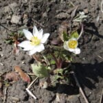 Click here for more information or to register Hosting Club: Toronto
Category: Urban Walk
Location (Google Maps): Meet me at Kipling Terminal by 9:15 for a 9:25 departure on MiWay bus #11. We will change to bus #42, leaving Goreway Dr North of Derry Rd at 10:01. Coming directly to the hike, park at Credit Valley Conservation Authority Parking, 1255 Old Derry Road, Mississauga. Please arrive by 10:50. Hike Leader(s): Andrew Proczek Click here to contact Hike Leader(s) Pace: Moderate (3-4 km/hr)
Terrain: Flat, Level 1 (Easy – mostly on flat, well maintained trails with hard-packed surface)
Distance (km): 10-11 km Description
Join me for a pleasant Spring Flowers Hike taking in the Bloodroot, and other Spring ephemerals. Bloodroot (Sanguinaria canadensis) grows in moist to dry woods and thickets, often on floodplains and near shores or streams. It is one of the earliest spring flowers and the white blooms last barely a week. The red juice from the underground stem was used by Native Americans as a dye for baskets, clothing, and war paint, as well as for insect repellent. The generic name, from the Latin sanguinarius, means “bleeding”. We will visit Terry Wilson and “Rosemary’s Garden” but this event will not include a Meadowvale Village Tour. The focus will be on hiking and spotting ephemerals. The hike will take us to Churchville in Brampton and we will return to Meadowvale by way of Levi Creek Valley, a tributary of the Credit River.
| 20 | 21 - Urban Walk: Valley View Park Thornhill
12:00 PM-2:00 PM 04/21/2026 https://hikes.brucetrail.org/event/urban-walk-valley-view-park-thornhill-161/2026-04-21/ Click here for more information or to register Hosting Club: Toronto Location (Google Maps): Parking lot is off Sycamore Drive, East of Bayview , across Starbucks plaza
Bus 91 from Finch East station stops at Sycamore station. Hike Leader(s): MOHAMMAD AGHAMIRI Click here to contact Hike Leader(s) Pace: Moderate (3-4 km/hr)
Terrain: Hilly, Level 2 (Intermediate – some hills and uneven surfaces, rocks and roots underfoot)
Distance (km): 6-7 km Description
We will explore Valleyview and Maple View parks, and walk along German Mill Creak, in return we stop in Huntington park and have snack under beautiful shed. Although this is considered an “Urban Walk”, you can expect some hills up and down and uneven surfaces with tree roots. Please bring hiking poles, Ice cleats water and snacks.
| 22 - Car Hike: Midweek Fitness Walk Around Island Lake (8.5 km)
10:30 AM-1:15 PM 04/22/2026 https://hikes.brucetrail.org/event/car-hike-midweek-fitness-walk-around-island-lake-8-5-km-4/2026-04-22/ Click here for more information or to register Hosting Club: Toronto
Category: Car Hike
Location (Google Maps): Island Lake Conservation Area (Hwy 10 and 4th Ave intersection) Hike Leader(s): Natalia Svechnikova Click here to contact Hike Leader(s) Pace: Moderate (3-4 km/hr)
Terrain: Flat
Distance (km): 9 km Description
Please join me for an enjoyable fitness walk (which is my first of the season) on a relatively flat and easy trail around the lake in the Island Lake Conservation area. The trail has treed sections as well as boardwalks near the water, meadows and more. I hope that we will see some nice spring flowers along the way. We will keep some steady but still comfortable pace of approximately 3-3.5 km/h. We will have a short break on the picnic area after about 6 km. Please dress for the weather and bring 2 L of water and some snacks/light lunch. We will meet at the start of the trail (near the large trail map) at 4th Ave and Hwy 10 intersection. You can park anywhere at the Zehrs Orangeville, Winners or Mark’s parking lot which is just across Hwy 10. Update from April 20, 3 pm: There is a construction affecting a section of the loop hike we are planning to hike. This section (and a boradwalk are closed). The entrance to the trail from the 4th Ave and Hwy 10 is accessible for hikers. We can park as I suggested near Zehrs and meet as planned at the start of the trail near the map; however, we cannot hike in a loop but would have to retrace our route back.Please see the notice for your info: https://cvc.ca/park-advisories/?filter_park=island-lake
| 23 - Fundraising Hike – Stained Glass Badge – Toronto Section in 2 and a half
9:00 AM-2:30 AM 04/23/2026 https://hikes.brucetrail.org/event/fundraising-hike-stained-glass-badge-toronto-section-in-2-and-a-half/2026-04-23/ This is a Multi-Day HikeYou are signing up for the following dates:
2026-04-23, 2026-04-30, 2026-05-01 Click here for more information or to register Hosting Club: Toronto, Beaver Valley Location (Google Maps): On Thursday April 23rd – Toronto Section KM 48.0 on Boston Mills Road west of Mississauga Road at 9 am
Details for April 30 & May 1 to be distributed after registration. Hike Leader(s): David Royston Click here to contact the hike leader. Pace: Medium
Terrain: Moderate, Some rocky footing, Some steep sections
Length of Hike: Varies Description
All 9 Stained Glass Badges over 3 years – Hike Series 4 – Toronto Section. We will complete an end to end of the Toronto Section (50 km) in 2 and a half days. The hikes will be (1) Cheltenham Badlands to Scotsdale Farm (2) Scotsdale Farm to Speyside, and (3) Speyside to km 0.0 just south of Hilton Falls Conservation Area. The detailed hike plan will be distributed to participants after they register. Parking options near km 0.0 are very limited and there will likely be an additional fee for parking at Hilton Falls Conservation Area. Final arrangements for that parking will be determined prior to the third hike. All hikes will proceed at a moderate pace (approx 4 km per hour not including a lunch stop). Breaks will be taken throughout each hike as appropriate. Hikes will proceed rain or shine. Except for shuttles, hikers are expected to be self reliant. Please bring everything you may need such as water, lunch, snacks, personal medical kit and appropriate footwear and clothing. At the start of the first hike participants will be expected to sign a waiver in favour of the hike leader similar to the one in favour of the BTC they sign on registration.
- Urban Walk: Valley View Park Thornhill
9:30 AM-12:00 PM 04/23/2026 https://hikes.brucetrail.org/event/urban-walk-valley-view-park-thornhill-162/2026-04-23/ Click here for more information or to register Hosting Club: Toronto Location (Google Maps): Parking lot is off Sycamore Drive, East of Bayview , across Starbucks plaza
Bus 91 from Finch East station stops at Sycamore station. Hike Leader(s): MOHAMMAD AGHAMIRI Click here to contact Hike Leader(s) Pace: Moderate (3-4 km/hr)
Terrain: Hilly, Level 2 (Intermediate – some hills and uneven surfaces, rocks and roots underfoot)
Distance (km): 6-7 km Description
We will explore Valleyview and Maple View parks, and walk along German Mill Creak, in return we stop in Huntington park and have snack under beautiful shed. Although this is considered an “Urban Walk”, you can expect some hills up and down and uneven surfaces with tree roots. Please bring hiking poles, Ice cleats water and snacks.
| 24 | 25 - Bus Hike: 2026 TBTC AGM Hikes and Meeting
8:00 AM-5:00 PM 04/25/2026 https://hikes.brucetrail.org/event/bus-hike-2026-tbtc-agm-hikes-and-meeting/2026-04-25/ Trip Information
Departure Time: 08:00
Return to City Time: 17:00
Departure Point: York Mills Bus Pickup Click here for more information or to register Optional Items
Hosting Club: Toronto
Category: Bus Hike
Location (Google Maps): Gellert Community Centre, Georgetown Hike Leader(s): Tom Swales Click here to contact Hike Leader(s) Distance (km): N/A Description
The bus will depart from the York Mills departure point to the Georgetown area for a morning of hiking followed by lunch and the 2026 TBTC AGM featuring guest speaker Nicola Ross, author of the Loopes and Lattes series of hiking guides, which often feature the Bruce Trail and Niagara Escarpment, and hundreds of magazine articles. Nicola has written on her multi-day adventures cycling, hiking, on horseback, and paddling. Note: You must register separately for the meeting at: https://torontobrucetrailclub.org/shop/agm2026/ Bus Fare is $20.00 for members and non-members. The TBTC Hike Leaders are pleased to offer you a choice of three hikes on this bus as listed below. You must register for the hike of your choice through the respective registration page. Please review the hike descriptions carefully to ensure you are signing up for a hike matching your interest and hiking ability. It would be helpful if you could finalize your hike choice before the date to avoid confusion and let us move to the hikes and to the Gellert Centre efficiently. Car Hikers may register for the hikes (meeting location will be advised) and meet the bus. (1) Forest Therapy/Shrinin-Yoku Slow Walk: https://hikes.brucetrail.org/event/tbtc-agm-forest-therapy-shinrin-yoku-slow-walk/2026-04-25/ Marijo and Olivier Roy (2) Exploring Biodiversity Along The Trail : https://hikes.brucetrail.org/event/agm-hike-explore-biodiversity-along-the-trail/2026-04-25/ Janet Patterson and George Lennon (3) Moderate Level Hike At Silver Creek: https://hikes.brucetrail.org/event/agm-hike-moderate-hike-at-silver-creek/2026-04-25/ Janet McColeman and Tom Swales Due to the time constraints to fit our hiking in before heading to the Gellert Centre for the meeting the longer distance In Search Of Walking Fern with Monica and hike at Terra Cotta with Lindita will only be available to Car Hikers.
- Car Hike: TBTC AGM Terra Cotta
8:15 AM-12:30 PM 04/25/2026 https://hikes.brucetrail.org/event/car-hike-tbtc-agm-terra-cotta/2026-04-25/ Click here for more information or to register Hosting Club: Toronto
Category: Car Hike
Location (Google Maps): Terra Cotta before TBTC AGM at the Gellert Centre in Georgetown Hike Leader(s): Lindita Kalo Click here to contact Hike Leader(s) Pace: Brisk (4-5 km/hr), Moderate (3-4 km/hr)
Terrain: Level 2 (Intermediate – some hills and uneven surfaces, rocks and roots underfoot), Variable
Distance (km): 10 km Description
This hike is a loop of Terra Cotta Side Trail and the main Bruce Trail, Please register for the AGM separately at: https://torontobrucetrailclub.org/shop/agm2026/
The hike will be moderate to brisk: 4-5km/hr. We will need to complete the loop and get to AGM by 12:45 latest to sign in for the meeting.
Location: Gellert Community Centre 10241 8th Line, Georgetown Our guest spaker this year is Nicola Ross, author of the Loopes and Lattes series of hiking guides, which often feature the Bruce Trail and Niagara Escarpment, and hundreds of magazine articles. Nicola has written on her multi-day adventures cycling, hiking, on horseback, and paddling. This hike will be a “Car Hike” only meaning hikers are responsible for their own transportation to the hike and AGM. More information will be sent to registered hikers before the hike.
- Hike of 2 lakes King city
8:30 AM-1:15 PM 04/25/2026 https://hikes.brucetrail.org/event/car-hike-glasgow-village-uxbridge-6/2026-04-25/ Click here for more information or to register Hosting Club: Toronto
Category: Car Hike
Location (Google Maps): Park along Fairfield Dr. or Dufferin Street, Gathering at trail head in Dufferin Street. Hike Leader(s): MOHAMMAD AGHAMIRI Click here to contact Hike Leader(s) Pace: Moderate (3-4 km/hr)
Terrain: Hilly, Level 2 (Intermediate – some hills and uneven surfaces, rocks and roots underfoot), Variable
Distance (km): 14-15 km Description
We will explore Seneca and Mary lakes and visit Eaton Hall . In the middle of hike we visit Pine Farm where you can have coffee,tea and delicious fruit pies. Some safety procedures during the hike: 1-Hikers must stay between the leader and the sweep. 2-Hikers must advise the leader or the sweep if they wish to leave the group. 3- Hikers must follow the whistle instructions: 1 blast- stay where you are; 2 blasts come to the leader; 3 blasts – come to the leader quickly. 4-Hike leader may request volunteers to stop at trail intersections, they need to help hikers to the direction the group walk and wait till they see the sweep . 5-Hikers have to make sure they can see the persons behind and in front of them. Please bring lots of water and snacks , hiking poles are recommended phone number for the day of hike 289 588 6482
- Car Hike: Walking the Bruce in search of Walking Fern
9:00 AM-12:00 PM 04/25/2026 https://hikes.brucetrail.org/event/car-hike-walking-the-bruce-in-search-of-walking-fern/2026-04-25/ 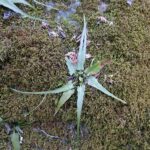 Click here for more information or to register Hosting Club: Toronto
Category: Car Hike
Location (Google Maps): We will meet at the Silver Creek Outdoor Education parking lot – coordinates are 43.692615, -79.968433. (Map 13 of the Bruce Trail Reference Guide, Edition 31). Hike Leader(s): Monica Pasquali; Ray Berzins Click here to contact Hike Leader(s) Pace: Leisurely (2-3 km/hr), Moderate (3-4 km/hr)
Terrain: Hilly, Level 2 (Intermediate – some hills and uneven surfaces, rocks and roots underfoot), Rocky
Distance (km): 8 km Description
Join me for a family-friendly trek through Silver Creek Conservation Area before the Toronto Bruce Trail Club’s Annual General Meeting on Saturday, April 25, 2026. We will hike up onto the escarpment via the Irwin Quarry Side Trail, taking in the views over Silver Creek Valley as we walk along the main trail. We will then descend the escarpment in order to do an out-and-back hike of the Walking Fern Side Trail to look for the Toronto Bruce Trail Club’s emblem: the Walking Fern. Next we will turn around and ascend the escarpment using the main trail before descending via the Roberts Side Trail where we will hopefully spot some interesting wetland wildlife as we walk along a beautiful boardwalk that borders a pretty pond. We will be hiking at a leisurely-moderate pace (approximately 3 km/hr) over technical (i.e. rocky) terrain for much of the hike, and the route will see us hiking up and down the escarpment a few times. We will take snack/hydration breaks as needed. You should bring enough water and food for a 2-3 hour hike, comfortable footwear with good traction, and appropriate clothing for the weather. Looking forward to finding the elusive Walking Fern with you on April 25th – see you then! Please note: You must register for the TBTC AGM on April 25th by purchasing your ticket here: https://torontobrucetrailclub.org/shop/agm2026/ (Early Bird ticket pricing is $20+tax in February and the price goes up to $25+tax after March 1st. Tickets always sell out so make sure you purchase yours asap!) Our guest speaker will be Nicola Ross, author of the Loops and Lattes series of hiking guides, which often feature the Bruce Trail and Niagara Escarpment, and hundreds of magazine articles. Nicola has written on her multi-day adventures cycling, hiking, on horseback, and paddling. The location of the AGM will be the Gellert Centre 10241 Eighth Line, Georgetown, ON L7G 4S5 This hike is a “Car Hike” meaning hikers are responsible for their own transportation to the trailhead and the AGM.
- AGM Hike: Explore Biodiversity along the Trail
9:00 AM-11:30 AM 04/25/2026 https://hikes.brucetrail.org/event/agm-hike-explore-biodiversity-along-the-trail/2026-04-25/  Click here for more information or to register Hosting Club: Toronto
Category: TBTC Special Events
Location (Google Maps): Silver Creek Hike Leader(s): Janet Patterson; George Lennon Click here to contact Hike Leader(s) Pace: Leisurely (2-3 km/hr)
Terrain: Variable Description
If you want to learn more about the flora and fauna (and even fungi) that flourish along the Bruce Trail, this hike is for you. Our small group will walk at a leisurely pace so that we can stop and observe our surroundings in more detail. This area boasts a variety of habitats for wildlife, including meadows, forests, ponds and streams. Bring your binoculars! Limited to 10 participants. If you require transportation from Toronto, you must register separately for the bus that will depart at 8:00 AM from, and return to, York Mills TTC station at: https://hikes.brucetrail.org/event/bus-hike-2026-tbtc-agm-hikes-and-meeting/2026-04-25/ ($20 Bus Fare) If you will be driving to meet us at the trailhead please let us know in the “Additional Information” field of the registration form. Our guest spaker this year for the AGM is Nicola Ross, author of the Loopes and Lattes series of hiking guides, which often feature the Bruce Trail and Niagara Escarpment, and hundreds of magazine articles. Nicola has written on her multi-day adventures cycling, hiking, on horseback, and paddling.
- AGM Hike: Moderate Level Hike At Silver Creek
9:15 AM-12:15 PM 04/25/2026 https://hikes.brucetrail.org/event/agm-hike-moderate-hike-at-silver-creek/2026-04-25/ Click here for more information or to register Hosting Club: Toronto
Category: TBTC Special Events
Location (Google Maps): Silver Creek Hike Leader(s): Tom Swales, Janet McColeman Click here to contact Hike Leader(s) Pace: Moderate (3-4 km/hr)
Terrain: Hilly, Level 2 (Intermediate – some hills and uneven surfaces, rocks and roots underfoot), Rocky
Distance (km): 7-8 km Description
Join us for a moderate level 2+ hike at Silver Creek in the morning before the Toronto Bruce Trail Club AGM. The area is very scenic but expect to be hiking at a moderate pace of 3-4 km/hour over rocky terrain with some hills going up and down the escarpment. Our hike would be a hike, at a minimum of 3km/hour, with photo opportunities. Starting on the main trail and moving over to the Maureen Smith and Bennett Heritage Side Trails to complete the loop with a diversion on 27 Sideroad by Silver Creek Falls. The bus from York Mills is full. Registration for the AGM Meeting/Lunch is at: https://torontobrucetrailclub.org/shop/agm2026/ If you wish to drive and meet us at the trailhead please let us know in the “Additional Information” field on the registration form. The speaker for our AGM will be Nicola Ross, author of the Loopes and Lattes series of hiking guides, which often feature the Bruce Trail and Niagara Escarpment, and hundreds of magazine articles. Nicola has written on her multi-day adventures cycling, hiking, on horseback, and paddling. The Gellert Centre is located at 10241 8th Line, Georgetown
- TBTC AGM – Forest Therapy/Shinrin-yoku Slow Walk
9:45 AM-12:15 PM 04/25/2026 https://hikes.brucetrail.org/event/tbtc-agm-forest-therapy-shinrin-yoku-slow-walk/2026-04-25/  Click here for more information or to register Hosting Club: Toronto
Category: TBTC Special Events
Location (Google Maps): Limehouse Conservation Area – Parking is available across from the Limehouse Public School. Hike Leader(s): Marijo Roy Click here to contact Hike Leader(s) Pace: Leisurely (2-3 km/hr)
Terrain: Level 1 (Easy – mostly on flat, well maintained trails with hard-packed surface)
Distance (km): n/a Description
Please join us for a Forest Therapy Slow Walk with Certified Forest Therapy Guide and Psychotherapist Nadia Frost. Nadia’s mission is “to provide education and guidance to individuals and groups on the benefits of forest therapy. She strives to create opportunities for everyone to connect with nature and, in doing so, contribute to better mental and physical health for all, while also caring for our natural environment”. After the hike, we will arrive at the Gellert Community Centre (10241 Eighth Line, Georgetown, ON L7G 4S5) by 12:45 pm at the latest for lunch before the AGM starts. You are encouraged to bring water for the 1.5-hour walk. Note that the forest therapy walk includes a tea ceremony, during which tea and snacks will be served. Make sure to wear comfortable footwear with good traction and appropriate clothing for the weather. NOTE: The bus will depart at 8:00 AM from the York Mills departure point to the Georgetown area for a morning of hiking, followed by lunch and the 2026 TBTC AGM featuring guest speaker Nicola Ross author of the Loops and Lattes Hiking Guides that often feature the Bruce Trail and trails around the Niagara Escarpment as well as articles on her many adventures by bicycle, walking, paddling, and horseback. This registration is for the Forest Therapy/Shinrin-yoku Slow Walk only.
IMPORTANT:
You must register for the AGM/Lunch separately at https://torontobrucetrailclub.org/shop/agm2026/
Participants intending to ride the bus must register and pay through the AGM Bus Hike registration at: https://hikes.brucetrail.org/event/bus-hike-2026-tbtc-agm-hikes-and-meeting/2026-04-25/ If you are planning to drive and meet us at the trailhead, please let us know in the “Additional Information” section of the registration form. Looking forward to walking with you, Marijo and Nadia
|
26 - Car Hike: Exploring Uxbridge Trails (Wilder Forest, Walker Woods, and Glen Major Forest)
8:30 AM-12:15 PM 04/26/2026 https://hikes.brucetrail.org/event/car-hike-exploring-uxbridge-trails-wilder-forest-walker-woods-and-glen-major-forest-19/2026-04-26/ Click here for more information or to register Hosting Club: Toronto
Category: Car Hike
Location (Google Maps): 2499 Brock Rd, Uxbridge, ON L9P 1R4. We will meet at the East Duffins Headwaters parking lot at the WILDER FOREST trail head. As soon as you got off the Brock Road, passing the horse back riding facility, there is a free designated parking lot 70 meters down the lane to your right. It includes a sign board for East Duffins Headwaters with a map of the trails. Please do not park on the lane or in the horse back riding property. Hike Leader(s): Amir Alemohammad Click here to contact Hike Leader(s) Pace: Moderate (3-4 km/hr)
Terrain: Hilly, Level 2 (Intermediate – some hills and uneven surfaces, rocks and roots underfoot)
Distance (km): Approx.15-16 Km Description
Join us for a delightful hike in Uxbridge, as we explore Wilder Forest, Walker Woods, and Glen Major Forest on a scenic loop starting from Brock Road. We’ll pass Concession Road 6, heading east and back, while also venturing onto several side trails for even more stunning views. What to Expect: •Beautiful scenic views and lookouts facing south •A mix of hilly and flat terrain •Frequent 2-minute breaks for hydration and photos, with a 10-15 minute snack stop •Stay on designated trails at all time What to Bring and Wear: •Hiking Boots and poles (recommended) and be prepared for the ice on the trail, keep your icers handy. •At least 2 liters of water •Your favorite snacks and lunch (pack your own refreshments for an outdoor meal) •Dress according to variable weather conditions! Important Details: •Stay on the designated trails •Be prepared for the elements and enjoy the adventure! Looking forward to seeing you on the trail! Don’t forget your camera and a smile as we explore the beauty of the Uxbridge trails! This is a joint hike with the Oak Ridges Trail Association (ORTA).
 Urban Walk: Hendrie Valley Sanctuary to West Harbour GO Station, Hamilton Urban Walk: Hendrie Valley Sanctuary to West Harbour GO Station, Hamilton 9:00 AM-2:30 PM 04/26/2026 https://hikes.brucetrail.org/event/urban-walk-hendrie-valley-sanctuary-to-west-harbour-go-station-hamilton-3/2026-04-26/ Click here for more information or to register Hosting Club: Toronto
Category: GO Train Hike
Location (Google Maps): Meet in the Great Hall of Union Station by the information desk with the clock with by 8:45 AM to take the Lakeshore West Express train towards Aldershot departing at 9:05 AM Hike Leader(s): Tom Swales Click here to contact Hike Leader(s) Pace: Moderate (3-4 km/hr)
Terrain: Hilly, Level 2 (Intermediate – some hills and uneven surfaces, rocks and roots underfoot), Variable
Distance (km): 12 km Description
From Aldershot GO Station we will hike to scenic Hidden Valley Park and the Hendrie Valley Sanctuary, a popular spot for birdlife. Then on to Burlington Heights and the Hamilton Waterfront Trail to catch the train back to Toronto from the West Harbour GO Station. Optional drop out at Burlington Heights by taking the local bus to Burlington GO Station. Optional pub stop at Fisher’s Pier 4 pub north of West Harbour GO Station.
- Car Hike: Spring Flowers in Hockley Valley, Map 18
10:00 AM-3:30 PM 04/26/2026 https://hikes.brucetrail.org/event/car-hike-spring-flowers-in-hockley-valley-map-18/2026-04-26/ Click here for more information or to register Hosting Club: Toronto, Caledon Hills
Category: Car Hike
Location (Google Maps): Hockley Valley Provincial Nature Reserve Hike Leader(s): Al Brown Click here to contact Hike Leader(s) Pace: Moderate (3-4 km/hr)
Terrain: Challenging, Hilly, Level 2 (Intermediate – some hills and uneven surfaces, rocks and roots underfoot)
Distance (km): 14 km Description
We will complete a loop hike through the nature reserve along one of the hilliest sections of the Trail. Spring flowers should be in bloom adding colour. After the hike those interested can meet for refreshments in the local area. To get to the meeting point drive north on Hwy 10 past Orangeville to Hockley Road. Turn right and go about 6 km to the parking area. It is across the road from the Black Birch restaurant.
| 27 | 28 - Urban Walk: Valley View Park Thornhill
9:30 AM-12:00 PM 04/28/2026 https://hikes.brucetrail.org/event/urban-walk-valley-view-park-thornhill-163/2026-04-28/ Click here for more information or to register Hosting Club: Toronto Location (Google Maps): Parking lot is off Sycamore Drive, East of Bayview , across Starbucks plaza
Bus 91 from Finch East station stops at Sycamore station. Hike Leader(s): MOHAMMAD AGHAMIRI Click here to contact Hike Leader(s) Pace: Moderate (3-4 km/hr)
Terrain: Hilly, Level 2 (Intermediate – some hills and uneven surfaces, rocks and roots underfoot)
Distance (km): 6-7 km Description
We will explore Valleyview and Maple View parks, and walk along German Mill Creak, in return we stop in Huntington park and have snack under beautiful shed. Although this is considered an “Urban Walk”, you can expect some hills up and down and uneven surfaces with tree roots. Please bring hiking poles, Ice cleats water and snacks.
| 29 | 30 - Urban Walk: Valley View Park Thornhill
9:30 AM-12:00 PM 04/30/2026 https://hikes.brucetrail.org/event/urban-walk-valley-view-park-thornhill-164/2026-04-30/ Click here for more information or to register Hosting Club: Toronto Location (Google Maps): Parking lot is off Sycamore Drive, East of Bayview , across Starbucks plaza
Bus 91 from Finch East station stops at Sycamore station. Hike Leader(s): MOHAMMAD AGHAMIRI Click here to contact Hike Leader(s) Pace: Moderate (3-4 km/hr)
Terrain: Hilly, Level 2 (Intermediate – some hills and uneven surfaces, rocks and roots underfoot)
Distance (km): 6-7 km Description
We will explore Valleyview and Maple View parks, and walk along German Mill Creak, in return we stop in Huntington park and have snack under beautiful shed. Although this is considered an “Urban Walk”, you can expect some hills up and down and uneven surfaces with tree roots. Please bring hiking poles, Ice cleats water and snacks.
| May | May |