|
Sun | Mon | Tue | Wed | Thu | Fri | Sat |
|---|
1  Car Hike: Jefferson Forest (Richmond Hill) Car Hike: Jefferson Forest (Richmond Hill) 9:00 AM-12:00 PM 03/01/2026 https://hikes.brucetrail.org/event/car-hike-jefferson-forest-richmond-hill-7/2026-03-01/ 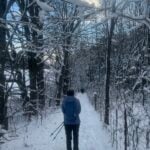 Click here for more information or to register Hosting Club: Toronto Location (Google Maps): 1245 Bethesda Side Rd, Richmond Hill, ON L4E 1A2 ( Bethesda Trail Head Parking lot) Hike Leader(s): Amir Alemohammad Click here to contact Hike Leader(s) Pace: Moderate (3-4 km/hr)
Terrain: Flat, Level 2 (Intermediate – some hills and uneven surfaces, rocks and roots underfoot), Variable
Distance (km): 10-12 Description
Let’s roll the hills of the Jefferson Forest this winter! Every weekend, we’ll explore the winter wonderland at this beautiful park. Located in the heart of Richmond Hill, it boasts numerous hiking trails. This 3-hour hike can range from 10 to 12 kilometres, depending on the weather conditions. Remember to bring water, snacks, hiking boots, icers, poles, and your camera. Not recommended for beginners. Park in the free Bethesda parking lot and avoid parking along the road. Dress appropriately for the weather. Difficulty Level: 2 (Moderate). Please arrive @8:45AM for start of 9:00AM. This is a joint hike with the Oak Ridges Trail Association (ORTA).
 Urban Walk: Sherwood Park/Sunnybrook Park Urban Walk: Sherwood Park/Sunnybrook Park 10:30 AM-1:30 PM 03/01/2026 https://hikes.brucetrail.org/event/urban-walk-sherwood-park-sunnybrook-park-5/2026-03-01/ Click here for more information or to register Hosting Club: Toronto
Category: Urban Walk
Location (Google Maps): NE Corner Yonge & Lawrence (by subway exit) Hike Leader(s): Tom Swales Click here to contact Hike Leader(s) Pace: Moderate (3-4 km/hr)
Terrain: Level 2 (Intermediate – some hills and uneven surfaces, rocks and roots underfoot), Variable
Distance (km): 12 KM Description
Join us for a hike through scenic ravines from Yonge & Lawrence to Sunnybrook & Serena Gundy parks to end at Laird Station of TTC Line 5 Icers (ice cleats) will be mandatory.
| 2  Toronto Winter Blues – Hike 6 Toronto Winter Blues – Hike 6 8:30 AM-1:30 PM 03/02/2026 https://hikes.brucetrail.org/event/toronto-winter-blues-hike-6/2026-03-02/ Click here for more information or to register Hosting Club: Iroquoia, Toronto
Category: General Hike
Location (Google Maps): Roadside Parking on Tenth Line Hike Leader(s): Pati Greenwood, Jeff Dowsett Click here to contact Hike Leader(s) Pace: Medium – 3 to 4 km/hr
Terrain: Dependent on Conditions, Moderate – Some hills and/or some poor footing
Distance: 12 km Description
This is a series of 6 hikes to explore various side trails in the Toronto Section of the Bruce Trail. Hikers completing all six hikes will be eligible to obtain the Toronto Side Trail Badge. Each hike requires a separate registration. The hikes in this series will take place on January 12, 26, February 2, 9, 23, and March 2. Hikes will be dependent on weather / travel conditions. All hikes will be undertaken at a medium pace. This hike, the final one of the series, will explore the Terra Cotta Side Trail as part of a loop around the Terra Cotta Conservation area. Dress in layers for the weather, wear appropriate hiking footwear, bring icers and hiking poles. Bring plenty of water or other hydration and a snack. Please arrive at the meeting place by 8:15 am. We will depart promptly at 8:30 am. If your plans change and you are unable to join the hike, please cancel your reservation in the My Hikes Section of the BTC website.
| 3 - Urban Walk: Valley View Park Thornhill 403
9:30 AM-12:00 PM 03/03/2026 https://hikes.brucetrail.org/event/urban-walk-valley-view-park-thornhill-147/2026-03-03/ Click here for more information or to register Hosting Club: Toronto Location (Google Maps): Parking lot is off Sycamore Drive, East of Bayview , across Starbucks plaza
Bus 91 from Finch East station stops at Sycamore station. Hike Leader(s): Mohammad Aghamiri Click here to contact Hike Leader(s) Pace: Moderate (3-4 km/hr)
Terrain: Hilly, Level 2 (Intermediate – some hills and uneven surfaces, rocks and roots underfoot), Variable
Distance (km): 6-7 km Description
We will explore Valleyview and Maple View parks, and walk along German Mill Creak, in return we stop in Huntington park and have snack under beautiful shed. Although this is considered an “Urban Walk”, you can expect some hills up and down and uneven surfaces with tree roots. Please bring hiking poles, Ice cleats water and snacks. phone number for the day of hike 289 588 6482
| 4 - Car Hike: Niagara Winter E2E in 5 – #3
8:30 AM-2:30 PM 03/04/2026 https://hikes.brucetrail.org/event/niagara-winter-e2e-in-5-3/2026-03-04/  Hike open to BTC Members only. Click here for more information or to register Hosting Club: Toronto
Category: Car Hike
Location (Google Maps): Rockway Conservation Area, near km 46.3,enter off Pelham Rd just east of Wessel Dr (15), 43.111255,-79.321901. Parking was free in 2025 but we may need to pay now so please be prepared for this. We will shuttle to Decew House Heritage Park, km 29.9, enter from Decew Rd (10), 43.107568,-79.249598 Hike Leader(s): Jacqueline Van Dyke Click here to contact Hike Leader(s) Pace: Brisk (4-5 km/hr), Moderate (3-4 km/hr)
Terrain: Variable
Distance (km): 17km Description
Come and join us for one or more of these hikes. The remaining two hikes are March 5 and 6. Hikers must register for individual hikes. Hikes are 14-18 kms and expect an average pace of 4 km/hr with snack/lunch breaks. Please arrive in time to be ready for our 8:30 departure. Hikers should be prepared for the season – layered clothing, hiking boots, icers, snowshoes (if we get fresh snowfall), poles, water, snacks/lunch, first aid kit, and icers. Hikers should be prepared to share their cars for shuttling – to be shared evenly. If we encounter unsafe hiking or driving conditions, I will cancel/re-schedule the hike the day before. If you are unable to join us on the day of the hike, please text me at 647-231-0946.
- Car Hike: Iroquoia Winter E2E 1/6
8:30 AM-3:00 PM 03/04/2026 https://hikes.brucetrail.org/event/car-hike-iroquoia-winter-e2e-1-6/2026-03-04/ Hike open to BTC Members only. Click here for more information or to register Hosting Club: Toronto
Category: Car Hike
Location (Google Maps): Twiss rd at #8. N 43.429065,W 79.927324 maps # 10, 11 km 96.8 Hike Leader(s): Smadar Junkin Click here to contact Hike Leader(s) Pace: Brisk (4-5 km/hr)
Terrain: Challenging, Level 3 (Advanced – steep hills and some scrambling over boulders), Variable
Distance (km): 23.5+ Description
First hike of 6 to complete the Iroquoia section for the winter badge. Please register to each day hike separately. We will car shuttle to Hilton Falls and walk back. About 0.5 km extra). Hilton Falls is a paid parking. If anyone has a parking pass please let me know. Everyone is expected to share in the paring cost. Hike is about 23.5 kms, + a walk to Hilton Falls from the 401 bridge. Bring icers, snowshoes and 2litres of water. Date may change due to extreme winter conditions. all hikers are expected to participate in the car shuttles.
| 5 - Car Hike: Iroquoia winter E2E 2/6
8:30 AM-3:00 PM 03/05/2026 https://hikes.brucetrail.org/event/car-hike-iroquoia-winter-e2e-2-6-3/2026-03-05/ Click here for more information or to register Hosting Club: Toronto
Category: Car Hike
Location (Google Maps): City View Park, north of km 75.3. Coordinates N 43.352308,W 79.862585 maps 9, 10 Hike Leader(s): Smadar Junkin Click here to contact Hike Leader(s) Pace: Brisk (4-5 km/hr)
Terrain: Challenging, Level 3 (Advanced – steep hills and some scrambling over boulders), Variable
Distance (km): 23.5 km Description
2nd hike of the Iroquoia winter E2E. We will car shuttle to Twiss rd and 8 and walk back. Please bring icers, snowshoes and 2 litres of water. Hike date may changed due to bad winter conditions. Be 15 minutes early. Expect to be moving at a pace of 4.5 km per hour.
- Car Hike: Niagara Winter E2E in 5 – #4
8:30 AM-2:30 PM 03/05/2026 https://hikes.brucetrail.org/event/car-hike-niagara-winter-e2e-in-5-4/2026-03-05/  Hike open to BTC Members only. Click here for more information or to register Hosting Club: Toronto
Category: Car Hike
Location (Google Maps): Meet at the parking area off of Cave Springs Rd, access main trail via Margaret Reed Side Trail, near km 64.9, GPS 43.150026,-79.446539. We will shuttle to Rockway CA, enter off Pelham Rd just east of Wessel Dr, near km 46.3, GPS 43.111255,-79.321901. Parking fee at Rockway CA will be shared among passengers and driver does not pay. Hike Leader(s): Jacqueline Van Dyke Click here to contact Hike Leader(s) Pace: Brisk (4-5 km/hr), Moderate (3-4 km/hr)
Terrain: Variable
Distance (km): 18km Description
Join us for one or more of these hikes! Hikers must register for individual hikes. Hikes are 14-18 kms and expect an average pace of 4 km/hr with snack/lunch breaks. Please arrive in time to be ready for our 8:30 departure. Hikers should be prepared for the season – layered clothing, hiking boots, icers, snowshoes (if we get fresh snowfall), poles, water, snacks/lunch, first aid kit, and icers. Hikers should be prepared to share their cars for shuttling – to be shared evenly. If we encounter unsafe hiking or driving conditions, I will cancel/re-schedule the hike the day before. If you are unable to join us on the day of the hike, please text me at 647-231-0946.
- Urban Walk: Valley View Park Thornhill
9:30 AM-12:00 PM 03/05/2026 https://hikes.brucetrail.org/event/urban-walk-valley-view-park-thornhill-148/2026-03-05/ Click here for more information or to register Hosting Club: Toronto Location (Google Maps): Parking lot is off Sycamore Drive, East of Bayview , across Starbucks plaza
Bus 91 from Finch East station stops at Sycamore station. Hike Leader(s): Mohammad Aghamiri Click here to contact Hike Leader(s) Pace: Moderate (3-4 km/hr)
Terrain: Hilly, Level 2 (Intermediate – some hills and uneven surfaces, rocks and roots underfoot), Variable
Distance (km): 6-7 km Description
We will explore Valleyview and Maple View parks, and walk along German Mill Creak, in return we stop in Huntington park and have snack under beautiful shed. Although this is considered an “Urban Walk”, you can expect some hills up and down and uneven surfaces with tree roots. Please bring hiking poles, Ice cleats water and snacks. phone number for the day of hike 289 588 6482
| 6 - Iroquoia Winter E2E 3/6
8:30 AM-3:00 PM 03/06/2026 https://hikes.brucetrail.org/event/iroquoia-winter-e2e-3-6-2/2026-03-06/ Hike open to BTC Members only. Click here for more information or to register Hosting Club: Toronto
Category: Car Hike
Location (Google Maps): Same as day 2. Hike Leader(s): Smadar Junkin Click here to contact Hike Leader(s) Pace: Brisk (4-5 km/hr)
Terrain: Challenging, Level 3 (Advanced – steep hills and some scrambling over boulders), Variable
Distance (km): 16.5 kms Description
We will meet at City View Park and shuttle to Sydenham Lookout and walk back. About 16.7 kms. Bring icers, snowshoes, 2 litres of water.
- Car Hike: Niagara Winter E2E in 5 – #5
8:30 AM-2:30 PM 03/06/2026 https://hikes.brucetrail.org/event/car-hike-niagara-winter-e2e-in-5-5/2026-03-06/  Hike open to BTC Members only. Click here for more information or to register Hosting Club: Toronto
Category: Car Hike
Location (Google Maps): Meet at the Grimsby Pool – 1 Elm St. Grimsby, 43.193201, -79.565301. We’ll shuttle to the parking area off of Cave Springs Rd and access the main trail via Margaret Reed Side Trail, near km 64.9, GPS 43.150026,-79.446539 to begin our hike. Hike Leader(s): Jacqueline Van Dyke Click here to contact Hike Leader(s) Pace: Brisk (4-5 km/hr), Moderate (3-4 km/hr)
Terrain: Variable
Distance (km): 17km Description
This is the last hike of this Niagara E2E and therefore, badge day for hikers who have completed the Niagara section. Please have $10 ready if you wish to purchase a Winter E2E badge. Hikers should be prepared for the season – layered clothing, hiking boots, icers, snowshoes (if we get fresh snowfall), poles, water, snacks/lunch, first aid kit, and icers. Please arrive so that you’re ready to leave with our 8:30 shuttle. Hikers should be prepared to share their cars for shuttling – to be shared evenly. If we encounter unsafe hiking or driving conditions, I will cancel/re-schedule the hike the day before. If you are unable to join us on the day of the hike, please text me at 647-231-0946.
| 7 - Car Hike: Bethesda Trail Richmond Hill
8:30 AM-1:15 PM 03/07/2026 https://hikes.brucetrail.org/event/car-hike-bethesda-trail-richmond-hill-40/2026-03-07/ Click here for more information or to register Hosting Club: Toronto
Category: Car Hike
Location (Google Maps): Oak Ridges Corridor, Bethesda Trail Head Parking Lot, Bethesda Side Road, Richmond Hill, Ontario Hike Leader(s): Mohammad Aghamiri Click here to contact Hike Leader(s) Pace: Moderate (3-4 km/hr)
Terrain: Hilly, Level 2 (Intermediate – some hills and uneven surfaces, rocks and roots underfoot), Variable
Distance (km): 14-15 km Description
Join us to explore the trails of York Regional Forest and the Oak Ridges Corridor at Jefferson Forest and Bond lake, From parking lot we hike thought Jefferson forest and continue to Bond Lake and have snack beside the lake and return to parking around 13 to 13.30 Please bring lots of water and snacks ,hiking poles are recommended phone number for the day of hike 289 588 6482
- Car Hike Dufferin Hi-Land End2End 2/4
8:30 AM-3:30 PM 03/07/2026 https://hikes.brucetrail.org/event/car-hike-dufferin-hi-land-end2end-2-4/2026-03-07/ Click here for more information or to register Hosting Club: Toronto, Dufferin Hi-Land
Category: Car Hike
Location (Google Maps): Roadside Parking – on Prince of Wales Rd just off 20 Sideroad. GPS N44.200231, W80.164257. Km 40.7, Map 21, Edition 31 Hike Leader(s): Ross Estrella Click here to contact Hike Leader(s) Pace: Moderate (3-4 km/hr)
Terrain: Challenging, Hilly, Level 2 (Intermediate – some hills and uneven surfaces, rocks and roots underfoot), Rocky
Distance (km): 18 Description
This is DHBTC E2E in 4. E2E hikers are rewarded the club coveted E2E badge upon completion. However, joiners must complete the four series hikes to earn their badge. Missed segment/s must be made up prior to the completion of the last leg to receive their badge. We’ll be on a moderate pace to enjoy, see and feel the stunning landscape and acquaint ourselves with the other souls on the group. Day hikes essentials to bring, lunch/snacks, sufficient preferred liquid hydration, sun screen, bug spray, head covering for sun protection, appropriate clothing for the weather, personal medication/s (if any), health card, happy face and your enthusiasm. Hiking shoes and poles are highly recommended. Please note that “Icers are Mandatory” to carry from the on set of Winter to mid-April. Showing up at meet up location for non-compliance will result to be refuse joining the group. Make sure you and your car are shuttle ready as everybody are expected to participate. Cost of badge is 10 dollars for BTC member and 15 dollars for non-member. Please arrive fifteen minutes early for car shuttling. This is a H4H-H4F !!! hike. If this schedule suits you, your welcome to join. Note: To reach the specific parking lot location, use GPS Coordinates, specified in the meet-up location above.
  School Bus Hike Toronto Section Winter Badge End to End #5 of 6 School Bus Hike Toronto Section Winter Badge End to End #5 of 6 8:30 AM-6:00 PM 03/07/2026 https://hikes.brucetrail.org/event/school-bus-hike-toronto-section-winter-badge-end-to-end-5-of-6/2026-03-07/ Trip Information
Departure Time: 08:30
Return to City Time: 18:00
Departure Point: York Mills Bus Pickup Click here for more information or to register Optional Items
Hosting Club: Toronto
Category: Bus Hike
Location (Google Maps): Toronto Section, Silver Creek/Terra Cotta Hike Leader(s): George Lennon, Janet Patterson Click here to contact Hike Leader(s) Pace: Leisurely (2-3 km/hr)
Terrain: Challenging, Level 2 (Intermediate – some hills and uneven surfaces, rocks and roots underfoot), Variable
Distance: 10 km Description
We will be hiking in winter conditions of ice and snow so these will be slower and shorter hikes than in other seasons. Icers or snowshoes are mandatory, and gaiters and poles recommended. The terrain is not too hilly, but the footing is treacherous in winter with many uneven, rocky sections to navigate. The leaders will let registrants know in advance if snowshoes are feasible for the day. Please bring at least 2L of water, snacks, and your lunch. Any hikers are welcome to join the hikes regardless of whether a person is working towards a badge. Those who complete all 6 hikes will qualify for the Toronto club’s Winter E2E badge. The fee is $10 per badge ($15 for non-members) and will be collected by the hike leader on trip #4. Or you may choose to purchase the special Fundraising End to End badge for $30. This fifth hike in the series will take us through Silver Creek and Terra Cotta Conservation Areas from the Eighth Line side trail to the Terra Cotta parking lot on Winston Churchill Blvd. There will be a refreshment/social stop in Georgetown after the hike before returning to the York Mills Station departure point by 6:00 PM.
|
8 - Car Hike: Jefferson Forest (Richmond Hill)
9:00 AM-12:00 PM 03/08/2026 https://hikes.brucetrail.org/event/car-hike-jefferson-forest-richmond-hill-8/2026-03-08/ Click here for more information or to register Hosting Club: Toronto
Category: Car Hike
Location (Google Maps): 1245 Bethesda Side Rd, Richmond Hill, ON L4E 1A2 ( Bethesda Trail Head Parking lot) Hike Leader(s): Amir Alemohammad Click here to contact Hike Leader(s) Pace: Moderate (3-4 km/hr)
Terrain: Flat, Hilly, Level 2 (Intermediate – some hills and uneven surfaces, rocks and roots underfoot)
Distance (km): 10-11 Description
Let’s roll the hills of the Jefferson Forest this winter! Every weekend, we’ll explore the winter wonderland at this beautiful park. Located in the heart of Richmond Hill, it boasts numerous hiking trails. This 3-hour hike can range from 10 to 12 kilometres, depending on the weather conditions. Remember to bring water, snacks, hiking boots, icers, poles, and your camera. Not recommended for beginners. Park in the free Bethesda parking lot and avoid parking along the road. Dress appropriately for the weather. Difficulty Level: 2 (Moderate). Please arrive @8:45AM for start of 9:00AM. This is a joint hike with the Oak Ridges Trail Association (ORTA).
- Car Hike: Hike #4 of 5 to earn the Toronto Side Trails Badge!
9:30 AM-2:30 PM 03/08/2026 https://hikes.brucetrail.org/event/car-hike-hike-4-of-5-to-earn-the-toronto-side-trails-badge/2026-03-08/  Click here for more information or to register Hosting Club: Toronto
Category: Car Hike
Location (Google Maps): We will meet at the Trafalgar & 401 Commuter Lot (43.571569, -79.831797) and then carpool to the start of the hike. Hike Leader(s): Monica Pasquali Click here to contact Hike Leader(s) Pace: Leisurely (2-3 km/hr), Moderate (3-4 km/hr)
Terrain: Level 2 (Intermediate – some hills and uneven surfaces, rocks and roots underfoot)
Distance (km): 10.8 km Description
This is the fourth in a series of five hikes that will be offered approximately one Sunday per month so that participants can earn the Toronto Side Trails Badge during the winter and early spring. Each out-and-back hike will cover a distance of 8-11 km and be hiked at a leisurely to moderate pace (approximately 3 km/h). Please note that the hikes will be posted separately on the BTC calendar – you will have to register for each hike that you’re interested in joining. For this fourth hike we will explore one long side trail in the Toronto section of the Bruce Trail: the Vanderleck Side Trail. Please dress appropriately for a winter hike by dressing in layers (wear an inner layer that wicks sweat away from your skin, a middle layer that keeps you warm, and an outer layer that protects you from wind and snow), wearing gloves/mittens and a toque, and wearing warm and comfortable footwear that has good traction in snow/ice (icers placed over your boots work great!). Hiking poles or walking sticks are an asset since they will help keep you balanced if the ground is slippery. As well, make sure you bring enough water and food for a 4 hour hike since we’ll be covering a total distance of 10.8 km over terrain that has some hills and exposed rocks. Since parking might be limited at the places we’ll be hiking in this hike series, we will meet at the Trafalgar & 401 Commuter Lot (43.571569, -79.831797) and then carpool to the start of each hike. Please be prepared to participate in each carpool by ensuring you have space in your car if you are not already carpooling with others to the Commuter Lot meeting point. After the hike, interested participants can join me at the Tim Horton’s on Trafalgar Road just a bit south of Highway 401 for some post-hike refreshment. Looking forward to exploring some of Toronto’s side trails with you!
- Urban Walk – Toronto Urban Badge Hike – 3 of 7
10:00 AM-1:00 PM 03/08/2026 https://hikes.brucetrail.org/event/urban-walk-toronto-urban-badge-hike-3-of-7-4/2026-03-08/  Click here for more information or to register Hosting Club: Toronto
Category: Urban Walk
Location (Google Maps): Toronto Waterfront Trail Hike Leader(s): Brian Rideout Click here to contact Hike Leader(s) Pace: Moderate (3-4 km/hr)
Terrain: Flat
Distance (km): 10.4 km Description
Please join me at the south west corner of Lakeshore Blvd West and Ellis by 10 AM. We will hike east along the Waterfront Trail to the Distillery District (km 8.3 to km 71.4). Here is an online map with km markings of our route for all 7 hikes for the Toronto Urban Badge. https://onthegomap.com/s/c2c1hf3n Please make sure you bring at least 2 liters of water, a lunch, and icers.
- Urban Walk: International Women’s Day Hike – all are welcome
10:00 AM-2:00 PM 03/08/2026 https://hikes.brucetrail.org/event/urban-walk-international-womens-day-hike-all-are-welcome/2026-03-08/  Click here for more information or to register Hosting Club: Toronto, Beaver Valley
Category: Urban Walk
Location (Google Maps): Meet at Matt Cohen Park on South East corner of Spadina and Bloor across from JCC and Scotia Bank
Toronto Nordheimer Ravine to Cedarvale Ravine through Wychwood park. Hike Leader(s): Marina Wray and Marijo Roy Click here to contact Hike Leader(s) Pace: Moderate (3-4 km/hr)
Terrain: Flat, Level 2 (Intermediate – some hills and uneven surfaces, rocks and roots underfoot), Other (Refer to Description)
Distance (km): 10 km Description
Join Marina on her “graduation hike” to become a certified TBTC Hike Leader. The hike is open to members and non members, to all who want to celebrate IWD and support women, community, nature, and movement. The hike will follow part of the route of Castle Frank Brook, a waterway that once carved a path through midtown Toronto until the 1930’s, when it was buried. We’ll hike some of its stream valleys that now make up part of Toronto’s ravine system. What to expect: We’ll start our hike from Matt Cohen Park close to Spadina TTC station and head to Roycroft park and the Nordheimer Ravine trail where the CFB flowed. We’ll cross over to Cedarvale Ravine, where the trail offers short glimpses of water from the Brook. On our hike we’ll see signs of spring in the cattail wetlands. We’ll pass a 200 year-old elm tree and hike through Toronto’s historic Wychwood Park and see Taddle Creek pond. The Hike will finish at Bathurst and Dupont streets, a short bus ride or walking distance to Bathurst Subway station. Everyone is welcome to join us for a post hike bite and refreshment at Annex Social on Bathurst Street. The hike goes ahead rain, snow or shine What to Bring: **The pathways in the ravine can be icy so ice traction footwear such as Crampon’s or Yaktrax are mandatory** •Bring water, and snacks
• Dress in layers Thank you Marina and Marijo
| 9 | 10 - Car Hike: Iroquoia Winter E2E 4/6
8:30 AM-3:30 PM 03/10/2026 https://hikes.brucetrail.org/event/car-hike-iroquoia-winter-e2e-4-6-3/2026-03-10/ Hike open to BTC Members only. Click here for more information or to register Hosting Club: Toronto
Category: Car Hike
Location (Google Maps): Km 38.6, Chedoke Civic Golf Club. N 43.246205,W 79.906935 map 8 Hike Leader(s): Smadar Junkin Click here to contact Hike Leader(s) Pace: Brisk (4-5 km/hr)
Terrain: Challenging, Level 3 (Advanced – steep hills and some scrambling over boulders), Variable
Distance (km): 20 km Description
4th hike in the winter E2E series. We will car shuttle to km 58.8, Sydenham Lookout and hike back. Please bring icers, snowshoes and 2 litres of water. Hike date may changed due to bad winter conditions. Come 15 minutes early. Hikers are expected to move at a pace of 4.5 km per hour.
- Urban Walk:: Valley View Park Thornhill
9:30 AM-12:00 PM 03/10/2026 https://hikes.brucetrail.org/event/urban-walk-valley-view-park-thornhill-149/2026-03-10/ Click here for more information or to register Hosting Club: Toronto Location (Google Maps): Parking lot is off Sycamore Drive, East of Bayview , across Starbucks plaza
Bus 91 from Finch East station stops at Sycamore station. Hike Leader(s): Mohammad Aghamiri Click here to contact Hike Leader(s) Pace: Moderate (3-4 km/hr)
Terrain: Hilly, Level 2 (Intermediate – some hills and uneven surfaces, rocks and roots underfoot), Variable
Distance (km): 6-7 km Description
We will explore Valleyview and Maple View parks, and walk along German Mill Creak, in return we stop in Huntington park and have snack under beautiful shed. Although this is considered an “Urban Walk”, you can expect some hills up and down and uneven surfaces with tree roots. Please bring hiking poles, Ice cleats water and snacks. phone number for the day of hike 289 588 6482
| 11 - Car Hike: Iroquoia Winter E2E 5/6
8:30 AM-3:00 PM 03/11/2026 https://hikes.brucetrail.org/event/car-hike-iroquoia-winter-e2e-5-6-2/2026-03-11/ Click here for more information or to register Hosting Club: Toronto
Category: Car Hike
Location (Google Maps): Chedoke Civic Golf Club. N 43.246205,W 79.906935 map 6, 7 Hike Leader(s): Smadar junkin Click here to contact Hike Leader(s) Pace: Brisk (4-5 km/hr)
Terrain: Challenging, Level 3 (Advanced – steep hills and some scrambling over boulders), Variable
Distance (km): 18 kms Description
This is the 5th hike towards the winter E2E badge. We will car shuttle to km 22.0 Veever Park Side Trail, Green Hill Ave and hike back. Bring icers, snowshoes and two litters of water. Arrive 15 minutes early. Hikers are expected to hike in a pace of 4.5 km per hour.
| 12 - Car Hike: Iroquoia winter E2E, hike 6/6
8:30 AM-3:00 PM 03/12/2026 https://hikes.brucetrail.org/event/car-hike-iroquoia-winter-e2e-hike-6-6/2026-03-12/ Hike open to BTC Members only. Click here for more information or to register Hosting Club: Toronto
Category: Car Hike
Location (Google Maps): Grimsby Lions Community Pool, Elm street, N 43.193201,W 79.565301 Hike Leader(s): Smadar Junkin Click here to contact Hike Leader(s) Pace: Brisk (4-5 km/hr)
Terrain: Level 3 (Advanced – steep hills and some scrambling over boulders)
Distance (km): 22 km Description
Badge day, treats day. Bring 2 litres of water. Bring icers and snowshoes to be able to hike in any trail conditions. Date of hike may need to be changed due to bad winter weather conditions. Please arrive 15 minutes early. Hikers are expected to walk at a 4.5 km per hour. We will car shuttle to Greenhill Ave Veever Park and hike back.
- Car Hike: Iroquoia End-to-End in 7: Hike 1
8:30 AM-3:00 PM 03/12/2026 https://hikes.brucetrail.org/event/car-hike-iroquoia-end-to-end-in-7-hike-1/2026-03-12/  Hike open to BTC Members only. Click here for more information or to register Hosting Club: Toronto
Category: Car Hike
Location (Google Maps): Meet at the Grimsby Pool, 1 Elm St at the south end of Coronation Park (GPS 43.193201, -79.565301). We’ll shuttle to the Oakridge Dr. Access Trail, km 18.2, roadside parking (GPS 43.213943, -79.742417) to begin our hike. Hike Leader(s): Jacqueline Van Dyke Click here to contact Hike Leader(s) Pace: Brisk (4-5 km/hr), Moderate (3-4 km/hr)
Terrain: Variable
Distance (km): 19 Description
Please join for one or more of this Iroquoia series to complete the section over 7 hikes. Hikers must register for individual hikes. Expect an average pace of 4 km/hr with snack/lunch breaks. Please arrive 15 minutes early so you’re ready for the shuttle to begin promptly at 8:30. Hikers should be prepared for the season – layered clothing, hiking boots, snowshoes (if we get fresh snowfall), poles, water, snacks/lunch, first aid kit, and icers. Hikers should be prepared to share their cars for shuttling – to be shared evenly. If we encounter unsafe hiking or driving conditions, I will cancel/re-schedule the hike the day before. If you are unable to join us on the day of the hike, please text me at 647-231-0946.
- Urban Walk: Valley View Park Thornhill
9:30 AM-11:45 AM 03/12/2026 https://hikes.brucetrail.org/event/urban-walk-valley-view-park-thornhill-150/2026-03-12/ Click here for more information or to register Hosting Club: Toronto Location (Google Maps): Parking lot is off Sycamore Drive, East of Bayview , across Starbucks plaza
Bus 91 from Finch East station stops at Sycamore station. Hike Leader(s): Mohammad Aghamiri Click here to contact Hike Leader(s) Pace: Moderate (3-4 km/hr)
Terrain: Hilly, Level 2 (Intermediate – some hills and uneven surfaces, rocks and roots underfoot), Variable
Distance (km): 6-7 km Description
We will explore Valleyview and Maple View parks, and walk along German Mill Creak, in return we stop in Huntington park and have snack under beautiful shed. Although this is considered an “Urban Walk”, you can expect some hills up and down and uneven surfaces with tree roots. Please bring hiking poles, Ice cleats water and snacks. phone number for the day of hike 289 588 6482
| 13 - Car Hike: Iroquoia End-to-End in 7: Hike 2
8:30 AM-3:00 PM 03/13/2026 https://hikes.brucetrail.org/event/car-hike-iroquoia-end-to-end-in-7-hike-2/2026-03-13/  Hike open to BTC Members only. Click here for more information or to register Hosting Club: Toronto
Category: Car Hike
Location (Google Maps): Meet at the Oakridge Dr. Access Trail, km 18.2 (GPS 43.213943, -79.742417) and we’ll shuttle to the Hillcrest Ave. ST, km 37.1 (GPS 43.246437, -79.892130) to begin our hike. Hike Leader(s): Jacqueline Van Dyke Click here to contact Hike Leader(s) Pace: Brisk (4-5 km/hr), Moderate (3-4 km/hr)
Terrain: Variable
Distance (km): 19 Description
Please join for one or more of this Iroquoia series to complete the section over 7 hikes. Hikers must register for individual hikes. Expect an average pace of 4 km/hr with snack/lunch breaks. Please arrive 15 minutes early so you’re ready for the shuttle to begin promptly at 8:30. Hikers should be prepared for the season – layered clothing, hiking boots, snowshoes (if we get fresh snowfall), poles, water, snacks/lunch, first aid kit, and icers. Hikers should be prepared to share their cars for shuttling – to be shared evenly. If we encounter unsafe hiking or driving conditions, I will cancel/re-schedule the hike the day before. If you are unable to join us on the day of the hike, please text me at 647-231-0946
| 14 - School Bus Hike Toronto Section Winter Badge End to End #6 of 6/Friendly Moderate Hike Bruce Trail/Terra Cotta/Caledon Trailway
8:30 AM-6:00 PM 03/14/2026 https://hikes.brucetrail.org/event/school-bus-hike-toronto-section-winter-badge-end-to-end-6-of-6/2026-03-14/ Trip Information
Departure Time: 08:30
Return to City Time: 18:00
Departure Point: York Mills Bus Pickup Click here for more information or to register Optional Items
Hosting Club: Toronto
Category: Bus Hike
Location (Google Maps): Toronto Section, Terra Cotta – Cheltenham Hike Leader(s): George Lennon, Tom Swales, Ted Moriarty Click here to contact Hike Leader(s) Pace: Leisurely (2-3 km/hr)
Terrain: Challenging, Level 2 (Intermediate – some hills and uneven surfaces, rocks and roots underfoot), Variable
Distance (km): 9-11 km Description
Come join us for the final bus hike of Winter, 2025-2026. The hike will cover the last 2.5 km of the Toronto section of the Main Bruce Trail and then follow the western section of the Caledon Trailway back to Terra Cotta Conservation Area. For those who have been on the five previous Winter Badge E2E hikes, completing this bus trip will qualify you for the awarding of the badge on this hike. For anyone taking this hike, it will be a moderate hike over the path of a former Canadian National (CN) rail line, originally built in 1877. Since the path is over the old rail bed, it is well-drained and well-surfaced, flat, and straight. However, it goes through woods and meadows, and we are already seeing there spring migratory birds like red-winged blackbirds and flocks of cedar waxwings. A celebration of the ending of the winter bus hikes and social hour will be held in Georgetown after the hike. Any hikers joining us for the very first time on a hike with the club on the Bruce Trail will receive a “My First Hike” badge.
- Car Hike Dufferin Hi-Land End2End 3/4
8:30 AM-2:00 PM 03/14/2026 https://hikes.brucetrail.org/event/car-hike-dufferin-hi-land-end2end-3-4/2026-03-14/ Click here for more information or to register Hosting Club: Toronto, Dufferin Hi-Land
Category: Car Hike
Location (Google Maps): Meet at Roadside Parking – on the north side of 8 Sideroad across from 2nd Line E. GPS N44.139350, W80.100503. Km 22.7, Map 20 Edition 31 Hike Leader(s): Ross Estrella Click here to contact Hike Leader(s) Pace: Moderate (3-4 km/hr)
Terrain: Challenging, Hilly, Level 2 (Intermediate – some hills and uneven surfaces, rocks and roots underfoot), Rocky
Distance (km): 14 Description
This is DHBTC E2E in 4. E2E hikers are rewarded the club coveted E2E badge upon completion. However, joiners must complete the four series hikes to earn their badge. Missed segment/s must be made up prior to the completion of the last leg to receive your badge. We’ll be on a moderate pace to enjoy, feel and see the stunning landscape and acquaint ourselves to the others souls on the group. Day hikes essentials to bring, lunch/snacks, sufficient preferred liquid hydration, sun screen, bug spray, head covering for sun protection, appropriate clothing for the weather, personal medication/s (if any), health card and your happy face and enthusiasm. Hiking shoes and poles are highly recommended. Please note that “Icers” are now mandatory on all hikes from the on set of Winter to mid-April. Showing up at meet up location for non-compliance will result to be refuse joining the group. Make sure you and your car are shuttle ready as everybody are expected to participate. Cost of badge is 10 dollars for BTC member and 15 dollars for non-member. Please arrive fifteen minutes early for car shuttling. This is a H4H-H4F !!! hike. If this schedule suits you, your welcome to join. Note: to reach the specific parking lot location, use the specified GPS Coordinates at the meet-up location above.
- Glasgow Village Whitchurch-Stouffville 230
8:30 AM-1:15 PM 03/14/2026 https://hikes.brucetrail.org/event/car-hike-cherry-beach-downtown-4/2026-03-14/ Click here for more information or to register Hosting Club: Toronto Location (Google Maps): Glasgow Trail, Concession Road 2 Park in parking lot at the head of trail From Highway 404 turn right to Stouffville Rd, till to the end of road and turn left on York Durham line in About 1km turn right to Webb rd. and turn right to Concession Road 2 ,you will see parking lot in 500 meter. Hike Leader(s): Mohammad Aghamiri Click here to contact Hike Leader(s) Pace: Moderate (3-4 km/hr)
Terrain: Hilly, Level 2 (Intermediate – some hills and uneven surfaces, rocks and roots underfoot)
Distance (km): 12-14 km Description
Please bring at least 2L of water, a snack, sun screen and bug spray. Some safety procedures during the hike: 1-Hikers must stay between the leader and the sweep. 2-Hikers must advise the leader or the sweep if they wish to leave the group. 3- Hikers must follow the whistle instructions: 1 blast- stay where you are; 2 blasts come to the leader; 3 blasts – come to the leader quickly. 4-Hike leader may request volunteers to stop at trail intersections, they need to help hikers to the direction the group walk and wait till they see the sweep . 5-Hikers have to make sure they can see the persons behind and in front of them. phone number for the day of hike 289 588 6482
- Urban Walk: Humber River/Swansea Theatre Hike – CANCELLED
3:00 PM-6:00 PM 03/14/2026 https://hikes.brucetrail.org/event/urban-walk-humber-river-swansea-theatre-hike-3/2026-03-14/ Click here for more information or to register Hosting Club: Toronto
Category: Cancelled
Location (Google Maps): Meet by the TTC Stop on the Southeast Corner of Scarlett Road and Eglinton Avenue West. Take the #79 Scarlett Road bus from Runnymede Station to Eglinton or the Eglinton West #32A from Eglinton West Station to Scarlett Road. Hike Leader(s): Miriam Stevens Click here to contact Hike Leader(s) Pace: Leisurely (2-3 km/hr)
Terrain: Level 1 (Easy – mostly on flat, well maintained trails with hard-packed surface), Variable
Distance: 10-12 km Description
This hike has been CANCELLED Leisurely hike (3 kms/hour – No Racers Please) suitable for beginners and families.
Hike along the Humber River trail and into the Swansea village at Runnymede road and Bloor street west. The hike will end opposite Runnymede Subway near the Village Playhouse Theatre and local restaurants and pubs. Distance may vary according to the weather and trail conditions and how people feel. Early dropout is possible at Old Mill Subway Station. After the hike you may choose to join us for dinner at around 6 PM at Ali Baba Mediterranean restaurant or at a nearby pub.
We will attend the play “These Shining Lives” at 8 PM at The Bloor West Village Players theatre, 2190 Bloor Street West, Toronto.
Call the Theatre directly at (416) 767 7702 to reserve your ticket, cost $26- $29.00. Please do mention that you’re with the Bruce Trail Conservancy, Toronto Club so they know we are supporting them. Anyone is welcome to join us for the hike only, join us for the theatre performance, or, join us for all three: Hike, Dinner and play. Paid parking is available off Kennedy Avenue north of Bloor Street West (behind the Village Playhouse Theatre building). There is no parking available at the start of the hike.
|
15 - School Bus Hike: Warkworth Maple Syrup Festival Hike
8:00 AM-7:00 PM 03/15/2026 https://hikes.brucetrail.org/event/school-bus-hike-warkworth-maple-syrup-festival-hike/2026-03-15/ Trip Information
Departure Time: 08:00
Return to City Time: 19:00
Departure Point: York Mills Bus Pickup Click here for more information or to register Optional Items
Entry To Sugar Bush ($5.00)
Visit Town Of Warkworth Only ($.01)
Hosting Club: Toronto
Category: Bus Hike
Location (Google Maps): Warkworth, Ontario Hike Leader(s): Lisa Ruth Lifshitz, Nijole Mockevicius Click here to contact Hike Leader(s) Pace: Moderate (3-4 km/hr)
Terrain: Flat, Variable
Distance (km): 8 km Description
Please join us on Sunday, March 15th for our Maple Syrup Hike! We will begin by travelling to the village of Warkworth to attend the 38th Annual Warkworth Maple Syrup Festival. At Warkworth we will board a free shuttle bus to Sandy Flat Sugar Bush about 5 km away, where you can enjoy a pancake breakfast, horse and wagon rides, maple taffy in the snow, and take in live musical entertainment. We will then head back downtown and allow some time to visit shops, boutiques and cafés, all bursting with maple themed items. Early in the afternoon we will start hiking along the beautiful Millenium Trail and will likely continue along the Oak Ridges trail (final hiking route to be determined) for a fun relaxing hike. Return back to the City around 6.30 pm. Please note that you must bring cash to attend the Festival and participate in Festival Events. Entry to the Sugar Bush is $5 per person, the pancake breakfast is $15 (children 12 years and under $10), and sleigh rides are $3 per person. See https://warkworthmaplesyrupfestival.ca/ for more details about the Festival.
- Car Hike: Jefferson Forest (Richmond Hill)
9:00 AM-12:00 PM 03/15/2026 https://hikes.brucetrail.org/event/car-hike-jefferson-forest-richmond-hill-9/2026-03-15/ Click here for more information or to register Hosting Club: Toronto
Category: Car Hike
Location (Google Maps): 1245 Bethesda Side Rd, Richmond Hill, ON L4E 1A2 ( Bethesda Trail Head Parking lot) Hike Leader(s): Amir Alemohammad Click here to contact Hike Leader(s) Pace: Moderate (3-4 km/hr)
Terrain: Flat, Hilly, Level 2 (Intermediate – some hills and uneven surfaces, rocks and roots underfoot)
Distance (km): 10-11 km Description
Let’s roll the hills of the Jefferson Forest this winter! Every weekend, we’ll explore the winter wonderland at this beautiful park. Located in the heart of Richmond Hill, it boasts numerous hiking trails. This 3-hour hike can range from 10 to 12 kilometres, depending on the weather conditions. Remember to bring water, snacks, hiking boots, icers, poles, and your camera. Not recommended for beginners. Park in the free Bethesda parking lot and avoid parking along the road. Dress appropriately for the weather. Difficulty Level: 2 (Moderate). Please arrive @8:45AM for start of 9:00AM. This is a joint hike with the Oak Ridges Trail Association (ORTA).
| 16 | 17 - Urban Walk: Valley View Park Thornhill
9:30 AM-12:00 PM 03/17/2026 https://hikes.brucetrail.org/event/urban-walk-valley-view-park-thornhill-151/2026-03-17/ Click here for more information or to register Hosting Club: Toronto Location (Google Maps): Parking lot is off Sycamore Drive, East of Bayview , across Starbucks plaza
Bus 91 from Finch East station stops at Sycamore station. Hike Leader(s): Mohammad Aghamiri Click here to contact Hike Leader(s) Pace: Moderate (3-4 km/hr)
Terrain: Hilly, Level 2 (Intermediate – some hills and uneven surfaces, rocks and roots underfoot), Variable
Distance (km): 6-7 km Description
We will explore Valleyview and Maple View parks, and walk along German Mill Creak, in return we stop in Huntington park and have snack under beautiful shed. Although this is considered an “Urban Walk”, you can expect some hills up and down and uneven surfaces with tree roots. Please bring hiking poles, Ice cleats water and snacks. phone number for the day of hike 289 588 6482
| 18 - Car Hike: Iroquoia End-to-End in 7: Hike 3
8:30 AM-3:00 PM 03/18/2026 https://hikes.brucetrail.org/event/car-hike-iroquoia-end-to-end-in-7-hike-3/2026-03-18/  Hike open to BTC Members only. Click here for more information or to register Hosting Club: Toronto
Category: Car Hike
Location (Google Maps): Meet at roadside parking at the Davidson Blvd ST, km 53.9, (GPS 43.265251, -79.990490) and we’ll shuttle to the Hillcrest Ave. ST, km 37.1, (GPS 43.246437, -79.892130) to begin our hike. Hike Leader(s): Jacqueline Van Dyke Click here to contact Hike Leader(s) Pace: Brisk (4-5 km/hr), Moderate (3-4 km/hr)
Terrain: Variable
Distance (km): 17 Description
Please join for one or more of this Iroquoia series to complete the section over 7 hikes. Hikers must register for individual hikes. Expect an average pace of 4 km/hr with snack/lunch breaks. Please arrive early enough so you’re ready for the shuttle to begin promptly at 8:30. Hikers should be prepared for the season – layered clothing, hiking boots, snowshoes (if we get fresh snowfall), poles, water, snacks/lunch, first aid kit, and icers. Hikers should be prepared to share their cars for shuttling – to be shared evenly. If we encounter unsafe hiking or driving conditions, I will cancel/re-schedule the hike the day before. If you are unable to join us on the day of the hike, please text me at 647-231-0946.
- Urban Walk: Lumiere: The Art Of Light At Trillium Park
7:00 PM-9:30 PM 03/18/2026 https://hikes.brucetrail.org/event/urban-walk-lumiere-the-art-of-light-at-trillium-park-3/2026-03-18/ Click here for more information or to register Hosting Club: Toronto
Category: Urban Walk
Location (Google Maps): Meet by the gates at the south end of Trinity Bellwoods Park on Queen Street, north of end of Strachan Avenue, about 8 blocks west of Bathurst Street. Hike Leader(s): Tom Swales Click here to contact Hike Leader(s) Pace: Leisurely (2-3 km/hr)
Terrain: Flat, Level 1 (Easy – mostly on flat, well maintained trails with hard-packed surface)
Distance (km): 4 km Description
Join me for leisurely evening walk south to Fort York and Trillium Park (east end of former Ontario Place site) to experience the enchantment of Lumière: The Art of Light, a free outdoor light exhibition that will transform Trillium Park into a mesmerizing display of light-based art with 14 unique installations. Cozy up at the Trillium Park fire pit which will be open nightly during March Break (weather permitting) Admission is free. Dress warmly according to the weather. After the art exhibiton we will take the 511 Streetcar to Bathurst Station.
| 19 - Car Hike: Iroquoia End-to-End in 7: Hike 4
8:30 AM-3:00 PM 03/19/2026 https://hikes.brucetrail.org/event/car-hike-iroquoia-end-to-end-in-7-hike-4/2026-03-19/  Hike open to BTC Members only. Click here for more information or to register Hosting Club: Toronto
Category: Car Hike
Location (Google Maps): Meet at the entrance to the Davidson Blvd. ST near km 53.9 (GPS 43.265251, -79.990490), and we’ll shuttle to km 67.8 on Snake Rd. (GPS 43.317174, -79.892363) where we’ll begin our hike. Hike Leader(s): Jacqueline Van Dyke Click here to contact Hike Leader(s) Pace: Brisk (4-5 km/hr), Moderate (3-4 km/hr)
Terrain: Variable
Distance (km): 14 Description
Please join for one or more of this Iroquoia series to complete the section over 7 hikes. Hikers must register for individual hikes. Expect an average pace of 4 km/hr with snack/lunch breaks. Please arrive early enough so that you’re ready for the shuttle to begin promptly at 8:30. Hikers should be prepared for the season – layered clothing, hiking boots, snowshoes (if we get fresh snowfall), poles, water, snacks/lunch, first aid kit, and icers. Hikers should be prepared to share their cars for shuttling – to be shared evenly. If we encounter unsafe hiking or driving conditions, I will cancel/re-schedule the hike the day before. If you are unable to join us on the day of the hike, please text me at 647-231-0946.
- Welcoming Spring at Mountsberg Conservation Area with “Maple Town – Sweet Water”
9:30 AM-2:00 PM 03/19/2026 https://hikes.brucetrail.org/event/welcoming-spring-at-mountsberg-conservation-area-with-maple-town-sweet-water/2026-03-19/  Click here for more information or to register Hosting Club: Iroquoia, Toronto
Category: Special Event
Location (Google Maps): Conservation Halton – Mountsberg Conservation Area Hike Leader(s): Ruth Moffatt Click here to contact Hike Leader(s) Pace: Leisurely – 3km/hr or less, Medium – 3 to 4 km/hr
Terrain: Dependent on Conditions, Easy – Mostly flat and usually good footing, Moderate – Some hills and/or some poor footing
Distance: 6.5km plus optional 5.6km Description
Mountsberg Conservation Area is part of Conservation Halton. Did you know that as a Bruce Trail member you can get 50% off an annual pass? https://brucetrail.org/member-discounts/ Maple syrup production is the gateway to spring and we are here for it. Please join Toronto Bruce Trail Club – Tom Swales and Iroquoia Bruce Trail Club – Ruth Moffatt as we usher in Spring with hike around Mountsberg Conservation Area. Mountsberg is part of Conservation Halton, so if you have a pass, tickets to this event are discounted. Please follow the link below. Please book your ticket for 9:30am or you might be able to purchase tickets at the gate, if available. We will assemble in the parking area, hike the Pioneer Creek Trail 6.5km, stop for pancakes (extra cost), take in all the festivities and then proceed around the optional Lakeshore Lookout Trail 5.6Km. Tickets can be obtained in advance at the link below. https://admin.parkpassproject.com/book?inventoryGroup=1554186518&startDate=2026-03-19&inventory=1374091365&carArrivalTime=9.3&reservationType=21&screen=2&selectedDiscountGroup=ch_member&&sid= Tickets include: - Learn all about tree tapping, sap collection, syrup making and our amazing Sugar Maples!
- Learn about the history of syrup making
- Explore the Maple Trivia Trail and other Mountsberg trails
- Sample maple sugar and syrup
- Enjoy maple taffy on snow available for purchase on site
- Enjoy fresh pancakes and treats by the fireside (Additional fees apply)
- Sugar Rangers Challenge for kids! Earn your Sugar Rangers certificate by completing fun maple challenges!
- Shop for delicious maple treats at the Country Store in the sugar bush or the Gift Shop in the Discovery Centre
- Visit the Animal Barn, Raptor Trail and Raptor Centre
- Play on the natural playground
- NEW! Meet a Raptor: Stop by the Raptor Centre Flyway to meet one of our Raptor Centre staff and a bird
- Add on a wagon ride, Talons & Tailfeathers, or a maple sugar making workshop (Additional fees apply)
Please check the weather and dress accordingly. Be sure to pack whatever snacks and lunch you would like and plenty of water and/or warm beverage. Bring icers in case the trails are still icy. Need a ride? A shared ride from Toronto for a few people can be arranged and a shared ride from Niagara can be arranged. Please click the Contact link on this form.
- Valley View Park Thornhill 410
9:30 AM-12:00 PM 03/19/2026 https://hikes.brucetrail.org/event/urban-walk-valley-view-park-thornhill-152/2026-03-19/ Click here for more information or to register Hosting Club: Toronto Location (Google Maps): Parking lot is off Sycamore Drive, East of Bayview , across Starbucks plaza
Bus 91 from Finch East station stops at Sycamore station. Hike Leader(s): Mohammad Aghamiri Click here to contact Hike Leader(s) Pace: Moderate (3-4 km/hr)
Terrain: Hilly, Level 2 (Intermediate – some hills and uneven surfaces, rocks and roots underfoot), Variable
Distance (km): 6-7 km Description
We will explore Valleyview and Maple View parks, and walk along German Mill Creak, in return we stop in Huntington park and have snack under beautiful shed. Although this is considered an “Urban Walk”, you can expect some hills up and down and uneven surfaces with tree roots. Please bring hiking poles, Ice cleats water and snacks. phone number for the day of hike 289 588 6482
| 20 - Car Hike: Iroquoia End-to-End in 7: Hike 5
8:30 AM-3:00 PM 03/20/2026 https://hikes.brucetrail.org/event/car-hike-iroquoia-end-to-end-in-7-hike-5/2026-03-20/  Hike open to BTC Members only. Click here for more information or to register Hosting Club: Toronto
Category: Car Hike
Location (Google Maps): Meet at km 81.6 on Guelph Line (GPS 43.388366, -79.854231). Do not block the farm gate. We’ll shuttle to km 67.8 on Snake Rd. (GPS 43.317174, -79.892363) to begin our hike. Hike Leader(s): Jacqueline Van Dyke Click here to contact Hike Leader(s) Pace: Brisk (4-5 km/hr)
Terrain: Challenging
Distance (km): 16 Description
Please join for one or more of this Iroquoia series to complete the section over 7 hikes. Hikers must register for individual hikes. Expect an average pace of 4 km/hr with snack/lunch breaks. Please arrive early enough so you’re ready for the shuttle to begin promptly at 8:30. The km markings in the 31st Ref. guide do not take into account the reroute on Brant St/Cedar Springs Rd and the actual hike is 16km. Hikers should be prepared for the season – layered clothing, hiking boots, snowshoes (if we get fresh snowfall), poles, water, snacks/lunch, first aid kit, and icers. Hikers should be prepared to share their cars for shuttling – to be shared evenly. If we encounter unsafe hiking or driving conditions, I will cancel/re-schedule the hike the day before. If you are unable to join us on the day of the hike, please text me at 647-231-0946.
| 21 - School Bus Hike: Caledon Trailway, “Pizza Hike”
8:30 AM-5:00 PM 03/21/2026 https://hikes.brucetrail.org/event/school-bus-hike-caledon-trailway-pizza-hike/2026-03-21/ Trip Information
Departure Time: 08:30
Return to City Time: 17:00
Departure Point: York Mills Bus Pickup Click here for more information or to register Optional Items
I want pizza! ($.01)
I prefer vegeterian pizza ($.01)
Hosting Club: Toronto
Category: Bus Hike
Location (Google Maps): Caledon, Caledon Trailway Hike Leader(s): Tom Swales, Michael Humpage Click here to contact Hike Leader(s) Pace: Moderate (3-4 km/hr)
Terrain: Flat, Level 1 (Easy – mostly on flat, well maintained trails with hard-packed surface)
Distance (km): 12 km Description
Celebrate the beginning of the spring hiking season with our annual “pizza hike”, a tradition established 24 years ago by Larry Haigh assisted by Ruth Dorey. The hike will be for a distance of 12 km at a moderate pace on mostly flat terrain, with a dropout at 8 km. If the bus is full then free hot pizza will be delivered to us on the trail.If the bus is NOT full then $5.00 will be collected on the bus. If you want to participate in the pizza party please select the option when registering so we know how many pizzas to order. There will be a 30 minute refreshment stop in Caledon East at the Four Corners Bakery. Register early and bring your friends and family along to fill the bus. We should be back at York Mills around 5:00 PM (depending on the Hwy 401 traffic)
- Car Hike: Dufferin Hi-Land End2End 4/4
8:30 AM-12:30 PM 03/21/2026 https://hikes.brucetrail.org/event/car-hike-dufferin-hi-land-end2end-4-4/2026-03-21/ Click here for more information or to register Hosting Club: Toronto, Dufferin Hi-Land
Category: Car Hike
Location (Google Maps): Meet at Mono Community Center gravel parking lot. GPS N44.026195, W80.071516. west of Km 72.2, Map 19, BTC Map Edition 31 Hike Leader(s): Ross Estrella Click here to contact Hike Leader(s) Pace: Moderate (3-4 km/hr)
Terrain: Challenging, Hilly, Level 2 (Intermediate – some hills and uneven surfaces, rocks and roots underfoot), Rocky
Distance (km): 9 Description
This is DHBTC E2E in 4. E2E hikers are rewarded the club coveted E2E badge upon completion. However, joiners must complete the four series hikes to earn their badge. Missed segment/s must be made up prior to the completion of the last leg to receive your badge. We’ll be on a moderate pace to enjoy, feel and see the stunning landscape and acquaint ourselves with other souls on the group. Day hikes essentials to bring: lunch/snacks, sufficient preferred liquid hydration, sun screen, bug spray, head covering for sun protection, appropriate clothing for the weather, personal medication/s (if any), health card, happy face and your enthusiasm. Hiking shoes and poles are highly recommended. Please note that “Icers” are now to be carry from the on set of Winter to mid-April. Showing up at meet up location for non-compliance will result to be refuse joining the group. Make sure you and your car are shuttle ready as everybody are expected to participate. Cost of badge is 10 dollars for BTC member and 15 dollars for non-members. Please arrive fifteen minutes early for car shuttling. This is a H4H-H4F!!! hike, If this schedule suits you, you’re welcome to join. Note: To reach the specific parking lot location, use this GPS Coordinates specified in the meet-up location.
- Car Hike: Happy Valley King City
8:30 AM-1:15 PM 03/21/2026 https://hikes.brucetrail.org/event/car-hike-happy-valley-king-city-10/2026-03-21/ Click here for more information or to register Hosting Club: Toronto Location (Google Maps): Happy Valley, Oak Ridges Trail 16th Sideroad & Weston Road Please park along 16th Side road Hike Leader(s): Mohammad Aghamiri Click here to contact Hike Leader(s) Pace: Moderate (3-4 km/hr)
Terrain: Hilly, Level 2 (Intermediate – some hills and uneven surfaces, rocks and roots underfoot)
Distance (km): 12-14 km Description
Come and join us to view nice scenery and look out of Happy valley
- Urban Walk – Toronto Urban Badge Hike – 4 of 7
10:00 AM-1:45 PM 03/21/2026 https://hikes.brucetrail.org/event/urban-walk-toronto-urban-badge-hike-4-of-7-2/2026-03-21/ 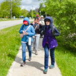 Click here for more information or to register Hosting Club: Toronto
Category: Urban Walk
Location (Google Maps): Finch Hydro Corridor West Hike Leader(s): Brian Rideout Click here to contact Hike Leader(s) Pace: Moderate (3-4 km/hr)
Terrain: Flat
Distance (km): 11.4 km Description
Please join me at the north west corner of Finch and Weston by 10 AM. We will hike east along the Finch Hydro Corridor Trail to Bathurst St (N of Finch) (km 30.2 to km 41.6). Here is an online map with km markings of our route for all 7 hikes for the Toronto Urban Badge: https://onthegomap.com/s/c2c1hf3n Please make sure you bring at least 2 liters of water, a lunch, and icers.
|
22 - Car Hike: Jefferson Forest (Richmond Hill)
9:00 AM-12:00 PM 03/22/2026 https://hikes.brucetrail.org/event/car-hike-jefferson-forest-richmond-hill-10/2026-03-22/ Click here for more information or to register Hosting Club: Toronto
Category: Car Hike
Location (Google Maps): 1245 Bethesda Side Rd, Richmond Hill, ON L4E 1A2 ( Bethesda Trail Head Parking lot) Hike Leader(s): Amir Alemohammad Click here to contact Hike Leader(s) Pace: Moderate (3-4 km/hr)
Terrain: Flat, Hilly, Level 2 (Intermediate – some hills and uneven surfaces, rocks and roots underfoot)
Distance (km): 10-11 km Description
Let’s roll the hills of the Jefferson Forest this winter! Every weekend, we’ll explore the winter wonderland at this beautiful park. Located in the heart of Richmond Hill, it boasts numerous hiking trails. This 3-hour hike can range from 10 to 12 kilometres, depending on the weather conditions. Remember to bring water, snacks, hiking boots, icers, poles, and your camera. Not recommended for beginners. Park in the free Bethesda parking lot and avoid parking along the road. Dress appropriately for the weather. Difficulty Level: 2 (Moderate). Please arrive @8:45AM for start of 9:00AM. This is a joint hike with the Oak Ridges Trail Association (ORTA).
- Car Hike: Caledon Rail Trail
10:00 AM-3:00 PM 03/22/2026 https://hikes.brucetrail.org/event/car-hike-caledon-rail-trail-3/2026-03-22/ Click here for more information or to register Hosting Club: Toronto
Category: Cancelled
Location (Google Maps): Caledon Rail Trail from Inglewood to Caledon East. Hike Leader(s): Al Brown Click here to contact Hike Leader(s) Pace: Moderate (3-4 km/hr)
Terrain: Flat, Level 1 (Easy – mostly on flat, well maintained trails with hard-packed surface)
Distance (km): 12 km Description
This is a hike for those who have been cooped up all winter and want to get back to hiking. We will meet in Caledon East and car pool to Inglewood to start the hike. We will have a refreshment stop after in local area. The meeting place will be in the parking lot east of the Caledon Town Hall, east of the community centre.
- Urban Walk: Highland Creek Trail–Waterfront Trail
10:00 AM-2:45 PM 03/22/2026 https://hikes.brucetrail.org/event/urban-walk-highland-creek-trail-waterfront-trail/2026-03-22/  Click here for more information or to register Hosting Club: Toronto
Category: Urban Walk
Location (Google Maps): Guildwood GO station, 4105 Kingston Road, Scarborough ON Hike Leader(s): Felix Wan, Ted Moriarty Click here to contact Hike Leader(s) Pace: Moderate (3-4 km/hr)
Terrain: Level 2 (Intermediate – some hills and uneven surfaces, rocks and roots underfoot), Variable
Distance (km): 12 Description
On the first Sunday of spring, join us on a walk along scenic Highland Creek in Scarborough and the Waterfront Trail, ending at Rouge Hill GO station. We will enjoy the beautiful Highland Creek valley, naturally-eroded cliffs and forests along the trail banks of the winding river, and Highland Creek and Morningside Parks. With luck, we may see white-tailed deer and red foxes that have been spotted in the area. There will also be several lookout points over Lake Ontario. This hike follows a modified route from Felix’s graduation hike one year ago. Route map: https://onthegomap.com/s/jreh9onn The terrain is mostly flat and features a mixture of paved paths, dirt trails, and road walking. Depending on weather conditions, parts of the trail may be muddy or snowy/icy. Bring icers/crampons just in case, as well as a lunch/snacks and at least 2L of drinking water. Travel to the trailhead: - By TTC: Meet Felix and Ted at Kennedy subway station by 9:15 a.m. to take the route 905 Eglinton East Express bus (bus bay #5 on Platform A, two levels directly above the Line 2 subway, and one level above the concourse level with the collector’s booth). The bus departs Kennedy station at 9:30 a.m. and arrives at Guildwood GO station at 9:51 a.m.
- By GO: Take the Lakeshore East train which departs Union station at 9:20 a.m. and arrives at Guildwood station at 9:48 a.m.
- By car: Free parking is available (first-come, first-served) at Guildwood station. Note that there are two parking lots: the main lot (to the north) and the south lot. We will meet outside the entrance to the station building in the main lot.
Washrooms: Please use washrooms at Kennedy station (east end of the level above the Line 2 subway, as well as just across the west staircase from/to the Line 5 LRT boarding platform) and Guildwood station before the start of the hike. During the hike, we will take “Bruce Trail-style” bio breaks in the woods, as access to public washrooms will be limited, given the season. Après-hike: There will be an optional après-hike stop at The Olde Stone Cottage Pub.
| 23 | 24 - Urban Walk: Valley View Park Thornhill
9:30 AM-12:00 PM 03/24/2026 https://hikes.brucetrail.org/event/urban-walk-valley-view-park-thornhill-153/2026-03-24/ Click here for more information or to register Hosting Club: Toronto Location (Google Maps): Parking lot is off Sycamore Drive, East of Bayview , across Starbucks plaza
Bus 91 from Finch East station stops at Sycamore station. Hike Leader(s): Mohammad Aghamiri Click here to contact Hike Leader(s) Pace: Moderate (3-4 km/hr)
Terrain: Hilly, Level 2 (Intermediate – some hills and uneven surfaces, rocks and roots underfoot), Variable
Distance (km): 6-7 km Description
We will explore Valleyview and Maple View parks, and walk along German Mill Creak, in return we stop in Huntington park and have snack under beautiful shed. Although this is considered an “Urban Walk”, you can expect some hills up and down and uneven surfaces with tree roots. Please bring hiking poles, Ice cleats water and snacks. phone number for the day of hike 289 588 6482
| 25 | 26 - Car Hike: Iroquoia End-to-End in 7: Hike 6
8:30 AM-1:00 PM 03/26/2026 https://hikes.brucetrail.org/event/car-hike-iroquoia-end-to-end-in-7-hike-6/2026-03-26/  Hike open to BTC Members only. Click here for more information or to register Hosting Club: Toronto
Category: Car Hike
Location (Google Maps): Meet at km 81.6 where the trail crosses Guelph Line (GPS 43.388366, -79.854231), south of No. 1 Sideroad. Do not block the farm gate. We’ll shuttle to km 101.6 on Twiss Rd (GPS 43.447743, -79.953436) where we’ll begin our hike. Hike Leader(s): Jacqueline Van Dyke Click here to contact Hike Leader(s) Pace: Brisk (4-5 km/hr), Moderate (3-4 km/hr)
Terrain: Challenging
Distance (km): 20 Description
Please join for one or more of this Iroquoia series to complete the section over 7 hikes. Hikers must register for individual hikes. Expect an average pace of 4 km/hr with snack/lunch breaks. Please arrive early enough so you’re ready for the shuttle to begin promptly at 8:30. Hikers should be prepared for the season – layered clothing, hiking boots, snowshoes (if we get fresh snowfall), poles, water, snacks/lunch, first aid kit, and icers. Hikers should be prepared to share their cars for shuttling – to be shared evenly. If we encounter unsafe hiking or driving conditions, I will cancel/re-schedule the hike the day before. If you are unable to join us on the day of the hike, please text me at 647-231-0946.
- Urban Walk: Valley View Park Thornhill
9:30 AM-12:00 PM 03/26/2026 https://hikes.brucetrail.org/event/urban-walk-valley-view-park-thornhill-154/2026-03-26/ Click here for more information or to register Hosting Club: Toronto Location (Google Maps): Parking lot is off Sycamore Drive, East of Bayview , across Starbucks plaza
Bus 91 from Finch East station stops at Sycamore station. Hike Leader(s): Mohammad Aghamiri Click here to contact Hike Leader(s) Pace: Moderate (3-4 km/hr)
Terrain: Hilly, Level 2 (Intermediate – some hills and uneven surfaces, rocks and roots underfoot), Variable
Distance (km): 6-7 km Description
We will explore Valleyview and Maple View parks, and walk along German Mill Creak, in return we stop in Huntington park and have snack under beautiful shed. Although this is considered an “Urban Walk”, you can expect some hills up and down and uneven surfaces with tree roots. Please bring hiking poles, Ice cleats water and snacks. phone number for the day of hike 289 588 6482
| 27 - Car Hike: Iroquoia End-to-End in 7: Hike 7
8:30 AM-3:00 PM 03/27/2026 https://hikes.brucetrail.org/event/car-hike-iroquoia-end-to-end-in-7-hike-7/2026-03-27/  Hike open to BTC Members only. Click here for more information or to register Hosting Club: Toronto
Category: Car Hike
Location (Google Maps): Meet at km 101.6 on Twiss Rd. (GPS 43.447743, -79.953436) north of Derry Rd. We’ll shuttle to the Hilton Falls CA parking lot (GPS 43.505705, -79.961589) and begin our hike from there. If you have a Halton CA pass, please let me know. Non pass holders will share in the cost of the parking. Hike Leader(s): Jacqueline Van Dyke Click here to contact Hike Leader(s) Pace: Brisk (4-5 km/hr), Moderate (3-4 km/hr)
Terrain: Variable
Distance (km): 20 Description
Please join for the last of this Iroquoia series. For those who have completed the main trail of this section, today is badge day. Please bring $10 if you’d like to purchase a badge. Expect an average pace of 4 km/hr with snack/lunch breaks. Please arrive 15 minutes early so you’re ready for the shuttle to begin promptly at 8:30. Hikers should be prepared for the season – layered clothing, hiking boots, snowshoes (if we get fresh snowfall), poles, water, snacks/lunch, first aid kit, and icers. Hikers should be prepared to share their cars for shuttling – to be shared evenly. If we encounter unsafe hiking or driving conditions, I will cancel/re-schedule the hike the day before. If you are unable to join us on the day of the hike, please text me at 647-231-0946.
| 28 - Boyd Conservation Park ,Vaughan
8:30 AM-1:00 PM 03/28/2026 https://hikes.brucetrail.org/event/car-hike-german-mills/2026-03-28/ Click here for more information or to register Hosting Club: Toronto Location (Google Maps): Free Parking lot before entrance of park on Islington Ave. Hike Leader(s): Mohammad Aghamiri Click here to contact Hike Leader(s) Pace: Moderate (3-4 km/hr)
Terrain: Hilly, Level 2 (Intermediate – some hills and uneven surfaces, rocks and roots underfoot), Variable
Distance (km): 12-14 km Description
Let’s hike Boyd conservation park trails through beautiful valleys. Please bring lots of water and snacks ,hiking poles are recommended phone number for the day of hike 289 588 6482
- Toronto Section – Winter Magic
8:30 AM-3:30 PM 03/28/2026 https://hikes.brucetrail.org/event/toronto-section-winter-magic/2026-03-28/  Click here for more information or to register Hosting Club: Iroquoia, Toronto
Category: Good Companions
Location (Google Maps): Meeting Point at parking lot on St. Helena Rd. near its juntion with Regional Rd 25. Note: The far end of this road is posted as “No parking” ( please park on the right side across houses- close to the trail. Hike Leader(s): Corina Seceleanu Click here to contact Hike Leader(s) Pace: Medium – 3 to 4 km/hr
Terrain: Dependent on Conditions, Moderate – Some hills and/or some poor footing, Slippery Sections Likely
Distance: 22.5km Description
Hello Fellow Hikers, Please join me for an unforgettable adventure as we explore a breathtaking stretch of the Toronto section of the Bruce Trail. This exhilarating and rewarding 22.5 km route forms a mostly open loop that highlights the beauty and character of a section that’s especially close to my heart.
Our journey begins (after the car shuttle point ) at Spyside Bruce Trail Pear Tree Park On. 15 Side Road 200 M South of Halton Rd 25 . From here, we’ll head out counterclockwise along a side trail before joining the main trail. Along the way, we’ll pass several notable landmarks within Hilton Falls Conservation Area, including the enchanting Hilton Falls, its serene reservoir, and a number of impressive glacial potholes.
Once we merge onto the main trail, we’ll enjoy approximately 9 km of steady ascent all the way to Helena Road, where our adventure concludes. This stretch of the Escarpment is both rewarding and challenging, offering sweeping vistas toward Milton, Mississauga, and Toronto—views that make every step worthwhile. Expectations: This is a medium with a difficult section (last portion ) hike but we gone tackle in various pace to allow ourself to enjoy and immerse in an endless beauty of this exploration. Expect to be on-trail 6- 7 hours. Breaks will be taken for lunch, snacks, photography, and to appreciate the scenery. Meeting Time: Please arrive no later than 15 minutes prior to the scheduled time. Participant Requirements: - Intermediate/experienced hikers, comfortable with longer distances and some elevation gains.
- Must be physically fit for group hiking, and mentally for an endurance of 22.5 km
- Proper hiking boots, layered clothing, and wet/cold weather gear. Hiking poles and icers recommendated/ must.
- Essentials: Lunch, snacks, water (1.5 2L min) , and your enthusiasm
- Breaks for photography and appreciation wildlife (if lucky, as I was seeing a bald eagle) and bio breaks as well.
We’ll run a short car shuttle from Helena Rd. meeting point to the Bruce Trail Pear Tree Park parking area on 15 Sideroad, about 200 metres southwest of Halton Road 25 where the hike will start . This quick shuttle will make logistics easy and ensure we finish right on time.
- Car Hike: Uxbridge-Brock Track
9:00 AM-12:00 PM 03/28/2026 https://hikes.brucetrail.org/event/car-hike-uxbridge-brock-track/2026-03-28/ Click here for more information or to register Hosting Club: Toronto
Category: Car Hike
Location (Google Maps): Meet at the Brock Tract parking lot on the east side of Durham 1/Brock Rd., approximately 5 km south of Coppin’s Corners, Uxbridge or 1 km north of Uxbridge Pickering Town Line. 1401 Brock Rd. (Free parking). Hike Leader(s): Amir Alemohammad Click here to contact Hike Leader(s) Pace: Moderate (3-4 km/hr)
Terrain: Flat, Hilly, Level 2 (Intermediate – some hills and uneven surfaces, rocks and roots underfoot), Variable
Distance (km): 10-12 km Description
Join us for a wonderful hike in Uxbridge starting from Brock Track parking lot. We will hike the Brock Track and Wilder Forest among the amazing trails of Uxbridge. Boots and icers mandatory, poles recommended, bring 2 litres of water and dress according to weather conditions. Be prepared for icy/snowy conditions. Please arrive at 8:45 for a 9:00 start. Beware, Iphone Maps may take you to the wrong location. Check the location with Google Maps the previous night. This is a joint hike with Oak Ridges Trail Association (ORTA).
 Go Train Hike: Smokey Hollow and Waterdown by GO Train Go Train Hike: Smokey Hollow and Waterdown by GO Train 10:00 AM-3:30 PM 03/28/2026 https://hikes.brucetrail.org/event/go-train-hike-smokey-hollow-and-waterdown-by-go-train/2026-03-28/ 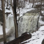 Click here for more information or to register Hosting Club: Toronto
Category: GO Train Hike
Location (Google Maps): Aldershot GO Station to Waterdown Hike Leader(s): Michael Humpage, Felix Wan Click here to contact Hike Leader(s) Pace: Moderate (3-4 km/hr)
Terrain: Hilly, Level 2 (Intermediate – some hills and uneven surfaces, rocks and roots underfoot), Rocky, Variable
Distance (km): 14 km Description
Please meet me under the clock in the Great Hall in Union Station by 8:45 AM. We will take the 9:04 AM (to be confirmed) Lakeshore West train to Aldershot GO arriving at 10:02 AM. We will hike from Aldershot GO station into Waterdown and then return to Aldershot GO station. The hike will be a mix of country roads and trails. For the most part this is an in and an out hike. Part of the hike will be on the Bruce Trail through Grindstone Creek and passing by Smokey Hollow waterfall. There is one steep descent, followed by one very steep climb. Continuing past Smokey Hollow we will hike into Waterdown where hikers can go to the Copper Kettle cafe and purchase food or drink if they wish. Please bring water (2 litres recommended), a lunch, bug spray and sunscreen. At this time of year conditions could be quite muddy so come prepared. Icers, poles and gaiters may be useful. Registration is limited to 20 spots.
|
29 - Car Hike: Jefferson Forest (Richmond Hill)
9:00 AM-12:00 PM 03/29/2026 https://hikes.brucetrail.org/event/car-hike-jefferson-forest-richmond-hill-11/2026-03-29/ Click here for more information or to register Hosting Club: Toronto
Category: Car Hike
Location (Google Maps): 1245 Bethesda Side Rd, Richmond Hill, ON L4E 1A2 ( Bethesda Trail Head Parking lot) Hike Leader(s): Amir Alemohammad Click here to contact Hike Leader(s) Pace: Moderate (3-4 km/hr)
Terrain: Flat, Hilly, Level 2 (Intermediate – some hills and uneven surfaces, rocks and roots underfoot), Variable
Distance (km): 10-11 km Description
Let’s roll the hills of the Jefferson Forest this winter! Every weekend, we’ll explore the winter wonderland at this beautiful park. Located in the heart of Richmond Hill, it boasts numerous hiking trails. This 3-hour hike can range from 10 to 12 kilometres, depending on the weather conditions. Remember to bring water, snacks, hiking boots, icers, poles, and your camera. Not recommended for beginners. Park in the free Bethesda parking lot and avoid parking along the road. Dress appropriately for the weather. Difficulty Level: 2 (Moderate). Please arrive @8:45AM for start of 9:00AM. This is a joint hike with the Oak Ridges Trail Association (ORTA).
- Car Hike: Hike #5 of 5 to earn the Toronto Side Trails Badge!
9:30 AM-2:30 PM 03/29/2026 https://hikes.brucetrail.org/event/car-hike-hike-5-of-5-to-earn-the-toronto-side-trails-badge/2026-03-29/  Click here for more information or to register Hosting Club: Toronto
Category: Car Hike
Location (Google Maps): We will meet at the Trafalgar & 401 Commuter Lot (43.571569, -79.831797) and then carpool to the start of the hike. Hike Leader(s): Monica Pasquali Click here to contact Hike Leader(s) Pace: Leisurely (2-3 km/hr), Moderate (3-4 km/hr)
Terrain: Level 2 (Intermediate – some hills and uneven surfaces, rocks and roots underfoot)
Distance (km): 10.98 km Description
This is the fifth hike in a series of five hikes that have been offered approximately one Sunday per month so that participants could earn the Toronto Side Trails Badge during the winter and early spring. For this fifth and final hike we will explore three side trails in the Toronto section of the Bruce Trail: the Canada Goose Side Trail, the Brown Benton Side Trail, and the Charles Hildebrandt Side Trail. Please dress appropriately for an early spring hike by dressing in layers (wear an inner layer that wicks sweat away from your skin, a middle layer that keeps you warm, and an outer layer that protects you from wind, rain, and snow), wearing gloves/mittens and a toque, and wearing warm and comfortable footwear that has good traction in snow/ice/mud (please bring your icers because there may still be ice on the trail even though it’s spring). Hiking poles or walking sticks are an asset since they will help keep you balanced if the ground is slippery. As well, make sure you bring enough water and food for a 4 hour hike since we’ll be covering a total distance of 10.98 km over terrain that has some hills and exposed rocks. As we have done for the other hikes in this series, we will meet at the Trafalgar & 401 Commuter Lot (43.571569, -79.831797) and then carpool to the start of the hike. Please be prepared to participate in the carpool by ensuring you have space in your car if you are not already carpooling with others to the Commuter Lot meeting point. After the hike, interested participants can join me at the Tim Horton’s on Trafalgar Road just a bit south of Highway 401 for some post-hike refreshments to celebrate our accomplishment 🙂 Looking forward to exploring some of Toronto’s side trails with you!
- Urban Walk – Toronto Urban Badge Hike – 4 of 7
10:00 AM-1:45 PM 03/29/2026 https://hikes.brucetrail.org/event/urban-walk-toronto-urban-badge-hike-4-of-7-3/2026-03-29/  Click here for more information or to register Hosting Club: Toronto
Category: Urban Walk
Location (Google Maps): Finch Hydro Corridor West Hike Leader(s): Brian Rideout Click here to contact Hike Leader(s) Pace: Moderate (3-4 km/hr)
Terrain: Flat
Distance (km): 11.4 km Description
Please join me at the north west corner of Finch and Weston by 10 AM. We will hike east along the Finch Hydro Corridor Trail to Bathurst St (N of Finch) (km 30.2 to km 41.6). Here is an online map with km markings of our route for all 7 hikes for the Toronto Urban Badge: https://onthegomap.com/s/c2c1hf3n Please make sure you bring at least 2 liters of water, a lunch, and icers.
| 30 | 31 - Car Hike: Toronto End-to-End in 3 – #1
8:30 AM-3:00 PM 03/31/2026 https://hikes.brucetrail.org/event/car-hike-toronto-end-to-end-in-3-1/2026-03-31/  Hike open to BTC Members only. Click here for more information or to register Hosting Club: Toronto
Category: Car Hike
Location (Google Maps): Meet at km 17.4 on the east side of Fourth Line (GPS 43.615163, -79.975157) where the trail crosses the road. Do not park in front of the junk yard. We’ll shuttle to Hilton Falls CA on Campbellville Rd, GPS 43.505705, -79.961589 to begin our hike. Hike Leader(s): Jacqueline Van Dyke Click here to contact Hike Leader(s) Pace: Moderate (3-4 km/hr)
Terrain: Rocky, Variable
Distance (km): 18 Description
This is the first of three hikes to hike the Toronto section E2E. We will be hiking in early spring conditions (mud, ice, snow) so be prepared for it all. Please bring your icers, gaitors, and poles. Hiking boots/shoes are mandatory. Please bring at least 2L of water, snacks, and your lunch. We will be shuttling to Hilton Falls CA parking, close to Appleby Line, and hiking by the location of the first blaze on the Bruce Trail. Please note, we will need to pay for parking at Hilton Falls. If any hiker has an annual pass, please let me know. Pass holders can do this shuttle and the rest of the hikers are expected to pay the driver $2. If there are no pass holders, hikers will share the cost of the parking.
- Urban Walk: Valley View Park Thornhill 183
9:30 AM-12:00 PM 03/31/2026 https://hikes.brucetrail.org/event/urban-walk-valley-view-park-thornhill-155/2026-03-31/ Click here for more information or to register Hosting Club: Toronto Location (Google Maps): Parking lot is off Sycamore Drive, East of Bayview , across Starbucks plaza
Bus 91 from Finch East station stops at Sycamore station. Hike Leader(s): Mohammad Aghamiri Click here to contact Hike Leader(s) Pace: Moderate (3-4 km/hr)
Terrain: Hilly, Level 2 (Intermediate – some hills and uneven surfaces, rocks and roots underfoot), Variable
Distance (km): 6-7 km Description
We will explore Valleyview and Maple View parks, and walk along German Mill Creak, in return we stop in Huntington park and have snack under beautiful shed. Although this is considered an “Urban Walk”, you can expect some hills up and down and uneven surfaces with tree roots. Please bring hiking poles, Ice cleats water and snacks. phone number for the day of hike 289 588 6482
| April | April | April | April |