|
Sun | Mon | Tue | Wed | Thu | Fri | Sat |
|---|
1  Car Hike: Jefferson Forest (Richmond Hill) Car Hike: Jefferson Forest (Richmond Hill) 9:00 AM-12:00 PM 02/01/2026 https://hikes.brucetrail.org/event/car-hike-jefferson-forest-richmond-hill-3/2026-02-01/ 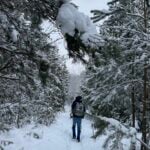 Click here for more information or to register Hosting Club: Toronto
Category: Car Hike
Location (Google Maps): 1245 Bethesda Side Rd, Richmond Hill, ON L4E 1A2 ( Bethesda Trail Head Parking lot) Hike Leader(s): Amir Alemohammad Click here to contact Hike Leader(s) Pace: Moderate (3-4 km/hr)
Terrain: Flat, Hilly, Level 2 (Intermediate – some hills and uneven surfaces, rocks and roots underfoot), Variable
Distance (km): 10-12 km Description
Let’s roll the hills of the Jefferson Forest this winter! Every weekend, we’ll explore the winter wonderland at this beautiful park. Located in the heart of Richmond Hill, it boasts numerous hiking trails. This 3-hour hike can range from 10 to 12 kilometres, depending on the weather conditions. Remember to bring water, snacks, hiking boots, icers, poles, and your camera. Not recommended for beginners. Park in the free Bethesda parking lot and avoid parking along the road. Dress appropriately for the weather. Difficulty Level: 2 (Moderate). Please arrive @8:45AM for start of 9:00AM. This is a joint hike with the Oak Ridges Trail Association (ORTA).
| 2  Toronto Winter Blues – Hike 3 Toronto Winter Blues – Hike 3 8:30 AM-1:30 PM 02/02/2026 https://hikes.brucetrail.org/event/toronto-winter-blues-hike-3/2026-02-02/ Hike open to BTC Members only. Click here for more information or to register Hosting Club: Iroquoia, Toronto
Category: General Hike
Location (Google Maps): Limehouse Parking Lot Hike Leader(s): Pati Greenwood, Jeff Dowsett Click here to contact Hike Leader(s) Pace: Medium – 3 to 4 km/hr
Terrain: Dependent on Conditions, Moderate – Some hills and/or some poor footing
Distance: 11 km Description
This is a series of 6 hikes to explore various side trails in the Toronto Section of the Bruce Trail. Hikers completing all six hikes will be eligible to obtain the Toronto Side Trail Badge. Each hike requires a separate registration. The hikes in this series will take place on January 12, 26, February 2, 9, 23, and March 2. Hikes will be dependent on weather / travel conditions. All hikes will be undertaken at a medium pace. This hike will explore several side trails including: Black Creek Side Trail, Todd Bardes Side Trail, Ridge Side Trail and the Limehouse Side Trail Dress in layers for the weather, wear appropriate hiking footwear, bring icers and hiking poles. Bring plenty of water or other hydration and a snack. Please arrive at the meeting place by 8:15 am. We will depart promptly at 8:30 am. If your plans change and you are unable to join the hike, please cancel your reservation in the My Hikes Section of the BTC website.
| 3  Urban Walk: Valley View Park Thornhill Urban Walk: Valley View Park Thornhill 9:30 AM-11:45 AM 02/03/2026 https://hikes.brucetrail.org/event/urban-walk-valley-view-park-thornhill-139/2026-02-03/ Click here for more information or to register Hosting Club: Toronto Location (Google Maps): Parking lot is off Sycamore Drive, East of Bayview , across Starbucks plaza
Bus 91 from Finch East station stops at Sycamore station. Hike Leader(s): Mohammad Aghamiri Click here to contact Hike Leader(s) Pace: Moderate (3-4 km/hr)
Terrain: Hilly, Level 2 (Intermediate – some hills and uneven surfaces, rocks and roots underfoot), Variable
Distance (km): 6-7 km Description
We will explore Valleyview and Maple View parks, and walk along German Mill Creak, in return we stop in Huntington park and have snack under beautiful shed. Although this is considered an “Urban Walk”, you can expect some hills up and down and uneven surfaces with tree roots. Please bring hiking poles, Ice cleats water and snacks. phone number for the day of hike 289 588 6482
| 4 | 5 - Urban Walk: Valley View Park Thornhill
9:00 AM-11:15 AM 02/05/2026 https://hikes.brucetrail.org/event/urban-walk-valley-view-park-thornhill-140/2026-02-05/ Click here for more information or to register Hosting Club: Toronto Location (Google Maps): Parking lot is off Sycamore Drive, East of Bayview , across Starbucks plaza
Bus 91 from Finch East station stops at Sycamore station. Hike Leader(s): Mohammad Aghamiri Click here to contact Hike Leader(s) Pace: Moderate (3-4 km/hr)
Terrain: Hilly, Level 2 (Intermediate – some hills and uneven surfaces, rocks and roots underfoot), Variable
Distance (km): 6-7 km Description
We will explore Valleyview and Maple View parks, and walk along German Mill Creak, in return we stop in Huntington park and have snack under beautiful shed. Although this is considered an “Urban Walk”, you can expect some hills up and down and uneven surfaces with tree roots. Please bring hiking poles, Ice cleats water and snacks. phone number for the day of hike 289 588 6482
| 6 | 7 - Seaton Trail Pickering
8:30 AM-1:15 PM 02/07/2026 https://hikes.brucetrail.org/event/car-hike-cherry-beach-downtown-3/2026-02-07/ Click here for more information or to register Hosting Club: Toronto Location (Google Maps): Seaton Trail Parking Lot, Pickering Hike Leader(s): Mohammad Aghamiri Click here to contact Hike Leader(s) Pace: Moderate (3-4 km/hr)
Terrain: Flat, Level 2 (Intermediate – some hills and uneven surfaces, rocks and roots underfoot)
Distance (km): 12-14 km Description
We will hike along Seaton trail and enjoy the lovely scenery of forest and river.
• Please dress appropriately for the weather.
• We will have short water, picture, Bio and a 15 minute snack breaks. Everyone is welcome! Please bring lots of water and snacks ,hiking poles are recommended phone number for the day of hike 289 588 6482
- Toronto Winter Blues – Hike 2 RESCHEDULED from January 26
8:30 AM-1:30 PM 02/07/2026 https://hikes.brucetrail.org/event/toronto-winter-blues-hike-2/2026-02-07/ Click here for more information or to register Hosting Club: Iroquoia, Toronto
Category: General Hike
Location (Google Maps): Bruce Trail Pear Tree Parking Lot Hike Leader(s): Pati Greenwood, Jeff Dowsett Click here to contact Hike Leader(s) Pace: Medium – 3 to 4 km/hr
Terrain: Dependent on Conditions, Moderate – Some hills and/or some poor footing, Slippery Sections Likely
Distance: 12 km Description
This is a series of 6 hikes to explore various side trails in the Toronto Section of the Bruce Trail. Hikers completing all six hikes will be eligible to obtain the Toronto Side Trail Badge. Each hike requires a separate registration. The hikes in this series will take place on January 12, 26, February 2, 9, 23, and March 2. Hikes will be dependent on weather / travel conditions. All hikes will be undertaken at a medium pace. This hike will explore the Al Shaw Side Trail and the northern part of the Hilton Falls Side Trail. Dress in layers for the weather, wear appropriate hiking footwear, bring icers and hiking poles. Bring plenty of water or other hydration and a snack. Please arrive at the meeting place by 8:15 am. We will depart promptly at 8:30 am. If your plans change and you are unable to join the hike, please cancel your reservation in the My Hikes Section of the BTC website.
  Coach Trip: Skiers Horseshoe, Hikers McCrae Lake Coach Trip: Skiers Horseshoe, Hikers McCrae Lake 9:00 AM-6:00 PM 02/07/2026 https://hikes.brucetrail.org/event/coach-trip-skiers-horseshoe-hikers-mccrae-lake/2026-02-07/ Trip Information
Departure Time: 09:00
Return to City Time: 18:00
Departure Point: York Mills Bus Pickup Click here for more information or to register Trip Activities
X-Country Ski ($0.01)
Snowshoe - McRae Lake ($0.01)
Snowshoe - Resort ($.01)
Optional Items
P/U at Hwy 400 & Major Mac ($.01)
Hosting Club: Toronto
Category: Coach Trips
Location (Google Maps): Horseshoe Resort Hike Leader(s): Tim Wainwright, Roland Mark; George Lennon; Robin Crombie Click here to contact Hike Leader(s) Pace: Moderate (3-4 km/hr)
Terrain: Hilly, Level 2 (Intermediate – some hills and uneven surfaces, rocks and roots underfoot), Variable Description
Join us for an awesome day of winter fun at Horseshoe Resort and in the beautiful McCrae Lake Conservation Reserve. Cross-country skiers: Glide through forests and fields on 30 km of trails groomed for classic and skate skiing. Classic ($49) and skate ski ($59) rentals available. All cross-country skiing is self-guided. Ski passes are $35 per person. Winter hikers: Join Roland and George for a fun guided hike in beautiful McCrae Lake Conservation Reserve. The group will be out all day and eat lunch on the trail. Depending on conditions you may need snowshoes, microspikes, or just boots. Option 2: Snowshoe with Tim and Robin on Horseshoe’s trails. Those staying on resort will need to purchase trail passes ($15); snowshoe rentals ($20) are available for those who stay on resort. Reserve your rental equipment ahead of time at https://horseshoeresort.com/nordic-centre/cross-country-ski/ Trail fees will be collected in cash on the bus. We will leave the resort at 4 PM. Departure 1: 9 AM, 10 York Mills Rd Departure 2: 9:20 AM, HWY 400 and Major Mackenzie Dr Park and Ride Please arrive at the pick-up location 15 minutes before departure. The bus waits for no one. Policy for running this trip: To run this trip we need 40 registrants 8 days in advance. We may cancel the trip on short notice if there is substantial risk of trail or resort closure due to major weather warnings. If there is enough snow to ski and conditions are marginal or better, we will go. Marginal conditions mean not ideal skiing conditions. For example, wet snow, a thin bumpy base, or some icy patches. If TBTC cancels the trip, we will refund your coach fare. No refund if you cancel.
- Urban Walk – Toronto Urban Badge Hike – 2 of 7
10:00 AM-12:30 PM 02/07/2026 https://hikes.brucetrail.org/event/urban-walk-toronto-urban-badge-hike-2-of-7-3/2026-02-07/  Click here for more information or to register Hosting Club: Toronto
Category: Urban Walk
Location (Google Maps): South Humber Recreational Trail/Toronto Waterfront Trail Hike Leader(s): Brian Rideout Click here to contact Hike Leader(s) Pace: Moderate (3-4 km/hr)
Terrain: Flat
Distance (km): 10.9 km Description
Please join me at the south east corner of Eglinton and Scarlett by 10 AM. We will hike south on the Humber Recreational Trail to Lakeshore Blvd and Ellis (km 19.2 to km 8.3). Here is an online map with km markings of our route for all 7 hikes for the Toronto Urban Badge: https://onthegomap.com/s/c2c1hf3n Please make sure you bring at least 2 liters of water, a lunch, and icers.
|
8 - Car Hike: Jefferson Forest (Richmond Hill)
9:00 AM-12:00 PM 02/08/2026 https://hikes.brucetrail.org/event/car-hike-jefferson-forest-richmond-hill-4/2026-02-08/ Click here for more information or to register Hosting Club: Toronto Location (Google Maps): 1245 Bethesda Side Rd, Richmond Hill, ON L4E 1A2 ( Bethesda Trail Head Parking lot) Hike Leader(s): Amir Alemohammad Click here to contact Hike Leader(s) Pace: Moderate (3-4 km/hr)
Terrain: Flat, Hilly, Level 2 (Intermediate – some hills and uneven surfaces, rocks and roots underfoot), Variable
Distance (km): 10-12 km Description
Let’s roll the hills of the Jefferson Forest this winter! Every weekend, we’ll explore the winter wonderland at this beautiful park. Located in the heart of Richmond Hill, it boasts numerous hiking trails. This 3-hour hike can range from 10 to 12 kilometres, depending on the weather conditions. Remember to bring water, snacks, hiking boots, icers, poles, and your camera. Not recommended for beginners. Park in the free Bethesda parking lot and avoid parking along the road. Dress appropriately for the weather. Difficulty Level: 2 (Moderate). Please arrive @8:45AM for start of 9:00AM. This is a joint hike with the Oak Ridges Trail Association (ORTA).
- Car Hike: Hike #3 of 5 to earn the Toronto Side Trails Badge!
9:30 AM-2:00 PM 02/08/2026 https://hikes.brucetrail.org/event/car-hike-hike-3-of-5-to-earn-the-toronto-side-trails-badge/2026-02-08/  Click here for more information or to register Hosting Club: Toronto
Category: Car Hike
Location (Google Maps): We will meet at the Trafalgar & 401 Commuter Lot (43.571569, -79.831797) and then carpool to the start of each hike. Hike Leader(s): Monica Pasquali; Marina Wray Click here to contact Hike Leader(s) Pace: Leisurely (2-3 km/hr), Moderate (3-4 km/hr)
Terrain: Level 2 (Intermediate – some hills and uneven surfaces, rocks and roots underfoot)
Distance (km): 9.24 km Description
This is the third in a series of five hikes that will be offered approximately one Sunday per month so that participants can earn the Toronto Side Trails Badge during the winter and early spring. Each out-and-back hike will cover a distance of 8-11 km and be hiked at a leisurely to moderate pace (approximately 3 km/h). Please note that the hikes will be posted separately on the BTC calendar – you will have to register for each hike that you’re interested in joining. For this second hike we will explore two side trails in the Toronto section of the Bruce Trail: the Bennett Heritage Trail and the Maureen Smith Side Trail. Please dress appropriately for a winter hike by dressing in layers (wear an inner layer that wicks sweat away from your skin, a middle layer that keeps you warm, and an outer layer that protects you from wind and snow), wearing gloves/mittens and a toque, and wearing warm and comfortable footwear that has good traction in snow/ice (icers placed over your boots work great!). Hiking poles or walking sticks are an asset since they will help keep you balanced if the ground is slippery. As well, make sure you bring enough water and food for a 3-4 hour hike since we’ll be covering a total distance of 9.24 km over terrain that has some hills and exposed rocks. Since parking might be limited at the places we’ll be hiking in this hike series, we will meet at the Trafalgar & 401 Commuter Lot (43.571569, -79.831797) and then carpool to the start of each hike. Please be prepared to participate in each carpool by ensuring you have space in your car if you are not already carpooling with others to the Commuter Lot meeting point. After the hike, interested participants can join me at the Tim Horton’s on Trafalgar Road just a bit south of Highway 401 for some post-hike refreshment. Looking forward to exploring some of Toronto’s side trails with you!
- Urban Walk: Rosedale Ravines
10:00 AM-1:00 PM 02/08/2026 https://hikes.brucetrail.org/event/urban-walk-rosedale-ravines-4/2026-02-08/ 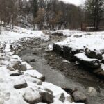 Click here for more information or to register Hosting Club: Toronto
Category: Urban Walk
Location (Google Maps): Meet Pleasant Blvd Exit, St Clair Subway Station Hike Leader(s): Tom Swales Click here to contact Hike Leader(s) Pace: Moderate (3-4 km/hr)
Terrain: Level 1 (Easy – mostly on flat, well maintained trails with hard-packed surface), Level 2 (Intermediate – some hills and uneven surfaces, rocks and roots underfoot), Variable
Distance (km): 10 km Description
Join us for a morning circular walk through David Balfour Park, Park Drive Reservation, the Evergreen Brickworks, Moore Park Ravine and Mount Pleasant Cemetery. On this walk we find nature close to the heart of the city.
| 9 - Toronto Winter Blues – Hike 4 (UPDATED NEW MEETING SPOT)
8:30 AM-1:30 PM 02/09/2026 https://hikes.brucetrail.org/event/toronto-winter-blues-hike-4/2026-02-09/ Hike open to BTC Members only. Click here for more information or to register Hosting Club: Iroquoia, Toronto
Category: General Hike
Location (Google Maps): Scotsdale Farm – Main Parking Area Hike Leader(s): Pati Greenwood, Jeff Dowsett Click here to contact Hike Leader(s) Pace: Medium – 3 to 4 km/hr
Terrain: Dependent on Conditions, Moderate – Some hills and/or some poor footing, Slippery Sections Likely
Distance: 14 km Description
This is a series of 6 hikes to explore various side trails in the Toronto Section of the Bruce Trail. Hikers completing all six hikes will be eligible to obtain the Toronto Side Trail Badge. Each hike requires a separate registration. The hikes in this series will take place on January 12, 26, February 2, 9, 23, and March 2. Hikes will be dependent on weather / travel conditions. All hikes will be undertaken at a medium pace. This hike will explore several side trails in the Scotsdale/Silver Creek area including: South Bennett Heritage ST, Great Esker ST, Trafalgar ST, Reservoir ST, Duff Pitt ST & North Rim ST. Dress in layers for the weather, wear appropriate hiking footwear, bring icers and hiking poles. Bring plenty of water or other hydration and a snack. Please arrive at the meeting place by 8:15 am. We will depart promptly at 8:30 am. If your plans change and you are unable to join the hike, please cancel your reservation in the My Hikes Section of the BTC website.
| 10 - Urban Walk: Valley View Park Thornhill
9:30 AM-11:45 AM 02/10/2026 https://hikes.brucetrail.org/event/urban-walk-valley-view-park-thornhill-141/2026-02-10/ Click here for more information or to register Hosting Club: Toronto Location (Google Maps): Parking lot is off Sycamore Drive, East of Bayview , across Starbucks plaza
Bus 91 from Finch East station stops at Sycamore station. Hike Leader(s): Mohammad Aghamiri Click here to contact Hike Leader(s) Pace: Moderate (3-4 km/hr)
Terrain: Hilly, Level 2 (Intermediate – some hills and uneven surfaces, rocks and roots underfoot), Variable
Distance (km): 6-7 km Description
We will explore Valleyview and Maple View parks, and walk along German Mill Creak, in return we stop in Huntington park and have snack under beautiful shed. Although this is considered an “Urban Walk”, you can expect some hills up and down and uneven surfaces with tree roots. Please bring hiking poles, Ice cleats water and snacks. phone number for the day of hike 289 588 6482
| 11 | 12 - Urban Walk: Valley View Park Thornhill
9:30 AM-11:45 AM 02/12/2026 https://hikes.brucetrail.org/event/urban-walk-valley-view-park-thornhill-142/2026-02-12/ Click here for more information or to register Hosting Club: Toronto Location (Google Maps): Parking lot is off Sycamore Drive, East of Bayview , across Starbucks plaza
Bus 91 from Finch East station stops at Sycamore station. Hike Leader(s): Mohammad Aghamiri Click here to contact Hike Leader(s) Pace: Moderate (3-4 km/hr)
Terrain: Hilly, Level 2 (Intermediate – some hills and uneven surfaces, rocks and roots underfoot), Variable
Distance (km): 6-7 km Description
We will explore Valleyview and Maple View parks, and walk along German Mill Creak, in return we stop in Huntington park and have snack under beautiful shed. Although this is considered an “Urban Walk”, you can expect some hills up and down and uneven surfaces with tree roots. Please bring hiking poles, Ice cleats water and snacks. phone number for the day of hike 289 588 6482
| 13 - Feb. 13-16, 2026 – Family Day Snowshoe Weekend in Tobermory (3 nights)
12:00 AM 02/13/2026 https://hikes.brucetrail.org/event/feb-13-16-2026-family-day-snowshoe-weekend-in-tobermory-3-nights/2026-02-13/ This is a Multi-Day HikeYou are signing up for the following dates and times:
2026-02-13 at
2026-02-14 at
2026-02-15 at
2026-02-16 at Click here for more information or to register Hosting Club: Toronto, Peninsula
Category: Car Hike
Location (Google Maps): Princess Hotel
34 BAY STREET SOUTH TOBERMORY, ONTARIO N0H 2R0, CANADA Hike Leader(s): Jeanette Vincent Click here to contact Hike Leader(s) Pace: Moderate (3-4 km/hr)
Terrain: Level 2 (Intermediate – some hills and uneven surfaces, rocks and roots underfoot), Variable
Distance (km): 8 -12km Description
Jeanette Vincent, Brenda Menezes and David Royle will continue Greg Vincent’s Legacy – Family Day Snowshoe Weekend in Tobermory. Celebrate with a weekend trip snowshoeing the trails of the National Park at the “Tip o’ the Bruce” Tobermory. We arrive Friday, February 13th at our comfortable hotel overlooking Little Tub Harbour where we stay and have our meals for three nights at the Princess Hotel in Tobermory. This outing is restricted to those staying and having their meals with us at the Princess Hotel in Tobermory for the weekend. Space is limited make your reservation soon. Please email Jeanette for the prices for the weekend at the Princess Hotel package and additional information. Once you receive the package, if you plan to join us call the Princess a reservation 1-519-596-8282 or sent an email to info@tobermoryprincesshotel.com and mention Vincent/Royle Winter Snowshoe weekend when booking. Once you have made your reservation, be sure to register for this event on the Toronto Bruce Trail Club. please send an email to Jeanette once you have done both, registered on the TBTC site and made your reservation at the Princess Hotel.
| 14 -
 School Bus Hike Toronto Section Winter Badge End to End #3 of 6 School Bus Hike Toronto Section Winter Badge End to End #3 of 6 8:30 AM-6:00 PM 02/14/2026 https://hikes.brucetrail.org/event/school-bus-hike-toronto-section-winter-badge-end-to-end-3-of-6/2026-02-14/ Trip Information
Departure Time: 08:30
Return to City Time: 18:00
Departure Point: York Mills Bus Pickup Click here for more information or to register Optional Items
Hosting Club: Iroquoia, Toronto
Category: Bus Hike
Location (Google Maps): Toronto Section, Limehouse Hike Leader(s): Tim Wainwright, Fayaz Mahmood Click here to contact Hike Leader(s) Pace: Leisurely (2-3 km/hr)
Terrain: Challenging, Level 2 (Intermediate – some hills and uneven surfaces, rocks and roots underfoot), Variable
Distance (km): 8.41 km Description
We will be hiking in winter conditions of ice and snow so these will be slower and shorter hikes than in other seasons. Icers or snowshoes are mandatory, and gaiters and poles recommended. The terrain is not too hilly, but the footing is treacherous in winter with many uneven, rocky sections to navigate. The leaders will let registrants know in advance if snowshoes are feasible for the day. Please bring at least 2L of water, snacks, and your lunch. Any hikers are welcome to join the hikes regardless of whether a person is working towards a badge. Those who complete all 6 hikes will qualify for the Toronto club’s Winter E2E badge. The fee is $10 per badge ($15 for non-members) and will be collected by the hike leader on trip #4. Or you may choose to purchase the special stained glass Fundraising End to End badge for $30. This hike goes through the Limehouse Conservation Area trail to the Sixth Line Parking lot from the Fourth Line Parking Lot. (8.41 km). This includes the portion of the trail taken off Fifth Line in 2025. There will be a refreshment/social stop in Georgetown after the hike before returning to the York Mills Station departure point by 6:00 PM.
- Car Hike: Happy Valley King City
8:30 AM-1:15 PM 02/14/2026 https://hikes.brucetrail.org/event/car-hike-happy-valley-king-city-9/2026-02-14/ Click here for more information or to register Hosting Club: Toronto Location (Google Maps): Happy Valley, Oak Ridges Trail 16th Sideroad & Weston Road Please park along 16th Side road Hike Leader(s): Mohammad Aghamiri Click here to contact Hike Leader(s) Pace: Moderate (3-4 km/hr)
Terrain: Hilly, Level 2 (Intermediate – some hills and uneven surfaces, rocks and roots underfoot)
Distance (km): 12-14 km Description
Come and join us to view nice scenery and look out of Happy valley
|
15 - Beginner Snowshoeing at the 100K Ranch
9:30 AM-1:00 PM 02/15/2026 https://hikes.brucetrail.org/event/beginner-snowshoeing-at-the-100k-ranch/2026-02-15/ 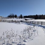 Click here for more information or to register Hosting Club: Toronto
Category: Car Hike
Location (Google Maps): Upon arrival, drive down the center of the driveway. At the fork, keep to your right. Drive through the open door of the first building on your right (the arena) and park inside. Hike Leader(s): Rob Schieck Click here to contact Hike Leader(s) Pace: Leisurely (2-3 km/hr), Moderate (3-4 km/hr)
Terrain: Flat
Distance (km): About 5km with a drop out point at the middle Description
If you received snowshoes for Christmas and don’t know how to put them on, then this is event is for you! After we gear up, we will be frolicking around the pastures and pond to allow everyone to acclimate to their snowshoes and poles. After that we will head down the driveway across the front of property and into the marked (yellow ribbons) trail for a little easy bushwhacking. At the end of the trail we will go through the pasture used by our two stallions. Hopefully they will come out and put a show on for us as they are handsome devils! From there we will head back to the arena for a water and snack break. At the end of the break, those with energy left in their tank, will had out and do the course backward mostly. The full out and back takes abut two hours or so.. If you’d like to have a tailgate lunch (indoors, but unheated) after snowshoeing, please bring your lunch. There is power in the arena. The fine print: We will be parking our vehicles and donning our gear inside the unheated horse arena on the ranch. If you need help putting your snowshoes on, come closer to he 9:30 am start time and I will help you put them on. We will be departing the arena at 10am sharp. There are five horses in stalls in the arena; they enjoy treats like apples and carrots. If you choose to feed them, please be cautious, as they cannot distinguish between fingers and carrots. Hikers (the snow is too deep) and dogs are not permitted. Meet: 9:30 a.m. in the arena (departure at 10:00 a.m.) at 111494 11th line, East:
- Urban Walk – Toronto Urban Badge Hike – 2 of 7
10:00 AM-12:30 PM 02/15/2026 https://hikes.brucetrail.org/event/urban-walk-toronto-urban-badge-hike-2-of-7-4/2026-02-15/  Click here for more information or to register Hosting Club: Toronto
Category: Urban Walk
Location (Google Maps): South Humber Recreational Trail/Toronto Waterfront Trail Hike Leader(s): Brian Rideout Click here to contact Hike Leader(s) Pace: Moderate (3-4 km/hr)
Terrain: Flat
Distance (km): 10.9 km Description
Please join me at the south east corner of Eglinton and Scarlett by 10 AM. We will hike south on the Humber Recreational Trail to Lakeshore Blvd and Ellis (km 19.2 to km 8.3). Here is an online map with km markings of our route for all 7 hikes for the Toronto Urban Badge: https://onthegomap.com/s/c2c1hf3n Please make sure you bring at least 2 liters of water, a lunch, and icers.
| 16 - Car Hike: Greenwood Conservation Area
9:00 AM-2:00 PM 02/16/2026 https://hikes.brucetrail.org/event/car-hike-greenwood-conservation-area-3/2026-02-16/ Click here for more information or to register Hosting Club: Toronto
Category: Car Hike
Location (Google Maps): Greenwood Conservation Area Hike Leader(s): Glynn Richardson Click here to contact Hike Leader(s) Pace: Moderate (3-4 km/hr)
Terrain: Flat, Hilly, Level 2 (Intermediate – some hills and uneven surfaces, rocks and roots underfoot), Variable
Distance (km): 10-14 km Description
We’ll spend sometime exploring Greenwood Conservation Area trails including parts of the Trans Canada Trail. Bring snacks, lunch, water. Hiking footwear and icers are MANDATORY. Hiking poles and gaitors are highly recommended. Check the weather in advance and dress accordingly in layers. There will be no dropouts and no dogs allowed. Registered participants are to arrive 15 minutes prior to the hike for briefing. Space is limited.
- Urban Walk: Toronto Islands Family Day Hike
10:15 AM-4:00 PM 02/16/2026 https://hikes.brucetrail.org/event/urban-walk-toronto-islands-family-day-hike-3/2026-02-16/ Click here for more information or to register Hosting Club: Toronto
Category: Urban Walk
Location (Google Maps): Meet inside the waiting area of Jack Layton Ferry Terminal at the foot of Bay Street at 10:15AM to take the 10:30 AM Ferry to Ward’s Island. Ferry tickets can be purchased when you arrive or online. Ferry return fares: $10 adult, $6 student/senior Hike Leader(s): Ray Berzins Click here to contact Hike Leader(s) Pace: Moderate (3-4 km/hr)
Terrain: Flat, Level 1 (Easy – mostly on flat, well maintained trails with hard-packed surface), Level 2 (Intermediate – some hills and uneven surfaces, rocks and roots underfoot)
Distance (km): 12 km Description
The Toronto Islands are very peaceful in the Winter Season. We will catch the 3:45 pm ferry to be back in the city by 4 pm. Bring a lunch, snacks, water, a hot beverage, and icers if available. Dress in warm layers appropriate to the weather. Heated washrooms available. Dropout anytime by walking back to the Ward’s Island Ferry Dock. We will hike to Hanlan’s Point and return to Ward’s Island (only destination served in the Winter) – approximately 6 km each way.
| 17 - Urban Walk;: Valley View Park Thornhill
9:30 AM-12:00 PM 02/17/2026 https://hikes.brucetrail.org/event/urban-walk-valley-view-park-thornhill-143/2026-02-17/ Click here for more information or to register Hosting Club: Toronto Location (Google Maps): Parking lot is off Sycamore Drive, East of Bayview , across Starbucks plaza
Bus 91 from Finch East station stops at Sycamore station. Hike Leader(s): Mohammad Aghamiri Click here to contact Hike Leader(s) Pace: Moderate (3-4 km/hr)
Terrain: Hilly, Level 2 (Intermediate – some hills and uneven surfaces, rocks and roots underfoot), Variable
Distance (km): 6-7 km Description
We will explore Valleyview and Maple View parks, and walk along German Mill Creak, in return we stop in Huntington park and have snack under beautiful shed. Although this is considered an “Urban Walk”, you can expect some hills up and down and uneven surfaces with tree roots. Please bring hiking poles, Ice cleats water and snacks. phone number for the day of hike 289 588 6482
| 18 | 19 - Urban Walk: Valley View Park Thornhill
9:30 AM-12:00 PM 02/19/2026 https://hikes.brucetrail.org/event/urban-walk-valley-view-park-thornhill-144/2026-02-19/ Click here for more information or to register Hosting Club: Toronto Location (Google Maps): Parking lot is off Sycamore Drive, East of Bayview , across Starbucks plaza
Bus 91 from Finch East station stops at Sycamore station. Hike Leader(s): Mohammad Aghamiri Click here to contact Hike Leader(s) Pace: Moderate (3-4 km/hr)
Terrain: Hilly, Level 2 (Intermediate – some hills and uneven surfaces, rocks and roots underfoot), Variable
Distance (km): 6-7 km Description
We will explore Valleyview and Maple View parks, and walk along German Mill Creak, in return we stop in Huntington park and have snack under beautiful shed. Although this is considered an “Urban Walk”, you can expect some hills up and down and uneven surfaces with tree roots. Please bring hiking poles, Ice cleats water and snacks. phone number for the day of hike 289 588 6482
| 20 | 21 -
 Toronto End to End for the Stained Glass Badge – Fundraiser Multi-day Hike Series – Feb 21, 22, and 28th 2026 – Meet time is 7:45am Toronto End to End for the Stained Glass Badge – Fundraiser Multi-day Hike Series – Feb 21, 22, and 28th 2026 – Meet time is 7:45am 8:00 AM-3:00 PM 02/21/2026 https://hikes.brucetrail.org/event/toronto-end-to-end-for-the-stained-glass-badge-fundraiser-multi-day-hike-series-feb-21-2026-meet-time-is-745am/2026-02-21/  This is a Multi-Day HikeYou are signing up for the following dates and times:
2026-02-21 at 08:00
2026-02-22 at
2026-02-28 at Click here for more information or to register Hosting Club: Iroquoia, Toronto
Category: Stained Glass Badge End to End Fundraiser Hike
Location (Google Maps): Day 1 February 21/ 26~22km – Meet in Limehouse across from the school on the south side of 22 Sideroad. https://maps.app.goo.gl/CPanxLLqpDLuv3aW8
Car shuttle to Hilton Falls Conservation Area (Conservation Halton) https://maps.app.goo.gl/SDmBuYe3vYbKYpem7 22km (Paid parking at Hilton Falls unless we have a pass. Drivers do not pay for parking but rather it is split amongst those without a pass)
Day 2 February 22/ 26 ~16.50km – Meet in Limehouse across from the school on the south side of 22 Sideroad. https://maps.app.goo.gl/CPanxLLqpDLuv3aW8
Car shuttle to Roadside parking on Tenth Line 2.2km southeast of 32 Sideroad https://maps.app.goo.gl/bZuaXMvTXEFJpCoP8
Day 3 February 28/26 ~ 12km – Meet at roadside parking on Boston Mills Rd just west of Mississauga Rd intersection. Note: the driveway is private property. https://maps.app.goo.gl/xjwrG9QQ8irmoqdLA
Car shuttle to Roadside parking on Tenth Line 2.2km southeast of 32 Sideroad https://maps.app.goo.gl/bZuaXMvTXEFJpCoP8
For those who are signed up for the next section, you will not have to complete the last 2.50km until we hike Caledon section. For those wishing to complete Toronto section in its entirety, you will be driven to the border at the end of today’s hike. You will walk to your car at Boston Mills. We will make sure that the car shuttle will work so that you will not have to worry about getting back to Tenth line where we started. Please save March 1 as a make up day for inclement weather. Hike Leader(s): Ruth Moffatt Click here to contact Hike Leader(s) Pace: Brisk – 4 to 5 km/hr, Medium – 3 to 4 km/hr
Terrain: Dependent on Conditions, Moderate – Some hills and/or some poor footing, Slippery and Steep Sections, Strenuous – Hilly with steep climbs and some poor footing
Distance: 12 – 22km Description
This is a monetized hike with the proceeds going towards the Toronto Bruce Trail Club – “Preserving a ribbon of wilderness for everyone, forever.” Your badge, depicting the arch over Black Creek, the hike logistics, shared shuttle driving and hike guidance are all included in your fee. Since it is the intention to run a similar hike in all sections this year, why not join or renew your membership with the Bruce Trail Conservancy if you are not already a member? Please use my code 67abd1234c568 until the end of 2025 to receive free digital maps as well as all the other great benefits included with membership. Membership details here: https://brucetrail.org/product-category/memberships/ Please read all details for this hike to ensure it is suitable for you. The pace and terrain are particularly important details.
Registered participants will receive a WhatsApp invitation (optional) which can be used for photo share and other items of interest.
You must be registered to participate in this group hike. You cannot just show up as there are often people on the waitlist.
This is a multi 3 day hike – Feb 21,22,28, 2026. Please save March 1 for potential make up days in case of inclement weather. Please ensure your car is car shuttle-ready with at least 4 available seatbelts including the driver’s. We will take turns either being the shuttle driver or driving the drivers back to their cars after the hike is over. Please pack whatever food you will require for a long day hike including lunch and snacks; 2l of water minimum; first aid kit; poles if you use them; and icers. You may also wish to pack extra socks and rain gear. Remember to dress in layers. Gloves/mitts, scarf / neck gator, a toque and a puffy jacket. Consider lined pants as well. We will break for a morning clothing adjustment, a 10min break around 10am, 15 min lunch and an afternoon break if we are finishing after 2pm. Bio-breaks are as you need them – please let the sweep know who will wait for you. This is a 3 day group hike so it is important you keep pace with the person in front of you. We will help each other and wait for one another but please consider your physical ability before signing up for this hike. There are no drop outs – if you are not able to finish the hike you will need to arrange for transportation back to your car via taxi or Uber at your cost. The Toronto stained-glass badges will be presented on the last day. If you have to miss one of these hiking days, you may make it up on your own before the last day of the series. Since it is a group hike, it is intended that everyone who registers be present on all days. Any questions may be directed through contact on this form.
If you cannot make it, please remove yourself from registration (or have the person who registered you remove your registration) by following these steps: To cancel your registration, here is a step by step:
– Sign into your account on the BTC website
– Click on My Hikes under your account
– This will take you to a list of hikes you have registered for
– Scroll down to the appropriate hike and cursor over to the far right hand column under the Action column.
– Click Cancel under the hike you wish to cancel
- Winter Coach Trip: Awenda Provincial Park
8:00 AM-6:00 PM 02/21/2026 https://hikes.brucetrail.org/event/winter-coach-trip-awenda-provincial-park-3/2026-02-21/ Trip Information
Departure Time: 08:00
Return to City Time: 18:00
Departure Point: York Mills Bus Pickup Click here for more information or to register Trip Activities
Snowshoe Hiking ($.01)
C-Country Skiing ($.01)
Optional Items
P/U at Hwy 400 & Major Mac ($0.01)
Hosting Club: Toronto
Category: Coach Trips
Location (Google Maps): Awenda Provincial Park Hike Leader(s): Lisa Lifshitz, Nijole Mockevicius; Ted Moriarty; Janet McColeman; Tim Wainwright Click here to contact Hike Leader(s) Pace: Moderate (3-4 km/hr)
Terrain: Level 2 (Intermediate – some hills and uneven surfaces, rocks and roots underfoot), Variable Description
Bus departs 10 York Mills Rd at 8:00 AM and Major Mackenzie Dr and HWY 400 Park and Ride at 8:20 AM. If you wish to be picked up at the Major Mackenzie Dr and HWY 400 Park and Ride, select that option when you register. Please arrive 15 minutes before departure. The bus waits for no one. Join us for a super fun winter day in beautiful Awenda Provincial Park. Be prepared to pick your activity according to the conditions. If snowshoeing is good – great! If winter hiking is better – enjoy! If skiing is possible – bonus! The trip will run no matter what. Driving time to Awenda is 1.75 hours. It’s so worth it to spend the day on the shore of Georgian Bay. Winter hikers: Explore the trails on your own or join Nijole and Lisa for a guided hikes on Awenda’s beautiful winter trails. The hikes will traverse parts of the Bluff, Wendat, and Connector trails, and will also circle around Kettle’s Lake. Mostly flat with a few short hills. Pace will be approximately 3 km/hr. Plenty of time to take pictures and enjoy the scenery. Skiers: If conditions allow, enjoy self-guided tours of Awenda’s beautiful ski trails with majestic views of Georgian Bay. No rentals. No food or drink. For information about trail conditions visit: https://www.ontarioparks.com/skireport. Hikers: It may not be clear ahead of time whether snowshoes, icers, or just boots will be the most appropriate footwear. Come prepared for anything. If the Club cancels this trip, your coach fare will be refunded.
- Toronto End to End – Limehouse Arch Stain-Glass Badge
8:00 AM-4:00 PM 02/21/2026 https://hikes.brucetrail.org/event/toronto-end-to-end-limehouse-arch-stain-glass-badge/2026-02-21/ This is a Multi-Day HikeYou are signing up for the following dates and times:
2026-02-21 at 08:00
2026-02-28 at 08:00
2026-03-07 at 08:00 Click here for more information or to register Hosting Club: Iroquoia, Toronto
Category: Stained Glass Badge End to End Fundraiser Hike
Location (Google Maps): This is a great beginner hike for those who want to learn to hike and collect the Stained-Glass Badge
**Meet on 3rd line (Charles Hildebrandt Side Trail) Hike Leader(s): Anita Bergsma Click here to contact Hike Leader(s) Pace: Leisurely – 3km/hr or less
Terrain: Moderate – Some hills and/or some poor footing
Distance: Varies Description
Join us for this special 3-day Toronto End to End this spring on Feb 21, Feb 28, and March 7th. The hikes will be at a leisurely pace, 3 + km per hour. Roughly 15 km for each hike. This is suitable for beginner to intermediate hikers. We will be using hikers’ vehicles to shuttle between our start point and our meeting point. As well, there will be entry costs at Hilton Falls. (If you are a member of Halton Conservation, please bring your pass.) Costs will be shared amongst the hikers unless you have a pass. Proper hiking boots are a must! Bring hiking poles (if you use them), icers, food, snacks, 2L of water, a hat, and rain gear. It may be cool, wet or warm. Please check the weather forecast each day before heading out. Arrive by 8:00 am to check in. Once everyone has arrived, we will proceed and drive to the starting point. Your fee includes the guidance and organization of a volunteer hike leader. Everyone will receive their Stained-glass End to End badge upon completion, which depicts the historic Limehouse Arch.
If you must miss a day but can make it up before the last scheduled hike, you will still qualify for this special badge. This is a fundraising hike for the Bruce Trail Club. Proceeds go to the Toronto Club to support the trail infrastructure and to the Bruce Trail Conservancy’s mission “Protecting this ribbon of wilderness, for everyone, forever.” Please, no dogs or children. There are no refunds for this hike series. Please ensure you are physically capable of these distances before signing up for this hike. If you have any questions, please enquire with the hike leader through this form.
- Car Hike: Boyd Conservation Park Vaughan
8:30 AM-1:15 PM 02/21/2026 https://hikes.brucetrail.org/event/car-hike-boyd-conservation-park-vaughan-12/2026-02-21/ Click here for more information or to register Hosting Club: Toronto Location (Google Maps): Parking lot before entrance of park on Islington Ave. Hike Leader(s): Mohammad Aghamiri Click here to contact Hike Leader(s) Pace: Moderate (3-4 km/hr)
Terrain: Hilly, Level 2 (Intermediate – some hills and uneven surfaces, rocks and roots underfoot), Variable
Distance (km): 14-15 km Description
Let’s hike Boyd conservation park trails through beautiful valleys. Please bring lots of water and snacks ,hiking poles are recommended Please bring lots of water and snacks ,hiking poles are recommended phone number for the day of hike 289 588 6482
|
22 - Car Hike: Jefferson Forest (Richmond Hill)
9:00 AM-12:00 PM 02/22/2026 https://hikes.brucetrail.org/event/car-hike-jefferson-forest-richmond-hill-6/2026-02-22/  Click here for more information or to register Hosting Club: Toronto
Category: Car Hike
Location (Google Maps): 1245 Bethesda Side Rd, Richmond Hill, ON L4E 1A2 ( Bethesda Trail Head Parking lot) Hike Leader(s): Amir Alemohammad Click here to contact Hike Leader(s) Pace: Moderate (3-4 km/hr)
Terrain: Flat, Level 2 (Intermediate – some hills and uneven surfaces, rocks and roots underfoot), Variable
Distance (km): 10-12 Description
Let’s roll the hills of the Jefferson Forest this winter! Every weekend, we’ll explore the winter wonderland at this beautiful park. Located in the heart of Richmond Hill, it boasts numerous hiking trails. This 3-hour hike can range from 10 to 12 kilometres, depending on the weather conditions. Remember to bring water, snacks, hiking boots, icers, poles, and your camera. Not recommended for beginners. Park in the free Bethesda parking lot and avoid parking along the road. Dress appropriately for the weather. Difficulty Level: 2 (Moderate). Please arrive @8:45AM for start of 9:00AM. This is a joint hike with the Oak Ridges Trail Association (ORTA).
- Car Hike: Jefferson Forest (Richmond Hill)
9:00 AM-12:00 PM 02/22/2026 https://hikes.brucetrail.org/event/car-hike-jefferson-forest-richmond-hill-5/2026-02-22/ Click here for more information or to register Hosting Club: Toronto
Category: Car Hike
Location (Google Maps): 1245 Bethesda Side Rd, Richmond Hill, ON L4E 1A2 ( Bethesda Trail Head Parking lot) Hike Leader(s): Amir Alemohammad Click here to contact Hike Leader(s) Pace: Moderate (3-4 km/hr)
Terrain: Level 2 (Intermediate – some hills and uneven surfaces, rocks and roots underfoot)
Distance (km): 10-12 km Description
Let’s roll the hills of the Jefferson Forest this winter! Every weekend, we’ll explore the winter wonderland at this beautiful park. Located in the heart of Richmond Hill, it boasts numerous hiking trails. This 3-hour hike can range from 10 to 12 kilometres, depending on the weather conditions. Remember to bring water, snacks, hiking boots, icers, poles, and your camera. Not recommended for beginners. Park in the free Bethesda parking lot and avoid parking along the road. Dress appropriately for the weather. Difficulty Level: 2 (Moderate). Please arrive @8:45AM for start of 9:00AM. This is a joint hike with the Oak Ridges Trail Association (ORTA).
- Crothers Woods – Introductory/New Members Hike
11:00 AM-1:30 PM 02/22/2026 https://hikes.brucetrail.org/event/crothers-woods-introductory-hike/2026-02-22/ Click here for more information or to register Hosting Club: Toronto
Category: Urban Walk
Location (Google Maps): Meet at Todmorden Mills Historical Site in front of the gallery building. Take bus #100, #25, #87, #62, or #8 from Broadview Station to Pottery Road and walk down the hill. Note that it is a fairly steep hill and can pose varying levels of difficulty for individuals. Free public parking is available. Hike Leader(s): Tom Swales, Janet McColeman Click here to contact Hike Leader(s) Pace: Moderate (3-4 km/hr)
Terrain: Level 1 (Easy – mostly on flat, well maintained trails with hard-packed surface), Level 2 (Intermediate – some hills and uneven surfaces, rocks and roots underfoot)
Distance (km): 6-7 km Description
New Members/Introductory Hike: Anyone is welcome to join this hike but we are especially inviting our new members (and prospective members) to learn about our hiking program and how our guided hikes are classified and described in the hike schedule and what you should bring with you on hike. We will explore Crothers Woods in the Don Valley, nature in the heart of the city, which will present some moderate challanges with it’s ups and downs giving it’s Level 2 classification. The actual route will depend on conditions of the day to keep it a moderate level hike. Please bring ice traction cleats (mandatory) for a safe hike. We’ll have a brief outdoor snack/lunch stop along the route. We will return to Todmorden Mills at the end of the hike. Note transit users will need to ascend the fairly steep hill on Pottery Road at the conclusion of the hike. Washrooms are available at the Todmorden Mills Site. On this introductory hike we will: - Discuss how a hike is classified (Level 1,2,3, Moderate/Fast, etc)
- Discuss the variables that affect the difficulty any particular hike
- Discuss why different people have different perspectives on the difficulty level of the same hike
- Demonstrate some terrain that would raise the difficulty level of hike hiking
- Help you know you have the information required to choose the hikes right for you
| 23 - Toronto Winter Blues – Hike 5
8:30 AM-1:30 PM 02/23/2026 https://hikes.brucetrail.org/event/toronto-winter-blues-hike-5/2026-02-23/ Hike open to BTC Members only. Click here for more information or to register Hosting Club: Iroquoia, Toronto
Category: General Hike
Location (Google Maps): Scotsdale Farm Main Parking Lot Hike Leader(s): Pati Greenwood, Jeff Dowsett Click here to contact Hike Leader(s) Pace: Medium – 3 to 4 km/hr
Terrain: Dependent on Conditions, Moderate – Some hills and/or some poor footing
Distance: 10 km Description
This is a series of 6 hikes to explore various side trails in the Toronto Section of the Bruce Trail. Hikers completing all six hikes will be eligible to obtain the Toronto Side Trail Badge. Each hike requires a separate registration. The hikes in this series will take place on January 12, 26, February 2, 9, 23, and March 2. Hikes will be dependent on weather / travel conditions. All hikes will be undertaken at a medium pace. This hike will explore additional side trails in the Scotsdale Farm area including the north Bennett Heritage Side Trail and the Roberts Side Trail Dress in layers for the weather, wear appropriate hiking footwear, bring icers and hiking poles. Bring plenty of water or other hydration and a snack. Please arrive at the meeting place by 8:15 am. We will depart promptly at 8:30 am. If your plans change and you are unable to join the hike, please cancel your reservation in the My Hikes Section of the BTC website.
| 24 - Urban Walk: Valley View Park Thornhill
9:00 AM-11:45 AM 02/24/2026 https://hikes.brucetrail.org/event/urban-walk-valley-view-park-thornhill-145/2026-02-24/ Click here for more information or to register Hosting Club: Toronto Location (Google Maps): Parking lot is off Sycamore Drive, East of Bayview , across Starbucks plaza
Bus 91 from Finch East station stops at Sycamore station. Hike Leader(s): Mohammad Aghamiri Click here to contact Hike Leader(s) Pace: Moderate (3-4 km/hr)
Terrain: Hilly, Level 2 (Intermediate – some hills and uneven surfaces, rocks and roots underfoot), Variable
Distance (km): 6-7 km Description
We will explore Valleyview and Maple View parks, and walk along German Mill Creak, in return we stop in Huntington park and have snack under beautiful shed. Although this is considered an “Urban Walk”, you can expect some hills up and down and uneven surfaces with tree roots. Please bring hiking poles, Ice cleats water and snacks. phone number for the day of hike 289 588 6482
| 25 | 26 - Urban Walk: Valley View Park Thornhill
9:30 AM-11:45 AM 02/26/2026 https://hikes.brucetrail.org/event/urban-walk-valley-view-park-thornhill-146/2026-02-26/ Click here for more information or to register Hosting Club: Toronto Location (Google Maps): Parking lot is off Sycamore Drive, East of Bayview , across Starbucks plaza
Bus 91 from Finch East station stops at Sycamore station. Hike Leader(s): Mohammad Aghamiri Click here to contact Hike Leader(s) Pace: Moderate (3-4 km/hr)
Terrain: Hilly, Level 2 (Intermediate – some hills and uneven surfaces, rocks and roots underfoot), Variable
Distance (km): 6-7 km Description
We will explore Valleyview and Maple View parks, and walk along German Mill Creak, in return we stop in Huntington park and have snack under beautiful shed. Although this is considered an “Urban Walk”, you can expect some hills up and down and uneven surfaces with tree roots. Please bring hiking poles, Ice cleats water and snacks. phone number for the day of hike 289 588 6482
| 27 - Car Hike: Niagara Winter E2E in 5 – #1
8:30 AM-2:30 PM 02/27/2026 https://hikes.brucetrail.org/event/car-hike-niagara-winter-e2e-in-5-1/2026-02-27/  Hike open to BTC Members only. Click here for more information or to register Hosting Club: Toronto
Category: Car Hike
Location (Google Maps): Meet at the entrance to Woodend Conservation Area, km 15.5, GPS co-ordinates 43.143241,-79.167617, just off Taylor Rd and we’ll shuttle to Locust Grove Picnic Area on Niagara River Parkway near Brock’s Monument. Hike Leader(s): Jacqueline Van Dyke Click here to contact Hike Leader(s) Pace: Brisk (4-5 km/hr), Moderate (3-4 km/hr)
Terrain: Variable
Distance (km): 16km Description
Come and join in on one or more hikes of this series. The other hikes will be Feb. 27, 28, Mar. 4, 5, 6. Hikers must register for individual hikes. Hikes are 14-18 kms and expect an average pace of 4 km/hr with snack/lunch breaks. Please arrive 15 minutes early so you’re ready for the shuttle to begin promptly at 8:30. Hikers should be prepared for the season – layered clothing, hiking boots, snowshoes (if we get fresh snowfall), poles, water, snacks/lunch, first aid kit, and icers. Hikers should be prepared to share their cars for shuttling – to be shared evenly. If we encounter unsafe hiking or driving conditions, I will cancel/re-schedule the hike the day before. If you are unable to join us on the day of the hike, please text me at 647-231-0946.
| 28 - Car Hike: Niagara Winter E2E in 5 – #2
8:30 AM-2:30 PM 02/28/2026 https://hikes.brucetrail.org/event/car-hike-niagara-winter-e2e-in-5-2/2026-02-28/  Hike open to BTC Members only. Click here for more information or to register Hosting Club: Toronto
Category: Car Hike
Location (Google Maps): Meet at Decew House Heritage Park, enter from Decew Rd, km 29.9, GPS 43.107568,-79.249598. We will shuttle to the parking at the entrance to Woodend Conservation Area, km 15.5, GPS 43.143241,-79.167617 to begin our hike. Hike Leader(s): Jacqueline Van Dyke Click here to contact Hike Leader(s) Pace: Brisk (4-5 km/hr), Moderate (3-4 km/hr)
Terrain: Variable
Distance (km): 15km Description
Come and join in on one or more of this winter series. Hikers must register for individual hikes. Hikes are 14-18 kms and expect an average pace of 4 km/hr with snack/lunch breaks. Hikers should be prepared for the season – layered clothing, hiking boots, icers, snowshoes (if we get fresh snowfall), poles, water, snacks/lunch, first aid kit, and icers. Please arrive in time to be ready for our 8:30 departure. Hikers should be prepared to share their cars for shuttling – to be shared evenly. If we encounter unsafe hiking or driving conditions, I will cancel/re-schedule the hike the day before. If you are unable to join us on the day of the hike, please text me at 647-231-0946.
- School Bus Hike Toronto Section Winter Badge End to End #4 of 6
8:30 AM-6:00 PM 02/28/2026 https://hikes.brucetrail.org/event/school-bus-hike-toronto-section-winter-badge-end-to-end-4-of-6/2026-02-28/ Trip Information
Departure Time: 08:30
Return to City Time: 18:00
Departure Point: York Mills Bus Pickup Click here for more information or to register Optional Items
Hosting Club: Toronto
Category: Bus Hike
Location (Google Maps): Duff Pit Side Trail – Eigth Line Side Trail Hike Leader(s): George Lennon, Janet Patterson Click here to contact Hike Leader(s) Pace: Leisurely (2-3 km/hr)
Terrain: Challenging, Level 2 (Intermediate – some hills and uneven surfaces, rocks and roots underfoot), Variable
Distance (km): 8.2 km Description
We will be hiking in winter conditions of ice and snow so these will be slower and shorter hikes than in other seasons. Icers or snowshoes are mandatory, and gaiters and poles recommended. The terrain is not too hilly, but the footing is treacherous in winter with many uneven, rocky sections to navigate. The leaders will let registrants know in advance if snowshoes are feasible for the day. Please bring at least 2L of water, snacks, and your lunch. Any hikers are welcome to join the hikes regardless of whether a person is working towards a badge. Those who complete all 6 hikes will qualify for the Toronto club’s Winter E2E badge. The fee is $10 per badge ($15 for non-members) and will be collected by the hike leader on this trip, #4. Or you may choose to purchase the special stained glass Fundraising End to End badge for $30. This hike will take us from the Duff Pit Side Trail to the Eighth Line Side Trail Parking Lot. There will be a refreshment/social stop in Georgetown after the hike before returning to the York Mills Station departure point by 6:00 PM.
- Car Hike: Dufferin Hi-Land End2End 1/4
8:30 AM-2:30 PM 02/28/2026 https://hikes.brucetrail.org/event/car-hike-dufferin-hi-land-end2end-1-4/2026-02-28/ Click here for more information or to register Hosting Club: Toronto, Dufferin Hi-Land
Category: Car Hike
Location (Google Maps): Roadside Parking – on Mulmur-Nottawasaga Townline, 550 meters east of Lavender Hill Rd at the cemetery. (Don’t block the cemetery gate). Km 54.9 Map 21, Edition 31. GPS N44.268777, W80.156810 Hike Leader(s): Ross Estrella Click here to contact Hike Leader(s) Pace: Moderate (3-4 km/hr)
Terrain: Challenging, Hilly, Level 2 (Intermediate – some hills and uneven surfaces, rocks and roots underfoot), Rocky
Distance (km): 14 Description
This is DHBTC E2E in 4. E2E hikers are rewarded the club coveted E2E badge upon completion. However, joiners must complete the four series hikes to earn their badge. Missed segment/s must be made up prior to the completion of the last leg to receive their badge. Hiking is not just being the fastest or finishing first, more stories are created along the journey on seeing and feeling the landscape and making friends with other member of the group. Day hikes essentials to bring, lunch/snacks, sufficient preferred liquid hydration, sun screen, bug spray, head covering for sun protection, appropriate clothing for the weather, personal medication/s (if any), health card, happy face and your enthusiasm. Hiking shoes and poles are highly recommended. Please note that “Icers” are now mandatory to carry on all hikes from the on set of Winter to mid-April. Showing up at meet up location for non-compliance will result to be refuse joining the group. Make sure you and your car are shuttle ready as everybody are expected to participate. Cost of badge is 10 dollars for BTC member and 15 dollars for non-member. Please arrive fifteen minutes early for car shuttling. This is a H4H-H4F !!!.hike. If this schedule suits you, you’re welcome to join. Note: to reach the specific parking lot location, use GPS Coordinates specified at the meet-up location above.
- Hike of 2 lakes King city
8:30 AM-1:15 PM 02/28/2026 https://hikes.brucetrail.org/event/car-hike-east-point-park-bird-sanctuary-scarborough-on-6/2026-02-28/ Click here for more information or to register Hosting Club: Toronto Location (Google Maps): Park along Fairfield Dr. or Dufferin Street, Gathering at trail head in Dufferin Street. Hike Leader(s): Mohammad Aghamiri Click here to contact Hike Leader(s) Pace: Moderate (3-4 km/hr)
Terrain: Level 2 (Intermediate – some hills and uneven surfaces, rocks and roots underfoot), Variable
Distance (km): 14-15 km Description
Some safety procedures during the hike: 1-Hikers must stay between the leader and the sweep. 2-Hikers must advise the leader or the sweep if they wish to leave the group. 3- Hikers must follow the whistle instructions: 1 blast- stay where you are; 2 blasts come to the leader; 3 blasts – come to the leader quickly. 4-Hike leader may request volunteers to stop at trail intersections, they need to help hikers to the direction the group walk and wait till they see the sweep . 5-Hikers have to make sure they can see the persons behind and in front of them. Please bring lots of water and snacks ,Ice cleats and hiking poles are recommended phone number for the day of hike 289 588 6482
- Urban Walk – Toronto Urban Badge Hike – 3 of 7
10:00 AM-1:00 PM 02/28/2026 https://hikes.brucetrail.org/event/urban-walk-toronto-urban-badge-hike-3-of-7-3/2026-02-28/  Click here for more information or to register Hosting Club: Toronto
Category: Urban Walk
Location (Google Maps): Toronto Waterfront Trail Hike Leader(s): Brian Rideout Click here to contact Hike Leader(s) Pace: Moderate (3-4 km/hr)
Terrain: Flat
Distance (km): 10.4 km Description
Please join me at the south west corner of Lakeshore Blvd West and Ellis by 10 AM. We will hike east along the Waterfront Trail to the Distillery District (km 8.3 to km 71.4). Here is an online map with km markings of our route for all 7 hikes for the Toronto Urban Badge. https://onthegomap.com/s/c2c1hf3n Please make sure you bring at least 2 liters of water, a lunch, and icers.
|