Pace: Moderate (3-4 km/hr) Terrain: Hilly, Level 2 (Intermediate – some hills and uneven surfaces, rocks and roots underfoot) Distance: 7-8 km
Description We will explore Valleyview and Maple View parks, and walk along German Mill Creak, in return we stop in Huntington park and have snack under beautiful shed ,
Even it is considered Urban walk, it is urban hike as we have some up and down hills and tree roots, please bring your hiking poles, water and snacks
Hosting Club: Toronto Category: Urban Walk Location (Google Maps):
Jack Layton Ferry Terminal, near the gates to Wards Island Ferry. Arrive 20 minutes prior to departure to check in with hike leader.
From Union Station take the LRT and get off at the stop Ferry Docks.Walk up to the Ferry Docks on Queens Quay West, street level. at the foot of Bay Street.
Pace: Leisurely (2-3 km/hr) Terrain: Flat Distance: 6-9 km
Description After a day’s work come and “cool off” on the Toronto Islands free of fumes and traffic. Enjoy the view of the city skyline and Toronto’s beautiful island parkland. Pack a dinner for a sit down picnic. Food is not available for purchase on the Islands early in the season. Also bring a warm jacket and flashlight. Return fare ticket for the ferry is $9.11 adults and $5.86 seniors. Hikes will take place rain or shine. Toronto Island evening hikes will take place every Thursday in May and June 2025. Same time and same meeting place. No preregistration is required – just show up at the ferry docks at 5:40 PM and sign in with the hike leader.
Pace: Moderate (3-4 km/hr) Terrain: Flat, Level 1 (Easy – mostly on flat, well maintained trails with hard-packed surface) Distance: 9km
Description Come join us for our second annual Alpaca/Presqu’ile Provincial Park hike, located in Brighton, Ontario. Travelling in a luxury coach bus, we start by visiting Old Mill Alpacas, an Alpca farm where you will have the opportunity to take turns walking Alpacas, spend time with them to feed them apples, learn about their habits and take lots of great photos. Our lunch will be in Presqu’ile Provincial Park. In the early afternoon we will hike the best trail of the Park, visiting paths along the shorelines, woodlands and meadows. We will also stop at the second oldest operating lighthouse in Ontario. We will also do the marsh boardwalk trail accessing the largest protected marsh on the north shore of Lake Ontario. We have negotiated a special rate for the Alpca experience ($40, tax included) which must be paid to Lisa separately from the bus rates in advance to join the bus. Please e-transfer $40 to lisa.ruth@rogers.com per person attending promptly (no later than 48 hours) after you register for this hike on the site. If time permits, we will also stop at the Big Apple before we head back to Toronto. Total hiking around 9km but it will be an amazing day.
Reminder to our non-members: You are most welcome to join this hike but you must remember to sign up with the Bruce Trail using this signup process in addition to e-transferring payment for the Alpaca tour as you have to be formally registered (and pay the Bruce Trail bus fees) in advance to get on the bus.
Hosting Club: Toronto Category: Car Hike Location (Google Maps):
2499 Brock Rd, Uxbridge, ON L9P 1R4. We will meet at the East Duffins Headwaters parking lot at the WILDER FOREST trail head. As soon as you got off the Brock Road, passing the horse back riding facility, there is a free designated parking lot 70 meters down the lane to your right. It includes a sign board for East Duffins Headwaters with a map of the trails. Please do not park on the lane or in the horse back riding property.
Pace: Moderate (3-4 km/hr) Terrain: Flat, Hilly, Level 2 (Intermediate – some hills and uneven surfaces, rocks and roots underfoot), Variable Distance: Approx.14-15 Km
Description Join us for a delightful spring hike in Uxbridge, as we explore Wilder Forest, Walker Woods, and Glen Major Forest on a scenic loop starting from Brock Road. We’ll pass Concession Road 6, heading west and back, while also venturing onto several side trails for even more stunning views.
What to Expect:
•Beautiful scenic views and lookouts facing south
•A mix of hilly and flat terrain
•Frequent 2-minute breaks for hydration and photos, with a 10-20 minute lunch/snack stop
•Stay on designated trails at all times
What to Bring and Wear:
•Hiking Boots and poles (recommended)
•At least 2 liters of water
•Your favorite snacks and lunch (pack your own refreshments for an outdoor meal)
Hosting Club: Toronto Category: Car Hike Location (Google Maps):
Rouge National Urban Park, 19th Avenue Day Use Area
Hike Leader(s): Alina Lin
Pace: Brisk (4-5 km/hr) Terrain: Challenging, Level 2 (Intermediate – some hills and uneven surfaces, rocks and roots underfoot), Variable Distance: 16 KM
Description Meet at the parking lot Northeast of the Ninth Line @ 19th Ave, GPS ( 43.952621, -79.246167) .
Please arrive before 8:45 am to get yourself ready.
We will leave the parking lot at 9:00am, hike along Rouge National Park Trails to the Regional Road 5 , and then return. Here is the planned route FYI: https://onthegomap.com/s/mkd1mq6k . Depending on the trail condition, we may have to adjust the route or distance.
After hike, feel free to join me for a local farm visit at the Carma Farms (11471 9th Line, Markham, ON L6B, Canada, Markham, ON, Canada, Ontario).
Notes for your attention:
Wear clothing in layers for the weather.
Bring water, snacks or light lunch. We will have a short break for lunch after reaching turning point.
Pace: Moderate (3-4 km/hr) Terrain: Flat Distance: 10.9 km
Description Please join me at the south east corner of Eglinton and Scarlett by 10 AM. We will hike south on the Humber Recreational Trail to Lakeshore Blvd and Ellis (km 19.2 to km 8.3). Here is an online map with km markings of our route for all 7 hikes for the Toronto Urban Badge: https://onthegomap.com/s/c2c1hf3n
Please make sure you bring at least 2 liters of water, a lunch, bug spray and sunscreen.
Pace: Moderate (3-4 km/hr) Terrain: Level 1 (Easy – mostly on flat, well maintained trails with hard-packed surface), Variable
Description We will complete a loop hike through the Mono Cliffs PP. The route will take us north out of the Park to the Split Rock Side Trail and thence back to the Community Centre. Spring flowers should be evident as well as the first buds of spring.
After the hike those interested may join me for refreshments in the local area.
To get to the meeting place drive north on Hwy 10 past Orangeville to County Road 8. The small community at the crossroads is called Camilla. Return right and go about 5 km to the village of Mono. the Community Centre is on your right just before the village. The entrance to the parking area is next to a tennis court.
Pace: Moderate (3-4 km/hr) Terrain: Flat, Level 1 (Easy – mostly on flat, well maintained trails with hard-packed surface) Distance: 12 Km
Description
On the first Saturday of the beautiful month of May, join us for an enjoyable walk at Tommy Thompson Park, Toronto’s urban wilderness. It’s a unique spot near downtown Toronto to experience nature and one of the best places for birdwatching, so bringing binoculars or monoculars is highly recommended.
Note:
-It’s May, and showers can be expected at any minute, so come prepared.
-Bring 2L of drinking water and a lunch/snack.
-Encourage your children to join, and they will receive some coloring markers for a stone coloring contest during the break while we enjoy the view of the city.
-Please be on time. If you need to cancel, kindly do so via the website to give an opportunity to our waitlisted hikers.
-TTC users can take bus #83 from Donlands subway station (you will be updated in case of any closures). Free public parking is available at the trailhead on a first-come, first-served basis. Washrooms are located at the trailhead, with an additional vault toilet available at the 8km mark on our way back.
Fingers crossed for a nice sunny day — see you all soon!
Location (Google Maps): Meet for a 3:00 PM departure from the TTC Route #79 Scarlett Road bus stop at the south east corner of Scarlett Road and Eglinton Avenue West.
Description Join us for a leisurely hike (3kms/hour- no runners!) south on the Humber River Trail and through the Swansea neighborhood. There are 3 steep staircases on the route. Optional drop out at the Old Mill subway station. Suitable for beginners and families. We will follow the Humber River Trail to the Old Mill and then hike parts of the Swansea neighborhood to Runnymede Road and Bloor Street West which is the end of the hike across from the Runnymede subway station.
After the hike you may choose to join us for dinner at 6:00 PM at either Ali Baba Mediterranean/Italian (that’s right, now with pasta options!) Cuisine or at a nearby pub, as you wish. We will attend the play at 8 PM at the village Players, 2190 Bloor Street West. This evening’s performance will be Halfway There by Norm Foster.
Call the Theatre directly 416 767 7702 to reserve your ticket($29.00 adults and seniors) and mention that you are with the Bruce Trail Conservancy, Toronto Club.
Anyone is welcome to come for the hike only, join us for the theatre performance, or, join us for all three: Hike, dinner and play at the theatre. Paid parking is available off Kennedy Avenue north of Bloor Street West (behind theatre building).
Pace: Moderate (3-4 km/hr) Terrain: Flat Distance: 11 km
Description Please join me at the south west corner of Finch and Weston by 10 AM. We will hike south on the Humber Recreational Trail to Scarlet and Eglinton (km 30.2 to km 19.2). Here is an online map with km markings of our route for all 7 hikes for the Toronto Urban Badge: https://onthegomap.com/s/c2c1hf3n
Please make sure you bring at least 2 liters of water, a lunch, bug spray and sunscreen.
Pace: Moderate (3-4 km/hr) Terrain: Flat, Level 1 (Easy – mostly on flat, well maintained trails with hard-packed surface) Distance: 9 kms.
Description Please join us on this wonderful spring hike taking us from Humber River down to Lake Ontario and then up into High Park. See some of Toronto’s true highlights and hopefully as well the beautiful Cherry Blossoms inside High Park. Do note that the start point and end point of the hike will not be the same, and thus plan accordingly.
Hosting Club: Toronto Category: Urban Walk Location (Google Maps): Power House Recreation Centre, Colonel Samuel Smith Park Dr. Coming by transit you can take TTC bus# 44 from Kipling Station at 9:21 (scheduled every 9 minutes) to the end. Look for the tall Powerhouse Smokestack. It is about 50 metres from the stop. Coming by car follow Kipling Avenue to Lake Shore Blvd and keep straight. Kipling Avenue becomes Colonel Samuel Smith Park Drive. Follow to the end parking lot which has free parking. On the way you will pass the Powerhouse smokestack on the left. After parking your car walk back to the Powerhouse meetup spot. Please arrive 15 minutes early.
Description Please join me and foremost local birder, Peter Sproule, for our second annual birding hike through Colonel Sam Smith Park and westward to Marie Curtis Park and the former Arsenal Lands. As promised last year this event is taking place two weeks earlier so that we can get better views of the birds in the yet undeveloped foliage. Peter won’t know exactly what birds are arriving or migrating through until the day before, but we can expect Warblers, Swallows and a variety of shore birds. You can see the birds with the naked eye but a pair of binoculars will certainly enhance your experience.
In case you cannot do a lot of walking and you will have your car, you can chose to return to your car when we will be leaving Colonel Sam Smith Park with the option of dropping out or meeting the group at Marie Curtis Park. There is one small park in between but most of the birding will take place at Sam Smith and Marie Curtis Parks including the former Arsenal Lands.
Public washrooms: Ken Cox Community Centre (open from 9 am) opposite the #44 Bus Loop stop; The Powerhouse Recreation Centre will likely be open and there is also a Porta Potty in front; Marie Curtis Park by the boardwalk.
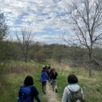
Pace: Moderate (3-4 km/hr) Terrain: Hilly, Level 2 (Intermediate – some hills and uneven surfaces, rocks and roots underfoot) Distance: 7-8 km
Description We will explore Valleyview and Maple View parks, and walk along German Mill Creak, in return we stop in Huntington park and have snack under beautiful shed ,
Even it is considered Urban walk, it is urban hike as we have some up and down hills and tree roots, please bring your hiking poles, water and snacks
Description Join BTC ecologist Mara McHaffie and members of the Toronto Bruce Trail Club’s Biodiversity Team on a hike to learn about birds along the Bruce Trail. This will be a leisurely walk with plenty of stops to observe and listen to the birds we find. This hike will be geared towards beginner birders (no experience necessary) but all are welcome. The BTC’s Silver Creek property boasts a variety of habitats, including meadows, forests, ponds and streams, so we expect to see a good diversity of birds. Some will be just passing through during migration, while others will be staying for the breeding season.
During the hike, we will discuss how you can use apps like iNaturalist, Merlin Bird ID and eBird to enhance your birding experience. If you’d like to try them out for yourself, please download them ahead of time, as cell service can be spotty at this location.
Besides water and snacks, bring binoculars if you have them, and please dress for the weather. Note that due to the slow pace and frequent stops, you may want to dress more warmly than you would for a faster-paced hike.
While there is no regular public parking at this location, we will have the gate open to allow parking on site. Parking is available just inside the farm gate off Highway 7, just west of where Trafalgar side trail enters the property (just west of the intersection of Highway 7 and Trafalgar Rd). A sign will be placed at the entrance and PLEASE NOTE that due to the divided road, you can only turn right into the property while travelling southwest on Highway 7 (no left turn). Refer to the map for more details: https://drive.google.com/file/d/1-GvFUz_TAnTi9iqKkJSyRwYNxZM3xxX3/view?usp=drive_link
Pace: Moderate (3-4 km/hr) Terrain: Hilly, Level 2 (Intermediate – some hills and uneven surfaces, rocks and roots underfoot) Distance: 7-8 km
Description We will explore Valleyview and Maple View parks, and walk along German Mill Creak, in return we stop in Huntington park and have snack under beautiful shed ,
Even it is considered Urban walk, it is urban hike as we have some up and down hills and tree roots, please bring your hiking poles, water and snacks
Jack Layton Ferry Terminal, near the gates to Wards Island Ferry. Arrive 20 minutes prior to departure to check in with hike leader.
From Union Station take the LRT and get off at the stop Ferry Docks.Walk up to the Ferry Docks on Queens Quay West, street level. at the foot of Bay Street.
Pace: Leisurely (2-3 km/hr) Terrain: Flat Distance: 6-9 km
Description After a day’s work come and “cool off” on the Toronto Islands free of fumes and traffic. Enjoy the view of the city skyline and Toronto’s beautiful island parkland. Pack a dinner for a sit down picnic. Food is not available for purchase on the Islands early in the season. Also bring a warm jacket and flashlight. Return fare ticket for the ferry is $9.11 adults and $5.86 seniors. Hikes will take place rain or shine. Toronto Island evening hikes will take place every Thursday in May and June 2025. Same time and same meeting place. No preregistration is required – just show up at the ferry docks at 5:40 PM and sign in with the hike leader.
Location (Google Maps): Meet at Bethesda Trail Head Parking on Bethesda Sideroad off Bayview Avenue, across from Lake Wilcox. This parking lot is free.
Pace: Moderate (3-4 km/hr) Terrain: Variable Distance: 16.4 km
Description Join us for a lovely hike through Short Hills Provincial Park outside of St. Catharines. We begin at the DeCew House Heritage Park, and then follow the shore of Lake Moodie, and cross Twelve Mile Creek on the way to Short Hills Provincial Park. In the park we’ll pass a couple of waterfalls, before ending at Rockway Falls in the Rockway Conservation Area. There will be a refreshment stop on the way back to Toronto.
Bring a packed lunch, two litres of water and sun/rain/bug protection as needed. Be prepared for some muddy ground along the way.
Hosting Club: Toronto, Dufferin Hi-Land Category: Car Hike Location (Google Maps): County Road 19 (Prince of Wales Rd) Parking Area. This parking is 80 meters south of the Prince of Wales Side Trail. GPS Coordinates N44.100049, W80.137339.
Pace: Brisk (4-5 km/hr) Terrain: Hilly, Level 2 (Intermediate – some hills and uneven surfaces, rocks and roots underfoot), Rocky Distance: 14 km
Description We’ll hike the Prince of Wales, Primrose Loop. Boyne Valley Side Trails and portion of the Main Trail at Boyne Valley Provincial Park. Atop Murphy’s Pinnacle we’ll enjoy and appreciate the early greening of the sorrounding landscape. Please bring your favorite liquid fuel, snacks/lunch and personal medications if any and health card. There maybe some muddy and slippery spots so hiking poles and proper footwear is always recommended. Please arrive fifteen minutes early.
Hosting Club: Toronto Category: Car Hike Location (Google Maps): Rouge National Urban Park, 16th Ave Parking Lot
Hike Leader(s): Alina Lin
Pace: Brisk (4-5 km/hr) Terrain: Flat, Level 2 (Intermediate – some hills and uneven surfaces, rocks and roots underfoot) Distance: 16 KM
Description Meet at the parking lot Northeast of the Ninth Line @ 19th Ave, GPS ( 43.952621, -79.246167) .
Please arrive before 8:45 am to get yourself ready.
We will leave the parking lot at 9:00am, hike along Rouge National Park Trails up to the Elgin Mills Road , and then return. Here is the planned route FYI: https://onthegomap.com/s/12v2do4v . Depending on the trail condition, we may have to adjust the route or distance.
Notes for your attention:
Wear clothing in layers for the weather.
Bring water, snacks or light lunch. We will have a short break for lunch after reaching turning point.
Pace: Moderate (3-4 km/hr) Terrain: Flat Distance: 10.4 km
Description Please join me at the south west corner of Lakeshore Blvd West and Ellis by 10 AM. We will hike east along the Waterfront Trail to the Distillery District (km 8.3 to km 71.4). Here is an online map with km markings of our route for all 7 hikes for the Toronto Urban Badge.
Please make sure you bring at least 2 liters of water, a lunch, bug spray and sunscreen.
Hosting Club: Toronto Category: Car Hike Location (Google Maps):
We meet at the Parking area off Side Road 15. If you are coming from 401 take exit for Hwy 25, take left on Side Road 15. Drive about 1KM, there is a sharp bend in the road (CAREFUL!). Turn left on to Nassagaweya–Esquesing Townline. Parking is a short drive to end of the road, which is blocked off.
We will hike the Hilton Falls Side Trail (ST) to the Al-Shaw ST, then join the Main Trail at 8.9KM, Map 12 Ed 31 to the point where it meets the Hilton Falls Side Trail at 1.4KM. We will walk on the Hilton Falls Side Trail and have lunch at Hilton Falls. We return back to the Nassagaweya–Esquesing Townline parking lot following the Hilton Falls ST. Bring 1.5 – 2 liters of water and your lunch. Please dress for the weather. Expect some bugs, so pack you bug spray.
Hosting Club: Toronto Category: Car Hike Location (Google Maps):
2499 Brock Rd, Uxbridge, ON L9P 1R4. We will meet at the East Duffins Headwaters parking lot at the WILDER FOREST trail head. As soon as you got off the Brock Road, passing the horse back riding facility, there is a free designated parking lot 70 meters down the lane to your right. It includes a sign board for East Duffins Headwaters with a map of the trails. Please do not park on the lane or in the horse back riding property.
Pace: Moderate (3-4 km/hr) Terrain: Flat, Hilly, Level 2 (Intermediate – some hills and uneven surfaces, rocks and roots underfoot), Variable Distance: Approx.14-15 Km
Description Join us for a delightful spring hike in Uxbridge, as we explore Wilder Forest, Walker Woods, and Glen Major Forest on a scenic loop starting from Brock Road. We’ll pass Concession Road 6, heading west and back, while also venturing onto several side trails for even more stunning views.
What to Expect:
•Beautiful scenic views and lookouts facing south
•A mix of hilly and flat terrain
•Frequent 2-minute breaks for hydration and photos, with a 10-20 minute lunch/snack stop
•Stay on designated trails at all times
What to Bring and Wear:
•Hiking Boots and poles (recommended)
•At least 2 liters of water
•Your favorite snacks and lunch (pack your own refreshments for an outdoor meal)
Hosting Club: Toronto Category: Car Hike Location (Google Maps): We will start from the Mast Trail Parking lot (South Trailhead) in Scarborough. If coming from Toronto, take the 401 east and get out at exit 390 for Kingston Rd. Address is shortly after 7450 Kingston Road and you’ll make a left.
For a Google map location: https://maps.app.goo.gl/MWQvvK8Ksg4PEaGg9
Pace: Moderate (3-4 km/hr) Terrain: Hilly, Level 2 (Intermediate – some hills and uneven surfaces, rocks and roots underfoot), Variable Distance: 9 km
Description Join us for a fantastic hike with views across the Rouge Valley on the Mast and Vista trails. We will pass by creeks and rivers and also climb up a few steep hills, ending the loop at the Vista lookout. There will be two stairs, boardwalks and more. Please arrive at 8:45 AM for briefing and we leave sharp at 9 AM.
Pace: Moderate (3-4 km/hr) Terrain: Flat Distance: 10.9 km
Description Please join me at the south east corner of Eglinton and Scarlett by 10 AM. We will hike south on the Humber Recreational Trail to Lakeshore Blvd and Ellis (km 19.2 to km 8.3). Here is an online map with km markings of our route for all 7 hikes for the Toronto Urban Badge: https://onthegomap.com/s/c2c1hf3n
Please make sure you bring at least 2 liters of water, a lunch, bug spray and sunscreen.
Hosting Club: Toronto Category: Urban Walk Location (Google Maps): We meet at Tommy Thompson Park by the public washrooms at Leslie and Unwin Sts. The TTC have routes that pass near Tommy Thompson Park. View the TTC schedules, routes, timetables, and find out how long does it take to get to Tommy Thompson Park in real time. List of stops closest to your destination: Leslie St at Mosley St; Queen St East at Alton Ave; Lake Shore Garage Loop.
Hosting Club: Toronto Category: Car Hike Location (Google Maps): Meet at the parking area at the end BOSTON Mills Rd. Just to the west of Mississauga Rd. 10:00 am loop hike
Pace: Leisurely (2-3 km/hr) Terrain: Level 2 (Intermediate – some hills and uneven surfaces, rocks and roots underfoot), Variable Distance: 7km
Description Spring has been a bit slow this year but the spring wild flowers are starting to bloom. It is really exciting to see bits of colour coming up along the trail. This is a loop hike and there are lots of plants and interesting things to see along the trail. we will walk the sidetrail and pick up a section of the main trail too. Be prepared for any kind of weather and maybe even some early bugs. Bring water and snacks
Pace: Moderate (3-4 km/hr) Terrain: Hilly, Level 2 (Intermediate – some hills and uneven surfaces, rocks and roots underfoot) Distance: 7-8 km
Description We will explore Valleyview and Maple View parks, and walk along German Mill Creak, in return we stop in Huntington park and have snack under beautiful shed ,
Even it is considered Urban walk, it is urban hike as we have some up and down hills and tree roots, please bring your hiking poles, water and snacks
Pace: Leisurely (2-3 km/hr) Terrain: Flat, Level 1 (Easy – mostly on flat, well maintained trails with hard-packed surface) Distance: 10 KM
Description Join us for a leisurely hike through High Park and then east along Toronto’s Waterfront Trail to Harbourfront Centre passing though many small parks including the Music Garden. Refreshments at a coffee shop on Queens Quay at Harbourfront. Bring lunch and drinking water. Dropout any time. We’ll arrive at Harbourfront Centre around 2:00 PM. This will be repeated Tuesday May 13th, Tuesday May 27th, Tuesday June 3rd, and Tuesday June 24th. No pre registration is required. Just show up 15-20 minutes before to departure time to sign in with the hike leader.
Pace: Moderate (3-4 km/hr) Terrain: Hilly, Level 2 (Intermediate – some hills and uneven surfaces, rocks and roots underfoot) Distance: 7-8 km
Description We will explore Valleyview and Maple View parks, and walk along German Mill Creak, in return we stop in Huntington park and have snack under beautiful shed ,
Even it is considered Urban walk, it is urban hike as we have some up and down hills and tree roots, please bring your hiking poles, water and snacks
Jack Layton Ferry Terminal, near the gates to Wards Island Ferry. Arrive 20 minutes prior to departure to check in with hike leader.
From Union Station take the LRT and get off at the stop Ferry Docks.Walk up to the Ferry Docks on Queens Quay West, street level. at the foot of Bay Street.
Pace: Leisurely (2-3 km/hr) Terrain: Flat Distance: 6-9 km
Description After a day’s work come and “cool off” on the Toronto Islands free of fumes and traffic. Enjoy the view of the city skyline and Toronto’s beautiful island parkland. Pack a dinner for a sit down picnic. Food is not available for purchase on the Islands early in the season. Also bring a warm jacket and flashlight. Return fare ticket for the ferry is $9.11 adults and $5.86 seniors. Hikes will take place rain or shine. Toronto Island evening hikes will take place every Thursday in May and June 2025. Same time and same meeting place. No preregistration is required – just show up at the ferry docks at 5:40 PM and sign in with the hike leader.
Please disregard the registration closed message that appears 24 hours prior to the hike. There is no registration as per above.
Pace: Moderate (3-4 km/hr) Terrain: Level 2 (Intermediate – some hills and uneven surfaces, rocks and roots underfoot), Rocky, Variable Distance (km): approx. 13-15 km
Description We continue Greg Vincent’s legacy of weekends away. Please join Jeanette Vincent, Brenda Menezes and David Royle as we explore the Lower Bruce Peninsula. The spring flowers will welcome us to the trails. We stay and have our meals at Evergreen a comfortable resort at Red Bay. Each day we will hike the Bruce Trail and its side trails to form loops with great views of Georgian Bay and its islands. The carpet of trilliums is the best along the length of the Bruce Trail along with other spring ephemerals. Approximately 15km/day.
This outing is restricted to those staying with us at Evergreen Resort for the weekend. You will need a car to access this outing.
Before registering at Evergreen Resort, please contact us for the price package for your accommodation and more details.
Then please contact Evergreen Resort for a reservations 1-519-534-1868 or frontdesk.evergreenresort@gmail.com and mention Vincent Wild Flower Victoria Day weekend. Once you are registered at Evergreen Resort then add your name to the TBTC registration online form for this outing. Space is limited.
Location (Google Maps): Meet at Bethesda Trail Head Parking on Bethesda Sideroad off Bayview Avenue, across from Lake Wilcox. This parking lot is free.
Pace: Moderate (3-4 km/hr) Terrain: Variable Distance: 13.0 km
Description Today’s hike starts at the beautiful Rockway Falls at Rockway Conservation Area. We’ll pass by another waterfall at Louth Conservation Area, and then on through vineyards to Ball’s Falls, one of the more spectacular falls in Ontario at 2/3 the height of Niagara Falls, before finishing at Fifth Ave. There will be a refreshment stop on the way back to Toronto.
Dropout point at 9 km.
Bring a packed lunch, two litres of water, and sun/rain/bug protection as needed.
Hosting Club: Toronto Category: Car Hike Location (Google Maps):
2499 Brock Rd, Uxbridge, ON L9P 1R4. We will meet at the East Duffins Headwaters parking lot at the WILDER FOREST trail head. As soon as you got off the Brock Road, passing the horse back riding facility, there is a free designated parking lot 70 meters down the lane to your right. It includes a sign board for East Duffins Headwaters with a map of the trails. Please do not park on the lane or in the horse back riding property.
Pace: Moderate (3-4 km/hr) Terrain: Flat, Hilly, Level 2 (Intermediate – some hills and uneven surfaces, rocks and roots underfoot), Variable Distance: Approx.14-15 Km
Description Join us for a delightful spring hike in Uxbridge, as we explore Wilder Forest, Walker Woods, and Glen Major Forest on a scenic loop starting from Brock Road. We’ll pass Concession Road 6, heading west and back, while also venturing onto several side trails for even more stunning views.
What to Expect:
•Beautiful scenic views and lookouts facing south
•A mix of hilly and flat terrain
•Frequent 2-minute breaks for hydration and photos, with a 10-20 minute lunch/snack stop
•Stay on designated trails at all times
What to Bring and Wear:
•Hiking Boots and poles (recommended)
•At least 2 liters of water
•Your favorite snacks and lunch (pack your own refreshments for an outdoor meal)
Hosting Club: Toronto Category: Car Hike Location (Google Maps):
We meet in the parking lot at Scotsdale Farm. Enter from Trafalgar Road, 1.7KM from where Trafalgar Road leaves Highway 7. Please note the main parking lot is in use, so we use the parking lot on the right entering Scotsdale Farm from Trafalgar Road.
Description We will hike the Main trail and Side Trails (ST) in the Scotsdale Farm / Silver Creek area. We start on the Bennett Heritage ST going North to join the Main Bruce trail at 35.1KM, Map 13, Ed 30. We turn back on the Main trail and join the Great Esker ST at 33.4KM. We leave the Great Esker trail to take the new Trafalgar ST, Reservoir ST and finally the Duff Pit ST to return back to the Main trail at 28.4KM. We take the Main trail going north until 31.2KM and take the Maureen Smith ST to return back on the Bennett Heritage ST to return back to the parking lot. Dress according to the weather. Hiking boots are required. Bring your lunch and 1.5-2 litres of water. Expect bugs, so pack your bug spray. No dogs please.
Pace: Moderate (3-4 km/hr) Terrain: Flat, Hilly, Level 2 (Intermediate – some hills and uneven surfaces, rocks and roots underfoot), Variable Distance: 12-14 km
Description Join us for a wonderful hike in Jefferson Forest and have a snack/lunch beside the Bond Lake with amazing Trillium views. We will hike among tall trees and bushes of the Jefferson Forest and across the Bayview-Yonge corridor to reach to the Bond Lake. Boots mandatory, poles recommended, bring at least 2L of water, bug spray, sunscreen, snack/lunch and dress according to the weather conditions. Please avoid parking along the road. Difficulty Level: 2 (Moderate)
Pace: Moderate (3-4 km/hr) Terrain: Hilly, Level 2 (Intermediate – some hills and uneven surfaces, rocks and roots underfoot), Rocky, Variable Distance: about 17 km
Description Please join me for an enjoyable spring flowers hike on the Bruce Trail (main and side trails) in the Pretty River River Provincial Park and the Petun Conservation Area. We will be following a relatevily challenging loop of ca 17 km from the south of the park (the Pretty River Road) moving up north to the north-west following the Bruce Trail main and side trails into the Petun Conservation area and down south passing many gorgeaus lookouts.
Please note that this is a long hike and a relatively long day trip if you are coming from the GTA.
We will try to keep a moderate pace of about 3 km/h while slowing down uphill. The trail is challenging with a few uphill sections after which we will stop for short water breaks. There will be a lunch break for about 20 min. We should be back to the parking lot around 4:30 pm.
Please be dressed for the weather, wear hiking shoes/boots, bring extra layers and pack your rain gear (just in case), at least 2 L of water, light lunch and snacks, your sunglasses and/or hut.
We will meet on the dedicated Pretty River PP parking lot on the Pretty River Road (exact map location 44.43147754685496, -80.27512513140113) around 10:45 am and start hiking at 11:00 am.
Please note that this hike is not suitable for a rainy/stormy day and will be cancelled in case of inclement weather.
Hosting Club: Toronto Category: Urban Walk Location (Google Maps):
Meet front entrance Civic Garden Centre Pavilion, Toronto Botanical Gardens – Leslie Street & Lawrence Avenue. Take Bus #54 Lawrence or #51 Leslie from Eglinton Station on Line 1
Pace: Moderate (3-4 km/hr) Terrain: Level 2 (Intermediate – some hills and uneven surfaces, rocks and roots underfoot), Variable Distance: 10-12 km
Description We’ll hike a couple of loops on side trails through Wilket Creek, Sunnybrook, ET Seton, and Serena Gundy Parks. Enjoy the trilliums and other wildflowers in the wooded areas of Sunnybrook as well as the gardens of the Toronto Botanical Gardens at the start of the hike. Bring lunch and water. Hiking boots recommended. Those who wish may join us for a post-hike refreshment stop at Corks Beer & Wine Bar in Longo’s in Leaside.
Hosting Club: Toronto Category: Car Hike Location (Google Maps): Erindale Park, Mississauga: Please note that due to on-going construction you can only enter Erindale Park on Dundas Street travelling West. If you approach travelling East you must proceed to the next set of lights and turn back.
Pace: Moderate (3-4 km/hr) Terrain: Hilly, Level 2 (Intermediate – some hills and uneven surfaces, rocks and roots underfoot)
Description We will explore Valleyview and Maple View parks, and walk along German Mill Creak, in return we stop in Huntington park and have snack under beautiful shed ,
Even it is considered Urban walk, it is urban hike as we have some up and down hills and tree roots, please bring your hiking poles, water and snacks,
Pace: Moderate (3-4 km/hr) Terrain: Hilly, Variable Distance: 10 km
Description Please join me for an enjoyable fitness hike on a hilly part of the park and, hopefully with views of apple tress blossom. We will hike a 10 km loop with one section going up hill. The trail has mostly treed sections as well as a few open areas. There will be a lunch stop near the Credit River. Be prepared wearing comfortable cloths, hiking shoes/boots. Please bring at least 2 L of water, a light lunch/snacks, sun screen and bug spray optional. We will on the parking lot at the trail head and map poster to the right of the washroom facilities. You have to drive to the main entrance on the McLaren Road and pay for the parking.
Pace: Moderate (3-4 km/hr) Terrain: Hilly, Level 2 (Intermediate – some hills and uneven surfaces, rocks and roots underfoot)
Description We will explore Valleyview and Maple View parks, and walk along German Mill Creak, in return we stop in Huntington park and have snack under beautiful shed ,
Even it is considered Urban walk, it is urban hike as we have some up and down hills and tree roots, please bring your hiking poles, water and snacks,
Jack Layton Ferry Terminal, near the gates to Wards Island Ferry. Arrive 20 minutes prior to departure to check in with hike leader.
From Union Station take the LRT and get off at the stop Ferry Docks.Walk up to the Ferry Docks on Queens Quay West, street level. at the foot of Bay Street.
Pace: Leisurely (2-3 km/hr) Terrain: Flat Distance: 6-9 km
Description *** Cancelled due to weather conditions **
Due to continued rainfall and cold temperatures this evening”s walk is cancelled.
After a day’s work come and “cool off” on the Toronto Islands free of fumes and traffic. Enjoy the view of the city skyline and Toronto’s beautiful island parkland. Pack a dinner for a sit down picnic. Food is not available for purchase on the Islands early in the season. Also bring a warm jacket and flashlight. Return fare ticket for the ferry is $9.11 adults and $5.86 seniors. Hikes will take place rain or shine. Toronto Island evening hikes will take place every Thursday in May and June 2025. Same time and same meeting place. No preregistration is required – just show up at the ferry docks at 5:40 PM and sign in with the hike leader.
Please disregard the registration closed message that appears 24 hours prior to the hike. There is no registration as per above.
Pace: Moderate (3-4 km/hr) Terrain: Variable Distance: 13.0 km
Description Join us as we continue to follow the escarpment through the Niagara Section of the Bruce Trail. On today’s walk we’ll pass through meadows and forests, cross over streams, and have some beautiful views over vineyards at Cave Springs, before finishing at Mountainview Conservation Area. There will be a refreshment stop on the way back to Toronto.
Dropout point at 9.2 km.
Bring a packed lunch, two litres of water, and sun/rain/bug protection as needed.
Hosting Club: Toronto Category: Urban Walk Location (Google Maps): Start at Whitby Go Station, Parking Garage on the south side https://maps.app.goo.gl/y9hBo7pJZi9s4qGF6
Pace: Moderate (3-4 km/hr) Terrain: Flat, Level 1 (Easy – mostly on flat, well maintained trails with hard-packed surface) Distance: 10 KM
Description Join us for a beautiful spring day hiking from Whitby Go station to visit Lynde Shores Conservation Area, a place known for its beautiful birds. We will be taking some paved and unpaved paths and returning back to Whitby Go. Bring your binoculars as you’ll likely see some great birds! Enjoy the many bird songs of the season. Would recommend downloading Merlin Bird ID before the hike.
If you’d like to drive in, you can park also at the Whitby Go station.
For those taking the Go Train from Union Toronto, please take the earliest 8:50 AM Lakeshore East train to Whitby Go so you can arrive on time.
Pace: Moderate (3-4 km/hr) Terrain: Hilly Distance: 13 km
Description We will complete a loop hike in the Forks of the Credit PP starting with a 1.3 km hike along the Elora Cataract Trailway to the pedestrian entrance.
The route includes some significant hills and a view of the waterfall. Refreshments after the hike TBA.
From Belfountain go north on Mississauga Road about 3 km to the tee intersection with Cataract Road. Parking is on both sides of Mississauga Road but be aware of restrictions.
Pace: Moderate (3-4 km/hr) Terrain: Flat Distance: 11.4 km
Description Please join me at the north west corner of Finch and Weston by 10 AM. We will hike east along the Finch Hydro Corridor Trail to Bathurst St (N of Finch) (km 30.2 to km 41.6). Here is an online map with km markings of our route for all 7 hikes for the Toronto Urban Badge: https://onthegomap.com/s/c2c1hf3n
Please make sure you bring at least 2 liters of water, a lunch, bug spray and sunscreen.
Hosting Club: Toronto Category: Car Hike Location (Google Maps):
2499 Brock Rd, Uxbridge, ON L9P 1R4. We will meet at the East Duffins Headwaters parking lot at the WILDER FOREST trail head. As soon as you got off the Brock Road, passing the horse back riding facility, there is a free designated parking lot 70 meters down the lane to your right. It includes a sign board for East Duffins Headwaters with a map of the trails. Please do not park on the lane or in the horse back riding property.
Pace: Moderate (3-4 km/hr) Terrain: Flat, Hilly, Level 2 (Intermediate – some hills and uneven surfaces, rocks and roots underfoot), Variable Distance: Approx.14-15 Km
Description Join us for a delightful spring hike in Uxbridge, as we explore Wilder Forest, Walker Woods, and Glen Major Forest on a scenic loop starting from Brock Road. We’ll pass Concession Road 6, heading west and back, while also venturing onto several side trails for even more stunning views.
What to Expect:
•Beautiful scenic views and lookouts facing south
•A mix of hilly and flat terrain
•Frequent 2-minute breaks for hydration and photos, with a 10-20 minute lunch/snack stop
•Stay on designated trails at all time
What to Bring and Wear:
•Hiking Boots and poles (recommended) and be prepared for the bugs
•At least 2 liters of water
•Your favorite snacks and lunch (pack your own refreshments for an outdoor meal)
Pace: Moderate (3-4 km/hr) Terrain: Flat Distance: 10.4 km
Description Please join me at the south west corner of Lakeshore Blvd West and Ellis by 10 AM. We will hike east along the Waterfront Trail to the Distillery District (km 8.3 to km 71.4). Here is an online map with km markings of our route for all 7 hikes for the Toronto Urban Badge: https://onthegomap.com/s/c2c1hf3n
Please make sure you bring at least 2 liters of water, a lunch, bug spray and sunscreen.
Pace: Moderate (3-4 km/hr) Terrain: Hilly, Level 2 (Intermediate – some hills and uneven surfaces, rocks and roots underfoot)
Description We will explore Valleyview and Maple View parks, and walk along German Mill Creak, in return we stop in Huntington park and have snack under beautiful shed ,
Even it is considered Urban walk, it is urban hike as we have some up and down hills and tree roots, please bring your hiking poles, water and snacks,
Pace: Leisurely (2-3 km/hr) Terrain: Flat, Level 1 (Easy – mostly on flat, well maintained trails with hard-packed surface) Distance: 10 KM
Description Join us for a leisurely hike through High Park and then east along Toronto’s Waterfront Trail to Harbourfront Centre passing though many small parks including the Music Garden. Refreshments at a coffee shop on Queens Quay at Harbourfront. Bring lunch and drinking water. Dropout any time. We’ll arrive at Harbourfront Centre around 2:00 PM. This will be repeated Tuesday May 13th, Tuesday May 27th, Tuesday June 3rd, and Tuesday June 24th. No pre registration is required. Just show up 15-20 minutes before to departure time to sign in with the hike leader.
Hosting Club: Toronto Category: Car Hike Location (Google Maps): Road side parking, Mulmur Nottawasaga Townline, at the cemetery. Coordinates N 44.268777,W 80.156810 map 21 edition 31
Pace: Brisk (4-5 km/hr) Terrain: Hilly, Variable Distance: 22 km
Description Welcome to Blue Mountains E2E, we will hike the section in 3 days. Please register to each hike individually. We will enjoy the beautiful section and go up and down the hills. Please bring 2 litres of water, bug protection, snacks and lunch. If you need to get in touch with me, email me on my email address provided in this posting. Arrive 15 minutes early so we can shuttle by 8:30. Please note that we are shuttling to a paid parking. Everyone is expected to pay their share of the parking.
Pace: Brisk (4-5 km/hr) Terrain: Challenging, Hilly Distance: 25 km
Description Second hike in the Blue Mountains E2E series. This is the longest hike of the series. Beautiful, hilly and challenging. Please bring 2litres of water. Arrive 15 minutes early. The meeting place parking is a paid parking, everyone is expected to pay their share of the parking fees. We will shuttle to km 46.8 and hike back.
Pace: Moderate (3-4 km/hr) Terrain: Hilly, Level 2 (Intermediate – some hills and uneven surfaces, rocks and roots underfoot)
Description We will explore Valleyview and Maple View parks, and walk along German Mill Creak, in return we stop in Huntington park and have snack under beautiful shed ,
Even it is considered Urban walk, it is urban hike as we have some up and down hills and tree roots, please bring your hiking poles, water and snacks,
Jack Layton Ferry Terminal, near the gates to Wards Island Ferry. Arrive 20 minutes prior to departure to check in with hike leader.
From Union Station take the LRT and get off at the stop Ferry Docks.Walk up to the Ferry Docks on Queens Quay West, street level. at the foot of Bay Street.
Pace: Leisurely (2-3 km/hr) Terrain: Flat Distance: 6-9 km
Description After a day’s work come and “cool off” on the Toronto Islands free of fumes and traffic. Enjoy the view of the city skyline and Toronto’s beautiful island parkland. Pack a dinner for a sit down picnic. Food is not available for purchase on the Islands early in the season. Also bring a warm jacket and flashlight. Return fare ticket for the ferry is $9.11 adults and $5.86 seniors. Hikes will take place rain or shine. If the weather is particularly inclement the day of the hike please check the hike schedule by 10:00 AM for an update. Toronto Island evening hikes will take place every Thursday in May and June 2025. Same time and same meeting place. No preregistration is required – just show up at the ferry docks at 5:40 PM and sign in with the hike leader.
Description Hike #3 of 3. Badge day! Beautiful and hilly. This is a brisk pace hike. The pace is expected to be 4 to 4.5 km per hour. Bring 2 litres of water. Aim to get there 15 minutes early. We will shuttle to km 67.3 and walk back.
Pace: Moderate (3-4 km/hr) Terrain: Level 2 (Intermediate – some hills and uneven surfaces, rocks and roots underfoot) Distance: 15 km
Description We will hike some of the Grand Valley Trails Association (GVTA) trails along with other local trails and the rare Charitable Research Reserve trail close to and beside the Grand River. Today Jeanette Vincent, a hike leader with both the TBTC and GVTA will co-lead and meet us in her local town of Kitchener. It being Spring wildflower season we shall have the opportunity to enjoy some of those.
A little about the trails that we will be hiking:
The Grand Valley Trail is a 250-kilometre footpath that stretches between the village of Belwood to Port Maitland, near Rock Point Provincial Park, on Lake Erie, south of Dunnville. https://www.gvta.on.ca/Grand-Valley-Trail.htm
RareCharitable Research Reserve In the mid-1990s, the University of Guelph explored opportunities to sell these lands, sparking a grassroots campaign from concerned citizens to ensure these lands were protected in perpetuity. As a result of this campaign, 913 acres were purchased as part of a new community-based conservation strategy. By February 2001, the land transfer was completed and, on December 6, 2001, the charity that would become the rare Charitable Research Reserve was incorporated as a community-based urban land trust, nature reserve and environmental institute. https://www.raresites.org/about/history
After the hike we will make a stop in the historic town of Galt, filming location of Handmaids Tale and Murdoch Mysteries because of it’s beautiful old architecture.
Pace: Moderate (3-4 km/hr) Terrain: Hilly, Level 2 (Intermediate – some hills and uneven surfaces, rocks and roots underfoot), Variable Distance: 14-15 km
Description We will hike Vista trail and part of orchard trail, will enjoy look outs between Rouge river and Little Rouge creek • Please dress appropriately for the weather. • We will have short water ,picture and a 15 minute snack break. Everyone is welcome!
Pace: Moderate (3-4 km/hr) Terrain: Flat Distance: 9.6 km
Description Please join me at the north east corner of Bathurst and Finch by 10 AM. We will hike east on the Finch Hydro Corridor Trail and south along East Don Parklands to Sheppard and Leslie (km 41.6 to km 51.2). Here is an online map with km markings of our route for all 7 hikes for the Toronto Urban Badge: https://onthegomap.com/s/c2c1hf3n
Please make sure you bring at least 2 liters of water, a lunch, bug spray and sunscreen.