
Join us for a hike! Registration required:
All hikes available to BTC members. Some hikes are open to non-members.
TIP: The calendar view displays up to 7 hikes on a day, but often there are more. Click “More events” to see them all.
Toronto Hike Schedule
Toronto Bruce Trail Club Registration Live Dates
Day Winter Coach Program
Registration begins two weeks in advance of the event departure (at 8:00 PM)
Day Bus Hikes
Registration begins two weeks in advance of the event departure (at 8:00 PM) with some exceptions of special event hikes
Day Coach Hikes
Registration begins 7 weeks in advance of the event departure
Day Car Hikes and Urban Hikes
Registration begins two weeks in advance of the event departure
Overnight and Weekend Trips
Registration begins 12 weeks in advance of the event departure
To view all Bruce Trail Conservancy Hikes click here
- 04August 4, 2024No events
- 05August 5, 2024
Toronto E2E (shuttle)
https://hikes.brucetrail.org/event/toronto-e2e-shuttle/Sorry, the registration cut-off time for this hike has been reached.Not a member? Click here to join today!This is a Multi-Day Hike
You are signing up for the following dates and times:
2024-08-05 at 08:30
2024-08-12 at 08:30
2024-08-19 at 08:30Hosting Club: Toronto, Caledon Hills
Category: End-to-End
Location (Google Maps): Meet at Fourth Line (where the trail crosses) (Bruce Trail Ref. Guide km 17.4)
Shuttle to Hilton Falls (paid parking)Hike Leader(s): Heather Murch Click here to contact Hike Leader(s)
Pace: Brisk – 4 to 5 km/hour
Terrain: Moderate – some hills and/or some poor footing
Distance: 17.6 kmDescription
You are signing up for 3 hikes. Please arrive at the meeting point ready to shuttle by 8:30.We will shuttle south and hike north. Everyone will need to shuttle; have your vehicle ready to take 4 people if possible.
Come prepared for… Hiking! You must wear hiking shoes/boots. Consider bringing hiking poles for uneven terrain.
Heat: At least 2L of water; a sun hat.
Rain: A raincoat/poncho and a love of the outdoors, no matter the weather.
Bugs: Bug spray or a bug hat/shirt.
Poison Ivy: Long sleeves; long pants.
An appetite: Bring a snack; we’ll take a short break along the way.
Although I have hiked the full Bruce Trail a few times, this is my first official hike series as a leader, so, Welcome! 🙂
5 Aug. 17.6 km
Meet at Fourth Line (where the trail crosses) (guide 17.4)
43.615163, -79.975157Shuttle to Hilton Falls (paid parking)
43.505705, -79.96158912 Aug. 16.9 km
Meet at
8th Line & 27 Sideroad (Guide approx. km 34.3)
43.686276, -79.975578Shuttle to:
Fourth Line (where the trail crosses)
43.615163, -79.97515719 Aug (total 16 km)
1. 2.5 km
Meet at:
Boston Mills Road (Guide 48 km)
43.750866, -79.951452Modified shuttle to Creditview Road
43.767739, -79.9429292. 13.5 km
Shuttle to:
8th Line & 27 Sideroad (Guide approx. km 34.3)
43.686276, -79.975578 - 06August 6, 2024

Peninsula Stained Glass Badge, Fundraiser in 8 hikes.
https://hikes.brucetrail.org/event/peninsula-stain-glass-badge-fundraiser/Sorry, the registration cut-off time for this hike has been reached.Not a member? Click here to join today!Hike open to BTC Members only.
This is a Multi-Day Hike
You are signing up for the following dates and times:
2024-08-06 at 09:00
2024-08-07 at 08:30
2024-08-08 at 08:30
2024-08-09 at 08:30
2024-08-19 at 09:00
2024-08-20 at 08:30
2024-08-21 at 08:30
2024-08-22 at 08:30Hosting Club: Toronto, Peninsula
Category: Car Hike
Location (Google Maps): BlueWater park, Wiarton, km 0.0 coordinates N 44.742514,W 81.135140 map 35Hike Leader(s): Smadar Junkin Click here to contact Hike Leader(s)
Pace: Brisk
Terrain: Challenging, Variable
Distance: 24.4 kmDescription
Thank you for registering to the Stain Glass, fund raising hike of the Peninsula. This will be a fundraising hike series in 8. Each hiker will be allowed to miss one hike and make it on their. The funds for this hike will be collected by the Toronto club and it will be transferred to the Peninsula club to help maintain the trail and keep the pledge of Ribbon Of Wilderness For Everyone, Forever.
on the first hike we will shuttle to km and hike back.
hike 2- we will meet at km 44.1, Hope Bay coordinates N 44.902930,W 81.155706 map 37 and shuttle to km 24.4hike 3- we will meet at km 44.1, Hope Bay and will shuttle to km 67.9 and walk back.
hike 4- we will meet at km 87.5, Richardson Side Trail, coordinates N 45.020460,W 81.283790 map 39, we will shuttle to km 67.9 and walk back.
hike 5- we will meet at Richardson SideTrail and shuttle to km 110.6 – (may be a paid parking) and walk back.hike 6- we will meet at km 110.6 coordinates N 45.147416,W 81.338921 map 40, we will shuttle to km 125.4 Crane Lake and walk back.
hike 7- we will meet at Crane Lake, km 124.4 coordinates N 45.190813,W 81.419658, map 41 we will shuttle to Cyprus Lake, parking B. this is a paid parking and will add about 2km to the hike. We will go on the trail that leads to mars lake, km 145.5 and walk back.
hike 8- we will park in Tobermory, there are some places that are free parking, we will park in a free parking place that I will explain how to get there during the duration of the hike. We will shuttle to cypress Lake, ( paid parking) and walk back. It’s badge day at the cairn, pictures and treats.
please bring 2 or more litres of water, snacks and lunch. Everyone is expected to participate in the shuttle once or twice in the duration of the 8 days.lets go and have fun on the trail.
- 07August 7, 2024
Car Hike: Midweek Fitness Walk Around Island Lake (8.5 km)
https://hikes.brucetrail.org/event/car-hike-midweek-fitness-walk-around-island-lake-8-5-km/Sorry, the registration cut-off time for this hike has been reached.Not a member? Click here to join today!Hosting Club: Toronto
Category: Car Hike
Location (Google Maps):Island Lake Conservation Area (Hwy 10 and 4th Ave intersection)
Hike Leader(s): Natalia Svechnikova Click here to contact Hike Leader(s)
Pace: Moderate
Terrain: Flat
Distance: 8.3 kmDescription
Please join me for an enjoyable fitness walk on a relatively flat and easy trail around the lake in the Island Lake Conservation area. The trail has treed sections as well as boardwalks near the water, meadows with beautiful flowers and much more. We will keep some steady but still comfortable pace of approximately 3 km/h. We will have a short break on the picnic area after about 6 km. Please bring 2 L of water, sunglasses, hut and some snacks/light lunch. We will meet at the start of the trail (near the large trail map) at 4th Ave and Hwy 10 intersection. You can park anywhere at the Zehrs Orangeville, Winners or Mark’s parking lot which is just across Hwy 10, - 08August 8, 2024No events
- 09August 9, 2024No events
- 10August 10, 2024
Urban Walk: Hendrie Valley Sanctuary to West Harbour GO Station, Hamilton
https://hikes.brucetrail.org/event/urban-walk-hendrie-valley-sanctuary-to-west-harbour-go-station-hamilton-2/Sorry, the registration cut-off time for this hike has been reached.Not a member? Click here to join today!Hosting Club: Toronto
Category: Urban Walk
Location (Google Maps):Meet in the Great Hall of Union Station by the information desk with the clock with no later than 8:30 AM to take the Lakeshore West train towards West Harbour departing at 8:45 AM
Hike Leader(s): Tom Swales, Janet McColeman Click here to contact Hike Leader(s)
Pace: Moderate (3-4 km/hr)
Distance: 12 km
Description
From Aldershot GO Station we will hike to scenic Hidden Valley Park and the Hendrie Valley Sanctuary, a popular spot for birdlife. Then on to Burlington Heights and the Hamilton Waterfront Trail to catch the train back to Toronto from the West Harbour GO Station. Optional drop out at Burlington Heights by taking the local bus to Burlington GO Station. Optional pub stop at Fisher’s Pier 4 pub 10 minutes walk Harbour GO Station.We will hike from Aldershot GO Station in Burlington to West Harbour Station in Hamilton via Hidden Valley Park, Hendrie Valley (RBG), Burlington Heights, and the Hamilton Waterfront Trail. The route is mostly flat with the exception of one hill to reach Burlington Heights to connect with the Waterfront Trail. Hendrie Valley features a lovely boardwalk through the wetlands. The total distance is about 12 km and we will walk at an average pace of 3 to 3.5 km per hour (and less than 4.).
We will take the train departing Union Station at 8:44 and arriving at Aldershot at 9:55. You may meet Tom in the Great Hall by the information desk with the clock over it to depart by 8:30 or find us in the upper level of the accessibility coach if boarding at a station on the way. The train will stop at Mimico Station at 9:00 and Port Credit Station at 9:13.
Trains depart West Harbour Station hourly at 23 minutes past the hour. There will be an optional pub stop 10 minutes walk from the station. Ice cream is also available at Hutches fish and chips next to the GO station. Arrival at West Harbour is expected to be approximately just after 2:00 PM.
If you have a cell phone with data you may purchase the $10 day pass at the link below. Make sure to select Weekend Day Pass and not an E-Ticket. The senior return fare from Union is less than $11.00 so with the “One Fare” program covering the TTC ride to the GO station it’s cheaper for seniors to use their Presto Card.
https://tickets.gotransit.com/en-us?start_address=UN&end_address=WR&ticket_adult=1&ticket_senior=0&mode=one_way
Car Hike: Glasgow Village (Uxbridge)
https://hikes.brucetrail.org/event/car-hike-glasgow-village-uxbridge/Sorry, the registration cut-off time for this hike has been reached.Not a member? Click here to join today!Hosting Club: Toronto
Category: Car Hike
Location (Google Maps): Glasgow Trail, Concession Road 2 Park in parking lot at the trail head.From Highway 404 turn right to Stouffville Rd, till to the end of road and turn left on York Durham line in About 1km turn right to Webb Rd. and turn right to Concession Road 2 ,you will see parking lot in 500 meters
Hike Leader(s): Mohammad Aghamiri Click here to contact Hike Leader(s)
Pace: Moderate (3-4 km/hr)
Terrain: Variable
Distance: 14-17 kmDescription
Lets explore Goodwood conservation area and visit Secord forest and pondApproximately 5-hour hike, bring lots of water and protect yourself from mosquitos
Some safety procedures during the hike:
1-Hikers must stay between the leader and the sweep.
2-Hikers must advise the leader or the sweep if they wish to leave the group.
3- Hikers must follow the whistle instructions: 1 blast- stay where you are; 2 blasts come to the leader; 3 blasts – come to the leader quickly.
4-Hike leader may request volunteers to stop at trail intersections, they need to help hikers to the direction the group walk and wait till they see the sweep .
5-Hikers have to make sure they can see the persons behind and in front of them.
Bus Hike: Pathways To Port Dover Lynn Valley Trail - Cancelled Due To Low Registration
https://hikes.brucetrail.org/event/bus-hike-pathways-to-port-dover-lynn-valley-trail-2/Sorry, the registration cut-off time for this hike has been reached.Not a member? Click here to join today!Hosting Club: Toronto
Category: Cancelled
Location (Google Maps):Lynn Valley Trail
Hike Leader(s): Tom Swales, Janet McColeman Click here to contact Hike Leader(s)
Pace: Moderate
Terrain: Flat
Distance: 12 kmDescription
Join us for a scenic and easy paced walk, a regular summer favorite led by Wayne Crockett, along the trails running through Norfolk County ending at historic Port Dover. The route is primarily on rail trails so is ideal for those who favor a flatter and easier route in the summer heat. Dropout at 8km. After the walk there will be the opportunity to indulge in the local perch fish and chips or hang out at the beach which together make Port Dover famous. Long Distance Bus Fare applies and there will be a late return (after 6:00 Pm).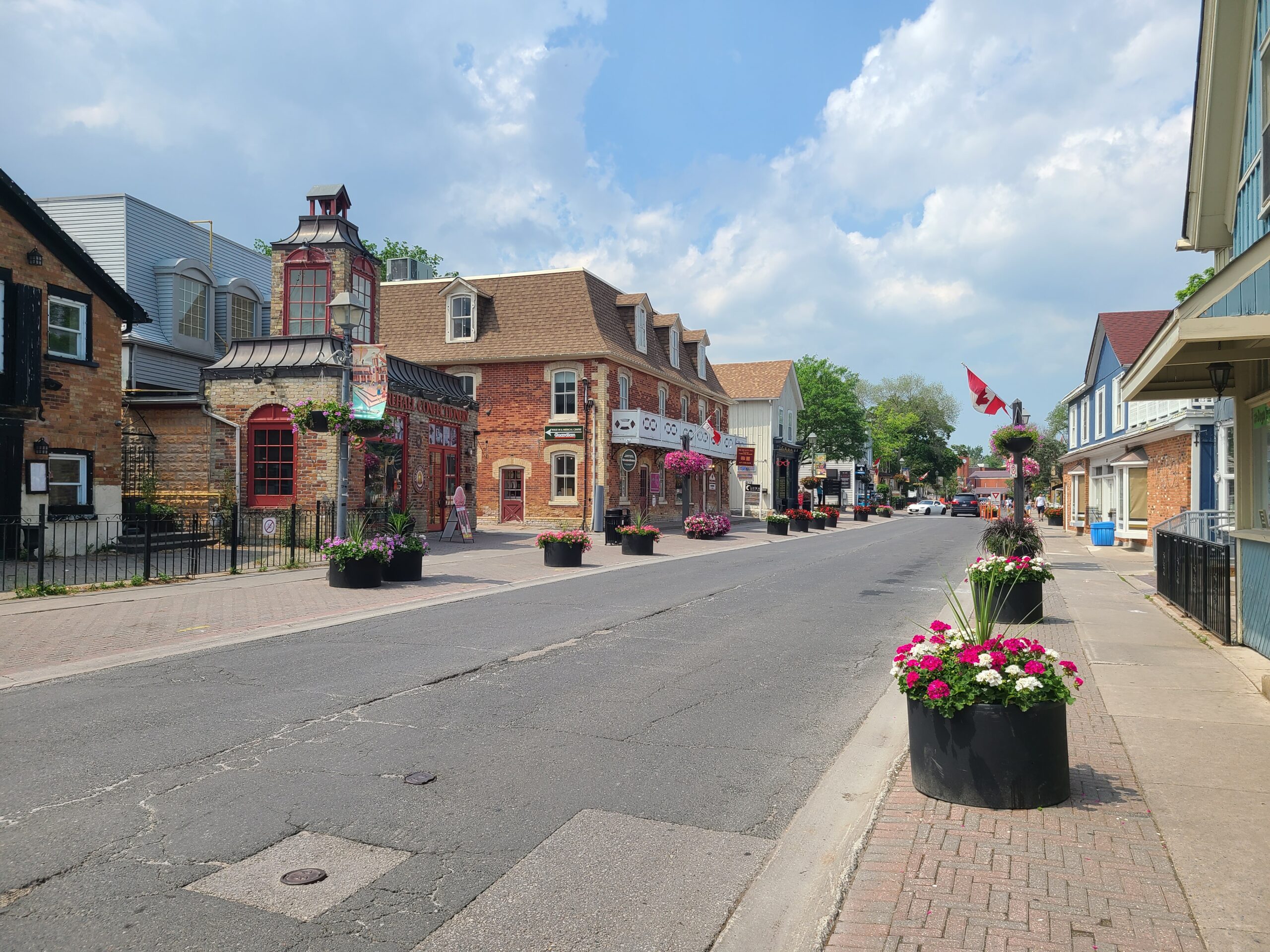
Urban Walk; Historic Main Street Unionville & Main Street Markham & Rouge Valley Trail
https://hikes.brucetrail.org/event/urban-walk-historic-main-street-unionville-main-street-markham-rouge-valley-trail/Sorry, the registration cut-off time for this hike has been reached.Not a member? Click here to join today!Hosting Club: Toronto
Category: Urban Walk
Location (Google Maps): Main Street Unionville, Main Street Markham, Milne Dam Conservation Area, Rouge Valley TrailHike Leader(s): Celia Ho Click here to contact Hike Leader(s)
Pace: Moderate
Terrain: Flat
Distance: 14.15 kmDescription
Visit the old villages of Unionville and Markham Village and part of the Rouge Valley Trail system in the City of Markham.We will meet at Varley Art Gallery of Markham in Main Street Unionville after the art event from 2:00 PM – 4:00 PM: https://visitmarkham.ca/event/curators-corner-discovering-art-together/
If you are not planning to join the event at the gallery, the meeting time for the walk is 4:00 PM at the entrance outside the gallery.
We will walk along the loop at Too Good Pond before heading to Bruce Creek, Austin Park, and Milne Dam Conservation Area along the Rouge Valley Trail, arriving at Main Street Markham. From this point on it will be road walking as we head back to Main Street Unionville. Drop-out points are available along the way with access to public transit and passing by Markham GO Station and Centennial GO Station.
Arriving in Main Street Unionville in the evening hours, there is the option to return home or have a walk on Main Street Unionville and/or have a refreshment stop. (https://unionville.ca/)
Please refer to the route map: https://onthegomap.com/s/t3o2m013