Join us for a hike! Registration required:
All hikes available to BTC members. Some hikes are open to non-members.
TIP: The calendar view displays up to 7 hikes on a day, but often there are more. Click “More events” to see them all.
Toronto Hike Schedule
Toronto Bruce Trail Club Registration Live Dates
Day Winter Coach Program
Registration begins two weeks in advance of the event departure (at 8:00 PM)
Day Bus Hikes
Registration begins two weeks in advance of the event departure (at 8:00 PM) with some exceptions of special event hikes
Day Coach Hikes
Registration begins 7 weeks in advance of the event departure
Day Car Hikes and Urban Hikes
Registration begins two weeks in advance of the event departure
Overnight and Weekend Trips
Registration begins 12 weeks in advance of the event departure
To view all Bruce Trail Conservancy Hikes click here
- 18June 18, 2023
Guelph Line to Old Guelph Road Parking - 17.5 KM
https://hikes.brucetrail.org/event/gueph-line-to-old-guelph-road-parking-17-5-km/Sorry, the registration cut-off time for this hike has been reached.Not a member? Click here to join today!Hosting Club: Toronto
Category: Car Hike
Location (Google Maps): Roadside parking on the north end of Old Guelph Road (Map 9, 65.8 KM)Hike Leader(s): Fayyaz Mahmood Click here to contact Hike Leader(s)
Pace: Brisk
Terrain: Challenging, Rocky, Variable
Distance: 17.5 KMDescription
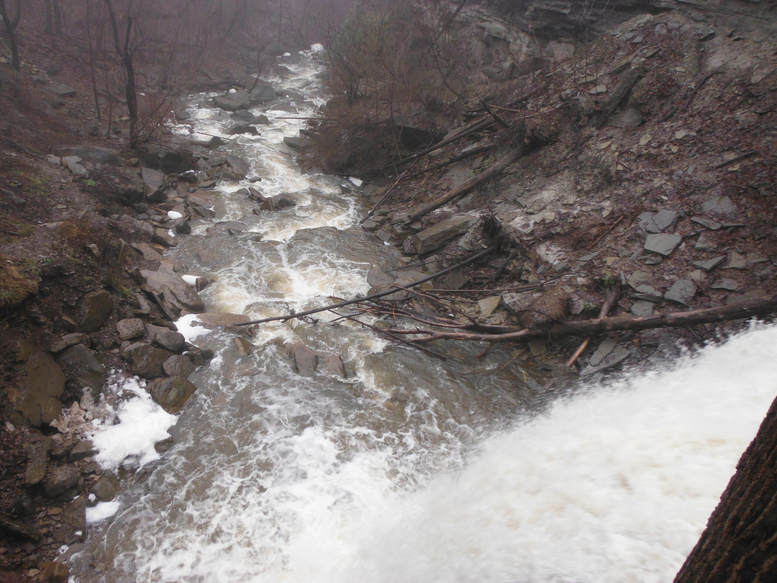
We will meet at the roadside parking at the north end of Old Guelph Road (Map 9, 65.8KM). We will carpool to Guelph Line (Map 10, 82.6KM). We will go South passing Fisher Pond, then cross Dundas Road at Signal Hill, going past City View Park, through Waterdown Woods to the Great Falls in Grindstone Creek Valley. We continue on crossing Snake Road going through Clappson Woods to complete the hike.Special Instructions:
Bring at least 2.5 litres of water and your lunch.
Bring bug spray – you will need it.
Hiking shoes required.
Toronto section E2E 4/4
https://hikes.brucetrail.org/event/toronto-section-e2e-4-4/Sorry, the registration cut-off time for this hike has been reached.Not a member? Click here to join today!Hosting Club: Niagara, Toronto
Category: Car Pool
Location (Google Maps): We meet each other at the roadside parking on Boston Mills Rd, just west of the Mississauga Rd intersection. Please note that the driveway is private property.Hike Leader(s): Mehrnoush Ahmadi Click here to contact Hike Leader(s)
Pace: Medium
Terrain: Moderate
Distance: 17kmDescription
This is the last leg of the Toronto section E2E hike, which is divided into four parts. Each part requires separate registration.In the last part, we will also be hiking some side trails during the hike. At the end of the hike, there is a 4-kilometer out-and-back stretch from the parking area to reach the endpoint of the Toronto section.
If you would like to receive the badge for completing the
E2E, there is a fee of ten dollars.IF THE HIKERS WOULD LIKE TO OBTAIN THE NEW FOUND RAISING BADGE, they have the option to e-transfer the fee (The fee is $30.00 for BTC members and $40.00 for non-members) to the TBTC treasurer’s email at tbtctreasurer211@gmail.com and receive it when you complete the section.
Please note that this is a carpool hike, so it’s important to come with an empty car and be prepared for carpooling and sharing rides.
On Badge day, there will be an option for a gathering during lunchtime. We can all come together to celebrate and enjoy a meal.
Dress appropriately for the weather conditions. Make sure to bring snacks, lunch, and a minimum of 2 liters of water.
During the hike, we will take short water breaks, as well as a 30-minute lunch break.
Every body is welcome! See you there!
Urban Walk: Forest Hill/Cedarvale Ravine/Beltline Sunday morning walk
https://hikes.brucetrail.org/event/urban-walk-forest-hill-cedarvale-ravine-beltline-sunday-morning-walk/Sorry, the registration cut-off time for this hike has been reached.Not a member? Click here to join today!Hosting Club: Toronto
Category: Urban Walk
Location (Google Maps): Yonge and St. ClairHike Leader(s): Danny Pivnick Click here to contact Hike Leader(s)
Pace: Moderate
Terrain: Flat
Distance: 10kmsDescription
Please join us for a nice relaxing walk through some beautiful parts of Forest Hill into Forest Hill Village before entering the Cedarvale Ravine up towards Eglinton and the Beltline Trail. Following the Beltline Trail back to Yonge St., we will briefly enter Mt. Pleasant Cemetery where we will look at the gravestone of Canada’s longest serving Prime Minister (Mackenzie King). This walk will begin and end at Yonge and St. Clair. For walk route, you can copy and paste the following link into your browser: https://onthegomap.com/s/6arbgc51
Toronto Urban Badge Hike - 1 of 7
https://hikes.brucetrail.org/event/toronto-urban-badge-hike-1-of-7-2/Sorry, the registration cut-off time for this hike has been reached.Not a member? Click here to join today!Hosting Club: Toronto
Location (Google Maps): Toronto, Ontario, Canada
Hike Leader(s): Brian Rideout Click here to contact Hike Leader(s)
Pace: Moderate
Terrain: Flat
Distance: 11 kmDescription
Please join me at the south west corner of Finch and Weston by 10 AM. We will hike south on the Humber Recreational Trail to Scarlet and Eglinton (km 30.2 to km 19.2). Here is an online map with km markings of our route for all 7 hikes for the Toronto Urban Badge.Please make sure you bring at least 2 liters of water, a lunch, bug spray and sunscreen.
- 19June 19, 2023
Car Hike: Toronto in 3 (New Fundraising Badge)
https://hikes.brucetrail.org/event/car-hike-toronto-in-3-new-fundraising-badge/Sorry, the registration cut-off time for this hike has been reached.Not a member? Click here to join today!Hike open to BTC Members only.
This is a Multi-Day Hike
You are signing up for the following dates:
2023-06-19, 2023-06-21, 2023-06-22Hosting Club: Toronto
Category: Car Hike
Location (Google Maps): km 17.4 on 4th Line.Hike Leader(s): Jacquie Van Dyke Click here to contact Hike Leader(s)
Pace: Moderate
Terrain: Challenging, Variable
Distance: 17kmDescription
Registered hikers will earn the new Toronto stained glass badge!!!
You are registering for the three days – June 19, 21, and 22.
Hikers need to complete all three hikes with the leader. Hikers may miss one hike and if so, will make up the hike on their own to still qualify for the badge. Please keep a log of the missed hike and give it to the leader on the last day. Hike 2 on June 21, we’ll again meet at km 17.4 and for hike 3, we’ll meet at km 48.3 (GPS N43.750866, W79.951452). Because these hikes are so close together, a missed hike may be made up ahead of time.
The fee goes towards supporting the Toronto Bruce Trail Club, which in turn supports the mission of the Bruce Trail Conservancy “preserving a ribbon of wilderness, for everyone, forever”.
This hike is intended to be MODERATE (3-4 km per hour). Please, register only if you are capable of sustaining this pace for the day over varied/rocky terrain.
Hikers are expected to follow the COVID 19 guideline and stay home if they have symptoms.
Hikers may choose to wear masks during the car shuttle. Hike 1 will involve $$ unless you have a Halton Conservation Pass. The cost will be shared equally by participants.
Please arrive 15 minutes early to ready for an 8:30 departure, wear sturdy footwear, always carry ID cards, bring a minimum of 2 litres of water, bug repellent, and your own first aid kit.
- 20June 20, 2023No events
- 21June 21, 2023No events
- 22June 22, 2023
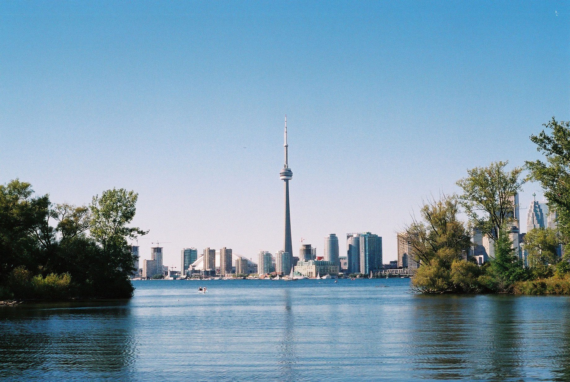
Toronto, Toronto Islands
https://hikes.brucetrail.org/event/toronto-toronto-islands-13/Sorry, the registration cut-off time for this hike has been reached.Not a member? Click here to join today!Hosting Club: Toronto
Location (Google Maps): Meet inside the Jack Layton Ferry Terminal, foot of Bay Street, beyond the cashiers selling the ferry tickets, in the open area with the benches and Muskoka chairs. From Union Station take the LRT one stop to “Ferry Docks” or take bus number #19 or #72 on Bay Street southbound to the Queens Quay. Walk across Queen Quay south through the park to the ferry terminal.
Hike Leader(s): Miriam Stevens, Tom Swales
Pace: Leisurely
Terrain: Flat
Distance: 8-12 kmDescription
After a day’s work, come and “cool off” on the Toronto Islands free of fumes and traffic to enjoy the view of the city skyline and Toronto’s own beautiful island parkland oasis away from the city. Pack a dinner for a sit-down picnic. Note that food is not available for purchase on the islands early in the season. Bring a warm jacket and flashlight. Return ticket for the ferry is approximately $8.70, $5.60 for seniors. The hike will take place rain or shine. Toronto Island Evening Hikes will take place every Thursday in May and June, same time and meeting place. The route and time we return to the city may vary depending if the ferries are running on the Spring or Summer (starts in May) schedule. Contact Hike Leaders via the Contact form for further information or to confirm the current ferry schedule that will be in place the week of the hike. Registration is not required for this hike – just meet the Hike Leader at the above location.** Please ignore the “registration cutoff time has been reached” message that appears 24 hours beta as it is not applicable **
- 23June 23, 2023No events
- 24June 24, 2023
Car Hike: Hike of 2 lakes King city
https://hikes.brucetrail.org/event/car-hike-hike-of-2-lakes-king-city-6/Sorry, the registration cut-off time for this hike has been reached.Not a member? Click here to join today!Hosting Club: Toronto
Category: Car Hike
Location (Google Maps): Park along Fairfield Dr. or Dufferin Street, Gathering at trail head in Dufferin Street.Hike Leader(s): Mohammad Aghamiri Click here to contact Hike Leader(s)
Pace: Moderate
Distance: 14-15KM
Description
We will hike in trails around Seneca lake and Mary Lake,pass by Eaton and visit Pine farm where you can enjoy coffee,tea,apple pie during our snack time.Some safety procedures during the hike:
1-Hikers must stay between the leader and the sweep.
2-Hikers must advise the leader or the sweep if they wish to leave the group.
3- Hikers must follow the whistle instructions: 1 blast- stay where you are; 2 blasts come to the leader; 3 blasts – come to the leader quickly.
4-Hike leader may request volunteers to stop at trail intersections, they need to help hikers to the direction the group walk and wait till they see the sweep .
5-Hikers have to make sure they can see the persons behind and in front of them.
Bus Hike – Great Esker Side Trail and Scotsdale Farm- Cancelled Due To Low Registration
https://hikes.brucetrail.org/event/bus-hike-great-esker-side-trail-and-scotsdale-farm/Sorry, the registration cut-off time for this hike has been reached.Not a member? Click here to join today!Hosting Club: Toronto
Category: Cancelled
Location (Google Maps): Scotsdale FarmHike Leader(s): George Lennon and Michael Humpage Click here to contact Hike Leader(s)
Pace: Leisurely
Terrain: Variable
Distance: 14 kmDescription
This leisurely hike through Scotsdale Farm and the Silver Creek Conservation Area was pioneered last year by Wayne Crockett just after the opening of the Trafalgar Side Trail. It takes in part of the Main Trail and the Great Esker Side Trail, along with the Duff Pit and Trafalgar Side Trails, to finish at 10th Line adjacent to the Walking Fern Side Trail. There will be one drop out at just over the halfway point.Warm summer temperatures and some steep ascents and descents along the Great Esker mean participants should bring plenty of water. Following the hike there will be a short drive into Georgetown for refreshments. There are two pubs and an ice cream shop, and you can explore the main street of this scenic town.

Toronto Urban Badge Hike - 3 of 7
https://hikes.brucetrail.org/event/toronto-urban-badge-hike-3-of-7/Sorry, the registration cut-off time for this hike has been reached.Not a member? Click here to join today!Hosting Club: Toronto
Category: Urban Walk
Location (Google Maps): Toronto, Ontario, CanadaHike Leader(s): Brian Rideout Click here to contact Hike Leader(s)
Pace: Moderate
Terrain: Flat
Distance: 10.4 kmDescription
Please join me at the south west corner of Lakeshore Blvd West and Ellis by 10 AM. We will hike east along the Waterfront Trail to the Distillery District (km 8.3 to km 71.4). Here is an online map with km markings of our route for all 7 hikes for the Toronto Urban Badge.Please make sure you bring at least 2 liters of water, a lunch, bug spray and sunscreen.

Urban Walk: Coote's Paradise/Hamilton Waterfront Trail
https://hikes.brucetrail.org/event/urban-walk-cootes-paradise-hamilton-waterfront-trail-2/Sorry, the registration cut-off time for this hike has been reached.Not a member? Click here to join today!Hosting Club: Toronto
Category: Urban Walk
Location (Google Maps):Hike will start from McMaster University GO Bus Terminal. We will meet at Toronto’s Union Station 8:30 AM to take the 8:45 AM Train to Aldershot where we will transfer to the GO Bus for a short ride to McMaster University. On the return we take the GO Train to Toronto from West Harbour GO Train Station. If you have a smart phone then the return fare is just $10 with GO’s Weekend Pass. Seniors fare return from Union is $11.44. Hikers without a smartphone may purchase pass from Hike Leader at Union Station. If meeting us at McMaster you will have to make your way back to start by local transit or Uber and parking fee would apply.
Hike Leader(s): Tom Swales, Roland Mark Click here to contact Hike Leader(s)
Pace: Moderate
Terrain: Hilly, Variable
Distance: 12-13 kmDescription
This will be a one way hike through the trails of the RBG’s (Royal Botanical Gardens) South Shore Cootes Paradise Trails to Princess Point and then continuing on Hamilton’s Waterfront Trail along Burlington Bay to Bayfront Park which is a 7 minute walk to the West Harbour GO Station. Cootes Paradise is the largest and most diverse of RBG’s sanctuaries. Nestled between the Niagara Escarpment and Lake Ontario the picturesque area is significant as a migratory bird flyover zone and home to a wide variety of flora and fauna. There will be a few hills including one steeper one.