|
Sun | Mon | Tue | Wed | Thu | Fri | Sat |
|---|
June | June | June | 1  Canada Day 🇨🇦 Hike – Meet time is 8:50am Canada Day 🇨🇦 Hike – Meet time is 8:50am 9:00 AM-11:00 AM 07/01/2026 https://hikes.brucetrail.org/event/canada-day-%f0%9f%87%a8%f0%9f%87%a6-hike-meet-time-is-850am/2026-07-01/  Click here for more information or to register Hosting Club: Iroquoia
Category: General Hike
Location (Google Maps): Parking lot off of Mud St Hike Leader(s): Ruth Moffatt Click here to contact Hike Leader(s) Pace: Medium – 3 to 4 km/hr
Terrain: Moderate – Some hills and/or some poor footing, Strenuous – Hilly with steep climbs and some poor footing
Distance: 10-12km Description
Happy Canada Day! 🇨🇦 What better way to celebrate than a Bruce Trail Hike?!
Please wear all your Canadian colours and bring enough water and snacks for the hike. There may very well be an all- Canadian treat for everyone after the hike.
| 2 | 3 - Early Morning Hike
7:15 AM-9:15 AM 07/03/2026 https://hikes.brucetrail.org/event/early-morning-hike/2026-07-03/ Click here for more information or to register Hosting Club: Iroquoia
Category: General Hike
Location (Google Maps): Kerncliff Park, Parking Lot (Parking capacity 30)
Access to the main trail is via Kerncliff Park Side Trail. (no access from Hwy 5) Hike Leader(s): Madeline Grady Click here to contact Hike Leader(s) Pace: Medium – 3 to 4 km/hr
Terrain: Moderate – Some hills and/or some poor footing
Distance: 8 km Description
Come start your day with a walk in the woods and listen to birds chirping. The trail will start and end with hills. The middle with be mostly flat but some rocks and tree roots to content with. Bonus: Getting natural light early in the morning helps reset your internal clock, anchors your circadian rhythm and gives us natural red light therapy from that early morning sun.
 CANCELLED – Afternoon Hike – Kelso Summit (reservation required) CANCELLED – Afternoon Hike – Kelso Summit (reservation required) 4:30 PM-6:30 PM 07/03/2026 https://hikes.brucetrail.org/event/afternoon-hike-kelso-summit-reservation-required-2/2026-07-03/  Click here for more information or to register Hosting Club: Iroquoia
Category: Afternoon/Evening Hikes
Location (Google Maps): Meet at 4:15 pm in the Kelso Summit parking lot on Steeles Ave. Hike Leader(s): Karen Bergmann Click here to contact Hike Leader(s) Pace: Medium – 3 to 4 km/hr
Terrain: Moderate – Some hills and/or some poor footing
Distance: 7 kms Description
Meeting at 4:15 pm, we will hike along a few of the trails in a loop. Please reserve your time for KELSO SUMMIT at www.conservationhalton.ca Bring bug spray/bug net.
| 4 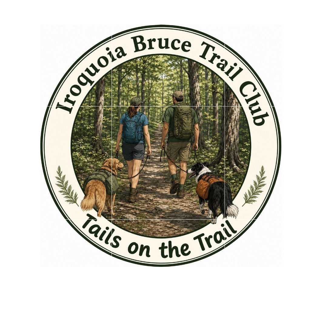 Tails on the Trail – A dog friendly hike! Meet at 8:20am Tails on the Trail – A dog friendly hike! Meet at 8:20am 8:30 AM-10:00 AM 07/04/2026 https://hikes.brucetrail.org/event/tails-on-the-trail-a-dog-friendly-hike-meet-at-820am/2026-07-04/  Click here for more information or to register Hosting Club: Iroquoia
Category: Tails on the Trail
Location (Google Maps): Parking lot off of Ridge Rd, in Grimsby Hike Leader(s): Ruth Moffatt Click here to contact Hike Leader(s) Pace: Medium – 3 to 4 km/hr
Terrain: Moderate – Some hills and/or some poor footing
Distance: 5km Description
Please join us for this dog-friendly hike where we will hike with our canine companions from the parking area over to Beamer’s Conservation Area and around the loop.
Please ensure your dog is leashed, well-socialized and all dog waste is carried out. Note: There may be a waste bin in the area. We will hike rain or shine. Please disregard the notice on the system generated confirmation about dogs. Please bring enough water and treats for you and your dog.
 RAINBOW HIKE: Smokey Hollows to Clappison Woods & Beyond RAINBOW HIKE: Smokey Hollows to Clappison Woods & Beyond 9:00 AM-1:15 PM 07/04/2026 https://hikes.brucetrail.org/event/rainbow-hike-smokey-hollows-to-clappison-woods-beyond/2026-07-04/  Click here for more information or to register Hosting Club: Iroquoia
Category: Rainbow Hike
Location (Google Maps): Smokey Hollow Waterfalls, Waterdown Hike Leader(s): Doug O’Neill Click here to contact Hike Leader(s) Pace: Medium – 3 to 4 km/hr
Terrain: Moderate – Some hills and/or some poor footing, Strenuous – Hilly with steep climbs and some poor footing
Distance: 13-14 km Description
Come by car or public transit for this all-inclusive 2SLGBTQIA+ friendly hike from Smokey Hollows Waterfall, Waterdown to Clappison Woods and beyond. This is an in-and-out hike, starting and returning to Smokey Hollow Waterfalls, Waterdown. Please arrive at the Smokey Hollow parking lot, 80 Mill St. South, by 8:45 a.m. for a 9 a.m. start. Parking fills up quickly. We’ll start at Smokey Hollows and follow the main trail along Grindstone Creek, through Clappison Woods and beyond the “tunnel.” We’ll be in deciduous forest for much of the day so we’ll have shade. Some excellent lookouts. Expect hills, a few steep climbs and descents, plus some rocky bits. We’ll hike about 6.5-7 km each way. By public transit. There are various HSR options from Hamilton that will take you to Mills Street, Waterdown. One popular route from Aldershot GO station is to hop on the local 18 Burlington bus and get off at “Mill at Mountain Brow,” a 5-minute walk to the Smokey Hollows parking lot. Another option from Hamilton central: Take the No. 1 “East to Appleby GO” from King street to Plains at Waterdown, where you will transfer to the No. 18 (which goes via Aldershot). Coming by GO Train from Toronto, Oakville and points east: : Simply get off at Aldershot GO, and take the above-mentioned local 18 bus. By car: There is unpaid parking at Smokey Hollow. Note: It fills up early. You can look for parking downtown Waterdown, and walk to Smokey Hollows Parking lot. PLEASE allow yourself enough time to find parking as we’re meeting at 8:45 a.m latest. There are no washroom facilities at the starting point so you may wish to hit a Tim Horton’s beforehand. Everyone is invited for a post-hike coffee or cold pint in downtown Waterdown. Bring 1.5 – 2 litres of water and lunch, as well as sunscreen, insect repellent, hat, hiking boots or sturdy footwear. Avoid wearing shorts as it’s tick season. Get your complimentary Bruce Trail Rainbow badge . Feel free to reach out to the Hike Leader if you have any questions – “Click here to contact Hike Leader” on this form.
|
5 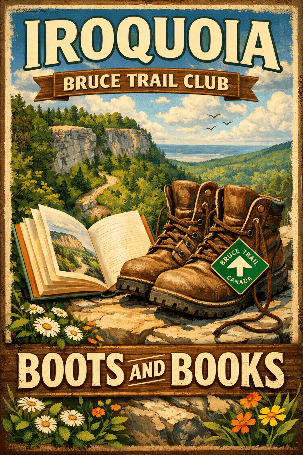 Boots and Books – The Iroquoia Bruce Trail Book Club Boots and Books – The Iroquoia Bruce Trail Book Club 9:00 AM-11:30 AM 07/05/2026 https://hikes.brucetrail.org/event/boots-and-books-the-iroquoia-bruce-trail-book-club-3/2026-07-05/  Click here for more information or to register Hosting Club: Iroquoia
Category: Boots and Books – The Iroquoia Bruce Trail Book Club
Location (Google Maps): Chedoke Golf Club Parking Lot Hike Leader(s): Ruth Moffatt Click here to contact Hike Leader(s) Pace: Medium – 3 to 4 km/hr
Terrain: Dependent on Conditions, Moderate – Some hills and/or some poor footing
Distance: Approx 8km Description
Welcome to the 4thIroquoia Bruce Trail Book Club – “Boots and Books” Our book is A History of Canada in 10 Maps by Adam Shoalts. Please check your local library for available copies of this book. We will hike from the parking lot westbound along the Chedoke Radial Trail and return – about 8km which will take about 2.5-3 hours approximately. Please wear suitable foot wear, dress for the weather and bring poles if you use them. Please bring enough snacks and water suitable for the length/duration of the hike. It is not necessary to bring the book. Our July book will be “A History of Canada in 10 Maps” by Adam Shoalts and the August book will be “Woman, Watching” by Merilyn Simonds. It may be a good idea to reserve this book now from your local library. The hike is open to everyone whether you have read the book or not but there may he spoilers, if you haven’t read it. It will be open to 10 people to keep it more intimate for discussing the book. If your plans change, please cancel your registration so that people who are waitlisted may join. To cancel your registration, here is a step by step:
– Sign into your account on the Bruce Trail website.
– Go to the Hike Schedule
– Click on My Hikes tab which you should find at the top of the schedule
– Scroll to the appropriate hike you wish to cancel
– Cursor to the far right of the hike to the Action column
– Click cancel under the hike you wish to cancel.
- Black Bank
9:30 AM-12:00 PM 07/05/2026 https://hikes.brucetrail.org/event/black-bank-2/2026-07-05/  Click here for more information or to register Hosting Club: Iroquoia
Category: General Hike
Location (Google Maps): Meet roadside at 9:15 at the corner of 20th Side Road and Prince of Wales Rd, just north of Kilgorie. Hike Leader(s): Karen Bergmann Click here to contact Hike Leader(s) Pace: Medium – 3 to 4 km/hr
Terrain: Moderate – Some hills and/or some poor footing
Distance: 9 kms Description
This hike will take us into a challenging valley with rocks and hills and then through a cattle pasture and over a few stiles. Black Bank is in the Dufferin Section. You are welcome to ride with me from Mississauga if you don’t want to drive. I’ll send an email a couple of days prior to the hike to remind you and see who wants to carpool. Please bring sufficient water, a snack as needed, and bug spray/bug net.
| 6 - Hilton Falls Side Trail – Shuttle Hike – RESCHEDULED FROM MARCH 30
8:30 AM-2:00 PM 07/06/2026 https://hikes.brucetrail.org/event/hilton-falls-side-trail-shuttle-hike/2026-07-06/ Click here for more information or to register Hosting Club: Iroquoia
Category: General Hike
Location (Google Maps): Hilton Falls Conservation Area Hike Leader(s): Pati Greenwood, Jeff Dowsett Click here to contact Hike Leader(s) Pace: Medium – 3 to 4 km/hr
Terrain: Dependent on Conditions, Moderate – Some hills and/or some poor footing
Distance: 16 km Description
From Hilton Falls Conservation Area, we will shuttle to the Bruce Trail Pear Tree Parking. We will make our way to the Hilton Falls Side Trail following the main trail and the Al Shaw Side Trail. We will hike along the Hilton Falls Side Trail to the main trail and the Philip Gosling Side Trail back to Hilton Falls parking lot. Hydration is important at this time of year. Bring plenty to drink, electrolytes, as well as a snack. Insects, including ticks, are sure to be in full force so take steps to avoid being bitten; wear long sleeves and pants, and bring insect repellent. Also wear hiking boots as the terrain will be quite rugged in areas. Hiking poles are recommended. Please arrive at the meeting place by 8:15 am for an 8:30 am departure. A park registration will be required for those parking at Hilton Falls for the day. Car shuttle arrangements will be worked out with registered hikers a few days prior to the hike. The hike will be dependent on weather conditions.
| 7 | 8 - Hiking the Credit
9:30 AM-12:30 PM 07/08/2026 https://hikes.brucetrail.org/event/hiking-the-credit/2026-07-08/  Click here for more information or to register Hosting Club: Iroquoia
Category: Good Companions
Location (Google Maps): Erindale Park/Culham Trail, 1695 Dundas St., Mississauga Hike Leader(s): Anne Armstrong Click here to contact Hike Leader(s) Pace: Leisurely – 3km/hr or less
Terrain: Easy – Mostly flat and usually good footing
Distance: Approx. 9 km. Description
Join in this easy hike which follows the Credit River up to Highway 403. We will then climb a gentle hill to do a loop which then returns us back to the river. Bring a snack, water, insect repellent and sunscreen. Poles for the climb and loop may be useful. I will send an email out the night before with my contact information in the event you need to cancel the night before or the morning of the hike.
| 9 - CANCELLED – Twiss Rd to Crawford Lake return
9:30 AM-12:30 PM 07/09/2026 https://hikes.brucetrail.org/event/twiss-rd-to-crawford-lake-return-2/2026-07-09/  Click here for more information or to register Hosting Club: Iroquoia
Category: General Hike
Location (Google Maps): Meet roadside on Twiss Road at 9:15 am. Hike Leader(s): Karen Bergmann Click here to contact Hike Leader(s) Pace: Medium – 3 to 4 km/hr
Terrain: Strenuous – Hilly with steep climbs and some poor footing
Distance: 10 kms Description
Meeting roadside at 9:15 am on Twiss Road, we will hike to Crawford Lake and around the trails and back to Twiss Road. There are some rocky sections along the way. Please bring water and a snack and bug spray/bug net.
| 10 - Rattlesnake Point – Crawford Lake Loop
8:30 AM-1:30 PM 07/10/2026 https://hikes.brucetrail.org/event/rattlesnake-point-crawford-lake-loop-3/2026-07-10/ Click here for more information or to register Hosting Club: Iroquoia
Category: General Hike
Location (Google Maps): Rattlesnake Conservation Area – reservation required Hike Leader(s): Pati Greenwood, Jeff Dowsett Click here to contact Hike Leader(s) Pace: Medium – 3 to 4 km/hr
Terrain: Moderate – Some hills and/or some poor footing
Distance: 15 km Description
Starting at Rattlesnake Point Conservation Area, we will hike on the Main Trail and Side Trails to Crawford Lake, around the escarpment edge, down through the Nassagaweya Canyon and back up to our meeting area in the parking lot at Rattlesnake Point. Wear hiking boots and bring poles. Dress for the weather conditions and insects – long sleeves and pants are suggested. Bring plenty to drink, a snack as well as sunscreen and insect repellent. Please arrive at the meeting place in the main parking lot, by 8:15 am for an 8:30 am departure. Park reservations will be required. They can be obtained online at Halton Conservation Area web-site: https://www.conservationhalton.ca/.
| 11 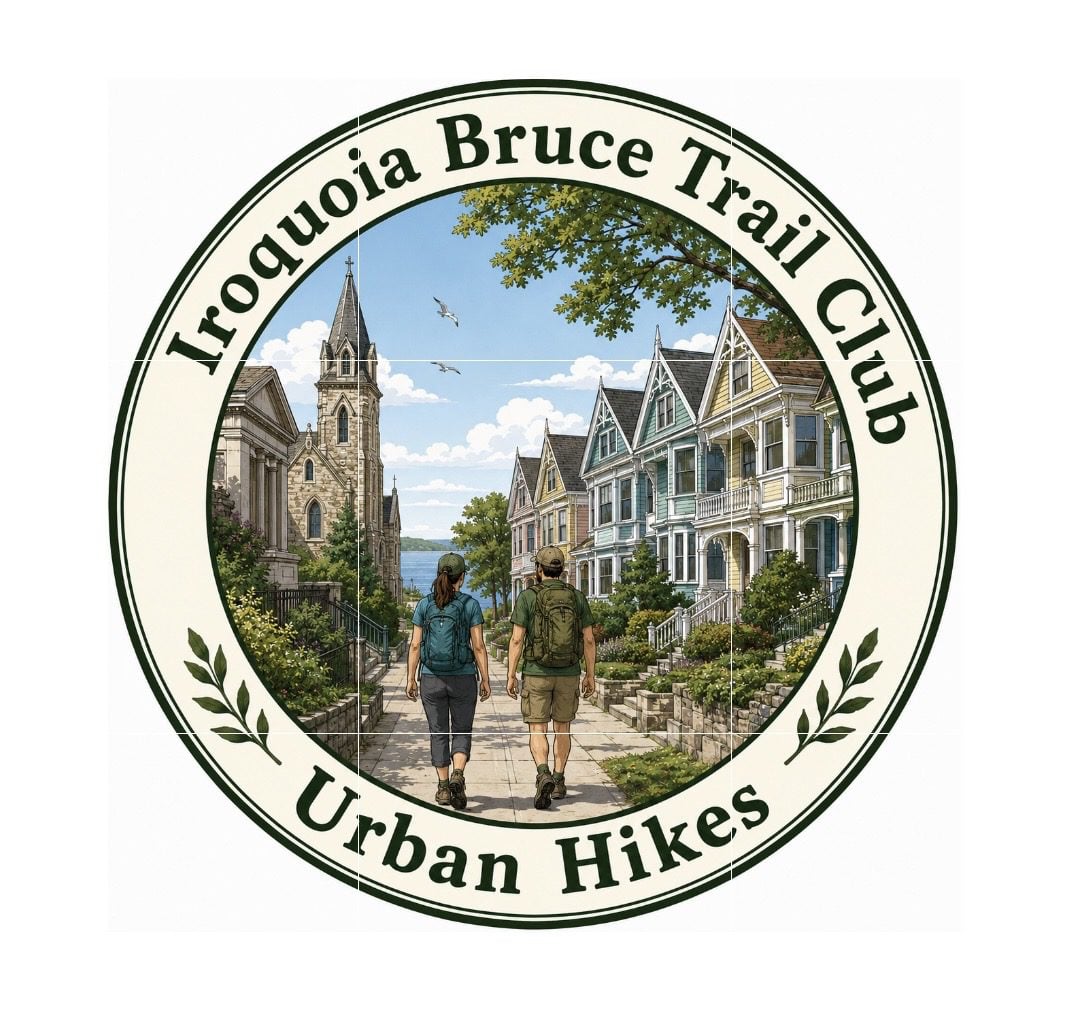 Urban Hike – Grimsby – “The Painted Ladies” Urban Hike – Grimsby – “The Painted Ladies” 9:00 AM-11:00 AM 07/11/2026 https://hikes.brucetrail.org/event/urban-hike-grimsby-the-painted-ladies/2026-07-11/  Click here for more information or to register Hosting Club: Iroquoia
Category: Urban Hikes
Location (Google Maps): Nelles Beach Park – 91 Lake St, Grimsby Hike Leader(s): Ruth Moffatt Click here to contact Hike Leader(s) Pace: Leisurely – 3km/hr or less
Terrain: Easy – Mostly flat and usually good footing
Distance: Approximately 7km Description
Please join us for an Urban Hike where we will explore all the wonderful “Painted Ladies” of Historic Grimsby Beach. A stop at all the favourites as well as some history of this at one time Methodist Church Camp meeting ground from the 1800’s. These Painted Ladies or gingerbread cottages are said to rival those in San Francisco. Please join us for this very special treat.
|
12  Iroquoia BTC Naturalist Hike Series- Discovering Nature One Hike at a Time – Sketching Nature – Meet in the parking lot at 8:15am Iroquoia BTC Naturalist Hike Series- Discovering Nature One Hike at a Time – Sketching Nature – Meet in the parking lot at 8:15am 8:15 AM-1:00 PM 07/12/2026 https://hikes.brucetrail.org/event/iroquoia-naturalist-hike-series-discovering-nature-one-hike-at-a-time-sketching-nature-meet-in-the-parking-lot-at-815am/2026-07-12/  Click here for more information or to register Hosting Club: Iroquoia
Category: Iroquoia BTC Naturalist Hike Series : Discovering Nature, One Hike at a Time.
Location (Google Maps): City View Park – From Dundas St turn onto Kerns Rd and then take the second road on the left. Follow it through to the parking on the left hand side. Hike Leader(s): Ruth Moffatt Click here to contact Hike Leader(s) Pace: Medium – 3 to 4 km/hr
Terrain: Easy – Mostly flat and usually good footing, Moderate – Some hills and/or some poor footing
Distance: 8.5km Description
Sketching nature has many benefits. It enhances observation and learning, it deepens our connection with nature and it will help to boost memory as the process of sketching helps us to remember details, emotions and places better than a quick photo. It also helps us to create our artistic skills and encourages creativity. John J. Audubon’s Birds of America famous bird drawings were published in 1838 – nearly 200 years ago. For our first foray into sketching nature, our focus will not be on perfection but rather the process of observation. Please join Corie and Ruth as we make our way over to a comfortable log where we will sit and choose something to sketch. All sketching materials will be provided and are yours to keep. Some artistic drawing guidance will be provided by Corie and possibly another guest. Please bring the snacks, lunch, water, poles if you use them and of course all the things you require for a day hike – hat, sunscreen, bug spray, first aid kit etc. If the Sketching Nature portion has to be cancelled due to a forecast of rain, we will hike but sketching will be postponed. Everyone will be notified. This hike is open to a small group of 10. If you have to cancel, please remove your registration so that someone from the waitlist can join. To cancel your registration, here is a step by step:
– Sign into your account on the BTC website
– Click on My Hikes under your account
– This will take you to a list of hikes you have registered for
– Scroll down to the appropriate hike and cursor over to the far right hand column under the Action column.
– Click Cancel under the hike you wish to cancel
- Glen Haffy to 7th Line – carpool hike
9:30 AM-1:00 PM 07/12/2026 https://hikes.brucetrail.org/event/glen-haffy-to-7th-line-carpool-hike/2026-07-12/  Click here for more information or to register Hosting Club: Iroquoia
Category: General Hike
Location (Google Maps): Meet at 9:15 in the 7th Line Bruce Trail parking lot, off Airport Road. Hike Leader(s): Karen Bergmann Click here to contact Hike Leader(s) Pace: Medium – 3 to 4 km/hr
Terrain: Moderate – Some hills and/or some poor footing
Distance: 9 kms Description
Meeting at 9:15 am in the Bruce Trail parking lot at the corner of 7th Line and Airport Road, we will carpool to Coolihans Side Road and hike back through Glen Haffy, along Hwy 7 and into the forest to the cars. There are some hills and tricky footing, so bring poles if you use them. Lots of variety along this trail. There is a 650 meter stretch of road walking just after leaving the Glen Haffy Conservation Area. Bring water and a snack, as needed, as well as bug spray/bug net.
| 13 - Dundas Valley to Tiffany Falls and Back
8:30 AM-1:30 PM 07/13/2026 https://hikes.brucetrail.org/event/dundas-valley-to-tiffany-falls-and-back-2/2026-07-13/ Click here for more information or to register Hosting Club: Iroquoia
Category: General Hike
Location (Google Maps): Dundas Valley Conservation Area – Main Parking off of Governor’s Road. Parking fee required. Hike Leader(s): Pati Greenwood, Jeff Dowsett Click here to contact Hike Leader(s) Pace: Medium – 3 to 4 km/hr
Terrain: Moderate – Some hills and/or some poor footing
Distance: 13 km Description
This hike will explore the main trail and side trails through the Dundas Valley Conservation Area to Tiffany Falls and back to form a large loop. Dress for the weather and insects, long sleeves and pants are suggested. Bring plenty to drink, a snack as well as sunscreen and insect repellent. Please arrive at the meeting place by 8:15 a.m. for an 8:30 a.m. departure. A parking fee will be required at the main gate. This hike will be dependent on weather conditions.
| 14 | 15 - CANCELLED – Nassagaweya Canyon, from Crawford Lake (reservations required)
9:30 AM-12:30 PM 07/15/2026 https://hikes.brucetrail.org/event/nassagaweya-canyon-from-crawford-lake-reservations-required-2/2026-07-15/  Click here for more information or to register Hosting Club: Iroquoia
Category: General Hike
Location (Google Maps): Meet in the first parking lot at Crawford Lake. You will need to reserve your time at conservationhalton.ca Hike Leader(s): Karen Bergmann Click here to contact Hike Leader(s) Pace: Medium – 3 to 4 km/hr
Terrain: Moderate – Some hills and/or some poor footing
Distance: 9 kms Description
Meeting at 9:15 am in the first parking lot, we will hike through the park and down into the canyon and back up into the park for a large loop. There are some rocks along the way and a couple of steep hills (going down into the canyon and then back up). Bring a snack, as needed, and bug spray/bug net.
| 16 | 17 - CANCELLED – City View Park to Grindstone Creek and Back
8:30 AM-1:30 PM 07/17/2026 https://hikes.brucetrail.org/event/city-view-park-to-grindstone-creek-and-back-2/2026-07-17/ Click here for more information or to register Hosting Club: Iroquoia
Category: General Hike
Location (Google Maps): City View Park, South Entrance, off of Kerns Road Hike Leader(s): Pati Greenwood, Jeff Dowsett Click here to contact Hike Leader(s) Pace: Medium – 3 to 4 km/hr
Terrain: Moderate – Some hills and/or some poor footing
Distance: 14 KM Description
This hike will explore the main trail and side trails from City View Park to Grindstone Creek and back, There will be a number of steep sections along the way. Dress for the wether condition and insects. Bring plenty to drink and a snack as well as sunscreen and insect repellent. Please arrive at the meeting place by 8:15 am for an 8:30 am departure. The hike will be dependent on weather conditions.
- CANCELLED – Afternoon Hike – Silver Creek
4:30 PM-6:30 PM 07/17/2026 https://hikes.brucetrail.org/event/afternoon-hike-silver-creek-2/2026-07-17/  Click here for more information or to register Hosting Club: Iroquoia
Category: Afternoon/Evening Hikes
Location (Google Maps): Meet at 4:15 roadside on Fallbrook Trail at Silver Creek Conservation Area. Hike Leader(s): Karen Bergmann Click here to contact Hike Leader(s) Pace: Medium – 3 to 4 km/hr
Terrain: Moderate – Some hills and/or some poor footing
Distance: 7 kms Description
Meeting at 4:15 pm roadside on Fallbrook Trail, we will hike around the Roberts ST and Irwin Quarry ST and then cross the road to the main trail and around a couple of side trails that you may not have known were there. Bring water and bug spray/bug net.
| 18 |
19 - Woolverton to Jones Rd (E2E)
9:30 AM-12:30 PM 07/19/2026 https://hikes.brucetrail.org/event/woolverton-to-jones-rd-e2e/2026-07-19/  Click here for more information or to register Hosting Club: Iroquoia
Category: General Hike
Location (Google Maps): Meet at 9:15 at the end of Jones Rd, off Hwy 8 just past Stoney Creek. Hike Leader(s): Karen Bergmann Click here to contact Hike Leader(s) Pace: Medium – 3 to 4 km/hr
Terrain: Moderate – Some hills and/or some poor footing
Distance: 9 kms Description
Meeting at the end of Jones Rd at 9:15 am, we will carpool to Woolverton Rd and hike back. There are plenty of rocks and roots and a few hills. Bring bug spray/bug net, plenty of water and a snack, as needed.
| 20 - Limehouse Loop Hike
8:30 AM-2:00 PM 07/20/2026 https://hikes.brucetrail.org/event/limehouse-loop-hike-5/2026-07-20/ Click here for more information or to register Hosting Club: Iroquoia
Category: General Hike
Location (Google Maps): Limehouse Parking Lot Hike Leader(s): Pati Greenwood, Jeff Dowsett Click here to contact Hike Leader(s) Pace: Medium – 3 to 4 km/hr
Terrain: Moderate – Some hills and/or some poor footing
Distance: 15 km Description
Starting at the Limehouse Parking Lot, the hike will follow the main trail, the Canada Goose Side Trail, the Ridge Side Trail and the Todd Bardes Meadowland Side Trail to form at 15 km loop. The route will include some rough, rocky areas which can be tricky to navigate. Wear hiking boots and bring poles to help navigate the terrain. There will be regular breaks, including a snack stop along the way. Bring snacks and plenty of water. Ticks and other insects are active at this time of year, so wearing clothing covering the legs are arms is recommended as is insect repellent. Please arrive at 8:15 am as we will depart promptly at 8:30 am.
| 21 | 22 - Dundas Valley Loops
9:30 AM-11:30 AM 07/22/2026 https://hikes.brucetrail.org/event/dundas-valley-mccormack-sawmill-beckett-loops/2026-07-22/  Hike open to BTC Members only. Click here for more information or to register Hosting Club: Iroquoia
Category: Good Companions
Location (Google Maps): Dundas Valley Conservation Area – 650 Governor’s Road
Parking Directions
Drive through the main entrance of the Dundas Valley Conservation Area to the largest parking lot at the very end of the road. Walk a few hundred meters to the Trail Centre It takes a few minutes to walk from the parking lot to the Trail Centre, so give yourself extra time. We will meet at the Trail Centre.
Entrance fee is free for HCA/Dundas Valley members; $11.50 per vehicle for non-members. Pay by credit card at kiosk at entrance Hike Leader(s): Kathy Rymal Click here to contact Hike Leader(s) Pace: Medium – 3 to 4 km/hr
Terrain: Easy – Mostly flat and usually good footing, Moderate – Some hills and/or some poor footing, Strenuous – Hilly with steep climbs and some poor footing
Distance: 7.5 km Description
We will head out on the McCormack trail from the trail centre and cross over Governor’s Road to continue the trail past a horse farm to a beautiful lookout point with views of the escarpment, Dundas, Hamilton and Lake Ontario. We will return along the Bruce, McCormack and Sawmill trail ending up back in the parking lot where we will pay homage to the savior of the Dundas Valley, Thomas A. Beckett Q.C. by hiking along a short 400m trail named in his honor.
| 23 | 24 - Scotsdale Farm – Silver Creek Loop
8:30 AM-2:00 PM 07/24/2026 https://hikes.brucetrail.org/event/scotsdale-farm-silver-creek-loop-2/2026-07-24/ Click here for more information or to register Hosting Club: Iroquoia
Category: General Hike
Location (Google Maps): Scotsdale Farm Main Parking Lot Hike Leader(s): Pati Greenwood, Jeff Dowsett Click here to contact Hike Leader(s) Pace: Medium – 3 to 4 km/hr
Terrain: Moderate – Some hills and/or some poor footing
Distance: 14 km Description
From the Scotsdale Farm parking lot, we will hike the main trail and side trails in Silver Creek Conservation area for a 14k loop. The terrain through this area can be tricky with uneven footing and rough, rocky areas. Wear sturdy footwear and clothing appropriate to conditions. Insect repellent is recommended. Bring a snack and plenty of water. Please arrive at 8:15 am as well will leave promptly at 8:30 am.
| 25 - RAINBOW HIKE: Devil’s Punch Bowl to Red Hill
9:00 AM-1:30 PM 07/25/2026 https://hikes.brucetrail.org/event/rainbow-hike-devils-punch-bowl-to-red-hill-2/2026-07-25/  Click here for more information or to register Hosting Club: Iroquoia
Category: Rainbow Hike
Location (Google Maps): Red Hill Valley South Parking Lot, Mud Street Hike Leader(s): Doug O’Neill Click here to contact Hike Leader(s) Pace: Leisurely – 3km/hr or less, Medium – 3 to 4 km/hr
Terrain: Easy – Mostly flat and usually good footing, Moderate – Some hills and/or some poor footing
Distance: 10-11 km Description
NOTE: This was scheduled for July 18 but now on July 25. Join this 2SLGBTQIA+ Rainbow hike from Devil’s Punch Bowl to Red Hill Parking lot. PLEASE NOTE: after you’ve completed registration for this hike, click “Contact the Hike Leader” and let us know if (a) you’re a car driver willing to shuttle a few fellow hikers at the start of the hike, or (b) if you need a ride for the shuttle. Read below for details. Note: While the hike begins at Devil’s Punch Bowl, we’ll actually meet at Red Hill Parking Lot. This hike involves a short car shuttle. If you’re arriving without a car, don’t worry—we’ll arrange rides for everyone. We’ll ask a number of drivers (in advance) if they would conisder volunteering for the shuttle. The Route: We plan to explore Devil’s Punchbowl, a geological treasure formed in the last Ice Age, after which we’ll hike westward along the main trail and a few sidetrails—passing a couple waterfalls-—ending up at Red Hill Parking Lot. Terrain: Expect a few hills, some paved (unused) roadway, and dirt paths along the Bruce Trail (main trail) overlooking the east branch of Red Hill Creek. “The Wonders of Devil’s Punchbowl in 10”
Upon arrival at Devil’s Punchbowl, Hike Leader and Geologist Ann Grindall will unravel some of the mysteries of this amazing 37-metre “ribbon waterfall” formation: • Learn how this massive amphitheatre-shaped gorge was carved into the Niagara Escarpment, exposing over 40 million years of geological history
• The visible rock strata: why it looks like a natural “layer cake” of shale, dolostone, sandstone, and limestone
• How it’s two waterfalls, not one—both formed in the last Ice Age
• Ann will be pleased to answer any questions! WHERE TO MEET: The Red Hill South Parking Lot at the corner of Mud Street and Pritchard. We’ll depart at 9:15 a.m. sharp COMING BY PUBLIC TRANSITt: Take the No. 21 Heritage Green Terminal Bus (which you can catch downtown and up on the mountain) and get off at Mud & Pritchard. You’ll see the parking lot entrance across the street. Parking: Free at Red Hill South Parking Lot (at Mud & Pritchard), where we’ll meet; but $8.50 per vehicle at Devil’s Punchbowl. Passengers will split the parking costs, about $2 or $3 each (drivers shouldn’t pay). PLEASE READ: HOW THE CAR SHUTTLE WORKS
Some of you may be unfamiliar with the magic of car shuttles. Three benefits of car shuttles:
A) We minimize the number of cars — thereby reducing our footprint, which is central our Bruce Trail approach
B) It allows non-car owners to join the hike
C) Saves money on the parking lot fees. Morning plan
• All hikers will meet at Red Hill South Parking Lot (Mud & Pritchard) by 8:45 a.m. (There’s a bus stop at the intersection.)
• We’ll quickly group ourselves into as few vehicles as possible (about 4–5 hikers per car). We’ll sort this out the week before. If you are able to drive hikers for the shuttle, let the Hike Leader know now–see “Contact” button on this page
• A small number of volunteer drivers will shuttle everyone to Devil’s Punch Bowl, where we’ll start hiking
• We ask that you don’t independently drive your own car to Devil’s Punch Bowl unless helping with the shuttle, as you could end up separated from your vehicle at the end of the hike.
• We depart Red Hill promptly at 9:00 a.m. and should arrive at Devil’s Punch Bowl by 9:15 a.m.-ish.
• Start hiking after Ann’s geological talk. At the end of the hike
• Our hike finishes back at Red Hill South
• We’ll ask for one additional volunteer driver to shuttle the morning drivers back to Devil’s Punch Bowl to retrieve their vehicles.
• Everyone else can hop into their cars or grab the bus (a 4-minute walk from the parking lot at Mud & Prichard). Complimentary Bruce Trail Rainbow badges to all participants! PLEASE CANCEL your registration if you change your mind: This is especially important if the hike has a waitlist, since your cancellation opens a spot for someone else. Online To Cancel: 1. Log in to the Bruce Trail hike site with the same account you used to register.
2, Go to “My Hikes” (under your profile menu).
3, You’ll see a list of the hikes you’re registered for.
4. Click “Cancel” beside the hike you want to withdraw from.
5. You should receive a confirmation email showing your spot has been released. What to bring: 2 litres of water, lunch, snacks, sunscreen, insect repellent, hat, hiking poles if you have them. NOTE: we strongly advise hikers not to wear shorts. Long pants (light coloured) are best to avoid ticks. “Contact the hike leader” link. Similarly, use that link if you have any questions whatsoever about our Rainbow hikes.
- Scotsdale Farm Duff Pit loop
9:30 AM-12:30 PM 07/25/2026 https://hikes.brucetrail.org/event/scotsdale-farm-duff-pit-loop-3/2026-07-25/  Click here for more information or to register Hosting Club: Iroquoia
Category: General Hike
Location (Google Maps): Meet in the main parking lot at Scotsdale Farm. Hike Leader(s): Karen Bergmann Click here to contact Hike Leader(s) Pace: Medium – 3 to 4 km/hr
Terrain: Moderate – Some hills and/or some poor footing
Distance: 9 kms Description
There are so many trails here that it’s hard to choose where to go. But this hike will take us down the main trail to the Side Trails of Duff Pit, Reservoir, Trafalgar Rd and Great Esker to the main trail and Maureen Bennett Side Trail and finishing on the Bennett Heritage Trail. Bring bug spray/bug net and plenty of water.
|
26 | 27 - Terra Cotta Loop
8:30 AM-2:00 PM 07/27/2026 https://hikes.brucetrail.org/event/terra-cotta-loop-4/2026-07-27/ Click here for more information or to register Hosting Club: Iroquoia, Toronto
Category: General Hike
Location (Google Maps): Boston Mills Road – Roadside Parking Hike Leader(s): Pati Greenwood, Jeff Dowsett Click here to contact Hike Leader(s) Pace: Medium – 3 to 4 km/hr
Terrain: Moderate – Some hills and/or some poor footing
Distance: 15 km Description
Starting from Boston Mills Road, we will take the main trail and side trails to form a large loop through the Terra Cotta Conservation Area. Our route will include some rocky and uneven terrain, which may be tricky to navigate. Wear hiking boots and bring poles. Ticks and other insects are active at this time of year, so wearing clothing covering the legs are arms is recommended as is insect repellent. Bring plenty to drink and a snack. Please arrive at the meeting place by 8:15 am for an 8:30 am departure.
- NEW Black Bear Badge Peninsula End2End – Hikes 6-8 of 8 hikes, July 27-29
9:30 AM-4:00 PM 07/27/2026 https://hikes.brucetrail.org/event/new-black-bear-badge-peninsula-end2end-hikes-6-8-of-8-hikes-july-27-29/2026-07-27/  This is a Multi-Day HikeYou are signing up for the following dates and times:
2026-07-27 at 09:30
2026-07-28 at 07:30
2026-07-29 at 07:30 Click here for more information or to register Hosting Club: Iroquoia, Peninsula
Category: General Hike
Location (Google Maps): Rush Cove Nature Reserve Parking – at the end of Rush Cove Rd Hike Leader(s): Steven White Click here to contact Hike Leader(s) Pace: Brisk – 4 to 5 km/hr
Terrain: Dependent on Conditions, Moderate – Some hills and/or some poor footing, Strenuous – Hilly with steep climbs and some poor footing
Distance: 22.4kms Description
Earn the NEW Peninsula Black Bear End to End Badge (Fundraising Badge is $30 for BTC members and $40 for non -members). Hike Peninsula in 8 hikes this summer!! June 1-5 and July 27-29, 2026. Separate registrations of June 1-5 and July 27-29. We will meet at 9:30am at Rush Cove Nature Reserve parking and shuttle to Lion’s Head, McCurdy Dr Municipal Parking Lot and hike south back to Rush Cove. For July 28&29, we will meet at 7:30am and shuttle to the trail head. Itinerary with GPS coordinates will be sent one week prior to the hikes. Each if these hikes is 22-24kms. Please arrive 15 minutes early each day to allow time to gear up and be ready to shuttle at posted times. Shuttling at the beginning of the day and one shuttle at end of each day to take morning drivers back to their cars, will be shared among all hikers. These start times allow hikers to travel the morning of the hike and finish mid-afternoon. Any parking fees will be shared equally by all hikers. For those booking accommodation, recommend staying near Wiarton. I will do my best to obtain the new Black Bear End to End badges for those completing the Peninsula End2End and have ready to distribute on our last hike. Hikers should bring layered clothing in case of cool, breezy or rainy days. Hikers should have hiking shoes/boots, poles, hat, raingear, sunblock, bug repellant, 2-3 litres of water and snacks/lunch. We will have 2 scheduled breaks each day. Anticipate 4 km/hr average pace including breaks, so please be honest with respect to your capability.
- CANCELLED – Afternoon Hike – Crawford Lake (reservation required)
4:30 PM-6:00 PM 07/27/2026 https://hikes.brucetrail.org/event/afternoon-hike-crawford-lake-reservation-required-2/2026-07-27/  Click here for more information or to register Hosting Club: Iroquoia
Category: Afternoon/Evening Hikes
Location (Google Maps): Meet at 4:15 pm in the first parking lot at Crawford Lake. Hike Leader(s): Karen Bergmann Click here to contact Hike Leader(s) Pace: Medium – 3 to 4 km/hr
Terrain: Moderate – Some hills and/or some poor footing
Distance: 5 kms Description
We will hike the loop around the park, which includes both side trails and main trail. Reserve your time at conservationhalton.ca Bring water and bug spray/bug net.
| 28   Peninsula End to End Fundraiser Peninsula End to End Fundraiser 7:00 AM-3:00 PM 07/28/2026 https://hikes.brucetrail.org/event/peninsula-end-to-end-fundraiser-2/2026-07-28/  Hike open to BTC Members only. This is a Multi-Day HikeYou are signing up for the following dates and times:
2026-07-28 at 07:00
2026-07-29 at
2026-07-30 at
2026-07-31 at
2026-08-01 at
2026-08-02 at
2026-08-03 at Click here for more information or to register Hosting Club: Iroquoia, Peninsula
Category: Stained Glass Badge End to End Fundraiser Hike
Location (Google Maps): Peninsula End to End in 7 days
Note: A section of trail is currently closed between Halfway Dump Rd and Lindsay Rd 40. This means it will not be hiked unless the section of trail is reopened by the time we start this ETE. This section is a one day hike, about 22km.
If the section opens by July 28, we will tack one extra day onto this schedule. The schedule will be shared on the WhatsApp which will for set up for everyone who registers.
Our meet time everyday is 7:00am. Please be early to get ready for the car shuttle.
July 28 – Park in all-day parking in Tobermory. Meet at the northern cairn.
Car shuttle to Halfway Log Dump. Today is a long, day. There is much to see and the terrain is tough. Expect to finish quite late. Distance is approximately 25km
July 29 – Park at the south end of Carter Road. Access to the trail is via a short side trail past the gate. 45.092716, -81272189 Distance about 19km
Car shuttle to Lindsay Rd 40 45.192206, -81.343243
July 30 – Park at the south end of Carter Road as above.
Car shuttle to Lion’s Head Municipal Campground in private parking. Distance about 16km
July 31 – Roadside parking on end of Cemetery Road. Access from Hwy 9 via Evergreen Rd or Cemetery Rd. 44.967285, -81.230603
Car shuttle to Lion’s Head Municipal Campground as above. Distance about 14km
August 1 – Park in Hope Bay parking lot just south of Cedarholm Campground 44.902930, -81.155706
Car shuttle to the end of Cemetery Rd as above. Distance about 26km
August 2 – Park in Hope Bay as above.
Car shuttle to Roadside parking at the bend on the grassy shoulder of Coveney’s Rd. Do not block private laneways 44.862613, -81067963 Distance 22km
August 3 – Park across from the arena in Wiarton in Bluewater Park 44.742514, -81.135140
Car shuttle to Coveney’s Rd as above. Distance about 22km. At our finish we will have a little celebration at the Wiarton Willy statue where the badges will be presented as well. Hike Leader(s): Ruth Moffatt Click here to contact Hike Leader(s) Pace: Brisk – 4 to 5 km/hr, Medium – 3 to 4 km/hr
Terrain: Dependent on Conditions, Moderate – Some hills and/or some poor footing, Strenuous – Hilly with steep climbs and some poor footing
Distance: 20-25km per day. Description
This end to end series is for Members only. Not a member? Please check out membership options at the link below and use Code 67abd1234c568 for free downloadable maps. https://brucetrail.org/product-category/memberships/ Registration opens June 28. There are no refunds for this hike.
Please read all details.
Do not overestimate your hiking ability for long, strenuous days and please do not register unless you can attend all 7(8) days. If your schedule conflicts with 1 day, you can make it up on one day on your own prior to the start of the hike.
A WhatsApp group will be set up for everyone. Please utilize this if you’re looking for roommates, carpooling, photo share, etc.
Please come prepared for potentially hot, humid weather. Bring a minimum 2l -3l of water, bug spray, sunscreen, hat, first aid kit, food, snacks, poles if you use them, rain gear and anything else you need for a long day.
Please be prepared to participate in the car shuttling by having a minimum of 4 available seatbelts. You can carpool with two people each day but if any more, please let the hike leader know. A car shuttling schedule will be set up on the WhatsApp. The stained glass bear badge is included in your fee.
we are hiking North to South and meeting everyday at 6:45am for a 7:am departure for the shuttle to the start.
This hike is limited to 8 hikers.
Since we are meeting at the northern cairn on the first day you will need to arrange all day parking which is $15 on Harpur Dr. and other streets in Tobermory. Check parking map at northbrucepeninsula.ca. For the first day, you can carpool to the parking location and split the cost amongst anyone in the car. I will drive everyone to our start, at Halfway Dump Rd on the first day.
From wherever you park, please walk to the northern cairn in Tobermory and allow 5-10min depending on where you park. I will pick everyone up at the cairn at 6:45am. We will depart as soon as everyone is ready to go but no later than 7am. We will shuttle to Halfway Dump Rd to begin our hike. The first day will be the toughest but also the most scenic and we will take our time to enjoy all there is to see.
Any other parking charges are split amongst everyone.
| 29 - Good Companions Dundas Escarpment Views
9:30 AM-12:00 PM 07/29/2026 https://hikes.brucetrail.org/event/good-companions-dundas-escarpment-views/2026-07-29/ Click here for more information or to register Hosting Club: Iroquoia
Category: Good Companions
Location (Google Maps): Rock Chapel Road Hamilton, RBG parking lot – paid parking or RBG members pass. Hike Leader(s): Janina Vanderpost Click here to contact Hike Leader(s) Pace: Leisurely – 3km/hr or less
Terrain: Easy – Mostly flat and usually good footing
Distance: 8 km Description
Meet in the RBG parking lot on Rock Chapel Road at 9:15 for a 9:30am start. We will take a gentle walk under shady trees along the escarpment between Borer’s Falls and the subdivision at Romer Drive. We will take our time enjoying lovely views of Cootes Paradise and the Dundas Valley as this will be a hot day. Bring plenty of water, sunscreen, poles if using but the terrain is mostly easy and flat. Optional refreshment stop in Waterdown after. I will send out a status update email on Tuesday evening. Remamber, 9:30 am start.
- Terra Cotta/Heritage Road loop
9:30 AM-12:00 PM 07/29/2026 https://hikes.brucetrail.org/event/terra-cotta-heritage-road-loop-2/2026-07-29/  Click here for more information or to register Hosting Club: Iroquoia
Category: General Hike
Location (Google Maps): Roadside on Winston Churchill Blvd, just north of Terra Cotta Conservation Area. Meet at 9:15 am, earlier if you can, as parking is limited. Hike Leader(s): Karen Bergmann Click here to contact Hike Leader(s) Pace: Medium – 3 to 4 km/hr
Terrain: Moderate – Some hills and/or some poor footing
Distance: 8.5 kms Description
We will meet at 9:15 am roadside on Winston Churchill Blvd, just north of Terra Cotta. Parking is limited, so try to come closer to 9 am in case there are other cars. Hiking along the main trail, across Heritage Rd and around to the Rockside Side Trail and back on the main trail to the cars. This trail has some easy parts and some challenging rocky parts, so come prepared. There’s a bit of road walking. Bring sufficient water and bug spray/bug net.
 Peninsula Buck Full Moon Hike – Meet time 8:30pm Peninsula Buck Full Moon Hike – Meet time 8:30pm 8:30 PM-10:00 PM 07/29/2026 https://hikes.brucetrail.org/event/peninsula-buck-full-moon-hike-meet-time-830pm/2026-07-29/  Click here for more information or to register Hosting Club: Iroquoia, Peninsula
Category: Moonlight Hikes
Location (Google Maps): The parking lot off of Forty Hills Rd. Hike Leader(s): Ruth Moffatt Click here to contact Hike Leader(s) Pace: Leisurely – 3km/hr or less, Medium – 3 to 4 km/hr
Terrain: Dependent on Conditions, Easy – Mostly flat and usually good footing, Moderate – Some hills and/or some poor footing
Distance: 6km Description
This full moon hike is in the Peninsula Section of trail and led by an Iroquoia Hike Leader. Welcome to more Full Moon Hike Series – This is the 2/4 that will be led this summer. Details for collecting badges are at the bottom of the hike details.
We will meet in the parking lot off of Forty Hills Road and make our way out on Richardson Side Trail to the main trail, loop around to the Whippoorwill Side Trail at then make our way back to the parking lot via the main trail and Richardson Side Trail. Sunset is at 8:57pm
Bring water and whatever snacks you need as well as a first aid kit, poles if you use them and most importantly, a head-lamp with a red light if you have one. The next full moon hike is August 28 Sturgeon Moon – Meet time is 7:45pm and lastly September 26 Harvest Moon – Meet time is 6:00 pm The following is from the Bruce Trail Conservancy website regarding Hiking at Night.
While most hikers choose to explore the Bruce Trail by day to take in the colourful sights and vast vistas, venturing out after dark also has its benefits.
Hiking at night allows you to tap into other senses and explore nature in a whole new way. From stargazing to nocturnal animal sightings, there is a lot to see and hear when exploring the Bruce Trail after sunset. No matter your motivation for heading out for a nighttime hike, certain precautions should be taken to ensure that your time on the Trail is safe and enjoyable. Before you go
Plan your route and choose somewhere familiar. It’s easy to get turned around in the darkness. Planning your route and hiking it in daylight first will help you know what to expect. If you’ve never tried hiking at night, start with a shorter hike somewhere familiar to you. Always stay on the Trail to avoid getting lost. Bring a headlamp or flashlight and extra batteries. The Trail can be quite rugged with uneven surfaces, rocks, and roots. A headlamp or flashlight is essential for preventing trips and falls – and both are brighter and last longer than your phone’s built-in light. A light source with different settings, including a red light, is ideal as bright lights can be hard on your eyes over time. Bring a fully charged cell phone. You should always bring your phone with you when hitting the trails in case you need to call for help. Most phones have a flashlight function that can act as a backup to your headlamp. You can also use your phone’s GPS with apps like the Bruce Trail App and what3words for navigational and safety purposes. Wear reflective clothing and bring a whistle. A reflective piece of clothing can help other hikers or drivers see you in the darkness. A whistle can help others hear you in case of an emergency, even if they can’t see you. Plan to do your first hike under a full moon and a clear sky.
A full moon can provide a surprising amount of light. Planning your first night hike during a full moon and clear sky can be a great way to acclimate yourself to hiking after dark. Don’t go solo and tell someone where you are going. Always share your route with someone before heading out in case of an emergency. Bring a friend to explore the Trail together, or join one of the moonlit hikes offered by some Bruce Trail Clubs. Bring layers. The temperature can drop quickly in the woods at night. Bring layers to stay warm and comfortable.
While Hiking Slow down and be aware of hazards. Don’t expect to hike at the same pace you would in daylight. Darkness can make the terrain more challenging. Slow down, pay attention to your surroundings, and stay away from cliff edges to prevent injuries. Be prepared for wildlife. Many animals such as coyotes, owls, bats, salamanders, foxes, opossums, and skunks are active at night. Sightings can enhance your nighttime hiking experience but be careful not to get too close. Keep your ears open to the sounds around you to avoid unwanted interactions. While more preparations may be needed for a hike after dusk, for many, once they find themselves in the cool of the night gazing up at the constellations or watching an owl swoop through the darkness, the effort is well worth it. If you are collecting your badge tonight or on any of the following full moon hikes: August 28 or September 26, please bring exact cash $10 for members and $15 for non-members to cover the cost of the badge. You must’ve have completed at least 4 full moon hikes. If you wish to pay by e-transfer and have your badge mailed out to you, you may also choose to receive it that way. For simplicity sake, and because it will be dark out, it would be appreciated if you could please choose one method of receiving your badge or the other. Badges are on the honour system so if this is your 4th hike, please feel free to receive your badge.
- Full Moon Night Hike No.8 (Buck Moon)
9:15 PM-11:30 PM 07/29/2026 https://hikes.brucetrail.org/event/full-moon-night-hike-no-8-buck-moon/2026-07-29/  Click here for more information or to register Hosting Club: Iroquoia
Category: Moonlight Hikes
Location (Google Maps): We will meet at Oakville Parking Lot 11B at 156 Navy Street. I will have my tailgate up on my white Nissan Qashqai. Hike Leader(s): Joe Borges Click here to contact Hike Leader(s) Pace: Brisk – 4 to 5 km/hr
Terrain: Easy – Mostly flat and usually good footing, Moderate – Some hills and/or some poor footing
Distance: 8.5 km Description
The Buck Moon hike is the eighth full moon of 2026. This is the second urban Oakville hike and this time we’ll be walking through DT Oakville to the lake, across Sixteen Mile Creek, down toward Tannery Park, we’ll stop at the Tannery Hill Observation Deck and then down along the lake towards Waterworks Park and the Indigenous gathering circle. We’ll then head back along the lake, through the marina and back over the bridge to our cars. The views of the lake and Moon should be excellent if we et a clear night. We’ll also try to hit as many of the Oakville Stairs as we can, not quite the Hamilton Stomp:) We’ll meet at Oakville Parking Lot 11B along the river. Please plan to arrive by 8:45 pm so we can get everyone registered and head out at 9:15 pm. Be sure to dress for the weather, bring 1.5 L of water, bug spray and poles if you use them. Also headlamp or flashlight. You can leave them off and use them when needed. To view our route on AllTrails, please visit:
https://www.alltrails.com/explore/custom-routes/custom-route-cec9bde?u=m&sh=4wexyx If this is your third hike in the series you qualify for the Iroquoia Full Moon badge – new for 2026! Cost is $10 for BTC Members and $15 for non-members. Badges can be picked up at this hike if you pre-order and pay through Iroquoia Bruce Trail Club Badges – Iroquoia Bruce Trail Club Members / Click to Purchase Your Badges
https://www.zeffy.com/en-CA/ticketing/1de4dba1-aca4-44e2-b0b0-d94f1c826c42 Non-Members / Click to Purchase Your Badges
https://www.zeffy.com/en-CA/ticketing/93131d23-cc73-44fe-913d-e4938ee174c6
| 30 - Kelso Summit (reservation required)
9:30 AM-12:00 PM 07/30/2026 https://hikes.brucetrail.org/event/kelso-summit-reservation-required-3/2026-07-30/  Click here for more information or to register Hosting Club: Iroquoia
Category: General Hike
Location (Google Maps): Kelso Summit parking lot at 9:15 am (reservation required) Hike Leader(s): Karen Bergmann Click here to contact Hike Leader(s) Pace: Medium – 3 to 4 km/hr
Terrain: Moderate – Some hills and/or some poor footing
Distance: 8 kms Description
Meet at 9:15 in the Summit parking lot. We will explore the trails for a large loop. Bring water and bug spray/bug net. Reserve your time at conservationhalton.ca for KELSO SUMMIT.
| 31 - Scotsdale Farm South
8:30 AM-1:30 PM 07/31/2026 https://hikes.brucetrail.org/event/scotsdale-farm-south/2026-07-31/ Click here for more information or to register Hosting Club: Iroquoia
Category: General Hike
Location (Google Maps): Roadside Parking on Eight Line – across from 8th line side trail Hike Leader(s): Pati Greenwood, Jeff Dowsett Click here to contact Hike Leader(s) Pace: Medium – 3 to 4 km/hr
Terrain: Moderate – Some hills and/or some poor footing
Distance: 12 km Description
Starting Eighth line, we will follow side trails and the main trail to form a large loop on the southern part of Scotsdale Farm and the Silver Creek area. The terrain in this area includes rocky sections which can be tricky to navigate. Wear hiking boots and bring poles. Ticks and other insects will be in full force, wearing long sleeves and pants is recommended, as is insect repellent. Bring plenty to drink and a snack. Please arrive at the meeting place at 8:15 am for an 8:30 a.m departure.
| August |