Categories
- 12July 12, 2026
Iroquoia BTC Naturalist Hike Series- Discovering Nature One Hike at a Time - Sketching Nature - Meet in the parking lot at 8:15am
https://hikes.brucetrail.org/event/iroquoia-naturalist-hike-series-discovering-nature-one-hike-at-a-time-sketching-nature-meet-in-the-parking-lot-at-815am/
REGISTRATION FULL: This hike has reached the maximum number of hikers.
Click here to be added to the Wait List.Hosting Club: Iroquoia
Category: Iroquoia BTC Naturalist Hike Series : Discovering Nature, One Hike at a Time.
Location (Google Maps): City View Park – From Dundas St turn onto Kerns Rd and then take the second road on the left. Follow it through to the parking on the left hand side.Hike Leader(s): Ruth Moffatt Click here to contact Hike Leader(s)
Pace: Medium – 3 to 4 km/hr
Terrain: Easy – Mostly flat and usually good footing, Moderate – Some hills and/or some poor footing
Distance: 8.5kmDescription
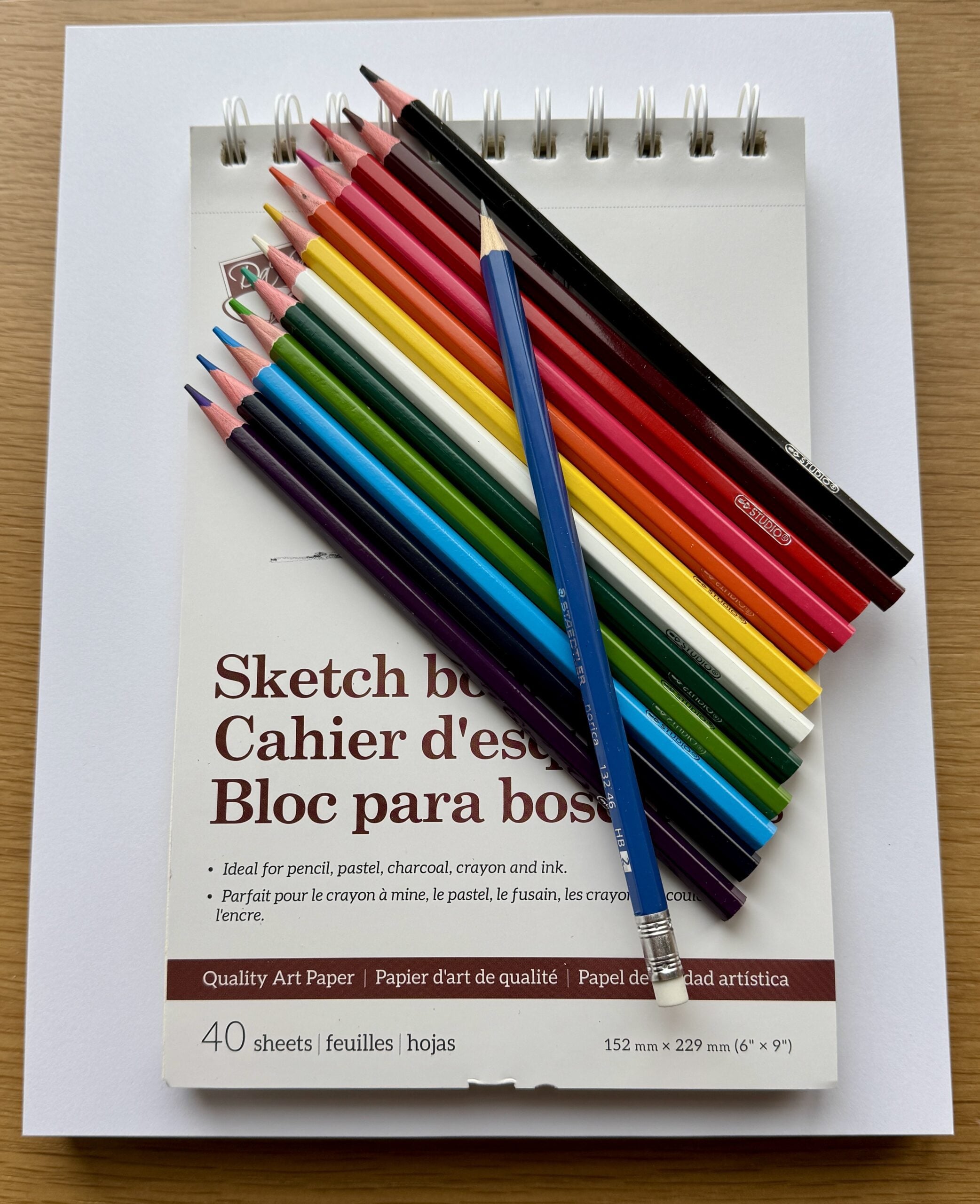
Sketching nature has many benefits. It enhances observation and learning, it deepens our connection with nature and it will help to boost memory as the process of sketching helps us to remember details, emotions and places better than a quick photo. It also helps us to create our artistic skills and encourages creativity.John J. Audubon’s Birds of America famous bird drawings were published in 1838 – nearly 200 years ago. For our first foray into sketching nature, our focus will not be on perfection but rather the process of observation.
Please join Corie and Ruth as we make our way over to a comfortable log where we will sit and choose something to sketch. All sketching materials will be provided and are yours to keep. Some artistic drawing guidance will be provided by Corie and possibly another guest.
Please bring the snacks, lunch, water, poles if you use them and of course all the things you require for a day hike – hat, sunscreen, bug spray, first aid kit etc.
If the Sketching Nature portion has to be cancelled due to a forecast of rain, we will hike but sketching will be postponed. Everyone will be notified.
This hike is open to a small group of 10.
If you have to cancel, please remove your registration so that someone from the waitlist can join.
To cancel your registration, here is a step by step:
– Sign into your account on the BTC website
– Click on My Hikes under your account
– This will take you to a list of hikes you have registered for
– Scroll down to the appropriate hike and cursor over to the far right hand column under the Action column.
– Click Cancel under the hike you wish to cancel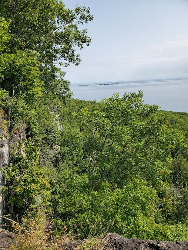
Sunday Side Trails: Jackson Cove
https://hikes.brucetrail.org/event/sunday-side-trails-jackson-cove/
REGISTRATION FULL: This hike has reached the maximum number of hikers.
Click here to be added to the Wait List.Hosting Club: Peninsula
Category: Peninsula Blue Series
Location (Google Maps): Meet at Bruce Trail parking located on Jackson’s Cove Rd at the top of the hill just to the west of the trail.Hike Leader(s): Barbara Reuber Click here to contact Hike Leader(s)
Pace: Leisurely (2.0 – 3.0 km/h): A relaxed pace with frequent breaks and a focus on enjoyment.
Terrain: Easy: Flat forested sections or lowland trails.
Distance: ~4 kmDescription
Peninsula BTC is offering a series of hikes covering all of the side trails on the Peninsula section of the Bruce Trail. These hikes are a great opportunity for those who want to do some hiking but don’t want to commit to a full end-to-end; for those who have completed an end-to-end and want to explore more of the beautiful trails on the Peninsula and for locals and visitors who want to get out on the trail on the weekend.The series will include 27 hikes on Sundays (and maybe the odd Saturday) over 2026 and 2027, covering more than 150 km of side trails or 78 trails! We will be offering hikes on a roughly biweekly basis, with hikes posted approximately two months in advance. The hikes will generally be loop hikes, although car shuttling may be required for a few hikes. Register for each hike individually, no need to commit to all 27 hikes!
For those who would like to earn the Peninsula Side Trails Badge, these hikes provide a chance to join a group for some or all of the side trail hikes.
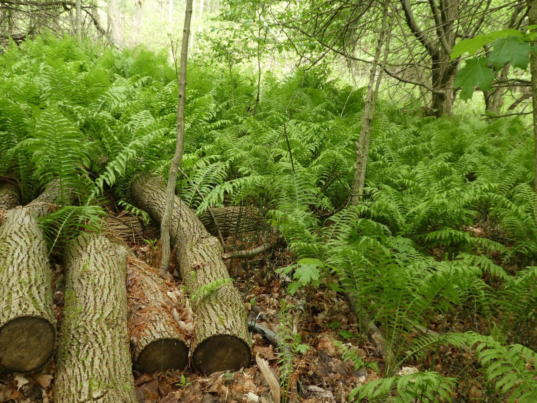
This hike includes the Jackson Cove, Cannon and Jackson Cove Lookout Side Trails. Most of the hike meanders through mature hardwood forest with a visit to the lookout for a spectacular view over Hope Bay. This is a short hike at 3.8 km so we will spend time observing and identifying the various ferns, flowers and trees along the way.
Hikers should be prepared for the weather, possible wet trails and insects. Bring a lunch, water and snacks. Hike leader will contact registered hikers one week before the hike.
If you would like to be notified when the side trail hikes are posted, go to the bottom of the Hikes page on the PBTC website to sign-up for hike notifications.
Glen Haffy to 7th Line - carpool hike
https://hikes.brucetrail.org/event/glen-haffy-to-7th-line-carpool-hike/
Registration Required:
Click here to register for this hike (9 spots remaining)Hosting Club: Iroquoia
Category: General Hike
Location (Google Maps): Meet at 9:15 in the 7th Line Bruce Trail parking lot, off Airport Road.Hike Leader(s): Karen Bergmann Click here to contact Hike Leader(s)
Pace: Medium – 3 to 4 km/hr
Terrain: Moderate – Some hills and/or some poor footing
Distance: 9 kmsDescription
Meeting at 9:15 am in the Bruce Trail parking lot at the corner of 7th Line and Airport Road, we will carpool to Coolihans Side Road and hike back through Glen Haffy, along Hwy 7 and into the forest to the cars. There are some hills and tricky footing, so bring poles if you use them. Lots of variety along this trail. There is a 650 meter stretch of road walking just after leaving the Glen Haffy Conservation Area. Bring water and a snack, as needed, as well as bug spray/bug net.Car Hike; Mono Cliffs
https://hikes.brucetrail.org/event/car-hike-mono-cliffs-9/
Registration Required:
Click here to register for this hike (16 spots remaining)Hosting Club: Toronto, Caledon Hills, Dufferin Hi-Land
Category: Car Hike
Location (Google Maps):Mono Cliffs Provincial Park, Map 19
Hike Leader(s): Al Brown Click here to contact Hike Leader(s)
Pace: Moderate (3-4 km/hr)
Terrain: Level 2 (Intermediate – some hills and uneven surfaces, rocks and roots underfoot), Variable
Distance (km): 14 kmDescription
We will complete a loop hike through Mono Cliffs PP and the North Outlier. The trail is mostly flat and under forest cover. We will stop at several viewpoints and natural features along the way.After the hike those interested may gather at a local establishment for refreshments.
To get to the meeting point take Hwy 10 north past Orangeville to County Rd 8 (Mono Centre Road). Proceed east about 6 km to Mono Centre. The parking area for the community centre is 200 meters south of the T-intersection if you go too far. The entrance to the parking area is on your right just before a tennis court.
Exploring Sydenham Hike #45 Skinners Bluff
https://hikes.brucetrail.org/event/exploring-sydenham-hike-45-skinners-bluff/
Registration Required:
Click here to register for this hike (7 spots remaining)Hosting Club: Sydenham
Category: General Hike
Location (Google Maps):We will carpool from 2888 3rd Ave. W., Owen Sound
Hike Leader(s): Bill Snel Click here to contact Hike Leader(s)
Pace: Leisurely: 3 km/h or less
Terrain: Easy: Mostly flat and good footing., Moderate: Some hills and/or poor footing
Distance: 4 kmDescription
We will carpool from Owen Sound to do a loop hike on Skinners Bluff using the Chris Walker Side Trail – Map 34. This is hike 45 in the book Exploring Sydenham. There will be one secret to find. If you do not have a book and would like one ($30) let me know by using the “Contact hike leader” link.