Categories
- 09June 9, 2026
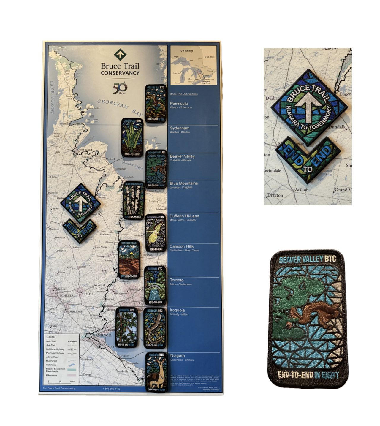
Beaver Valley Stained Glass Badge Fundraiser - June 9, 10, 11, 12 13, 2026 7:30 meet time
https://hikes.brucetrail.org/event/beaver-valley-stained-glass-badge-fundraiser-june-9-10-11-12-13-2026-730-meet-time/Sorry, the registration cut-off time for this hike has been reached.Not a member? Click here to join today!Hosting Club: Iroquoia, Beaver Valley
Category: Stained Glass Badge End to End Fundraiser Hike
Location (Google Maps): Registered participants will receive a WhatsApp invitation (optional)which can be used for photo share and other pertinent information.
June 9 – Meet at the Kolopore Uplands Parking Lot Grey Rd 2 located 650m south of the Trail 44.422919, -80.405597 (30) Shuttle to Roadside Parking along the north side of Maple Lane 44.504973, -80.331780 (4) 26km
June 10 – Meet at Kolopore Uplands, Shuttle to Roadside Parking on the northern shoulder of Sideroad 7B where the main trail enters the forest. 44.395310, -80.518495 (6) 20km
June 11 – Meet at Hogg’s Falls parking lot 44.285307, -80.543081 (16) Shuttle to Sideroad 7B 21km
June 12 – Meet at Hogg’s Falls Shuttle to John Muir Epping Lookout – Enter from Grey Rd 7, 300 m north of 19 Sideroad 44.461522, -80.554756 (40) 29km
June 13 – Meet at John Muir Lookout. Shuttle to BTC parking lot on the east side of Grey Rd 12 where the trail crosses the road. 44.500537, -80.632902 (15) 24kmHike Leader(s): Ruth Moffatt Click here to contact Hike Leader(s)
Pace: Brisk – 4 to 5 km/hr, Medium – 3 to 4 km/hr
Terrain: Dependent on Conditions, Moderate – Some hills and/or some poor footing, Strenuous – Hilly with steep climbs and some poor footing
Distance: 20-29 per dayDescription
Beaver Valley Stained Glass Badge Fundraiser End 2 EndEveryone who is registered for this hike series will be invited to join an optional WhatsApp which can be used to share photos and other information.
In this series of 5 hikes you will get a chance to test your strength, endurance and perseverance! You will be rewarded with the breathtaking views of spring in the valley, good company and of course the Beaver Valley Stained Glass badge ETE badge. This is a monetized hike – proceeds go to the Beaver Valley Bruce Trail Club to continue to maintain infrastructure along the trail. There are no refunds.
This E2E is intended for strong hikers only. We will be hiking at a steady pace with very few short breaks It will be tough hiking due to the distances involved so be sure of your physical ability before signing up for this hike. We will take only a few short breaks and lunch. Photo stops, as well. It is expected that everyone keep pace with the person in front of them. Bio breaks are as you need; please let the sweep know and they will wait for you.
Please do not register for this hike unless you can commit to all 5 days. If you need to miss one day, please make it up before this hike begins.
The Stained Glass ETE Beaver Valley Club series can only be completed with a club leader.
All hikes in this series will include a car shuttle and everyone will take a turn as a shuttle driver. Please have your vehicle passenger-ready with at least 4 available seatbelts.
If you have any questions please email me.
Please bring all snacks/lunch and at least 2l of water as well as all the other things you require for a long day hike including a first aid kit, bug spray, sunscreen and poles, if you use them.
No dogs. Do not show up unregistered.
Any questions may be directed through contact on this form.
If you cannot make it, please remove yourself from registration.To cancel your registration, here is a step by step:
– Sign into your account on the BTC website
– Click on My Hikes under your account
– This will take you to a list of hikes you have registered for
– Scroll down to the appropriate hike and cursor over to the far right hand column under the Action column.
– Click Cancel under the hike you wish to cancelThere are no drop outs. If for some reason you are unable to complete the days’ hike, you will be responsible for finding your way back to your vehicle. Badges will be presented on the last day, hopefully. If not, a list of finishers will be sent to the club for mailing out.
Refunds: https://brucetrail.org/paid-hike-refund-policy/
Long Haulers Hike NEW TIME NEW LOCATION
https://hikes.brucetrail.org/event/long-haulers-hike-new-time-new-location-4/Sorry, the registration cut-off time for this hike has been reached.Not a member? Click here to join today!Hosting Club: Niagara
Location (Google Maps): Short Hills Wiley Road, Thorold
Pace: Fast 5+ km/hr
Terrain: Moderate: some hills and some poor footing
: 10k+Description
Back to our regular Spot for the Tuesday Long Hike. Note the new location. We will hike the trails around Short Hills Dress for the weather and bring sunscreen bug spray, poles snack and drinkCar Hike: Dufferin E2E 2/4
https://hikes.brucetrail.org/event/car-hike-dufferin-e2e-2-4-2/Sorry, the registration cut-off time for this hike has been reached.Not a member? Click here to join today!Hike open to BTC Members only.
Hosting Club: Toronto, Dufferin Hi-Land
Category: Car Hike
Location (Google Maps):Km 28.3, 1st Line E coordinates N 44.148246,W 80.118529 map 20
Hike Leader(s): Smadar Junkin Click here to contact Hike Leader(s)
Pace: Brisk (4-5 km/hr)
Terrain: Level 3 (Advanced – steep hills and some scrambling over boulders)
Distance (km): 14.2 km.Description
Second hike of the series to complete the Dufferin section. Please be in the parking area at 8;15 and be ready to shuttle by 8:30. Bring 2 litres of water, food, bug repellent, sun screen. Hiking boots. We will shuttle to km 14.1 and walk back. Everyone is expected to participate in the car shuttle during the 4 days hike.Peter Beecham and Griffith Ravine Side Trails
https://hikes.brucetrail.org/event/peter-beecham-and-griffith-ravine-side-trails/Sorry, the registration cut-off time for this hike has been reached.Not a member? Click here to join today!Hosting Club: Dufferin Hi-Land
Category: Tuesday Hike
Location (Google Maps):(Google Maps) Caledon Hills Section, Map 18. Meet at roadside parking on 4th Line East, Mono 1.5 km north of 5 Sideroad.
Hike Leader(s): Les Babbage, Inge Eckerich, Julie Daley,Tony Evangelista Click here to contact Hike Leader(s)
Pace: Leisurely
Terrain: Moderate
Distance: Long Hike 5 km Short Hike 2.7 kmDescription
From roadside parking at km 54.9, we will hike west via the Peter Beecham Side Trail and Main Trail until we reach 3rd Line EHS. At this point, we will retrace our steps and return to the parking lot, taking the Griffith Ravine Side Trail at Km 56.2. The short hike will take the Griffith Ravine Side Trail when we first meet it to return to the parking.Bring water, snacks, and sunscreen. Hiking poles are recommended.
9:15 Short Hike, Short Hills Provincial Park, St. Catharines
https://hikes.brucetrail.org/event/915-short-hike-short-hills-provincial-park-st-catharines/Sorry, the registration cut-off time for this hike has been reached.Not a member? Click here to join today!Hike open to BTC Members only.
Hosting Club: Niagara
Category: Hike
Location (Google Maps): Short Hills Provincial Park, Pelham Rd entranceHike Leader(s): Debbie Demizio Click here to contact Hike Leader(s)
Pace: Medium 3- 4 km/hr
Terrain: Moderate: some hills and some poor footing
Distance: 7 kmDescription
Hike the main and side trails of Short Hills Provincial Park. Please wear appropriate footwear, bring water and hiking poles. Check yourself for ticks following the hike.Forks of the Credit - postponed.
https://hikes.brucetrail.org/event/forks-of-the-credit-6/Sorry, the registration cut-off time for this hike has been reached.Not a member? Click here to join today!Hosting Club: Caledon Hills
Category: Tuesday Hikers
Location (Google Maps): Mississauga Rd. intersection with Elora-Cataract Trailway.
Driving direction: From Highway 401, north on Mississauga Rd., pass through Belfountain village, after crossing Cataract Rd. and Elora-Cataract Trailway, park on either side of the road.
Alternate direction: North on Highway 410, continue on Highway 10, at Caledon Village, left on Charleston Sideroad (24), left on Mississauga Rd., drive 2 km to the roadside parking.Hike Leader(s): Mohammad Shafiq Click here to contact Hike Leader(s)
Pace: Medium – 3 to 4 km/hour
Terrain: Moderate – some hills and/or some poor footing
Distance: 11 kmDescription
Will enter Forks of the Credit Conservation Area using Elora-Cataract Trailway and hike main Bruce Trail, Mill Pond Trail and parts of conservation trails.
Bring water and snack; poles are recommended.
Optional refreshment stop at one of the cafes nearby – more information on the hiking day.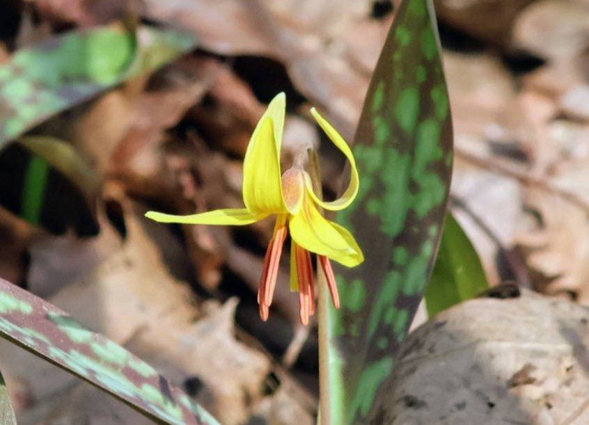
Terra Cotta Loop Hike
https://hikes.brucetrail.org/event/terra-cotta-loop-hike-2/Sorry, the registration cut-off time for this hike has been reached.Not a member? Click here to join today!Hike open to BTC Members only.
Hosting Club: Caledon Hills
Category: General
Location (Google Maps): Terra Cotta Conservation Area (entry fee $8 per person at the gate)
14452 Winston Churchill Blvd., Halton HillsHike Leader(s): Jane Hull Click here to contact Hike Leader(s)
Pace: Medium – 3 to 4 km/hour
Terrain: Moderate – some hills and/or some poor footing
Distance: 6.5 kmDescription
Join us for a late spring loop hike through Terra Cotta Conservation area. We will hike several of the trails (moderate difficulty with some hilly sections/roots/rocks) and may spot some remaining spring wildflowers, or see some painted turtles in the wetland ponds. Bring your choice of hydration and snacks.. Hiking boots/shoes required. Participants will be notified the night before if the hike must be cancelled due to inclement weather.Urban Walk: Valley View Park
https://hikes.brucetrail.org/event/urban-walk-valley-view-park-thornhill-175/Sorry, the registration cut-off time for this hike has been reached.Not a member? Click here to join today!Hosting Club: Toronto
Location (Google Maps): Parking lot is off Sycamore Drive, East of Bayview , across Starbucks plaza
Bus 91 from Finch East station stops at Sycamore station.Hike Leader(s): MOHAMMAD AGHAMIRI Click here to contact Hike Leader(s)
Pace: Moderate (3-4 km/hr)
Terrain: Hilly, Level 2 (Intermediate – some hills and uneven surfaces, rocks and roots underfoot)
Distance (km): 6-7 kmDescription
We will explore Valleyview and Maple View parks, and walk along German Mill Creak, in return we stop in Huntington park and have snack under beautiful shed.Although this is considered an “Urban Walk”, you can expect some hills up and down and uneven surfaces with tree roots. Please bring hiking poles, Ice cleats water and snacks.
POSTPONED due to weather -Tuesday Trekkers- Dufferin (km36.8-55.5) 3of 3
https://hikes.brucetrail.org/event/dufferin-km36-8-55-5-3-of-3/Sorry, the registration cut-off time for this hike has been reached.Not a member? Click here to join today!Hosting Club: Beaver Valley
Location (Google Maps): Meet at the Roadside parking on Mulmur-Nottawasaga Townline, 550 m east of Lavender Rd at the Cemetery. Km 54.9 Map 21 Ed 31
Shuttle to BT parking off of 15th Sideroad.Hike Leader(s): Kristina Rettie Click here to contact the hike leader.
Pace: Brisk, Medium
Terrain: Moderate, Some rocky footing, Some steep sections, Strenuous
Length of Hike: 18kmDescription
This Dufferin E2E will take place over 3 Tuesdays. Come out for all of them and earn you Dufferin E2E badge (you can apply for this independenly) or just come to the ones that interest you. We will start at km 0 and make our way north to km 55.5 covering the entire Dufferin section.This will be a car shuttle hike so please come with your car passenger ready. We will all take turns being the shuttle driver.
This time of year we can expect all types of trail conditions. Please be prepared with for the condition of the day.
Bring water lunch and a snack
Please no dogs
Walk In Nature Series (WINS) Tuesday Summer Evenings - Jones Falls trails
https://hikes.brucetrail.org/event/walk-in-nature-series-wins-jones-falls-trails/Sorry, the registration cut-off time for this hike has been reached.Not a member? Click here to join today!Hosting Club: Sydenham
Category: General Hike
Location (Google Maps): Click the Google Maps link to take you there. Meet and park at the Owen Sound Transportation parking lot 200 m north of Springmount. In the Bruce Trail Reference, Edition 31, meet at the Merle Gunby Side Trail trailhead, west of km 101.8 on Map 32Hike Leader(s): Stewart Brown Click here to contact Hike Leader(s)
Pace: Medium: 3 to 4 km/h
Terrain: Moderate: Some hills and/or poor footing
Distance: 5 kmDescription
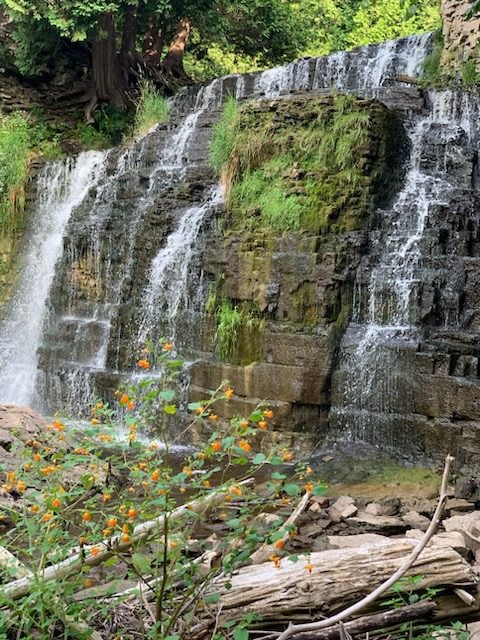
Tuesday evening WINS summer hikes begin at 6:30 p.m. as a way to enjoy the daylight and nice weather of summer evenings. Join us on this evening hike to view Jones Falls both from above and below. Enjoy the tranquil beauty of the forests of the Pottawatomi Convservation area on the Merle Gunby side trail atop the escarpment and the Memorial Forest side trail along the base of the escarpment.