Categories
- 20June 20, 2026
Kimberly Forest S.T. / Bill's Creek
https://hikes.brucetrail.org/event/kimberly-forest-s-t-bills-creek/Sorry, the registration cut-off time for this hike has been reached.Not a member? Click here to join today!Hosting Club: Beaver Valley
Location (Google Maps): Meet on the deck of the Beaver Valley Ski Club clubhouse. The address is 100 Pioneer Drive, Markdale. Enter the ski club property at the gates on Grey Road 30. Coordinates 44.357747 -80.544822
Hike Leader(s): Marg Parkin Click here to contact the hike leader.
Pace: Leisurely
Terrain: Moderate
Length of Hike: Short hike of 45 minutes, longer option is 1 hr 20 minDescription
Our hike offers two distances: a short 45-minute hike (2.5km) into the forest, and a longer 1.5 hour (5km) hike, going farther along the trail which will include the always-interesting karst Bill’s Creek. Have you ever wondered what goes on behind the scenes of trail-making for our hiking pleasure? Come out to the Beaver Valley club’s post-AGM hike, and learn about trail-making partnerships, coordination and construction as you stroll the trail from the Beaver Valley ski club into the Kimberly Forest. We will be accompanied by Cathy Little, who has facilitated the sharing of trails for hiking, skiing, biking and snowshoeing. Cathy will share some interesting stories from her 10+ years of partnership-building and will encourage discussion.
Car Hike: Exploring Uxbridge Trails (Wilder Forest, Walker Woods, and Glen Major Forest)
https://hikes.brucetrail.org/event/car-hike-exploring-uxbridge-trails-wilder-forest-walker-woods-and-glen-major-forest-20/Sorry, the registration cut-off time for this hike has been reached.Not a member? Click here to join today!Hosting Club: Toronto
Category: Car Hike
Location (Google Maps):2499 Brock Rd, Uxbridge, ON L9P 1R4. We will meet at the East Duffins Headwaters parking lot at the WILDER FOREST trail head. As soon as you got off the Brock Road, passing the horse back riding facility, there is a free designated parking lot 70 meters down the lane to your right. It includes a sign board for East Duffins Headwaters with a map of the trails. Please do not park on the lane or in the horse back riding property.
Hike Leader(s): Amir Alemohammad Click here to contact Hike Leader(s)
Pace: Moderate (3-4 km/hr)
Terrain: Flat, Hilly, Level 2 (Intermediate – some hills and uneven surfaces, rocks and roots underfoot)
Distance (km): Approx.15-16 KmDescription
Join us for a delightful hike in Uxbridge, as we explore Wilder Forest, Walker Woods, and Glen Major Forest on a scenic loop starting from Brock Road. We’ll pass Concession Road 6, heading east and back, while also venturing onto several side trails for even more stunning views.What to Expect:
•Beautiful scenic views and lookouts facing south
•A mix of hilly and flat terrain
•Frequent 2-minute breaks for hydration and photos, with a 10 minute snack stop
•Stay on designated trails at all time
What to Bring and Wear:
•Hiking Boots and poles (recommended) and be prepared for the ticks on the trail, keep your bug spray handy.
•At least 2 liters of water
•Your favorite snacks (pack your own refreshments for an outdoor meal)
•Dress according to variable weather conditions!
Important Details:
•Stay on the designated trails
•Be prepared for the elements and enjoy the adventure!
Looking forward to seeing you on the trail!
Don’t forget your camera and a smile as we explore the beauty of the Uxbridge trails!
This is a joint hike with the Oak Ridges Trail Association (ORTA).
Six Pack at Blue - Lavender to Nottawasaga 9/10 Sideroad
https://hikes.brucetrail.org/event/six-pack-at-blue-lavender-to-nottawasaga-9-10-sideroad/Sorry, the registration cut-off time for this hike has been reached.Not a member? Click here to join today!Hosting Club: Blue Mountains
Category: Organized Hike
Location (Google Maps): Tim Hortons, First street, Collingwood, or 8667 Nottawasaga Sideroad 9, Glen HuronHike Leader(s): Murray Morrison Click here to contact Hike Leader(s)
Pace: Medium – 3 to 4 km/hr
Terrain: Moderate – Some hills and/or some poor footing
Distance: 14.7 kilometersDescription
We will be hiking the Bruce Trail from Lavender Cemetery to Nottawasaga 9/10 Sideroad. At the moderate pace of 3 to 4 Km per hour the 14.7-kilometer hike should take about 5 hours with nutrition breaks. There are two strenuous climbs out of valleys, varied terrain, rolling escarpment views and peaceful meadows on this hike. Please bring lunch or snacks for a nutritional break. Bug protection is advised.
We will need to car jockey from 9/10 Sideroad to Lavender. We can carpool from Tim Horton’s at 8:00 a.m. or meet at Concession 9/10 Sideroad at 8:30 a.m.
Dates for six-pack hikes are as follows;
20 June 2026
27 June 2026
12 Sept 2026
19 Sept 2026
26 Sept 2026
17 Oct 2026Awenda Provincial Park and Sainte-Marie among the Hurons/Wye Marsh
https://hikes.brucetrail.org/event/awenda-provincial-park-and-sainte-marie-among-the-hurons-wye-marsh/Sorry, the registration cut-off time for this hike has been reached.Not a member? Click here to join today!Trip Information
Departure Time: 08:00
Return to City Time: 18:30
Departure Point: York Mills Bus PickupOptional Items
Hosting Club: Toronto
Category: Bus Hike
Location (Google Maps): Awenda Provincial ParkHike Leader(s): Robin Crombie and Ted Moriarty Click here to contact Hike Leader(s)
Pace: Moderate (3-4 km/hr)
Terrain: Level 2 (Intermediate – some hills and uneven surfaces, rocks and roots underfoot)
Distance (km): About 10 kmDescription
Join us on this trip to beautiful Awenda Provincial Park, on the shores of Georgian Bay, where we’ll enjoy a lovely circular route, the Bluff Trail, and take a detour down the staircase to the beach for lunch. Afterwards, we’ll make the short drive to Highway 12, where you’ll have the opportunity to visit one of two local gems:- Saint-Marie among the Hurons, an historic site and Huronia education centre
OR
- Wye Marsh Wildlife Centre,
Please note that while there will not be time for a refreshment stop, Sainte-Marie has an onsite restaurant and patio.
From June 19 to 30, Saint-Marie is also offering free online Indigenous-led learning resources here.
8:30 a.m. Dog Pack Walk
https://hikes.brucetrail.org/event/830-a-m-dog-pack-walk/Sorry, the registration cut-off time for this hike has been reached.Not a member? Click here to join today!Hosting Club: Niagara
Category: Dog Pack Walk
Location (Google Maps): Woodend Conservation Area- Park at Taylor Road entranceHike Leader(s): Sam Rutherford Click here to contact Hike Leader(s)
Pace: Leisurely <3 km/hr
Terrain: Moderate: some hills and some poor footing
Distance: 4 kmsDescription
This dog pack walk is a structured group walk where dogs and their handlers walk together on-lead in a natural environment. It promotes exercise, calm socialization and exposure to other dogs and people in a safe, controlled setting. We will meet at the Taylor Road parking area and follow the Wetland Ridge Side Trail out to the main trail and follow the main trail back to the parking area. Dogs must be kept on-lead and under control at all times. Please bring water and treats for you and your dog.Boyd Conservation Park Vaughan
https://hikes.brucetrail.org/event/car-hike-boyd-conservation-park-vaughan-14/Sorry, the registration cut-off time for this hike has been reached.Not a member? Click here to join today!Hosting Club: Toronto
Location (Google Maps): Free Parking lot before entrance of park on Islington Ave.
Hike Leader(s): Mohammad Aghamiri Click here to contact Hike Leader(s)
Pace: Moderate (3-4 km/hr)
Terrain: Hilly, Level 2 (Intermediate – some hills and uneven surfaces, rocks and roots underfoot), Variable
Distance (km): 12-14 kmDescription
Let’s hike Boyd conservation park trails through beautiful valleys.Please bring lots of water and snacks ,hiking poles are recommended
phone number for the day of hike 289 588 6482
Seven Rivers Hike Badge Series - Hike 4
https://hikes.brucetrail.org/event/seven-rivers-hike-badge-series-hike-4/Sorry, the registration cut-off time for this hike has been reached.Not a member? Click here to join today!Hosting Club: Dufferin Hi-Land
Category: General Hike
Location (Google Maps): Pine River Dufferin Hi Land Section Map 20
Parking: new BT parking lot on 15th side Rd just west of Prince of Wales Rd.Hike Leader(s): Tristan Goguen and Pat Foley Click here to contact Hike Leader(s)
Pace: Medium
Terrain: Moderate
Distance: Short Hike 8.63 Longer hike 12.45Description
Today we will hike south bound on the main trail from the parking are to where the main trail intersects with the Pine River Valley Side Trail. We will hike the Pine River Valley side trail to the second intersection with the Carl Alexander Side Trail. Take the Carl Alexander Side Trail back to the Pine River Valley Side trail then proceed back to the main trail. From there we will hike south bound to the Bell Look out side Trail, enjoy the view then return to the main trail to continue hiking south bound past the Pine River Fishing area and then along the river . We will the cross River Road and pick up the Kilgore side Trail on the north side and return to the main trail and the parking lot. Total distance to this point is approximately 8.63 Km. For enthusiasts we can continue north bound on Prince of Wales Rd from the parking are to the intersection with the Melodonna Side Trail. From there we will follow the side trail back to the main trail and return to the cars. With the added distance the total would be 12.45 km.Please be prepared for the weather, we will hike rain or shine. Ensure you have enough water,lunch and snacks, sunscreen and bug repellent. Hats and sunglasses are recommended as are poles and sturdy shoes.
For those wishing to earn their 7 Rivers – complete all 7 hikes, badges will be available on the last day from the hike leaders at a cost of $10 for members and $15 for non members.
Anyone completing make-up hikes may log their hikes and apply directly to the Dufferin Highlands BT Club for the badge.
Car Hike: Scotsdale Farm
https://hikes.brucetrail.org/event/car-hike-scotsdale-farm-21/Sorry, the registration cut-off time for this hike has been reached.Not a member? Click here to join today!Hosting Club: Caledon Hills
Category: General
Location (Google Maps): Scotsdale Farm, Map 13. Directions; from Highway 401, head north on Trafalgar Road past Georgetown. Trafalgar briefly merges with Highway 7 for about 3 km before separating to the right at the village of Silver Creek. At the stop light in Silver Creek, continue north on Trafalgar Road for about 1 km to the entrance of Scotsdale Farm on your right. Drive in about half a kilometre to reach the parking area.Hike Leader(s): Lana Hubbard Click here to contact Hike Leader(s)
Pace: Medium – 3 to 4 km/hour
Terrain: Moderate – some hills and/or some poor footing
Distance: 14 kmDescription
🌈 Join us for a queer/trans-led, 2SLGBTQIA+ inclusive loop hike along the main Bruce Trail and its scenic side trails, including the stunning Great Esker Side Trail.This hike is welcoming to LGBTQ+ hikers, and anyone interested in connecting with community while enjoying a beautiful day on the trail.
We’ll be hiking approximately 14 km at a medium pace. Please dress appropriately for the weather, bring plenty of water, and pack snacks or a light lunch. Some sections of the trail are rocky, so hiking poles are highly recommended.
Weather permitting, I’ll be heading to the Copper Kettle after the hike for refreshments, and everyone is welcome to join. ^_^
🇨🇦 HISTORIC HIKE - LYNN VALLEY TRAIL - SIMCOE TO PORT DOVER - 15 KM OR 24 KM
https://hikes.brucetrail.org/event/%f0%9f%87%a8%f0%9f%87%a6-historic-hike-lynn-valley-trail-simcoe-to-port-dover-15-km-or-24-km/Sorry, the registration cut-off time for this hike has been reached.Not a member? Click here to join today!Hosting Club: Toronto
Category: Car Hike
Location (Google Maps): Coordinates: 42.829197, -80.298343
Parking and departure: Meet for a 9:30 am departure from Simcoe Memorial Park parking lot, 273 Owen St. Simcoe, ON, N3Y 2V3 Norfolk County. (Simcoe ON Hwy 24 south)
If you want the shorter hike of 15 km arrive at 8:50 am to do a car shuttle to drop off your car and return to the start.Hike Leader(s): Jeanette Vincent Click here to contact Hike Leader(s)
Pace: Moderate (3-4 km/hr)
Terrain: Flat, Level 1 (Easy – mostly on flat, well maintained trails with hard-packed surface), Level 2 (Intermediate – some hills and uneven surfaces, rocks and roots underfoot)
Distance (km): 15km or 24kmDescription
🇨🇦 HISTORIC HIKE – LYNN VALLEY TRAIL – SIMCOE TO PORT DOVER – 15 KM OR 24 KMAbout the historic hike: The rail trail in Carolinian Canada is one of Canada’s best, following the Lynn River to Lake Erie, We will hike the trail to Dover approximately 3 1/2 – 4 km per hour, flat easy terrain. The Historic talk by Bob Rennie will begin at noon once we are at the parking lot on Prospect St. in Dover and we will hike for an hour throughout the town approximately 3 km hearing Dover’s history. Lunch stop will be approximately at 1pm, you can purchase your “fish” lunch at a local restaurant or bring your lunch and sit on benches at the lighthouse pier and enjoy the view. After lunch those of us hiking back to Simcoe will continue on with the hike and those with their cars on Prospect St. can enjoy the ambience of Dover a little longer.
Originally part of the Grand Trunk Railway line, the rail line was still very much operational when Bob lived there (until his 20s). It became the former CNR rail line which was established along the pioneer river trail in 1873 as the Lake Huron and Port Dover Railway. The rail line was abandoned in 1988.
Bob, guest of this hike, will share Dover’s early “discovery” by French priests in 1669 previously inhabited by Algonquins and Neutrals. – Dover’s founding by his ancestor and early development of Dover Mills. – War of 1812 Brock’s attack on Detroit out of Dover, and the burning/redevelopment as Port Dover. – Rum running days in the prohibition era. – The importance of the largest fresh water fishing fleet in the world.
Geology Hike #8 (Indian Falls) & #11 (Lindenwood)
https://hikes.brucetrail.org/event/geology-hike-8-indian-falls-11-lindenwood-2/Sorry, the registration cut-off time for this hike has been reached.Not a member? Click here to join today!Hosting Club: Sydenham
Category: Geology Hike
Location (Google Maps):Indian Falls Conservation Area parking lot accessed from Grey Road 1.
Hike Leader(s): Jeannine Kralt Click here to contact Hike Leader(s)
Pace: Leisurely: 3 km/h or less
Terrain: Easy: Mostly flat and good footing., Moderate: Some hills and/or poor footing, Strenuous: Hilly with steep climbs and some poor footing., There might be muddy sections., There might be sections with water on the trail.
Distance: 4.2 km combinedDescription
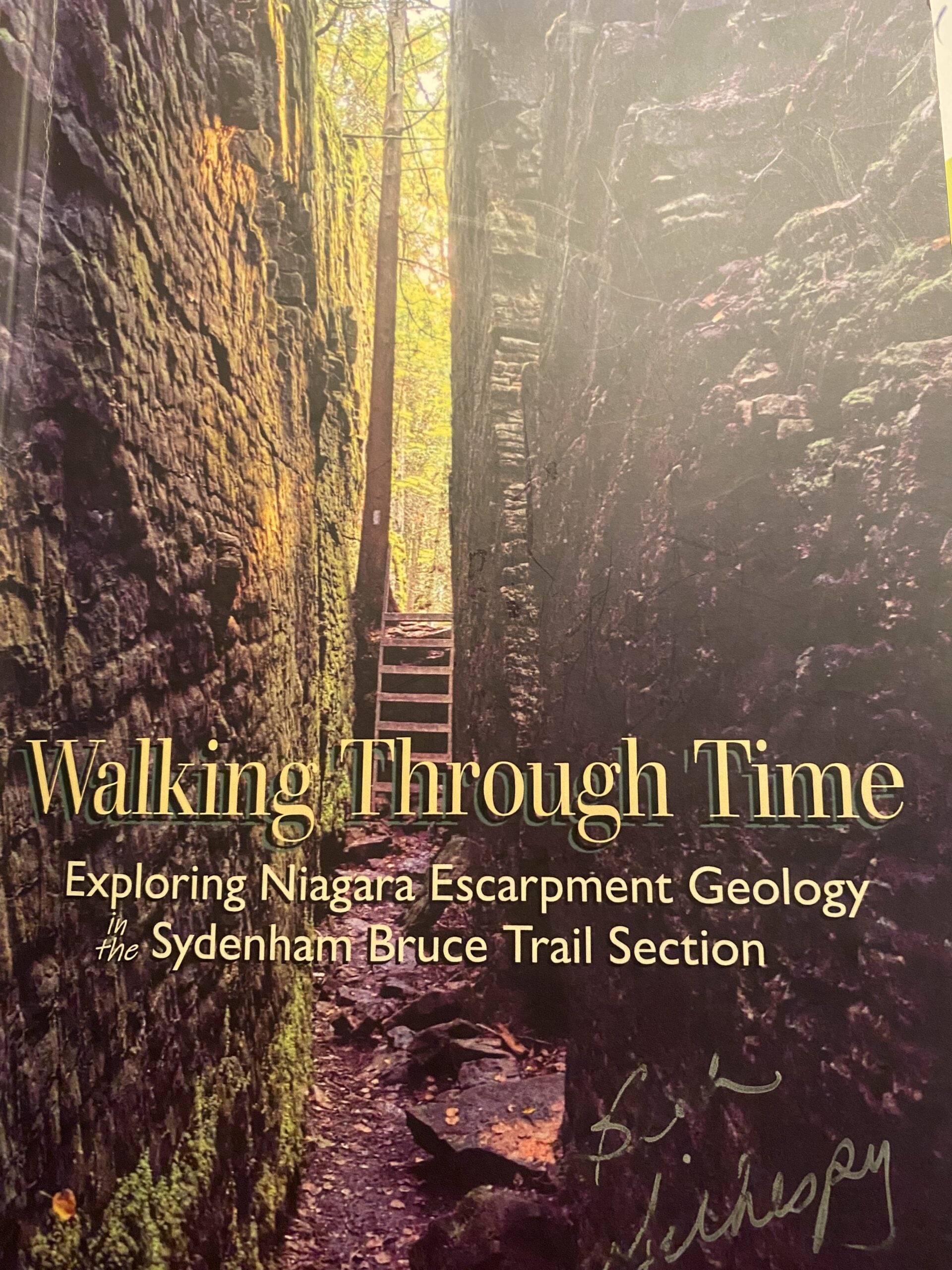
This is a combination of 2 hikes as described in “Walking Through Time” , Beth Gilhespy’s book that explores the geology of the Niagara Escarpment in the Sydenham Bruce Trail section. We will park and meet at the first hike (1.6 km loop): Indian Falls, accessed from the Grey Sauble Conservation Area parking lot. This trail features a magnificent example of the falls tumbling over layers of rock from the Manitoulin dolostone layer down to Queenston shale. (This is not on the Bruce Trail, but is part of the GSCA trails.) At times this trail is closed due to slippery conditions, so this part of our hike will be decided at the parking lot on the day of the hike.We will then carpool from this location a short distance north to our second hike of the day, # 11 Lindenwood Nature Reserve. The parking lot ( 44.685276 -80.995970 ) is located on Lindenwood Road between Grey Road 17 and Grey Road 1. This is a loop hike of 2.6 km featuring impressive erratic boulders, a prime example of an alvar and a newly constructed donor arch recognizing the generosity of our Bruce Trail supporters.
Bring water and a pack lunch to enjoy between the hikes . Beth’s Sydenham geology book and others will be available for purchase (cash, or etransfer). A Sydenham Bruce Trail Geology Badge has been developed. Details can be shared from hike leader during hike.
Car Hike: Hockley Valley, Map 18
https://hikes.brucetrail.org/event/car-hike-hockley-valley-map-18-5/Sorry, the registration cut-off time for this hike has been reached.Not a member? Click here to join today!Hosting Club: Toronto, Caledon Hills
Category: Car Hike
Location (Google Maps):Hockley Valley Provincial Nature Reserve
Hike Leader(s): Al Brown Click here to contact Hike Leader(s)
Pace: Moderate (3-4 km/hr)
Terrain: Challenging, Hilly, Level 2 (Intermediate – some hills and uneven surfaces, rocks and roots underfoot)
Distance (km): 14 kmDescription
We will complete a loop hike through the nature preserve along one of the hilliest sections of the Trail.After the hike those interested can meet for refreshments in the local area.
To get to the meeting point drive north on Hwy 10 past Orangeville to Hockley Road. Turn right and go about 6 km to the parking area. It is across the road from the Black Birch restaurant.
Ferns on the Trail - Part of Iroquoia Bruce Trail Club’s Discovering Nature Series
https://hikes.brucetrail.org/event/ferns-on-the-trail-part-of-iroquoia-bruce-trail-clubs-discovering-nature-series/Sorry, the registration cut-off time for this hike has been reached.Not a member? Click here to join today!Hosting Club: Iroquoia
Category: Iroquoia BTC Naturalist Hike Series : Discovering Nature, One Hike at a Time.
Location (Google Maps): Meet at 10:15 am at the Pear Tree parking lot on 15 Side Road at Speyside.Hike Leader(s): Karen Bergmann Click here to contact Hike Leader(s)
Pace: Leisurely – 3km/hr or less
Terrain: Moderate – Some hills and/or some poor footing
Distance: 6 kmsDescription
Would you like to learn more about the Ferns you see along the trail? This is the hike for you! Rhiannon Carruthers, Bruce Trail Conservancy Volunteer Coordinator, is our BTC knowledge expert on Ferns (and other plants). On this hike, Rhiannon will identify various Ferns and tell us how to identify them and how they reproduce.
If you’d like to brush up on your ferns prior to the hike, you may wish to view The Fascinating World of Ferns BTC YouTube Webinar Rhiannon hosted. Here is a link: https://youtu.be/flKIyVdbyWQ?si=9c06TbNdo8glbxroWe will meet in the Pear Tree parking lot on 15 Side Road at Speyside and hike the main trail, Al Shaw Side Trail and into the St. Helena Forest, back to the cars. Although the hike is just under 6 kms, we will be stopping along the way, so the hike will take about 2 hours. Bring bug spray and bug net as this area can be buggy.
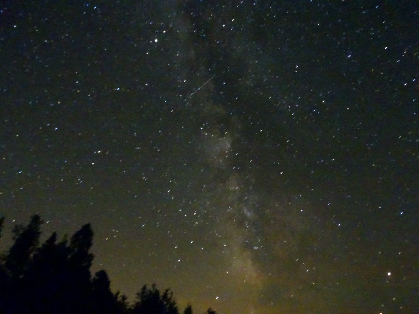
Stargazing and Evening Hike
https://hikes.brucetrail.org/event/stargazing-and-evening-hike/Sorry, the registration cut-off time for this hike has been reached.Not a member? Click here to join today!Hosting Club: Blue Mountains
Category: Organized Hike
Location (Google Maps): Hike meets in the parking lot behind Tim Hortons on First St. in Collingwood.Hike Leader(s): Robert Johnston Click here to contact Hike Leader(s)
Pace: Leisurely – 3 km/hr. or less
Terrain: Moderate – Some hills and/or some poor footing
Distance: 5KmDescription
RESCHEDULED FROM 28 MARCH 2026. Join us this spring for our first Blue Mountains Bruce Trail Club Stargazing hike event. This is a evening hike followed by viewing of night sky features at the E.C. Carr Astronomical Observatory. We will meet behind Tim Hortons on First Street in Collingwood and carpool to the Observatory off Blue Mountains 6th Sideroad in Loree. LEAVING TIM’S AT 7:45PM. Should get us to observatory by 8:15. There we will hike a loop around the Margaret Paull Sidetrail returning to the observatory approximately 9:30 for light refreshments and viewing of night sky objects. There will be a host astronomer on site from the Royal Astronomical Society of Canada to direct this activity. Note sunset is at 9:10 PM so our hike will be in low light conditions. There is a $25 fee ($30 for non-members) to cover the observatory rental cost and refreshments. This hike is weather dependent and in overcast or rainy conditions may be cancelled and rescheduled for a future date.