Categories
- 05April 5, 2026
Peninsula BT Makeup Hike (km 33.3 – km 51.9)
https://hikes.brucetrail.org/event/peninsula-bt-makeup-hike-km-33-3-km-51-9/Sorry, the registration cut-off time for this hike has been reached.Not a member? Click here to join today!Hosting Club: Peninsula
Category: Peninsula BT Makeup Hike
Location (Google Maps):Hike Leader(s): Shawn Radcliffe & Saabir Sohrab Click here to contact Hike Leader(s)
Pace: Medium (3.0 – 4.5 km/h): A comfortable pace for most hikers with steady progress.
Terrain: Difficult: Steep ascents/descents, rocky scrambling, and some rugged escarpment paths., Moderate: Rolling hills, mild slopes and rocky paths.
Distance: ~ 18.6Description
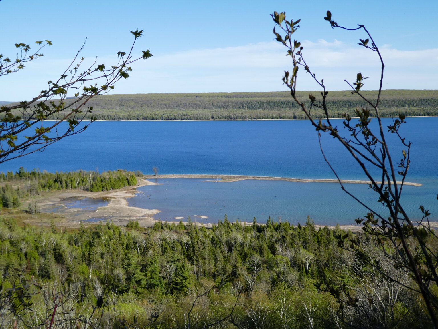
Cape Croker Park Gate to Jackson’s Cove Rd.This hike is part of the Peninsula BT Makeup Hikes, intended for hikers completing missed sections of the Peninsula Bruce Trail. Each hike requires individual registration.
To hike the entire Peninsula Section, please register for the Full Peninsula End-to-End Series (single registration for all 10 hikes): https://hikes.brucetrail.org/event/peninsula-end2end-in-10-series/2026-05-01/
Hikers may register for all 10 Makeup Hikes if they wish.
Expectations: Expect ~7 hours on the trail, depending on the terrain, weather, and group pace. The hike leader sets the pace, aiming for 3–4 km/h, and may adjust as needed for group ability and trail conditions. Breaks will be taken throughout the day.
For safety, participants must remain between the hike leader and the hike sweep at all times.
Fees:
- Registration fee does not include Cape Croker park parking fees
- Parking costs will be shared equally among participants.
- Fundraising: This hike is a fundraiser to support the Peninsula Bruce Trail Club’s volunteer-run hike program.
Participant Requirements
- Intermediate/experienced hikers with good fitness
- Proper hiking boots, layered clothing, wet weather gear
- Hiking poles recommended
- Bring: Lunch, snacks, water, bug spray
Transportation & Accommodations
- Car shuttle: Participants rotate as drivers; vehicles must be passenger-ready
- Accommodations: Book early; options include motels, campgrounds, hostels, and B&Bs
Note: Dogs are not permitted.
Hilton Falls Conservation Halton
https://hikes.brucetrail.org/event/hilton-falls-conservation-halton/Sorry, the registration cut-off time for this hike has been reached.Not a member? Click here to join today!Hosting Club: Iroquoia, Toronto
Category: General Hike
Location (Google Maps): Meet at Hilton Falls Conservation Park Parking lot.
Coordinates: 43.505705, -79.961589Hike Leader(s): IgorT Click here to contact Hike Leader(s)
Pace: Brisk – 4 to 5 km/hr, Medium – 3 to 4 km/hr
Terrain: Dependent on Conditions, Moderate – Some hills and/or some poor footing, Slippery and Steep Sections, Slippery Sections Likely
Distance: 16Description
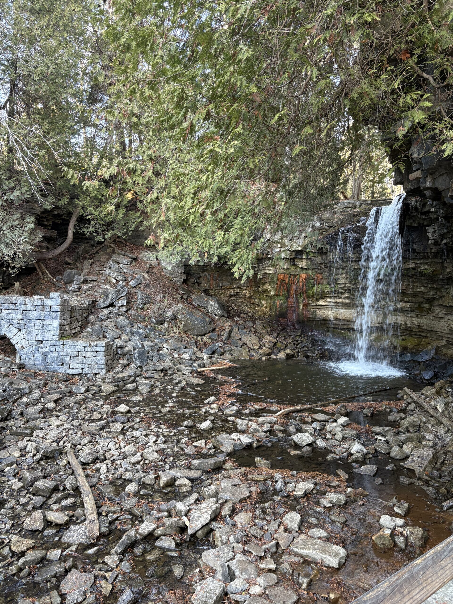
Join me to explore Hilton Falls.park entrance fee 10.50 plus tax per car, reservation required.
https://www.conservationhalton.ca/parks/hilton-falls/
We going to hike thru beautiful forest, enjoy amazing views, 2 waterfalls.
If you wish bring you treats, like marshmallows, hotdogs etc., we going to stop for break at campfire by the falls.
Please read all details for this hike to ensure it is suitable for you. The pace and terrain are particularly important details.
You must be registered to participate in this group hike. You cannot just show up as there are often people on the waitlist.
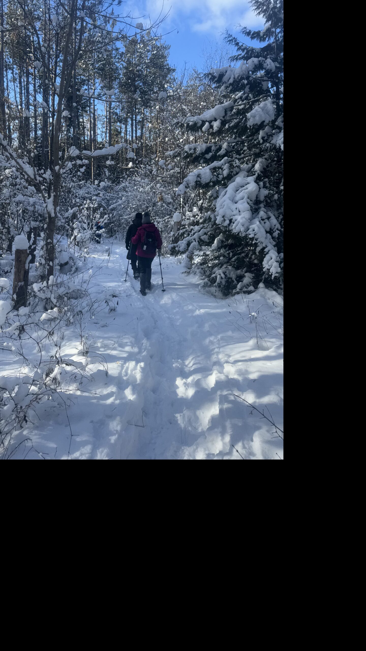
Please pack whatever food you will require for a long day hike including lunch and snacks; 2l of water minimum; first aid kit; poles if you use them; and icers. You may also wish to pack extra socks and rain gear. Remember to dress in layers. Gloves/mitts, scarf / neck gator, a toque and a puffy jacket. Consider snow shoes, depending on conditions.
We will help each other and wait for one another but please consider your physical ability before signing up for this hike.
There are no drop outs – if you are not able to finish the hike you will need to arrange for transportation back to your car via taxi or Uber at your cost.
Car Hike: Jefferson Forest (Richmond Hill)
https://hikes.brucetrail.org/event/car-hike-jefferson-forest-richmond-hill-12/Sorry, the registration cut-off time for this hike has been reached.Not a member? Click here to join today!Hosting Club: Toronto
Category: Car Hike
Location (Google Maps):1245 Bethesda Side Rd, Richmond Hill, ON L4E 1A2 ( Bethesda Trail Head Parking lot)
Hike Leader(s): Amir Alemohammad Click here to contact Hike Leader(s)
Pace: Moderate (3-4 km/hr)
Terrain: Flat, Hilly, Level 2 (Intermediate – some hills and uneven surfaces, rocks and roots underfoot)
Distance (km): 10-11 kmDescription
Let’s roll the hills of the Jefferson Forest for s winter like hike in spring. Every weekend, we’ll explore the winter wonderland at this beautiful park. Located in the heart of Richmond Hill, it boasts numerous hiking trails. This 2,5 hour hike can range from 10 to 12 kilometres, depending on the weather conditions. Remember to bring water, snacks, hiking boots, icers, poles, and your camera. Not recommended for beginners. Park in the free Bethesda parking lot and avoid parking along the road. Dress appropriately for the weather. Difficulty Level: 2 (Moderate).Please arrive @8:45AM for start of 9:00AM.
This is a joint hike with the Oak Ridges Trail Association (ORTA).
Car Hike: 7th line to Airport Rd.
https://hikes.brucetrail.org/event/car-hike-7th-line-to-airport-rd-2/Sorry, the registration cut-off time for this hike has been reached.Not a member? Click here to join today!Hosting Club: Caledon Hills
Category: General
Location (Google Maps): 7th Line Parking Area – km 43.3Hike Leader(s): Lana Hubbard Click here to contact Hike Leader(s)
Pace: Brisk – 4 to 5 km/hour
Terrain: Moderate – some hills and/or some poor footing
Distance: 12 kmDescription
Join me for a quick spring hike as we go from the main parking lot on 7th line to Airport Rd. and back. This will complete a 12 km loop.Pace will be brisk, bring snacks and water. Might need icers.
Terrain isn’t very hilly.
Spring & Migration Monitor Hike
https://hikes.brucetrail.org/event/spring-migration-monitor-hike-10/Sorry, the registration cut-off time for this hike has been reached.Not a member? Click here to join today!Hosting Club: Peninsula
Location (Google Maps): Cape Chin Meadows hike: 388 Cape Chin Rd N, Driveway, Maple Cross Nature Reserve at Cape Chin. Special Guest: Sheilagh Rose – growing up field naturalist and restoring eastern bluebird populations
Hike Leader(s): Tamara Wilson Click here to contact Hike Leader(s)
Pace: Leisurely (2.0 – 3.0 km/h): A relaxed pace with frequent breaks and a focus on enjoyment.
Terrain: Easy: Flat forested sections or lowland trails.
Distance: 6kmDescription
This Spring & Migration Monitor Hike is an easy, low-impact, out and back stroll along the Cape Chin Drive Way to the Cape Chin Point. This will be a weather dependent hike. We will take a break at Cape Chin to observe the changing shoreline that stretches to the South. We may return to the cars via Cape Chin Meadows depending on conditions. Will the Sandhills have returned to the Cape Chin wetlands (usually return by March 1)? Will we see returning Eastern bluebirds that make the Cape Chin meadows their home (observation is Mar 22)? Bring you binoculars and keen sense of observation. Open to everyone! On Apr 5, special guest will be Sheilagh Rose who will talk about growing up in a family of passionate amateur field naturalists who worked tirelessly on the restoration of the Eastern bluebird population in Oro Medonte.