Categories
- 19April 19, 2026

Fort to Fort SECOND DAY ONLY April 19, 2026
https://hikes.brucetrail.org/event/fort-to-fort-second-day-only-april-19-2026/Sorry, the registration cut-off time for this hike has been reached.Not a member? Click here to join today!Hosting Club: Niagara
Category: Event Hikes
Location (Google Maps):Kingsbridge Park, Chippawa, Ontario
Hike Leader(s): Lauren Doig Click here to contact Hike Leader(s)
Pace: Medium
Terrain: Easy
Distance: 27kmDescription
Meet at Kingsbridge Park at 6:45. You will be bussed to Old Fort Erie. Hike back to Kingsbridge Park from Old Fort Erie. Terrain is flat with mostly paved paths. There are 2 checkpoints along the way. This registration is for those hikers who are only doing the second day of the Fort to Fort.
This is a self-led hike.
Registration is $60. (members) , $70 (non-members) for 1 day. Fee includes bus, parking pass, and checkpoints .
Event Coordinator: Lauren Doig, ldoig52@gmail.com
CANCELD - Peninsula BT Makeup Hike (km 139.5 – km 156.4)
https://hikes.brucetrail.org/event/peninsula-bt-makeup-hike-km-139-5-km-156-4/Sorry, the registration cut-off time for this hike has been reached.Not a member? Click here to join today!Hosting Club: Peninsula
Category: Peninsula BT Makeup Hike
Location (Google Maps):Hike Leader(s): Kathleen Stahlbaum & Saabir Sohrab Click here to contact Hike Leader(s)
Pace: Medium (3.0 – 4.5 km/h): A comfortable pace for most hikers with steady progress.
Terrain: Difficult: Steep ascents/descents, rocky scrambling, and some rugged escarpment paths., Moderate: Rolling hills, mild slopes and rocky paths.
Distance: ~17.8Description
Halfway Log dump to Little Cove parking lotThis hike is part of the Peninsula BT Makeup Hikes, intended for hikers completing missed sections of the Peninsula Bruce Trail. Each hike requires individual registration.
To hike the entire Peninsula Section, please register for the Full Peninsula End-to-End Series (single registration for all 10 hikes): https://hikes.brucetrail.org/event/peninsula-end2end-in-10-series/2026-05-01/
Hikers may register for all 10 Makeup Hikes if they wish.
Expectations: Expect ~6 hours on the trail, depending on the terrain, weather, and group pace. The hike leader sets the pace, aiming for 3–4 km/h, and may adjust as needed for group ability and trail conditions. Breaks will be taken throughout the day.
For safety, participants must remain between the hike leader and the hike sweep at all times.
Fees:
- Registration fee does not include Bruce Peninsula National Park entry fees and parking fees
- Parking costs will be shared equally among participants.
- Fundraising: This hike is a fundraiser to support the Peninsula Bruce Trail Club’s volunteer-run hike program.
Participant Requirements
- Intermediate/experienced hikers with good fitness
- Proper hiking boots, layered clothing, wet weather gear
- Hiking poles recommended
- Bring: Lunch, snacks, water, bug spray
Transportation & Accommodations
- Car shuttle: Participants rotate as drivers; vehicles must be passenger-ready
- Accommodations: Book early; options include motels, campgrounds, hostels, and B&Bs
Note: Dogs are not permitted.
Car Hike: Forks Of The Credit - Dog-Friendly hike
https://hikes.brucetrail.org/event/car-hike-forks-of-the-credit-dog-friendly-hike/Sorry, the registration cut-off time for this hike has been reached.Not a member? Click here to join today!Hosting Club: Toronto, Caledon Hills
Category: Car Hike
Location (Google Maps): Forks of the Credit Provincial ParkHike Leader(s): Lindita Kalo Click here to contact Hike Leader(s)
Pace: Moderate (3-4 km/hr)
Terrain: Hilly, Level 2 (Intermediate – some hills and uneven surfaces, rocks and roots underfoot), Variable
Distance (km): 12kmDescription
Hello, I am exited to organize the first Dog-Friendly hike – a pilot program for the TBTC. My dog is an 2 years old Australian Sheppard, she is friendly with humans and other dogs. Dogs must be on leash. If you will be bringing your dog please read the Bruce Trail dog policy – https://brucetrail.org/dogs-on-the-trail/
This hike is a loop hike, we will return to parking lot. Reserve and pay for a daily Vehicle pass online at https://reservations.ontarioparks.com. If you are a badge hunter this hike is 1/4 of Caledon side trail badge. Future hikes TBA. Participants who register can expect at least one dog present on the hike.
Please don’t hesitate to contact me if any questions.
Best Regards,
Lindita
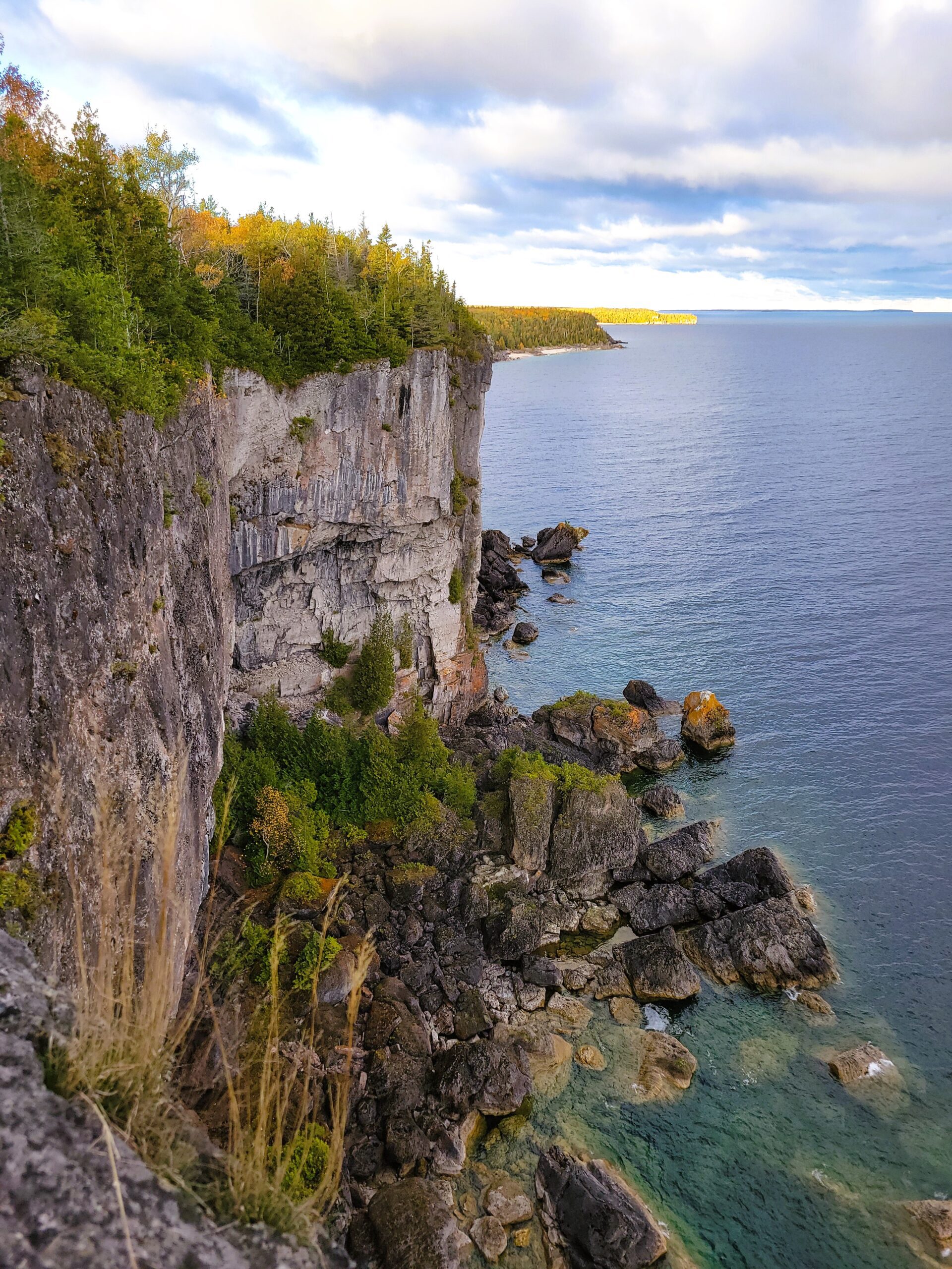
Nassagaweya Canyon, from Rattlesnake Point (reservations required)
https://hikes.brucetrail.org/event/nassagaweya-canyon-from-rattlesnake-point-reservations-required/Sorry, the registration cut-off time for this hike has been reached.Not a member? Click here to join today!Hosting Club: Iroquoia
Category: General Hike
Location (Google Maps): Meet in the upper parking lot at Rattlesnake Point. You will need to reserve your time at conservationhalton.caHike Leader(s): Karen Bergmann Click here to contact Hike Leader(s)
Pace: Medium – 3 to 4 km/hr
Terrain: Moderate – Some hills and/or some poor footing
Distance: 9 kmsDescription
Meeting at 9:15 am in the upper parking lot at Rattlesnake Point, we will hike through the park and down into the canyon and back up into the park for a large loop. There are some rocks along the way and a couple of steep hills (going down into the canyon and then back up). Bring icers for your boots. Reserve your time at conservationhalton.ca
Urban Walk: Toronto Urban Badge Hike - 5 of 7
https://hikes.brucetrail.org/event/urban-walk-toronto-urban-badge-hike-5-of-7-4/Sorry, the registration cut-off time for this hike has been reached.Not a member? Click here to join today!Hosting Club: Toronto
Category: Urban Walk
Location (Google Maps): Toronto, Ontario, CanadaHike Leader(s): Tom Swales Click here to contact Hike Leader(s)
Pace: Moderate (3-4 km/hr)
Terrain: Flat
Distance (km): 9.6 kmDescription
Please join me at the north east corner of Bathurst and Finch by 10 AM. We will hike east on the Finch Hydro Corridor Trail and south along East Don Parklands to Sheppard and Leslie (km 41.6 to km 51.2). Here is an online map with km markings of our route for all 7 hikes for the Toronto Urban Badge: https://onthegomap.com/s/c2c1hf3nPlease make sure you bring at least 2 liters of water, a lunch, bug spray and sunscreen.
Spring & Migration Monitor Hike
https://hikes.brucetrail.org/event/spring-migration-monitor-hike-8/Sorry, the registration cut-off time for this hike has been reached.Not a member? Click here to join today!Hosting Club: Peninsula
Category: Spring Birds and Blooms
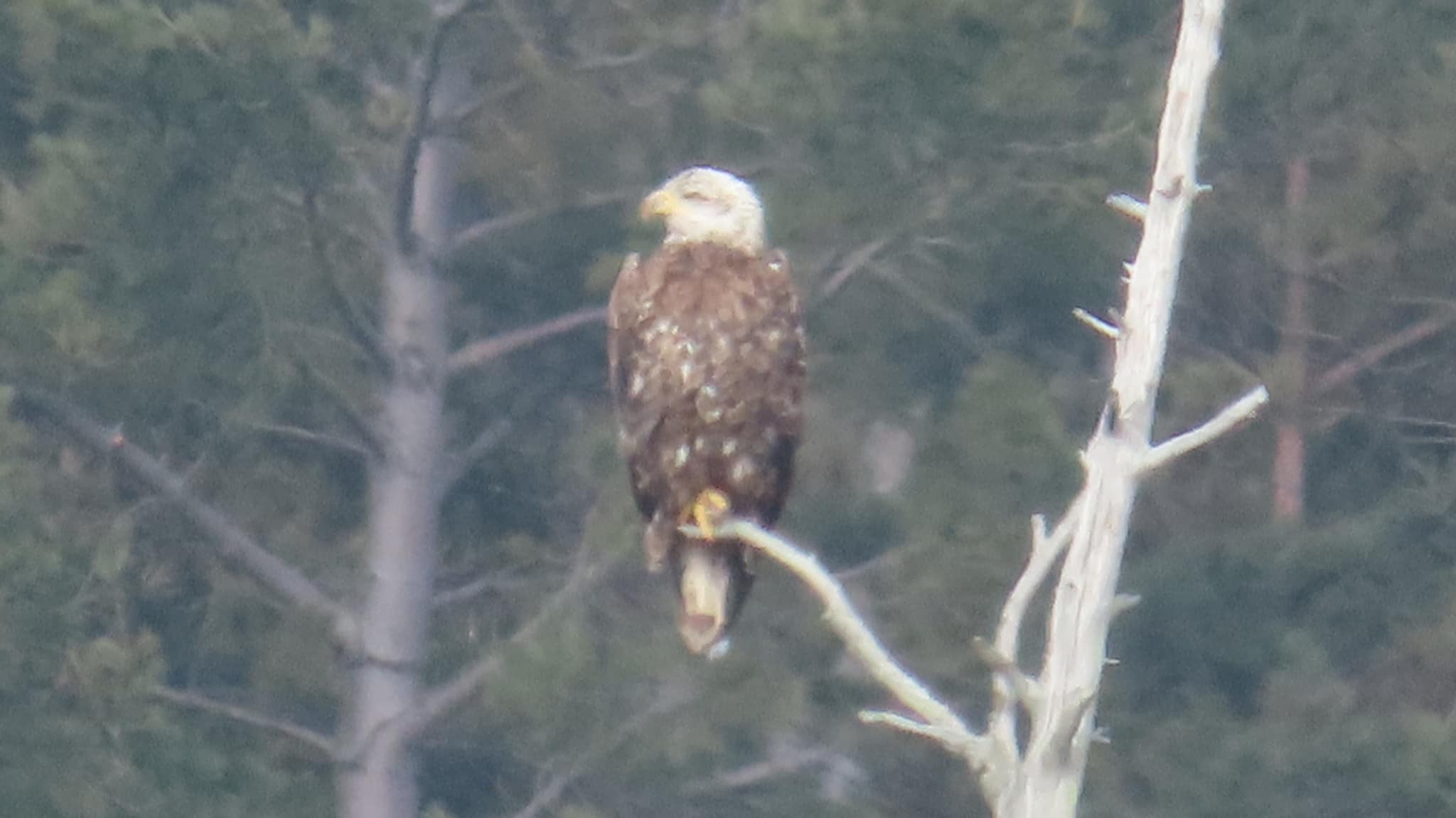
Location (Google Maps): Cottrill Lake Hike – park at km 180.7 Borchardt Parking Lot. From her early years in the Bavarian Alps, Special Guest, Barbara Von Der Heide of Loving Yoga, has formed a deep appreciation for the sensory journey as we enter the cathedral of nature. Barbara encourages us to use our senses to absorb our surroundings as we embrace the colour, textures and sounds of spring. This hike will be be a quiet, immersive experience with check ins along the route as we take in the arrival of spring.Hike Leader(s): Tamara Wilson Click here to contact Hike Leader(s)
Pace: Leisurely (2.0 – 3.0 km/h): A relaxed pace with frequent breaks and a focus on enjoyment.
Terrain: Difficult: Steep ascents/descents, rocky scrambling, and some rugged escarpment paths.
Distance: 6kmDescription
Starting on the Borchardt Rd parking lot (km 108.7), we will follow the Minhinnik ST to the Lillie Family parking area on Britain Lk Rd at the Cotrill Lake ST (110.8 km) we will loop around the Cotrill Lk ST spending time on the shores looking for the arrival of water fowl. On the return trip to the cars, we will follow the Main Trail South, looking for grebes, loons and other shoreline birds that frequent Dyers Bay. We will visit the Devil’s Monument viewing platform, and check out the waterfall before heading back to the parking lot along Devil’s Monument ST and the Minhinnik to Borchardt Rd. Throughout our hike, we will keep an eye out for the arrival of spring flowers and other harbingers of spring. This route is quite rocky in places with stairs. The Trail may be wet and muddy around Cotrill Lake. We will be taking stairs down to the viewing platform and the waterfall. Total distance is around 8 km. This hike may take 3 hours to complete. Pack snacks and drinks accordingly. From her early years in the Bavarian Alps, Special Guest, Barbara Von Der Heide of Loving Yoga, has formed a deep appreciation for the sensory journey as we enter the cathedral of nature. Barbara encourages us to use our senses to absorb our surroundings as we embrace the colour, textures and sounds of spring. This hike will be be a quiet, immersive experience with check ins along the route as we take in the arrival of spring.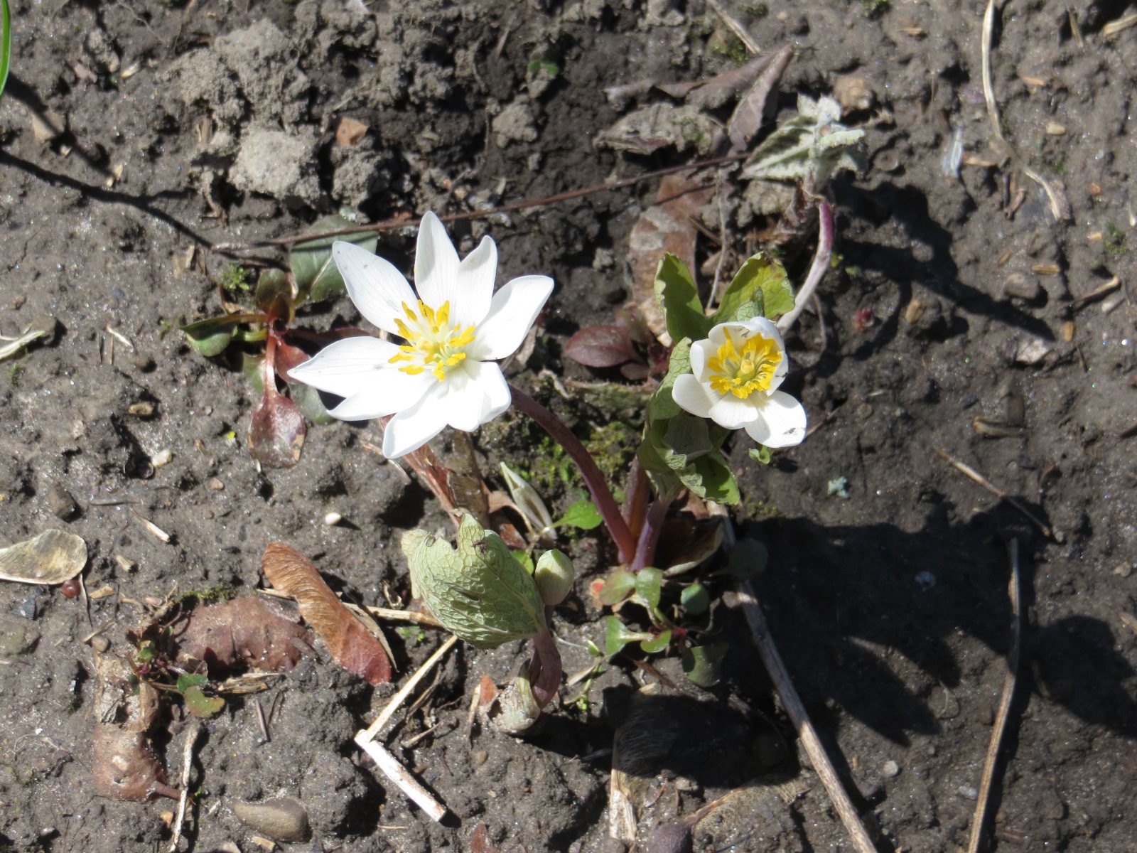
Urban Walk: Bloodroot Spring Flowers Hike: Meadowvale-Churchville Loop
https://hikes.brucetrail.org/event/urban-walk-bloodroot-spring-flowers-hike-meadowvale-churchville-loop/Sorry, the registration cut-off time for this hike has been reached.Not a member? Click here to join today!Hosting Club: Toronto
Category: Urban Walk
Location (Google Maps): Meet me at Kipling Terminal by 9:15 for a 9:25 departure on MiWay bus #11. We will change to bus #42, leaving Goreway Dr North of Derry Rd at 10:01. Coming directly to the hike, park at Credit Valley Conservation Authority Parking, 1255 Old Derry Road, Mississauga. Please arrive by 10:50.Hike Leader(s): Andrew Proczek Click here to contact Hike Leader(s)
Pace: Moderate (3-4 km/hr)
Terrain: Flat, Level 1 (Easy – mostly on flat, well maintained trails with hard-packed surface)
Distance (km): 10-11 kmDescription
Join me for a pleasant Spring Flowers Hike taking in the Bloodroot, and other Spring ephemerals. Bloodroot (Sanguinaria canadensis) grows in moist to dry woods and thickets, often on floodplains and near shores or streams. It is one of the earliest spring flowers and the white blooms last barely a week. The red juice from the underground stem was used by Native Americans as a dye for baskets, clothing, and war paint, as well as for insect repellent. The generic name, from the Latin sanguinarius, means “bleeding”.We will visit Terry Wilson and “Rosemary’s Garden” but this event will not include a Meadowvale Village Tour. The focus will be on hiking and spotting ephemerals. The hike will take us to Churchville in Brampton and we will return to Meadowvale by way of Levi Creek Valley, a tributary of the Credit River.
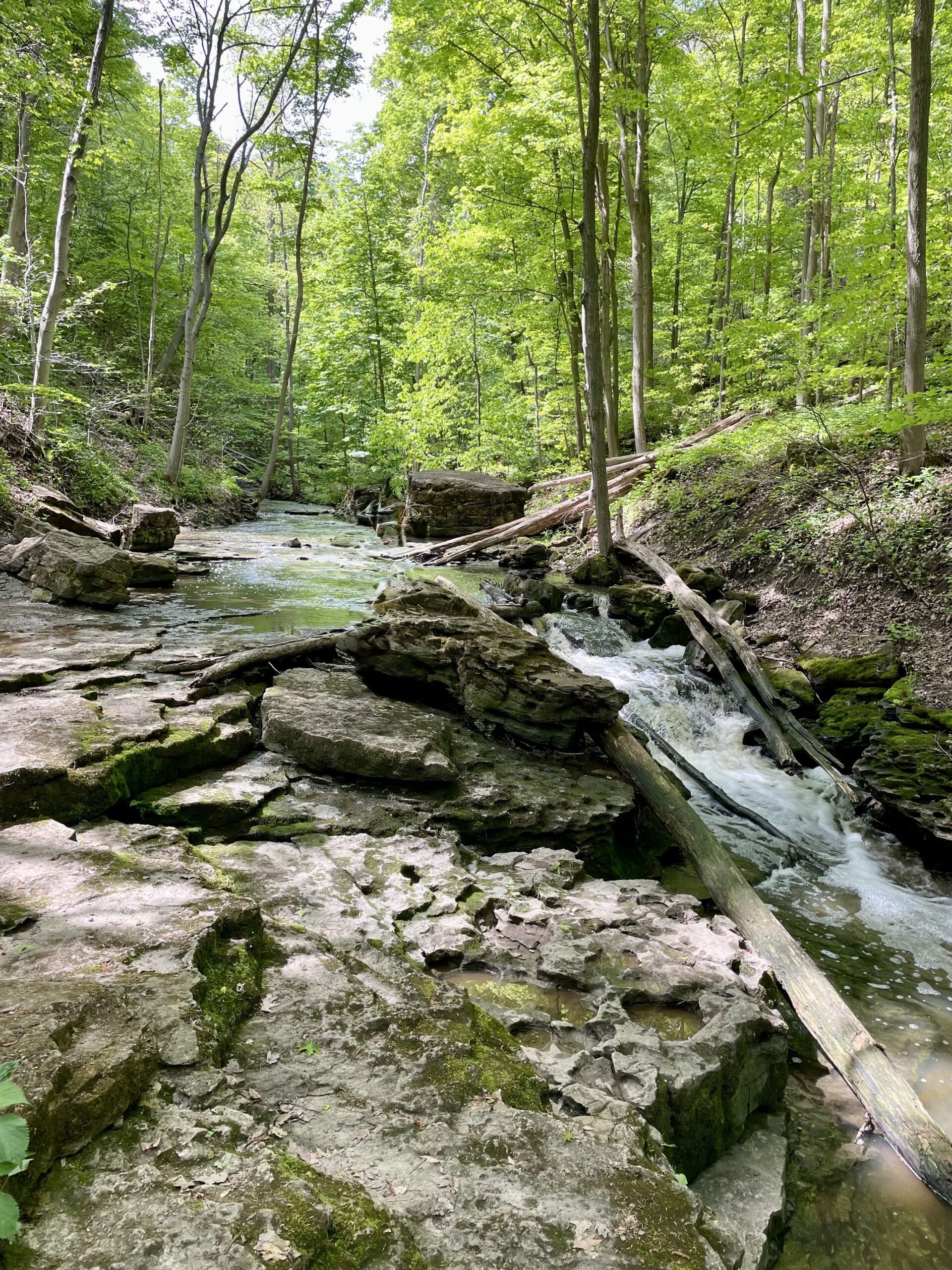
GeoHike - Louth Conservation Area
https://hikes.brucetrail.org/event/geohike-louth-conservation-area/Sorry, the registration cut-off time for this hike has been reached.Not a member? Click here to join today!Hike open to BTC Members only.
Hosting Club: Niagara
Category: Geology
Location (Google Maps): Louth Conservation Area, 3155 Staff Avenue, St. CatharinesHike Leader(s): Kristin Hanson Click here to contact Hike Leader(s)
Pace: Medium 3- 4 km/hr
Terrain: Moderate: some hills and some poor footing
Distance: 3.8Description
Discover the geology of the Vinemount Ridge wine sub-appellation, and the beauty of the waterfalls at Louth Conservation Area. We will see some interesting geologic features and evidence of glaciers. We will follow Sixteen Mile Creek and get a great view of both the upper falls and lower falls as Sixteen Mile Creek makes its way over the Niagara Escarpment. We will use a slow pace and stop and discuss geology along the way. It will take us 2-2.5 hours to cover the distance. There are three small hills we will climb, otherwise the terrain is generally flat. However, some of the footing is rocky and uneven with holes and gaps between the rocks we are walking on. It may be wet and muddy. Hiking poles may give more stability on uneven footing. After about 2.9km, we will arrive at Louth Falls where will stop to enjoy it. Early spring melting should offer us a fantastic view. We will return to the parking lot via the main Bruce Trail and walk a short distance along Staff Road. Parking is free at Louth, but spots are limited. There are no washrooms or facilities.