Categories
- 18April 18, 2026

Fort to Fort FIRST DAY ONLY April 18, 2026
https://hikes.brucetrail.org/event/fort-to-fort-first-day-only-april-18-2026/Sorry, the registration cut-off time for this hike has been reached.Not a member? Click here to join today!Hosting Club: Niagara
Category: Event Hikes
Location (Google Maps):Kingsbridge Park, Niagara Parkway, Niagara Falls, ON
Hike Leader(s): Lauren Doig Click here to contact Hike Leader(s)
Pace: Medium
Terrain: Easy
Distance: 27kmDescription
Meet at Kingsbridge Park at 6:45 a.m. You will be bussed to Fort George. Hike from Fort George to Kingsbridge Park , approximately 27 km. Small hills involved but mostly paved paths with some road walking. 2 checkpoints along the way. This hike is for hikers who are only going to do Day 1 of the Fort to Fort.This is a self-led hike.
Masks are optional on buses.
Registration is $60 for one day. Fee includes bus, parking pass, and checkpoints .
Event Co-ordinator: Lauren Doig, ldoig52@gmail.com
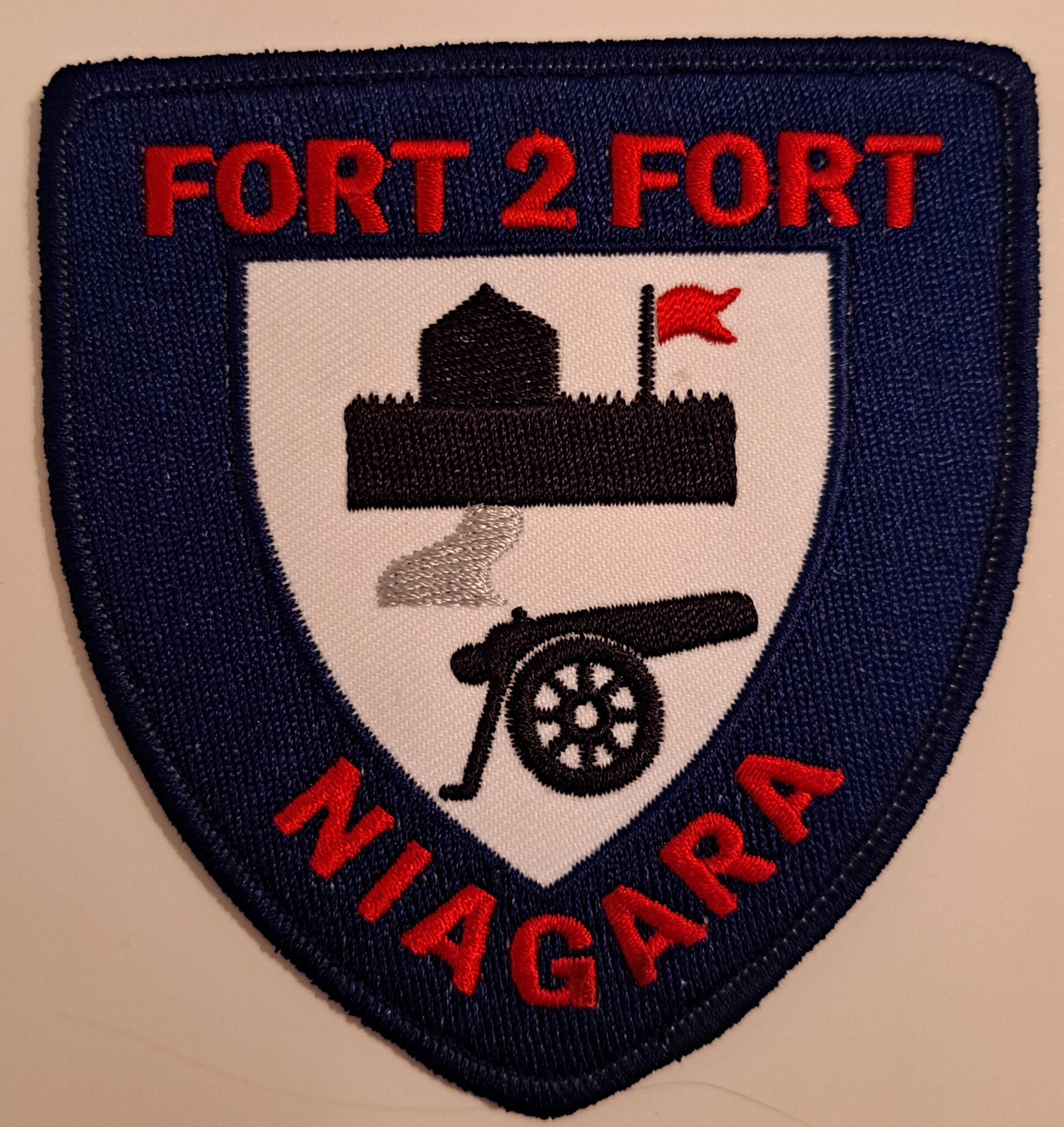
Fort to Fort ENTIRE 2 DAY, April 18, 19, 2026
https://hikes.brucetrail.org/event/fort-to-fort-entire-2-day-april-18-19-2026/Sorry, the registration cut-off time for this hike has been reached.Not a member? Click here to join today!This is a Multi-Day Hike
You are signing up for the following dates and times:
2026-04-18 at 06:45
2026-04-19 atHosting Club: Niagara
Category: Event Hikes
Location (Google Maps):Kingsbridge Park, Chippawa, Ont
Hike Leader(s): Lauren Doig Click here to contact Hike Leader(s)
Pace: Medium
Terrain: Easy
Distance: 54 km over 2 daysDescription
You are SIGNING UP FOR BOTH DAYSHike the entire length of the Niagara Parkway, from Fort George to Fort Erie, over two days. Enjoy approximately 27 KM each day of beautiful river scenery. Small hills involved but mostly paved paths with some road walking. This is a self-led hike.
Meet at Kingsbridge Park each day at 6:45. You will be bussed to starting point each day.
Registration is $70 (members) or $80 (non-members). Fee includes bus, parking pass, checkpoints and badge.
Event Coordinator: Lauren Doig, ldoig52@gmail.com
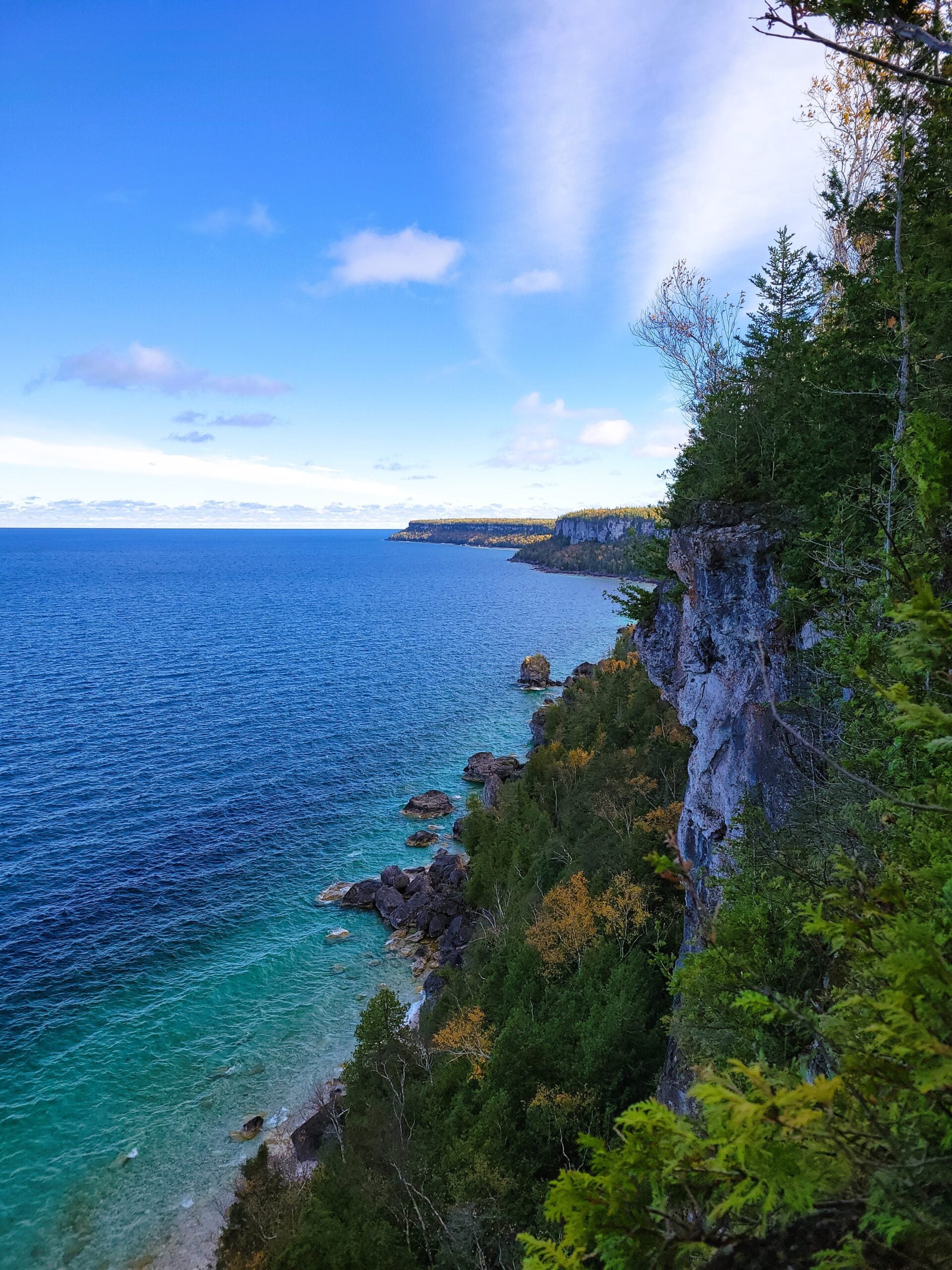
CANCELD - Peninsula BT Makeup Hike (km 117.8 – km 139.5)
https://hikes.brucetrail.org/event/peninsula-bt-makeup-hike-km-117-8-km-139-5/Sorry, the registration cut-off time for this hike has been reached.Not a member? Click here to join today!Hosting Club: Peninsula
Category: Peninsula BT Makeup Hike
Location (Google Maps):Hike Leader(s): Shawn Radcliffe & Saabir Sohrab Click here to contact Hike Leader(s)
Pace: Medium (3.0 – 4.5 km/h): A comfortable pace for most hikers with steady progress.
Terrain: Difficult: Steep ascents/descents, rocky scrambling, and some rugged escarpment paths., Moderate: Rolling hills, mild slopes and rocky paths.
Distance: ~26.6Description
Lindsay Rd 40 to Halfway Log dumpThis hike is part of the Peninsula BT Makeup Hikes, intended for hikers completing missed sections of the Peninsula Bruce Trail. Each hike requires individual registration.
To hike the entire Peninsula Section, please register for the Full Peninsula End-to-End Series (single registration for all 10 hikes): https://hikes.brucetrail.org/event/peninsula-end2end-in-10-series/2026-05-01/
Hikers may register for all 10 Makeup Hikes if they wish.
Expectations: Expect ~9 hours on the trail, depending on the terrain, weather, and group pace. The hike leader sets the pace, aiming for 3–4 km/h, and may adjust as needed for group ability and trail conditions. Breaks will be taken throughout the day.
For safety, participants must remain between the hike leader and the hike sweep at all times.
Fees:
- Registration fee does not include Bruce Peninsula National Park entry fees and parking fees
- Fundraising: This hike is a fundraiser to support the Peninsula Bruce Trail Club’s volunteer-run hike program.
Participant Requirements
- Intermediate/experienced hikers with good fitness
- Proper hiking boots, layered clothing, wet weather gear
- Hiking poles recommended
- Bring: Lunch, snacks, water, bug spray
Transportation & Accommodations
- Car shuttle: Participants rotate as drivers; vehicles must be passenger-ready
- Accommodations: Book early; options include motels, campgrounds, hostels, and B&Bs
Note: Dogs are not permitted.
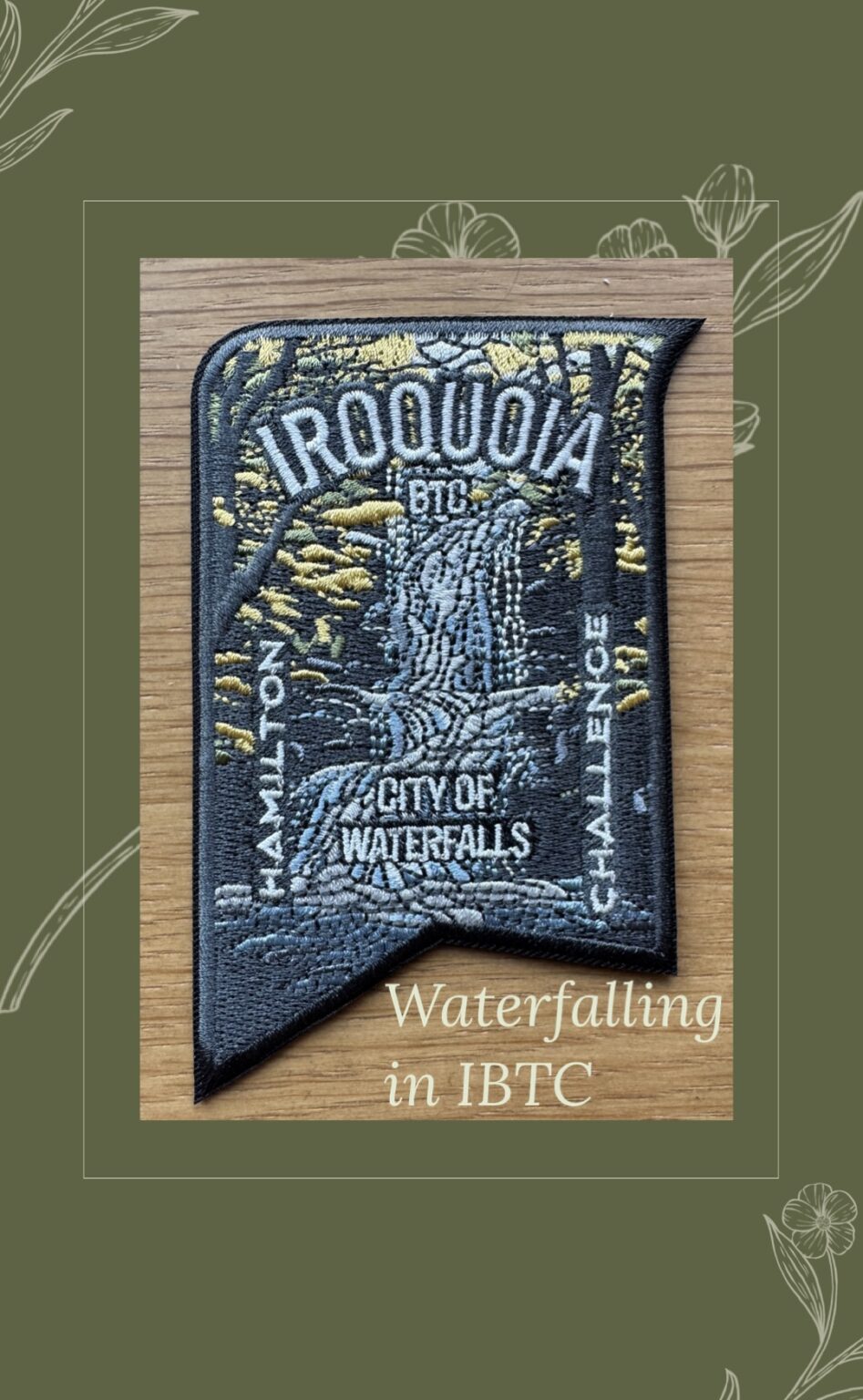
City of Waterfalls – Special Event Fundraiser
https://hikes.brucetrail.org/event/city-of-waterfalls-special-event-fundraiser-6/Sorry, the registration cut-off time for this hike has been reached.Not a member? Click here to join today!This is a Multi-Day Hike
You are signing up for the following dates and times:
2026-04-18 at 08:00
2026-04-19 at 08:00Hosting Club: Iroquoia
Category: City of Waterfalls – Special Event Fundraiser
Location (Google Maps): VariesHike Leader(s): Freddy Wang Click here to contact Hike Leader(s)
Pace: Brisk – 4 to 5 km/hr
Terrain: Strenuous – Hilly with steep climbs and some poor footing
Distance: Day 1- 21km/ Day 2-24kmDescription
Welcome to Iroquoia, City of Waterfalls Challenge! This is a fundraiser challenge event. All funds raised go towards the Iroquoia Bruce Trail Club to maintain the infrastructure of this beautiful section of trail and to “Preserve this ribbon of wilderness, for everyone, forever!”We also encourage participants to consider a membership with Conservation Hamilton https://conservationhamilton.ca/hca-membership-pass/
DAY 1: FEB 14 – We will meet at Cityview Park and car shuttle to Spencer Gorge Parking Lot (Conservation Hamilton) and hike back. The cost at this parking lot is $16.50 per vehicle and driver plus $5.50 for each passenger.
Day 1 Distance 21kmDAY 2: FEB 15 – We will meet in the parking area off of Mud St and car shuttle to Artaban Rd Parking Lot (Conservation Hamilton) and hike back. The cost for this parking lot is $11.00 per vehicle.
Day 2 Distance 24 kmPlease ensure your vehicle is car shuttle ready by having a minimum of 4 seatbelts available – drivers do not pay for the parking. Please volunteer for this important component of this challenge. While we encourage carpooling to the start of the hike, please let the hike leader know if you’re planning to arrive with more than two people in your vehicle. This hike will be limited to 20 people including the hike leader so we will need 4-5 vehicles and one vehicle with 4 seatbelts to drive the drivers back at the end of the day. We will try to take as few vehicles as possible. On the second day, those who did not drive on the first day will be asked to drive.
There will be short breaks along the way to admire the waterfalls on route and a short lunch.
This hike is intended to be at a Brisk pace and through a very hilly section. Please be honest about your degree of physical fitness prior to registration. It is a group hike so it is important you are able to keep pace with the person in front of you.
Hikers will be expected to wear proper hiking footwear and layered clothing. Sufficient snacks/lunch, water, hiking poles, gaiters and layered clothing are recommended. Depending on terrain, icers may be required.
Don’t forget your camera for all the photo ops!
The badge will be presented to all participants who have completed the challenge at the end of the second day.
Any questions may be directed through the “Contact Hike Leader” on this form.
The fee is non-refundable.
If your availability changes, please cancel your Bruce Trail hike registration by logging into the BTC website, go to your “My Hikes” section, find the hike, and click “cancel”; if it’s last minute (under 24 hours), please email the Hike Leader directly.
Car Hike: Uxbridge-Brock Track
https://hikes.brucetrail.org/event/car-hike-uxbridge-brock-track-2/Sorry, the registration cut-off time for this hike has been reached.Not a member? Click here to join today!Hosting Club: Toronto
Category: Car Hike
Location (Google Maps):Meet at the Brock Tract parking lot on the east side of Durham 1/Brock Rd., approximately 5 km south of Coppin’s Corners, Uxbridge or 1 km north of Uxbridge Pickering Town Line. 1401 Brock Rd. (Free parking).
Hike Leader(s): Amir Alemohammad Click here to contact Hike Leader(s)
Pace: Moderate (3-4 km/hr)
Terrain: Flat, Hilly, Level 2 (Intermediate – some hills and uneven surfaces, rocks and roots underfoot)
Distance (km): 14-15Description
Join us for a wonderful hike in Uxbridge the capital trail of Canada, in starting from Brock Track parking lot. We will hike the Brock Track and Wilder Forest among the amazing trails of Uxbridge.Boots mandatory, poles recommended, bring 2 litres of water and dress according to weather conditions.
Please arrive at 8:15 for a 8:30 start.
Beware, Iphone Maps may take you to the wrong location. Check the location with Google Maps the previous night.
This is a joint hike with Oak Ridges Trail Association (ORTA).
School Bus Hike Iroquoia E2E #6 of 8
https://hikes.brucetrail.org/event/bus-hike-iroquoia-e2e-6-of-8/Sorry, the registration cut-off time for this hike has been reached.Not a member? Click here to join today!Trip Information
Departure Time: 08:30
Return to City Time: 18:00
Departure Point: Kipling Departure PointOptional Items
Hiking ($.01)Hosting Club: Toronto
Category: Bus Hike
Location (Google Maps): Smokey Hollow to Mount NemoHike Leader(s): Tom Swales, Robin Crombie Click here to contact Hike Leader(s)
Pace: Moderate (3-4 km/hr)
Terrain: Hilly, Level 2 (Intermediate – some hills and uneven surfaces, rocks and roots underfoot), Rocky, Variable
Distance (km): 16 kmDescription
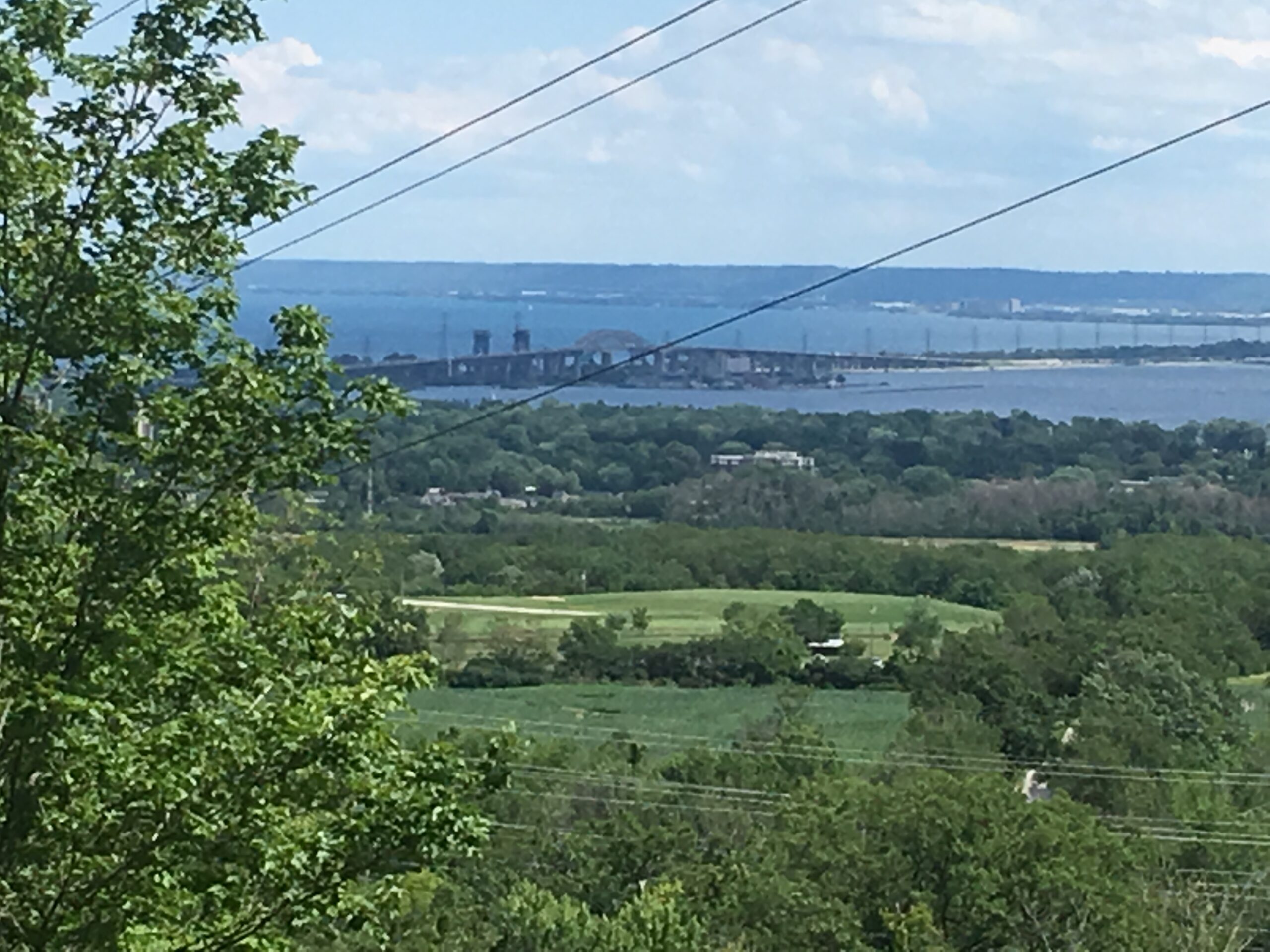
We continue our Iroquoia section End-2-End series which we began in the Fall of 2025. Any capable hikers are welcome regardless if completing the End-2-End for one of the badges or not. Hikers can expect rocky portions and hills as the trail goes up and down the Niagara escarpment. The trail may be wet and muddy. We hope to maintain a steady pace of 4 km/hr. We resume where we left off on April 4th at King Road. The hike will proceed through Kerncliff Park and Cityview Park with views over to the Burlington Skyway Bridge. There will be some road work to reach Fisher’s Pond (7 km), a BTC protected area. We continue another 2,1/2 km to the Guelph Line. The section of trail between Guelph Line and Humberside Drive is closed for an unknown duration so the bus will take us to where the trail meets Humberside Road. There will be an option to drop out of continue on road fo another 3.6 km to the Walkers Line parking lot. We will have a refreshment stop in Burlington before returning to Kipling Station.Blue Mountains End-to-End in 5 - Hike 2
https://hikes.brucetrail.org/event/blue-mountains-end-to-end-in-5-hike-2/Sorry, the registration cut-off time for this hike has been reached.Not a member? Click here to join today!Hike open to BTC Members only.
Hosting Club: Iroquoia, Blue Mountains
Category: General Hike
Location (Google Maps): Parking Lot Devil’s Glen Provincial ParkHike Leader(s): Pati Greenwood, Jeff Dowsett Click here to contact Hike Leader(s)
Pace: Medium – 3 to 4 km/hr
Terrain: Dependent on Conditions, Strenuous – Hilly with steep climbs and some poor footing
Distance: 15.4 kmDescription
This is an End-to-End hike series to complete the Blue Mountains section of the Bruce Trail in 5 hikes. Join for all or as many hikes as desired – you will need to register for each hike in the series which will take place on the following dates in April: 17, 18, 19, 24 and 25.Since this is a group hike, please consider your fitness level before registering. We will be walking at a pace of 3km – 4km per hour and hikers will need to keep up with the person in front of them for the duration of the hike. The hike series will also involve car shuttles and every hiker is expected to participate as drivers.
Weather conditions in the spring can be changeable, so it’s best to dress in layers and come prepared for varying conditions throughout the day. Hiking boots are required and hiking poles are strongly recommended. Bring plenty of fluids and a snack.
This second hike of the series will be 15.4 km long. Plan to arrive at the meeting place by 8:15 a.m. as we will start the car shuffle to the hike starting point at 8:30 a.m. sharp. Further details will be provided to registered hikers a few days prior to the hike.
Car Hike: Happy Valley King City
https://hikes.brucetrail.org/event/car-hike-happy-valley-king-city-11/Sorry, the registration cut-off time for this hike has been reached.Not a member? Click here to join today!Hosting Club: Toronto
Location (Google Maps): Happy Valley, Oak Ridges Trail 16th Sideroad & Weston Road
Please park along 16th Side road
Hike Leader(s): Mohammad Aghamiri Click here to contact Hike Leader(s)
Pace: Moderate (3-4 km/hr)
Terrain: Hilly, Level 2 (Intermediate – some hills and uneven surfaces, rocks and roots underfoot)
Distance (km): 12-14 kmDescription
Come and join us to view nice scenery and look out of Happy