Categories
- 14December 14, 2025
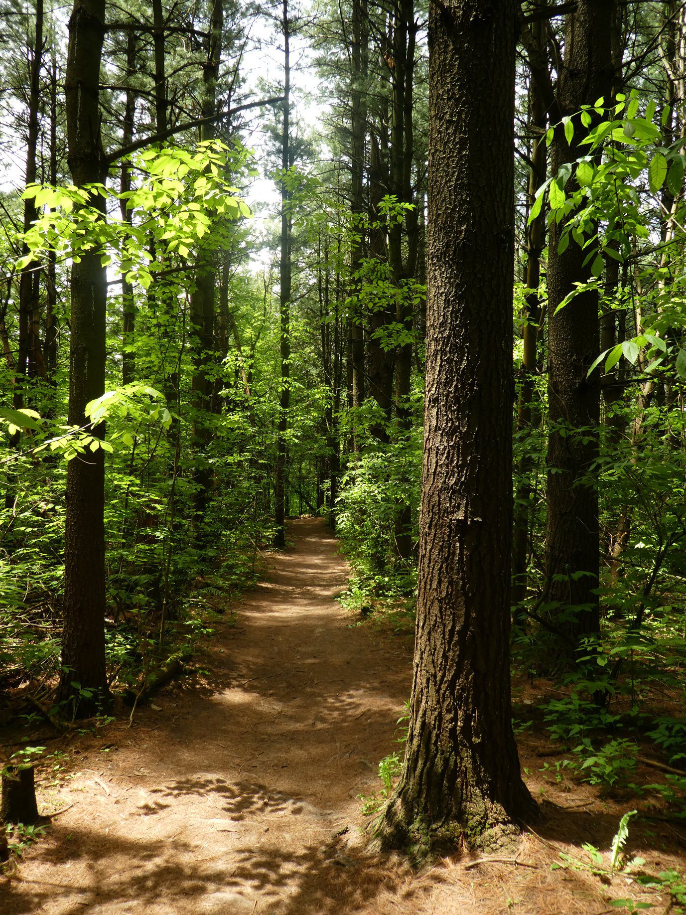
Nassagaweya Canyon, from Crawford Lake (reservations required)
https://hikes.brucetrail.org/event/nassagaweya-canyon-from-crawford-lake-reservations-required/Sorry, the registration cut-off time for this hike has been reached.Not a member? Click here to join today!Hosting Club: Iroquoia
Category: General Hike
Location (Google Maps): Meet in the first parking lot at Crawford Lake. You will need to reserve your time at conservationhalton.caHike Leader(s): Karen Bergmann Click here to contact Hike Leader(s)
Pace: Medium – 3 to 4 km/hr
Terrain: Moderate – Some hills and/or some poor footing
Distance: 9 kmsDescription
Meeting at 9:15 am in the first parking lot, we will hike through the park and down into the canyon and back up into the park for a large loop. There are some rocks along the way and a couple of steep hills (going down into the canyon and then back up). Bring a snack, as needed.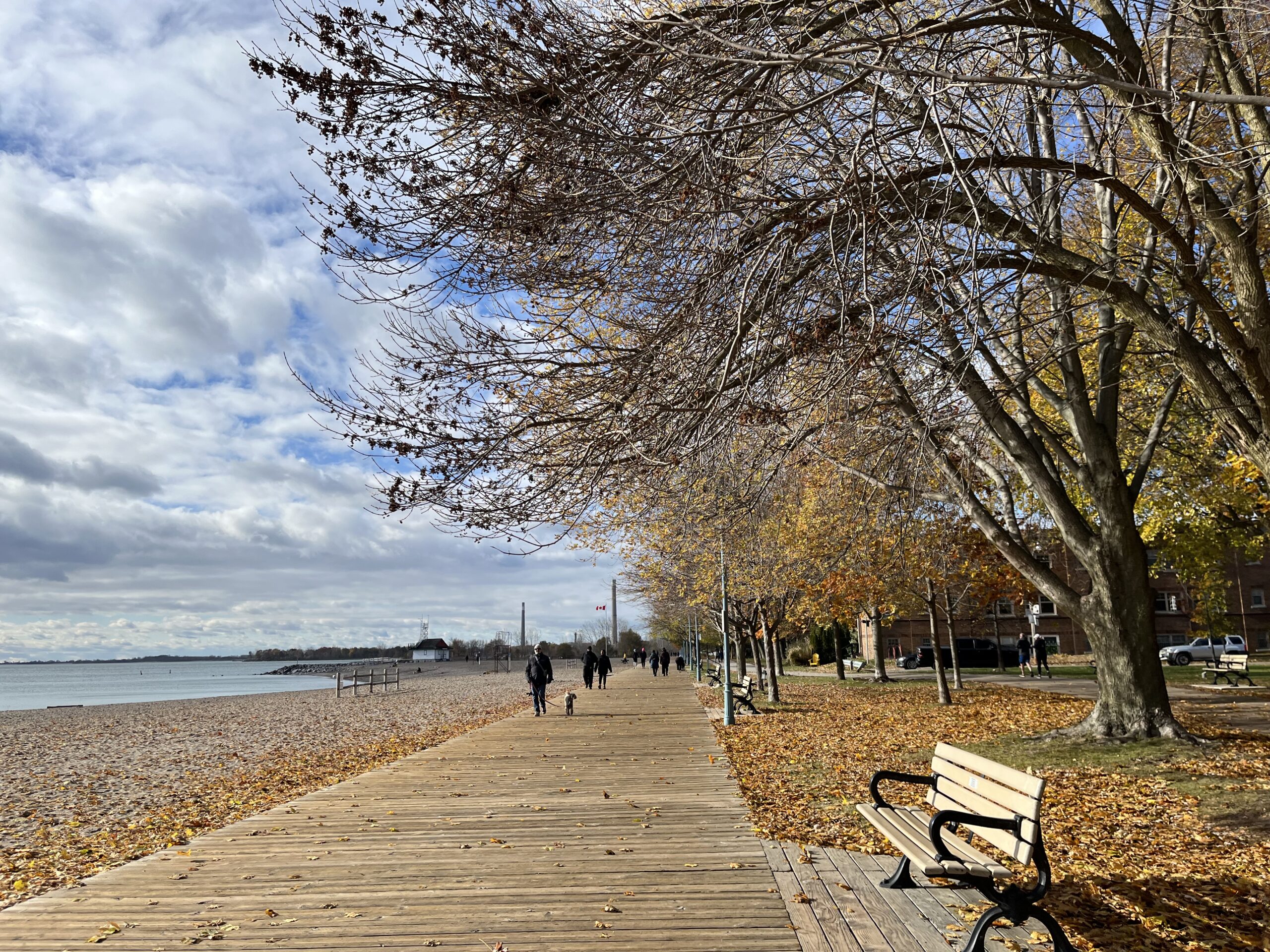
Urban Walk: "Christmas is in the air" Toronto Beaches & Glen Stewart Ravine
https://hikes.brucetrail.org/event/urban-walk-christmas-is-in-the-air-toronto-beaches-glen-stewart-ravine/Sorry, the registration cut-off time for this hike has been reached.Not a member? Click here to join today!Hosting Club: Toronto
Category: Urban Walk
Location (Google Maps): Meet at the Toronto Public Library, Beaches Branch, 2161 Queen Street East, Toronto, M4L 1J1Hike Leader(s): Jeanette Vincent Click here to contact Hike Leader(s)
Pace: Moderate (3-4 km/hr)
Terrain: Level 1 (Easy – mostly on flat, well maintained trails with hard-packed surface)
Distance (km): 12/13kmDescription
Meet at the Toronto Public Library, Beaches Branch. My late husband Gregory Vincent grew up in the beach and we often visited and walked the area. We will walk the boardwalk and easy pathways that wind along the variety of beaches between Victoria Park Avenue to Ashbridges Bay Park. It will be an out and back route with a couple short loops with lots of views into Lake Ontario, you will see many points of interest, parks, Kew gardens, including the historic Leuty Lifesaving Station and the historic architecture of the Ashbridges Bay Wastewater Treatment Plant, the R.C. Harris Filtration Plant. I have frequent visits to this area and we will make our way across Queen St. to walk the Glen Stewart Ravine a nice ascent, taking in beautiful picturesque natural areas along Ames creek, meandering on elevated boardwalks and stair cases and then descending the area on some of the pleasing neighbourhood streets back to our start at the Beaches Branch Library. A pleasing area that offers a little something for everyone and with the sights and sounds of Christmas in the beach neighbourhood.
If you want something a little shorter you can drop-out at various locations along the way. For those who want a stop after the hike, we have a variety of cafes and restaurants to choose from. No dogs. Wear good footwear, bring snacks/lunch and water. Dress according to the weather conditions for the day.
Hiking boots recommended and if there is snow and/or ice bring along icers or similar ice traction wear.Urban Walk: Humber River/Black Creek Trail
https://hikes.brucetrail.org/event/urban-walk-humber-river-black-creek-trail-3/Sorry, the registration cut-off time for this hike has been reached.Not a member? Click here to join today!Hosting Club: Toronto
Category: Urban Walk
Location (Google Maps):Meet Jane Subway Station outside the Station Attendant’s Booth
Hike Leader(s): Tom Swales, Click here to contact Hike Leader(s)
Pace: Moderate (3-4 km/hr)
Terrain: Level 1 (Easy – mostly on flat, well maintained trails with hard-packed surface), Variable
Distance: 9 kmDescription
Join us for a morning hike north on the Humber Recreation Trail to Dundas Street and eastbound on the Black Creek and Lavender Creek Trail finishing near St. Clair an Runnymede. Mainly paved or gravel paths but expect a couple of short but steep hills. Bring lunch to have early at our stop at Lambton Arena or join us for lunch after the hike.Walk In Nature Series (WINS) - Rocklyn Creek Management Area
https://hikes.brucetrail.org/event/walk-in-nature-series-wins-rocklyn-creek-management-area/Sorry, the registration cut-off time for this hike has been reached.Not a member? Click here to join today!Hosting Club: Sydenham
Category: General Hike
Location (Google Maps):This location is a Bruce Trail off-road parking lot on the east side of Grey Road 12, less than 1 km north of Grey Rd 40. It is found at km 0.0, the start of the Sydenham section, on Map 28 of Edition 31 of the Bruce Trail Reference.
For directions using GPS Coordinates, open a map on your device by following the link embedded in “Google Maps” at the start of this description or copy them from here: 44.50053, -80.63290Hike Leader(s): Stewart Brown Click here to contact Hike Leader(s)
Pace: Medium: 3 to 4 km/h
Terrain: Moderate: Some hills and/or poor footing
Distance: 7 kmDescription
The Walk In Nature Series (WINS) consists of short loop hikes in the Sydenham section of the Bruce Trail that combine nature appreciation with fitness in a safe and welcoming group environment led by an experienced hike leader. Consider these hikes to be appointments with yourself in nature that promote health and fitness.This northbound linear hike from Blantyre, km 0.0 of the Sydenham section, along the gently-sloped escarpment and through the scenic Rocklyn Creek Management Area leads us to our preplaced shuttle vehicle(s) at the St. Vincent-Sydenham townline. From there, hikers enjoy a 10 minute shuttle ride back to their vehicles. Some good news about this hike, that more or less follows down Rocklyn Creek, is that gravity is on our side!
Arrive 15 min early, dress in layers with good footwear. Hiking poles may be helpful. Bring water and a snack. See you there!
- 15December 15, 2025
Caledon Hills E2E in 5 - Hike #3
https://hikes.brucetrail.org/event/caledon-hills-e2e-in-5-hike-3/Sorry, the registration cut-off time for this hike has been reached.Not a member? Click here to join today!Hike open to BTC Members only.
Hosting Club: Niagara
Location (Google Maps): Meet in Parking lot on north side of Mono 5 Sideroad. Carpool to Innis Lake Rd north of Finnerty Sideroad.
Hike Leader(s): Robin Garrett Click here to contact Hike Leader(s)
Pace: Medium
Terrain: Strenuous
Distance: 14kmDescription
This End-to-End series will start 2kms south of the Cheltenham Badlands and end at the Mono Centre. Earn your E2E Caledon Hills badge in 5 hikes ($10 for members). We will be carpooling and will ask for volunteers to drive other hikers. Please take turns with the driving.Please bring poles, icers, water and lunch.
- 16December 16, 2025
Urban Walk: Valley View Park Thornhill
https://hikes.brucetrail.org/event/urban-walk-valley-view-park-thornhill-126/Sorry, the registration cut-off time for this hike has been reached.Not a member? Click here to join today!Hosting Club: Toronto
Location (Google Maps): Parking lot is off Sycamore Drive East of Bayview , across Starbucks plaza
Bus 91 from Finch east station stops at Sycamore station.Hike Leader(s): Mohammad Aghamiri Click here to contact Hike Leader(s)
Pace: Moderate (3-4 km/hr)
Terrain: Hilly, Level 2 (Intermediate – some hills and uneven surfaces, rocks and roots underfoot)
Distance: 7-8 kmDescription
We will explore Valleyview and Maple View parks, and walk along German Mill Creak, in return we stop in Huntington park and have snack under beautiful shed.Although this is considered an “Urban Walk”, you can expect some hills up and down and uneven surfaces with tree roots. Please bring hiking poles, water and snacks.
phone number for the day of hike 289 588 6482
9:00 Long Hike Wiley Road Short Hills NEW TIME
https://hikes.brucetrail.org/event/900-long-hike-wiley-road-short-hills-new-time-10/Sorry, the registration cut-off time for this hike has been reached.Not a member? Click here to join today!Hosting Club: Niagara
Location (Google Maps):
Short Hills Wiley Road Entrance
Pace: Medium
Terrain: Moderate
: 10kmDescription
Explore Short Hills and the majestic side trails of Scarlett Tanager, Hemlock. Swayze Falls and Terrace. Register for each hikeBring Poles, , snack, and dress for the weather
9:15 Short Hike - Short Hills Park, Pelham Rd
https://hikes.brucetrail.org/event/915-short-hike-short-hills-park-pelham-rd-34/Sorry, the registration cut-off time for this hike has been reached.Not a member? Click here to join today!Hosting Club: Niagara
Category: Hike
Location (Google Maps): Short Hills Provincial Park, Pelham Rd., Thorold, ONHike Leader(s): Debbie Demizio Click here to contact Hike Leader(s)
Pace: Medium
Terrain: Moderate
Distance: ~ 6kmsDescription
Hike the main and side trails in Short Hills Provincial Park. Bring hiking boots, water and sunscreen.Tews Falls to Snake Road
https://hikes.brucetrail.org/event/tews-falls-to-snake-road/Sorry, the registration cut-off time for this hike has been reached.Not a member? Click here to join today!Hosting Club: Dufferin Hi-Land
Category: General Hike
Location (Google Maps): Roadside parking at Snake Road in Waterdown where the main Bruce Trail crosses the road. Please see Google Maps link for GPS.Hike Leader(s): Stuart Law Click here to contact Hike Leader(s)
Pace: Medium
Terrain: Slippery and Steep Sections, Strenuous
Distance: 13.3 kmsDescription
Please join us on a winter shuttle hike from Tews Falls to Snake Road in the Iroquoia section. It will be icy, rocky, and snowy and there will also be several ups and downs but the views from the escarpment will be worth it. Icers, hiking boots and gaiters essential. Poles recommended. Please bring a warm drink, water, a snack, a lunch and a smile. Please bring a change of footwear and a garbage bag for the shuttle and be ready to shuttle at 9:15 am sharp. If you have a Hamilton Conservation pass please let me know using the hike leader contact link in this hike posting.Hockley Valley - Dunby Rd/Cam Snell Side Trails
https://hikes.brucetrail.org/event/hockley-valley-dunby-rd-cam-snell-side-trails-4/Sorry, the registration cut-off time for this hike has been reached.Not a member? Click here to join today!Hosting Club: Dufferin Hi-Land
Category: Tuesday Hike
Location (Google Maps):Caledon Hills Section, Hockley Valley, Map 18, Meet at the parking lot on the south side of Dunby Rd, Km 68.0
Hike Leader(s): Tony Evangelista; Inge Eckerich; Julie Daley, Les Babbage Click here to contact Hike Leader(s)
Pace: Leisurely
Terrain: Slippery Sections Likely
Distance: 6.5 km, short hike 4 kmDescription
We will meet at the roadside parking on Dunby Rd, and hike south along the Main Trail for 2.5 km. We will then follow the Cam Snell Side Trail loop (2 km), and return on the Main Trail. For those wishing a shorter hike, return to the parking before the Side Trail (4 km). Please come prepared for the weather. Snowshoes or icers may be needed. Hiking poles are recommended. Bring snack and water.Hilton Falls Conservation Area Trails
https://hikes.brucetrail.org/event/hilton-falls-conservation-area-trails-4/Sorry, the registration cut-off time for this hike has been reached.Not a member? Click here to join today!Hosting Club: Iroquoia
Category: General Hike
Location (Google Maps):Hilton Falls Conservation Area parking lot, Campbellville Rd/Side Rd 5 East of Guelph Line Rd. Reservation required with valid Conservation pass or fee for parking.
Hike Leader(s): Karen Capindale-Smith Click here to contact Hike Leader(s)
Pace: Brisk – 4 to 5 km/hr
Terrain: Easy – Mostly flat and usually good footing
Distance: 13kmDescription
We will hike the Beaver Dam loop and part of the Hilton Falls and Red Oak Trails at a brisk speed. There will an opportunity to visit the falls and stop for other sights along the way but please know that we will be moving at a clip. Please bring water, a snack and appropriate layers for the weather. Proper icers may be necessary.Baked goods can be expected 🙂

Annual Christmas in the Village Hike - St. Jacob's Ont.
https://hikes.brucetrail.org/event/annual-christmas-in-the-village-hike-st-jacobs-ont-2/Sorry, the registration cut-off time for this hike has been reached.Not a member? Click here to join today!Hosting Club: Caledon Hills
Category: Tuesday Hikers
Location (Google Maps): Health Valley Trail
3 Water Street, St. Jacobs OntarioHike Leader(s): Doris Harper Click here to contact Hike Leader(s)
Pace: Medium – 3 to 4 km/hour
Terrain: Easy – mostly flat and usually good footing
Distance: 8 kmDescription
Annual easy hike in St. Jacob’s Village Ontario, followed by lunch in the Village at Harvest Moon Restaurant – 5 Parkside Dr. St Jacob’s OntarioThe annual ‘Christmas in the Village’ continues.
We will hike the Health Valley Trail and short easy Mill Race Trail through the Village which will be decorated for the season. Lots of birds and ducks winter here, and will gladly eat seeds from your hand. Bird seeds will be provided, you can also bring seeds if you want.
Post hike we will gather at the Harvest Moon restaurant, a short 2 minute drive. Reservations required so please include your participation if you plan on joining us for lunch. Traditional German Christmas cookie treats provided.
The restaurant has new ownership and has been renovated. The room for groups has also been renovated.
Looking forward to celebrating the Holiday Season with you.
- 17December 17, 2025

Niagara E2E in 6 - Hike #5
https://hikes.brucetrail.org/event/niagara-e2e-in-6-hike-5/Sorry, the registration cut-off time for this hike has been reached.Not a member? Click here to join today!Hosting Club: Niagara
Category: Car Pool
Location (Google Maps): Meet at Woodend Conservation Area (at road entrance), Taylor Rd, Niagara-on-the-Lake. Carpool to DeCew House, DeCew Rd, ThoroldHike Leader(s): Margaret Northfield Click here to contact Hike Leader(s)
Pace: Medium
Terrain: Moderate
Distance: 14.5kmDescription
This End-to-End series will start in Grimsby and end in Queenston. Upon completion of all 6 hikes, you can earn the new independent Brock monument badge. $10 for members and $15 for non-members. We will be carpooling and will ask for volunteers to drive other hikers. Please take turns with the driving.Poles, water and snack recommended.
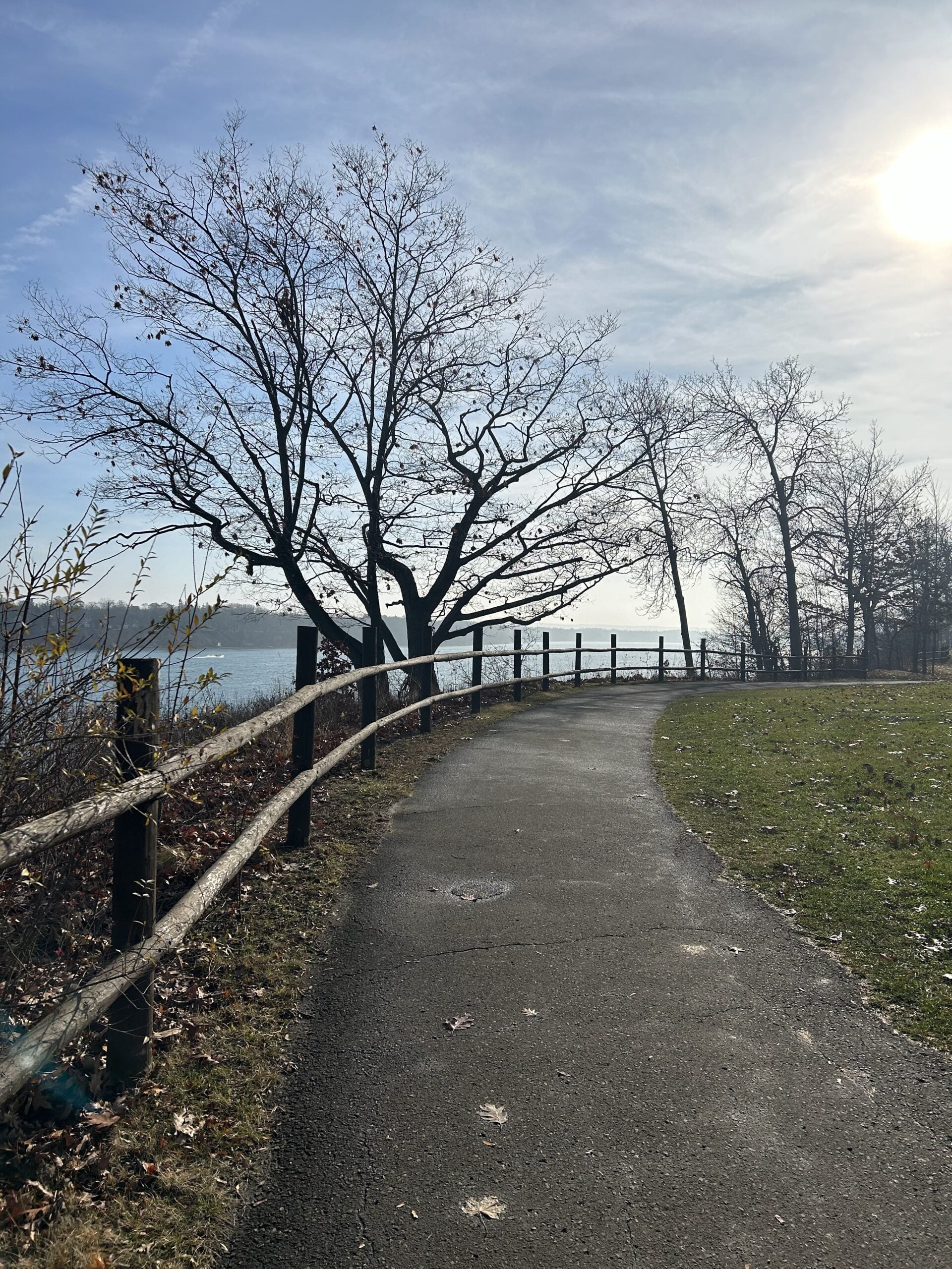
EASY DOES IT HIKE: Merrit Island Park
https://hikes.brucetrail.org/event/easy-does-it-hike-merrit-island-park/Sorry, the registration cut-off time for this hike has been reached.Not a member? Click here to join today!Hosting Club: Niagara
Category: Leisurely
Location (Google Maps): Park at Merritt Island Parking Lot, 8 Merrit Island, Welland OnHike Leader(s): Diane Marlatt Click here to contact Hike Leader(s)
Pace: Leisurely
Terrain: Easy
Distance: 3kmDescription
Humpday Hikers - Hockley Valley South
https://hikes.brucetrail.org/event/humpday-hikers-hockley-valley-south/Sorry, the registration cut-off time for this hike has been reached.Not a member? Click here to join today!Hike open to BTC Members only.
Hosting Club: Caledon Hills
Category: General
Location (Google Maps): Hockley Road parking lot, located on the north side of Hockley Road at the Hockley Road Side Trail.Hike Leader(s): Mel Thornley; Jennie Greenfield Click here to contact Hike Leader(s)
Pace: Medium – 3 to 4 km/hour
Terrain: Moderate – some hills and/or some poor footing, Strenuous – hilly with steep climbs and some poor footing
Distance: 10.16 kmDescription
This is the second hike in some new bi-monthly hikes – the Humpday Hikers. The hikes will be from 8 – 11 km in length with a short snack break. Option to join the group post hike at a local spot for refreshments and some comraderie.This is a shuttle hike in the Hockley Valley south area. This hike has some big hills and can be strenuous.
Bring your choice of hydration and snack. Hiking boots, poles and carry your icers/crampons as it is possible to have snow this time of year.
If you can plan to come for a warm drink and treat, we’re meeting at Hockley General Store after the hike.
Participants will be notified the night before if a hike must be cancelled due to inclement weather.

Halton Forest to Speyside (E2E) - date changed to Wednesday
https://hikes.brucetrail.org/event/halton-forest-to-speyside-e2e-2/Sorry, the registration cut-off time for this hike has been reached.Not a member? Click here to join today!Hosting Club: Iroquoia
Category: General Hike
Location (Google Maps): Meet at the Pear Tree parking lot at Speyside on 15 Side Road at 9:15 am.Hike Leader(s): Karen Bergmann Click here to contact Hike Leader(s)
Pace: Medium – 3 to 4 km/hr
Terrain: Moderate – Some hills and/or some poor footing
Distance: 8 kmsDescription
We will meet at 9:15 in the Pear Tree parking lot on 15 Side Road and carpool to 6th Line at the Halton Agreement Forest and hike back along the Hilton Falls Side Trail, Al Shaw Side Trail and the main trail. This trail has some serious rocks and we cross a couple of creeks. Bring sufficient water and a snack, as needed.Wednesday Walkers: Silent Valley (Changed)
https://hikes.brucetrail.org/event/wednesday-walkers-bayview-escarpment-2/Sorry, the registration cut-off time for this hike has been reached.Not a member? Click here to join today!Hosting Club: Beaver Valley
Location (Google Maps): Meet in the parking area on the road at the end of 2nd Concession South, Edition 31, Map 30, east of km 34.5
Hike Leader(s): Mike Arkless Click here to contact the hike leader.
Pace: Medium
Terrain: Moderate, Some rocky footing
Length of Hike: 5 kmDescription
This hike through Silent Valley is special. Cedar groves, scarp face and large boulders as well as the site of an old farm. Interesting historical features including the remains of a downed airplane. Please bring a drink and, if you’d like, a snack.Guidelines
- Arrive 15 minutes before the start of the hike.
- Wear sturdy footwear and appropriate attire for the weather and the terrain.
Hiking poles are a good idea in any season, especially if the terrain is rocky or slippery. In winter, snowshoes or icers/crampons are needed when conditions dictate.
Wearing appropriate clothing and footwear prevents injuries and shows consideration for a safe and positive group hiking experience. - Always carry I.D. and your health card.
- Bring sufficient water and snacks (or lunch if indicated). A minimum of 1L of water is recommended on all hikes, and 3L is recommended for long, challenging hikes in the heat of the summer.
- Bring sunscreen and insect repellent (for spring and summer hikes).
- Bring your own first aid kit.
- Please leave dogs at home.
*Good Companions - Chedoke Radial Trail and Scenic Drive Side Trail
https://hikes.brucetrail.org/event/good-companions-chedoke-radial-trail-and-scenic-drive-side-trail-2/Sorry, the registration cut-off time for this hike has been reached.Not a member? Click here to join today!Hike open to BTC Members only.
Hosting Club: Iroquoia
Category: Good Companions
Location (Google Maps):Chedoke Golf Club Parking Lot – Hamilton
Hike Leader(s): Ted Bossence Click here to contact Hike Leader(s)
Pace: Medium – 3 to 4 km/hr
Terrain: Dependent on Conditions, Moderate – Some hills and/or some poor footing
Distance: 8 kmDescription
We will walk up the Chedoke Radial Trail and into the Iroquoia Heights Conservation Area. We will then loop back and follow the Scenic Drive Side Trail along the top of the escarpment and down either the Dundurn or Chedoke (Leader’s choice) escarpment stairs to the golf course parking lot. Bring water and icers, in case they are needed. I will be leaving on time at 10:00 am. In case of bad weather I will cancel the hike and notify you by email the evening before. Please check your email. If you must cancel after 4:00 pm on the Tuesday, please use contact information I will send on the Tuesday. Please arrive by 9:45 am, I will be leaving on time. - 18December 18, 2025
Urban Walk: Valley View Park Thornhill
https://hikes.brucetrail.org/event/urban-walk-valley-view-park-thornhill-127/Sorry, the registration cut-off time for this hike has been reached.Not a member? Click here to join today!Hosting Club: Toronto
Location (Google Maps): Parking lot is off Sycamore Drive East of Bayview , across Starbucks plaza
Bus 91 from Finch east station stops at Sycamore station.Hike Leader(s): Mohammad Aghamiri Click here to contact Hike Leader(s)
Pace: Moderate (3-4 km/hr)
Terrain: Hilly, Level 2 (Intermediate – some hills and uneven surfaces, rocks and roots underfoot)
Distance (km): 7-8 kmDescription
We will explore Valleyview and Maple View parks, and walk along German Mill Creak, in return we stop in Huntington park and have snack under beautiful shed.Although this is considered an “Urban Walk”, you can expect some hills up and down and uneven surfaces with tree roots. Please bring hiking poles, water and snacks.
phone number for the day of hike 289 588 6482
9:00 am Annual Christmas Party Hike
https://hikes.brucetrail.org/event/900-am-long-hike-new-location-bailey-bridge-jordan-2/Sorry, the registration cut-off time for this hike has been reached.Not a member? Click here to join today!Hosting Club: Niagara
Location (Google Maps): Baily bridge Jordan
Hike Leader(s): Alan Laver Click here to contact Hike Leader(s)
Pace: Brisk
Terrain: Strenuous
Distance: 7kDescription
Welcome Back to Jordan for our annual Winter Holiday Party. There will be 2 hikes today one medium and another brisk so you can join your preferred hike. If you choose not to hike you can join us for the celebrations after which will commence around 10:45 .After the hike we will be celebrating the holiday season so bring something to share and a lawn chair to sit on. If the weather is bad we will reschedule for the 18thHiking around Jordan
https://hikes.brucetrail.org/event/hiking-around-jordan-40/Sorry, the registration cut-off time for this hike has been reached.Not a member? Click here to join today!Hosting Club: Niagara
Location (Google Maps): Parking Lot near Bailey Bridge in Jordan
Hike Leader(s): Bill Russell Click here to contact Hike Leader(s)
Pace: Medium
Terrain: Moderate
Distance: 7 kmDescription
Hiking in and around Jordan, Jim Rainforth Trail and Balls Falls alternating every 3 weeks.Mount Nemo to Twiss Road
https://hikes.brucetrail.org/event/mount-nemo-to-twiss-road/Sorry, the registration cut-off time for this hike has been reached.Not a member? Click here to join today!Hosting Club: Dufferin Hi-Land
Category: General Hike
Location (Google Maps): Where the main Bruce Trail crosses Twiss Road north of Kilbride. Please see Google Maps link for GPS.Hike Leader(s): Stuart Law Click here to contact Hike Leader(s)
Pace: Medium
Terrain: Slippery and Steep Sections, Moderate
Distance: 15 kmsDescription
Please join us on a shuttle hike from Mount Nemo lower parking lot to Twiss Road. Icers, gaiters and hiking boots mandatory. Poles recommended. Please bring a warm drink, water, a snack, a lunch and a smile. Parking fee may be payable at Mount Nemo if we have insufficient hikers with Conservation Halton passes. Please let me know if you have such a pass by contacting me via the contact hike leader link on this hike post. Please bring a change of footwear and a garbage bag for the shuttle. Please be ready to shuttle at 9:15 sharp.
7:00 pm New Moon & Holiday Lights - Night Hike in Niagara on the Lake
https://hikes.brucetrail.org/event/700-pm-new-moon-holiday-lights-night-hike-in-niagara-on-the-lake/Sorry, the registration cut-off time for this hike has been reached.Not a member? Click here to join today!Hosting Club: Niagara
Category: Night
Location (Google Maps):Veteran’s Memorial Park, park just outside the park on King Street
Hike Leader(s): Robin Garrett Click here to contact Hike Leader(s)
Pace: Medium
Terrain: Easy
Distance: 6-7 kmDescription
New Moon Night Hike – The dark sky of the new moon is the best for stargazing! This hike includes a walk along Lake Ontario, the Niagara River and through the streets of Historic Old Town to enjoy the holiday lights. Bring a night light and dress for weather. Counts towards your night hike badge (5 night hikes) and winter badge (15 hikes between December 21st and March 20th). - 19December 19, 2025
9:00 am Niagara-on-the-Lake Tour
https://hikes.brucetrail.org/event/900-am-niagara-on-the-lake-tour-51/Sorry, the registration cut-off time for this hike has been reached.Not a member? Click here to join today!Hosting Club: Niagara
Category: Urban
Location (Google Maps):Veterans Memorial Park, park just outside the park on King Street
Hike Leader(s): Robin Garrett Click here to contact Hike Leader(s)
Pace: Medium
Terrain: Easy
Distance: 6-7 kmDescription
Each Friday we will explore different neighbourhoods, trails and parkland throughout Historic Niagara-on-the-Lake.Moderate pace with some weeks entirely on sidewalks and roads while others may include a mix of trails and paved pathways. Great way to build up endurance for longer more strenuous hikes.
Prepare for cooler windy conditions on open parkland and along Lake Ontario and Niagara River trails.
Plan to stay for conversation and a warm cup of coffee or tea at Sweets & Swirls, Community Centre, Niagara Stone Road, NOTL
- 20December 20, 2025
Car Hike: Caledon Hils E2E #1 of 6
https://hikes.brucetrail.org/event/car-hike-caledon-hils-e2e-1of6/Sorry, the registration cut-off time for this hike has been reached.Not a member? Click here to join today!Hosting Club: Toronto
Category: Car Hike
Location (Google Maps): Meet at GPS Coordinates: N43.831244, W79.980588 at roadside parking at the southest shoulder of the Willoughby Road and Escarpment Side Trail intersection.Hike Leader(s): Ross Estrella Click here to contact Hike Leader(s)
Pace: Brisk (4-5 km/hr), Moderate (3-4 km/hr)
Terrain: Challenging, Hilly, Level 3 (Advanced – steep hills and some scrambling over boulders), Variable
Distance (km): 16kmDescription
This is an End 2 End hiking series to cover the Caledon Hills section of the Bruce Trail in 6 hikes. As it is time of year with unsettled weather we will undertake this event at approximately 4 km/hour for an average of 13 kms per segment. Caledon Hills have numerous steep hills and deep valleys so the hikes require consistent stamina. Please consider your hiking fitness level prior to registering as this is a group hike and everyone is expected to keep pace. We will be travelling south to north and will require car shuttling. Please make sure yourself and car shuttle ready, where everyone is expected to participate. First hike is 16 km in length. Please arrive fifteen minutes early for shuttling schedule. Things to bring: lunch/snacks, liquid hydration, sunscreen, layered clothing, personal medication (if any) health card. Hiking boots, icers, gaiters and hiking poles are highly recommended. This series hikes must be completed to receive the CHBTC E2E and Winter E2E. Don’t forget to bring your happy face and enthusiasm.NOTE: Cost of Badge is 10 dollars for BTC members and 15 dollars for Non BTC members. If you want to receive two CHBTC E2E badges, the Club E2E and Winter E2E badge there’s an additional 10 dollars for BTC members and 15 dollars for Non BTC members.
Car Hike: Wilder Forest Uxbridge
https://hikes.brucetrail.org/event/car-hike-wilder-forest-uxbridge-11/Sorry, the registration cut-off time for this hike has been reached.Not a member? Click here to join today!Hosting Club: Toronto
Location (Google Maps): Parking Lot off Brock road beside horse training building
Hike Leader(s): Mohammad Aghamiri Click here to contact Hike Leader(s)
Pace: Moderate (3-4 km/hr)
Terrain: Hilly, Level 2 (Intermediate – some hills and uneven surfaces, rocks and roots underfoot), Variable
Distance (km): 14-15 kmDescription
Let’s explore beautiful scenery of Uxbridge Wilder forest
Niagara Glen Hike
https://hikes.brucetrail.org/event/niagara-glen-hike-6/Sorry, the registration cut-off time for this hike has been reached.Not a member? Click here to join today!Hosting Club: Niagara
Category: Loop
Location (Google Maps):Meet at the Niagara Glen Nature Centre parking lot, 3050 Niagara Parkway, Niagara Falls. This is located between the Whirlpool Golf Course and the Niagara Botanical Gardens, on the river side of the Niagara Parkway. Parking fees may apply.
Hike Leader(s): Dan Wilson Click here to contact Hike Leader(s)
Pace: Medium
Terrain: Strenuous
Distance: 10kmDescription
Hike deep in the Niagara Gorge, along stairways cut into the rock and rugged paths that wind through this pristine pocket of Carolinian Forest. View ancient geological formations and fossils dating back millions of years, while hiking along the turbulent rapids of the Niagara River. This is a strenuous hike and there is a chance hikers could get wet. Bring water, a snack, gaiters, hiking poles and icers, if necessary. Also, please dress in layers. 🙂Inglis Falls loop
https://hikes.brucetrail.org/event/inglis-falls-loop/Sorry, the registration cut-off time for this hike has been reached.Not a member? Click here to join today!Hosting Club: Sydenham
Category: General Hike
Location (Google Maps):Meet in the parking lot behind the Grey-Sauble Conservation Authority head office.
237897 Inglis Falls Road, Owen SoundHike Leader(s): Carol Graham-Mullin Click here to contact Hike Leader(s)
Pace: Leisurely: 3 km/h or less
Terrain: Easy: Mostly flat and good footing., Moderate: Some hills and/or poor footing, Strenuous: Hilly with steep climbs and some poor footing., There might be icy and slippery sections.
Distance: 4 km. approxDescription
This is a loop hike, starting from the parking lot at Grey Sauble Conservation Area parking lot behind the main building. We will hike in a southerly direction on the main trail towards Inglis Falls, loop around on the Keeling sidetrail and back on some of the conservation trails.Please bring water and a snacks if you wish. Proper hiking footwear and hiking poles are recommended. Snowshoes or boot grippers may be required depending on the conditions.
Urban Walk: Toronto Island By Night
https://hikes.brucetrail.org/event/urban-walk-toronto-island-by-night-3/Sorry, the registration cut-off time for this hike has been reached.Not a member? Click here to join today!Hosting Club: Toronto
Category: Urban Walk
Location (Google Maps):Jack Layton Ferry Terminal, foot of Bay Street. Take any streetcar from Union Subway Station one stop to Ferry Docks Station, cross Queen Quay at lights and walk south.
Hike Leader(s): Tom Swales, David Royle, Brenda Menezes Click here to contact Hike Leader(s)
Pace: Leisurely (2-3 km/hr)
Terrain: Flat, Level 1 (Easy – mostly on flat, well maintained trails with hard-packed surface)
Distance (km): 9 kmDescription
- Join us for a leisurely walk on The Toronto Islands from Ward Island to the Gibraltar Point Lighthouse, returning via the paths and trails along the northern side with great views of the city at night. Route: https://onthegomap.com/s/rdt1vns0
Please bring a headlamp or flashlight. Icers are strongly recommended but keep an eye on the weather forecast. The lake side of the island is generally breezy so dress in layers. Bring a litre of water and possibly snacks. This year we have moved up the start time by one hour so it’s less of a rush at the end.
After the walk we’ll head to the Firkon On Harbour for refreshments and fellowship.
We will take the Ward Island Ferry scheduled for 2:30 pm, please arrive at the Jack Layton Terminal by 2:15 to check in. Please pre register once registration opens.
Fares: Adult Return, $9.11 ; Senior Return (65+), $5.86 ; Youth Return (under 19 with ID), $5.86 ; Junior Return (under 14), $4.29. You can purchase your ticket online at: https://secure.toronto.ca/FerryTicketOnline/tickets2/index.jsp
Our aim will be to catch the 6:30 pm return ferry from Ward Island so we can be at the Harbour On Harbour by about 7:00 PM. Please use Contact Hike Leader or email Tom if you wish to join us at the restaurant so we can have an accurate count. Reservation for maximum of 30 has been confirmed for dinner and seperate bills will be provided.