Categories
- 30November 30, 2025
Sights of Kerncliff and Cityview
https://hikes.brucetrail.org/event/sights-of-kerncliff-and-cityview-2/Sorry, the registration cut-off time for this hike has been reached.Not a member? Click here to join today!Hike open to BTC Members only.
Hosting Club: Iroquoia
Category: General Hike
Location (Google Maps): Meet at the north end of Havendale Blvd. in Mansfield Park. On street parking available on Havendale Blvd. and Monmouth Drive. Try to arrive by 9:15 as we will depart at 9:30. See map 9 of the Bruce Trail Guide (formerly Havendale Blvd Side Trail). Bring water and optional snack. We will go for a tea or coffee at the nearby Tim Hortons on Brant Street after the hike, for those who wish to join us.Hike Leader(s): Paul Toffoletti Click here to contact Hike Leader(s)
Pace: Brisk – 4 to 5 km/hr
Terrain: Moderate – Some hills and/or some poor footing
Distance: 7Description

Walk In Nature Series (WINS) - Sydenham Nature Reserve loop side trail trail
https://hikes.brucetrail.org/event/walk-in-nature-series-wins-sydenham-nature-reserve-loop-side-trail-trail/Sorry, the registration cut-off time for this hike has been reached.Not a member? Click here to join today!Hosting Club: Sydenham
Category: General Hike
Location (Google Maps): 103038 Grey Rd 18, 400 metres east of Rockford in an off-road parking lot beside the rail trailHike Leader(s): Stewart Brown Click here to contact Hike Leader(s)
Pace: Medium: 3 to 4 km/h
Terrain: Moderate: Some hills and/or poor footing, There might be icy and slippery sections., There might be muddy sections., There might be sections with water on the trail.
Distance: 4 kmDescription
The Walk In Nature Series (WINS) consists of short loop hikes in the Sydenham section of the Bruce Trail that combine nature appreciation with fitness in a safe and welcoming group environment led by an experienced hike leader. Consider these hikes to be 90 or 120 minute reset appointments with yourself in nature that promote health and fitness. Medium paced WINS hikes are open to all ages and levels of hiking experience whether members or non-members of the Bruce Trail Conservancy (BTC)On this hike we will walk a 4 km loop with a medium pace on the interesting side trail, Sydenham Nature Reserve and the access along the rail trail, the Keeling side trail. It is quite level with a short rocky section and almost certainly one or both of mud and snow.
Dress in layers, bring water, a snack and hiking poles if you have them.
Arrive 15 min before the hike start time.
Thanks and see you soon.
Urban Walk: Sherwood Park/Sunnybrook Park
https://hikes.brucetrail.org/event/urban-walk-sherwood-park-sunnybrook-park-4/Sorry, the registration cut-off time for this hike has been reached.Not a member? Click here to join today!Hosting Club: Toronto
Category: Urban Walk
Location (Google Maps):NE Corner Yonge & Lawrence (by subway exit)
Hike Leader(s): Tom Swales Click here to contact Hike Leader(s)
Pace: Moderate (3-4 km/hr)
Terrain: Level 1 (Easy – mostly on flat, well maintained trails with hard-packed surface), Variable
Distance: 12 KMDescription
Join us for a hike through ravines from Yonge & Lawrence to Sunnybrook & Serena Gundy parks to end at Brentcliffe & Eglinton. - 01December 1, 2025
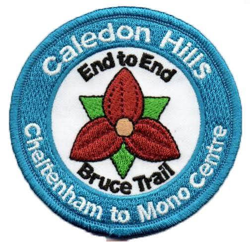
Caledon Hills E2E in 5 - Hike #1
https://hikes.brucetrail.org/event/caledon-hills-e2e-in-5-hike-1/Sorry, the registration cut-off time for this hike has been reached.Not a member? Click here to join today!Hike open to BTC Members only.
Hosting Club: Niagara
Category: Car Pool
Location (Google Maps): Meet at SW shoulder of Willoughby & Escarpment Sideroad. Carpool to Boston Mills Rd west of Mississauga Rd.Hike Leader(s): Robin Garrett Click here to contact Hike Leader(s)
Pace: Medium
Terrain: Strenuous
Distance: 18kmDescription
This End-to-End series will start 2kms south of the Cheltenham Badlands and end at the Mono Centre. Earn your E2E Caledon Hills badge in 5 hikes ($10 for members). We will be carpooling and will ask for volunteers to drive other hikers. Please take turns with the driving.Please bring poles, icers, water and lunch.
CANCELLED - Mulmur Hills
https://hikes.brucetrail.org/event/mulmur-hills-2/Sorry, the registration cut-off time for this hike has been reached.Not a member? Click here to join today!Hosting Club: Iroquoia
Category: General Hike
Location (Google Maps): Meet in the Bruce Trail parking lot on 1st LineHike Leader(s): Karen Bergmann Click here to contact Hike Leader(s)
Pace: Medium – 3 to 4 km/hr
Terrain: Moderate – Some hills and/or some poor footing
Distance: 9 kmsDescription
We will hike around the main trail, Oliver Creek Side Trail, Moss Haven Side Trail and across the road to the Rockhill Park Side Trail. Bring sufficient water and a snack, as needed.There are some hills to contend with on this hike.
Men’s Jones Bluff Loop Hike
https://hikes.brucetrail.org/event/mens-jones-bluff-loop-hike/Sorry, the registration cut-off time for this hike has been reached.Not a member? Click here to join today!Hosting Club: Peninsula
Location (Google Maps): Meet at Royal Canadian Legion 202, 6 Hellyer Road, Lion’s Head, ON
Hike Leader(s): Owen Glendon Click here to contact Hike Leader(s)
Pace: Medium (3.0 – 4.5 km/h): A comfortable pace for most hikers with steady progress.
Terrain: Moderate: Rolling hills, mild slopes and rocky paths.
Distance: 7 kmDescription
Jones Bluff Loop
This is the first of a series of weekly men’s hikes held in conjunction with the Bruce Men’s Shed. We will meet at the Lion’s Head Royal Legion #202 on highway 6 at Hellyer Rd, Lion’s Head, just north of Ferndale.Jones Bluff Trail offers wonderful escarpment views of both the rolling hills of Kings Point Bluff to the south and Sydney Bay to the north.
We will carpool to the Jones Bluff parking location and walk the main and side trails as a loop. The ground may be wet and slippery so hiking footwear is a must and hiking poles are suggested. Dress warmly in layers. Bring water and snack.
The hike should last about 2 hours with the possibility of lunch after.
- 02December 2, 2025
Urban Walk: Valley View Park Thornhill
https://hikes.brucetrail.org/event/urban-walk-valley-view-park-thornhill-122/Sorry, the registration cut-off time for this hike has been reached.Not a member? Click here to join today!Hosting Club: Toronto
Location (Google Maps): Parking lot is off Sycamore Drive East of Bayview , across Starbucks plaza
Bus 91 from Finch east station stops at Sycamore station.Hike Leader(s): Mohammad Aghamiri Click here to contact Hike Leader(s)
Pace: Moderate (3-4 km/hr)
Terrain: Hilly, Level 2 (Intermediate – some hills and uneven surfaces, rocks and roots underfoot)
Distance: 7-8 kmDescription
We will explore Valleyview and Maple View parks, and walk along German Mill Creak, in return we stop in Huntington park and have snack under beautiful shed.Although this is considered an “Urban Walk”, you can expect some hills up and down and uneven surfaces with tree roots. Please bring hiking poles, water and snacks.
phone number for the day of hike 289 588 6482
9:00 Long Hike Wiley Road Short Hills NEW TIME
https://hikes.brucetrail.org/event/900-long-hike-wiley-road-short-hills-new-time-8/Sorry, the registration cut-off time for this hike has been reached.Not a member? Click here to join today!Hosting Club: Niagara
Location (Google Maps):
Short Hills Wiley Road Entrance
Pace: Medium
Terrain: Moderate
: 10kmDescription
Explore Short Hills and the majestic side trails of Scarlett Tanager, Hemlock. Swayze Falls and Terrace. Register for each hikeBring Poles, , snack, and dress for the weather
9:15 Short Hike - Short Hills Park, Pelham Rd
https://hikes.brucetrail.org/event/915-short-hike-short-hills-park-pelham-rd-33/Sorry, the registration cut-off time for this hike has been reached.Not a member? Click here to join today!Hosting Club: Niagara
Category: Hike
Location (Google Maps): Short Hills Provincial Park, Pelham Rd., Thorold ONHike Leader(s): Debbie Demizio Click here to contact Hike Leader(s)
Pace: Medium
Terrain: Moderate
Distance: ~ 6kmsDescription
Hike the main and sidetrails in Short Hills Provincial Park. Brind hiking boots, water and sunscreen.Meltwater Moraine, map 16
https://hikes.brucetrail.org/event/meltwater-moraine-map-16/Sorry, the registration cut-off time for this hike has been reached.Not a member? Click here to join today!Hosting Club: Caledon Hills
Category: Tuesday Hikers
Location (Google Maps): Roadside parking on Mountainview Rd.
Going north on Airport Road, turn left on Charleston Sideroad, left on Mountainview Road to the roadside parking.
You may look for other directions depending upon where you are driving from.Hike Leader(s): Mohammad Shafiq Click here to contact Hike Leader(s)
Pace: Medium – 3 to 4 km/hour
Terrain: Moderate – some hills and/or some poor footing
Distance: 11-12 kmDescription
Will be hiking in and around Meltwater Moraine Nature Reserve, the main trail was relocated to this area eliminating road walk on Airport Road and Escarpment Road making the hike nature friendly.
Will also explore all or parts of Metlwater, Songbird and Paris Moraine side trails.
Open for a refreshment stop after hike, participants suggestions are welcomed.*NEW* Meltwater and Paris Moraines
https://hikes.brucetrail.org/event/new-meltwater-and-paris-moraines/Sorry, the registration cut-off time for this hike has been reached.Not a member? Click here to join today!Hosting Club: Dufferin Hi-Land
Category: Tuesday Hike
Location (Google Maps): Caledon Hills, Map 16: Meet at roadside parking at Km 26.0 on the north side of Escarpment Sideroad 0.6 km west of Mountainview Rd
Note: The trails we will be hiking are not shown in the BT Guide, Edition 31. You can preview maps in the Trail Changes and Notices section of the BTC website or on the BTC app.Hike Leader(s): Les Babbage, Inge Eckerich, Julie Daley, Tony Evangelista Click here to contact Hike Leader(s)
Pace: Leisurely
Terrain: Moderate
Distance: ~7 km; Short hike: 3-4 kmDescription
Remember slogging along Airport Rd with speeding cars and trucks blasting along beside you? Well, no more! The Main Trail has finally been moved off of the road and, as a bonus, two side trails have been added, creating new loop opportunities. Today we will shuttle to parking where the Main Trail crosses Airport Rd, then hike back taking in the Meltwater and Paris Moraine Side Trails. Bring water and snacks. Icers could be needed if winter comes early. Hiking poles recommended.
Perimeter Cape Chin Woods
https://hikes.brucetrail.org/event/perimeter-cape-chin-woods/Sorry, the registration cut-off time for this hike has been reached.Not a member? Click here to join today!Hosting Club: Peninsula
Category: Winter Hikes
Location (Google Maps): Meet at Borchardt Parking lot. Hike South on the Main Trail to the boundary of 100 acre Cape Chin Woods.Hike Leader(s): Tamara Wilson Click here to contact Hike Leader(s)
Pace: Leisurely (2.0 – 3.0 km/h): A relaxed pace with frequent breaks and a focus on enjoyment.
Terrain: Difficult: Steep ascents/descents, rocky scrambling, and some rugged escarpment paths.
Distance: 4 kmDescription
Hike South on MT to boundary of Cape Chin Woods, Head in on unmarked Land Steward Trail, past an old deserted vehicle, vernal pools, dense cedar bush and towering hardwood forests. Some areas will be bush whacking so suggest wear water proof clothing. Land Steward, Tim Wilson, will discuss some of the duties of Land stewardship and what he is looking for on his perimeter walk. Expect hiking on ground that is lightly covered in snow. - 03December 3, 2025
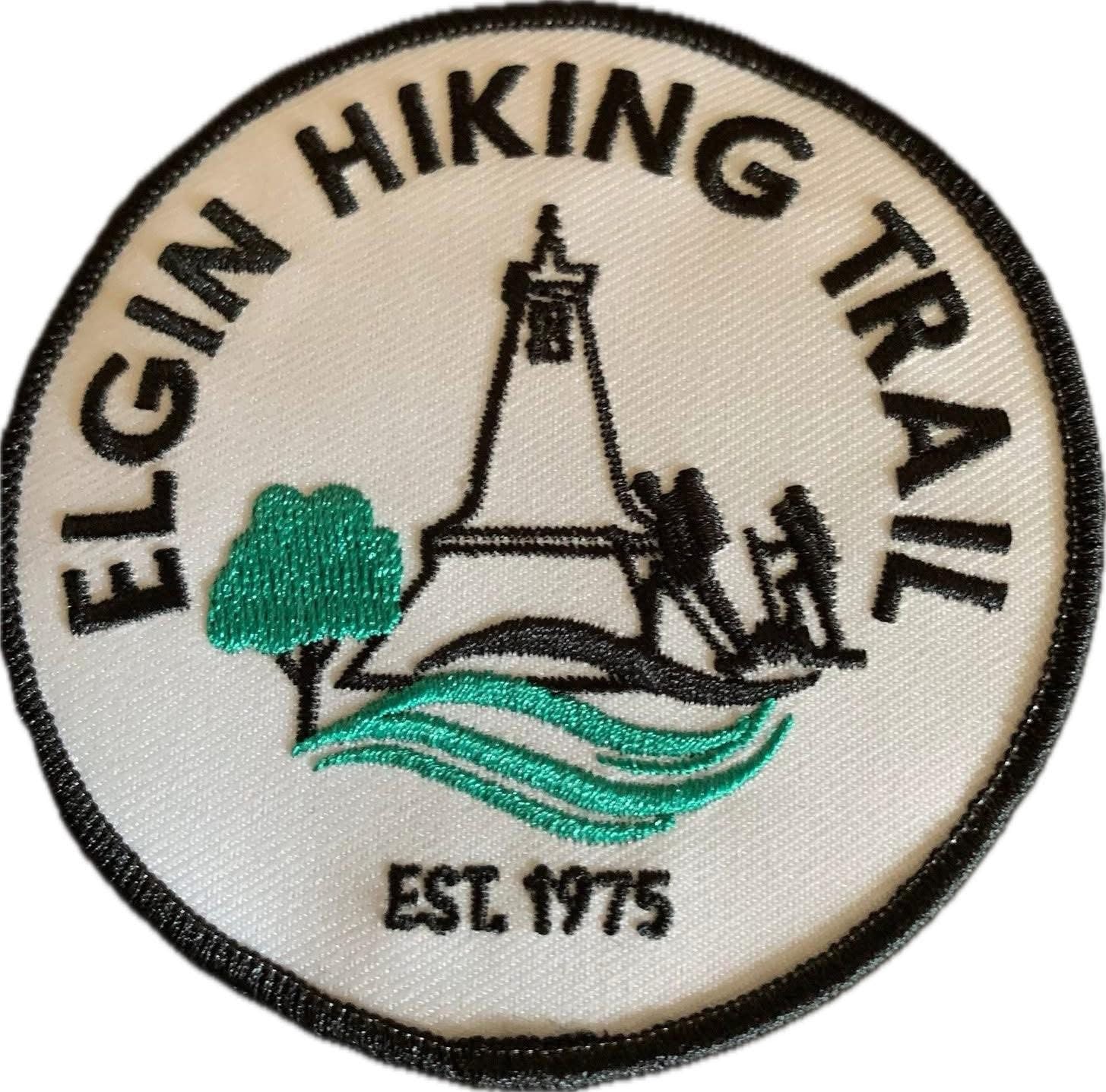
Elgin Hiking Trail End to End - two day hike Dec 3 and 4th - meet time 7:45am
https://hikes.brucetrail.org/event/elgin-hiking-trail-end-to-end/Sorry, the registration cut-off time for this hike has been reached.Not a member? Click here to join today!This is a Multi-Day Hike
You are signing up for the following dates:
2025-12-03, 2025-12-04Hosting Club: Iroquoia
Category: Special Event
Location (Google Maps): We will meet at V.A. Barrie Disc Golf Park at 68 Sunset Drive, St. Thomas on both days. Please arrive by 7:45 for check-in.
Day 1 – We will start the hike in Port Stanley – parking in the Pierside Beach Parking Lot. Hiking is northbound.
Day 2 – We will start our hike at the top end of the Elgin Trail 10002 Southdel St, Southwold. Look for the Elgin Trail/Thames Valley Trail signage. Hiking is southbound.Hike Leader(s): Ruth Moffatt Click here to contact Hike Leader(s)
Pace: Brisk – 4 to 5 km/hr, Medium – 3 to 4 km/hr
Terrain: Dependent on Conditions, Moderate – Some hills and/or some poor footing, Slippery and Steep Sections, Slippery Sections Likely, Strenuous – Hilly with steep climbs and some poor footing
Distance: Approximately 22-25km per dayDescription
Occasionally hikes are offered outside of the Bruce Trail by Bruce Trail hike leaders in an effort to reach any members who reside outside of the immediate Bruce Trail area. This is a two day hike on the Elgin Hiking Trail which runs from Lake Erie in Port Stanley to 10002 Southdel St in Southwold, where it meets the Thames Valley Trail. Look for the Thames Valley/Elgin signage. Elgin Hiking Trail is approximately 42km long.Please pack all the items you would require for a long day hike (food, snacks, 2l of water, first aid kit, extra socks) and dress in layers. Please bring rain gear if the forecast is for rain. This 2 day hike will be postponed if the forecast is such that we may have ice or snow. All registered hikers will be advised.
Please ensure you are capable of two long days of hiking at a brisk pace before signing up for these hikes. The trail is variable; some trail and quite a long stretch of road at the north end.
There is a club badge and an end to end badge available for purchase at $15each. Proceeds go toward supporting the Elgin Trail infrastructure and maintenance and also to show our support for the trail.
Please be prepared to share in the hiker shuttle by having at least 4 seatbelts available for use. This includes the driver. We may have a couple of Trail Angels from the club so fingers crossed, we won’t have to shuttle.
This hike is limited to 12 people.
Do you need accommodation? We have an Air B&B rental in St Thomas. The bedrooms are taken but we can bring a couple of air mattresses if you bring the linen. Please contact Ruth through this form if you are interested in sharing.
Please ensure you cancel your registration if your plans change. If someone else has registered you, please have them remove your registration. Cancelling your registration with lots of time to spare allows people who may be on a waitlist to participate.
Any questions may be directed through contact on this form.
If you cannot make it, please remove yourself from registration by following these steps:To cancel your registration, here is a step by step:
– Sign into your account on the BTC website
– Click on My Hikes under your account
– This will take you to a list of hikes you have registered for
– Scroll down to the appropriate hike and cursor over to the far right hand column under the Action column.
– Click Cancel under the hike you wish to cancel
Niagara E2E in 6 - Hike #3
https://hikes.brucetrail.org/event/niagara-e2e-in-6-hike-3/Sorry, the registration cut-off time for this hike has been reached.Not a member? Click here to join today!Hosting Club: Niagara
Category: Car Pool
Location (Google Maps): Meet in Short Hills Provincial Park, parking lot B, Roland Rd. Carpool to Glen Rd, LincolnHike Leader(s): Margaret Northfield Click here to contact Hike Leader(s)
Pace: Medium
Terrain: Moderate
Distance: 12.8kmDescription
This End-to-End series will start in Grimsby and end in Queenston. Upon completion of all 6 hikes, you can earn the new independent Brock monument badge. $10 for members and $15 for non-members. We will be carpooling and will ask for volunteers to drive other hikers. Please take turns with the driving.Poles, water and snack recommended.
EASY DOES IT HIKE Mel Swartz Lake Gibson Conservation Park NEW HIKERS WELCOME!
https://hikes.brucetrail.org/event/mel-swartz-lake-gibson-conservation-park/Sorry, the registration cut-off time for this hike has been reached.Not a member? Click here to join today!Hosting Club: Niagara
Category: Leisurely
Location (Google Maps): Decew and Abby Road, Thorold,OntHike Leader(s): Diane Marlatt Click here to contact Hike Leader(s)
Pace: Leisurely
Terrain: Easy
Distance: 3 kmDescription
Wednesday Walkers: Bognor Marsh
https://hikes.brucetrail.org/event/wednesday-walkers-bognor-marsh-2/Sorry, the registration cut-off time for this hike has been reached.Not a member? Click here to join today!Hosting Club: Beaver Valley
Location (Google Maps): Meet in the parking lot of Bognor Marsh Management Area. This is a Grey Sauble Conservation Authority fee site.
Hike Leader(s): Margaret Yaraskavitch Click here to contact the hike leader.
Pace: Medium
Terrain: Moderate, Some rocky footing, Some steep sections
Length of Hike: 5 kmsDescription
We’ll follow the Main Trail from the parking lot and walk on the marsh boardwalks. The Trail then starts upland along an old cart trail along the scarp face. We’ll use the Bognar Marsh Side Trail to return towards the parking lot.Guidelines
- Arrive 15 minutes before the start of the hike.
- Wear sturdy footwear and appropriate attire for the weather and the terrain.
Hiking poles are a good idea in any season, especially if the terrain is rocky or slippery. In winter, snowshoes or icers/crampons are needed when conditions dictate.
Wearing appropriate clothing and footwear prevents injuries and shows consideration for a safe and positive group hiking experience. - Always carry I.D. and your health card.
- Bring sufficient water and snacks (or lunch if indicated). A minimum of 1L of water is recommended on all hikes, and 3L is recommended for long, challenging hikes in the heat of the summer.
- Bring sunscreen and insect repellent (for spring and summer hikes).
- Bring your own first aid kit.
- Please leave dogs at home.
Full Moon/Festival of Northern Lights Hike
https://hikes.brucetrail.org/event/full-moon-festival-of-northern-lights-hike/Sorry, the registration cut-off time for this hike has been reached.Not a member? Click here to join today!Hosting Club: Sydenham
Category: An evening walk.
Location (Google Maps): Meet in the municipal parking lot by the river on the west side of 1st Ave E between 7th St E and 8th St E in Owen SoundHike Leader(s): Harriet Nixon Click here to contact Hike Leader(s)
Pace: Medium: 3 to 4 km/h
Terrain: Moderate: Some hills and/or poor footing, There might be icy and slippery sections.
Distance: Approx 5 kmDescription
Join us for an evening Full Moon Hike visiting the Festival of Northern Lights displays in the River District and Harrison Park in Owen Sound. If there are icy conditions please bring icers to wear. There is no need to show up 15 minutes early for this hike, but we will leave promptly at 7:00 pm. Following the hike there is an opportunity to socialize over refreshments. - 04December 4, 2025
Urban Walk: Valley View Park Thornhill 150
https://hikes.brucetrail.org/event/urban-walk-valley-view-park-thornhill-123/Sorry, the registration cut-off time for this hike has been reached.Not a member? Click here to join today!Hosting Club: Toronto
Location (Google Maps): Parking lot is off Sycamore Drive East of Bayview , across Starbucks plaza
Bus 91 from Finch east station stops at Sycamore station.Hike Leader(s): Mohammad Aghamiri Click here to contact Hike Leader(s)
Pace: Moderate (3-4 km/hr)
Terrain: Hilly, Level 2 (Intermediate – some hills and uneven surfaces, rocks and roots underfoot)
Distance: 7-8 kmDescription
We will explore Valleyview and Maple View parks, and walk along German Mill Creak, in return we stop in Huntington park and have snack under beautiful shed.Although this is considered an “Urban Walk”, you can expect some hills up and down and uneven surfaces with tree roots. Please bring hiking poles, water and snacks.
phone number for the day of hike 289 588 6482
9:00 am Long hike NEW Location. Bailey bridge Jordan
https://hikes.brucetrail.org/event/900-am-long-hike-new-location-bailey-bridge-jordan/Sorry, the registration cut-off time for this hike has been reached.Not a member? Click here to join today!Hosting Club: Niagara
Category: In and Out
Location (Google Maps): Bailey bridge JordanHike Leader(s): Alan Laver Click here to contact Hike Leader(s)
Pace: Brisk
Terrain: Strenuous
Distance: 10kDescription
This will be our permanent Thursday Location until Bridge repairs complete. Hike up from the Bailey bridge to Balls Falls and explore the trailsYou must register for each hike. Bring Poles, snack and a drink. Dress for the weather
Hiking around Jordan
https://hikes.brucetrail.org/event/hiking-around-jordan-38/Sorry, the registration cut-off time for this hike has been reached.Not a member? Click here to join today!Hosting Club: Niagara
Category: Hike
Location (Google Maps): 3640 Glen Road, Lincoln LOR 1SOHike Leader(s): Bill Russell Click here to contact Hike Leader(s)
Pace: Medium
Terrain: Moderate
Distance: 7 kmDescription
Hiking in and around Jordan, Jim Rainforth Trail and Balls Falls alternating every 3 weeks.
Crawford Lake (reservation required)
https://hikes.brucetrail.org/event/crawford-lake-reservation-required-2/Sorry, the registration cut-off time for this hike has been reached.Not a member? Click here to join today!Hosting Club: Iroquoia
Category: General Hike
Location (Google Maps): Meet in the first parking lot at Crawford Lake at 9:15 am. Reserve your time at conservationhalton.caHike Leader(s): Karen Bergmann Click here to contact Hike Leader(s)
Pace: Medium – 3 to 4 km/hr
Terrain: Moderate – Some hills and/or some poor footing
Distance: 6-7 kmsDescription
Meeting at 9:15 am in the first parking lot, we will hike a loop around the hiking trails. This is a short hike but with a few rocky places. Parking reservations required.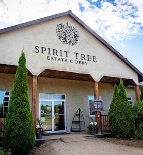
Car Hike: Toronto Section Hike to Spirit Tree Estate Cidery
https://hikes.brucetrail.org/event/car-hike-toronto-section-hike-to-spirit-tree-estate-cidery/Sorry, the registration cut-off time for this hike has been reached.Not a member? Click here to join today!Hosting Club: Toronto
Category: Car Hike
Location (Google Maps): Boston Mills Road and Mississauga Road (48.0k marker, Map 14) – northwest cornerHike Leader(s): David Rowney and Magdalena Vanderkooy Click here to contact Hike Leader(s)
Pace: Moderate (3-4 km/hr)
Terrain: Level 2 (Intermediate – some hills and uneven surfaces, rocks and roots underfoot), Variable
Distance: 9.1 kDescription
Join us for a mid-week 9.1K hike from Terra Cotta Cotta Conservation area to Boston Mills. Our journey should take about 2 1/2 hours to complete. When we finish, there will be an opportunity to stop in at the Spirit Tree Estate for hot apple cider, baked goods or to purchase a Christmas basket for your family. If there is interest among the group , there is also a bistro where you may enjoy a full sit-down lunch.We will start by shuttling some cars to the Tenth Line where we will park, then enter Terra Cotta Conservation area. This hike will take us through the park on the main Bruce Trail through mature forests, meadows and river valleys. The terrain will vary, there will be some hilly sections and sections with uneven, rocky terrain, making footing tricky to navigate. On arrival back at our cars, and after retrieving our shuttle vehicles, you will have an option to carry on to Spirit Tree Cidery, which is a 1 k drive away, with your hike leaders.
December weather can be unpredictable with cold winds, rain, sleet or snow! So, dress for the weather, keeping in mind to dress in layers and get your icers packed. Hiking shoes/boots are required and hiking poles are recommended. Bring plenty of fluids, including electrolytes, and a snack.
As this is a group hike, please consider your fitness level before registering. We will be walking at a pace of 3km – 4km per hour and everyone is expected to keep up with the person in front of them for the duration of the hike.
Plan to arrive at the meeting place by 9:45 a.m. as we will start the car shuffle to the hike starting point at 10 a.m. sharp. Further details will be provided to registered hikers a few days prior to the hike. Please indicate to the leaders if you wish to dine with us and we will work on reservations.
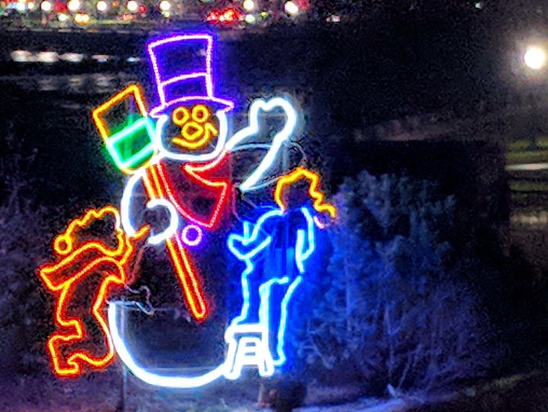
Winter Festival of Lights Hike
https://hikes.brucetrail.org/event/winter-festival-of-lights-hike/Sorry, the registration cut-off time for this hike has been reached.Not a member? Click here to join today!Hosting Club: Niagara
Category: Night
Location (Google Maps): Meet at Floral Showhouse, Niagara River Parkway, just south of the Falls. Parking Fee. Annual parking passes are the best rates.Hike Leader(s): Margaret Northfield Click here to contact Hike Leader(s)
Pace: Medium
Terrain: Easy
Distance: 5-6kmDescription
Get into the holiday spirit with a walk among the Festival of Lights. Wear warmer clothes than you normally would for a hike so you can comfortably take photos.Hot apple cider and treats will be shared following the hike. You are welcome to bring a treat to share.
- 05December 5, 2025
Caledon in 5 End-to-End Hike Series - Hike #5 - DATE CHANGE
https://hikes.brucetrail.org/event/caledon-in-5-end-to-end-hike-series-hike-5/Sorry, the registration cut-off time for this hike has been reached.Not a member? Click here to join today!Hosting Club: Iroquoia, Caledon Hills
Category: General Hike
Location (Google Maps): Meeting Place: Mono Community Centre Parking LotHike Leader(s): Pati Greenwood, Jeff Dowsett Click here to contact Hike Leader(s)
Pace: Medium – 3 to 4 km/hr
Terrain: Dependent on Conditions, Strenuous – Hilly with steep climbs and some poor footing
Distance: 11.5 kmDescription
NOTE – THE DATE OF THIS HIKE HAS BEEN CHANGED FROM DECEMBER 1 TO DECEMBER 5This is an end-to-end hiking series to complete the Caledon section of the Bruce Trail in 5 hikes.
The hikes will be undertaken at a medium pace of approximately 4 km/hour for approximately 15 kms each hike. Please consider your fitness level before registering; this is a group hike, and everyone is expected to keep pace with the person in front of them for the duration of the hike.
The weather can be changeable at this time of year, so dress in layers for any possibility. There here are many steep and hilly segments in this section of the Bruce Trail so the hikes will require considerable stamina. Wear hiking boots and bring hiking poles. Bring a snack, plenty of water and other hydration as needed.
We will be travelling from south to north over the course of the End-to-End. The series will require car shuffles, and everyone will be expected to participate as drivers.
Today’s hike, the fifth and final hike of the series, is 11.5 km in length. Please plan to arrive at the meeting place by 8:15 am as we will start the car shuffle at 8:30 am sharp.
Further details will be provided to registered hikers a few days prior to the hike.
9:00 am Niagara-on-the-Lake Tour
https://hikes.brucetrail.org/event/900-am-niagara-on-the-lake-tour-50/Sorry, the registration cut-off time for this hike has been reached.Not a member? Click here to join today!Hosting Club: Niagara
Category: Urban
Location (Google Maps):Veterans Memorial Park, park just outside the park on King Street
Hike Leader(s): Robin Garrett Click here to contact Hike Leader(s)
Pace: Medium
Terrain: Easy
Distance: 6-7 kmDescription
Each Friday we will explore different neighbourhoods, trails and parkland throughout Historic Niagara-on-the-Lake.Moderate pace with some weeks entirely on sidewalks and roads while others may include a mix of trails and paved pathways. Great way to build up endurance for longer more strenuous hikes.
Prepare for cooler windy conditions on open parkland and along Lake Ontario and Niagara River trails.
Plan to stay for conversation and a warm cup of coffee or tea at Sweets & Swirls, Community Centre, Niagara Stone Road, NOTL
Black Bank and Honeywood Ridge - Dufferin Hi-Land Delights in the Snow
https://hikes.brucetrail.org/event/black-bank-and-honeywood-dufferin-hi-land-delights-in-the-snow/Sorry, the registration cut-off time for this hike has been reached.Not a member? Click here to join today!Hosting Club: Dufferin Hi-Land
Category: General Hike
Location (Google Maps): Roadside parking on Prince of Wales Road at 20 Side Road. See Google Maps link for GPS.Hike Leader(s): Stuart Law
Pace: Medium
Terrain: Slippery and Steep Sections, Strenuous
Distance: 11.5 kmsDescription
Join us on a snowy shuttle hike from 30 Side Road to 20 Side Road in the beautiful Dufferin Hi-Land section of the Bruce Trail. We will take in Black Bank and Honeywood. The hills will be steep and there will be a decent amount of snow. Icers mandatory. Snow shoes optional. Poles highly recommended. Please bring a warm drink, a snack and a smile. Please be ready to shuttle at 9:30 am sharp.Ron Savage loop
https://hikes.brucetrail.org/event/ron-savage-loop/Sorry, the registration cut-off time for this hike has been reached.Not a member? Click here to join today!Hosting Club: Sydenham
Category: General Hike
Location (Google Maps): Indian Falls Conservation Area parking lot, 318614 Grey Rd 1 , in Balmy Beach, west side of the road. We will carpool from here.Hike Leader(s): Carol Graham-Mullin Click here to contact Hike Leader(s)
Pace: Leisurely: 3 km/h or less
Terrain: Moderate: Some hills and/or poor footing, Strenuous: Hilly with steep climbs and some poor footing., There might be icy and slippery sections., There might be muddy sections.
Distance: 5.6 kmDescription
This is a delightful loop hike through the forest featuring wetlands, “wells”, erratics, fossils and views across the Glen.Please bring water, snacks and poles if needed. If you are working towards the Sydenham geology badge, this would qualify for Beth’s “Savage Wells” hike. If you wish to purchase a copy of Beth Gilhespy’s geology book for Sydenham, please contact the leader directly prior to the hike. $37.oo cash or e-transfer at trail side. Carol Mullin 226-787-8804 call or text.
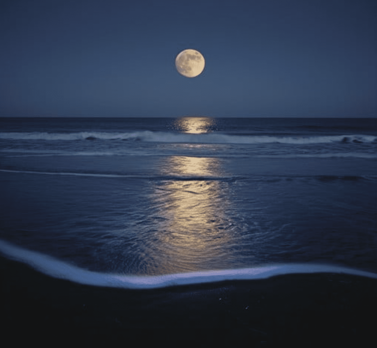
🌕 Full Moon Hike Series: Part 3 of 7 🌕 Serenade the Supermoon at Black Creek Provincial Park
https://hikes.brucetrail.org/event/%f0%9f%8c%95-full-moon-hike-series-part-3-of-7-%f0%9f%8c%95-serenade-the-supermoon-at-black-creek-provincial-park/Sorry, the registration cut-off time for this hike has been reached.Not a member? Click here to join today!Hosting Club: Peninsula
Category: Moonlit Hike Series
Location (Google Maps): Parking Lot of Black Creek Provincial ParkHike Leader(s): Beige McIntosh Click here to contact Hike Leader(s)
Pace: Leisurely (2.0 – 3.0 km/h): A relaxed pace with frequent breaks and a focus on enjoyment.
Terrain: Easy: Flat forested sections or lowland trails.
Distance: 3.5kmDescription
🌕Full Moon Hike Series: Part 3 of 7 🌕 Serenade the Super-moon @ Black Creek Provincial ParkWe’ll hike ~3.5 kms along a sandy trail through a softwood forest, then we’ll turn around to go back the way we came. Here we will enjoy the full moon on a sandy beach along the Lake Huron shoreline. For those interested, local song leader Beige McIntosh will guide the group in singing some simple nature songs to the stunning super-moon above (if you’re feeling shy you can just enjoy the sounds!). The moon offers us so much beauty, the least we can do is return the favour with a few songs! Please bring a blanket or chair to sit on at the beach and be aware there is poison ivy along the trail.
Badge Alert:
- New this year – earn a Full Moon Hiking badge by joining 4 of the 7 hikes in this Full Moon Hiking Series.
What to bring:
- Illuminate the path with a red light headlamp (or flashlight).
- Sturdy boots
- Appropriate clothing for the weather conditions (layers are great)
- Hiking poles could be helpful (but not mandatory)
- something to sit on, snack, water or hot beverage
- 06December 6, 2025

School Bus hike-Nottawasaga Bluffs and Holiday Luncheon
https://hikes.brucetrail.org/event/school-bus-hike-nottawasaga-bluffs-and-holiday-luncheon/Sorry, the registration cut-off time for this hike has been reached.Not a member? Click here to join today!Trip Information
Departure Time: 08:00
Return to City Time: 19:00
Departure Point: York Mills Bus PickupOptional Items
Banquet Burger ($34)
Chicken Caesar Salad Wrap ($34)
Fish and Chips ($34)
Falafel Wrap (veg) ($34)Hosting Club: Toronto
Category: Bus Hike
Location (Google Maps): Nottawasaga Bluffs and SinghamptonHike Leader(s): George Lennon, Roland Mark, Tim Wainwright, Tom Swales Click here to contact Hike Leader(s)
Pace: Brisk (4-5 km/hr), Moderate (3-4 km/hr)
Terrain: Level 2 (Intermediate – some hills and uneven surfaces, rocks and roots underfoot), Rocky, Variable
Distance: 8.7 kmDescription
Come celebrate with us the beginning of holiday season with a hike along the Niagara Escarpment with great views in Nottawasaga Bluffs Conservation Area. We will hike for about four hours at a 3.5 km/hr pace, explore the Key Hole Side Trail and enjoy the view from the Nottawasaga Bluffs Lookout. After the hike we will go to Mylar and Loreta’s Restaurant for our celebration luncheon. When you register, please select one of the lunch choices listed under optional items. All regular entrées include fries, dessert bar and non-alcoholic beverage. Vegetarian entrées include salad, dessert bar and non-alcoholic beverage. Tax and gratuity are included in the prices. Beer and wine are extra. You will need to pay your bus fare when you register. E-transfer your lunch money ($34 per person) to blennon@sympatico.ca.Bethesda Trail Richmond Hill 216
https://hikes.brucetrail.org/event/car-hike-trail-richmond-hill/Sorry, the registration cut-off time for this hike has been reached.Not a member? Click here to join today!Hosting Club: Toronto
Category: Car Hike
Location (Google Maps): Free parking lot at the head of trail Bethesda Side Road off Bayview AveHike Leader(s): Mohammad Aghamiri Click here to contact Hike Leader(s)
Pace: Moderate (3-4 km/hr)
Terrain: Hilly, Level 2 (Intermediate – some hills and uneven surfaces, rocks and roots underfoot), Variable
Distance (km): 12-14 kmDescription
oin us to explore the trails of York Regional Forest and the Oak Ridges Corridor at Jefferson Forest and Bond lake,From parking lot we hike thought Jefferson forest and continue to Bond Lake and have snack beside the lake and return to parking around 13 to 13.30
Louth to Swayze Falls return
https://hikes.brucetrail.org/event/louth-to-swayze-falls-return/Sorry, the registration cut-off time for this hike has been reached.Not a member? Click here to join today!Hosting Club: Niagara
Category: Loop
Location (Google Maps): Louth Conservation Area, Staff AvenueHike Leader(s): Lauren Doig Click here to contact Hike Leader(s)
Pace: Brisk
Terrain: Strenuous
Distance: 20 kmDescription
Meet at Louth Conservation Area and Hike a Swayze Falls loop, taking some side trails along the way. Bring poles, icers, water and a snack.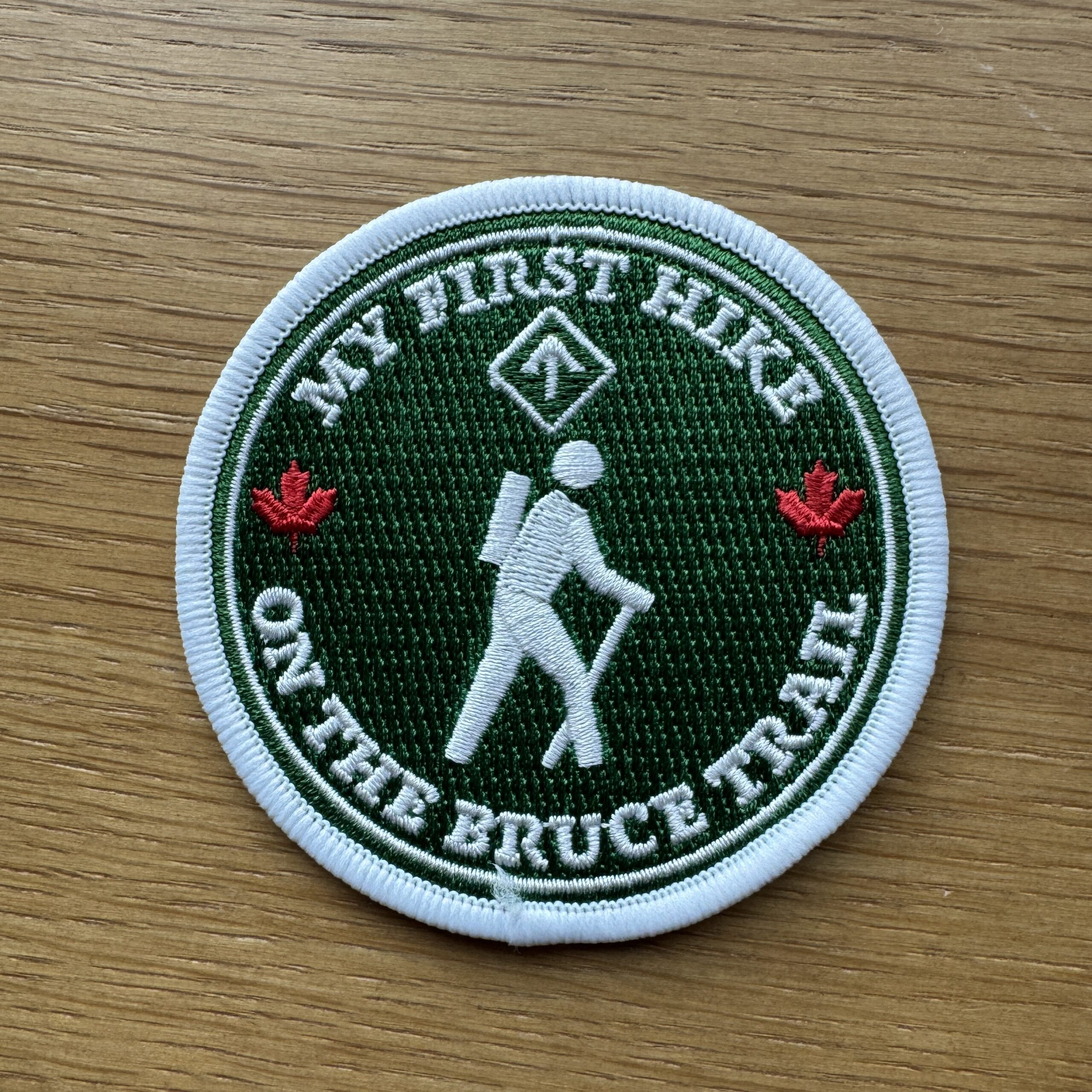
My First Hike - Complementary Badge and a draw for one free membership and two Bruce Trail Guides. Ed 31.
https://hikes.brucetrail.org/event/my-first-hike-complementary-badge-and-a-draw-for-one-free-membership/Sorry, the registration cut-off time for this hike has been reached.Not a member? Click here to join today!Hosting Club: Iroquoia
Category: My First Hike
Location (Google Maps): In the parking lot at Felker’s Falls Conservation Area.
From Mud St turn north on Paramount Drive and continue to Ackland Street. Follow signage to parking area.Hike Leader(s): Ruth Moffatt Click here to contact Hike Leader(s)
Pace: Leisurely – 3km/hr or less, Medium – 3 to 4 km/hr
Terrain: Dependent on Conditions, Moderate – Some hills and/or some poor footing, Strenuous – Hilly with steep climbs and some poor footing
Distance: 10kmDescription
Are you new to hiking? Do you need a little guidance on how to get started? This hike is for you!
Please join experienced Hike Leader Ruth for a hike that will take us around Felker’s Falls and over to Devil’s Punchbowl Falls, if we’re feeling up for it. Please bring water, snacks and wear good sturdy hiking shoes/boots. Bring hiking poles if you use them. This introduction to hiking will be part instructional and part physical. Any and all questions about hiking and the Bruce Trail can be answered.
Please dress for forecasted weather. All participants will receive a My First Hike badge and be entered in a draw for one, one year BTC membership to begin immediately and a 2 draws for a Bruce Trail Guide Ed 31.Everyone is welcome, even if you are not new to hiking. Lots of hiking tips will be shared.
#3/3 Toronto E2E: Alina's Hanging-Up-the-Boots Hike 🥾17KM
https://hikes.brucetrail.org/event/3-3-toronto-e2e-alinas-hanging-up-the-boots-hike-%f0%9f%a5%be17km/Sorry, the registration cut-off time for this hike has been reached.Not a member? Click here to join today!Hosting Club: Toronto
Category: Car Hike
Location (Google Maps): Spirit Tree Estate Cidery West Parking LotHike Leader(s): Alina Lin
Pace: Brisk (4-5 km/hr)
Terrain: Challenging, Flat, Hilly, Level 2 (Intermediate – some hills and uneven surfaces, rocks and roots underfoot), Rocky, Variable
Distance (km): 17 kmDescription
Since becoming a hike leader in 2015, I’ve had the joy of leading more than 200 group hikes—most memorably the End‑to‑End hikes of the Bruce Trail (900 km) for twice, Oak Ridges Trail (270 km), Ganaraska Trail (500 km), and the Grand Valley Trail (260 km). Along the way, I’ve met hundreds of enthusiastic hikers, been inspired by countless volunteers, and made lifelong friends. This is likely my last time leading an End-to-End hike on the Bruce Trail —a symbolic “Hanging Up the Boots” moment. But I’m not done hiking! New adventures await in Western Canada. Happy hiking, happy living!Meeting Point :
Spirit Tree Estate Cidery west parking lot ( west up of the main parking lot)- thanks their permission out of kindness! Please arrive at the parking area before 8:45am to allow time for car shuttle coordination.We will car shuttle to Roadside parking east of KM33.4 across from the Eighth Line Side Trail on Eighth Line. GPS: 43.679840, -79.966419. From there we will hike main trail back to the KM 50 at the Creditview Rd.
All drivers are expected to participate in the car shuttle, either before or after the hike.
After hike option: Spirit Tree Cidery’s coffee, bakeries and pizza!
Important Notes:
- Wear sturdy hiking footwear and dress appropriately for the weather. Icers might be needed.
- Bring snacks, and at least 1L of water
- No dropouts available.
- No pets.
Cabot Head Lighthouse Hike
https://hikes.brucetrail.org/event/cabot-head-lighthouse-hike/Sorry, the registration cut-off time for this hike has been reached.Not a member? Click here to join today!Hosting Club: Peninsula
Location (Google Maps): On roadside at the south end of Harkins Rd
Hike Leader(s): Marie-José van der Zande Click here to contact Hike Leader(s)
Pace: Medium (3.0 – 4.5 km/h): A comfortable pace for most hikers with steady progress.
Terrain: Moderate: Rolling hills, mild slopes and rocky paths.
Distance: ~20kmDescription
Perched 80 feet above Georgian Bay, on the beautiful Bruce Peninsula, the Cabot Head Lighthouse has guided ships for over 100 years. Located in Cabot Head Nature Reserve on Georgian Bay. Today its closed to visitors, but we will have the unique opportunity to take in the views as we walk along the bay on the road to the lighthouse. From there we will take the trail to Wingfield Basin. A refuge for ships back in the day in stormy weather and today for sailors and boaters to anchor and rest. We will see relics from a ship left there many years ago. A reminder of the beauty and the strength of mother nature in this hidden gem. Let’s take a walk back in time.This will be approximately a 20km out-and-back hike, and we aim to return to the parking lot by 3pm.
Please bring water, snacks, and lunch, as well as any refreshments you may need. Layered clothing is recommended since the weather may change throughout the day, and hiking poles are optional.
Our lunch stop will be at the Lighthouse before we head back to Harkins Rd parking.

Saturday Shorts: Hockleycrest
https://hikes.brucetrail.org/event/saturday-shorts-hockleycrest-5/Sorry, the registration cut-off time for this hike has been reached.Not a member? Click here to join today!Hosting Club: Caledon Hills
Category: General
Location (Google Maps): Meet at the Mono 5 Sideroad parking area at km 45.4 on the north side of the road where the Trail crosses. This is east of Airport Road. It is best to aim for arriving around 9:45, so we can start hiking as close to 10 am as possible. Thanks!Hike Leader(s): Elizabeth Ganong Click here to contact Hike Leader(s)
Pace: Medium – 3 to 4 km/hour
Terrain: Moderate – some hills and/or some poor footing
Distance: Approximately 5 kmDescription
Looking to get out on a Saturday but not give up your whole day? Saturday Shorts, a hiking series, will get you out in a small group on a short hike. Following the main Bruce Trail and side trails, this Saturday’s hike takes us through Hockleycrest. We will cover our approximately 5 km route at a comfortable pace, which allows for enjoying our time out in nature. Things to consider in your preparations: hiking shoes/boots, icers (depending on trail conditions), poles, warm gear, dressing in layers, water, and a snack. There will be short standing breaks. No dogs please.After the hike, you may wish to visit the CHBTC’s winter market just around the corner at Hockleycrest on Airport Road. Proceeds from all sales support the BTC.
Spirit Rock snowshoe/hike
https://hikes.brucetrail.org/event/spirit-rock-snowshoe-hike/Sorry, the registration cut-off time for this hike has been reached.Not a member? Click here to join today!Hosting Club: Sydenham
Category: Snowshoe Hike
Location (Google Maps): Map 35, the Parking at 0.0 in Bluewater Park, Wiarton opposite the arenaHike Leader(s): Cindy Paczkowski Click here to contact Hike Leader(s)
Pace: Leisurely: 3 km/h or less
Terrain: Moderate: Some hills and/or poor footing, There might be icy and slippery sections., There might be muddy sections.
Distance: Approx. 5.5 kmDescription
We will hike up the Wiarton side Trail into the Conservation Area. Depending on whether or not there is snow, we will snowshoe into the Corran area and hike spirit Rock side trail and through the meadow area heading towards Colpoy’s Bay to the road and then return via Wiarton Side trail. If there is no snow or light conditions, we will consider doing the same route but return via the spiral staircase and along the main trail back to our cars. This hike will be rife with flexibility depending on our winter conditions. An opportunity to maybe have coffee or lunch afterwards can be considered.