Categories
- 23November 23, 2025
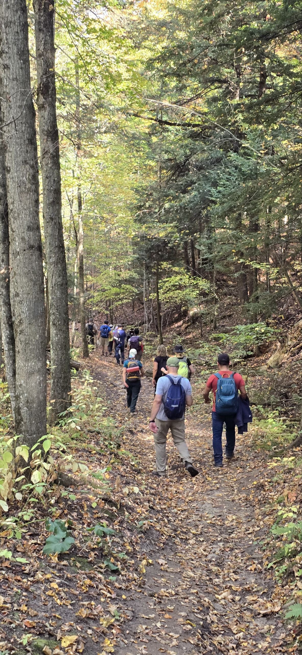
Car Hike: Exploring Uxbridge Trails (Wilder Forest, Walker Woods, and Glen Major Forest)
https://hikes.brucetrail.org/event/car-hike-exploring-uxbridge-trails-wilder-forest-walker-woods-and-glen-major-forest-18/Sorry, the registration cut-off time for this hike has been reached.Not a member? Click here to join today!Hosting Club: Toronto
Category: Car Hike
Location (Google Maps):2499 Brock Rd, Uxbridge, ON L9P 1R4. We will meet at the East Duffins Headwaters parking lot at the WILDER FOREST trail head. As soon as you got off the Brock Road, passing the horse back riding facility, there is a free designated parking lot 70 meters down the lane to your right. It includes a sign board for East Duffins Headwaters with a map of the trails. Please do not park on the lane or in the horse back riding property.
Hike Leader(s): Amir Alemohammad Click here to contact Hike Leader(s)
Pace: Moderate (3-4 km/hr)
Terrain: Flat, Hilly, Level 2 (Intermediate – some hills and uneven surfaces, rocks and roots underfoot), Variable
Distance: Approx.15-16 KmDescription
Join us for a delightful hike in Uxbridge, as we explore Wilder Forest, Walker Woods, and Glen Major Forest on a scenic loop starting from Brock Road. We’ll pass Concession Road 6, heading west and back, while also venturing onto several side trails for even more stunning views.What to Expect:
•Beautiful scenic views and lookouts facing south
•A mix of hilly and flat terrain
•Frequent 2-minute breaks for hydration and photos, with a 10-20 minute lunch/snack stop
•Stay on designated trails at all time
What to Bring and Wear:
•Hiking Boots and poles (recommended) and be prepared for the ice on the trail, keep your icers handy.
•At least 2 liters of water
•Your favorite snacks and lunch (pack your own refreshments for an outdoor meal)
•Dress according to variable weather conditions!
Important Details:
•Stay on the designated trails
•Be prepared for the elements and enjoy the adventure!
Looking forward to seeing you on the trail!
Don’t forget your camera and a smile as we explore the beauty of the Uxbridge trails!
This is a joint hike with the Oak Ridges Trail Association (ORTA).

Canada Goose to Speyside (E2E)
https://hikes.brucetrail.org/event/canada-goose-to-speyside-e2e-2/Sorry, the registration cut-off time for this hike has been reached.Not a member? Click here to join today!Hosting Club: Iroquoia
Category: General Hike
Location (Google Maps): Meet at 9:15 in the parking lot on 22 Side Rd, just off Fourth Line.Hike Leader(s): Karen Bergmann Click here to contact Hike Leader(s)
Pace: Medium – 3 to 4 km/hr
Terrain: Moderate – Some hills and/or some poor footing
Distance: 8 kmsDescription
Meeting at 9:15 am in the Bruce Trail parking lot on 22 Side Rd, just off Fourth Line, we will carpool to 15 Side Road and hike back along the main trail and Canada Goose Side Trail. There are some rocky parts to this hike, so be prepared.Exploring Sydenham Hike #36 Ross McLean
https://hikes.brucetrail.org/event/exploring-sydenham-hike-36-ross-mclean/Sorry, the registration cut-off time for this hike has been reached.Not a member? Click here to join today!Hosting Club: Sydenham
Category: General Hike
Location (Google Maps):The Owen Sound Galaxy Cinema parking lot. Meet at the tall “Galaxy Centre” sign next to the traffic lights.
Hike Leader(s): Bill Snel Click here to contact Hike Leader(s)
Pace: Leisurely: 3 km/h or less
Terrain: Moderate: Some hills and/or poor footing
Distance: 3 kmDescription
We will carpool to do a loop hike of the Ross McLean. This is hike 36 in the book Exploring Sydenham. There will be one secret to find. If you do not have a book and would like one ($30) let me know by using the “Contact hike leader” link. - 24November 24, 2025
Niagara End-to-End #6 of 6
https://hikes.brucetrail.org/event/niagara-end-to-end-6-of-6/Sorry, the registration cut-off time for this hike has been reached.Not a member? Click here to join today!Hosting Club: Niagara, Iroquoia
Category: General Hike
Location (Google Maps): Parking Lot at Grimsby Community Pool. Enter at 1 Elm Street at the south end of Coronation Park.Hike Leader(s): Pati Greenwood, Jeff Dowsett Click here to contact Hike Leader(s)
Pace: Medium – 3 to 4 km/hr
Terrain: Moderate – Some hills and/or some poor footing
Distance: 13.4 kmDescription
This is an End-to-End hike series to complete the Niagara section of the Bruce Trail in 6 hikes. Join for all or as many hikes as desired.This sixth and final hike of the series begins at Kinsmen Park, where we ended the last hike and follows the escarpment through a number of conservation areas until reaching the Forty Mile Creek Creek Side Trail, marking the end of the Niagara Section.
Weather conditions in the fall can be changeable, so it’s best to dress in layers and come prepared for varying conditions throughout the day. Insects, particularly ticks, are still active in the fall months, so take appropriate precautions to avoid them including using repellant and wearing clothing that covers the legs and arms. Hiking boots are required and hiking poles are recommended.
Bring plenty of fluids, including electrolytes, and a snack.
Since this is a group hike, please consider your fitness level before registering. We will be walking at a pace of 3km – 4km per hour and everyone is expected to keep up with the person in front of them for the duration of the hike.
Plan to arrive at the meeting place by 8:15 a.m. as we will start the car shuffle to the hike starting point at 8:30 a.m. sharp. Further details will be provided to registered hikers a few days prior to the hike.
- 25November 25, 2025
Heather & Steve's 3rd Annual Fall Cairn2Cairn - Iroquoia section, Nov 25,26,27, Dec 2,3,4
https://hikes.brucetrail.org/event/heather-steves-3rd-annual-fall-cairn2cairn-iroquoia-section-nov-252627-dec-234/Sorry, the registration cut-off time for this hike has been reached.Not a member? Click here to join today!This is a Multi-Day Hike
You are signing up for the following dates and times:
2025-11-25 at 07:45
2025-11-26 at
2025-11-27 at
2025-12-02 at
2025-12-03 at
2025-12-04 atHosting Club: Iroquoia
Category: General Hike
Location (Google Maps): We will meet at the Calcium Pits on Twiss Rd, and shuttle to Hilton Falls Conservation Area (fee required and we will share equally amongst hikers)Hike Leader(s): Steven White Click here to contact Hike Leader(s)
Pace: Brisk – 4 to 5 km/hr
Terrain: Strenuous – Hilly with steep climbs and some poor footing
Distance: 19kmDescription
Hike the bodacious Iroquoia section 121 kms over 6 days. We will meet each morning at 7:45 and be ready to shuttle at 8:00. Hikers will take turns shuttling and taking drivers to their cars each day.Hikers should wear layered clothing, hiking boots, poles, hat, sunscreen, bug spray, rain gear and bring plenty of water, snacks and lunch. We will hike rain or shine.
Full itinerary will be emailed to hikers the week before the first hike.
Urban Walk: Valley View Park Thornhill
https://hikes.brucetrail.org/event/urban-walk-valley-view-park-thornhill-120/Sorry, the registration cut-off time for this hike has been reached.Not a member? Click here to join today!Hosting Club: Toronto
Location (Google Maps): Parking lot is off Sycamore Drive East of Bayview , across Starbucks plaza
Bus 91 from Finch east station stops at Sycamore station.Hike Leader(s): Mohammad Aghamiri Click here to contact Hike Leader(s)
Pace: Moderate (3-4 km/hr)
Terrain: Hilly, Level 2 (Intermediate – some hills and uneven surfaces, rocks and roots underfoot)
Distance: 7-8 kmDescription
We will explore Valleyview and Maple View parks, and walk along German Mill Creak, in return we stop in Huntington park and have snack under beautiful shed.Although this is considered an “Urban Walk”, you can expect some hills up and down and uneven surfaces with tree roots. Please bring hiking poles, water and snacks.
phone number for the day of hike 289 588 6482
9:00 Long Hike Wiley Road Short Hills NEW TIME
https://hikes.brucetrail.org/event/900-long-hike-wiley-road-short-hills-new-time-7/Sorry, the registration cut-off time for this hike has been reached.Not a member? Click here to join today!Hosting Club: Niagara
Location (Google Maps):
Short Hills Wiley Road Entrance
Pace: Medium
Terrain: Moderate
: 10kmDescription
Explore Short Hills and the majestic side trails of Scarlett Tanager, Hemlock. Swayze Falls and Terrace. Register for each hikeBring Poles, , snack, and dress for the weather
9:15 Short hike, Pelham Road entrance, Short Hills
https://hikes.brucetrail.org/event/915-short-hike-pelham-road-entrance-short-hills-3/Sorry, the registration cut-off time for this hike has been reached.Not a member? Click here to join today!Hosting Club: Niagara
Location (Google Maps): Short Hills Provincial Park, Pelham Road entrance
Hike Leader(s): janet davey Click here to contact Hike Leader(s)
Pace: Medium
Terrain: Moderate
Distance: 6 kmsDescription
Hike the main and side trails in Short Hills Provincial Park. Please wear hiking boots and bring water.Riverside Woods Nature Reserve
https://hikes.brucetrail.org/event/riverside-woods-nature-reserve-2/Sorry, the registration cut-off time for this hike has been reached.Not a member? Click here to join today!Hosting Club: Dufferin Hi-Land
Category: Tuesday Hike
Location (Google Maps):Caledon Hills Section, Map 18 (Edition 31)
Park in the BTC lot at the end of 1st Line EHS, north of 5 SideroadHike Leader(s): Les Babbage, Inge Eckerich, Julie Daley, Tony Evangelista Click here to contact Hike Leader(s)
Pace: Leisurely
Terrain: Slippery Sections Likely, Moderate
Distance: 4.5 km; Short Hike: 2.2 kmDescription
We will hike a loop consisting of the Uplands, Goodyear and Rushing River Side Trails. Bring water and a snack. Hiking poles are recommended. Icers could be needed if we get an early blast of winter.Speyside, Map 12
https://hikes.brucetrail.org/event/speyside-map-12/Sorry, the registration cut-off time for this hike has been reached.Not a member? Click here to join today!Hosting Club: Caledon Hills
Category: Tuesday Hikers
Location (Google Maps): Bruce Trail Pear Tree parking lot, 15 Sideroad.
Driving directions: From Highway 401 going west, turn right (north) on Road 25, left on 15 Sideroad, drive about 300 m to Pear Tree parking lot on the left.Hike Leader(s): Mohammad Shafiq
Pace: Medium – 3 to 4 km/hour
Terrain: Moderate – some hills and/or some poor footing
Distance: 11 kmDescription
Will walk southwards from parking lot, main Bruce Trail, Al Shaw Side Trail and parts of Hilton Falls Side Trail, there and back.
Dress according to weather, poles are strongly recommended,
Bring water and snack.
Hike leaders phone contact for hiking day: 416-566-0503 - 26November 26, 2025

Niagara E2E in 6 - Hike #2
https://hikes.brucetrail.org/event/niagara-e2e-in-6-hike-2/Sorry, the registration cut-off time for this hike has been reached.Not a member? Click here to join today!Hosting Club: Niagara
Category: Car Pool
Location (Google Maps): Meet on Glen Rd (road side parking) near Balls Falls, Lincoln. Carpool to Kinsmen Park, Lincoln.Hike Leader(s): Margaret Northfield Click here to contact Hike Leader(s)
Pace: Medium
Terrain: Moderate
Distance: 13.24kmDescription
This End-to-End series will start in Grimsby and end in Queenston. Upon completion of all 6 hikes, you can earn the new independent Brock monument badge. $10 for members and $15 for non-members. We will be carpooling and will ask for volunteers to drive other hikers. Please take turns with the driving.Poles, water and snack recommended.
WEDNESDAY WALKERS: Griersville GSCA
https://hikes.brucetrail.org/event/wednesday-walkers-griersville-gsca-3/Sorry, the registration cut-off time for this hike has been reached.Not a member? Click here to join today!Hosting Club: Beaver Valley
Location (Google Maps): Park in the new parking area on the north side of Euphrasia-St Vincent Townline, just west of GR 7. Near Km 111.0, Bruce Trail Reference Edition 31. Map 28
Hike Leader(s): Margaret Yaraskavitch Click here to contact the hike leader.
Pace: Medium
Terrain: Moderate
Length of Hike: 6.5 kmsDescription
This hike takes us through a long stretch of forest protected by the Grey Sauble Conservation Authority and by the BTC. There are some crevices in rock to be seen here. A good walk in the woods. Once we reach the 7th Line, we return on the same route.Guidelines
- Arrive 15 minutes before the start of the hike.
- Wear sturdy footwear and appropriate attire for the weather and the terrain.
Hiking poles are a good idea in any season, especially if the terrain is rocky or slippery. In winter, snowshoes or icers/crampons are needed when conditions dictate.
Wearing appropriate clothing and footwear prevents injuries and shows consideration for a safe and positive group hiking experience. - Always carry I.D. and your health card.
- Bring sufficient water and snacks (or lunch if indicated). A minimum of 1L of water is recommended on all hikes, and 3L is recommended for long, challenging hikes in the heat of the summer.
- Bring sunscreen and insect repellent (for spring and summer hikes).
- Bring your own first aid kit.
- Please leave dogs at home.
Credit River Ramble CANCELLED
https://hikes.brucetrail.org/event/credit-river-ramble/Sorry, the registration cut-off time for this hike has been reached.Not a member? Click here to join today!Hosting Club: Iroquoia
Category: Good Companions
Location (Google Maps): Erindale Park in MississaugaHike Leader(s): Anne Armstrong Click here to contact Hike Leader(s)
Pace: Leisurely – 3km/hr or less
Terrain: Easy – Mostly flat and usually good footing
Distance: Approx. 8 – 9 km.Description
Please join us for this easy hike on the Culham Trail which follows the Credit River. We will go north to Highway 403, climb a short trail to join a pleasant loop along a lovely ravine and then return. Our route also takes in part of the Riverwood Park area. Meet in the Large parking lot in Erindale Park located on the north side of Dundas St., just east of Mississauga Rd. bring water, sunscreen, a snack and poles if using, although there are only one or two longish hills. I will send out an email the night before with my contact information. - 27November 27, 2025
Urban Walk: Valley View Park Thornhill
https://hikes.brucetrail.org/event/urban-walk-valley-view-park-thornhill-121/Sorry, the registration cut-off time for this hike has been reached.Not a member? Click here to join today!Hosting Club: Toronto
Location (Google Maps): Parking lot is off Sycamore Drive East of Bayview , across Starbucks plaza
Bus 91 from Finch east station stops at Sycamore station.Hike Leader(s): Mohammad Aghamiri Click here to contact Hike Leader(s)
Pace: Moderate (3-4 km/hr)
Terrain: Hilly, Level 2 (Intermediate – some hills and uneven surfaces, rocks and roots underfoot)
Distance: 7-8 kmDescription
We will explore Valleyview and Maple View parks, and walk along German Mill Creak, in return we stop in Huntington park and have snack under beautiful shed.Although this is considered an “Urban Walk”, you can expect some hills up and down and uneven surfaces with tree roots. Please bring hiking poles, water and snacks.
phone number for the day of hike 289 588 6482
EASY DOES IT HIKE Glenridge Quarry Naturilization Site
https://hikes.brucetrail.org/event/easy-does-it-hike-glenridge-quarry-naturilization-site/Sorry, the registration cut-off time for this hike has been reached.Not a member? Click here to join today!Hosting Club: Niagara
Category: Leisurely
Location (Google Maps): Park at Glenridge Quarry Naturilization Site parking lot,Hike Leader(s): Diane Marlatt Click here to contact Hike Leader(s)
Pace: Leisurely
Terrain: Easy
Distance: 3KmDescription
9:00 am Long Hike Cave Spring Conservation Area NEW TIME
https://hikes.brucetrail.org/event/900-am-long-hike-cave-spring-conservation-area-new-time-7/Sorry, the registration cut-off time for this hike has been reached.Not a member? Click here to join today!Hosting Club: Niagara
Location (Google Maps):
Cave Spring Conservation Area
Pace: Medium
Terrain: Moderate
: 10kDescription
This will be our permanent Thursday Location until Bridge repairs complete. From Cave Spring Conservation Area explore the trail network on the escarpment towards Kinsman Park and Moyer Road.You must register for each hike. Bring Poles, snack and a drink. Dress for the weather
Hiking around Jordan
https://hikes.brucetrail.org/event/hiking-around-jordan-37/Sorry, the registration cut-off time for this hike has been reached.Not a member? Click here to join today!Hosting Club: Niagara
Location (Google Maps): 3640 Glen Road, Lincoln
Hike Leader(s): Bill Russell Click here to contact Hike Leader(s)
Pace: Medium
Terrain: Moderate
Distance: 7 kmDescription
Hiking in and around Jordan including Jim Rainforth Trail, Balls Falls and Bailey Bridge through the Village of Jordan. - 28November 28, 2025
Caledon in 5 End-to-End Hike Series - Hike #4
https://hikes.brucetrail.org/event/caledon-in-5-end-to-end-hike-series-hike-4/Sorry, the registration cut-off time for this hike has been reached.Not a member? Click here to join today!Hosting Club: Iroquoia, Caledon Hills
Category: General Hike
Location (Google Maps): Hockley Road Parking Area – north side of Hockley RoadHike Leader(s): Pati Greenwood, Jeff Dowsett Click here to contact Hike Leader(s)
Pace: Medium – 3 to 4 km/hr
Terrain: Dependent on Conditions, Strenuous – Hilly with steep climbs and some poor footing
Distance: 16 kmDescription
This is an end-to-end hiking series to complete the Caledon section of the Bruce Trail in 5 hikes.The hikes will be undertaken at a medium pace of approximately 4 km/hour for approximately 15 kms each hike. There here are many steep and hilly segments in this section of the Bruce Trail so the hikes will require considerable stamina. Please consider your fitness level before registering; this is a group hike, and everyone is expected to keep pace with the person in front of them for the duration of the hike.
The weather can be changeable at this time of year, so dress in layers for any possibility. Wear hiking boots and bring hiking poles. Bring a snack, plenty of water and other hydration as needed.
We will be travelling from south to north over the course of the End-to-End. The series will require car shuffles, and everyone will be expected to participate as drivers.
Today’s hike, the fourth of the series, is 16 km in length. Please plan to arrive at the meeting place by 8:15 am as we will start the car shuffle at 8:30 am sharp.
Further details will be provided to registered hikers a few days prior to the hike.
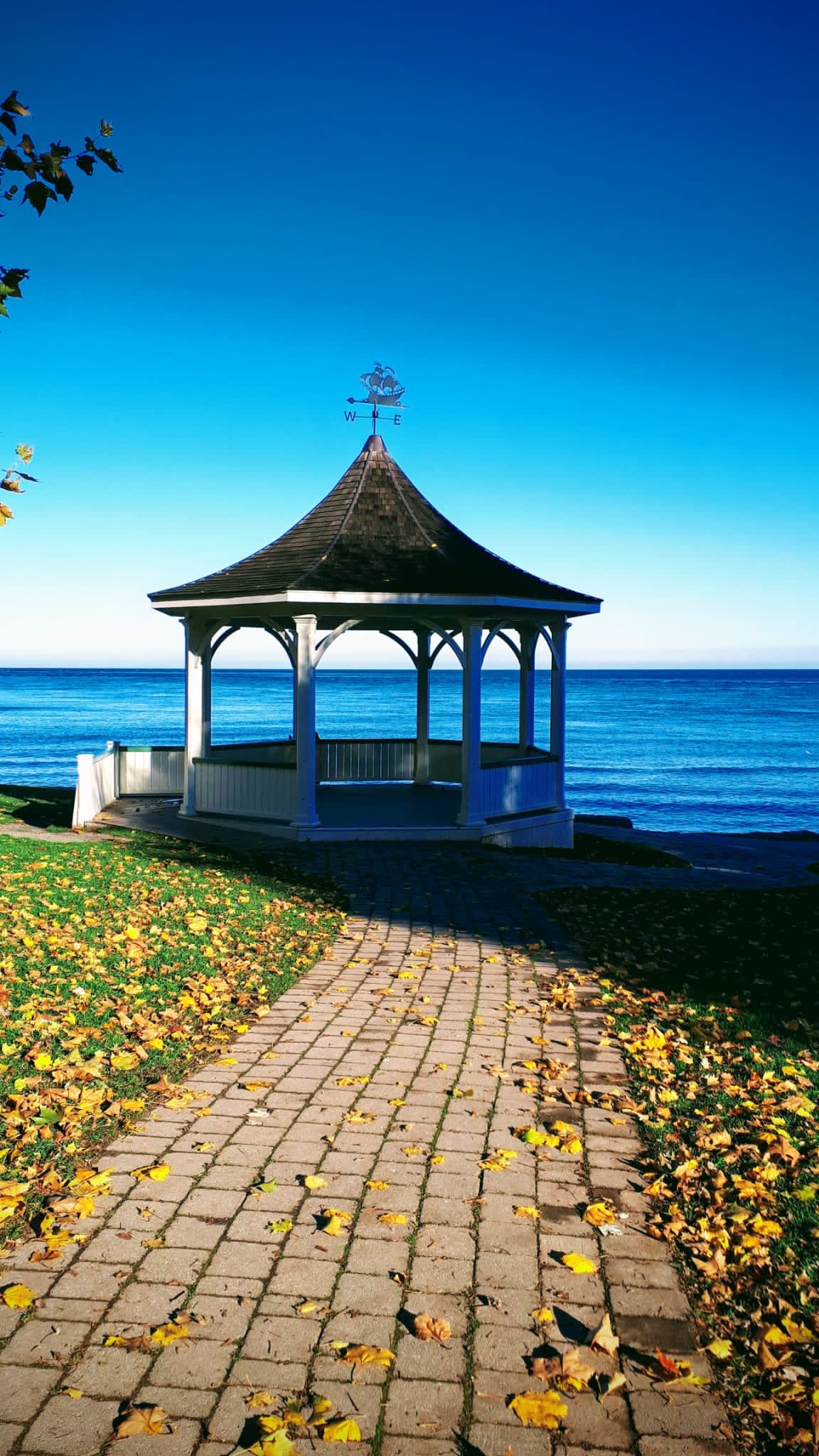
Niagara-on-the-Lake Tour
https://hikes.brucetrail.org/event/niagara-on-the-lake-tour-18/Sorry, the registration cut-off time for this hike has been reached.Not a member? Click here to join today!Hosting Club: Niagara
Category: Urban
Location (Google Maps): Park on King St near Centre St, Niagara-on-the-LakeHike Leader(s): Margaret Northfield Click here to contact Hike Leader(s)
Pace: Medium
Terrain: Easy
Distance: 5-6kmDescription
Each Friday we will explore some aspect of Niagara-on-the-Lake while getting a moderate paced walk. Discover where the Niagara River meets Lake Ontario. Experience the Heritage District, woods and the Niagara Parkway.Some weeks may be totally on sidewalks and roads while others may include a mix of trail and paved pathways.
Great way to build up endurance for longer more strenuous hikes.
Plan to stay for conversation and a coffee at Sweets & Swirls, Community Centre, Niagara Stone Rd., NOTL
Dundas Valley
https://hikes.brucetrail.org/event/dundas-valley/Sorry, the registration cut-off time for this hike has been reached.Not a member? Click here to join today!Hosting Club: Dufferin Hi-Land
Category: General Hike
Location (Google Maps): 650 Governor’s Road, Dundas, L9H 5E3. Iroquoia Section, BTC Map 8. Dundas Valley Conservation Area Parking Lot P3 just south of the main entrance. Take DVCA Trail Centre Entrance off Governors Road, near km 51.8. Click Google Map link for GPS.Hike Leader(s): Stuart Law Click here to contact Hike Leader(s)
Pace: Medium
Terrain: Dependent on Conditions, Slippery Sections Likely, Moderate
Distance: 16-17 kmsDescription
Join us on hike in the Dundas Valley. We take in part of the Bruce Trail and several DVCA trails. Lots of ups and downs and waterfalls. Please bring a warm drink, water, a snack for “elevensies”, lunch, hiking boots, poles and lots of smiles. Entrance fee to DVCA in effect at gate. Please arrive at 9:15 to be ready to hike at 9:30. We will hike two loops to allow folks to drop out after the first 10 kms if they would like.
Halton Agreement Forest
https://hikes.brucetrail.org/event/halton-agreement-forest-11/Sorry, the registration cut-off time for this hike has been reached.Not a member? Click here to join today!Hosting Club: Iroquoia
Category: General Hike
Location (Google Maps): Meet roadside on 4th Line at 9:15 am. Up Guelph Line from the 401, turn right on 10 Side Road and follow the curve as it becomes 4th Line. There is a small parking lot on the right and if that is full, park roadside.Hike Leader(s): Karen Bergmann Click here to contact Hike Leader(s)
Pace: Medium – 3 to 4 km/hr
Terrain: Moderate – Some hills and/or some poor footing
Distance: 8 kmsDescription
We will hike around the bike trails in this lovely Forest, including The Den and The Pines. Although fairly flat, there are plenty of rocks and roots along the way.
Little Cove and Fairway Meadows
https://hikes.brucetrail.org/event/little-cove-and-fairway-meadows/Sorry, the registration cut-off time for this hike has been reached.Not a member? Click here to join today!Hosting Club: Peninsula
Location (Google Maps): Municipal Parking at Little Cove (GPS: 45.247139, -81.615338).
Hike Leader(s): Marg and Owen Glendon Click here to contact Hike Leader(s)
Pace: Medium (3.0 – 4.5 km/h): A comfortable pace for most hikers with steady progress.
Terrain: Difficult: Steep ascents/descents, rocky scrambling, and some rugged escarpment paths., Easy: Flat forested sections or lowland trails., Moderate: Rolling hills, mild slopes and rocky paths.
Distance: ~8.3Description
This is the last of our Fall series of favourite hikes. Winter will be knocking at our door as we take our morning coffee by the shore of Little Cove. Then, we will begin our hike along the Main Trail through a mostly coniferous forest. Weather permitting, we will take a short diversion to the Dolostone Arch Side Trail to view the natural land arch, before retracing our steps to join the Fairway Meadows Side Trail and closing our loop back to Little Cove. Approximately 3 hr.Footwear with good grip is essential. Walking poles are recommended. Bring snacks and water. Dress in layers and according to the weather conditions.
Free coffee and muffins for hike participants arriving before 9:15 a.m.
- 29November 29, 2025
Car Hike: Scenic Adam Dopko ST, Felker's Falls via Devil Punch Bowl
https://hikes.brucetrail.org/event/car-hike-scenic-adam-dopko-st-felkers-falls-via-devil-punch-bowl/Sorry, the registration cut-off time for this hike has been reached.Not a member? Click here to join today!Hosting Club: Iroquoia, Toronto
Category: Car Hike
Location (Google Maps): Meeting location GPS coordinates, N43.202814, W79.791216 at Km 23.2 Map 6, Edition 31. Felker’s Falls Parking Area. From Mud St, turn north on Paramount Drive and continue to Ackland St and follow signs to parking aera. Please follow these coordinates to arrive at the specific parking lot.Hike Leader(s): Ross Estrella Click here to contact Hike Leader(s)
Pace: Brisk (4-5 km/hr)
Terrain: Hilly, Level 2 (Intermediate – some hills and uneven surfaces, rocks and roots underfoot), Rocky, Variable
Distance: 17 kmsDescription
From the hilly and beautiful Adam Dopko St, we’ll follow the Main Trail to Felker’s Falls via Devil Punch Bowl on a brisk pace. We’ll have occasional stops for photo shoots while maintaining the pace. Items to bring on day hike: Snacks, lunch, sufficient hydration liquid, sun protection, rain/snow jacket and first aid kit. Now that we’re on an unsettled weather condition clothes layering is highly recommended. Durable hiking shoe/boot and poles (if your using) are recommended. Always bring your personal medication if any and health card and most of all bring your happy face and enthusiasm. Before signing please make sure you’ll be able to pace with the rest of the group. Please arrive fifteen minutes early for car shuttling. See you all at the trail.Note: Shift in weather forecast of snow starting midweek thru the weekend. Please bring your icers and gaiters in case it’s needed.
Car Hike: Boyd Conservation Park Vaughan
https://hikes.brucetrail.org/event/car-hike-boyd-conservation-park-vaughan-10/Sorry, the registration cut-off time for this hike has been reached.Not a member? Click here to join today!Hosting Club: Toronto
Category: Car Hike
Location (Google Maps): Free parking lot before main entrance of parkHike Leader(s): Mohammad Aghamiri Click here to contact Hike Leader(s)
Pace: Moderate (3-4 km/hr)
Terrain: Hilly, Level 2 (Intermediate – some hills and uneven surfaces, rocks and roots underfoot), Variable
Distance: 12-14 kmDescription
Let’s hike Boyd conservation park trails through beautiful valleys.Please bring lots of water and snacks ,hiking poles are recommended
phone number for the day of hike 289 588 6482
School Bus Hike: Northumberland Forest and Peter's Woods
https://hikes.brucetrail.org/event/school-bus-hike-northumberland-forest-and-peters-woods/Sorry, the registration cut-off time for this hike has been reached.Not a member? Click here to join today!Trip Information
Departure Time: 08:30
Return to City Time: 18:30
Departure Point: York Mills Bus PickupOptional Items
Moderate group ($0.01)
Fast group ($0.01)Hosting Club: Toronto
Category: Bus Hike
Location (Google Maps): Northumberland ForestHike Leader(s): Martina Furrer, Leila Damband, Roland Mark, Duro Vukman Click here to contact Hike Leader(s)
Pace: Brisk (4-5 km/hr), Moderate (3-4 km/hr)
Terrain: Hilly, Level 2 (Intermediate – some hills and uneven surfaces, rocks and roots underfoot), Variable
Distance: 15 kmDescription
Join us for a fun hike on the Oak Ridges Trail and through the rolling hills of the beautiful Northumberland County Forest. We will explore a black oak woodland, one of Canada’s rarest habitats, and stop to enjoy the view of the Rice Lake plains from the top of Lookout Mountain. Our day will also include a walk through Peter’s Woods, a magnificent old growth forest that’s home to oak and maple trees that are more than 400 years old. Finish with refreshments and holiday shopping at The Big Apple.Expect some short, steep hills. Total distance: moderate group about 12 km, fast group 15 km +

Car Hike: #2/3 Toronto End to End - 21KM
https://hikes.brucetrail.org/event/car-hike-2-3-toronto-e2e-in-memory-of-doug-sloan-21km/Sorry, the registration cut-off time for this hike has been reached.Not a member? Click here to join today!Hosting Club: Toronto
Category: Car Hike
Location (Google Maps): 17th side roadHike Leader(s): Alina Lin
Pace: Brisk (4-5 km/hr)
Terrain: Challenging, Hilly, Level 2 (Intermediate – some hills and uneven surfaces, rocks and roots underfoot), Rocky, Variable
Distance: 21 kmDescription
Meeting Point:
17th side road parking, GPS: 43.592859,-79.980456. Please arrive at the parking area before 8:45am to allow time for car shuttle coordination.We will car shuttle to Roadside parking east of KM33.4 across from the Eighth Line Side Trail on Eighth Line. GPS: 43.679840, -79.966419. From there we will hike main trail back to 17th Side Road Parking.
All drivers are expected to participate in the car shuttle, either before or after the hike. All hikers are expected to chip in for parking fees, if applicable.
Important Notes:
- Wear sturdy hiking footwear and dress appropriately for the weather
- Bring snacks, and at least 1L of water
- No dropouts available.
- No pets.
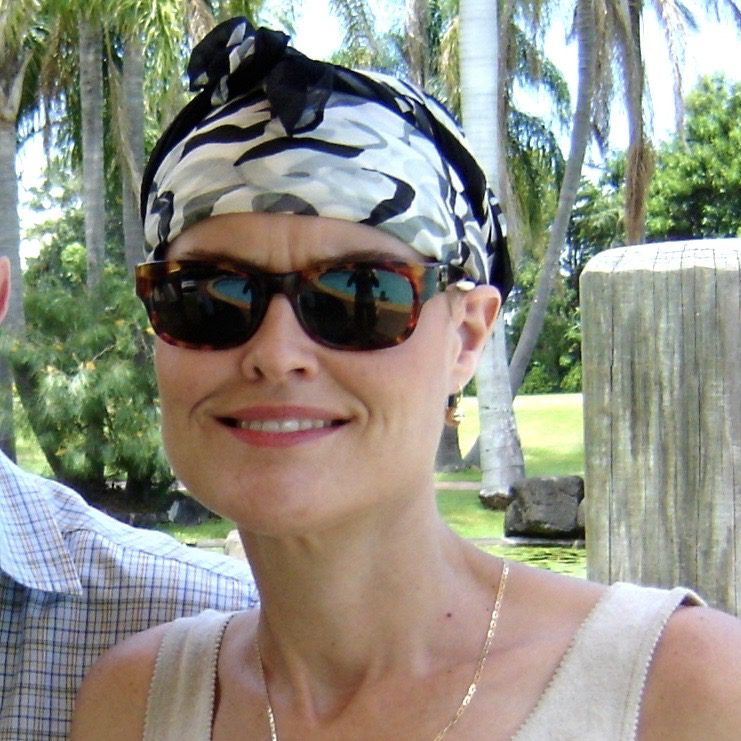
9:00 Breast Cancer Survivor Celebration Hike
https://hikes.brucetrail.org/event/900-breast-cancer-survivor-celebration-hike/Sorry, the registration cut-off time for this hike has been reached.Not a member? Click here to join today!Hike open to BTC Members only.
Hosting Club: Niagara
Category: In and Out
Location (Google Maps): Glen Road-off road parking areaHike Leader(s): Suzanne Gourluck Click here to contact Hike Leader(s)
Pace: Brisk
Terrain: Strenuous
Distance: 20 kmDescription
Come and celebrate my 20th anniversary as a cancer survivor by hiking 20 km with me!Meet on Glen Road in the roadside parking area and hike to Cave Springs (around Quarry Road) After a short break, we will retrace our path.
This section of the trail has some steep, technical sections and a long flight of stairs at the escarpment.
Consider your fitness level before registering. Everyone is expected to keep up with the person in front of them for the duration of the hike.
Wear something pink if you’d like. Hiking poles and boots are highly recommended. Bring fluids and a snack.
Plan to arrive at the start point by 8:45 as we will leave at 9:00 sharp.
Niagara Glen Hike
https://hikes.brucetrail.org/event/niagara-glen-hike-5/Sorry, the registration cut-off time for this hike has been reached.Not a member? Click here to join today!Hosting Club: Niagara
Category: Loop
Location (Google Maps):Meet at the Niagara Glen Nature Centre parking lot, 3050 Niagara Parkway, Niagara Falls. This is located between the Whirlpool Golf Course and the Niagara Botanical Gardens, on the river side of the Niagara Parkway. Parking fees may apply.
Hike Leader(s): Dan Wilson Click here to contact Hike Leader(s)
Pace: Medium
Terrain: Strenuous
Distance: 10kmDescription
Hike deep in the Niagara Gorge, along stairways cut into the rock and rugged paths that wind through this pristine pocket of Carolinian Forest. View ancient geological formations and fossils dating back millions of years, while hiking along the turbulent rapids of the Niagara River. This is a strenuous hike and there is a chance hikers could get wet. Bring water, a snack, gaiters, hiking poles and icers, if necessary. Also, please dress in layers. 🙂