This is a Multi-Day Hike
You are signing up for the following dates:
2026-03-07, 2026-03-08, 2026-03-14, 2026-03-15
Click here for more information or to register
Hosting Club: Iroquoia, Caledon Hills
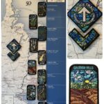
Category: Stained Glass Badge End to End Fundraiser Hike
Location (Google Maps): Day 1 – Sat, Mar 7 – Meet at Mono Community Centre, 200m south of Mono Centre (County Road 8). Park in gravel lot. https://maps.app.goo.gl/hW5VcpFWCBhAe5xq7
Shuttle to BT parking lot on the east side of the 5th Line EHS just south of the Hockley Rd https://maps.app.goo.gl/JgGmJD9tjqh1KBGJ7 ~ 21.50km
Day 2 – Sun, Mar 8 – Meet in BT parking lot on the east side of the 5th Line EHS just south of the Hockley Rd https://maps.app.goo.gl/JgGmJD9tjqh1KBGJ7
Shuttle to Roadside parking on Innis Lake Rd north of Finnerty Sideroad https://maps.app.goo.gl/AYqSXpPmFtc4EytN6~ 21km
Day 3 – Sat, Mar 14 – Meet at Roadside parking along the southwest shoulder of the Willoughby Rd and Escarpment Sideroad https://maps.app.goo.gl/sRMCqGTsFX2zWGNeA
Shuttle to Roadside parking on Innis Lake Rd north of Finnerty Sideroad https://maps.app.goo.gl/AYqSXpPmFtc4EytN6 – 15km
Day 4 – Sun, Mar 15 – Meet at Roadside parking at Boston Mills Rd just west of the Mississauga Rd intersection. Note: driveway is private property.
Shuttle southwest shoulder of the Willoughby Rd and Escarpment Sideroad https://maps.app.goo.gl/sRMCqGTsFX2zWGNeA(includes 2.47km of Toronto section) Includes 2.5km of Toronto section – 18.50km
Please save March 21 for a make-up day in the event of inclement weather.
Hike Leader(s): Ruth Moffatt Click here to contact Hike Leader(s)
Pace: Brisk – 4 to 5 km/hr
Terrain: Dependent on Conditions, Slippery Sections Likely, Strenuous – Hilly with steep climbs and some poor footing
Distance: 72km split over 4 days – daily distance dependent on parking capacities
Description
This is a monetized hike with the proceeds going towards the Caledon Bruce Trail Club – “Preserving a ribbon of wilderness for everyone, forever.” Your badge depicting the white-tailed deer, the hike logistics, shared shuttle driving and hike guidance are all included in your fee. Since it is the intention to run a similar hike in all sections this year, why not join the Bruce Trail Conservancy if you are not already a member? Please use my code 67abd1234c568 until the end of 2025 to receive free digital maps as well as all the other great benefits included with membership. https://brucetrail.org/product-category/memberships/
Registered participants will receive a WhatsApp invitation (optional) which can be used for photo share.
Please read all details for this hike to ensure it is suitable for you. The pace and terrain are particularly important details.
You must be registered to participate in this group hike. You cannot just show up as there are often people on the waitlist.
This is a multi-day hike – Mar 7/8, 14/15, 2026. Please save March 21 for a make-up day in case there is inclement weather.
Please ensure your car is car shuttle-ready with at least 4 available seatbelts including the driver’s. We will take turns either being the shuttle driver or driving the drivers back to their cars after the hike is over.
Please pack whatever food you will require for a long day hike including lunch and snacks; 2l of water minimum; first aid kit; poles if you use them; and icers. You may also wish to pack extra socks and rain gear. Remember to dress in layers. Gloves/mitts, scarf / neck gator, a toque and a puffy jacket. Consider snow shoes, depending on conditions.
We will break for a morning clothing adjustment, a 10min break around 10am, 15 min lunch and an afternoon break if we are finishing after 2pm. Bio-breaks are as you need them – please let the sweep know who will wait for you. This is a 4 day group hike so it is important you keep pace with the person in front of you. We will help each other and wait for one another but please consider your physical ability before signing up for this hike. There are no drop outs – if you are not able to finish the hike you will need to arrange for transportation back to your car via taxi or Uber at your cost.
The Caledon stained-glass badge will be presented on the last day. If you have to miss one of these hiking days, you may make it up on your own before the last day of the series. Since it is a group hike, it is intended that everyone who registers be present on all days.
Any questions may be directed through contact on this form.
If you cannot make it, please remove yourself from registration.
To cancel your registration, here is a step by step:
– Sign into your account on the BTC website
– Click on My Hikes under your account
– This will take you to a list of hikes you have registered for
– Scroll down to the appropriate hike and cursor over to the far right hand column under the Action column.
– Click Cancel under the hike you wish to cancel